Overview
Social Mix
Public Space
Amenities
Connections
Final Project
Size
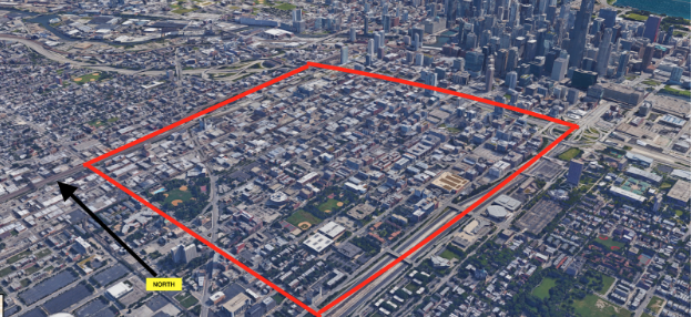
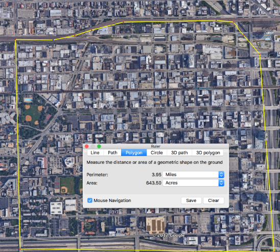
The West Loop is almost entirely covered by two census tracts, #8331 and #8330. It stretches a block or two far to the north, and only misses one block to the east, so it is a relatively good approximation. The total population of this area is 10,442 according to the 2015 data. The physical size of the neighborhood is approximately 643.5 acres in total, with a perimeter of 3.95 miles.
Identity
When talking about the coherence of identity of a neighborhood in the context of an initial visit to the place, one must necessarily be talking about the cursory, surface-level manifestations of such an identity. These manifestations are of many types, including gateways, street banners, advertisements and institutional or establishment nomenclature, but they do not get down into the actual nature of the identity of an area; we are talking about the identity that a passerby would inference.
However, before we can talk about these manifestations of identity in the neighborhood I am focusing on, the west loop, we must first consider what constitutes the neighborhood in the first place. Here are the things I find as close to indisputable as is possible: West Town is certainly a neighborhood, generally considered to be north of West Loop and west of 90, with an east-west border between them along Grand. East of 90 is always a different neighborhood - it’s some combination of the West Loop Gate, River West and the Fulton River District. South of the Eisenhower is always considered a different neighborhood, as UIC dominates that part of town. And Greektown exists just west of 90 and north of the Eisenhower, with a border usually drawn along Sangamon street and in between Madison and Washington. Past that, however, the neighborhood I and many others want to call the West Loop is sometimes not drawn at all, in favor of a larger West Town neighborhood.
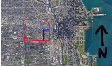
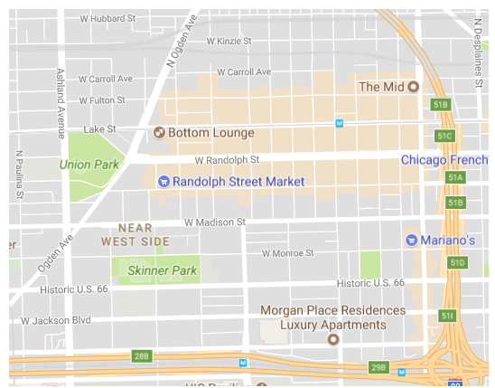
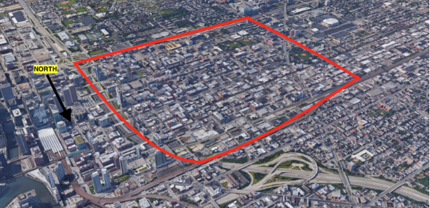
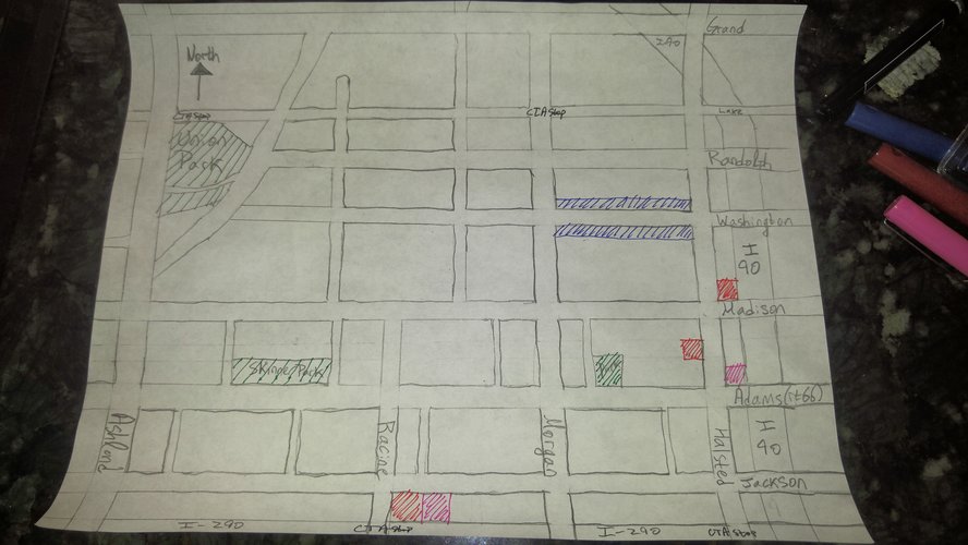
If you ask me (and we are asking me) I’d draw the western border along Ashland (we must include Union Park, the endcap to the City Beautiful style boulevard, Randolph street, the eastern end of which is often thought of as ‘downtown west loop’), with the northern border at the tracks north of Wayman (because the tracks totally sever the neighborhood, making the shops along Grand extremely distinct from those along Lake, Fulton or Randolph), the southern border along the Eisenhower and the eastern border along 90. These borders are depicted in the attached image.
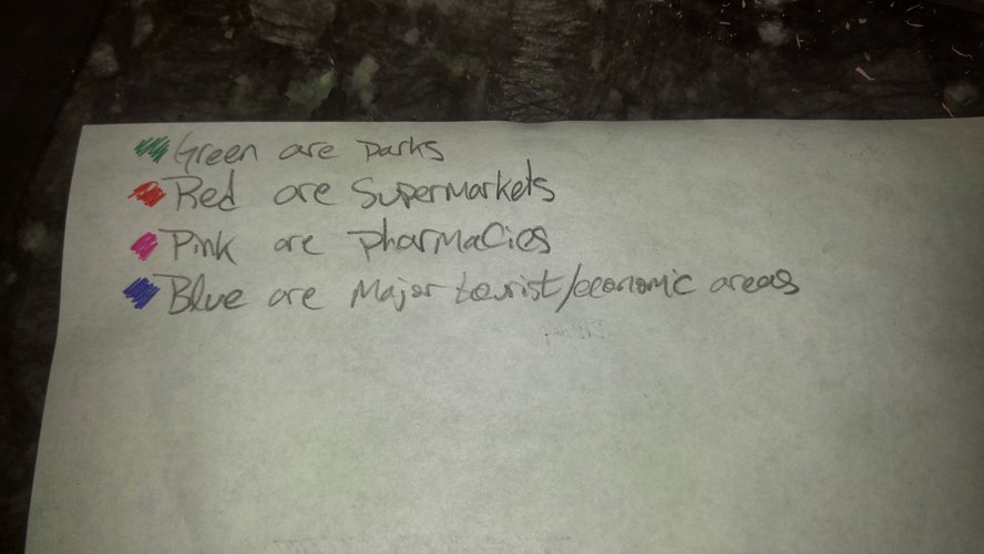
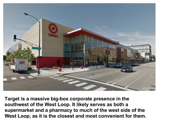
This does mean I consider the entirety of Greektown (drawn in blue) to be a subset of the west loop. Part of my reasoning for this decision is that signage in Greektown, both advertisements for developments and also street banners put in by the city, claim to be part of the west loop; another part is that the ‘west loop’ is not just a neighborhood but a geographical description, a description which Greektown fits; another part is that there’s no clear delineation between the west loop and Greektown. The strongest part of the argument, however, is that the only supermarket or pharmacy actually in the west loop is a target well out of walking distance of most of the neighborhood. This forces west loop residents to shop at the two supermarkets in tiny old Greektown. Now this isn’t to say that Greektown doesn’t exist, just that it’s a part of the west loop, in the same way that Hyde Park exists as a part of the south side.
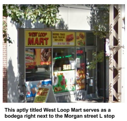
The most impressive manifestation of its surface level identity is the clearly faux-ancient greek structure standing on the southeast corner of Halsted and Van Buren, establishing the beginning of Greektown (caddy corner to which is a new development that claims to be in the west loop). Another manifestation are the many street banners that say “West Loop,” some of which are located in sections of the neighborhood usually considered to be in Greektown. These are most present along randolph street but can also be seen along Madison and several other streets. There also exists a shop called “West Loop Mart” underneath the Morgan street station. But the west loop doesn’t necessarily need the kind of surface-level validation that other, less coherent neighborhoods crave in order to insist on their presence on the map: downtown west loop, along Randolph street; the local hangouts along Madison; these prove it themselves.
Layers
Diagram
History
The West Loop has a very rich history as part of the city as, due to its proximity with the loop itself, it was part of the city from almost the very beginning. Well before interstate 90 was put in, the whole area west of the river and east of Ashland was considered a single neighborhood, known as the west loop gate. The famous architect of Chicago’s Master Plan, Daniel Burnham named it so, as the “gateway from the west into the loop.”
In the 19th century, the west loop was home to both the rich and the poor. Immigrants who worked on the railroad yards and in the lumber district along the South Branch of the Chicago River built ‘frame shanties’ in the eastern side of the neighborhood, within walking distance of their places of employment. This immigrant population was very diverse, building many different (differing in denomination) churches. On the west side of the neighborhood was one of the city’s most prestigious addresses, along ashland avenue; home to some of the city’s wealthy. Another prominent street was Washington boulevard. This may have been known briefly as ‘the west side gold coast.’
The West Market Hall, a large public food hall and meeting space stood in the middle of Randolph between Desplaines and Halsted. This Randolph Street market in Haymarket square was a prominent site for capitalistic exchange of goods, and as the 19th century progressed. After the fire of 1871, many companies demolished residential buildings to make way for warehouses and manufacturing plants, clustered strategically around the market. By 1884, the Medical district to the south was soundly established.
In the 1880s, labor conflicts and a few strikes were gaining ground in the area. The strife began to push some of the wealthier residents out of the neighborhood. The conflicts came to a head with the May 4th 1886 Haymarket massacre. The aforementioned market was the site of a labor-strike rally for the second half of the day of May 4th 1886, and as the rally was coming to a close (after many of the attendees had gone home), the police arrived to forcibly break up the gathering, shortly after which a bomb was dropped in front of the police, and in the ensuing chaos most of the police ‘emptied their revolvers.’ The only thing that everyone agrees upon is that the square was empty but for the dead and wounded within 5 minutes of the chaos erupting.
Since then, the neighborhood generally moved towards industrialisation and away from residential living. It was the site of many factories, rail yards and other forms of non-residential life.
It wasn’t until the 1980s that companies began coming in to convert old light industrial buildings into loft apartments. Since then, the neighborhood has slowly gentrified, adding more condos and other forms of residential life, with industrial entities slowly moving out. In 1995, Mayor Daley brought the Democratic Convention to the United Center (just to the west of the west loop), helping to further energize the area. Oprah Winfrey based her Harpo Studios on Randolph street, which is generally considered the beginning of the tidal wave of very gentrified shops and restaurants. The area is now home to famous restaurants such as Girl and the Goat, Maude’s, Next, The Aviary, Au Cheval, The Madison Bar -- I could go on for days.
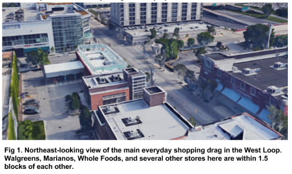
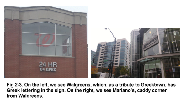
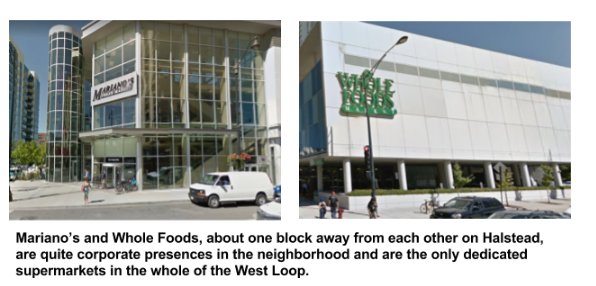
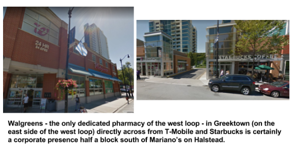
In my opinion, the center of a neighborhood is the spot which pulls everyone in, usually for a multitude of reasons. So I’d say that the center of the west loop is the everyday shopping strip that is within walking distance for the residents of the eastern half of the west loop, depicted below in figure 1. There are two groceries and a pharmacy, and several other stores within sight of each other. This place serves as the center for the west loop as it is a place that draws in everyone from the vicinity during their everyday chores.
Notably, this spot exists in the northern corner of Greektown, and as such has some Greektown tributes; the Walgreens has Greek lettering in its signage.
The West Loop has a solid amount of corporate presence, having been a center of gentrification for many years now, which one can clearly see in the grocery stores and pharmacies available in the West Loop; hint: past the specialty Greek stores, everything in that category is corporate.
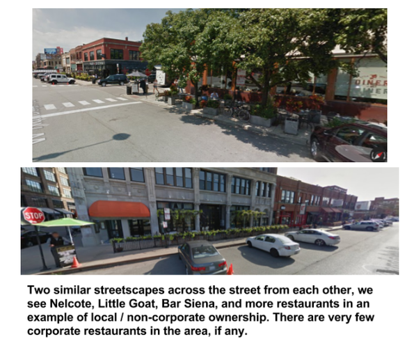
In all, there is a mix of corporate and local presences throughout the neighborhood, although it certainly leans corporate. Many daily staples must be purchased from the corporations, yet few others can be satisfied locally.
The West Loop is composed mostly of elongated block types, although there are a few exceptions, noteably, the lots created by the diagonal Ogden Ave. It’s characterized by the neighborhood’s rectangular blocks, each with alleys (not pictured) behind them running through the back of the lots.
In terms of network types, the West Loop generally follows the “Savannah Pattern,” characterized by its directional orientation, controllable lot depth and monotony.
However, because of the diagonal Ogden Ave that cuts through the west part of the neighborhood, it has a small flavor of the “Washington Pattern”.
Interestingly, it appears as if the west loop has almost all of the different thoroughfare types in or surrounding the neighborhood, even if they are misnomered on the map. To begin, there are two highways that mark the border of the neighborhood, 90 and 290.
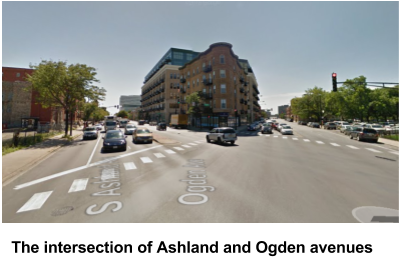
There are several avenues, notably Ashland Ave and Ogden Ave, and I think one can argue that Halstead acts much like an avenue, despite its short width.
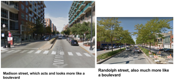
There are several boulevards, most notably Randolph and Madison, both with median dividers, which is what makes me say that they are boulevards (and even though Jackson and Washington are called boulevards, I’d say they act more like avenues or streets due to the fact that they’re both one way, their widths and their lack of median dividers).
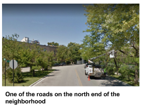
There are roads; on the north end of the neighborhood, the streets that are near and around the railroad tracks have the characteristics of roads.
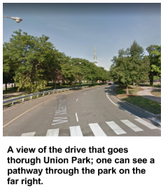
There is even a drive, though a short one, through Union Park, and many pathways besides throughout the several parks. And of course, as with the rest of Chicago, there are alleys (not depicted) behind most of the lots to allow for service access. Essentially, all the rest are normal streets. The only thoroughfare type mentioned in the lexicon that is not apparent in this neighborhood are rear lanes, which don’t exist because the alleys do.
Overall, the West Loop is a really connected and interconnected neighborhood. In terms of its connectivity to the rest of the city, it is almost perfectly situated for one to get anywhere; it’s in the middle of the city such that it’s equidistant from the north and south sides, and much of the neighborhood is within walking distance of the loop. Moreover, there are three L stops in the neighborhood on two different lines such that no spot in the neighborhood is further than a 10 minute walking distance from a light rail stop.
In addition to being well connected to the rest of the city, the neighborhood itself is very interconnected as well. The thoroughfares through the area provide solid rapid transit from one corner to the other; by way of a combination of walking and public transit it’s no more than 20 minutes from one extreme corner to the other.
However, even though the neighborhood is functionally very interconnected, in practice it may be less so. This, I would say, is due to the dispersion of services -- because of the placement of the supermarkets and pharmacies, residents of the neighborhood who live in one corner are not compelled to go to other parts of the neighborhood.
In all, this neighborhood is much more connected and interconnected than most in Chicago, and probably represents some of the inequities between poorer and richer neighborhoods in the city. That it is so connected is probably mostly due to the location of the neighborhood, making it more wealthy than most.
I think the West Loop is one of the coolest neighborhoods in the city. Its location - and thus one’s ability to get around the rest of the city - is excellent; it’s home to many stellar restaurants, and although it is a neighborhood which has undergone gentrification, most of it has not displaced people but instead industry. Yet as much as I love the neighborhood, it definitely has a few flaws. With much of the housing stock in the area further than a 5 minute walk from either a pharmacy or a grocery store, it’s a pretty car-centric neighborhood; it could be a lot easier to get around on foot. And though much of the neighborhood is within a 10 minute walk from an L stop, there’s not much public transportation to get around the neighborhood itself. As a result, my three proposals are aimed at improving the pedestrian experience through addressing problems with respect to connectivity.
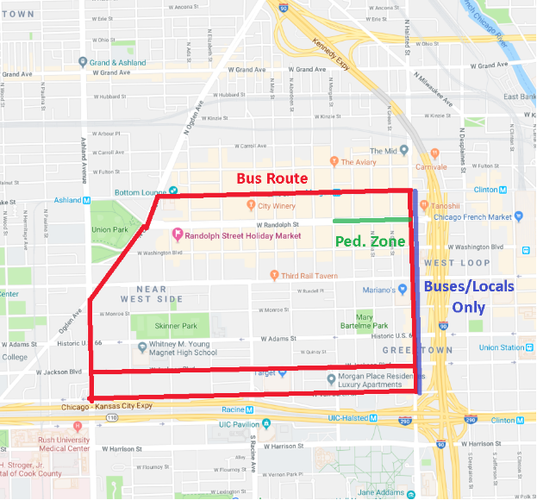
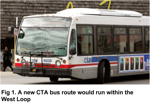
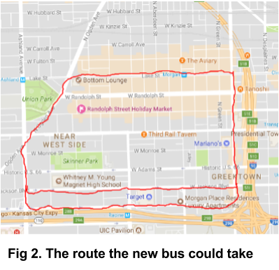
The first of my proposals aims to immediately address the problem of walkability. I would install a new two-way circular bus route that travels around or near the circumference of the neighborhood. Starting in the northeast corner, it would travel from Halstead west on Lake to Ogden, turning south onto Ashland, followed eastward Jackson ave before turning north on Halstead to arrive back at Lake. As Jackson is a one way street, the other direction would have to go down Van Buren instead. The addition of this new bus route, which at some point comes within a 5 minute walk of the entire neighborhood, would increase the connectivity of the area by reducing reliance on the car and by reducing the amount of time the average resident travels while going about their neighborhood chores. It brings the neighborhood closer together.
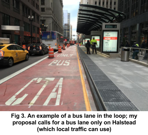
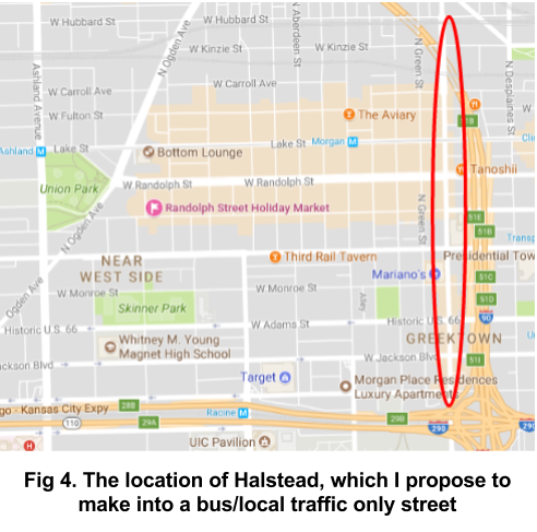
My next proposal is to improve the pedestrian experience by closing off a main thru street - Halstead - to all but buses and local traffic (in just the West Loop). As it currently stands, the street is regularly used mostly by vehicles not travelling to or from the West Loop, but going from an area further south to one north of the neighborhood. It is crowded, loud, and the street was not built to handle the capacity it currently withstands. So I say let’s focus on the experience of the pedestrian and try to calm the street down a bit - we want people to be able to enjoy patronizing the enterprises along Halstead without having to deal with all the thru traffic. Although I wish I could suggest closing Halstead entirely, the #8 bus runs up and down that street far beyond this neighborhood and cutting off local deliveries would make things difficult for the businesses on this street.
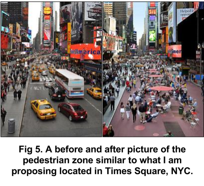
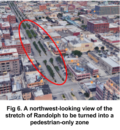
For my final proposal, however, I have found a spot in the neighborhood which is ripe for pedestrianization: Randolph street from Halstead west to Morgan for a total of four blocks. This stretch is the epicenter of restaurants in the neighborhood, if not the city, and is constantly bustling with activity. People already hang out there, and a pedestrian zone would only enhance the experience. Yet, currently, the pedestrian experience is totally ignored. Not only are sidewalks routinely blocked for new construction, the four lane street is pretty harrowing to cross because there are only stop signs, not lights, at many of the intersections. My proposal of a pedestrian zone in this area addresses these problems and, without cutting off the north/southbound traffic through the pedestrian zone, we can create a great space in which to enjoy the city and each other’s company.
It’s pretty clear that the pedestrian experience in the West Loop is more or less ignored, and the neighborhood’s interconnectivity for those without a car is completely lacking. My proposals to add a bus route, to close one street to thru traffic and to pedestrianize another in an area with high foot traffic aim to address these problems to improve the neighborhood of the West Loop for all to enjoy.
Photo sources
Fig 1: https://cbschicago.files.wordpress.com/2016/02/cta-bus-3.jpg?w=1500
Fig 2: Google Maps
Fig 3: http://www.transportnexus.com/wp-content/uploads/2015/12/LoopLink-1024x768.jpg
Fig 4: Google Maps
Fig 6: Google Maps (3D terrain)
Social Mix
In short: no, the west loop is not a diverse neighborhood. With a population of just over 10,000 people, it is overwhelmingly white (73%), educated (43% with a bachelor’s degree), likely middle to upper middle class, and likely commuting to office jobs in the loop. In terms of racial diversity, it scores a Simpson Diversity Index of about 1.79, compared to the city’s 2.84. I found that the people living in this area tended to be young, with a median age of 34 years, and without families. Noting the nightlife around Randolph and Halstead and up and down Madison, it is not unexpected that young folk would want to congregate here and move elsewhere in the city or to the suburbs if they’re starting a family.