Overview
Social Mix
Public Space
Amenities
Connections
Final Project
Size
Total population= 12,081
Square feet (including park)=46,245,982
Square feet (not including park)=31,019,606
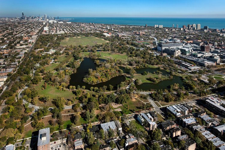
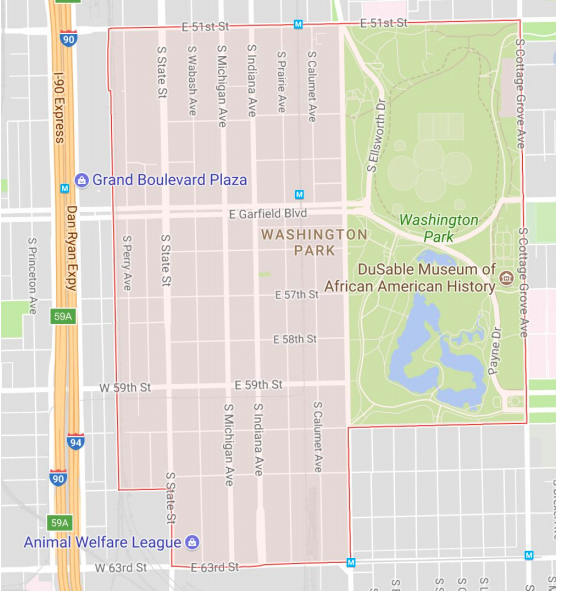
Washington park is the size of a small town. However the neighborhood is not as dense as
some other areas of the city. The square footage per person is 2,567.64.
Identity
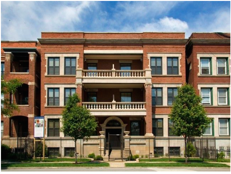
Buildings: In contrast to the North and West sides of the city Washington Park has a different atmosphere and look, reminiscent of other Southside neighborhoods. The area is extremely residential without major business hubs like Bronzeville’s 47th street and Hyde Park’s 53rd street. The houses are composed of the common red brick seen throughout Hyde Park, Bronzeville, and Woodlawn.
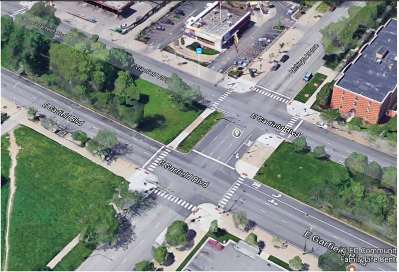
Streets: Unlike more insular neighborhoods,
Washington Park hosts a number of broad
streets which create divisions with the
neighborhood. For example Garfield boulevard
runs through the middle of Washington Park
separating the north and south side. There is no
serious difference between the two communities
however, an unfamiliar tourist might consider
them to be different neighborhoods. Other major streets include State, Wabash, 57th, 59th.
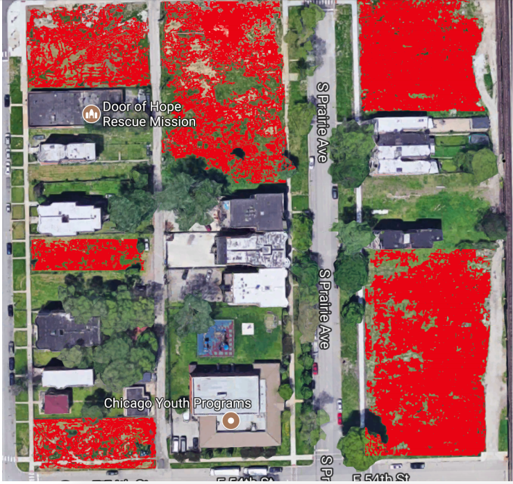
Lots: Another aspect of Washington that differentiates it from
its neighbors are the amount of vacant lots. Although I was
unable to find the exact number, when walking around I
noticed that on every block there were 2 to 3 empty patches of
land. In order to combat this the city has begun selling lots to
local entrepreneurs for $1.
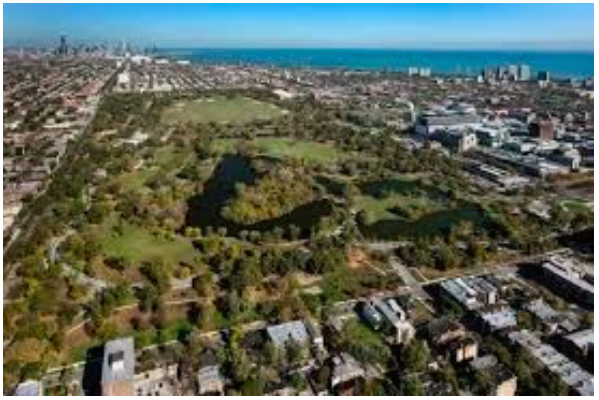
The Park: The Washington Park neighborhood is named after an actual park which marks the eastern border. The park hosts many attractions like the Fountain of Time, the Dusable Museum, and the arboretum. Although it is considered a part of the neighborhood, the park feels separate. It acts more as a filter, dividing Washington Park from Hyde Park without belonging to either. This may be because the park is a boundary, rather than an unit enclosed within the larger neighborhood.
The Train Tracks: On the the other hand, the western boundary of Washington Park is made up of old industrial train tracks. This cuts off Englewood from Washington Park. Similarly to the
eastern boundary of the actual Washington Park you feel the neighborhood end at the
tracks. As you move more west, more vacant lots appear and the houses began to spread
out. Many neighborhoods use wide open spaces in order to mark their limits.
Layers
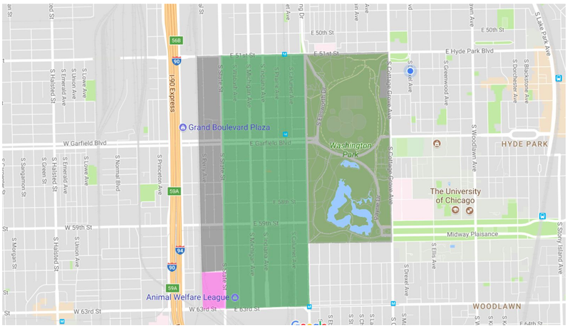
Community Area=Black
Zolk Neighborhood
Map=green
US tracts: Pink
Unlike most Chicago neighborhoods Washington park shares the same ward, police district, and parish.
Ward=20th ward
Police district=2nd
Parish= Saint Anselm
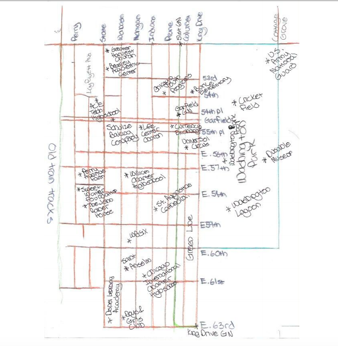
Diagram
History
The history of Washington Park can be divided into two parts; that of the physical park and of the surrounding neighborhood.
Like most neighborhoods on the Southside, Washington Park was originally settled in the mid 19th century by Irish immigrant workers who needed a place to live close to industry. The area was close to the railroad as the Chicago, Rock Island & Pacific Railroad ran just east of today’s Dan Ryan expressway. In the later half of the 19th century German and Jewish immigrants also began moving into the neighborhood to look for work.
In 1870 Frank Olmsted and Calvert Vauax designed the actual Washington Park. Olmsted wanted to create an oasis from city life. Olmsted created the famous Washington Park lagoon and arboretum. During the 1893 World’s Fair, the park and neighborhood became an attraction hosting many of the famous “White City” buildings. However, many of these buildings have been torn down. Today, the Dusable Museum for African American history occupies the administrative building while the Washington Park refectory is rented out for special events.
As mentioned earlier, Washington Park has many wide streets and boulevards which was originally a draw to many of Chicago’s wealthiest residents. Residents built huge mansions along Michigan, State, and Garfield boulevard that still stand today. The west of the neighborhood was reserved for the working class while the east of the neighborhood was inhabited by the upper class. By the beginning of the 20th century Washington Park was a booming neighborhood, with many street cars and the first L lines running through the area.
However, during that same time the Southside went through apartment boom. This attracted many the city’s growing African American population who came during the Great Migration. As a result the rich and working class white residents began to leave the neighborhood. Many eventually converted their homes into two flats which were often rented for above market value. By the 1930’s Washington Park was over 90% African American. Yet, this change did not happen smoothly as the neighborhood was one of the sites for the 1919 Chicago race riots.
Eventually Washington Park began to deteriorate as landlords kept the conditions of the
apartments very low while charging high for rent. This along with the redlining and on contract
house ownership made it impossible for African Americans to leave. During the 1960’s the
Chicago Housing Authority decided to build one of the nation’s largest public housing projects, The Robert Taylor Homes. Unfortunately, this along with other housing projects were neglected
by the city and became a hotbed for gang activity until it was torn down in 2007.
Today, Washington Park is the subject of heated debate around gentrification. In 2009 the neighborhood became the proposed site for the Olympic games. This led to a housing bubble in the area in which residents are just beginning to recover. The neighborhood is also home to the Bud Billiken parade which is the largest African American parade in the country.
Works Cited
Chicago Historical Society. "Washington Park (community Area)." Encyclopedia of Chicago. Encyclopedia Chicago, Inc., n.d. Web.
Chicago Historical Society. "Washington Park." Washington Park. Encyclopedia Chicago, Inc., n.d. Web.
Grossman, Ron. "Washington Park Long a Site of Change, Controversy." Chicago Tribune. Tribune Publishing, 24 July 2015. Web.
Jarz, Hank. "Where the Sheep Used to Graze and the Games Never Came." Curbed Chicago. Vox Media, 22 June 2011. Web.
"Washington Park." Chicago Gang History. Chicago Gang History, n.d. Web.
Worley, Sam. "Case Study: Washington Park." Chicago Reader. Sun-Times Media, LLC, 16
Oct. 2017. Web.
Background
In 1870 Frank Olmsted and Calvert Vauax designed Washington Park on commission from Chicagoan Paul Cornell. Olmsted wanted to create an oasis from city life and designed the famous Washington Park lagoon and arboretum. During the 1893 World’s Fair, the park and neighborhood became an attraction hosting many of the famous “White City” buildings. However, many of these building have been torn down with only a couple remaining. Today, the Dusable Museum for African American history occupies the administrative building while the Washington Park refectory is rented out for special events.
Background
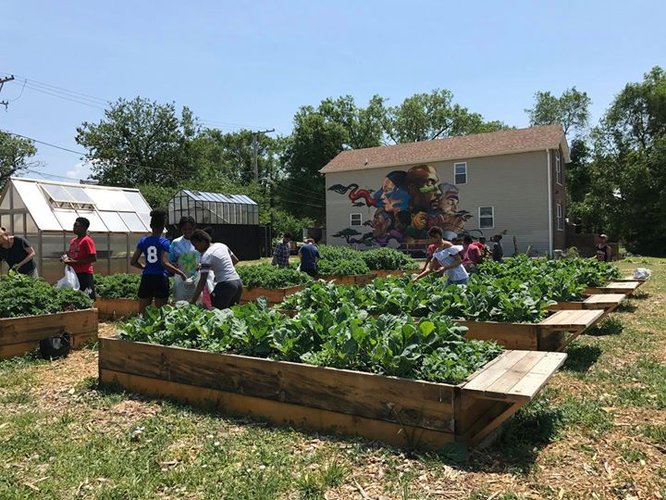
The Sweet Water Foundation is a non-for-profit organization founded in 2007 by Emmanuel Pratt. The organization practices “regenerative place making” meaning that they use the assets already found in Washington Park to promote neighborhood life. Sweetwater is located on Perry Avenue hosting a farm, youth programs, and two different community centers. Their farm, Perry Avenue Farms, was given to the foundation by the City of Chicago in order to revitalize the abandoned city block
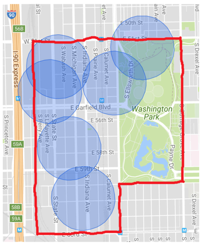
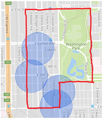
As Washington Park is sparsely populated, neighborhood public amenities are spread out making them hard to access for the majority of residents. There are currently 6 schools located in the Washington Park neighborhood, all of which belong to the CPS system. In fact, the last private school, Saint Anselm, closed down in 1994. It is also important to note the type of schools located in the different parts of Washington Park. There are 2 high school both of which are located on the northern section. This makes the students living south of Garfield travel north or go to a surrounding charter school in the Englewood and Woodlawn neighborhoods. This is interesting considering Washing Park is more densely populated in the southern region. One of the high schools, Dyett, was scheduled for a school closure but after parents went on a much publicized hunger strike the school was reopened. Dyett is the only neighborhood high school in the Washington Park region, the other high school ACE is a charter school which bases admission on lottery. As far as the location, all schools are located on busy streets which make them easy to access. Only about 17% (2054 people) do not live within a 5 min walking distance of a school.
To a greater extent 23% (2778 people) of Washington Park residents do not live next to a grocery store with a 5 min walking distance. There is only 1 major grocery, Save-A-Lot, which is located across from the King Drive Green Line on 61st and Martin Luther King Drive. The rest of the grocery stores highlighted are extremely tiny mini-marts which cannot offer fresh foods or many of the foods necessary to sustain a family. Therefore most resident have to travel to the 47th street Walmart in order to go shopping. The lack of adequate grocery stores in Washington Park makes it one of the many food deserts located on the Southside.
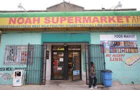
Noah's Grocery located in Washington Park (taken from Google images)
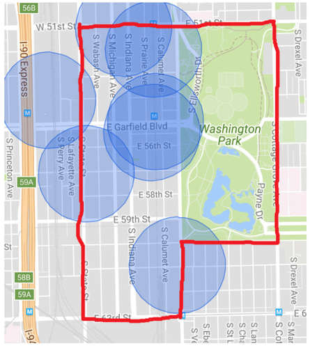
However, the biggest need in Washington Park stems from the lack of financial institutions. There is only 1 bank near Washington Park which is technically located outside the neighborhood boundaries. Less than 1% of the population lives within a 5min walking distance of this bank. Similarly there are no banks in surrounding areas like Woodlawn and Englewood. This leaves the residents of Washington Park without access to their finances. It has been shown that even the presence of banks can inspire people to start accounts and consider the state of their accounts. The rest of the spots highlighted are general ATMs which are beneficial but do contain the services of full functioning banks. There have been a couple of credit unions run through local churches but closed down during the recession. About 15% (1812 people) of the population do not live within a 5 min walking distance of an ATM.
In general the services offered in Washington Park need to be improved. The residents lack many of institutions that provide basic needs. The fact that there is only 1 high school and 1 bank in the area is ridiculous. Yet, those services only represent only a handful of needs that are missing from the area. When walking around in Washington Park I also noticed the lack of pharmacies, doctors offices, clinics, dentists, and other professional services.
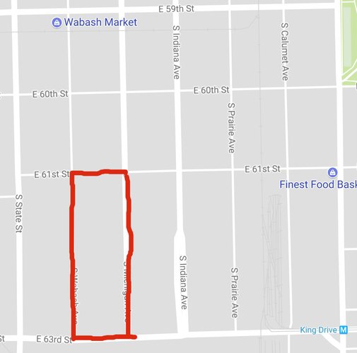
Elongated Block
For the most part Washington Park comprises of two different block types. Here we see the elongated block which dominates the northern part of Washington Park.
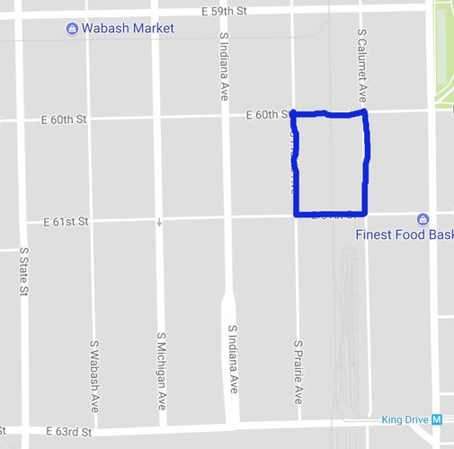
Square Block
The second type are the square blocks which are scattered throughout the neighborhood.
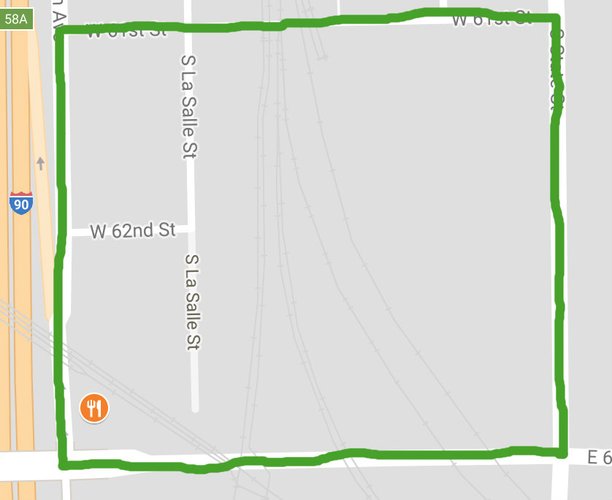
Super Block
Washington Park also has 3 major super blocks. This particular block is squared off, being used for a industry. There is also another super block located on the northern side of Washington Park which is where the old Robert Taylor homes stood.
The layout of Washington Park closely follows the grid system, matching the Savannah Pattern. It has the Savannah Pattern advantages of being easy to navigate but at the same time very monotonous.
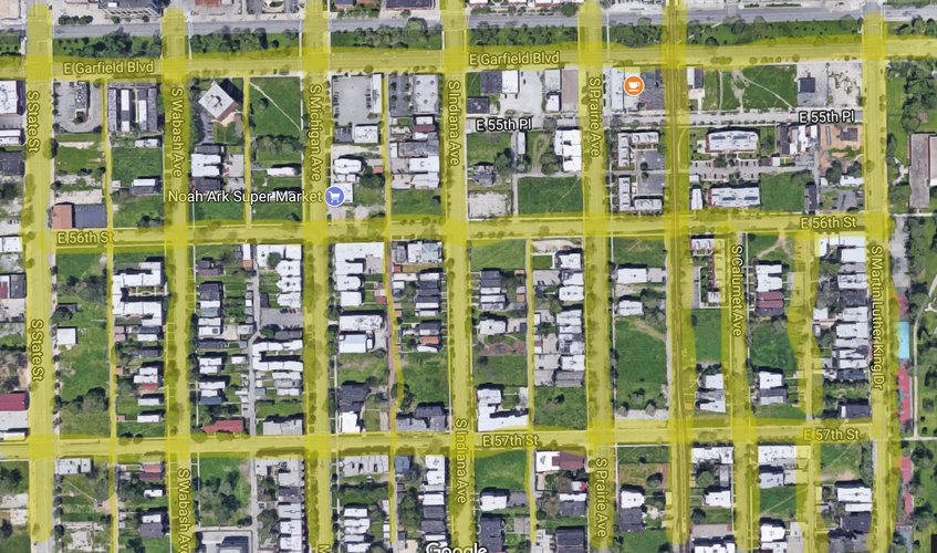
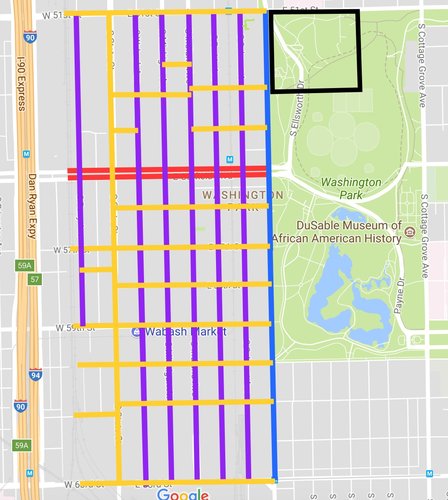
As Washington Park is extremely residential it hosts a variety of througoughways. Additionally the actual Washington Park has several paths for pedestrians. However, I found the naming of Ellsworth and Payne Drive to be misleading. Drives, according to the lexicon, border nature not run through it. I would rename these as roads to most accurately describe their function.
Boulevard (red)
Drive (blue)
Avenues (purple)
Street (yellow)
Path (black)
Passage (green)
As stated before Washington Park is an extremely residential neighborhood. There are very few business or even single family homes. Most of the real estate is dominated by 3 to 4 floor apartment brick buildings. The neighborhood also closely follows the grid system which makes it very connected at least by car. When looking at the Savannah Pattern we can see how a grid system tries to make navigation as simple as possible for drivers. Every street leads to another one with almost no dead ends. Yet, at the same time Washington Park is an aesthetically boring neighborhood. The square/rectangular layout of blocks along with similar architectural design allow for few social landmarks. For example, a person could not easily say to a friend you know you are here when you see such and such. This may not be a problem for connectedness but it certainly bring up issues with neighborhood identity.
However, when looking at connectedness in the city we have to account for vehicle use. When driving around I found Washington Park really easy to move through, the streets are numbered with the other thoroughfares always leading to a major one. For example, avenues like Indiana run straight through the neighborhood. This means that if I am driving from south from Bronzeville or another neighborhood I can easily access 55th to 63rd street. At the same time, these avenues can be tricky as most are one way. Using a Savannah pattern with one way streets can cause heavy traffic when there is road construction. For example, over the summer, it took me almost 20 minutes to find my way out of Washington Park during construction. I found Garfield Boulevard to be the highlight of the Washington Park thoroughfares. With 5 lanes along each side, the boulevard does a great job of alleviating traffic while also providing beautiful green scenery.
Although great for vehicles Washington Park is horrible for the pedestrian. In the neighborhood there are no paths or even pedestrian friendly block types that can make movement easier. For example, the elongated block shown above hosts a couple apartment buildings. If I was on Wabash but lived on Michigan I would have to walk around that entire block in order to get to my apartment. When analysing connectivity this explains the lack of pedestrians on the street. It is just too hard of a neighborhood to walk through.
Throughout the weeks I spent doing research on the urban structure of Washington Park I discovered that the neighborhood lacked in many areas like diversity, amenities, and connectedness. However, the most pressing matter in Washington Park is the lack of substantial public space. In the public space portion of my hood mapping project I found that Washington Park only has 2 public spaces; the physical park and the Sweet Water foundation. The actual Washington Park which is managed by the City of Chicago is a horrible public space in that there is little to no community involvement as well as being located on the outskirts of the neighborhood. By contrast Sweet Water Foundation represents an amazing and dynamic public space. It has a community garden that targets the food amenity problem in Washington Park while hosting a variety of youth programs. By being located on the interior of Washington Park and being a smaller space the Sweet Water Foundation combats many of the problems encountered by the actual Washington Park. As such I am modeling my public space interventions on this organization.
Another problem faced by Washington Park that I covered in my overview section of hood mapping was the amount of vacant lots and property in the area. Washington Park currently has 523 vacant properties making it the 8th highest in the City of Chicago. The surrounding neighborhoods of Englewood and Grand Boulevard also have high amounts of vacant land. Vacant lots have a negative impact on a neighborhoods as a whole. They lower the property value and damage the aesthetic beauty of the areas. Additionally vacant lots attract crime and are costly for the city to clean. Many vacant lands are contaminated with hazardous wastes such as lead, cadmium, arsenic and asbestos which result in unsafe conditions for children and adults. The City of Chicago City currently has the $1 lot program which sells vacant lots to community members for $1 but none are offered in the Washington Park neighborhood and the program is very restrictive. With my proposed interventions I plan to transform vacant lots into community public spaces.
It is important to note that when revitalizing vacant lots the solution is not always development. In many high density cities there is a significant need for open and green space. Open space has proven to increase the overall physical and social health of individuals. It improves air quality while reducing stress and depression. The inclusion of developed and well maintained open space can help alleviate the problems with vacant lots by increasing liveability of an area, giving people a place to socialize, and raising property value. That is why the guiding question for my project is: How do we reutilize and revamp vacant land while fulfilling the need for open space in an urban environment?
I want to locate all of the proposed interventions in a central part of Washington Park. This way my interventions are integrated and accessible to the larger community.
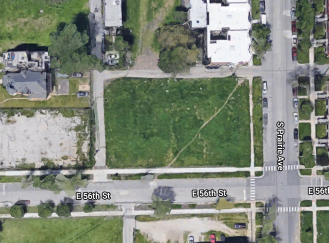
For my first intervention I want to build community gardens in Washington Park similar to the Sweet Water foundation. In the amenities portion of my hood mapping project I found that Washington Park lacked grocery stores making it a food desert. According to my research 23% of residents do not live within 5 minutes walking distance of a grocery store and those that do live next to mini marts which do not provide enough food to sustain a family. Community gardens have been used in many cities including Chicago to combat the problem of food deserts. What makes them so effective is that they are cheap to build while engaging the larger community.
Taken from google maps
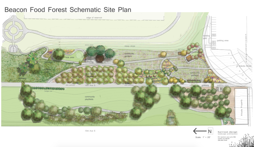
Example of a large scale food forest in Seattle, Washington. This shows the future of community gardening which recreates ecosystems.
Taken from: http://beaconfoodforest.org/media/downloads/bff-plan.jpg
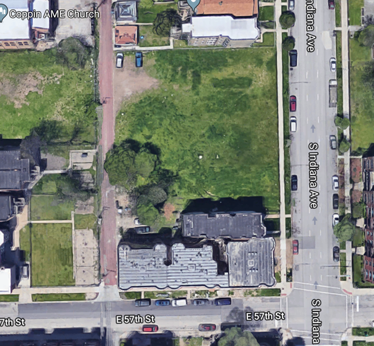
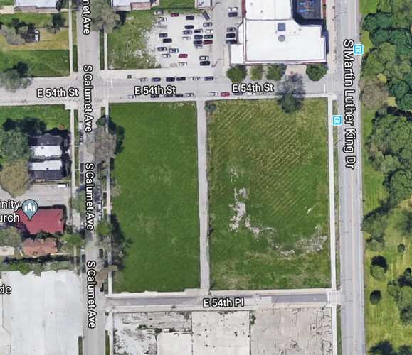
Location: 57th and Indiana
Area: 29719 square feet
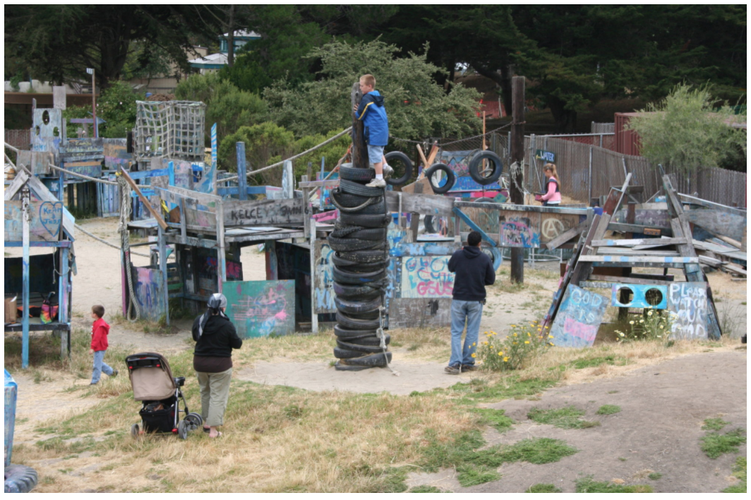
My second intervention involves building small recreational spaces in Washington Park. In terms of public space, there are almost no spaces where kids as well as adults can go sit down or play. Creating a variety of recreational spaces not only contributes to physical health of a neighborhood but provides people the opportunity to meet and socialize within their area while improving social connectivity. There are three major recreational spaces that could fit into the 57th and Indiana lot; a playground, sports court, and a mini park.
Taken from google maps
Adventure playground located in Berkeley, California. This innovative playground takes discarded material and turns them into an oasis for kids to play and experiment. This shows that recreational spaces can take many different forms and shapes.
Taken from: https://archpaper.com/wp-content/uploads/2016/06/Adventure-Playground-Berkeley-CA-Courtesy-of-Adventure-Playground-e1466111622702.jpg
Area: 125819 square feet
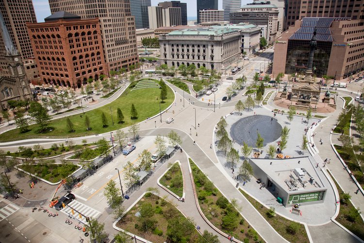
My last intervention focuses on creating a public square in Washington Park. One of the biggest assets a neighborhood can have is a sense of place. By creating a public square we are creating an area that Washington Park residents can flock to and claim as their own. In the same way the Daley Plaza is indicative of the loop, this public square will be indicative of Washington Park. Another benefit of having a public square is the creation of a Washington Park market. When exploring Washington Park under the green line I noticed that there were people selling goods. It reminded me my visit to Sunshine Gospel Ministries in Woodlawn were one of the program directors said that most people in Washington Park and Woodlawn have their own informal businesses. A public square can give the opportunity for small business owners to showcase their goods benefiting the local economy.
Taken from google maps
This example of a public square in Cleveland, Ohio shows the ways in squares are integrated into the neighborhood while providing much needed green space.
Taken from: http://www.fieldoperations.net/project-details/project/cleveland-public-square.html
Abbasi, Ayah, et al. “Open Space Quality in Deprived Urban Areas: User Perspective and Use Pattern.” Procedia - Social and Behavioral Sciences, vol. 216, 6 Jan. 2016, pp. 194–205. ScienceDirect, doi:10.1016.
Dardick, Hal. “Aldermen Advance Fly-Dumping Crackdown.” Chicago Tribune, Chicago Tribune, 3 Oct. 2017, www.chicagotribune.com/news/local/politics/ct-met-emanuel-fly-duming-crackdown-20171003-story.html.
Gladwell , Hattie. “A Basketball Court in Paris Has Been given the Most Amazingly Vibrant Makeover.” Metro, Associated Newspapers Limited Read More: Http://Metro.co.uk/2017/06/29/a-Basketball-Court-in-Paris-Has-Been-given-the-Most-Amazingly-Vibrant-Makeover-6744319/?Ito=Cbshare Twitter: Https://Twitter.com/MetroUK | Facebook: Https://Www.facebook.com/MetroUK/, 29 June 2017, metro.co.uk/2017/06/29/a-basketball-court-in-paris-has-been-given-the-most-amazingly-vibrant-makeover-6744319/.
Jobson, Christopher. “City Museum: A 10-Story Former Shoe Factory Transformed into the Ultimate Urban Playground.” Colossal, Colossal, 2 June 2015, www.thisiscolossal.com/2015/06/city-museum/.
Social Mix
Analysis
The results from the Simpson Diversity Index showcase the impact of white flight and segregation in the city of Chicago. During the Great Migration thousands of black families moved to the city in order to find work and escape the Jim Crow south. Neighborhoods like Washington Park underwent a system of white flight, leading to disinvestment in the area. Additionally, landlords would charge their African Americans tenants above market value knowing that racist housing covenants restricted their ability to move. This combined with predatory lending and government redlining drained the savings of many African American families leading to the creation of urban ghettos. From the chart we can see the effects of this. For example, most residents of Washington Park rent instead of own their houses/apartments. Ownership is one of the main ways in which Americans accumulate wealth. Furthermore we can see the education gap in Chicago. The diversity index for education is low in Washington Park as many residents were unable to attend college. The most important conclusion to draw of the Simpson index is that diversity does not always mean there is a lack of lack of segregation. In Chicago we have high diversity but still remains a very segregated city.