Overview
Social Mix
Public Space
Amenities
Connections
Final Project
Size
Around 54,402 people live in Rogers Park, based on my estimation using Social Explorer. The area is about 1.8 square miles (1152 acres).
There are very few single-unit residences (only 7%) and the rest are multi-unit apartments and condominiums (censusreporter.org).
I would call Rogers Park a face-block neighborhood. Additionally, there are many “U” shaped apartment buildings with courtyards in the middle, perhaps creating mini face-block “neighborhoods.”
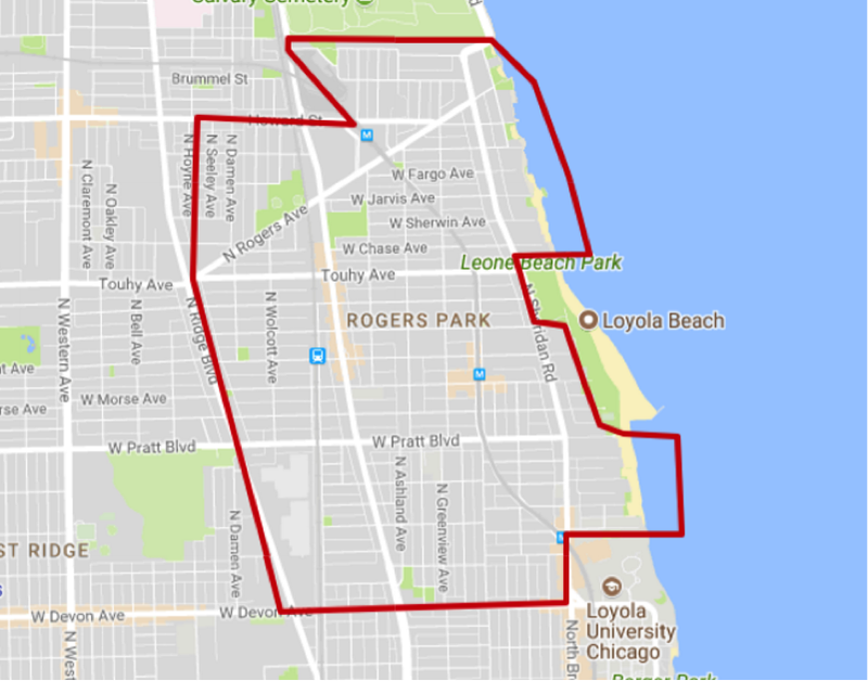
Source:
Christopher Devane (http://neighborhooddigest.com/udf/gdHoodMapChicago.cfm?gdHood=183&gdMLS=MLS)
Identity
When
you are in Rogers Park, you are aware of it. There are banners on the lampposts
with the neighborhood’s logo and signs when entering the area. Additionally,
many local establishments have used the neighborhood’s name in their own, such
as Rogers Bark (pet groomers), and Pub 626 (a bar whose name represents the
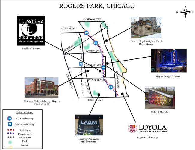
last digits of the Rogers Park zip code). Because of the “Mile of Murals”
project, there are many murals in the area that depict the history and culture
of Rogers Park. These reinforce the sense of neighborhood, as do the many other
works of public art in the area.
The neighborhood seems quite coherent, with the exception of Loyola University seeming like its own separate neighborhood. However, there is some overlap and interaction between Loyola and the greater Rogers Park area, so they are not totally disconnected from each other and share many of the same eateries and cafes. It should be noted that some maps of Rogers Park do not include Loyola University, including Christopher Devane’s.
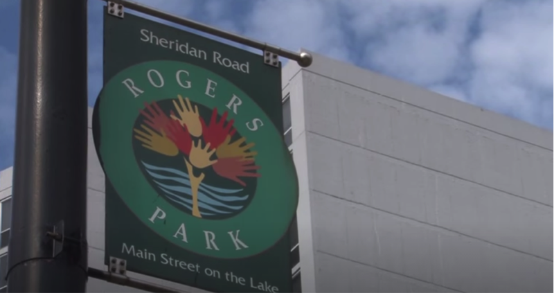
A
Rogers Park banner on a lamppost. Source: Rogers Park Chamber of Commerce
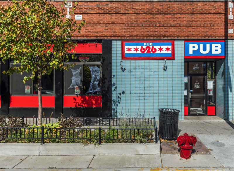
Pub
626, at 1406 W Morse Ave, so named for the zip code of Rogers Park. Source:
Google
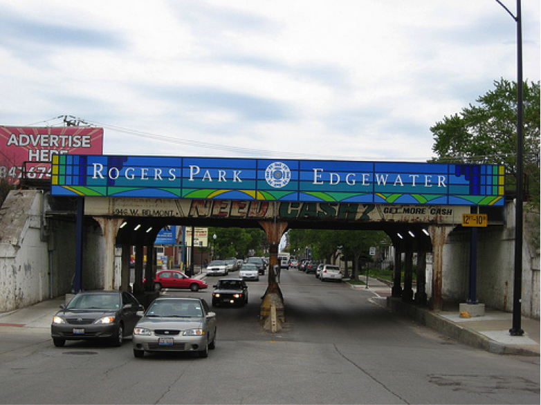
Sign
marking the border between Rogers Park and its neighbor, Edgewater. Source:
Google
Layers
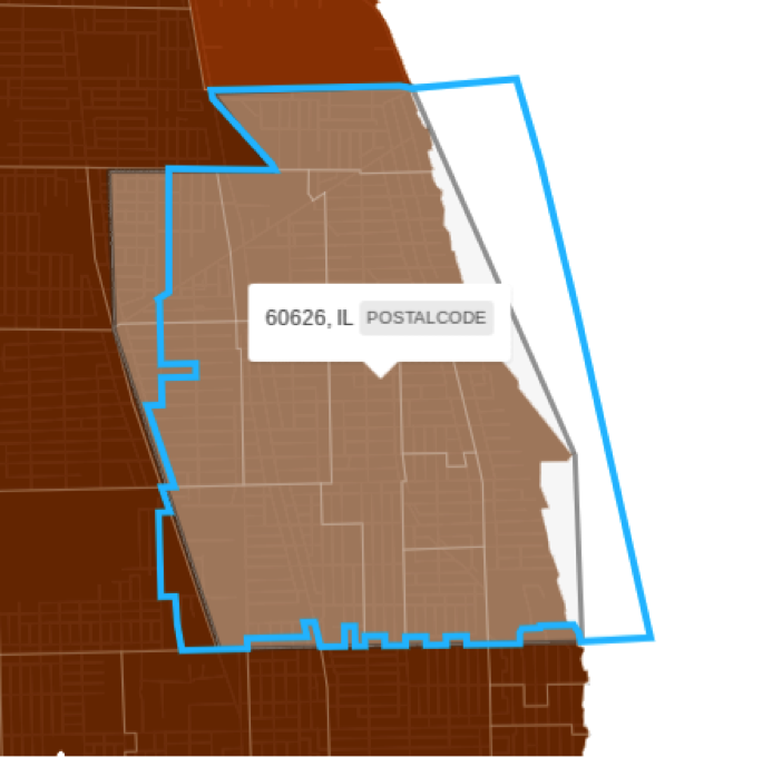
Rogers Park (grey shading) compared to the zip code 60626 (blue outline), showing that they do not overlap exactly. Produced with Social Explorer.
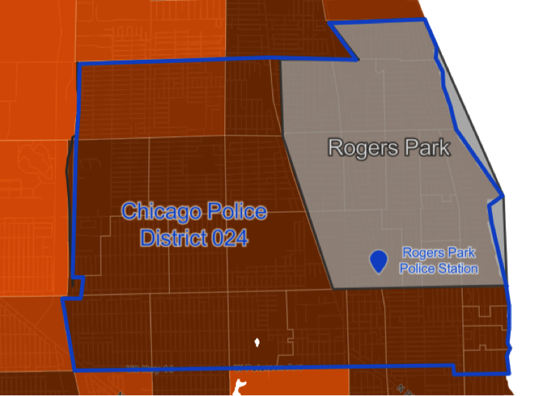
Map
showing the overlap of Chicago Police District 24 (blue outline) and Rogers
Park (grey shading). The District 24 police station, which is located in Rogers
Park, is also shown. Produced using Social Explorer.
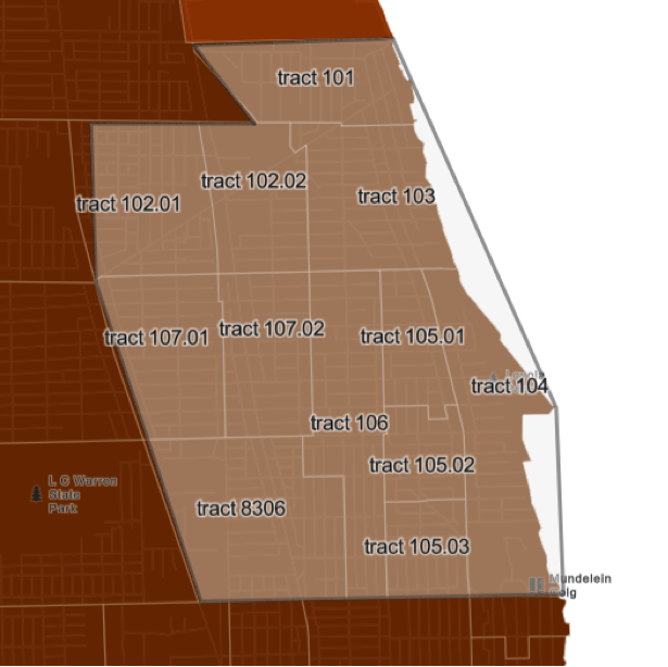
Census tracts in Rogers Park. Produced with Social Explorer.
History
Rogers Park is named for Phillip Rogers, who originally purchased 600 acres of land along the Chicago & Milwaukee Railroad (now Metra). Between 1830 and his death in 1856, Rogers acquired about 1,600 acres of land from the government some time, which includes what would become the neighborhoods of Ravenswood, Rogers Park, and West Ridge. In 1872, the land was subdivided Patrick Touhy, Rogers’ son-in-law. He sold parts of land to Stephen Lunt, Andrew B. Jackson, Charles Morse, Luther Greenleaf, and John Farwell (all of these names are now well-known streets in the area). These men called themselves The Rogers Park Land Company, and purchased the rest of land that would become Rogers Park. Many settlers moved into the region by 1878, when the village was chartered by the state. The population grew enough to be annexed to Chicago by 1893.
In the 1860s, the Chicago and North Western Railroad, along with the Chicago, Milwaukee and St. Paul Railroad allowed Rogers Park residents access to Chicago. Eventually the Howard “L” station opened in 1908, causing an influx of people to Rogers Park. Because of the fast growth, large apartment buildings were built along the train line, and large apartment buildings remain the norm today and 93 percent of buildings are multi-unit, and most residents rent rather than own.
World War II brought housing shortages, which led to the subdivision of large apartments into smaller ones. Public-private partnerships were formed to invest in the housing stock and to provide social services because of growing concerns that the overcrowding and poverty would lead to crime.
Religious, entertainment, and commercial areas emerged on Clark Street, Devon Avenue, and CTA stations. Theatre venues were very important to the neighborhood until the 1980s, and Rogers Park used to be home to extravagant theatres including the Adelphi Theatre, which is now an historical site.
Rogers Park is known as one of the most diverse neighborhoods in Chicago, and it has become increasingly so over the years. Most of the initial population consisted of Irish, Germans and Luxembourgers. The 1960s brought Russian and Eastern European immigrants. A growing number of Asian immigrants and black citizens was seen during the 1970s. Rogers Park continues to be home to a diverse set of people. According to 2015 census data, the population is 44% White, 22% Black, 7% Asian, and 23% Hispanic. Around 40% of the population speaks a language other than English in their household, and about 30% of residents were born outside the U.S.
(Sources: Encyclopedia of Chicago, Rogers Park/West Ridge Historical Society, Census Reporter)
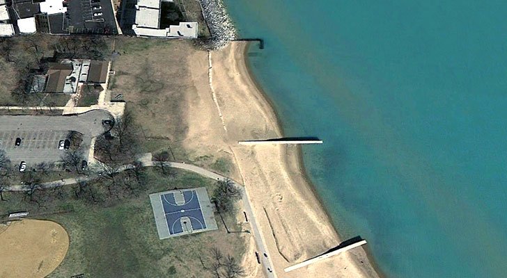
Being very close (in terms of walkability and via transit or drive) to the lake, Rogers Park is home to many beaches and lakefront parks. While admittedly the parks are not used year round due to weather and the beach is mostly utilized during the summer, I would argue that the way Rogers Park residents use it is representative of their sense of comfort and belonging in most public spaces. I have been visiting Rogers Park’s lakefront beaches and parks since I was nine years old, and feel very familiar with the public space.
Being a diverse neighborhood, the public spaces in Rogers Park are often utilized by a diverse set of people. This is certainly true of Rogers Park. People of various ages, races, socioeconomic backgrounds, and cultures frequent the lakefront. There seems to be a strong sense of community and familiarity--I have often seen people run into their neighbors and friends while swimming, jogging along the path or taking their dog for a walk. Teens in the neighborhood play basketball on hot afternoons, It is a welcoming place where residents can relax and spend time with neighbors, friends, and family.
Since the western limit of Rogers Park is roughly 1.5 miles from the lake, it is extremely easy to walk to the beach or lakefront park, and driving is not necessary but parking is provided. It is a safe place; parents feel at ease having their unsupervised children walk a few blocks to the lake to swim in the lake or play at the park. The parks and beaches are well maintained by the Chicago Park District, and recreation such as yoga classes and paddleboarding are offered.
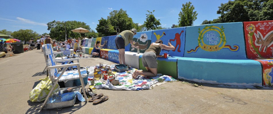
For the past 24 years, the community is invited to participate in the “Artists of the Wall” event, which invites residents to help create a 600-foot mural along the sea wall. Originally a community effort against graffiti on this wall, this has become an annual celebration of culture and creativity of the residents of Rogers Park (not to mention its contribution to Rogers Park’s rich public art scene). There is free live music and celebration and Every year the mural undergoes a metamorphosis; it remains for one year and then is painted over, so as the neighborhood changes so does the mural. Events like this, in addition to holidays such as Independence Day, Labor Day and Memorial Day, bring the community to this shared space.
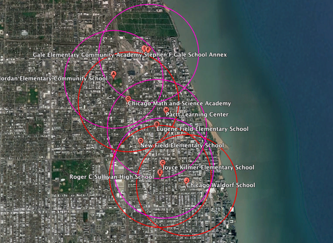
This image shows a 10 minute walk (0.5 mile radius) from elementary schools (magenta circles) and high schools (red circles). As you can see, much of Rogers Park has access to schools only 0.5 miles away.
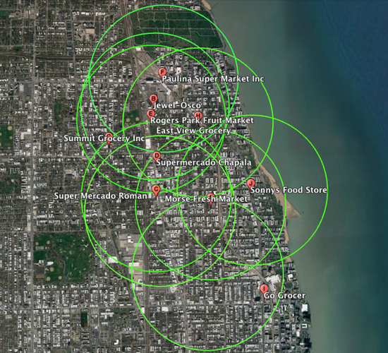
This image shows areas within a 0.5 mile radius of a grocery store. Most residents can shop for food and necessities without walking more than 10 minutes.
As you can see from the graphics, almost everyone living in Rogers Park is within a ten minute walk, or half a mile, from grocery stores (lime green circles), elementary schools (magenta) and high schools (red). Rogers Park has mixed-income housing and is a mixed use neighborhood, which means it has affordable housing near businesses and services, and this contributes to its walkability. It has a walkscore of 86 out of 100 points (walkscore.com).
Further, daily life needs are very accessible in Rogers Park by walking and by bike, especially after the neighborhood began work on a neighborhood greenway project that includes aspects such as raised pedestrian crosswalks, contraflow bike lanes, sinusoidal (smoother) speed humps, curb extensions, and clearer street markings that will increase the safety of pedestrians and cyclists. This greenway project is part of the Chicago Complete Streets Campaign (http://chicagocompletestreets.org/).
Public transportation is also very easy to use in Rogers Park, and makes residents’ daily lives more convenient. About 42 percent of Rogers Park residents use public transit to get to their places of work, compared to 9 percent of all Chicagoans (censusreporter.com). Especially when considering Chicago’s rough winters and unpredictable and often inclement weather, I think public transit can be factored into the “pedestrian shed.”
I would say that one could live quite easily and happily in Rogers Park without having to leave to get daily life needs and services. In addition to schools and grocery stores, there are countless restaurants, museums, culture, music, and entertainment all in the 1.7 miles that encompass Rogers Park.
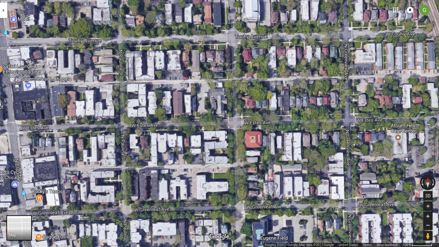
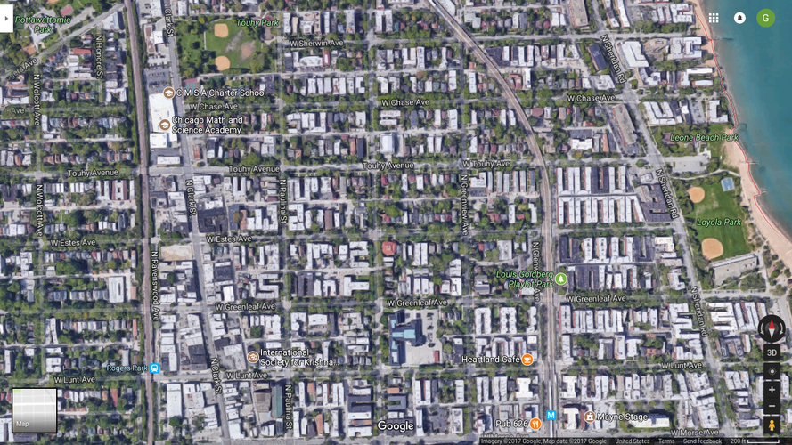
The dominant (and, based on my findings, essentially the only) block type in Rogers Park is elongated blocks, as demonstrated in this picture.
The elongated blocks make up a larger network resembling an orthogonal grid, similar to the example of the Savannah pattern given in the Lexicon of New Urbanism.
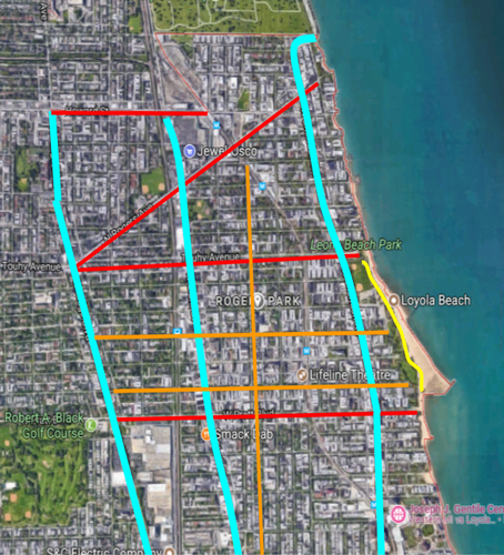
Some examples of the types of thoroughfares in Rogers Park. Blue represents boulevards, red represents avenues, orange represents streets (although of course there are significantly more than drawn), and yellow represents a path.
Rogers Park is a very connected neighborhood, as neighborhoods with orthogonal grid layouts often are. This layout makes it easy to navigate and the large amount of connections and intersections of these thoroughfares provide pedestrians, bikers, and drivers a multiplicity of options for effortless travel. This design also encourages favorable traffic distribution, with vehicles concentrated in the periphery rather than the center, causing less congestion. Many people walk in Rogers Park, as amenities are closeby, which means people know their neighbors (in the sense of recognition and sense of belonging, rather than very personally). The most common (and nearly the only) block type, elongated blocks, allow for the endgrain to border higher-traffic streets so the residential buildings are quieter and more conducive to residents enjoying their front yards and going on walks both for pleasure and utility.
My proposed interventions for Rogers Park focus on designating public spaces within the neighborhood that will encourage connection and interaction. While there is a rich culture and sense of identity in Rogers Park, there are not distinct places in the public realm that can serve as centers for the community.
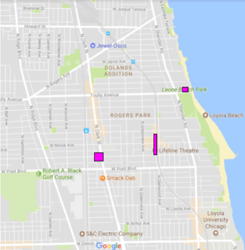
Shown above are the proposed locations for my neighborhood interventions.
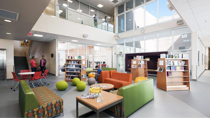
The first intervention is in response to community members' rising concerns about crime and violence in Rogers Park. Specifically, many parents and residents are concerned about youth involvement in gangs, as there has been a rise in gang-related crime in Rogers Park in recent months. While there is already a community center in the neighborhood, it does not seem to draw many young people to it and there is no space that specifically caters to the needs of teens and children. The creation of a youth center will provide a public location for teens and kids to access tutors, get music and art lessons, and socialize. This will encourage academic, social, and emotional growth.
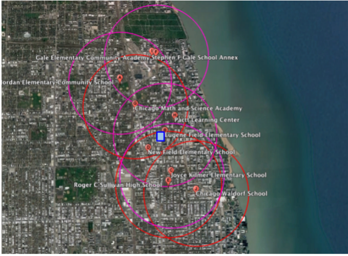
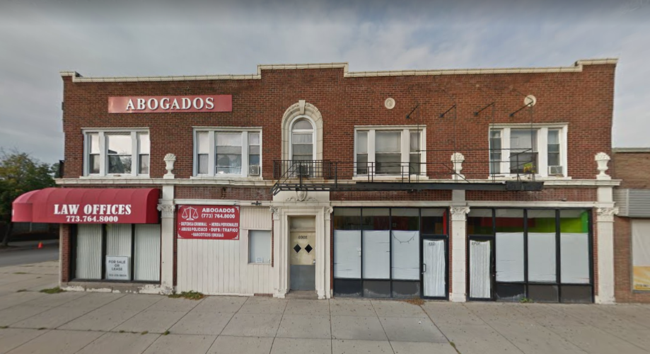
The proposed location was chosen because it is central to the neighborhood and is located within walking distance from nearly all Rogers Park schools, as shown in the graphic below. Additionally, the proposed location is directly across the street from the Rogers Park Chicago Public Library, which could be a resource for the children and adolescents attending the youth center. The lot is owned by the city already, so perhaps this could be helpful in securing the property.
A visual showing the proximity of the youth center to the neighborhood schools. It is in walking distance from all Rogers Park high schools (represented by red circles) and most of the elementary/middle schools (magenta circles). Original image from Google Maps.
The proposed location for the youth center building, at 6902 N Clark. Image courtesy of Google Maps.
An example of how the inside of the building could look. Those attending the youth center would have access to books, games, computers, art supplies. Image from https://www.glumac.com/project/ashland-youth-center/#.
Rogers Park lacks a clearly defined center; providing the neighborhood with a central gathering center can serve as a way to encourage more personal interactions with neighbors, local shop owners. The center of the neighborhood can act as a nucleus to a cell: a central place from which growth and activity originate.
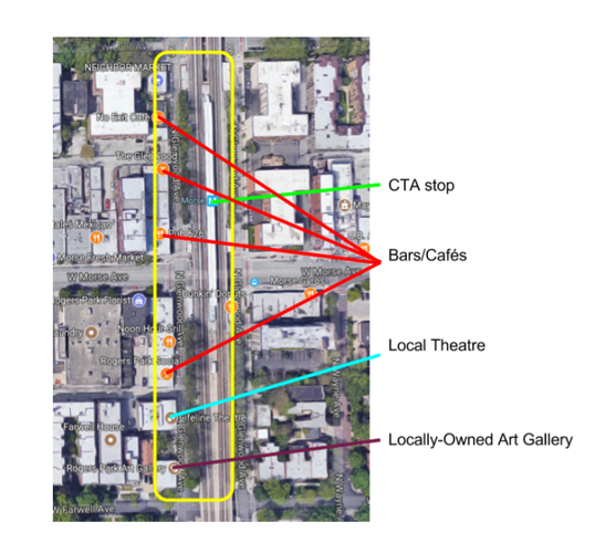
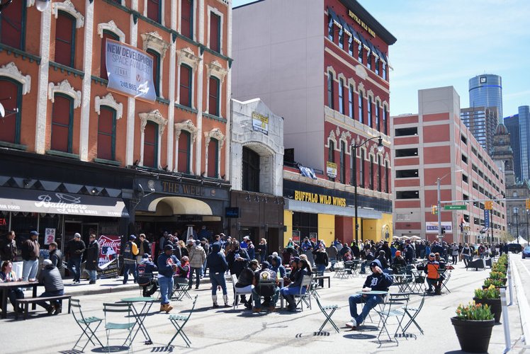
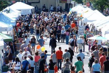
The location chosen for the plaza is on Glenwood Ave between Lunt Ave and Farwell Ave. already has potential to be a neighborhood hub. By using what is already there-- an art gallery, local theater, cafes, local bars-- the space can bring people in to a less-used area that is already part of Rogers Park's identity. The plaza will include two blocks of the Mile of Murals, a community-led project made to bring beauty to the neighborhood. This plaza will blur the lines between the public and private realms, creating a space that is welcoming for everyone. In fact, the exact blocks proposed for this plan are closed for a weekend once a year for the well-attended Glenwood Arts Festival, and perhaps the draw of the area during the festival could be a daily reality with the pedestrian street.
A map showing the location of the intervention (yellow) on Glenwood Avenue that will stretch from Lunt Ave to Farwell Ave. It also depicts the locations of local businesses that currently attract people, but are not yet places that residents linger in.
An example of a street converted into a pedestrian plaza. Photo from Michigan Live website: http://www.mlive.com/news/detroit/index.ssf/2017/04/detroit_tigers_fans.html.
A photo taken during the Glenwood Avenue Arts Festival. Source: DNA info: https://www.dnainfo.com/chicago/20170816/rogers-park/glenwood-avenue-arts-fest-time-schedule-date-when-food
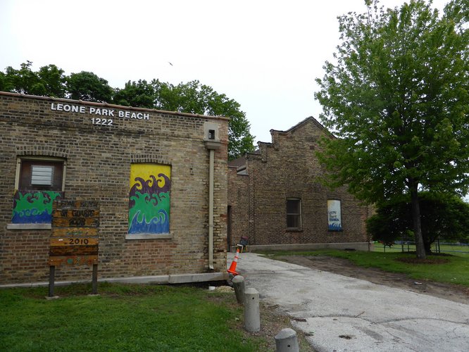
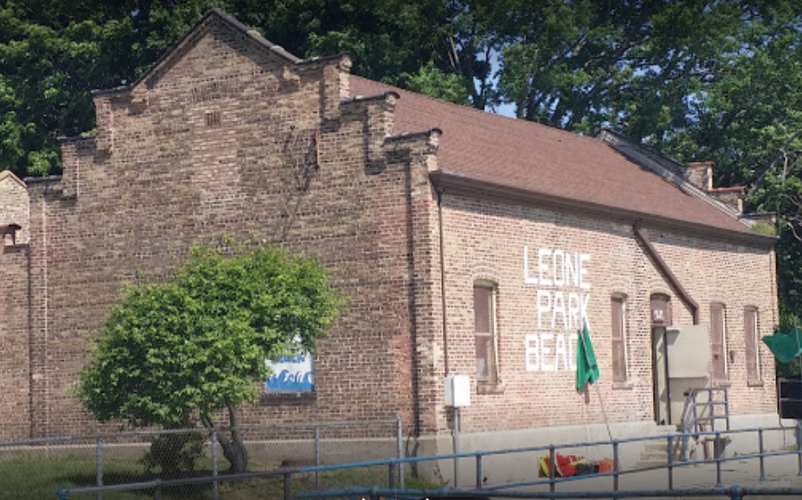
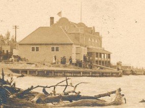
Leone Park beach is a favorite neighborhood spot to many of the residents of Rogers Park for its natural beauty and opportunities for recreation, but the amenities are lacking. The beach house, which was built 114 years ago, is in a state of disrepair and as a result is underused. However, it has sentimental value to many neighborhood residents, especially those who attended the Leone Beach Junior Lifeguard program that began in the 1920s and continues to exist today, but no longer uses the beach house. A renovation could turn this space back into an active space and an asset for Rogers Park.
Leone Beach house currently (above) and over a century ago (below). Sources: Google Maps and www.ward49.com.
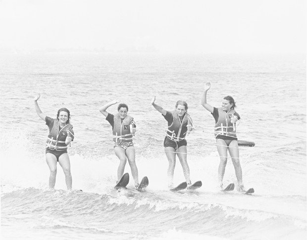
A photo from the old days of Leone Junior Guard Program. From the book "Sam's Boys," by Chris Serb.
Social Mix