Overview
Social Mix
Public Space
Amenities
Connections
Final Project
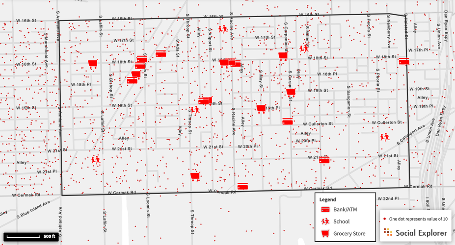
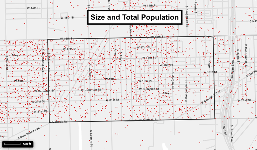
Pilsen has a total population of 11,140 people, according to 2016 survey data, and encompasses an area of 337 acres. Each dot on this map from Social Explorer represents 25 people.
Identity
Pilsen, a predominantly Mexican neighborhood, has a strong sense of identity. From the moment one steps off the bus at 18th and Ashland, murals and banners sporting the Mexican flag set the scene. One of the first establishments east of the stop is Taquería Los Comales, advertising Mexican cuisine under a green, red, and white sign. One block east, Latin music emanates from a tamale restaurant, and the bookstore across the street advertises solely in Spanish.
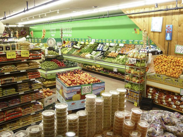
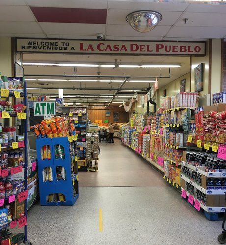
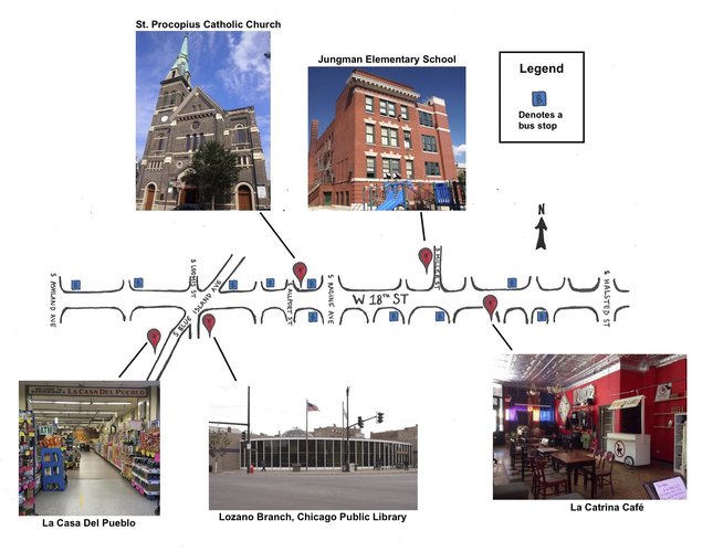
Off of 18th Street, Pilsen becomes sparser; away from this ribbon of commerce and culture, the neighborhood’s identity becomes markedly more discrete, relegated to a few other busy streets like South Blue Island Avenue. Here, the neighborhood’s Mexican heritage shines through in several distinct moments, most notably in La Casa Del Pueblo, Pilsen’s largest supermarket. Inside, one sees an array of fruits, vegetables, and spices that couldn’t be found in just any American supermarket: red and green jalapeños, habaneros, chiles, queso fresco, all boldly marked “Product of Mexico.” South Blue Island Avenue is lined with several of Pilsen’s most acclaimed and authentic Mexican restaurants, the Lozano Branch Public Library, and even a medical marijuana service. South Blue Island, however, is one of few instances of Pilsen culture south of 18th Street.
Away from the neighborhood’s periphery, the neighborhood is residential, and for blocks at time, a visiting pedestrian would have little to no indication that they were still in Pilsen. The architecture is somewhat cohesive, but in no way distinct from most Chicago neighborhoods or indicative of a particular culture. To combat this, some houses are adorned with red, green, and white banners. Corner groceries stores, too, restore a sense of identity in these otherwise unremarkable streets with their vibrant signage and Spanish adverts.
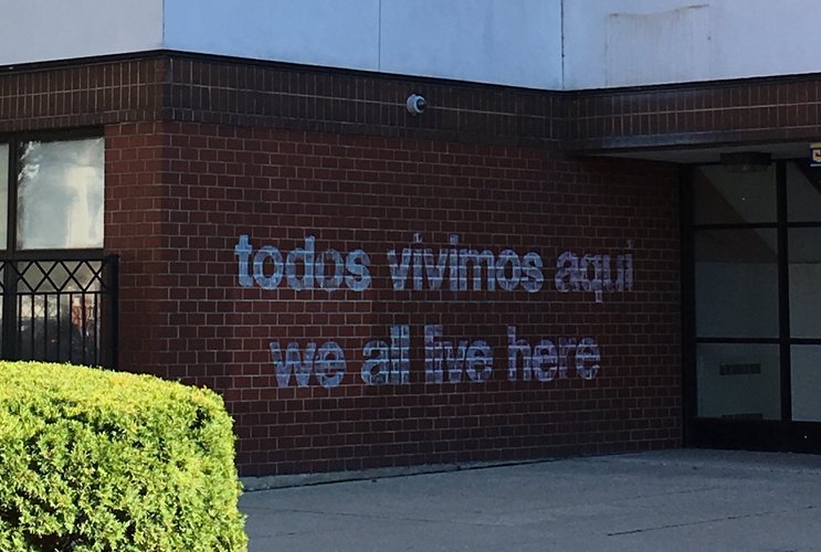
Additionally, Pilsen is a neighborhood of murals. Dispersed sporadically throughout the neighborhood, these huge, colorful gems serve no apparent purpose other than neighborhood unification and identification, much like the one I unexpectedly encountered across from Dvorak Park.
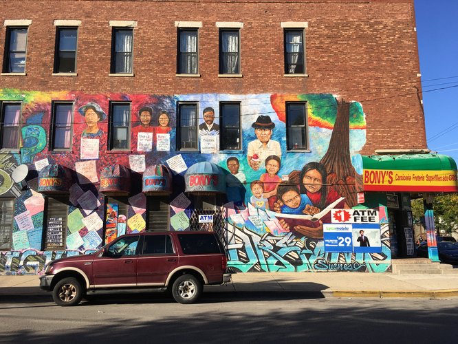
This, the westernmost edge of 18th street, feels like Pilsen at its most authentic; the prevalence of its Mexican influence dissipates gradually as one travels east into gentrified territory. Past South Allport Street, there is a notable shift from local lavanderías to sparkling new breweries and coffee shops. Situated throughout the newness are reminders that this is still Pilsen: A dress store for quinceañeras, a small Mexican art gallery, a smattering of corner groceries specializing in Mexican cuisine, and of course, the residents. In the midst of twenty-something-year-old newcomers and thrift shop-seeking tourists, families and friends who have called Pilsen home for decades cluster on the sidewalk or lounge on one another’s front steps. They chat about neighborhood happenings, like the open mic for women’s rights at La Catrina Café, or the community garden at St. Procopius Catholic Church. I approached one such group, and they told me about casual cookouts that turned into all-out block parties. These seasoned residents keep their doors open to one another, they entertain one another, they look out for one another, even if, as they say, newcomers don’t seem to appreciate their hospitality. Though old and new Pilseners coexist peacefully, the veteran residents acknowledge that gentrifiers don’t fit into the close-knit, family-friendly neighborhood environment that they have known for so long.
History
Since its founding in the 1840s, Pilsen has been shaped and defined by “both geography and human engineering” (Pero 10). At its conception, the German and Irish-settled neighborhood extended from the railroad tracks of 16th Street down to the Chicago River, from a cattle stockyard as its western border, eastward to Canal Street (Pero 11). Its prie location in between such a multitude of transportation modes – wagons, ships, trains, and cars – made the nascent Pilsen a commercial hub brimming with opportunity.
Lumber, beer, and textile were three particularly lucrative industries that brought Pilsen onto the public eye. In the 19th century, the Pilsen Yards were one of the largest, most prosperous lumber distributors worldwide. Brewers like the Atlas Brewing Company, the Pilsen Brewing Company, and the Peter Schoenhofen Company brought both wealth and public acclaim to Pilsen, and to this day remain known for their extraordinary success. Additionally, Pilsen industries showed their relative progressiveness by implementing policy that put women and other minorities to work at the textile assembly lines in the mid 1900s (Pero 12-15).
However, industrial success of this scale did not come without strife. A nationwide rail strike in 1877 (Gellman), spurred by repeated wage cuts, escalated into “one of the biggest street battles in U.S. labor history.” Due to the situation of a major railroad junction at the eastern edge of Pilsen, the worst of the violence, which took the lives of 30 immigrants and inflicted serious injury upon many others, took place at the intersection of 16th Street and Halsted (Pero 19).
The creation of so many unskilled jobs on railroads, lumber yards, and textile sweatshops in the 1870s brought about the influx of many Bohemian immigrants, who would go on to give Pilsen its name. One Bohemian settler gave his new restaurant the name “At the City of Plzn,” and the name subsequently caught on (Gellman).
However, the Czech heyday in Pilsen was somewhat short lived. In the 1920s, due labor shortages spurred by World War I, a significant population of Mexican immigrants first made their appearance in Pilsen, and have been a major presence ever since (Gellman). The Mexican population of Pilsen grew when immigration law and policy related to the expansion of the University of Illinois at Chicago in 1963 forced hundreds of Mexican families to relocate to the Lower West Side, south of 16th Street (Gellman). Once established, the Mexican immigrants created a “local economy that paralleled the dominant Chicago economy” (Pero 37). With their highly successful, albeit small, family business, the Mexican population thrived in Pilsen as other ethnic groups moved to different locations throughout Chicago.
Works Cited
Pero, Peter N. Chicago’s Pilsen Neighborhood. Charleston, SC: Arcadia Pub., 2011. Print.
Gellman, Erik. "Pilsen." Encyclopedia.chicagohistory.org. N. p., 2017. Web. 14 Oct. 2017.
Diagram
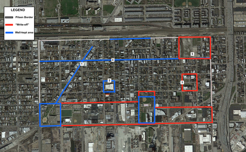
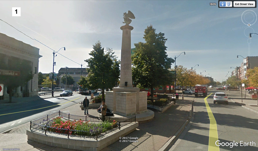
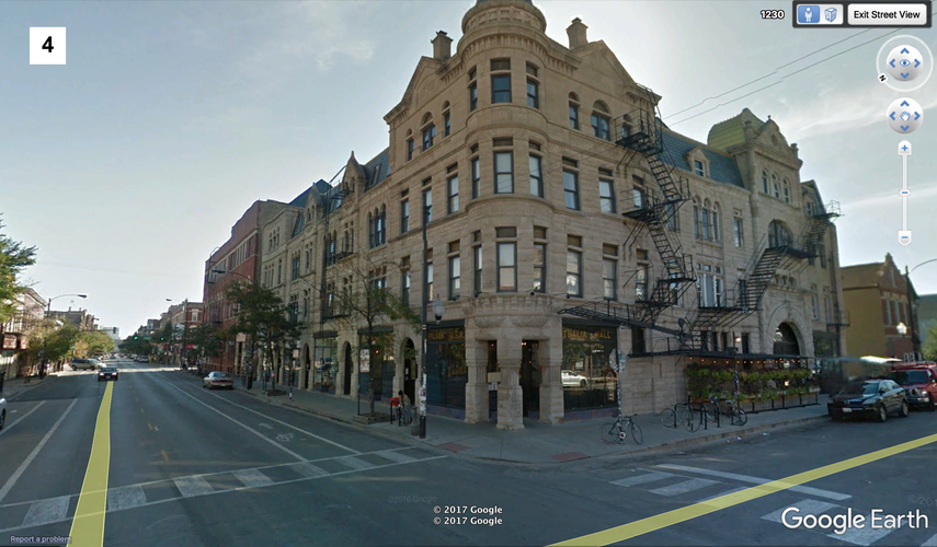
When evaluating Pilsen’s public spaces, those areas that were relatively clean, kept-up and updated, and those that attracted public life stood out to me as spaces that people care about. For example, one area that conveys a strong sense of ownership in Pilsen is 18th Street, which traverses the whole neighborhood and serves as a commercial and tourist hub (item 4 on the map below). On its west end, there is a strong presence of Mexican culture, and it is clear that the space is inhabited and frequented by the neighborhood’s more seasoned residents (Pilsen’s Mexican population has had a significant presence since the mid-1900s at the culmination of World War II).
South Blue Island Avenue (item 2 on the map) is another stretch bubbling with life. South Blue Island certainly has a lot of personality; it hosts La Casa Del Pueblo (Pilsen’s largest and most popular supermarket specializing in Mexican cuisine), as well as the Public Library and many other necessities like laundromats, post offices, etc. This street bears a lot of foot traffic; this amenities of South Blue Island Avenue clearly play a significant role in residents’ lives, excepting the very northernmost portion just before the 16th street train racks, at which point the small shops cease and one only sees parking lots and chain-link fences.
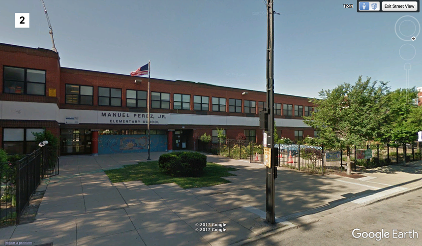
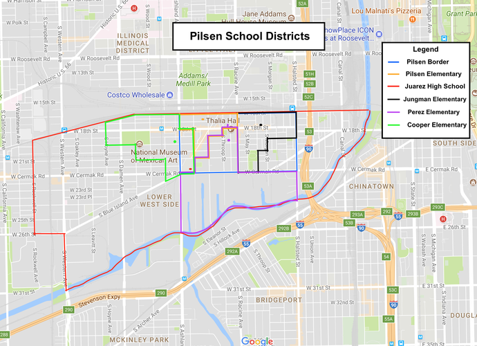
Additionally, the schools, like Juarez High School and Perez Elementary School (item 2) necessarily play an important role in the (almost) daily lives of residents. But other than regular foot traffic, the schools are very well-kept areas, boasting pleasant landscaping and free of litter.
Finally, though not a space that necessitates public interaction, the mural that stretches along the sidewall of the 16th street railway overpass brings life to the surrounding area. People walking along 16th street, for at least a few blocks, feel safe, entertained, and welcomed to a space that otherwise would have been a blank, intimidating concrete façade.
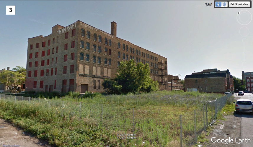
Conversely, areas lacking in development, lacking in people, graffitied, and/or littered signaled to me that these spaces had generally been given up on. For instance, the far south side of Pilsen, between 21st street and Cermak Road is particularly dilapidated. Buildings that once housed great Pilsen factories are now graffiti-ridden buildings wasting away on overgrown lots, surrounded by uninviting chain-link fences (item 3, for example). These spots definitely do not foster a sense of ownership.
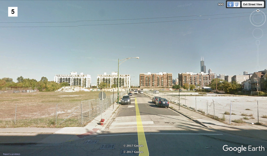
Pilsen’s far northeastern corner, too, is essentially a wasteland (item 5). When I spoke to residents who lived on the east end of 18th Street, I asked if I should head north towards 16th to see the rest of the neighborhood, and they opined that there was absolutely nothing to see up there. They were right. Besides housing, the northernmost portion of Pilsen, particularly spots like this corner, host horribly unkempt wasted space; vast parking lots riddled with weeds and ugly, empty buildings are not exactly encouraging landscapes for bustling public life.
In the following map, the areas described have been marked with numbers. Those five areas can be seen in greater detail below the map in images labeled with corresponding numbers.
Though a bit lighter on the east side, Pilsen’s population is generally quite evenly dispersed. Given this fact, as well as the clumping of Pilsen’s stores, I posit that Pilsen’s amenities are not well distributed. There are two particularly active thoroughfares, 18th Street and South Blue Island Avenue, on which the majority of the neighborhood’s services are housed, especially at their intersection. As can be seen from the map below, there is a cluster of banks and grocery stores at 18th and South Blue Island and a smattering of stores throughout the middle of the neighborhood, but the easternmost third of the neighborhood and its southwestern corner are in something of a service desert.
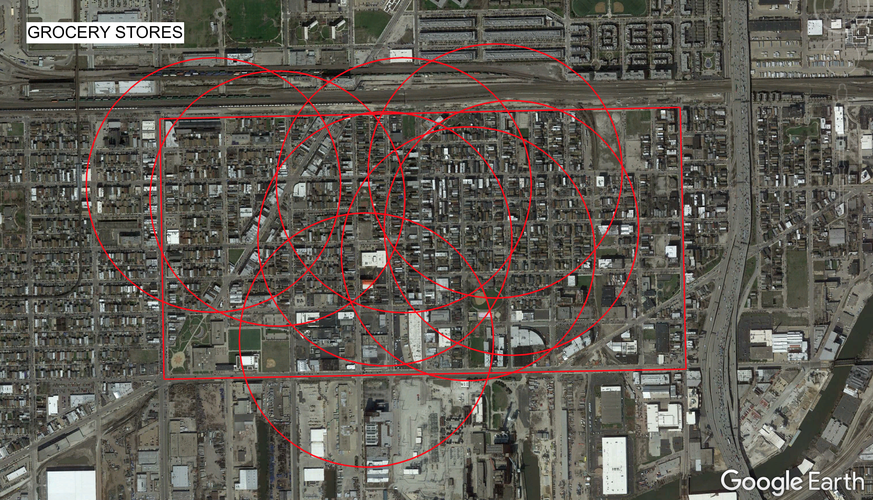
In the following visual, we see the "pedestrian sheds," one quarter mile in radius, surrounding Pilsen's grocery stores. Though they appear well spread out longitudinally, the grocery stores are primarily concentrated in the two westernmost thirds of the neighborhood, leaving the easternmost third, from Carpenter Street to Halsted without easy access to groceries. There are some small food stores in this area, though they are not noted on the map, as they are either seasonal (i.e., a farmers market) or unable to fulfill the daily life needs of a family (i.e., those that do not sell produce or most common groceries). Using data from Social Explorer, I estimate that about 1,000 Pilsen residents live farther than 1/4 mile from the nearest grocery store, leaving over 10,000 residents (>90%) within this "pedestrian shed." A very strong percentage of Pilsen's inhabitants is indeed accounted for and well provided for, but convenience could be maximized by the addition of a proper produce market on the neighborhood's east side.
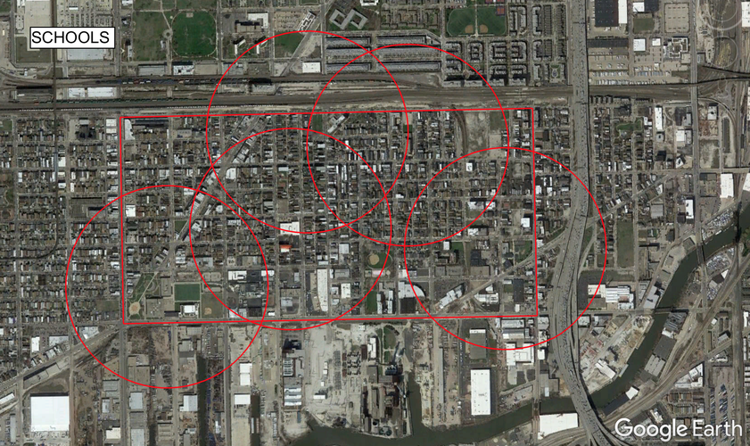
Pilsen is very much a family neighborhood. Though gentrifying and becoming more millennial-friendly, children under 18 still comprise over 16% of Pilsen's population. Accordingly, this neighborhood, not even one square mile in area, has over five different schools. Additionally, at least 85% of the population is a five minute walk away (or less) from one of these schools. However, despite Pilsen's apparently wide selection of schools, only one is a high school. Juarez high school, located in the less populated, somewhat amenity-scarce southwestern corner of Pilsen, is only accessible (1/4 mile or closer) to about 2,500 to 3,000 residents. This means that for about 8,000 Pilseners, access to their neighborhood high school is more difficult.
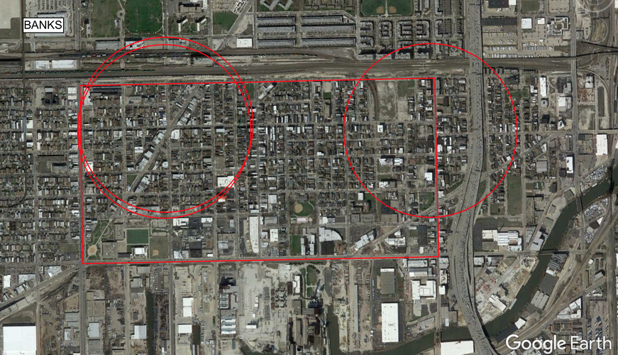
When looking at Pilsen's banks, Harris Bank, Wintrust Bank, and Byline Bank, it can be estimated that only about 3,000 residents live within a quarter mile of a proper bank. What's more, two of the three are located across the street from one another at the intersection of 18th Street and South Blue Island Avenue (where, as has been previously discussed, nearly all of Pilsen's best services are concentrated). The third, Byline Bank, is all the way to the east, situated at 18th and Halsted. Should someone live in the center of the neighborhood, between Allport and Morgan Streets, or anywhere south of 21st Street (which, incidentally, about 63% of Pilseners do), they would find themselves having to trek some distance.
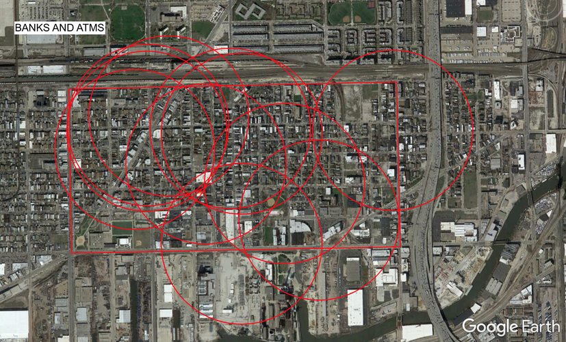
However, when taking into account ATMs as well as proper banks, I estimate that there are only about 500 individuals (less than 4.5% of the population) live farther than 1/4 mile from monetary services. As can be seen in the visual below, banks and ATMs are incredibly ubiquitous, spanning the entire neighborhood from east to west, and even all the way down to Pilsen's southern border, Cermak Road.
Though there is a definite grouping of daily necessities around a couple choice places, Pilsen's small size and friendly aura make these amenities much more accessible in reality than they may seem on a map. If one is willing and able to walk for just a bit longer than five minutes, one can traverse most, if not all, of the neighborhood, and find whatever they may need.
Block Types:
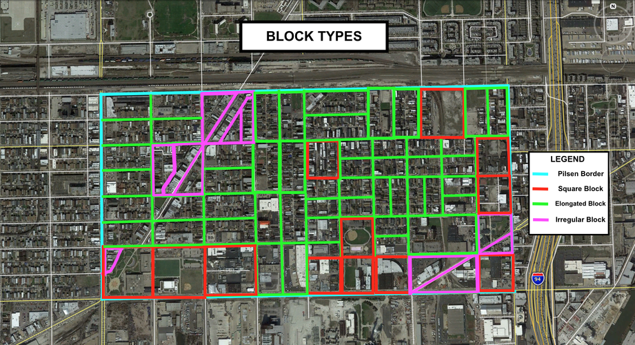
Pilsen is predominantly comprised of a mix of square and elongated blocks. A small number of blocks, transected by an avenue, have an irregular shape, but these blocks are in the minority. Most blocks in Pilsen are elongated blocks, which makes sense, as these are the most useful of the block types. These elongated blocks vary in length and depth and, shown in the following visual, allow for the neighborhood to incorporate alleys and rear lanes, keeping dumpsters and large trucks out of the main thoroughfares for the most part.
Thoroughfare Types:
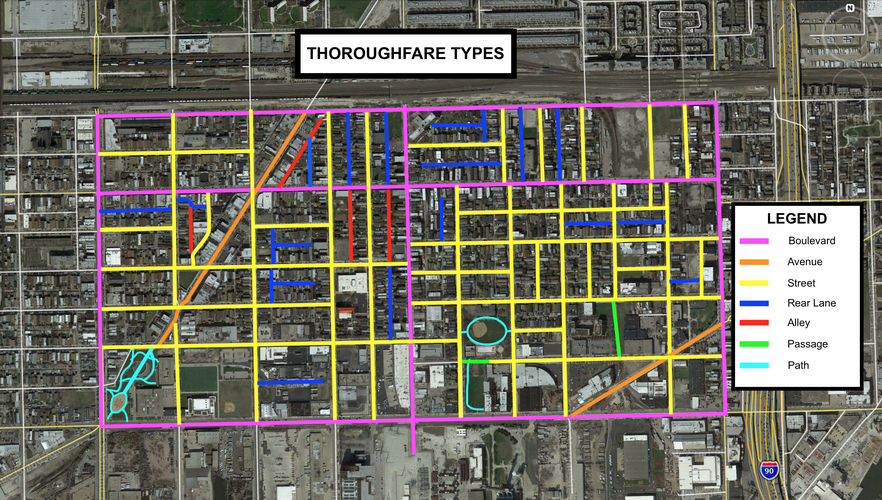
Pilsen is mainly residential, with its commercial activity concentrated on a few main thoroughfares. This makes sense because, as we can see in the above image, there are very few thoroughfares within Pilsen's borders that hold a high vehicular capacity (and thus would attract many tourists). Aside from the avenues and boulevards that cut across the grid, Pilsen is all narrower streets, paths, and passages (in other words, extremely low velocity and highly walkable).
Network Type:
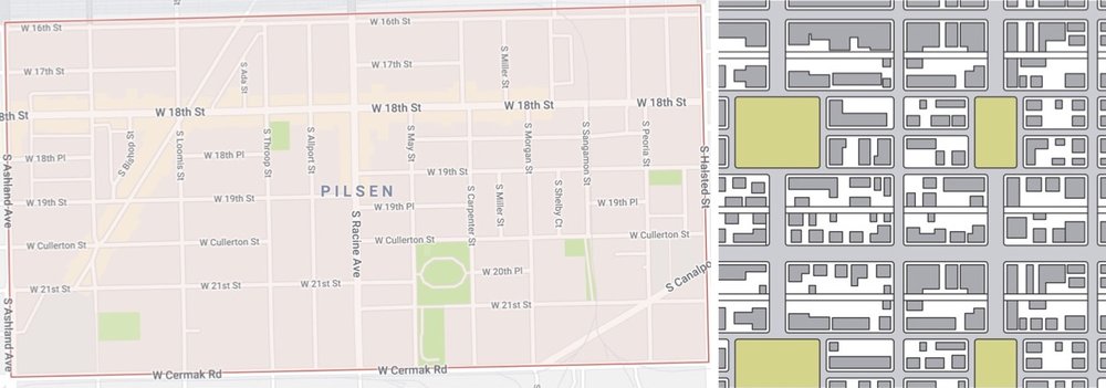
Pilsen's network type most closely emulates the Savannah Pattern. In the above image, we see Pilsen's network (left) compared with the Savannah Pattern (right; image courtesy of Duany Plater-Zyberk & Co.'s "Lexicon of New Urbanism"). We can see that, like the Savannah Pattern, Pilsen is comprised of all straight lines, fosters directional orientation with ease, relegates most high-speed traffic to its outskirts, and makes efficient use of alleys and rear lanes. Pilsen diverges from the Savannah Pattern, however, in that there is not an even dispersal of traffic throughout the neighborhood; fast and/or heavy traffic is only able to travel around the neighborhood's perimeter or through the neighborhood by way of only three thoroughfares. Otherwise, the neighborhood is comprised of narrower streets through residential areas with slow speed limits.
Connectivity Analysis
Pilsen is very well connected within its own borders; the neighborhood, well-paved and equipped with sidewalks, is extremely pedestrian-friendly. Pilsen is also car-friendly, and most residents do have cars that they may either park in the street or in rear lanes behind the homes, but the low velocity of the streets creates a safe environment for drivers and walkers alike.
Aside from possibly needing to cross a busy intersection at times, there are no major obstructions in the neighborhood that would inhibit walkability. There are parks with vast green space, but these parks provide paths and passages that pedestrians may use to shorten their route, rather than having to walk all the way around them.
Furthermore, nearly every block contains a rear lane or alley (most, but not all of which were highlighted in the image entitled "Thoroughfare Types"), which definitely aid the neighborhood's connectivity. If they feel safe in doing so, a pedestrian may also use these thoroughfares as short-cuts, and their situation within blocks keeps unsightly dumpsters and intimidating delivery trucks out of sight.
It is true that, given its grid-like network and consistent block shape, Pilsen can be a bit monotonous from a designer's perspective, but this is not entirely the case when actually walking the streets. Pilsen is a very lively neighborhood with a lot of personality, certainly due in part to its excellent connectivity; as residents are able to access one another with ease, social bonds are formed and neighborhood identity flourishes.
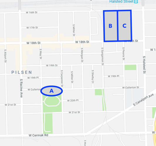
An analysis of Pilsen’s public space reveals that most social activity centers on 18th Street, the site of adult attractions: Trendy bars, restaurants, and music venues. This makes Pilsen a hot destination for young tourists and gentrifiers, but leaves families with children without many options. What spaces the neighborhood does have, such as the park center located at the north end of Dvorak Park, are in a state of disrepair, and elsewhere throughout the neighborhood, there are pockets of barren, dead space. Therefore, I propose to make three interventions that will enhance Pilsen’s public space and help public life to flourish among residents of all ages, through ever corner of the neighborhood. The locations of these interventions are pictured below.
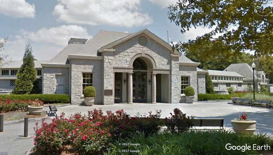
First, I posit that renovations to the Drovak Park center will make the space more accommodating to residents and will therefore be more frequently utilized. Currently, the building looks run-down, grimy, and forgotten. Updates to the center could be relatively simple; a fresh coat of paint, a sign clearly demarcating the name and purpose of the building, and new and better lighting that would make the center look much more inviting and safe. This center, given its central location within the neighborhood, has the potential to serve as a frequented and beloved spot for Pilsen residents.
The chipped paint, graffiti, and grating on the windows gives the Dvorak Park center a generally unwelcoming aura. Images from Google Earth.
Much like the Piedmont Park center pictured below, the new and improved Dvorak Park center could host gatherings ranging from neighborhood association meetings to children’s birthday parties to sports game viewings.
This building located in Atlanta's Piedmont Park is attractive and well-maintained. It signals to passersby that it is a safe and fun hub of activity. Image from Google Earth.
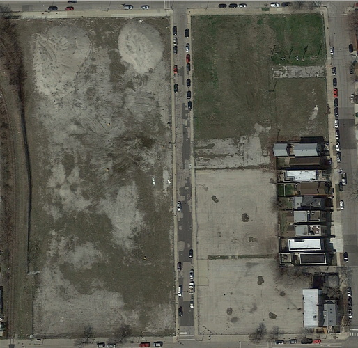
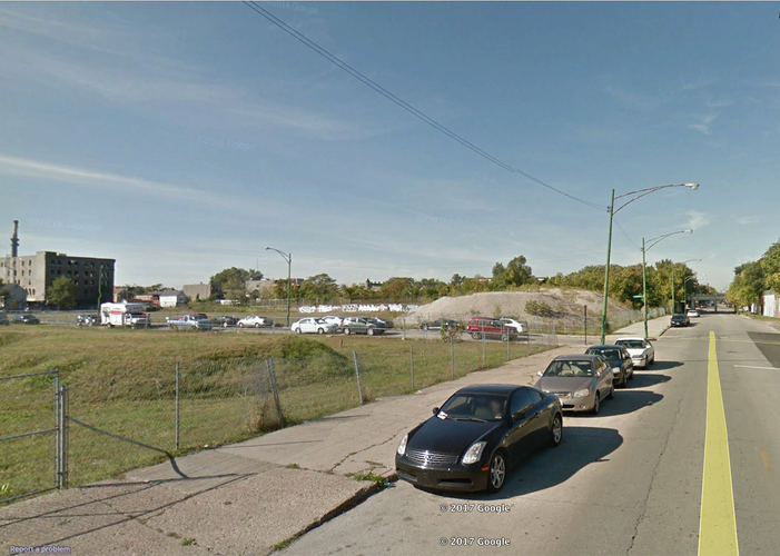
Second, the egregiously barren space in Pilsen’s northeast corner is in desperate need of attention. With a little bit of landscaping, this block (which we will refer to as Block B) could easily become a beautiful, bustling green space.
Block B (above) is overrun by weeds, unsightly dirt piles, and ugly chain-link fences. Image from Google Earth.
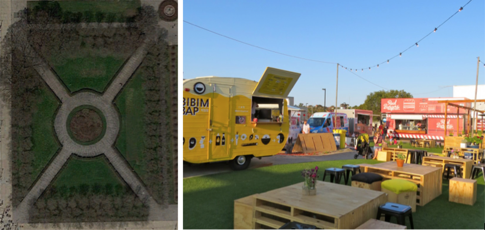
Planting green grass on the plot, perhaps with other landscaping like small trees or flowers, along with pedestrian paths, tables, and benches, this bleak area could be utterly transformed. Furthermore, this block's border along 16th Street could provide easy access for food trucks or pop-up shops to line the block, turning Block B into a sort of picnic area. Residents could engage with one another over lunch, or while simply out for a walk.
Above left, Chicago's Grant Park provides an example of a design that both pleases the eye and accommodates pedestrians. Image from Google Earth. Above right, this image from Pinterest via holland3.com shows that food trucks and pop-up shops surround by plenty of seating create the perfect environment for social interactions among neighbors.
Lastly, though we have transformed one block of dead space into a pedestrian haven, the northeast corner still generally lacks surveillance.
Empty streets like this one feel treacherous to pedestrians and therefore function as a place to avoid rather than a hub for social activity. Image from Google Earth.
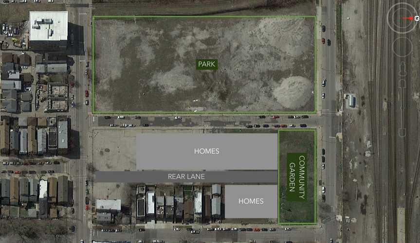
In order to bring watchful eyes to our newly beautified Block B, we need either storefronts or homes adjacent to it (on Block C), from which people can consistently keep an eye on things and discourage crime. Given that there are already homes on part of Block C, as well as the fact that 16th Street is slightly too isolated to be a successful spot for permanent storefronts, I believe that adding more homes to Block C would be the best way to bring surveillance. Furthermore, residents of Block C would also have easy access to the new green space on Block B, and the northernmost edge of the Block C could be converted into a community garden.
Image from Google Earth, with illustrations by the author.
With these three interventions, not only would young, hip residents have their stomping ground on 18th Street, but so would families have access to several excellent spots to take their children and to build social bonds with one another. As an added benefit, these new green spaces would encourage Pilseners to spend more time outside, which would only improve the overall mental and physical health of residents. Pilsen, a wonderful neighborhood as-is, has the capacity to become an even better space, and with the implementation of these simple interventions, its full potential could be realized.
Social Mix
The following tables display Pilsen's diversity in a variety of categories, compared with the calculated diversity of the Western region of Chicago and that of the City of Chicago as a whole. All data courtesy of Social Explorer.
Diversity Analysis
Given the generated data, I do not believe that Pilsen is a particularly diverse neighborhood. Its extremely high concentration of Hispanic or Latino residents, who constitute 72.6% of its total population, drastically outweigh the presence of other racial groups in the neighborhood. Particularly when compared with Chicago’s rather high racial diversity profile (3.47 out of 5 possible points), it is clear that Pilsen, which only earned a score of 1.78 out of 5, is relatively homogeneous when it comes to race. Additionally, we can see from the tables that housing values in Pilsen are greatly concentrated between $150,000 and $499,999. Well over half of all owner-occupied housing units, 62.4% to be exact, fall within this price range.
However, in terms of education, the neighborhood's most diverse category of the three that I chose, Pilsen exhibits a considerable equity between those who completed less than high school, those who completed high school or attained their GED, those who attended some college, and those who attained their Bachelor's degree. Very few residents attained a Master's or other advanced degree, but the drop-off here is comparable to drop-off that we see in the data for all of Chicago.
Despite this heterogeneous mixing of education levels, Pilsen still does not hold up to the diversity of the West Region or Chicago as a whole. Given these findings, it cannot be said that Pilsen is a truly diverse neighborhood, especially when compared with the socioeconomic and cultural cornucopia that is the city of Chicago.