Overview
Social Mix
Public Space
Amenities
Connections
Final Project
The Coherence of Little Village
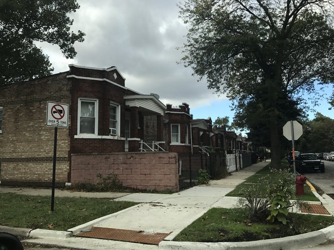
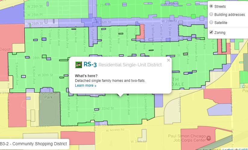
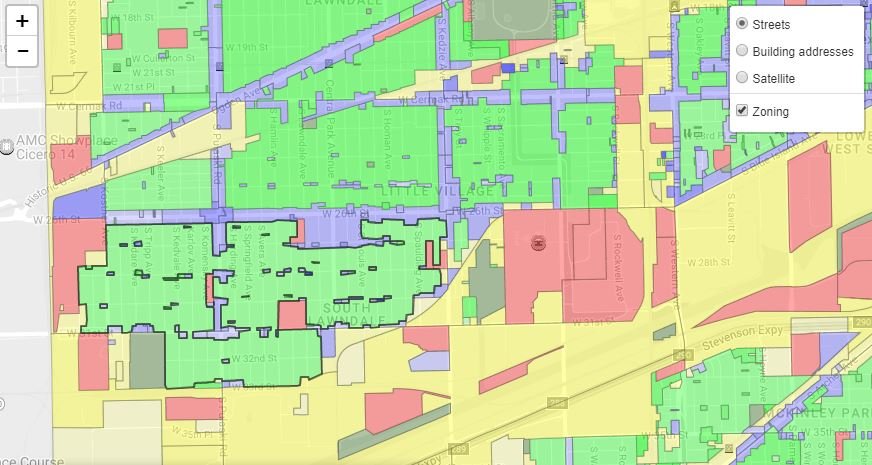
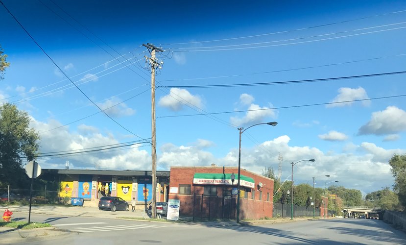
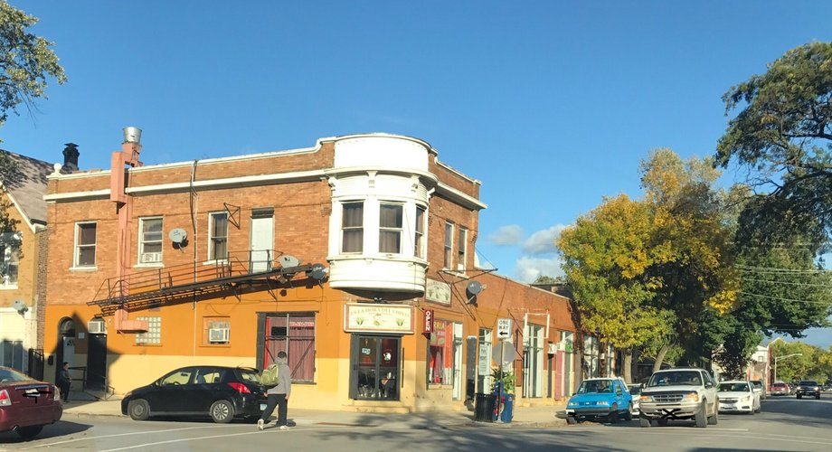
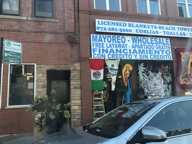
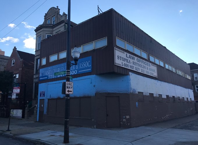
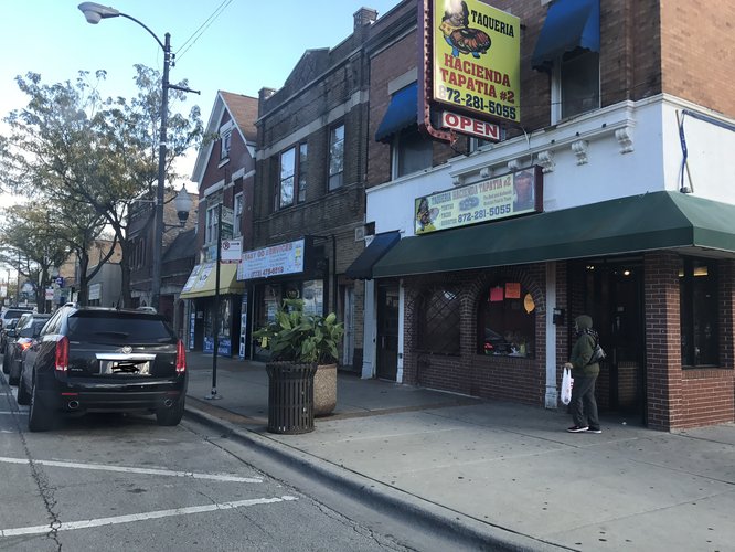
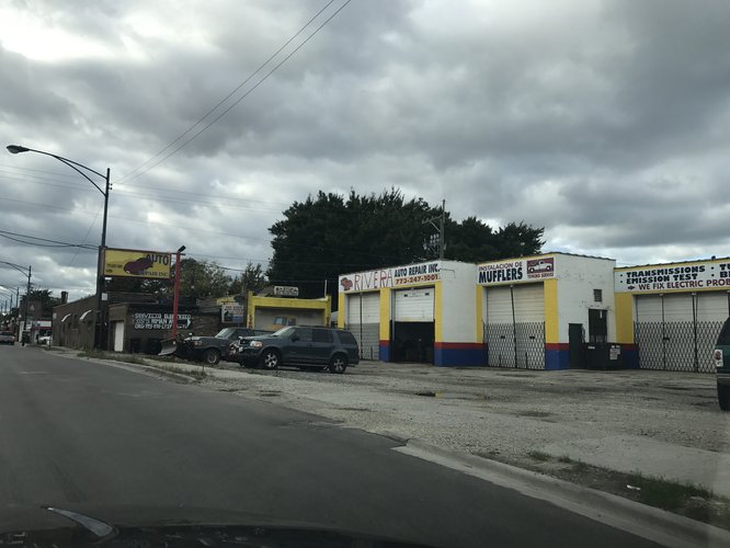
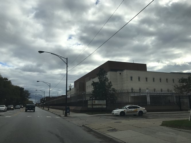
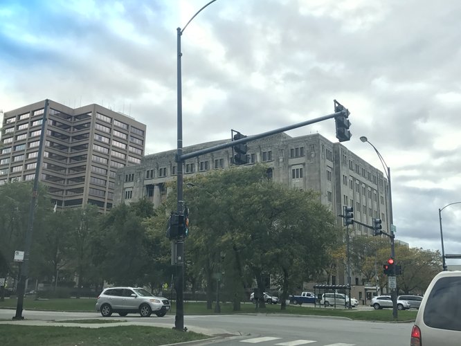
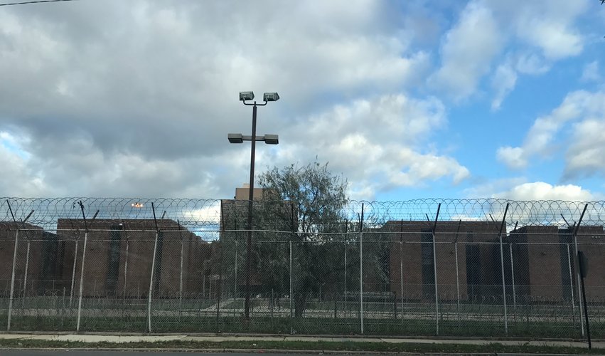
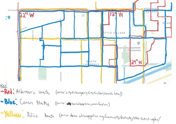
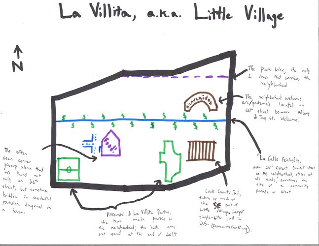
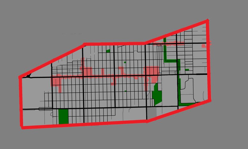
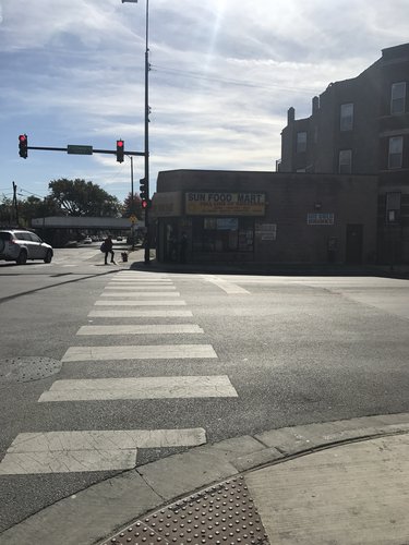
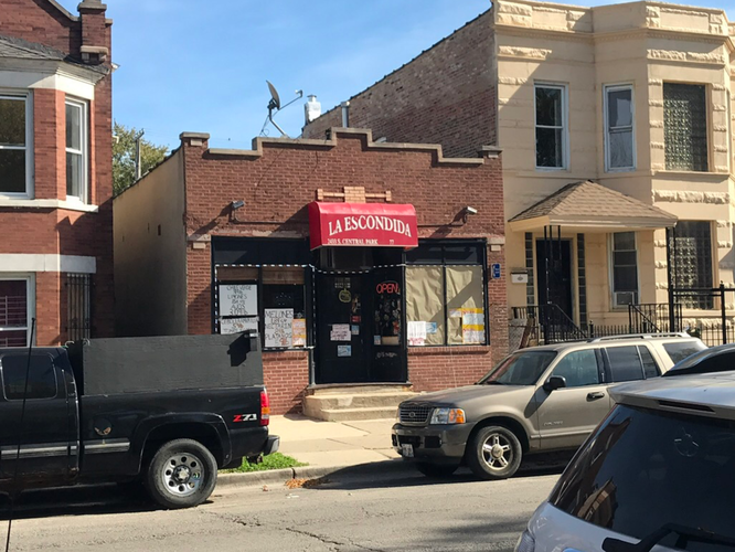
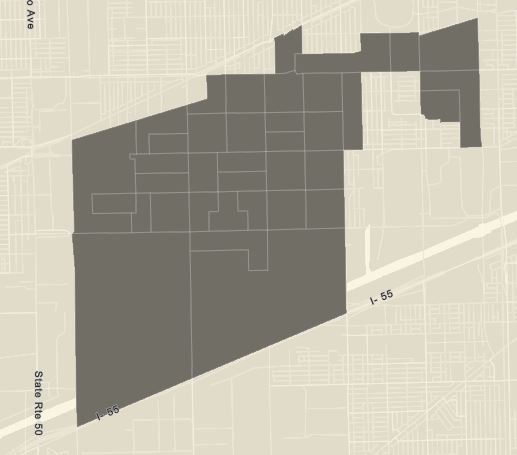
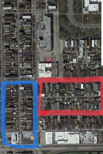
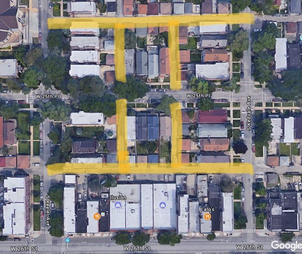
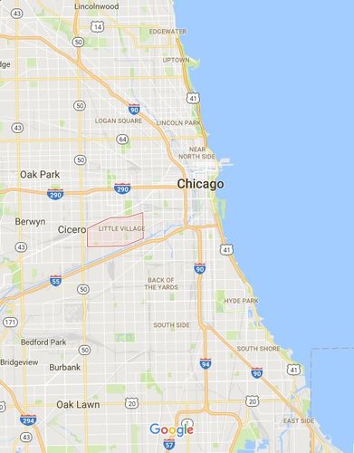
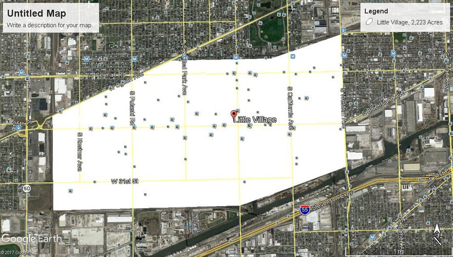
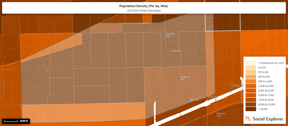
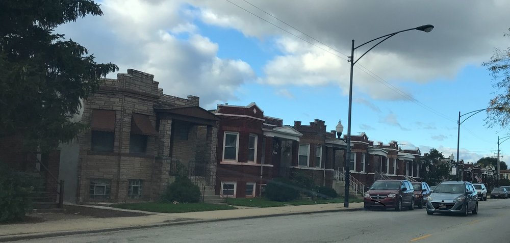
Little Village, also known as La Villita or South Lawndale, has ample coherence; it’s made abundantly clear by the “Bienvenidos a La Villita” (“Welcome to Little Village”) gateway that resides on the east side of the neighborhood in between Troy and Albany ave leading westward onto 26th street. Little Village has a distinct identity throughout the entirety of its boundaries, made possible in part by its large presence of Mexican and Mexican-American residents who give the neighborhood its Mexican character. However, there are some areas of the neighborhood that seem to be divided in such a way that doesn’t necessarily disrupt Little Village’s collective identity, but does differentiate some parts of the neighborhood from others. For instance, the neighborhood is thought to have a distinctive residential area along its southern border, with the residential area between 3100 and 3300 S blocks being mentioned in some literature as “the burbs” (Vargas 2016, 66, 69). This area is characterized by its lower density; upon survey of the neighborhood, this seemed to be because this area had higher abundances of low-density, single family homes (see images 1 and 2). This is confirmed by a zoning map of Chicago that shows this area to be zoned for single family homes (see image 3). Additionally, the neighborhood is thought to have both a west side and an east side, with the east side of the neighborhood being east of Marshall Blvd (more or less east Kedzie) and continuing east until Western Avenue. Interestingly, there has been a recent push by some of the local community organizations on the east side of the neighborhood to refer to that part as “Marshall Square” (Vargas 2016, 181), but this change seems to still be in development and appears to be the result of larger sociopolitical issues. Still, the east side of the neighborhood is delineated by the large, commercial avenues to its eastern and western boundaries (Kedzie and Western Avenues) and roughly Cermak Avenue to the north and the Cook County Department of Corrections and a nursing home to the south.
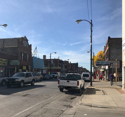
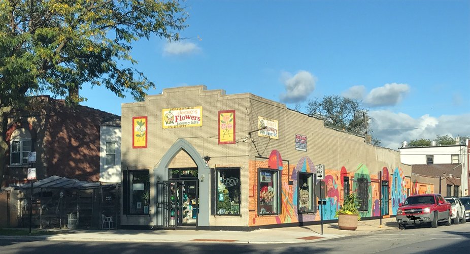
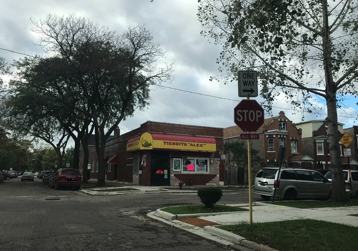
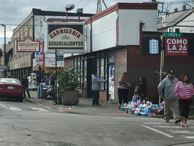
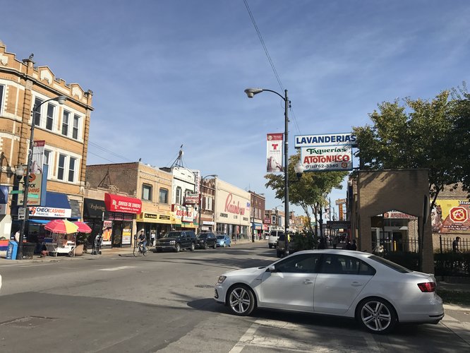
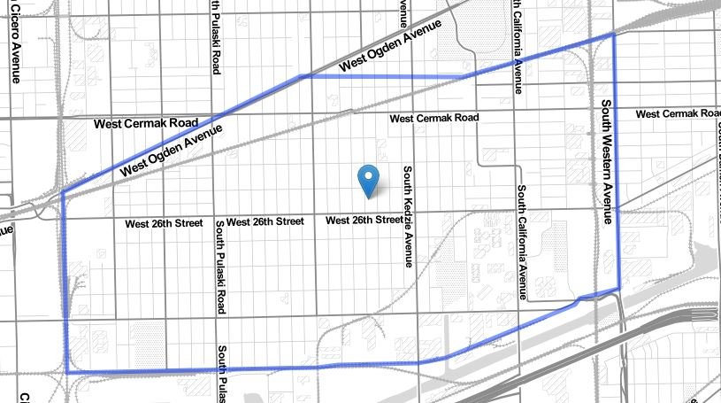
These areas, though distinctive, all still refer to themselves as Little Village, as many of the retail stores or restaurants will put Little Village or La Villita in their name. What also makes this neighborhood distinctive throughout the neighborhood is its predominantly Mexican population that is like such throughout the neighborhood, not just in particular parts; many of the stores in the neighborhood are named in Spanish, advertise in Spanish, or provide both English and Spanish signage and advertising. An easy sign of this is the neighborhood’s 26th street commercial area (also known as La Calle Veintiseis [26] or simply “La Veintiseis” in Spanish). The street stretches right through the middle of the neighborhood, serving the populations to the north and south of the street, and is lauded as the second biggest source of tax revenue for the city of Chicago, second only to Michigan Avenue according the Chicago Reader. The streets have everything one can think of or need, including laundromats, restaurants, clothing stores, grocery stores, convenience stores, music shops, retail stores, banks, flower stores, liquor stores, and many other stores along with street vendors. I say this not to provide mere description of the neighborhood, but rather to argue that this helps to centralize and characterize the neighborhood. It makes perfect sense that 26th street is not the northern or southern border of the neighborhood because both residential areas to the north and south of the street frequently use this street for daily needs. In addition, the street is also used by neighborhood organizations for events like 5k running events or the annual Mexican Independence Day Parade, providing the area a communal identity. The neighborhood’s borders also make complete sense and provide the area with a distinct identity if one simply looks at the neighborhood through the eyes of its zoning codes (see Image 4). The neighborhood is bordered to the west by Cicero and to the east by manufacturing districts, railroads, and the Cook County Department of Corrections. It’s bordered to the north by Ogden Ave and Douglas Park, and to the south by manufacturing districts that lie a block or two away from the Chicago River and Stevensen Expressway. Hence, the neighborhood’s borders are either manufacturing, non-residential districts, city limits, parks, railroads, or main streets. Overall, the neighborhood’s shape and boundaries make sense, and the neighborhood seems to have a collective sense of identity.
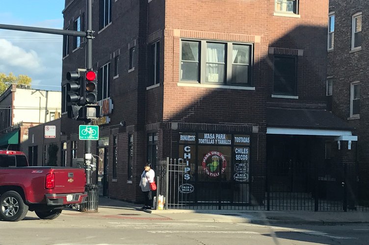
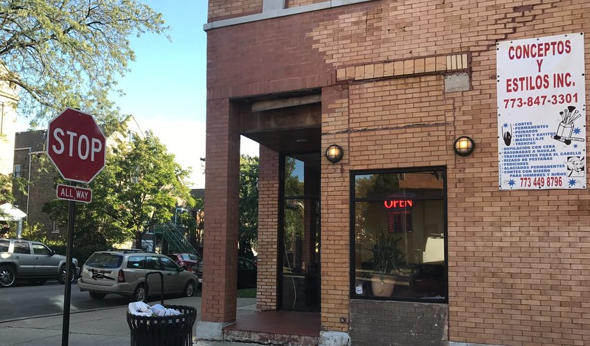
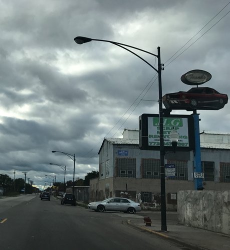
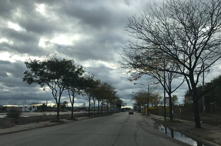
See more images of places throughout Little Village below.
Sources: Vargas, Robert. Wounded City: Violent Turf Wars in a Chicago Barrio. New York, NY: Oxford University Press, 2016.
Zoning Map found at: www.secondcityzoning.org/
The History of Little Village
After the annexation of the Lawndale area in 1869 and after the Great Fire of 1871, there were two wealthy businessmen, Alden Millard and Edwin Decker, who decided to invest in and build an affluent Anglo-Saxon neighborhood in what now would be considered Little Village. The location was ideal for its fair price and the Chicago, Burlington and Quincy railroad which ran through the area. It the beginning of the 20th century, the neighborhood began developing a sizable Polish population, which sought to rename the neighborhood Pulaski from its original name, Crawford. The neighborhood began to grow in the first thirty years of the century as factories and rail yards were built along the neighborhood’s perimeter. As Czechoslovakian and Eastern European immigrant groups began to accumulate wealth, they moved away from the crowded Near West Side and pushed out the wealthier Anglo-Saxon residents who were residing in the neighborhood, replacing sizable brick buildings with bungalows and two-flats. The Czech population there flourished by WWII with the advent of industrial jobs moving into the neighborhood, and 26th street became known as “Czech California.” As African-Americans moved into North Lawndale in the 1950s and 60s, the neighborhood tried to distance itself from the growing Black populations and the socioeconomic disadvantages that came with being a Black neighborhood in this time period; it was rebranded as “Little Village” after the neighborhood’s significant Eastern European population. As UIC began to be built in the Near West Side, many Mexicans in the neighboring Pilsen area were pushed into Little Village while whites and white immigrants fled the neighborhood to the more prosperous suburbs either because of the changing neighborhood demographics, better quality of life, or better economic opportunities. The neighborhood quickly became predominantly Latino over the next twenty or thirty years, and by 1991 the neighborhood was gifted its famous “Bienvenidos a Little Village” arch by the Mexican government.
The neighborhood seems far from poorly or mistakenly planned, but rather it seems it has a clear history of why the neighborhood is the way it is today. 26th street from the very beginning of the 20th century emerged as a commercial hub—just not with predominantly Mexican family working the stores at the time. What was crucial to the early development of Little Village was clearly its manufacturing and industrial sectors and the presence of rail lines and rail yards. For instance, Binford notes that post-Great-Fire, “the most powerful actors in this new gridded landscape…were those who had the means to deal in property” (Binford 2008, 44). This was exactly true of Peter Crawford, who gave some of his land in the area to Chicago, Burlington, and Quincy railroad so that there would be a railroad stop in the area. As a canal was built to the south of the neighborhood and a factory to the west in the early 20th century, it’s clear that Little Village began as one of the many manufacturing communities that blossomed after the Great Fire of 1871.
Sources: Binford, Henry. 2008. "Multicentered Chicago" In Keating, Ann Durkin, ed. Chicago Neighborhoods and Suburbs. Pp. 41-54.
All other information gathered from two articles:
https://www.wbez.org/shows/wbez-blogs/south-lawndale-aka-little-village/08cd0f0a-248a-464d-84ec-75995bc6bec4
http://www.enlacechicago.org/littlevillagehistory
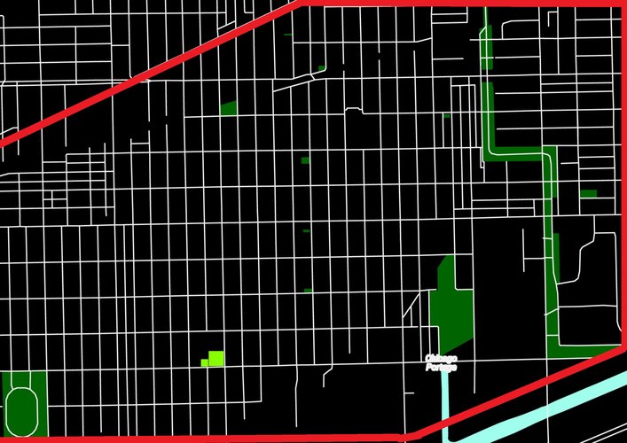
Source: www.snazzymaps.com
Key:
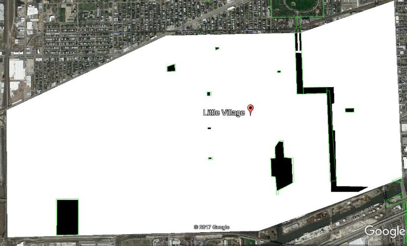
Little Village, though a self-sustaining neighborhood in its local economic activity, suffers greatly when it comes to public space and green space. Though it's one of the youngest and most dense neighborhoods in Chicago, the neighborhood does not have the adequate greenspace per capita that would justly serve its population. Indeed, its most recent park was just added less than three years ago, adding over 30 acres of parkspace to an area with a total parkspace of roughly 92 acres. To mitigate this lack of public space, especially for kids, there are sometimes local schools (discussed below) that work with non-profit organizations to serve as safe-space park resources to the population when possible.
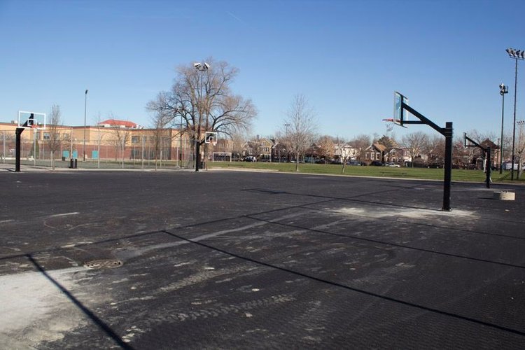
This park, located on 31st Street in the neighborhood, has been serviced by community organizations working to provide youth in the neighborhood with greater amounts of parkspace/greenspace. With new artificial turf and basketball hoops added in the last five years to the area with a small outdoor track space, this serves as an example of how spaces not initially dedicated as parkspaces (schools, in this case) can provide essential public space and services to all ages in the neighborhood.
NOTE: All figures estimates courtesy of Google Earth Pro
Neighborhood Greenspace/Parkspace (in black): 92 acres
Total Area of Little Village Neighborhood: 2,223 acres
Percentage of Greenspace/Parkspace in Neighborhood: 4.14%
The total park to land ratio in the neighborhood is more than 1/2 the size of Chicago's total greenspace (8.5% of land area according to http://moss-design.com/chicago-parks/).
Source: www.snazzymaps.com
Key:
The area, because of its spatial density and lack of public space, often makes use of its large commercial space, primarily along 26th street, to house public space for residents. Residents can stop for vasos de elote from local street vendors or sit on a bench that lines 26th street and enjoy the view of local street traffic. This makes for busy sidewalks and an interesting scene at peak times. Some examples of this are shown below.
On Little Village and its serviceability to residents’ daily needs
Little Village has well-established commercial areas that service the neighborhood residents’ daily needs quite well. The following graphics will focus on the neighborhood’s walkability and serviceability regarding grocery stores and schools, though there are a multitude of daily services available in the neighborhood. This includes laundromats (a common need for this high-density community), clothing stores, and discount/non-discount retail stores (Family Dollar, for example), medical and legal resources, banks, and many other services.
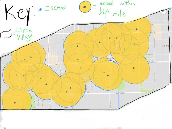
(Map image source: Google Maps)
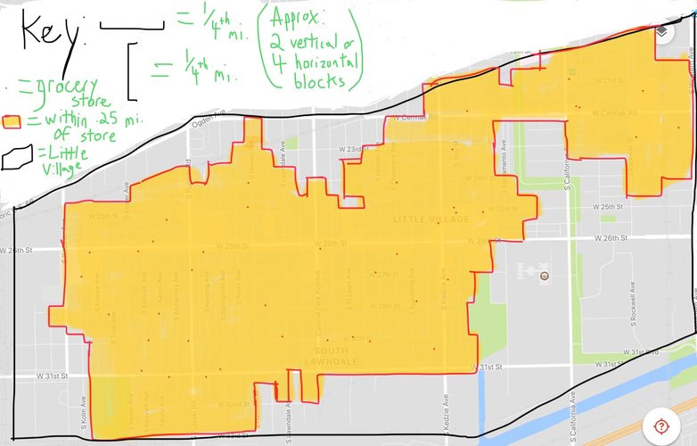
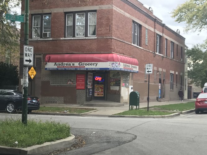
This map shows a plethora of grocery stores in Little Village. They are of a great variety in size and type of grocery products offered, though on this map I did not include larger retailers which also provide some grocery needs. Some grocery stores, like La Chiquita, even have mini-restaurants inside the grocery stores that serve authentic Mexican cuisine. Many of these grocery stores are locally-owned (not chain stores) and advertise in Spanish. These grocery stores seem to be spot-zoned and interspersed well throughout most areas of the neighborhood, which benefits neighborhood residents as a whole. Residents can be seen at all times of the day walking throughout the neighborhood and frequenting grocery stores. As seen from the graph above, much of the neighborhood has grocery stores within five minutes walking distance. Since the neighborhood is so walkable, an overwhelming majority residents—more than 3 out of every 4 (see population graphic below)—have a safe, quick, and easy-to-navigate route to a grocery store. Those who lack quick access generally are on the east side of the neighborhood or are north of the train tracks that diagonally lie just below Cermak Ave on the northwest side of the neighborhood. The rest of the areas lacking access are non-residential areas. See below for some examples of grocery stores in Little Village.
(Map image source: Google Maps)
As seen above, Little Village is also home to a large amount of schools, with many of those being elementary and catholic schools to serve its large population of youth. These routes are just as safe as the grocery store routes, and even though census block data has a hard time mimicking the image of the map above, it roughly estimates nearly 7 out of every 8 people in the neighborhood are within .25 miles of a school (see population graphic below). The areas to the east do have relatively close access to schools, but those schools lie outside of the neighborhood boundaries. Though parents may choose to send their kids to schools farther away, at least the majority of homes have a nearby option for schools; if not within 5 minutes walking, it’s likely that a school lies just a few more minutes away. Overall, this means the neighborhood does an exceptional job at providing residence with close access to schools in addition to grocery stores.
Block Type:
Little Village consists mostly of (vertical) elongated block types, as seen below:
(source: snazzymaps.org)
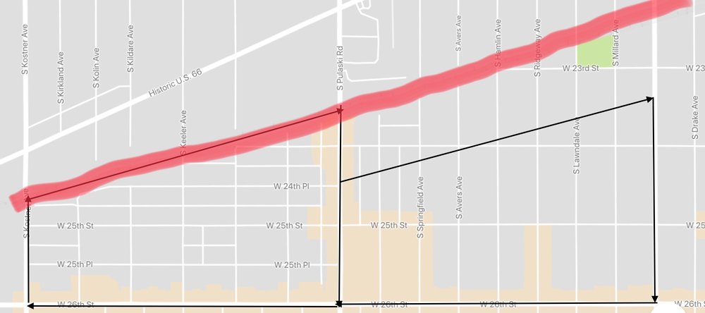
Where there aren't vertical elongated blocks or where there are shorter elongated blocks, there is a presence of some type of physical barrier. In the image below, the red line indicates the presence of railroad tracks. The polygons show how the area on the left has more streets and more blocks precisely because a railroad cuts through it; one sees it functions better than the polygon on the right.
(Source: Google Maps)
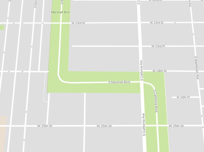
One also sees shorter blocks in the presence of Marshall Park/Marshall Boulevard (see image below), wherein the blocks are much smaller in size (though they are still not complete because the park borders some of the blocks).
(Source: Google Maps)
Similarly, the only reason why elongated blocks are horizontal in the neighborhood is when they’re in the presence of physical barriers. In the image below, the block outlined in red is a horizontal block on the east side of the neighborhood. Below it is the Cook County Department of Corrections, and above it is Marshall Park/Boulevard. These physical, non-commercial, non-residential barriers are so big that they force the reconfiguration of the east side of the neighborhood. As is the case with the red block below, most of the blocks on the east side of the neighborhood are horizontal.
(Source: Google Maps)
There may be some rare instances of what appear to be square blocks, but these are actually just large alleys (the areas highlighted in yellow are alleys). In the image below, the alleyways allow for parking in the back of some stores that border 26th street.
(Source: Google Earth)
Thoroughfare Type:
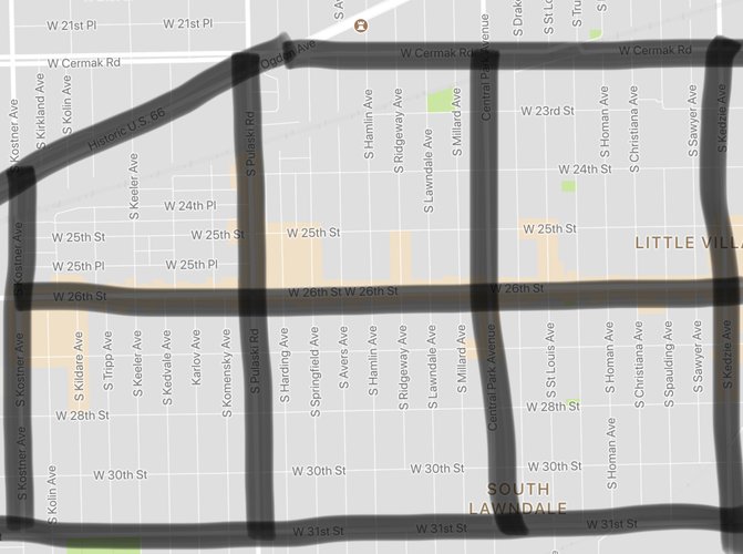
Little Village has a very simple format overall with little variety in street size/types. It consists of either arterial streets or local streets, with the exception of on boulevard (Marshall Park/Boulevard). In the image below, the arterial, or larger, feeder streets, are highlighted in black and occur every square mile. The part of Ogden Ave--the lone diagonal arterial street--that borders Little Village is no wider than other arterial streets in the neighborhood.
(Source: Google Maps)
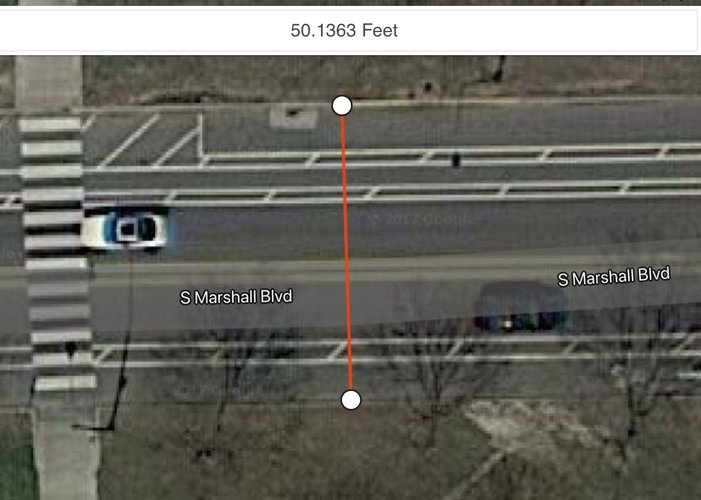
Marshall Boulevard (see first image below) is named a boulevard because it serves as a connecting thoroughfare to two main parks in Chicago, one in North Lawndale and the other in Brighton Park. This is a common and planned phenomena throughout Chicago, as major parks usually are connected by a large thoroughfare with surrounding greenspace. At over fifty feet wide (see second image below), this is one of the widest streets in the neighborhood.
(Source of first image: Google Maps)
(Source of second image: App Store application Mapulator)
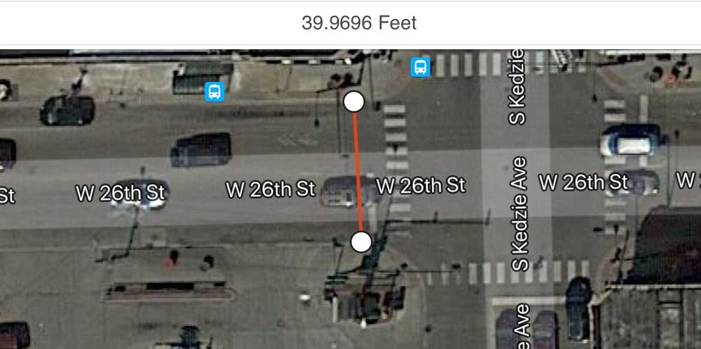
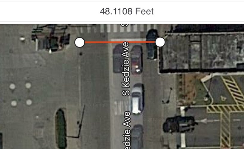
Below are two images that show the pavement widths of two arterial streets in Little Village (26th Street and Kedzie Ave, respectively). These streets are relatively wide, almost always allow for parallel parking on both sides, and almost always have two directions of traffic.
(Source of both images: App Store application Mapulator)
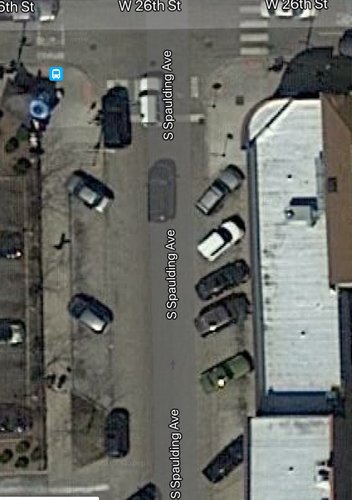
Other local streets are usually of smaller size, have parallel parking on both sides, and can either have two directions of traffic or be one-way. There are some instances of diagonal parking (see image below), but those are limited to the parts of north-south avenues that connect to 26th street, the neighborhood's busiest street and greatest source of commercial activity.
(Source: Google Maps)
Network Type:
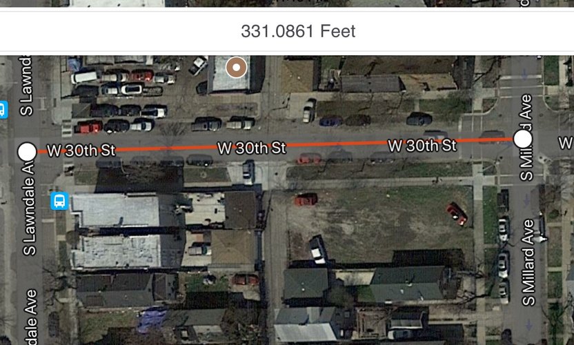
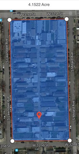
Little Village is overwhelmingly an orthogonal grid (a.k.a. a Savannah pattern), which allows for roughly even dispersal of traffic, multiple potential routes to destinations, and has alleys that allow for back-lot parking. It's average elongated blocks are also of optimal size (between 300 and 400 feet) for neighborhood connectivity, as seen in the first image below. In addition, the area of the average block is below the low end of the ideal maximum block size (5-12 acres), as seen in the second image below.
(Source of both images: App Store application Mapulator)
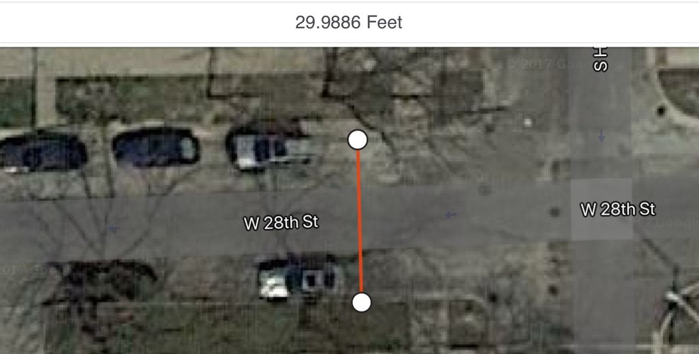
Though the prevalence of local one-way streets may sometimes inhibit multiple routes via automobile, these streets tend to be smaller streets that have ideal pavement widths (between 24-36 feet). Below we see an example of this, which helps foster neighborhood connectivity via walking.
(Source: App Store application Mapulator)
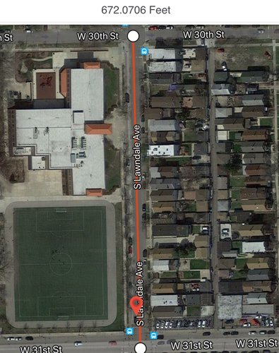
In the image below, the average elongated block does not meet the requirements of being less than a maximum of 600 feet separation between local street intersections. However, this is only the case for the elongated size of the blocks; the shorter, horizontal sides seen earlier are small enough to foster ideal neighborhood connectivity.
(Source: App Store application Mapulator)
Analysis of Overall Neighborhood Connectivity:
Overall, I find the neighborhood's connectivity to be adequate, and though it's not perfect in specific ways, the neighborhood fosters social interaction and is helped in large part due to its blocks, thoroughfare types, and networks. For instance, the neighborhood meets the ideal standards outlined by the Victoria Transport Policy Institute in terms of the maximum area of its blocks (as discussed earlier). Most of the blocks in the neighborhood are less than 5 acres. It also succeeds in the shorter sides of its blocks being less than 400 feet from one local intersection to the next, and it has a generous amount of one-way streets that have an ideal pavement length within 24-36 feet. The neighborhood also does a fantastic job of essentially being free of cul-de-sacs and dead ends, with the latter only occurring in the case of parks or industries that border the neighborhood. However, the long sides of the blocks of are usually over the maximum 600 feet between local intersections, and the neighborhood has a large amount of streets that are larger than 36 feet in pavement width. Though I see lots of room for improvement in the neighborhood, especially in regards to having more demarcated spaces for the large prevalence of young bike riders, the neighborhood is successful in fostering the networks and social interactions that are so often sought after in urban planning. Residents are almost always walking out on the street, and its gridiron design makes it easy to take a variety of routes from point A to B, especially in the case that one is walking. Overall, the neighborhood is very well-connected, and its only real hiccup is the physical separation of the east side of the neighborhood which Marshall Boulevard/Park and the Cook County Correctional Facilities help to facilitate.
Little Village has long suffered from a park problem—that is, a lack of safe recreational park spaces. It lags behind the rest of Chicago with 1.27 acres of open space per 1000 residents[1] (compared to Chicago’s 4.6 acres[2]) and parks only comprise roughly 4.2% of space[3] in the neighborhood compared to Chicago’s 8.6%[4]. This especially hurts a community whose median age is more than 4 years younger than Chicago’s median age[5]. Additionally, the two main parks in the neighborhood, Piotrowski Park and La Villita Park, are often said to be unsafe by youth in the neighborhood. They’re either elevated or concealed around their perimeters, making “natural” or public surveillance very difficult. The fact that they’re especially large parks tucked between industrial corridors, county facilities like Cook County Correctional Facilities, or residential areas makes public surveillance even harder.
For this proposal, I draw largely from Jane Jacobs’ The Death and Life of Great American Cities and her ideas regarding safety and the uses of neighborhoods. Jacobs was adamant about the relationship between a lively street, one which has many stores and public places throughout the street and subsequently many users and “watchers,” and the safety of said street[6]. Jacobs also argued that public spaces and parks be a part of the street fabric rather than compartmentalized or relegated to certain enclosed areas[7]. Thus, my three-point proposal incorporates Jacobs’ framework and feedback from the community of Little Village, largely gathered through city-led planning projects. The community has consistently voiced its desire for new or renovated park and recreational spaces; it has also expressed its desire to keep the culture and character of the neighborhood intact and work with existing vacant or undeveloped spaces[8]. Seeing as how Little Village lacks large vacant spaces except for vacant industrial spaces on the perimeter of the neighborhood, I propose that the city rezones particular parking lots in commercial areas or large parking lots next to schools. These would be on the east side and north-central areas of the neighborhood where there is a lack of any nearby recreational areas but a surrounding school or established commercial area (or potential for commercial revitalization). These implementations would be park spaces that are near enough to the sidewalk and in one case near enough to the school. This way, these park spaces become intertwined in the fabric of the street and are always visible to the public and stores on opposite sides of the street. In the case of the park near the school, that park could serve as a space for local organizations to provide safe-space recreational programming after school and in the summer.
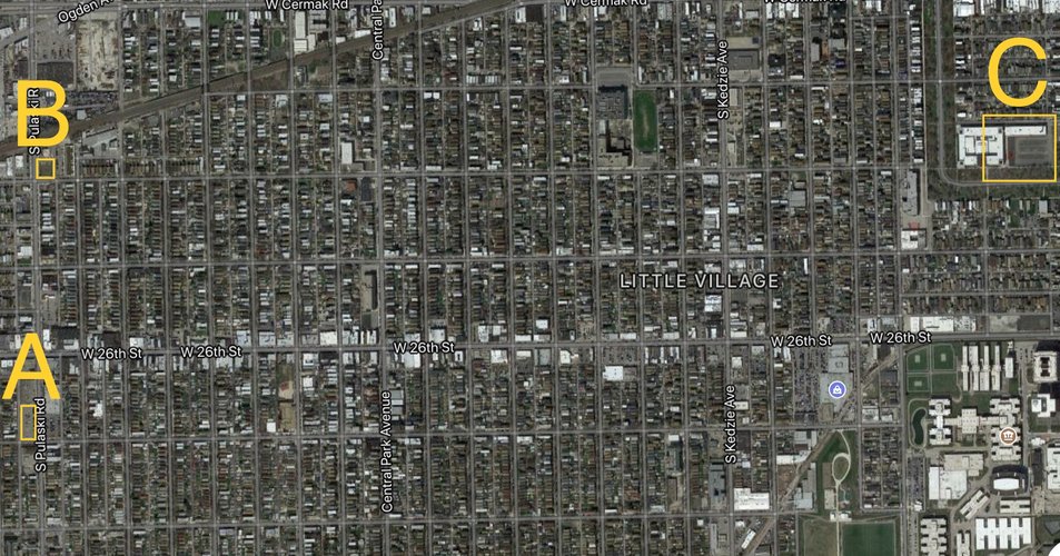
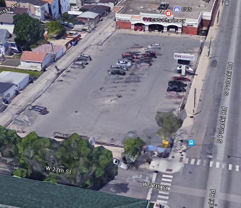
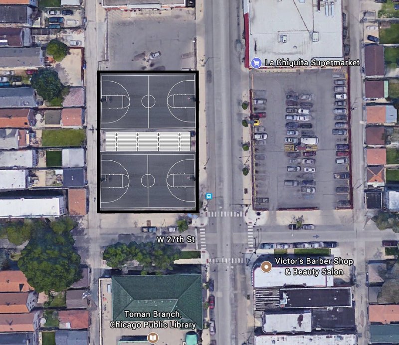
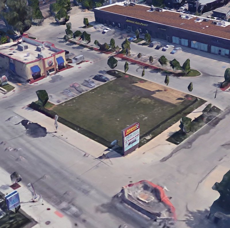
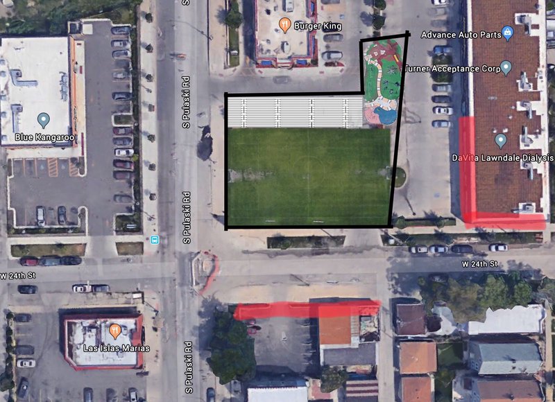
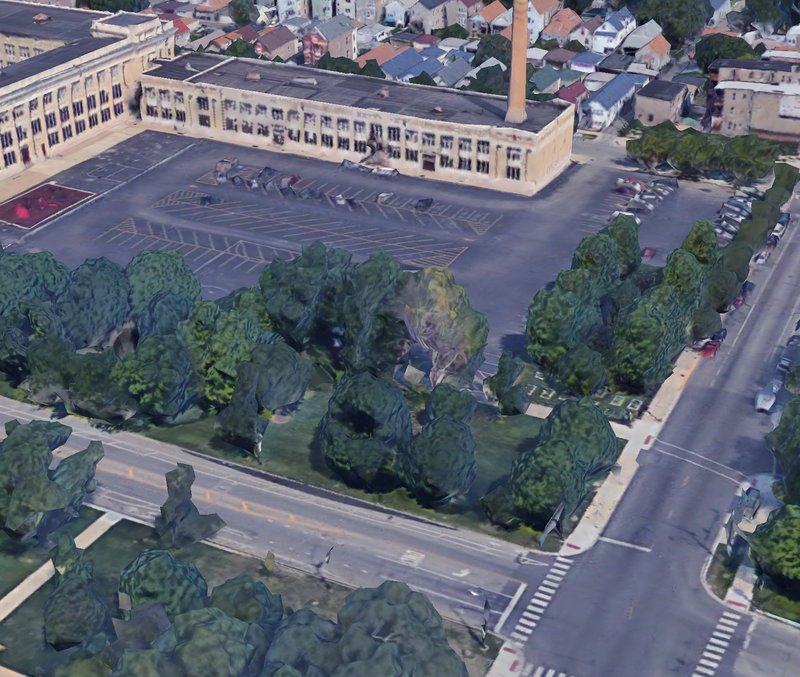
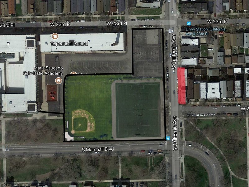
The three implementations are thus as follows: First (A), ask the city to rezone and provide funding for a multipurpose recreational space in the parking lot of the CVS on 27th street and Pulaski. This space could be used primarily as a fenced, outside basketball courts with water fountains and adequate lighting. It could be used as an ice skating rink during winter months. Second (B), ask the city to rezone and provide funding for a recreational space on the NE corner of 24th street and Pulaski. This could be a fenced soccer field with adequate lighting and water fountains, and the space could include a playground. These two interventions both a) make use of the existing landscape—basketball courts for the parking lot, soccer field for the patch of grass—and b) are placed in plain sight in commercial areas wherein they can become part of the street landscape, be public visible and watched, serve areas lacking park space, and potentially draw in more business. The third intervention (C) involves asking the city for permission and funding to turn a large school parking lot into a significant park space, complete with a track, basketball courts, tennis courts, and maybe a baseball diamond or skateboarding area. This would be similar to Gary-Ortiz field[9] and would allow for organizations working with the school to have safe, quality park space. It would serve the east side of the neighborhood, (which lacks quality parks), be in plain sight, and could allow for businesses to reestablish themselves across the street.
[1] See Draft of “Pilsen & Little Village Action Plan” Report on www.cmap.illinois.gov/programs/lta/pilsen-little-village
[2] See “2016 City Park Facts” by The Trust For Public Land on www.tpl.org/sites/default/files/2016%20City%20Park%20Facts_0.pdf
[3] See “Public Space” section of Little Village page
[4] See “2016 City Park Facts” by The Trust For Public Land on www.tpl.org/sites/default/files/2016%20City%20Park%20Facts_0.pdf
[5] See “Social Mix” section of Little Village page
[6] Jacobs, Jane. 1961. Chap. 2, “The uses of sidewalks: safety” in The Death and Life of Great American Cities. New York: Vintage. Pp. 29-54.
[7] Jacobs, Jane. 1961. Chap. 6, “The uses of city neighborhoods” in The Death and Life of Great American Cities. New York: Vintage. Pp. 112-142.
[8] See Draft of “Pilsen & Little Village Action Plan” Report on www.cmap.illinois.gov/programs/lta/pilsen-little-village
[9] See “Public Space” section of Little Village page
Above: Parking Lot on the NW corner of 27th Street and Pulaski, as it is now. It does little for its street and its corner and is unnecessarily large. (Source: Google Earth)
Above: The proposed changes. These courts could activate street life; they’d be visible through perimeter fences. It could also help activate commercial activity among surrounding stores. (Source: Google Earth)
Above: The current parking lot on the NE corner of 24th Street and Pulaski. The patch of green serves no purpose, and the lot is underused and hinders the possibility of a lively sidewalk and street. (Source: Google eart
Above: The proposed changes. This field could create a more interesting street and a safe recreational area, as it would be visible through the protective fencing. Additionally, the area serves the northern part of the neighborhood that lacks recreational space, and (if successful enough) it could revitalize the commercial areas in red. (Source: Google Earth)
Above: Parking lot next to Telpochcalli School on the SW corner of California and 23rd Place. This parking lot is unnecessarily large and blocks the entire view from the street of the school and lot with a heavy presence of trees along the perimeter. (Source: Google Earth)
Above: The proposed changes to the parking lot. Though dimensions may vary in implementation, having the park on full display of the streets next to it and having the school in view makes this area much more available to (natural) public surveillance. It gives the children who attend the school more recreational options, serves the east side of the neighborhood, and (with enough traffic) could allow for the revitalization of stores in the commercial area marked in red. (Source: Google Earth)
Social Mix
On Little Village's Diversity
According to the indices used in the image below, Little Village is not a diverse racial neighborhood. As seen in census statistics, the neighborhood is predominantly Hispanic with relatively few other ethnic minorities and whites. Compared to Chicago and the West Region, Little Village isn't even close to having a diverse racial neighborhood. However, the neighborhood is diverse in regards to age (with the categories being 25-34, 35-44, 45-54, 55-64) and levels of education (with the categories being less than high school, high school diploma, some college, and bachelor's degree and above). It's age diversity is high and matches up competitively with the West Region and Chicago, though Chicago is a bit more diverse in education levels than is Little Village. In addition, though not in the tables, it is clear that Little Village has little income diversity as well. Many of the residents are far below the median income in the city as a whole, and the neighborhood has a significant level of poor residents compared to the West Region and Chicago.