Overview
Social Mix
Public Space
Amenities
Connections
Final Project
SIZE
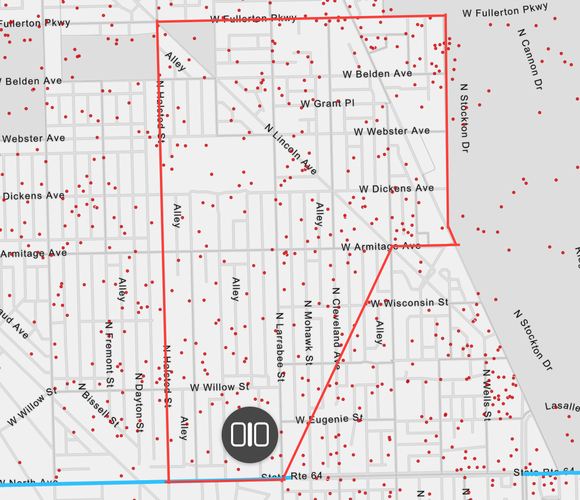
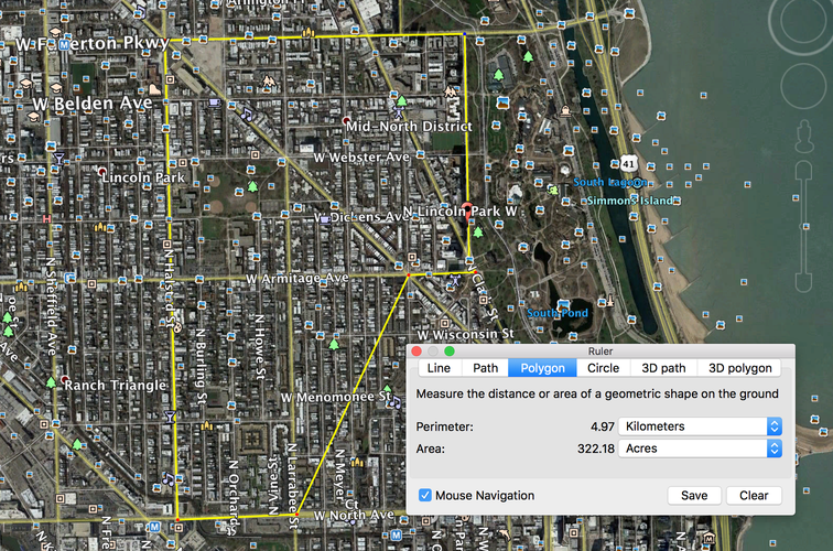
According to Social Explorer, the neighborhood of Lincoln Park contains around 12,350 people. The map contained 247 dots, each one representing 50 people. This population would be slightly less than twice the size of the 7,000-person neighborhood proposed by Jane Jacobs. In terms of area, Lincoln Park had a perimeter of 4.97 kilometers which encloses 322.18 acres. The neighborhood is by no means huge, but, from when I visited, walking north to south can be a lengthy affair. There are definitely many larger neighborhoods on the outskirts of the city, and many smaller neighborhoods closer to, or in, downtown Chicago.
IDENTITY
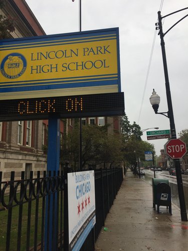
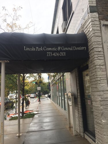
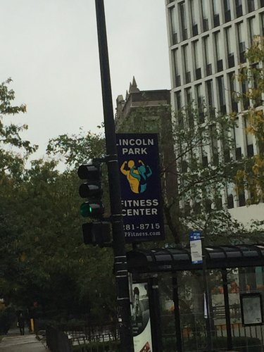
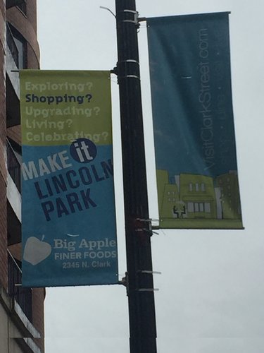
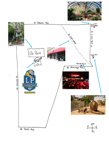
I was thouroughly impressed by the sense of identity possessed by Lincoln Park. Lincoln Park was mostly residential, but the areas of commercial activity often carried Lincoln Park in the business name. Clark Street runs diagonally through the top half of Lincoln Park and contained the majority of business activity in the neighborhood. Clark Street was lined with street flags going down the block on every light post, each one promoting a different local Lincoln Park business or event. More often than not, I saw the name Lincoln Park somewhere in my sight line, especially on Clark Street. In addition to normal array of businesses, the neighborhood also contains Park West Theater, which adds entertainment to the daily necessities offered.
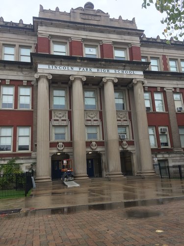
In terms of coherence, Lincoln Park was also very well put together. Clark Street, along with a few other smaller commerical areas, gives residents easy access to basic daily needs. These business areas are located centrally and conviently. While Lincoln Park High School does serve other students outside of the delinated neighborhood area, it is very centrally located within the delinated boundaries. It has a student population of 2,261.
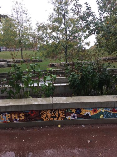
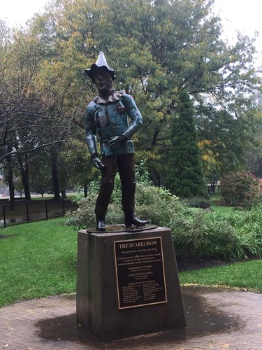
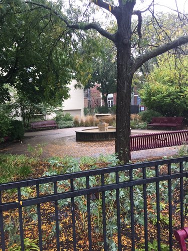
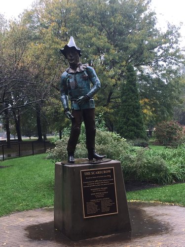
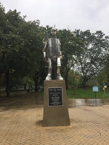
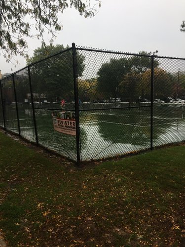
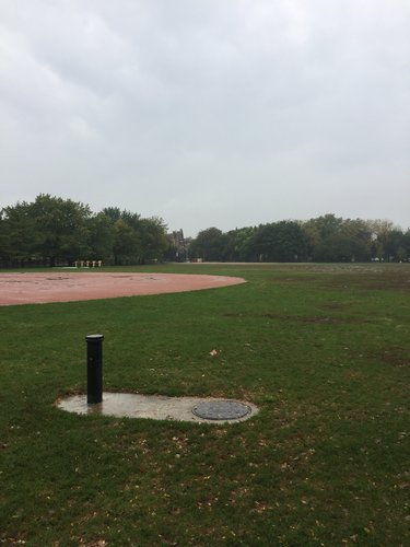
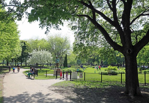
Lincoln Park High School is located right next to Oz Park, which by far the largest park located within the boundaries. Oz Park contains great walking areas with Wizard of Oz statues as seen in some of the pictures above. The park also contains many great community areas. There are tennis courts, baseball fields, large open spaces, and gardens, making the park a perfect place to get away and feel like you are not in the city of Chicago. On my visit, the park was rainy and wet, but still contained many residents of different ages, and many with dogs, enjoing the grounds.
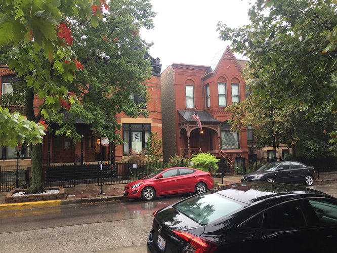
Residential blocks take up most of the delinated area of Lincoln Park. The residential buildings all possess a sense of unique character. Some of these buildings look relatively new, while others look like they would have been built many decades ago. While these buildings are different, they all possess a sense of cohesivity and work well together. The neighborhood did not seem to be a makeup of smaller neighborhoods or a conglomerate. The residential areas have a very quiet and safe feeling to them. Most of the buildings have a small black fence surrounding them, but this just creates a sense of astetic and helps connect the differently constructed residential buildings. The residential areas also have periodic small community areas, such as gardens or benches, dispersed among the residences. One of the only things I did not see a lot of was playgrounds. The area would be very safe of children, but many of the small community spaces were geared seemingly toward older residents.
The delination of Lincoln Park has both pros and cons. The boundaries of Lincoln Park are very busy and heavy trafficked streets, while the inner streets are much more walkable and contain far less traffic. One of the boundaries even possesses the name “N Lincoln Park W,” adding to the sense that one is entering the neighborhood. On the other hand, the community area of Lincoln Park creates some confusion as to where the neighborhood is actually deliniated. The neighborhood has a population of around 12,350 people, while the community area is said to possess closer to 65,961 residents. Due to the fact that many people are prideful that they live in Lincoln Park, many areas outside of the boundaries also carry the “Lincoln Park” name. The official neighborhood boundaries also do not contain things most often associated with Lincoln Park, such as the Lincoln Park Conservatory, the Lincoln Park Zoo, and Lincoln Park itself. If these areas were annexed into the Lincoln Park neighborhood, it might help the community. However, in order to get to these areas, one must cross either N Lincoln Park W or N Clark Street, both of which possess heavy traffic and are not very pedestrian friendly.
LAYERS
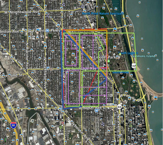
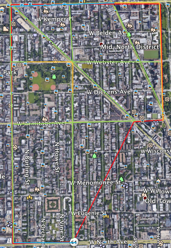
The only boundary of Lincoln Park High school that can be seen in this picture is the left boundary, which is the river. The other boundaries of school are not even in the picture, as they extend far beyond the delineation of the neighborhood. The neighborhood is part of the 18th police district, the Near North district under commander Paul R. Bauer. There are two close and serviceable police stations, one far north and one far south, both of which are also too far away to be seen on this map. Lincoln Park is also part of the Vicariate II-D Parish, and the neighborhood contains three out of the fourteen churches in the Parish. The churches in the neighborhood are St. Paul’s United Church of Christ, St. Paul UCC, and Cenacle Sisters Chicago, all of which are concentrated toward the top of the neighborhood. On the map, the solid red line represents the delineated Lincoln Park. Lincoln Park Neighborhood association recognizes eight total “Lincoln Park Neighborhood Associations,” but only two of these associations are in the delineated Lincoln Park. The dark blue marked area represents the Lincoln Central Association, while the golden marked area represents the Mid North Association. Both boundaries extend slightly past the delineation of Lincoln Park. The light green lines represent the census tract groups, six of which are in the neighborhood. The purple lines represent the the census block groups, nine of which are in the neighborhood.
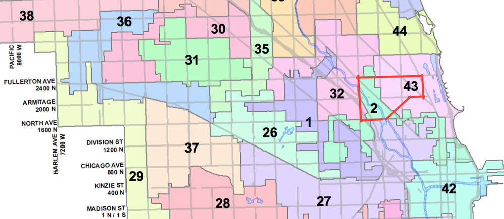
This picture represents the aldermanic wards in Lincoln Park. Represented in Lincoln Park are ward 32 with alderman Scott Waguespack, ward 2 with alderman Brian Hopkins, and ward 43 with alderwoman Michelle Smith.
DIAGRAM
HISTORY
Lincoln Park has an interesting history, but what is perhaps most interesting is how it received its name. Many years ago, the area next to the neighborhood of Lincoln Park was used to bury those who had died from smallpox and cholera. Residents did not like these victims next to their water supply, and the area was converted into a park in the early 1860s. After President Lincoln was assassinated in 1865, the park was renamed from Lake Park in honor of him (Greene, 2015). While this area is not technically located in Lincoln Park, it is often associated with the neighborhood due to its proximity and, thus, helped give the neighborhood its name.
Throughout its history, Lincoln Park has been known for housing affluent residents. However, in the 1800s, Lincoln Park had a more diverse group of inhabitants. The early makeup consisted of German famers and industrial workers along with wealthy residents. The Germans influenced the neighborhood greatly, even building St. Michael’s Church. The Great Chicago Fire swept through much of the neighborhood, and after the fire many new factories were built. These factories along the North Branch of the Chicago river drew many European immigrants that settled in Lincoln Park, along with the affluent families. Lincoln Park had settled itself as a residential neighborhood. The Great Depression set off a chain effect of neighborhood worry. Residents did not want their neighborhood to become run-down, and many neighborhood associations were created in order to combat this. Due to private investment and federal funding, the neighborhood quickly renewed itself and fermented its place on top of Chicago neighborhoods in a financial sense. These renewal efforts drove up the price of living in Lincoln Park, and now the majority of low income residents have been driven out (“Lincoln Park,” 2005). The broader time periods of development would be around early Chicago though the Great Fire, the Great Fire through the Great Depression, the Great Depression through the 1960s, and the 1960s until present day.
I would say that the neighborhood, from its proximity to the center of the city, did not solely grow from the industry located on the North Branch of the Chicago river. The factories definitely added to the makeup of the neighborhood, both physically and residentially, but the neighborhood would have had residents without the business. The settlers were of many types, from affluent to farmer to industrial worker, but never a monopoly of workers. The neighborhood would have probably just been a convenient place to commute to work for these residents, thus accounting for the worker population. The famers, being early settlers, were probably just there for the quality of the land next to the water, as well as the proximity to daily necessities. Otherwise, there are no transit stops, government buildings, or environmental features that significantly contributed to the development of Lincoln Park.
I think that the neighborhood has been the beneficiary of much planning and guidance. The neighborhood overall, from what I have seen and learned so far, works very well and would be a wonderful place for a resident to live. I would speculate that the neighborhood was somewhat redesigned and planned during the rebuilding after the Great Fire. More importantly, however, I would conjure that the neighborhood has benefitted more from the planning of neighborhood associations and other groups dedicated to the bettering of the neighborhood after the Great Depression. With the money and influence possessed by these residents, I think most of the positive features of Lincoln Park would have been designed or improved by these associations. Most of Lincoln Park today seems deliberate and connected, except for a few buildings. These few buildings are the high rise apartments that look the part of low income housing. They seem out of place, and just put there to appease those who wanted to change the makeup of the neighborhood. I believe there does need to be low income housing to change up the makeup of the residents, but I also think this could be much better done in other ways. If one was to buy up existing residences, they could integrate low income citizens more smoothly into the neighborhood, as well as keep the ascetic of Lincoln Park looking nice. Overall, the planning and history of Lincoln Park have allowed it to develop into one of Chicago’s most well thought of neighborhoods.
WORKS CITED
Akira Chicago. (n.d.). Retrieved October 15, 2017, from visitclarkstreet.com.
Archdiocese of Chicago Parishes. (n.d.). Retrieved October 15, 2017.
Districts. (n.d.). Retrieved October 15, 2017, from chicagopolice.org.
Google Earth Pro. (n.d.). Retrieved October 15, 2017.
Greene, N. (2015). How Chicago's Neighborhoods Got Their Names. Retrieved October 15, 2017, from mentalfloss.com.
Lincoln Park Chamber of Commerce. (n.d.). Retrieved October 15, 2017, from lincolnparkchamber.com.
Lincoln Park High School. (n.d.). Retrieved October 15, 2017, from lincolnparkhs.org.
Lincoln Park Zoo. (n.d.). Retrieved October 15, 2017, from chicagotonight.wttw.com.
Lincoln Park . (2005). Retrieved October 15, 2017, from encyclopedia.chicagohistory.org.
Maps of all 50 Wards. (n.d.). Retrieved October 15, 2017, from cityofchicago.org.
Oz Park. (n.d.). Retrieved October 15, 2017, from minitime.com.
Park West. (n.d.). Retrieved October 15, 2017, from pintrest.com
School Location and Boundaries. (n.d.). Retrieved October 15, 2017, from lincolnparkhs.org.
Social Explorer. (n.d.). Retrieved October 15, 2017.
Take a Stroll Through Lincoln Park Conservatory. (n.d.). Retrieved October 15, 2017, from upout.com.
Zolkiewicz, K. (n.d.). Chicago Neighborhoods Map. Retrieved October 15, 2017.
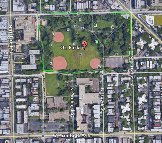
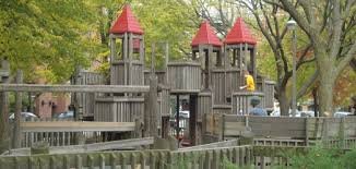
The biggest and, in my opinion, the best use of public space in Lincoln Park is Oz Park. Oz Park is a park that contains statues of Wizard of Oz characters, a garden area, tennis and other recreational courts, an open grassy space, and a children’s playground. The space is relatively centrally located in Lincoln Park, making it readily accessible for most residents.
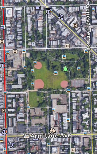
The boundaries of Oz Park are probably one of the worse features of the public space. Most of the streets surrounding the park are some of the busier ones in Lincoln Park, and the three-way intersection of N Lincoln Ave, W Webster Ave, and N Larrabee St is a nightmare in and of itself. I would definitely not send my kids to walk to Oz Park without adult supervision because of the surrounding roads. In addition, one can see from the map taken on Google Earth Pro that not all of the green area is technically part of Oz Park. One small section is connected to Lincoln Park High school. The only thing separating the park from the school and the rest of its land is a small, unpaved, and ambiguous pathway. When visiting, I thought the school might share the park’s facilities, and that the school’s small green area was part of Oz Park. The boundaries of Oz Park would benefit from better definition in some places as well as reduced traffic on the boarding streets.
The space was being used by a variety of occupants, ranging from younger children to older adults. The wide variety of spaces within Oz Park mentioned in the beginning make it an attractive destination for many different residents. The wide variety and placement of spaces within the park facilitate social interaction between all types of residents. The playground was being used by many younger kids, and the top half of the park containing the garden was more contusive for older residents to stroll through. The tennis courts were being used by middle aged residents at the time, and the walking trails throughout the park were ideal for those with dogs. The two spaces that were not being used, however, were the baseball fields and the large open field. It was a wet, rainy morning, but the two fields also did not look as though they had been maintained in any recent time. The ‘dead’ spaces could easily be used for practice for youth sports teams and other events throughout the year. I suspect that they are up kept and used regularly when those teams are in season during the warmer months, as the entirety of the rest of the park was well maintained. However, it would add to the ascetic of the park if those two spaces were better maintained year round and used for other events.
The large, extended space of the park really allows one to feel as if they are separated from the busyness of the city, even being bordered by higher traffic roads. It also has a very safe feel and does not seem as if anyone could be mugged or in danger walking alone in the park, at least when I visited during a Saturday morning.
Overall, Oz Park has many positives and is a great aspect of the neighborhood for Lincoln Park residents. The park just needs to strengthen its definition in relation to Lincoln Park High School, cut down traffic on the surrounding streets, and maintain and better utilize the open field as well as the baseball facilities. If Oz Park is able to do these things, it can really cement itself as one of the true gems of Lincoln Park.
Sources:
Map Photo- taken from Google Earth Pro
Photo of Oz Park Gardens- dnainfo.com
Photo of Playground- kidop.com
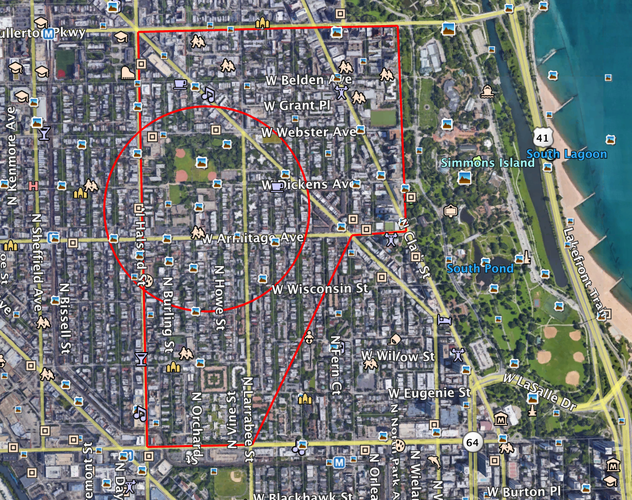
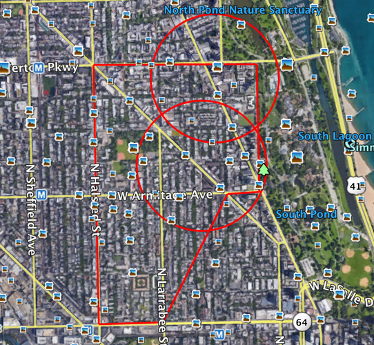
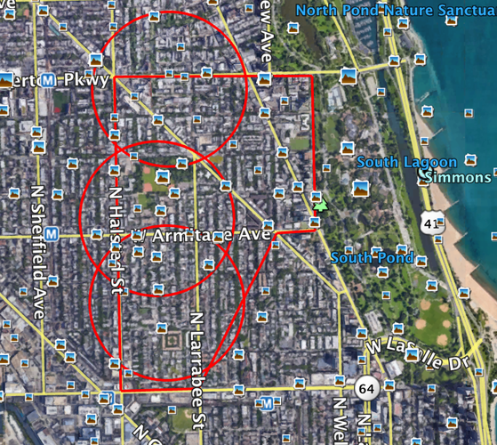
Lincoln Park High School serves 2,261 students extending well outside of the Lincoln Park Neighborhood boundaries, so it would be difficult for all of these students to be located within a 1/4 of a mile (5 minutes walking) radius. The radius extends slightly outside of the neighborhood boarders, but for the most part is contained within Lincoln Park. If the school was shifted slightly to the right, it might better serve the Lincoln Park citizens as fewer might not have to drive to school.
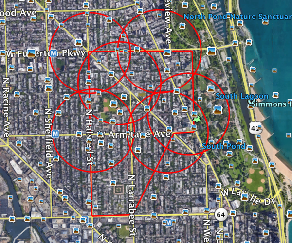
There are two grocery stores, Big Apple Finer Foods and Carnival Foods, located within the boundaries of Lincoln Park. Both of these stores serve the upper northeast side of the neighborhood very well, but the left and south sides of the neighborhood are not within an easy walking distance. If someone in these parts of the neighborhood wanted to grocery shop for more than a single meal, they would most certainly need to drive.
There are three churches located within Lincoln Park; Saint Pauls United Church of Christ, Second City Church, and The Church of Jesus Christ of Latter-day Saints. These churches are within walking distance of the left side of Lincoln Park. Depending on your denomination, however, one may have to commute to their church or other house of worship.
Lincoln Park has a total of 6 banks and ATMs. These service the neighborhood well, except for the bottom southwest corner, which is not within an easy walking distance. If a bank or ATM was placed within this corner, the neighborhood would be much better served in this regard.
Overall the neighborhood of Lincoln Park is not terribly lacking in daily necessities. However, there does appear to be a slight concentration of resources in the northern half of Lincoln Park. If the southern half of Lincoln Park had better access to these daily places, the neighborhood would justly service the entirety of its residents.
Sources:
Pictures taken from Google Earth Pro
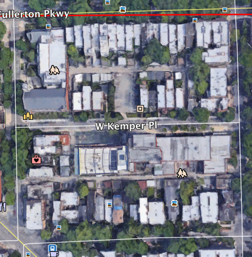
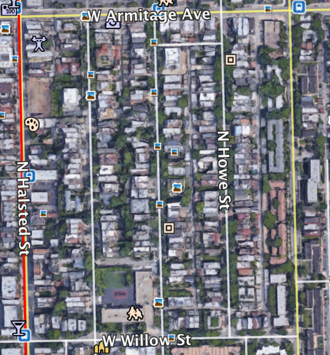
A horizontal elongated block pattern in the north section of Lincoln Park.
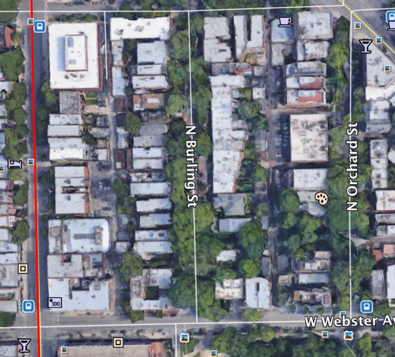
A vertical elongated block pattern in the west section of Lincoln Park.
A vertical, extremely elongated block pattern in the south section of Lincoln Park.
The majority of Lincoln Park is set up in elongated block patterns. These elongated blocks are typically residential. The North section of Lincoln Park typically has the shorter elongated blocks, while the southern half of Lincoln Park has very elongated blocks like the one shown in the third image. When one is walking around Lincoln Park, these blocks do feel longer, but I believe the atmosphere and safety of the neighborhood keep many pedestrians out and walking around Lincoln Park even with the very elongated blocks.
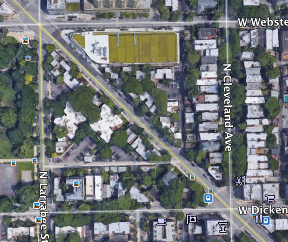
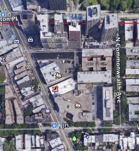
An irregular block pattern around North Lincoln Avenue in the middle of Lincoln Park.
An irregular block pattern around North Clark Street in the northern section of Lincoln Park.
While the majority of Lincoln Park is composed of elongated blocks, some of the blocks connected with North Lincoln Avenue and North Clark Street are irregular blocks. These intersections of diagonal cross streets cause the surrounding blocks to be composed of many variations. Compared to the rest of Lincoln Park, these intersections on irregular blocks are very busy, while the block can be confusing to navigate.
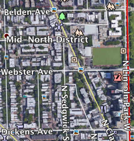
A Savannah Network type in the north side of Lincoln Park.
A Savannah Network type in the west side of Lincoln Park.
Lincoln Park most closely resembles a Savannah Network. The elongated blocks provide the neighborhood with easy directional orientation, with the exception of the few irregular block patterns. Traffic thought these networks was very evenly dispersed, leading to the quiet and walkable feel of the residential areas. The neighborhood can feel somewhat monotonous with the network pattern as well as lack of business, but the network also comes with its many perks, such as the sense of direction.
Key:
Red- border of Lincoln Park neighborhood
Gold- Drive
Blue- Boulevard
Green- Road
Unmarked Roads- Streets
The northeast edge of Lincoln Park is defined by a drive, separating the more natural landscape from the residential and business areas of Lincoln Park. Oz Park is also somewhat defined by a drive, where the other boarders are defined by walking trails. Some of the north and south borders of Lincoln Park are boulevards, as West North Avenue and West Fullerton Street take care of a large amount of traffic every day on the edge of the neighborhood. The west border, North Halsted Street, is one of the roads in the neighborhood. These roads have the highest amount of traffic within Lincoln Park, and they also contain the majority of the business in the neighborhood. The remaining are all streets, as they are highly residential with very low traffic and contain frontage for the many apartments and other building types. The majority of thoroughfares in Lincoln Park are these residential streets.
In terms of block pattern, Lincoln Park is somewhat well connected. There are not many irregular blocks, and the irregular blocks in themselves do not contain many looping roads or long intersections. The elongated blocks, however, are not ideal. Some of the shorter elongated blocks on the northern section have intersection spacing that is around 700 feet. This could be much better spaced, but it is very nice compared to the spacing on the other half of the neighborhood. The other extremely long elongated blocks in the south side of Lincoln Park contain intersection spacing that is above 1,500 feet. This section of the neighborhood also has worse access to daily needs, so the combination of this as well as intersection spacing leads for residents on the southern portion of Lincoln Park to lean away from walking. The elongated blocks, however, do control the parking to a reasonable amount, and they give residents a good sense of direction if they do choose to walk.
As for network type, Lincoln Park most closely resembles a Savannah Network. This network type greatly helps Lincoln Park, as it, just like the elongated blocks, help give residents an excellent sense of where they are directionally within the neighborhood. The traffic is dispersed evenly throughout the inner streets of Lincoln Park, lending towards a more quaint, residential feel. The network also allows for controllable lot depth, and many of the housing types take advantage of this with a small fenced in front yard. The only downside to this Savannah Network is the repetitive feel of residential housing. The streets are long and uniform with little business, so this type of area rarely feels broken up by the network type.
Lincoln Park's thoroughfare types are mostly consistent of streets within the neighborhood. These streets are very low traffic, allowing for a peaceful feel in the majority of the residential areas. The neighborhood also consists of a few drives, which busily break up residential and business areas from more natural areas. These drives, in my option, are too heavily trafficked and discourage pedestrians from traversing them to enter the parks in and around Lincoln Park. The boulevards break up the outskirts of Lincoln Park and carry most of the through traffic without directing it through the neighborhood. There are a decent amount of roads in Lincoln Park, mostly surrounding business areas. These roads are a contrast from the streets of Lincoln Park, as the roads do carry a higher volume of traffic and a different feel. However, the roads do a good job of leading traffic to the business areas and around the more residential sections. The roads help connect the different areas of the neighborhood while leaving the streets with little through traffic.
Overall, Lincoln Park possesses a good sense of connectivity. Traffic throughout the neighborhood is well controlled, and the more well trafficked thoroughfares are on the outskirts of Lincoln Park or in a more business district. The elongated blocks are the main downside to the neighborhood, as the intersection spacing between them is far too long. However, Lincoln Park overall has a good sense of connectivity.
Sources:
Google Earth Pro
Duany Plater-Zyberk & Co. "The Lexicon of New Urbanism." www.dpz.com.
As most people tend to categorize neighborhoods as either “good” or “bad,” many would easily classify Lincoln Park as a “good” neighborhood. Overall, Lincoln Park does have numerous positive qualities, but the connectivity of a few aspects of the neighborhood is lacking. Improving the connectivity of Lincoln Park would allow for residents to better enjoy the spaces and services around them. This improved connectivity would, in turn, increase social interaction between residents, as well as increase interaction with visitors that enjoy some of the main attractions associated with Lincoln Park.
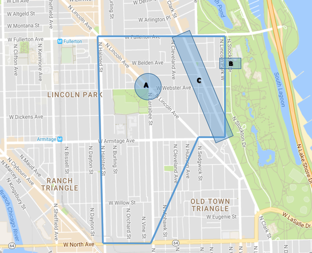
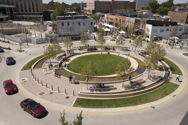
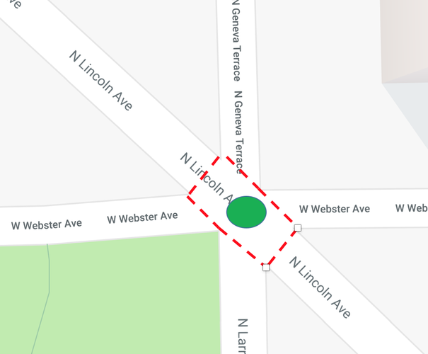
My first intervention (A) will take place at the intersection of North Lincoln Avenue, West Webster Ave, and North Larrabee Street. This intersection is one that would be crossed by most residents coming from the north section of Lincoln Park to use Oz Park. West Webster Avenue is a drive on the north border of Oz Park, and the speed and busyness of this road along with the intersection hurt the use of the park. Many younger residents could not travel to Oz Park on their own, and crossing the intersection is a difficult task that I am sure deters many residents from choosing to use the park. I am proposing a roundabout, where the center of the roundabout could also be used as a small public space. The residents would be consulted in order to design the crosswalks surrounding the intersection, an effort that has helped foster community and safety in Seattle (Project of Public Spaces). The intersection will help reduce speed and draw attention to the park, thereby increasing resident’s connectivity to Oz Park.
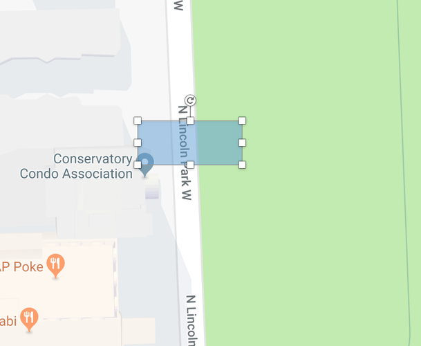
My second intervention (B) will take place on the border of Lincoln Park at North Lincoln Park West. Across the border is the actual park, Lincoln Park, and within the park are more public spaces such as Lincoln Park Conservatory and the Lincoln Park Zoo. While these spaces are not technically a part of Lincoln Park, they still border the neighborhood and are very much associated with Lincoln Park. However, North Lincoln Park West is a busy drive which deters any pedestrians with the speed and amount of traffic passing through. I am proposing a pedestrian bridge over the roadway to connect “Lincoln Park” with the actual neighborhood of Lincoln Park. Most who use the Zoo and other areas in the park are not neighborhood residents, so the bridge should better connect residents to the public spaces. Oz Park provides the majority of public space for residents, so the bridge will increase the public space as well as the connectivity of the residents to the space associated with their neighborhood.
My third intervention (C) will take place on North Clark Street. North Clark Street is a road that runs diagonally through Lincoln Park, breaking up the pattern of elongated blocks and creating irregular blocks. This creates a sense of disorder due to the irregular blocks and the high volume of speeding traffic cutting through the neighborhood. I am proposing to increase the pedestrian friendless of the street by increasing the size of the sidewalk and eliminating some of the roadside parking. The sidewalk currently is very small, and the trees and trashcans scattered along the sidewalk make the width even smaller. Increasing the sidewalk frontage as well as eliminating some of the parking spots would help promote walking in Lincoln Park. This would be around the most commercialized street in Lincoln Park, fostering socialization as well as cutting down on traffic within Lincoln Park.
My three interventions will increase the connectivity of Lincoln Park by helping residents overcome the few highly trafficked streets in the area. The proposed changes should help foster pedestrian traffic and socialization while at the same time cutting down on motorized traffic. These changes will improve the connectivity of Lincoln Park and help it continue to be referred to as a “good” neighborhood.
Sources:
pps.org; Actions for Streets as Places
While a roundabout in itself would slow down traffic, it would also be nice for it to function as a small area of public space for pedestrians in Lincoln Park.
Photo Source: archdaily.com
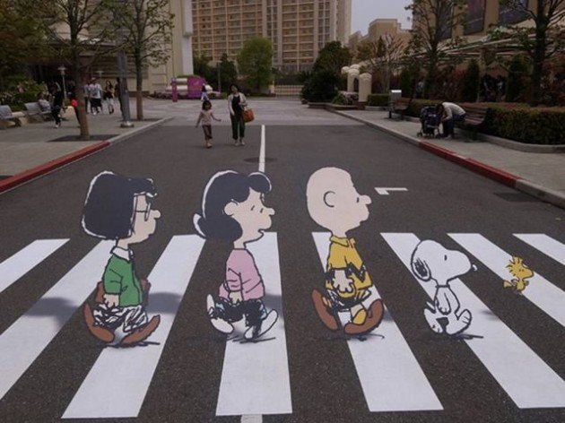
Coming from a Seattle-based intervention, Lincoln Park residents would have the power to design the crosswalks around the roundabout. The crosswalks could be anything from Wizard of Oz themed to Peanuts. These will not only help to decrease vehicular speed and awareness of pedestrians, but it will also help give residents an even greater sense of connection to the area.
Photo Source: dramafever.com; 10 Coolest Crosswalks from Around the World
This is the proposed location of the roundabout and crosswalks with their proximity to Oz Park shown as the green space in the bottom lefthand corner.
Photo Source: Google Maps
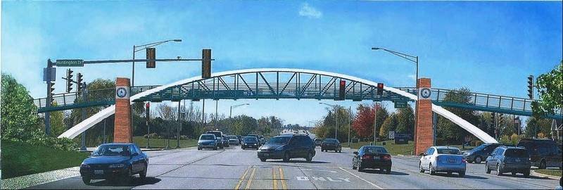
This is type of pedestrian bridge similar to the one that would work well on the North Lincoln Park West border of the neighborhood. This bridge would help connect residents to Lincoln Park itself and the many public spaces within it.
Photo Source: dailyherald.com; Algonquin Chooses Design for Pedestrian Bridge
This is where the pedestrian bridge would be enacted, on the northern half of North Lincoln Park West. It would encounter many people as it is close to the commercial North Clark Street.
Photo Source: Google Maps
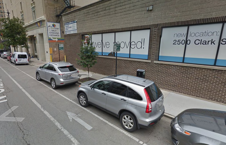
This is the current state of North Clark Street, with trees and other sidewalk objects that further narrow the width of the sidewalk.
Photo Source: Google Maps
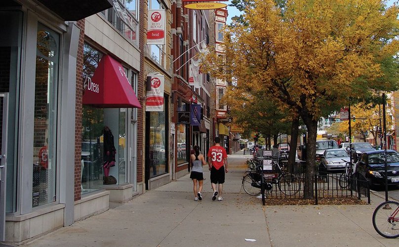
This is the type of sidewalk I am proposing to create on North Clark Street. The increased width would help promote walking and increase business as well as discourage traffic passing through the middle of the neighborhood.
Photo Source: nacto.org; Urban Street Design Guide
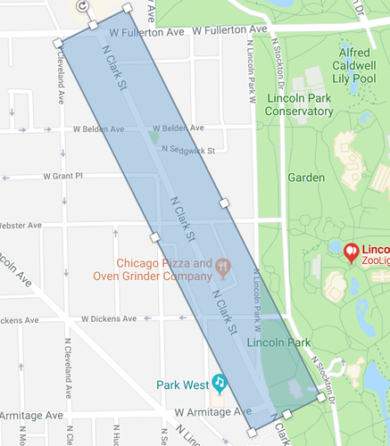
This is the section of North Clark Street that would undergo the changes. It is the section within Lincoln Park's neighborhood borders.
Photo Source: Google Maps
Social Mix
From the outside looking in, one might first view Lincoln Park as a very “good” neighborhood, based on the success and sense of identity possessed by its inhabitants. However, when one looks at data depicting the diversity of the neighborhood, this story of a “good” neighborhood takes a turn for the worse. In terms of race and ethnicity, Lincoln Park possesses a 1.44/4 on the Simpson Diversity Index, as compared to the whole city of Chicago’s 2.74/4. Lincoln Park is very much a “white” neighborhood with little racial diversity. Going along with this, Lincoln Park’s residents are highly educated, with little of their residents possessing anything less than a bachelor’s degree. It scores a 2.61/5 on the Simson Diversity Index for Education, a far contrast to the city of Chicago’s 4.84/5. As for housing, the categories were divided into equal monetary sections. These sections split up many upper priced homes, allowing Lincoln Park to come out above the city of Chicago with a 3.12/4 compared to a 2.23/4. However, this number appears this way because Lincoln Park has many more middle and upper tier housing residents, while the city of Chicago’s housing values are concentrated in the lower to middle class housing.
Moving up in a stair step fashion from the neighborhood, to the community area, to the region, and, finally, to the city, it is apparent that the makeup of social diversity is concentrated in large areas. As one “zoom’s out,” the diversity increases from the sparsely diverse Lincoln Park. These numbers indicate that Lincoln Park is very much a white, educated, and wealthy neighborhood surrounded by similar areas. This definitely needs to change in order to help others in the area as well as to promote economic growth and innovation, as discussed by Emily Talen in Why Diversity. While those living in Lincoln Park might not see this as an issue, one needs to be made aware of this problem in order to help both those on the outside looking in and the residents of Lincoln Park.
Sources: socialexplorer.com for all demographic data