Overview
Social Mix
Public Space
Amenities
Connections
Final Project
Size
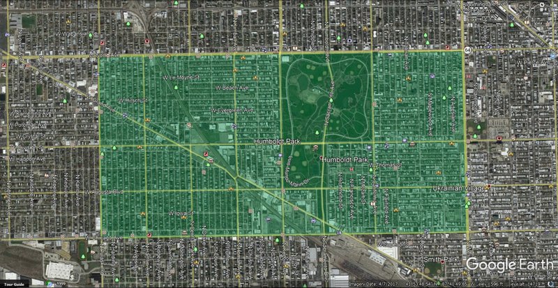
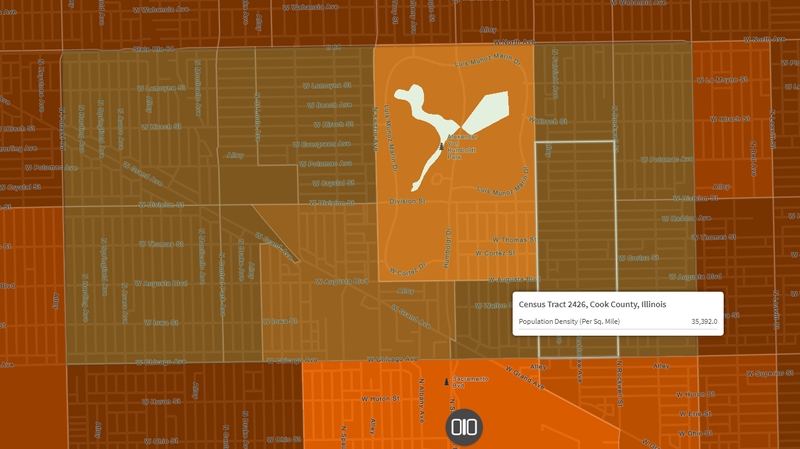
Humboldt Park is rather large in both population and geographic size. Based on the data from social explorer and google earth, Humboldt Park’s population ranges from about 55,000 to 65,000 people and contains about 1302 acres of land in all (slightly over 2 square miles).
Identity
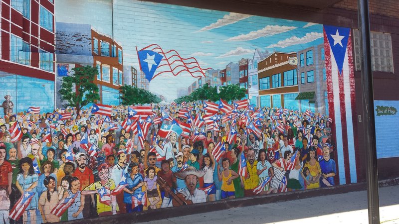
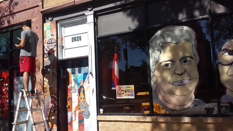
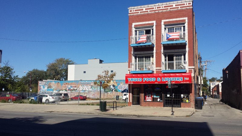
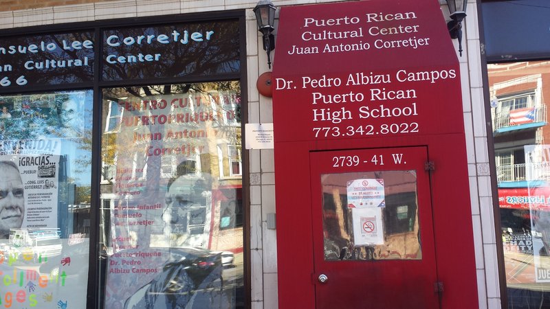
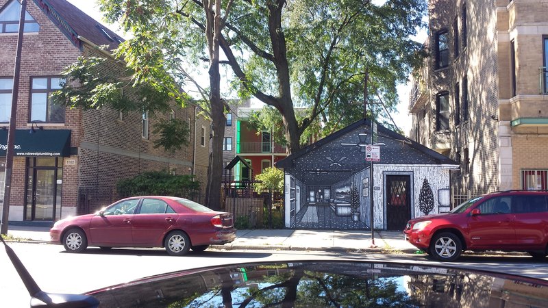
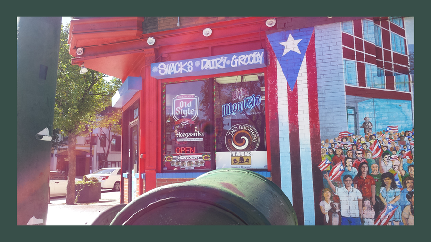
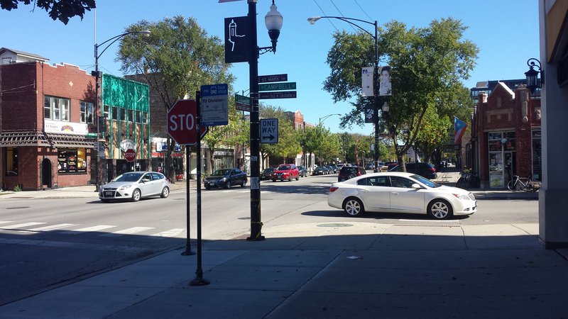
Humboldt Park mostly has a coherent identity. It has had a very strong Puerto Rican presence since the 1970’s, and the commercial and public areas definitely reflect this identity. There are a couple “themes” one could gather from simply walking around the area. For example, there is a lot of pride in the Puerto Rican heritage on display in terms of art and murals, flags displayed, Spanish language accommodations, local shops, corner stores, restaurants and numerous community centers. More notably there are two giant metal “gates” that are in the shape and color of the Puerto Rican flag, as well as mythical creatures and culturally significant items on the street light poles’ banners, and multiple murals of a controversial hero, Oscar Lopez Rivera.
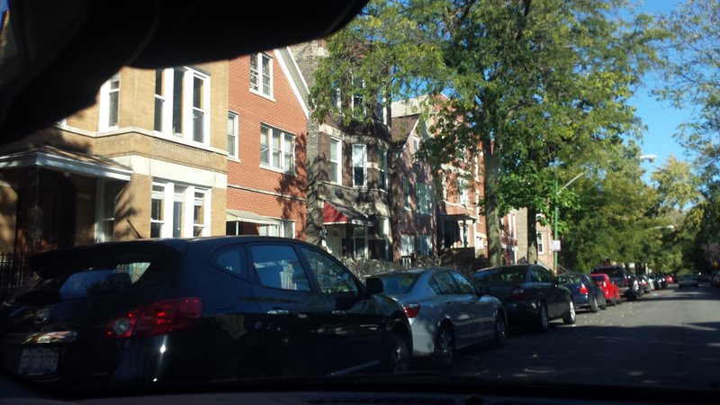
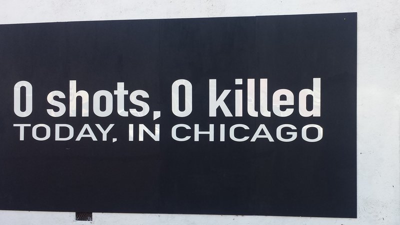
There is also a sense of wanting what’s best for the community and trying to escape the evils of rampant crime in Chicago. There are multiple advertisements for private schooling opportunities, as well as a mural on Division that records how many people have been shot and how many have been killed in Chicago on that day. Accompanying that mural in a much less graceful manner is some strong language that condemns drugs and drug users. While the Puerto Rican and other Hispanic presence is quite easily the strongest in terms of presentation, Humboldt Park has a significant African American and White American population as well. Most Non-Hispanic Whites generally populate the north-eastern side of Humboldt Park and most African Americans generally populate the southern and south-western portions. Those portions do seem as though they are separate neighborhoods from the rest of Humboldt Park due to the difference in the stores and general culture. One thing that remains similar in all of the residential areas are the brick houses and apartments. They are all mostly 2 to 5 stories high and are built close together. Most seem alike in terms of looks and style, but there are occasional unique modern-styled buildings sprinkled in between randomly.
Layers
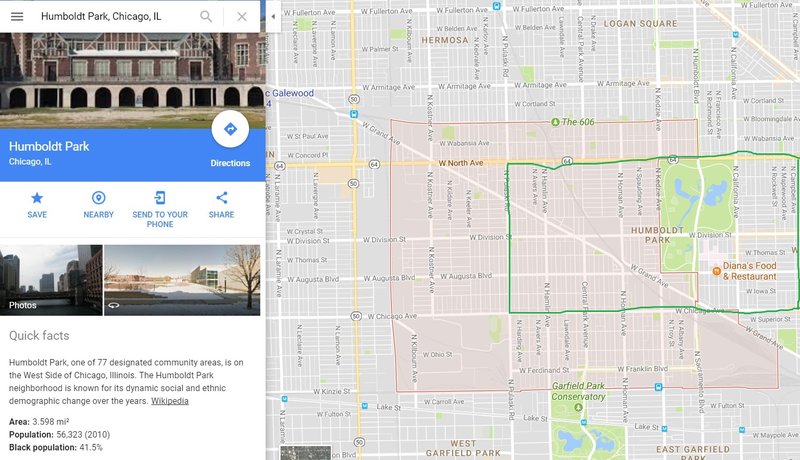
When searching Humboldt Park on the web, Google maps gives the area delineation in the orange shaded area. While this is technically the community area and includes part of West Humboldt Park, it does not include a significant portion of the neighborhood area of the Humboldt Park neighborhood. The eastern half is considered part of the West Town Community Area.
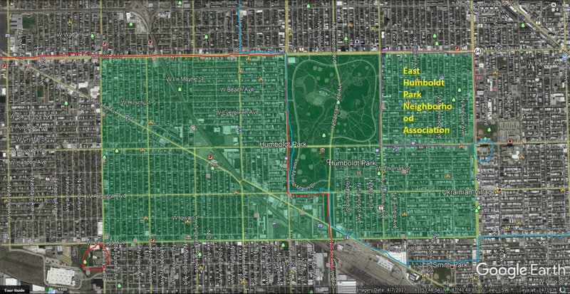
Other layers include that of the East Humboldt Park Neighborhood Association and the two Chicago Public High School District Boundaries. The Association’s goal as stated on their website was “to help improve the quality of life (safety, commercial interest, amenities) of East Humboldt Park.” The Association’s boundaries are bordered in purple, Orr Academy High School is circled in red and its boundary is also in red, while Clemente Achievement Academy High School is circled in blue and has its boundary also in blue.
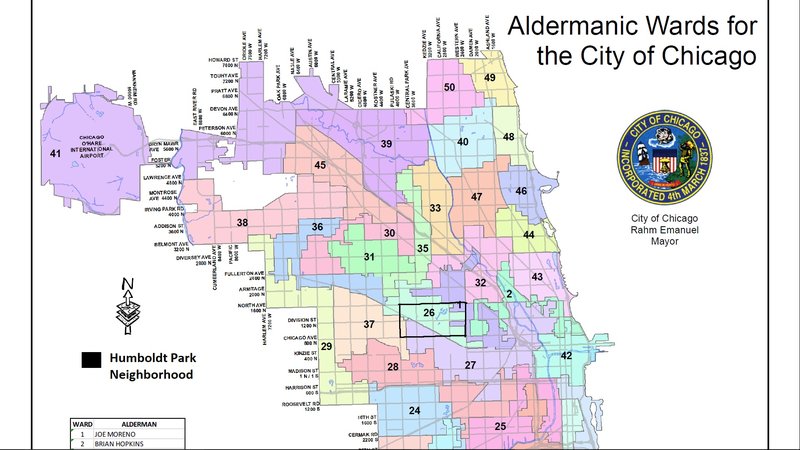
In terms of Aldermanic Wards, the Humboldt Park neighborhood has 4 wards within it in total. These wards being ward 26 at its heart, ward 1 to the northeast, ward 37 to the southwest corner, and ward 27 to the south of Grand Ave in the southwest.
History
Humboldt Park was named after Alexander von Humboldt and was annexed to Chicago in 1869 along with much of its west side. In its beginnings it was a prairie settlement. At the time of its annexation, the three great West Side Parks were starting to develop. After the Great Fire of 1871, new building laws were adopted in Chicago, but Humboldt park was just outside the new fire code limits, allowing the area to make low-cost construction possible. This caused the area to experience dramatic gains in real-estate value in the early 1870’s. Brick housing was the most common type that was built in the area. The original inhabitants were mostly German and Scandinavian (Norwegian & Danish), and many of the new residents were employed at the Chicago & North-Western Railroad’s 40th Avenue shops or in factories. The street railway system arrived at Humboldt Park in 1886, which encouraged even greater growth in the population. Later, in the early 20th century, Russian Jews, Italians, and Polish people became significant groups within the population of Humboldt Park. By 1960, Italians became the largest remaining European ethnic group as many of the Jewish residents moved to Albany Park and North Park. The next significant entrants were Puerto Ricans in the 1950s and 1960s, as they started moving in from West Town and migrating directly from Puerto Rico as well. Division Street anchored settlement for Puerto Ricans since the 1960s due to its stores and restaurants. Puerto Ricans faced an incredible amount of discrimination from the white inhabitants, leading to unrest within their community. This led to a three-day riot in Division Street against police after a Puerto Rican man was shot by a white police officer in 1966. Around the 1960s and 1980s, African Americans and Mexican immigrants joined the community mix, eventually rivaling the Puerto Rican numbers.
References
1. https://www.socialexplorer.com
3. http://www.easthumboldtpark.org/
5. http://www.encyclopedia.chicagohistory.org/pages/617.html
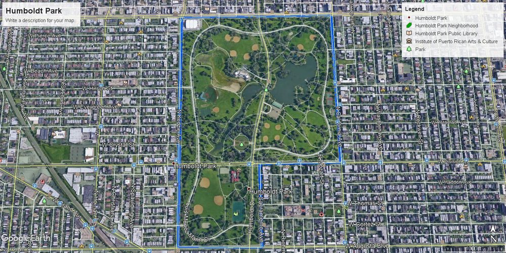
The Humboldt Park neighborhood has a very well defined center, the park itself. In total, it encompasses 207 acres and has a variety of landmarks, uses, and attractions.
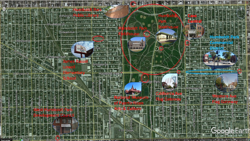
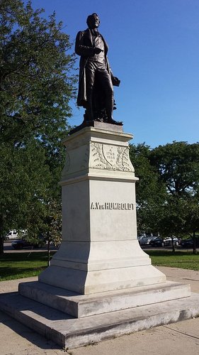
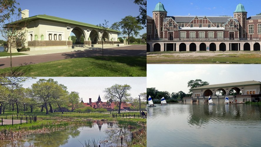
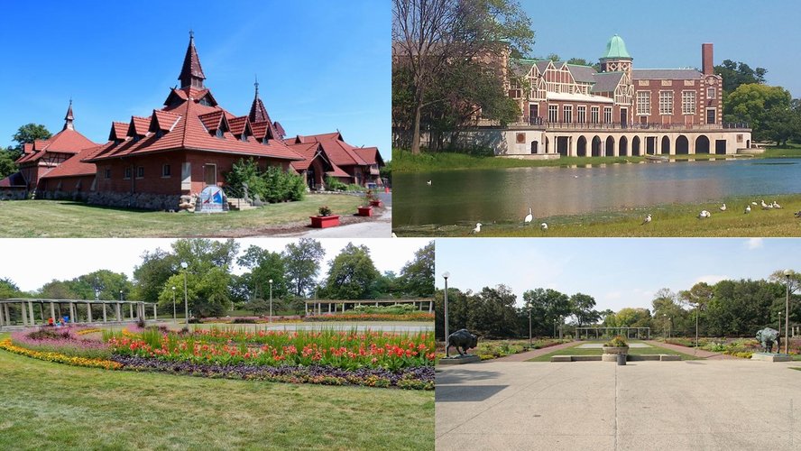
Humboldt Park is filled with beautiful landmarks including the statue of Alexander von Humboldt, boathouse pavilion, the National Museum of Puerto Rican Arts and Culture, the Field House and Refectory, as well as the Formal Gardens. All these landmarks draw people together for varied reasons, whether it be for talks and events at the museum and field house, looking over the water at the boathouse, or enjoying the beauty of the garden.
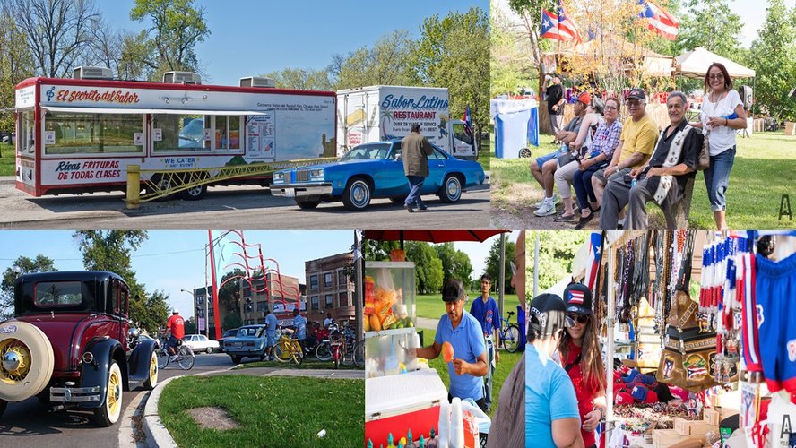
Perhaps the most popular spot in Humboldt park is just north of Division Street and east of Sacramento Avenue. Luis Munoz Marin Drive is often filled with food trucks, classic cars, and vendors selling bandannas, small Puerto Rican flags, hats & clothing, and handmade trinkets. People often gather around this area to talk in groups or to rest and relax. .
All throughout the park there are also fields for various sports including tennis, soccer, and baseball. Occasionally other events are also held in the park including live music and cultural festivals, as well as car meets, and volunteer events such as Go Run Chicago. The park is an excellent center that draws the neighborhood residents out for a wide variety of reasons and occasions.
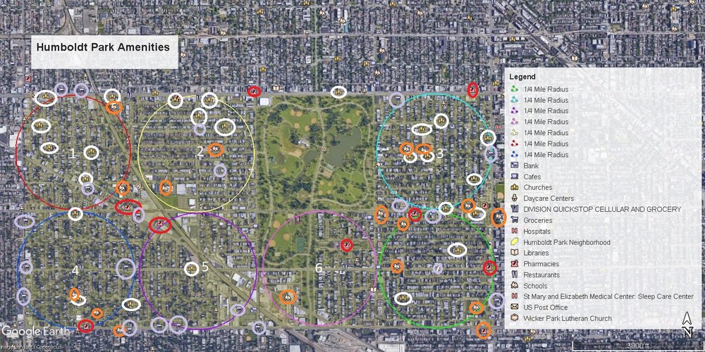
With approximately 2 square miles of land, the Humboldt Park neighborhood is relatively large. Its rectangular shape allows it to be mostly grid-like and as such can be separated into about 7 quarter-mile radius populated areas. Due to the size of the neighborhood, a variety of necessary amenities can be found within or near each of these area boundaries . Humboldt Park has many locally owned grocery stores (cicled in purple) to service the specific demographics that populate the areas. There are many elementary schools, a few high schools (both circled in orange), and a large number of churches in the neighborhood (circled in white). Health clinics and pharmacies (circled in red) are plentiful as well. However, walkability to these various services varies between each of these 7 areas for the residents.
Humboldt Park has walking accessible churches in most of these 7 areas. Citizens who live in area 6 would have the most trouble arriving at a church through walking alone as it has no church within it's boundary. Others who may have some trouble arriving at a church would be those who live in the southern portion of area 2 as most churches are clustered to the north.
For schools, areas 5, 1, 6, and parts of 4 may also have trouble with walkability. Area 5 has no school within its border, 6 has only one, area 1 only has schools immediately outside of its border, and area 4 only has them in its lower half.
Pharmacies are much less plentiful than the first two categories for all areas. For those living in the centers of these areas, these pharmacies are right outside or near the border of each area and are thus much more difficult to reach by walking alone.
Humboldt Park has many locally owned grocery and convenience stores. Due to the sheer quantity alone, walkability does not appear to be an issue for most of the neighborhood. Though, it appears that residents of areas 5 and 6 may find it more challenging than the residents living in others to walk to grocery stores.
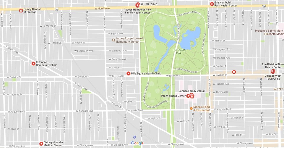
Health clinics and medical centers seem to be less numerous than the other amenities, but they are spread out nearly evenly across the neighborhood. Most residents seem to have clinics within walking distance, though there are certain pockets that could have more trouble reaching them than the rest. These pockets include the north-eastern and south-eastern corners of the map, residents who live near St. Louis Avenue and Augusta Boulevard, and residents who live near Hirsch Street and St. Louis Avenue.
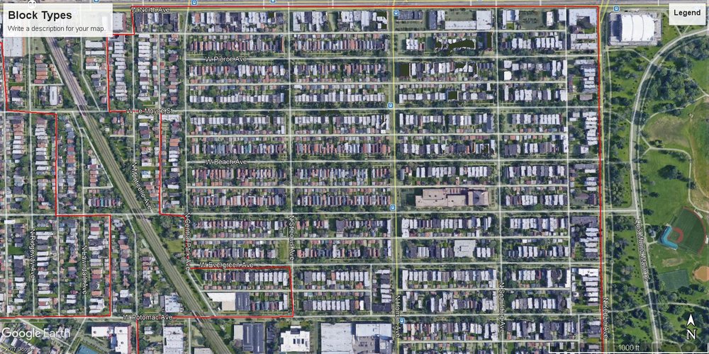
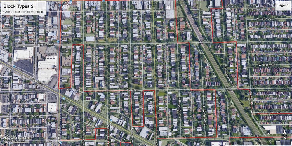
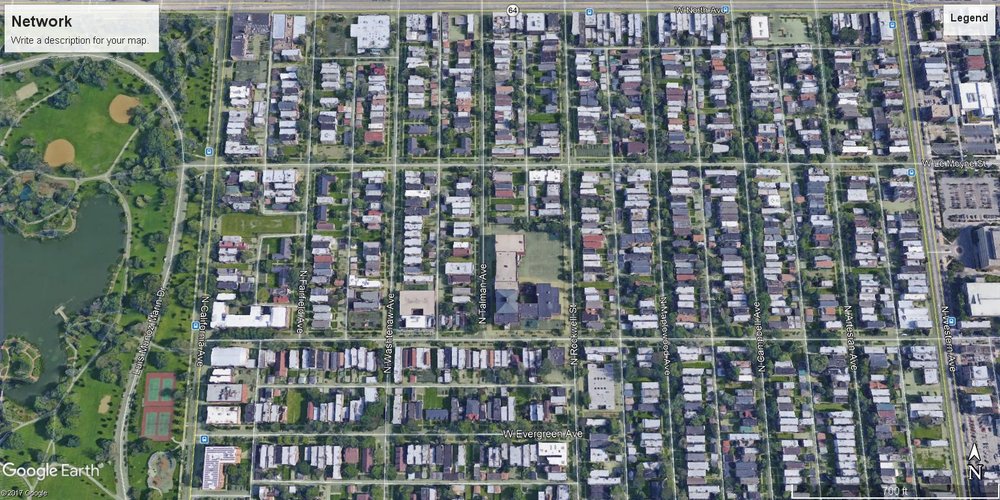
The majority of Humboldt Park is grid-like, making most blocks in the neighborhood either rectangular or square-shaped. This picture shows a northwest section, east of the railroad tracks.
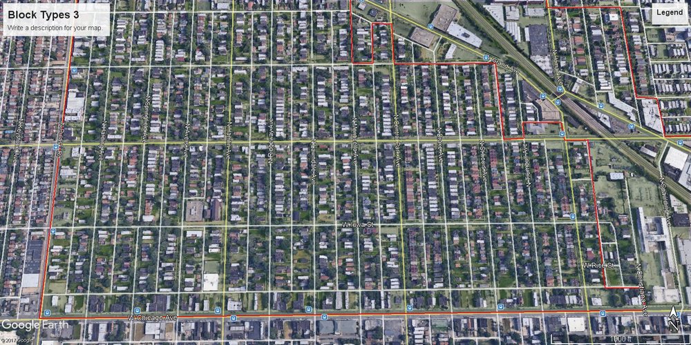
Here we have more square/rectangular blocks in the northwestern area, west of the railroad tracks.
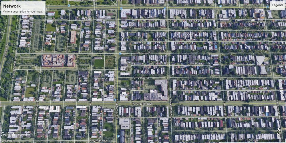
This square/rectangular block pattern continues in this southwestern section.
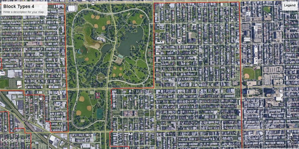
Most of the eastern section follows this pattern as well.
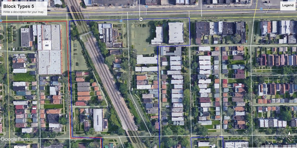
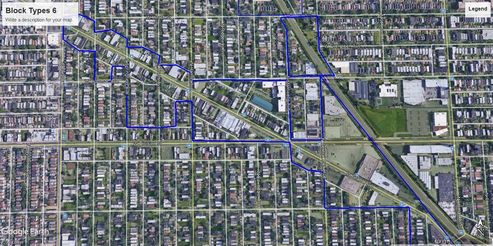
Humboldt Park has only two diagonal features that interrupt the grid pattern. These are the train tracks and W Grand Avenue. Due to their interruption of the grid pattern Humboldt Park has a few irregular blocks on the western region.
More irregular blocks as a result of the two diagonal features.
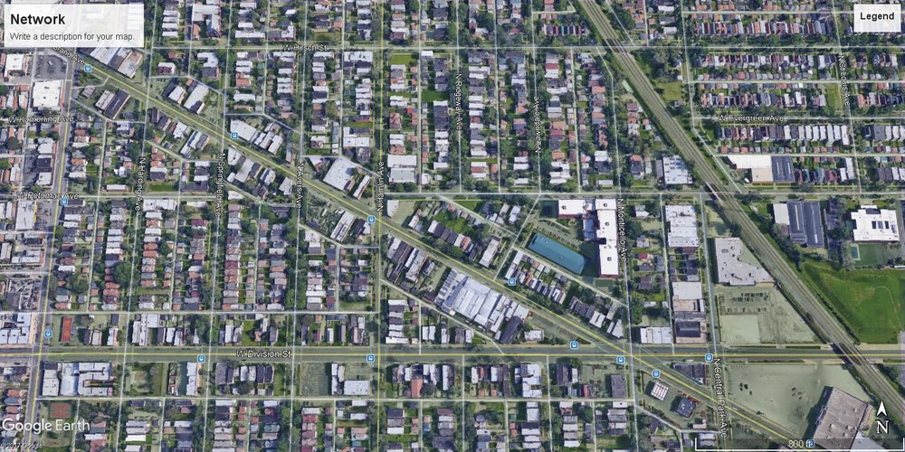
Humboldt Park's network mostly follows the Savannah pattern. The train tracks do not interrupt most streets due to the many overpasses built over them, allowing the Savannah pattern to continue under them.
Another Savannah pattern network.
However, certain sections around the diagonal W. Grand Ave. seem to form more of a Mariemont pattern.
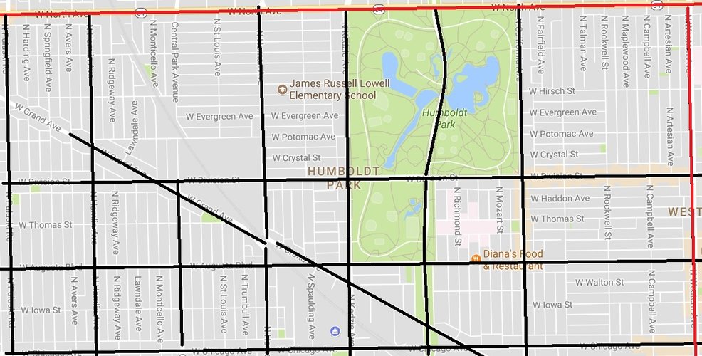
Humboldt Park mostly consists of streets and avenues. The red thoroughfares are boulevards, the black are avenues and the white thoroughfares are streets. The center park itself is filled with many paths that are colored in a dark grey. North Avenue and Western Avenue seem to be much wider and somewhat faster thoroughfares than Pulaski and Chicago Avenue. The black thoroughfares are generally wider than the streets, but are still low to moderate in terms of speeds. All other thoroughfares in white have lower car capacities and speeds.
Humboldt Park is large for a neighborhood, so in terms of connectivity it benefits greatly from its mostly grid like pattern. It is also not gated and has multiple thoroughfares that make it easy to get around, enter, or exit the neighborhood. The main interruptions to the grid are W Grand Ave and the enormous park itself, but neither seem to be huge hindrances to connectivity. Avenues such as Division, Homan, California, and Augusta help connect the southwestern region to the eastern half of Humboldt Park. In terms of driving Humboldt Park seems well connected. The main problem is overall walkability in terms of the entire neighborhood. Despite the grid, Humboldt Park is still enormous as a neighborhood at 2 square miles. Walking within the different pockets is relatively easy, but walking between the west and east regions is much more troublesome due to distance alone.
As stated in the previous sections, Humboldt Park is rather large for a neighborhood, as it takes up 2 square miles of land in total. It is therefore advantageous that much of the neighborhood follows a grid pattern, and thus is easy to navigate in terms of direction. However, its size makes it difficult to traverse the entire neighborhood by foot on a day to day basis to reach essential services. Certain pocket areas of the neighborhood are severely more lacking in amenities than others and this should be corrected to make the neighborhood become more balanced overall. Therefore, I will propose three interventions to try to correct this difference in ability to meet daily-life needs.
Humboldt Park has been slowly changing over a long period of time. Gentrification is the root cause of this and it can most clearly be seen in the east side of the neighborhood. Modern architectural buildings are on the rise, as well as new businesses aimed at the rising demographic of younger gentrifying adults. While some residents may see this as a detriment to their future in the neighborhood, it can lead to some much-needed change for the rest of the neighborhood. These new businesses and residents mean more revenue being brought in for the entire neighborhood, which could lead to more investment in other areas that are currently struggling.
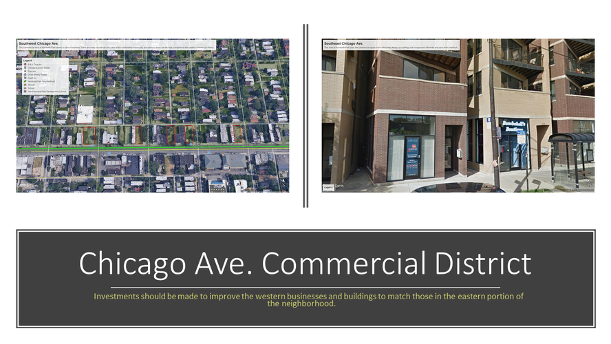
This leads to my first intervention, investing in the commercial area on Chicago Avenue, west of Homan Avenue. Currently there are many vacant lots and decrepit buildings in this area that could benefit from investments. Mixed use buildings could be built where the vacant lots are located in order to fulfill both needs for housing and for other local services to bring in more revenue for the neighborhood. This change may also help in lowering crime by utilizing Jane Jacobs’ “eyes on the street” concept. Investing in the small businesses that are already in place would allow the area to keep its sense of identity, while simultaneously helping the neighborhood improve aesthetically and financially.
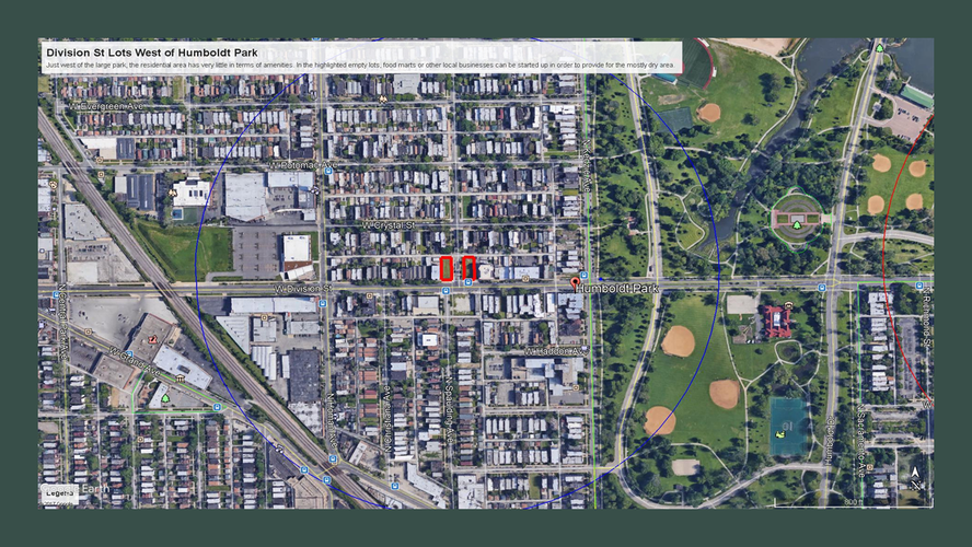
As for the second intervention, I suggest utilizing the two empty lots on Division Street, west of Kedzie Avenue. Using a quarter-mile radius to gauge which services are provided within walking distance of these lots, one can find that there aren’t many amenities within the area. The only business resembling a grocery store within this boundary is a “mini-grocery.” An investment in local businesses that could provide more necessary groceries and some other service would greatly benefit the locals within the surrounding residential area. This could also serve to preserve some ethnic identity in the area if the businesses cater to the current Latino residents if losing this identity to gentrification is a concern.
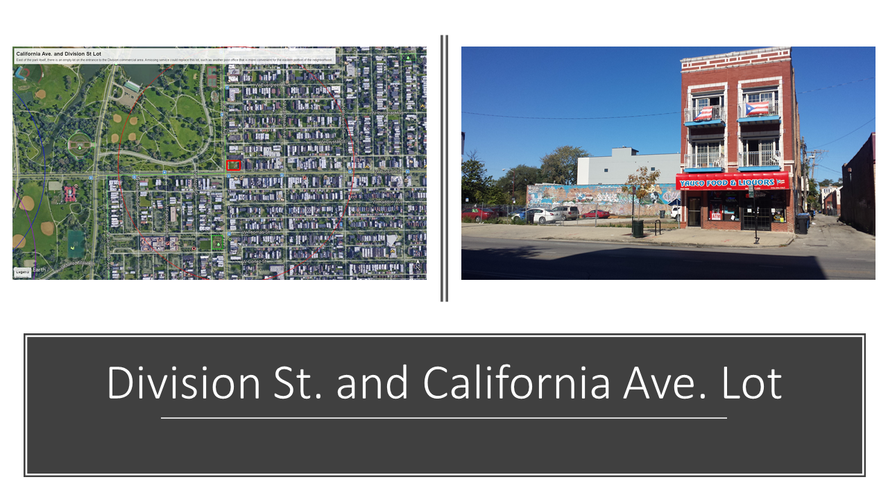
For my final intervention, I focus on the empty lot on the north-east corner of Division Street and California Avenue. This lot faces the park and a private high school, both of which create a lot of foot traffic. Due to this being situated in the main commercial district of Humboldt Park there is no need to invest in a private business at this location. However, this area is being underutilized in its current state, and it would greatly benefit residents if a government service such as a post office (of which there is currently only one in the entire neighborhood to the north-west corner) or youth center were built in this space. This would create a purpose for this space and provide more walkability to this section of the neighborhood.
Shown here is the location that would require investment in the first picture and the typical business buildings in the east in the second picture. Investments need to be made to have the west area match the east.
Here we have two locations in Humboldt Park. The first is west of the park, the latter is in the east. The second picture demonstrates the type of grocery store mixed building that could be introduced in the western location to improve the area's servicing as well as further solidifying ethnic identity.
Shown here is the location of the vacant lot on Division St. and California Ave. The lot is in a location in which foot traffic would be plentiful and would be put to better use if a government service building or locally owned retail business were built there.
Social Mix
From the data gathered from Social Explorer and the Simpson Diversity Index scores, we can see that the Humboldt Park neighborhood is significantly diverse in terms of Educational levels and in Household income. However, the Simpson Diversity Index score is rather low for Race and Ethnicity. This is due to the fact that nearly half of the population (49.3%) is of Hispanic or Latino origin, however there still are sizable non-Hispanic White (23.8%) and non-Hispanic Black (22.7) populations within it. In comparison, racially the neighborhood itself is more diverse than the community area, slightly less diverse than the western region, and further less diverse than the city itself. In education, its diversity fairs better than the community area, and is only slightly less diverse than the western region and the city. This pattern mostly holds true for household income as well, with the sole exception being that the neighborhood just beats out the western region in this case. Overall, the Humboldt Park neighborhood does appear to be considerably diverse, and based on recent trends of population change, the racial aspect will continue to transform in the near future.
1. All data used for this table’s variables was collected using https://www.socialexplorer.com/