Overview
Social Mix
Public Space
Amenities
Connections
Final Project
Size
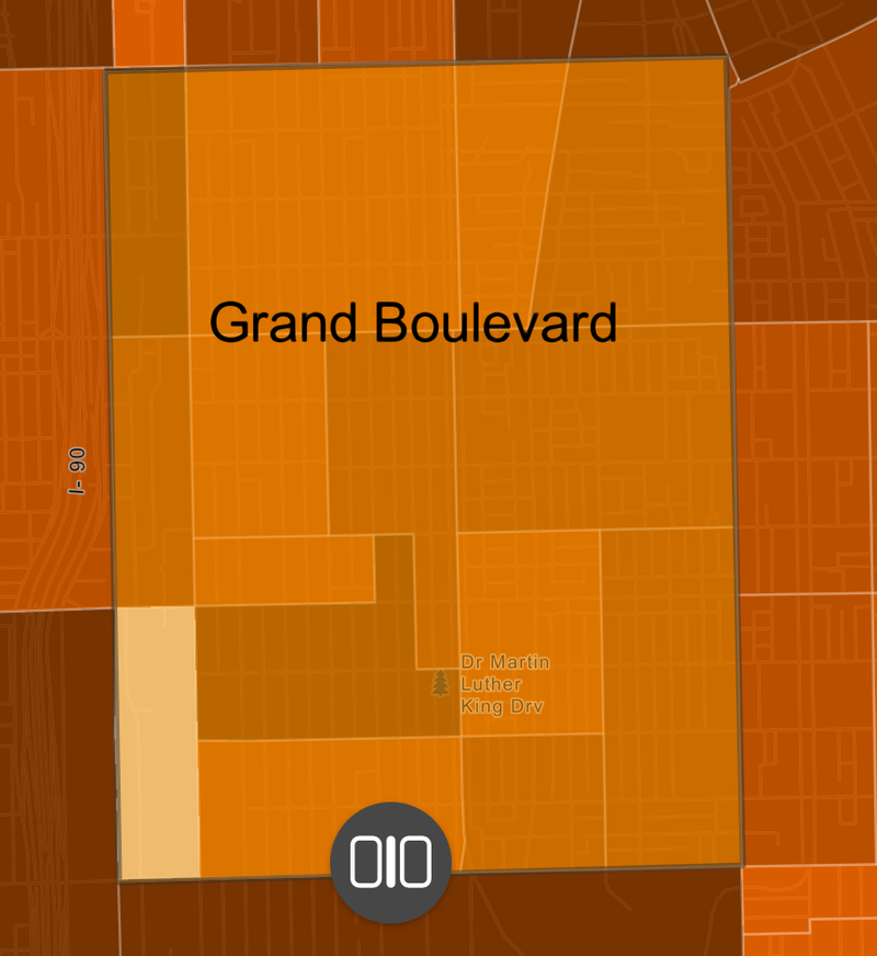
The Grand Boulevard has roughly 19,945 people according to Social Explorer's 2015 report. This is about as big as 1/5 of a football stadium's seating. It is about 1.73 mi^2.
Identity
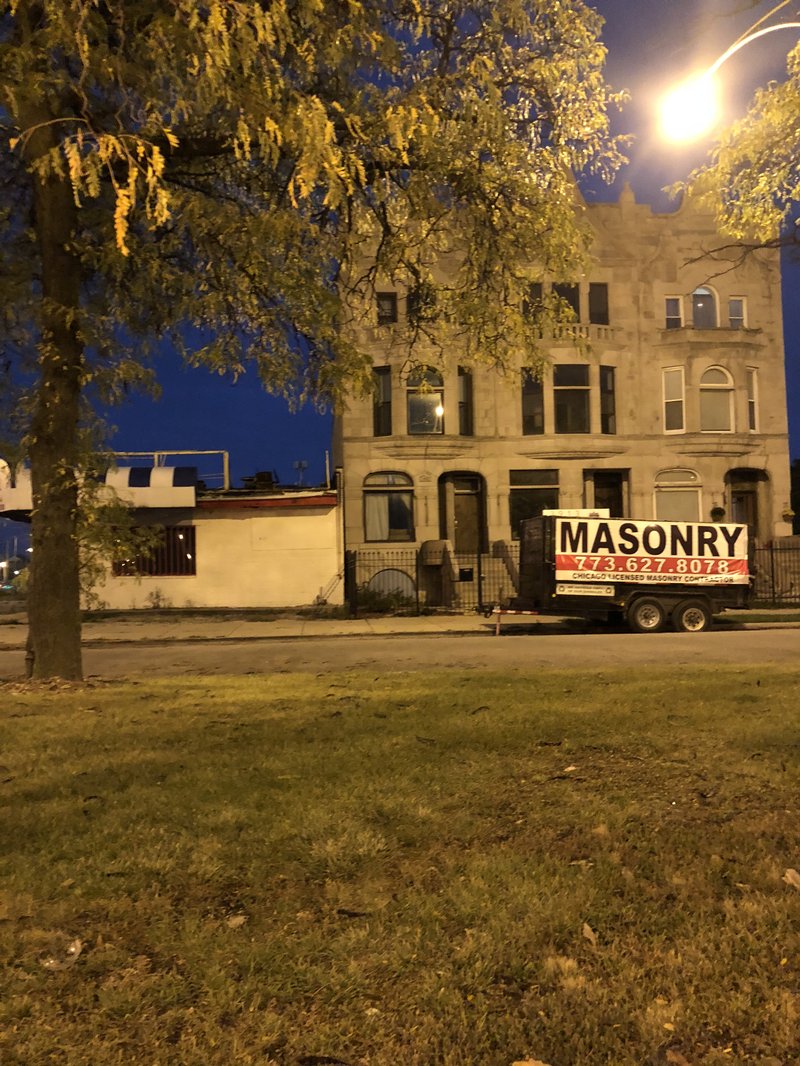
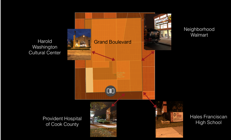
The Grand Boulevard Neighborhood definitely has coherence to it. The area has an abundance of resources including big grocery stores, schools, including elementary, middle, and high, cultural centers, restaurants, means of transportation, clothing stores, and anything else a neighborhood would need to meet its basic needs. There are banners along Cottage Grove in specific detailing a Roman Catholic, Hales Franciscan High School's 50 years of service to the community. A banner remembering how historic the area was also resides there. Along with banners, seen at the Harold Washington Cultural Center is a grand statue of the former Harold Washington himself with a plaque to honor him. Harold Washington was Chicago's first black mayor elected in 1983. In order to remember that the Grand Boulevard was part of a major blues scene within the city, there are two poles with men on them top of them playing instruments, one is in front of the Harold Washington Cultural Center and the other across the street.
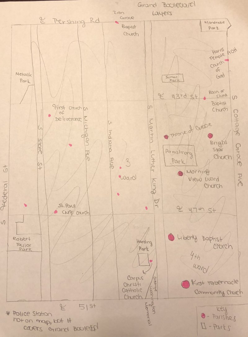
As far as delineation, the Grand Boulevard goes from East Pershing Road to East 51st Street North to South. Going West to East, the Grand Boulevard goes from South Federal Street to South Cottage Grove Avenue making the delineation very symmetric. It is definitely a conglomerate of black life for the Southside of Chicago as it is a part of the historic Bronzeville area.
Layers
Diagram
History
Grand Boulevard, located on the Southside of Chicago, was originally called the Forrestville Settlement and was a part of the Hyde Park Township before it was annexed in 1889. Spanning from East Pershing Road to East 51st Street North to South and from South Federal Street to South Cottage Grove Avenue going West to East, it was once home to many groups including those of Irish, Scottish, English, German, and Jewish origin with some African Americans. Quickly the number of African Americans completely took over the area, and by the early 2000s, there was roughly 0.6% of whites living in the area. The Grand Boulevard's name came to be because of a street located within the neighborhood called Grand Boulevard. Chicagoans now call this drive Dr. Martin Luther King, Jr. Drive or King Drive for short. The community area was once prairie like and of thick wood; today it is mostly residential and commercial.
Historically speaking, the Grand Boulevard neighborhood was a planned neighborhood being the it was a part of the Hyde Park Township meaning that the area functioned as an independent suburb of Chicago. After being annexed, again, I would have to say that the Grand Boulevard was once again a planned neighborhood filled with majority African Americans due to discriminatory housing segregation and segregation in general within the city of Chicago. Being that it was probably always an ad hoc with deliberate means of delineation, when African Americans started to take over the area, it was home to many black owned businesses, churches, theaters, clubs, and black elites until poverty and unemployment took its toll.
It is possible to broadly characterize the different types of development within the area in my opinion based off of a sequence of events: being a part of the Hyde Park Township, after being annexed, Black Hub, and in today's terms being that these were drastic changes to the neighborhood. The Grand Boulevard has always had transits running through it making the commute to downtown a breeze. There is the Green Line EL with stops that run through the neighborhood. A government building within the neighborhood included the Ida B. Wells Housing Project 1939-2011, which were the Chicago Housing Authority's project homes for majority African Americans.
Bowly, Devereux, Jr. The Poorhouse: Subsidized Housing in Chicago, 1895–1976. 1978.
Holt, Glen E., and Dominic A. Pacyga. “Grand Boulevard.” In Chicago: A Historical Guide to the Neighborhoods: The Loop and the South Side. 1979.
Keating, Ann Durkin. Building Chicago: Suburban Developers and the Creation of a Divided Metropolis. 1988.
Reed, Christopher R., and Annie Ruth Leslie, “Grand Boulevard.” In Local Community Fact Book: Chicago Metropolitan Area, 1990, ed. Chicago Fact Book Consortium. 1995. 1990.s
Spatial Definition
The figure ground indicates that the spatial definition of the public realm is sparse and spread out. There is so much private property, including a high density of housing , that much of the space is filled.
Map Courtesy of Snazzy Maps -->
Sense of Ownership
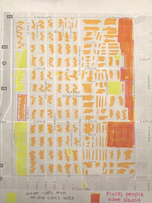
In order to determine which spaces I felt were cared about and which weren't was pretty simple because the Grand Boulevard neighborhood has a high density of housing. In this being the case, I colored all of the residential areas orange. The yellow colored areas are mostly parks because I never see people at these parks being that they are hidden away and tucked in places where no one can see them. There is also some yellow where there isn't anything in the area or open space.
Map Courtesy of Google Maps
<--
Problematized space
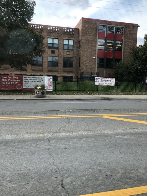
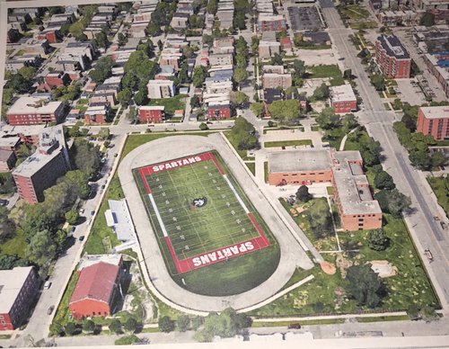
Hales Franciscan High School is a private Roman Catholic High School located on 49th Cottage Grove. Being that is located on the busy Cottage Grove Avenue, it is visible to the public. Although it is a private school, many public events happen within the realms of the space including football games, soccer games, dances, standardized testing, and more. There aren't any negative critiques to say about the space being that it is accessible to the community members if in the event they wanted to use it. On the other hand, I will say that the space is balanced making it easy for traffic to flow and pedestrians to walk, engaging because of the black and red color scheme/ how the schools looks overall, and meaningful being that it is a predominantly African American school in the midst of an African American neighborhood willing to provide men with a proper education.
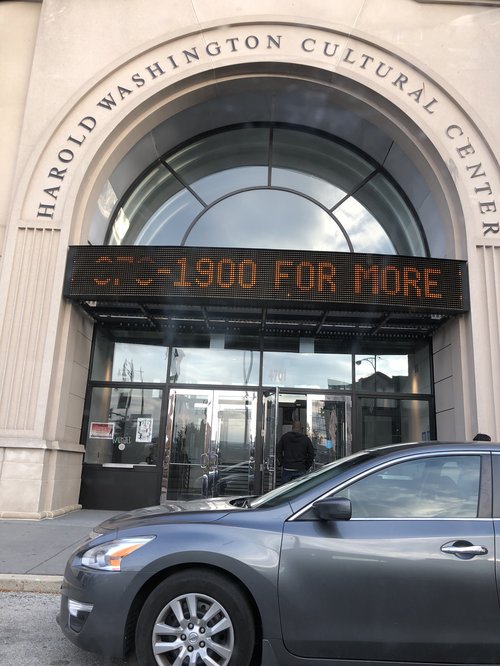
The Harold Washington Cultural Center located on 47th King Drive is a center in which performances happen and other events. It is also located on a busy street, Dr. Martin Luther King, Jr. Drive, and it is able to stand out to the general public. Anyone is welcomed to the events that happen in the center making it a public space for the community. Again, there aren't any critiques I have for the center being that it is located in a residential area with multiple means of transportation and public access. The space is social and able to provide entertainment, engaging because of it has a civic and modern look within the community, and meaningful being that is was named after the late Mayor Harold Washington who contributed a lot to the black community in Chicago.
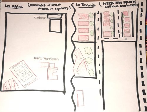
Res publica vs. Res economica
Picture Courtesy of Google Earth -->
The center
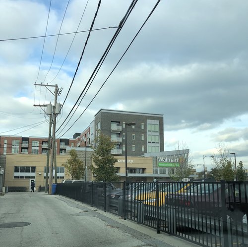
The Grand Boulevard area does not have a center in my opinion because the neighborhood isn't heavily community based all of the time. As far as a center, the neighborhood Walmart located on 47th Cottage Grove avenue can serve as a place where community members can buy produce and other everyday needs such as toiletries. There is also a pharmacy present along with a Deli. There are always long lines, you can pay bills, and cash checks. Assess to the neighborhood market is simple being that it is off of Cottage Grove in a residential area. Bus transportation and walking is feasible as well. Furthermore, in addition to the Walmart, there is a McDonalds, Burger King, Uncle Remus, Subway, and the main light of 47th Cottage Grove, so access to multiple food options are at anyone's convenience.
Civic realm
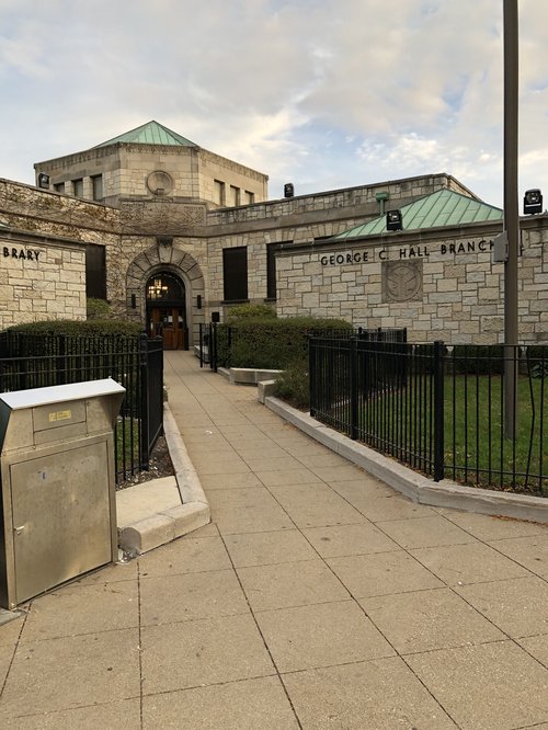
. Upon walking into the George C. Hall Branch library, I could tell that it was small and intimate. There were three big main rooms filled with book for children, adults, and magazines. There was also a small auditorium room that was for multipurpose use. There were children on the computers and doing homework in their specific room. The same thing was happening in the adult room. The library is public, warm, and also had free wifi making it the ideal place to get work done or somewhere for anyone in the area to settle. The tall ceilings and polished wood walls made for a grand feel. The library was definitely an active space.
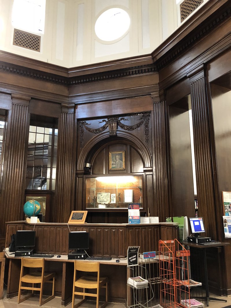
Inside of the Hall Branch Library- Chicago Public Library
Daily Life Needs
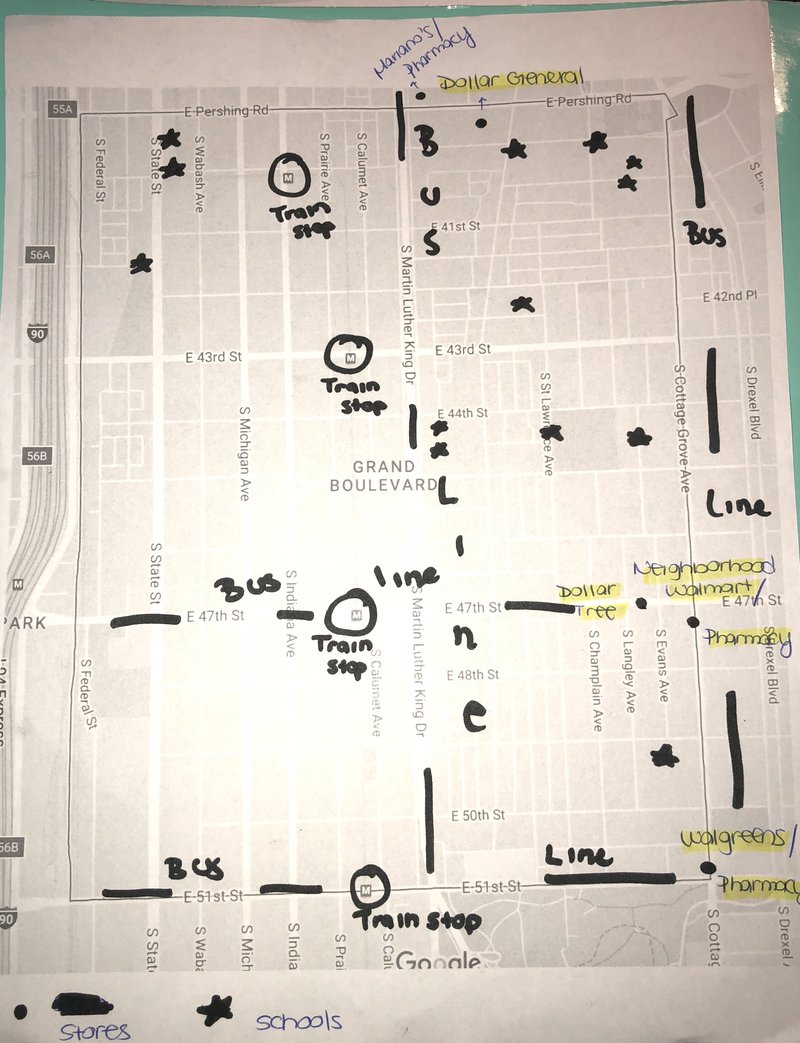
The daily needs of residents in the Grand Boulevard are made easy through means of public transportation. No matter where you are, there is either a bus stop or a train available to get you to a grocery store for food needs or to corner stores which serve as aids when there is no time to go to big stores. The commute to the big grocers should take no more than 10-15 minutes if done by transit making access convenient for all. As far as walking, the walk is within a 1/4 to 1 mile distance depending on ones starting point. Being that the Grand Boulevard is in such a central location, there are also store close to the area although they are in different neighborhoods. The big chain stores in the neighborhood such as the neighborhood Walmart and the Walgreens also have pharmacies making obtaining your prescriptions convenient. Getting to these stores is safe being that there are a bunch of people around always, and there are sidewalks for walking.
As far a schools, there are over 10 schools catering to a variety of different ages. Schools in the area are for grade school students, high schoolers, and even the college level such as trade schools allowing everyone access to education. Most are accessible by the bus lines off of major streets, and some dip into specific blocks. The routes to these schools are pretty pedestrian friendly being that there are ample amounts of sidewalks within the neighborhood, and there are also crossing guards for the children going to and from school.
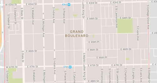
Block types
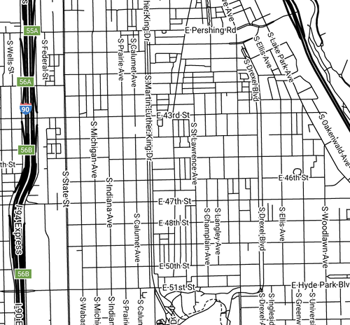
The Grand Boulevard consist of elongated blocks that make distances seem far to walk and make the streets extend for multiple blocks. For example, within the illustration E 47th St extends from S Federals St to S Cottage Grove Ave. It extends even further, but that is outside of the neighborhood.
Photo Courtesy of Google Maps.
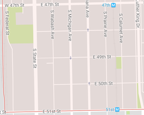
Network types
The neighborhood resembles the Savannah Pattern whereas traffic is able to flow steadily through the neighborhood. This also makes for a great directional orientation within the area. All of the blocks within the image have passages that lead to main streets. For example, E 47th St, E 48th St, 49th, 50th, and 51st all lead to S State street making it easy to access street from multiple areas of the neighborhoods.
Photo Courtesy of Google Maps.
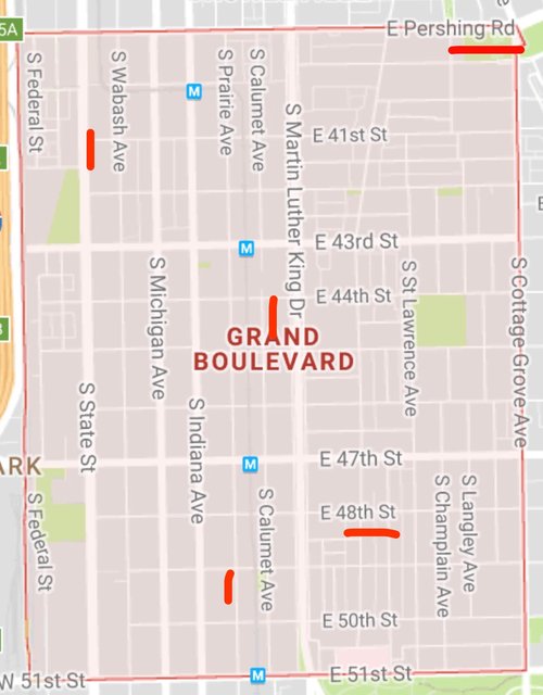
Thoroughfare types
The Grand Boulevard consist of many high and low speed vehicular systems making the area very fluid in its movement of pedestrians and vehicles. The area has a number of Streets, Avenues, Roads, a Drove, and even a Boulevard. A few are highlighted in the image to the left. Because of the block types and network types, services like lanes and alleys exist, pedestrian paths and passages arise, and rail and buses flow through the neighborhood.
Photo Courtesy of Google Maps.
The Grand Boulevard is one of the few neighborhoods that is well connected through multiple categories of connectivity. Although the neighborhood type is elongated making the blocks a bit long to walk, it allows for there to be parking not only in the back of houses via alleys, but also parking within the front of houses, apartments, etc as well. The blocks are also able to push traffic through them without blocking, trapping, or isolating people out of neighborhoods with cul de secs for example. Because of Grand Boulevard’s Savannah pattern structure, the straight line aspects of the various blocks allows for connectivity between blocks that ultimately connect smaller streets to bigger ones. A specific example of this is how from E Pershing Road to E 51st Street can connect you to all of the main streets including Cottage Grove, King Drive, State Street, and more. The neighborhood is in that way very conducive to connectivity deeming it a connected area.
As far as thoroughfare types, the Grand Boulevard has almost every type available. It has a multitude of avenues in which more residential properties are placed. These avenues run North to South. It has streets which run East to West that most traffic, buses, and businesses are on. There is a road named Pershing which is one of the borders of the the area that has a low speed, capacity, and density. As far as drives, present is the Dr. Martin Luther King Jr Drive which all of the main streets, including 41st, 43rd, 47th, 48th, 49th, and 51st, have easy access to. Lastly, there is a Boulevard that goes by the name of Oakwood which is surrounded by a park leading residents to and from the lakefront and Lake Shore Drive area. All in all, the Grand Boulevard is one that I think is the most connected neighborhood within the city. It offers an elongated neighborhood type able to provide its residents with sidewalks, driving space, parking space, public transportation sources, and blocks that connect rather than isolate.
In studying the Grand Boulevard neighborhood, one can see that it is well connected via its public transportation options. There are multiple trains and buses that flow through the area connecting it to Downtown and further North, West, and South. With this in mind, I decided to focus on improving the area’s public space in an effort to make the neighborhood better improved for community members and even outsiders. In an effort to improve the public space of the Grand Boulevard, I propose a historic landmark sign introducing the neighborhood and detailing its significance and history, a couple of neighborhood enhancements including decorative trash cans and a community garden, and lastly, relocating big chain stores, the neighborhood Walmart in particular.
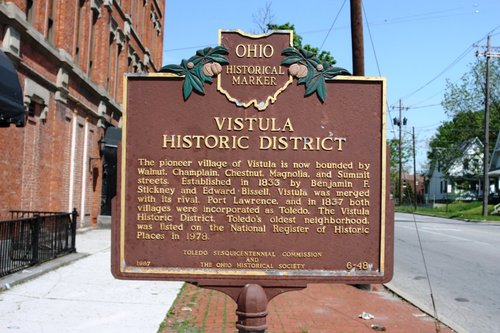
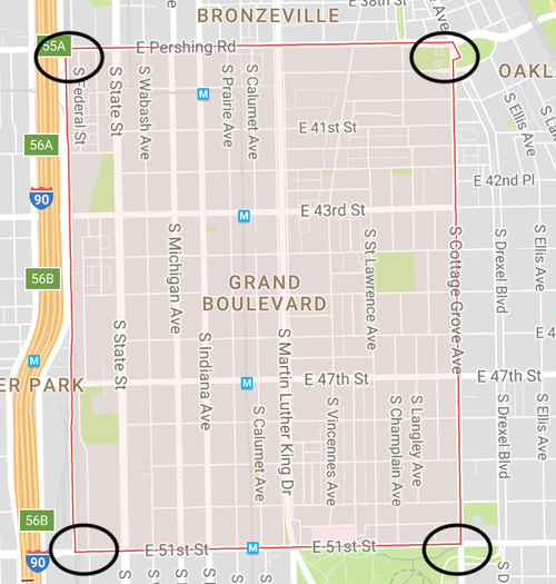
For my first intervention, I plan for there to be a sign introducing the Grand Boulevard to its neighborhood and visitors in an effort to raise awareness about the neighborhood and to distinguish it from other neighborhoods nearby. This is important in giving the neighborhood identity and in detailing its historical significance to Chicago as a whole. The Grand Boulevard has an interesting history including that it was apart of the Hyde Park Township, wasn’t once predominantly African American, and it had musical roots involving The Blues. The sign would be located at one of the four corners where the neighborhood begins. The potential sites include at the West or East border of E Pershing Road and/ or at the West or East border of E 51 Street.
Photo Found on the Historic Vistula Foundation's Website . Photo gives an example of a sign that could potentially give the historical facts of the Grand Boulevard area and introduce/ distinguish the area from others.
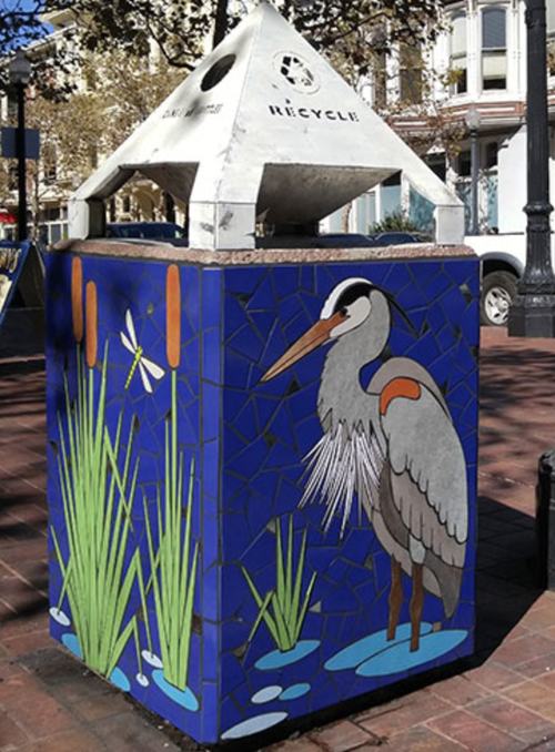
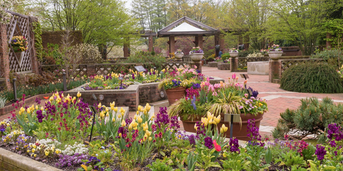
Photo Taken As A Screenshot from Google Maps. Circles indicate where the Historical Grand Boulevard sign could be potentially placed.
My second intervention includes providing the area with some neighborhood enhancements. This would include decorative trash cans designed by the community and strategically placed, and also, a community garden that includes beauty and art. This would be an important asset into the community because it can foster engagement between neighbors in the community that isn’t present now. For both projects, members in the community would have to come together to paint the trash cans and place them all around. Members would also have to pick out a plot of land in which they think a garden would fit, collect materials of all sorts, and maintain the area as a whole. The trash cans can be places at the ends of each corner of a given block, and the garden can be placed in a empty vacant lot not being occupied.
Artwork on Trash Can produced by Juan Lopez. Other works can be found on website: http://newworldmosaics.com/.
Example of how a trash can in the community could be decorated encouraging people not to litter and trash residential areas.
Photo By Chicago Botanic Garden. Example of community garden that would bring beauty into the area.
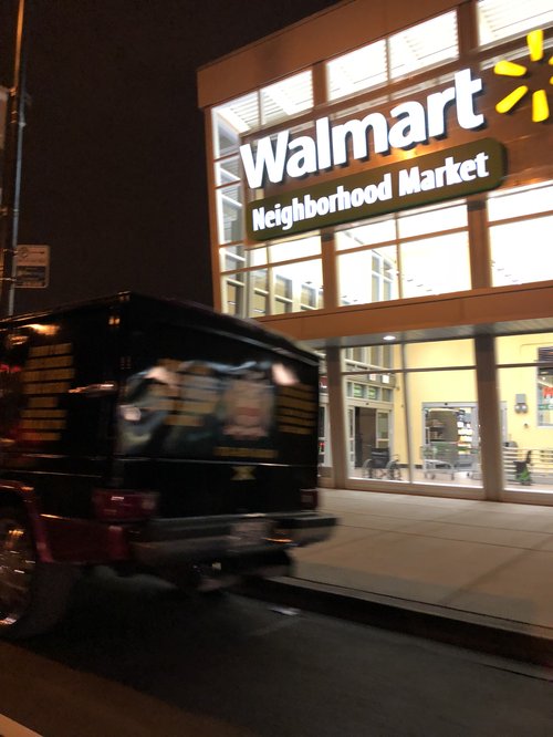
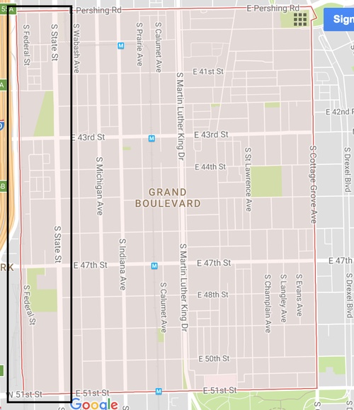
Furthermore, my last intervention would include the removal of big chain stores in the residential area to a more open space that is more pedestrian and car friendly. In specific, I am referring to the neighborhood Walmart that is now located on 47th Cottage Grove avenue right off of the busy 47th street. The area close by already has a McDonald’s, a Save a Lot grocery store, and a Popeyes in the vicinity, so another cause of congestion and traffic should not have been added to further complicate the area. It is important to realize that chain store don’t belong in residential areas because as I have mentioned, the area is for residents. Too many cars producing unsafe conditions for pedestrians arise when there is too much traffic in a given area. In my proposal, the Walmart on 47th Cottage Grove Avenue would be relocated to a vacant lot on South State street between East Pershing Road and East 51st Street allowing for traffic to flow smoother, more parking, and the Walmart being out of the neighbor’s back yard.
Photo taken by Jala Conley. Neighborhood Walmart located on 47th Cottage Grove Avenue.
Photo Taken As A Screenshot from Google Maps. Box indicates where the Neighborhood Walmart could be potentially relocated.
Other Source includes ideas from:
http://salvagingcreativity.com/outdoor/ about Public Space Amenities
Social Mix