Overview
Social Mix
Public Space
Amenities
Connections
Final Project
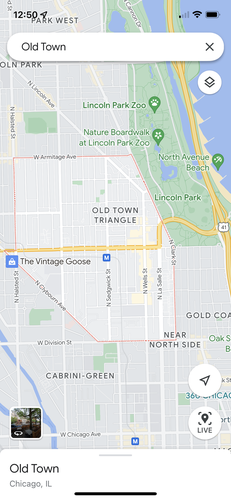
Old Town is a fairly large neighborhood when the full possible extent of its boundaries are considered. Despite this, the neighborhood does seem to have a unified identity. However, I suspect that there are also sub-neighborhoods within this larger geographic area, which I hope to explore further in future assignments. One interesting point is that Google Maps shows a portion of the city as belonging to both Old Town and Lincoln Park, so the boundary between these two neighborhoods could be evaluated further.
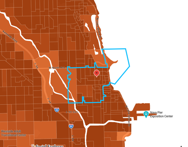
To estimate the population of Old Town, I used the social explorer tool and counted the population by census district. I counted approximately 16,800 people living in the 60610 zip code area of Old Town and approximately 13,100 people living in the 60614 zip code area. In total, I am estimating the population of the entire Old Town area to be about 29,900 people. This is much larger than Perry’s ideal 5000 person neighborhood, suggesting that there are likely many smaller communities within the larger area of Old Town. Another consideration is that some people identify the “Old Town Triangle” as the key geographic area of the neighborhood, while areas around this triangle could be classified as other neighborhoods.
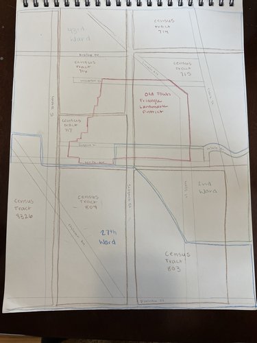
The image below shows how I found the zip codes that make up Old Town in Social Explorer. I then hovered over each delineated census tract and added up the population in each census tract for the sections of the 60610 and 60614 zip codes that are identified as being part of Old Town.
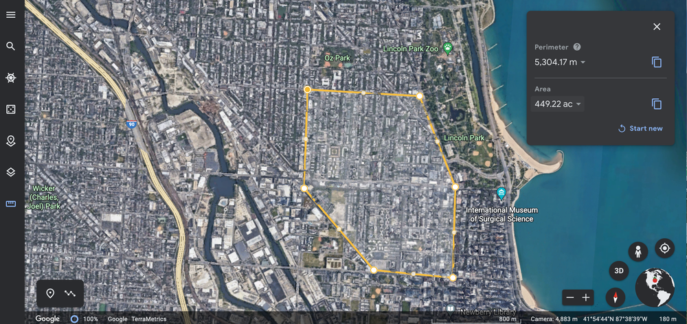
To estimate the size of Old Town, I drew the boundaries (as stated by Google Maps) in Google Earth to calculate the land area. Google Earth determined that the area inside these boundaries is 1.82 km2, 0.7 mi2, and 449.22 acres.
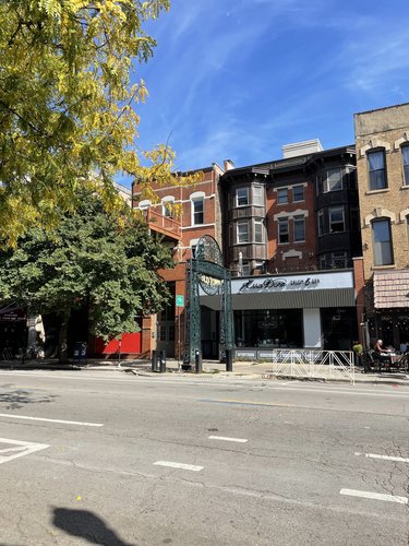
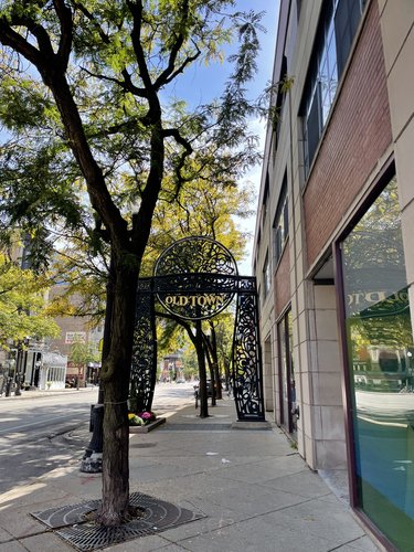
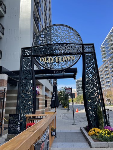
Based on my experience exploring the neighborhood of Old Town, I believe the area has a distinct sense of identity. This was evident through physical markers and shop signs. The most clear indication of Old Town’s identity and delineation was the installation of several large archways that serve as a sort of welcome gateway into the neighborhood. I saw six of these gateways during my time in Old Town, and three are pictured below. Their wrought iron material and design calls on the neighborhood’s identity as an area with significant history and historical significance. The openness of the gateways, rather than being actual physical gates, helps to prevent a suggestion of exclusion.
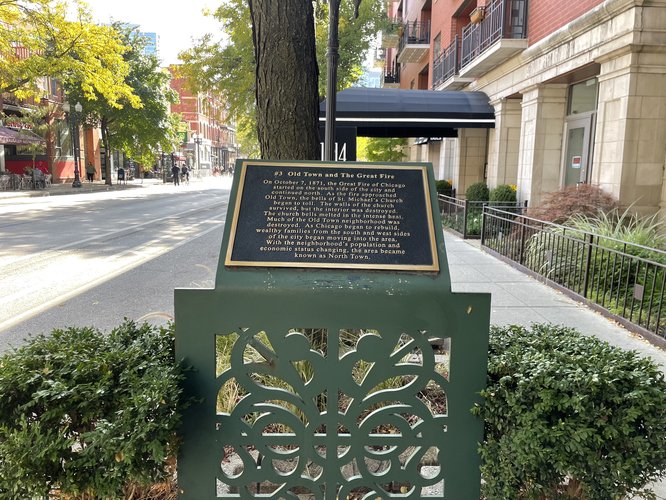
Another indication of the neighborhood’s identity were the historical placards located along Wells St, the main commercial street in the neighborhood. These plaques described important historical events that had taken place in Old Town and detailed the area’s development since its first settlement. The presence of these informational pieces suggests a sense of local identity and identification with the place’s history.
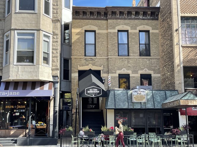
A third indication of Old Town’s neighborhood identity is the names of businesses in the area. The below photo shows the Old Town Barbershop and the Old Town Pub located next door to one another. These are certainly not the only local businesses that identify themselves as being located in Old Town. The Old Town Ale House, for example, has been a neighborhood dive bar since 1958 and continues to encourage a sense of identity among the local community
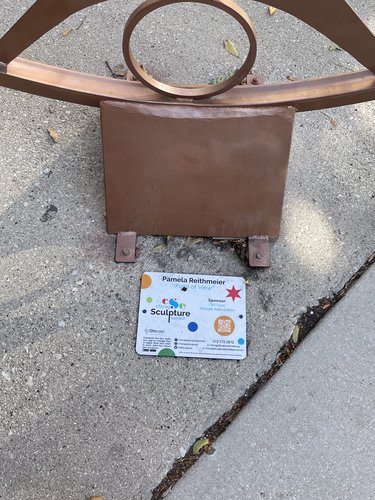
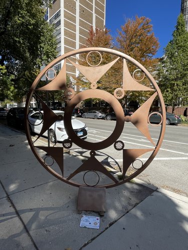
Lastly, I want to highlight the Old Town Triangle Association (OTTA) which has a visible and strong presence in the neighborhood. Such a strong neighborhood association also points to there being a strong sense of local identity, at least within the Old Town Triangle section of the neighborhood (a delineation which has been expanded from its original boundaries by the OTTA, and is no longer triangular shaped, but still does not include the entirety of what Google Maps says is Old Town). When I was walking through the neighborhood, I saw multiple art installations that were sponsored by the OTTA. I have included a photo of one of these installations as well as the accompanying plaque that names the OTTA as the sponsor.
Parts of Old Town exist in three different aldermanic wards and six different census tracts. The Old Town Triangle Landmark District marks the boundaries of what is considered the “Old Town Triangle” as well as the boundaries for the Old Town Triangle Association, the most prominent neighborhood governance group in this area. All of Old Town sits in the 18th police district.
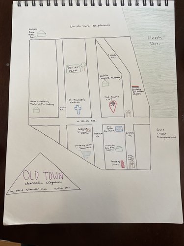
This character diagram of Old Town highlights many of the key locations in the neighborhood. The major schools in the area are marked by green building drawings. The Second City Comedy theater is one of the most famous locations in Old Town and is represented on this map by a representation of its iconic sign on North Ave. A few important community landmarks are shown on the map, including the Sedgwick ‘L’ station which, constructed in 1900, is one of the oldest standing ‘L’ stations. The stop serves the brown and purple CTA lines. Also highlighted are Bauler Park and the shopping center at the intersection of Sedgwick St., Clybourn Ave., and Division St., which serves much of the area as a major shopping location for groceries and other needs.
St. Michael’s Church is one of the most notable historical buildings in the area, and it is represented by a cross at its location between Larrabee St. and Sedgwick St. The original location of the Society for Human Rights (the first gay rights organization in the US) is highlighted with a gay pride flag alongside Wells St.
House of Glunz is the city’s oldest wine merchant and has operated in Old Town since 1888. The Old Town Ale House has been in operation since 1958 and is an essential neighborhood landmark. Other notable locations include Lincoln Park, which constitutes an eastern boundary, and the gateways lining Wells St. that welcome visitors to the neighborhood.
The land now known as Old Town was originally inhabited by Indigenous peoples of the Potawatomi, Miami, and Illinois tribes. Most of these Indigenous people were forcibly removed after the 1833 Treaty of Chicago, and Old Town was primarily settled by German immigrants in the 1850s. These immigrants primarily farmed crops such as potatoes and cabbage, which was the origin of Old Town’s nickname “The Cabbage Patch” (Town Square Publications). Over time, Old Town evolved from an agricultural area to a hotspot of commercial and cultural activity.
It seems that this neighborhood was not deliberately “planned”. Many of the streets, particularly in the central “Old Town Triangle” area were formed before the Chicago Fire and do not conform with the classic gridded street pattern. Old Town was not originally a part of the city of Chicago, but was annexed in 1851. Since then, it has undergone developments and “renewal” that have perhaps been a sort of retroactive planning, but the area does not seem to have originally been intentionally designed.
In the 1920s, Old Town became a center of arts and culture in Chicago, which continued on through the 20th century. Three primary examples of this are the Old Town Holiday art fair, the Old Town School of Folk Music, and the Second City comedy club.
The “Old Town Holiday” is an art fair that was started by a group of artists in 1950. Many people cite this as the origin of the Old Town neighborhood name, which stuck after the year had been going on for many years. The Old Town Art Fair still happens today and is one of two major art fairs in the neighborhood.
In 1957 a group of folk musicians founded the Old Town School of Folk Music. This school went on to bring many major musicians to the neighborhood such as Bob Gibson and Bonnie Kolac (Town Square Publications). In addition to this institution, Old Town was a center for music and all forms of counterculture during the mid 20th century.
The Second City, one of the world’s most prolific comedy theaters, was founded in Old Town in 1959. The Second City serves as a major cultural center for the city of Chicago and a key entertainment center for the neighborhood. The theater has been a launching point for many prominent actors and comedians such as Steve Carrell, Tina Fey, Amy Poehler, Jordan Peele, and Stephen Colbert (The Second City).
Old Town has historically been an important location for LGBT Chicagoans, although that identity of the neighborhood has dwindled in recent years. In 1924, Henry Gerber founded the first gay rights organization in American history, known as the Society for Human Rights, in Old Town (National Park Service). Gerber’s home in Old Town is now a National Historic Landmark. In the decades following Gerber’s activism, Old Town became perhaps the first widely known LGBT neighborhood in the city. Wells Street, the main commercial street in Old Town, was lined by many gay bars and other LGBT-friendly establishments. However, as the area gentrified and rent prices dramatically increased, most LGBT businesses and many residents were pushed further north to the Lake View neighborhoods (Wikipedia). All of the gay bars on Wells Street had closed as of 2013.
Although originally dominated by German immigrants, the Old Town neighborhood gradually became more diverse. In the 1950s and 60s, the area saw a significant number of Puerto Rican immigrants move into the area (Newhart, 2016). More recently, as prices have risen and gentrification has accelerated, the diversity has again declined and become more homogeneously white and higher income.
During World War II, a civil defense map highlighted the boundaries of North Avenue, Clark Street, and Ogden, leading the neighborhood to be called the “Old Town Triangle” because these three streets created a triangle shape. This triangular region was designated a neighborhood defense unit during the war, creating a spirit of association and solidarity (Encyclopedia of Chicago). Following the war, the area became known as “North Town” and then “Old Town” after the creation of the Old Town Holiday market (Town Square Publications).
The St Michael's Catholic Church was built by Old Town’s German settlers in 1852. Throughout history, this location has served in many ways as a neighborhood center. In 1967, Donna Gill wrote in a Chicago Tribune article: “... it was said that all who lived within hearing distance of the church's bells were Old Towners” (Chicago Tribune). This church was one of less than ten buildings known to have survived the Great Chicago Fire in 1871 (Rumore and Cassella, 2021).
Resources
Chicago Tribune (Rumore and Cassella): https://www.chicagotribune.com/history/great-chicago-fire/ct-great-chicago-fire-buildings-that-survived-20210928-rgxpmogysfdivecjq2b67erz7e-story.html
Culture Trip: https://theculturetrip.com/north-america/usa/illinois/articles/a-brief-history-of-puerto-ricans-in-chicago/
Encyclopedia of Chicago: http://www.encyclopedia.chicagohistory.org/pages/927.html
National Park Service:
The Second City: https://www.secondcity.com/people/alumni/
Town Square Publications: https://townsquarepublications.com/history-of-old-town-chicago/
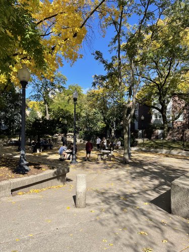
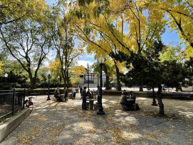
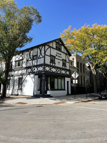
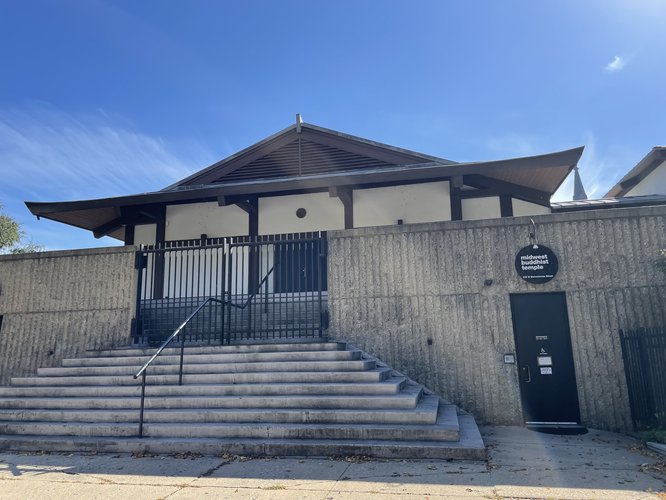
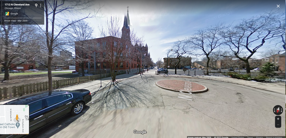
When I was wandering around Old Town, I stumbled into a small neighborhood park filled with people playing chess. The park is called Hudson Chess Park and is equipped with 6 concrete chess tables (with chess boards engraved on the top). The park is largely paved with concrete except for the outer edge which has trees planted in raised beds of soil. When I found this park on a Sunday afternoon, every chess table was occupied, and other people were standing around to watch the games and spend time with friends. The park is located on a street corner and is blocked off to car traffic with a cement bollard in the pathway (see image 1). The park is lined with street lamps that come on at night. In the center of the park, there is a bronze fountain of Hansel and Gretel (visible when zoomed in closely on image 2), serving as a reminder of the neighborhood’s earliest German immigrants. According to Carmona, the uses surrounding public spaces are an important contributor to how engaging a public space is for users. Across the street to one side of the park is the Schmidt Mitzgerei building (see image 3), one of the few remaining examples of classic German design that was once the norm in the neighborhood. To the opposite side of the park is the Midwest Buddhist Temple (see image 4), which offers religious services, neighborhood programming, and a well-maintained temple garden.
Although I would not argue that this street corner serves as the center of the entire neighborhood of Old Town, I do think it may serve as a center for a smaller section of the neighborhood that surrounds this park. It is fairly clear that this is public space because it has a clear entryway from the public street and does not appear to be connected to any private building. This clear delineation of public space is important for parks feeling publicly accessible, according to Carmona.
How it is used and by whom
When I visited, the chess park was being used primarily for the purpose of playing chess, with the occasional person lingering to briefly watch the chess activities. The people present represented a range of ages but were nearly all men.
Dead space & active space
The park is fairly small so there is not much space left to be dead space if the chess tables are being used. The size of the park encourages people to come together in the center, allowing the park to feel alive and well-utilized even if there are only a few people present.
Comfort & safety
The numerous lampposts in the park allow the park to be well lit even at nighttime hours. The park is fairly visible from some apartment buildings and the street corner, allowing there to be “eyes on the street” in Jane Jacobs’ words to create a feeling of safety. In addition, because the park is so small, visitors have little fear of being alone/out of sight of passersby or susceptible to crime. More could be done to create a comfortable environment because most of the seating options are small concrete stools, apart from a few metal benches.
Facilities & maintenance
The park appeared well-maintained, although there were not any significant facilities to maintain beyond the chess tables and small fountain. The clean nature of the park made it feel more inviting and safe.
Design
The fountain within the park is thoughtfully designed to honor the history of the space. Because the area was originally settled by German immigrants, the fountain represents the characters Hansel and Gretel – an homage to the German fairytale.
There are several trees planted in the middle of the park, while the majority of trees are placed around it. This design contributes to a feeling of being in a green space and also being somewhat enclosed. The design of the park feels thoughtfully considered, rather than impromptu or haphazard.
Sociability
The park does an excellent job of encouraging social interaction. The primary purpose of the park – playing chess – is inherently a social one. In addition, all of the chess tables are arranged close to one another, encouraging interaction between different groups of players. The park employs the idea of “triangulation” by introducing a third object of interest (chess) for strangers to start conversations about. And by forcing strangers into a fairly small area of space, it makes contact with others more likely, further encouraging sociability.
Aesthetic appeal
The park is largely made of concrete, which does not create the most inviting aesthetic. However, the trees surrounding and within the park create a sort of green space and a sense of being within an enclosed grove. The fountain in the middle of the park adds an attractive aesthetic to the space
Conclusion
Based on Mehta’s framework for evaluating the quality of public spaces, I would argue that the Hudson Chess Park scores fairly high on the inclusiveness (no restrictions on entry, no financial barriers), meaningful activities (chess), pleasurability (quiet oasis in a big city), and safety (well-lit and small enough to be well-watched) attributes. It could improve on the comfort attribute, perhaps by providing more variety of seating and/or some grass for comfortable seating and aesthetic purposes.
Old Town does not seem to have a dense concentration of primary uses. There are a few key locations that draw visitors from outside the neighborhood, but for the most part, the neighborhood spends and generates wealth through a diverse range of secondary use establishments. Overall, I argue that Old Town has a higher concentration of secondary uses, with few primary uses other than housing and cultural shows and events.
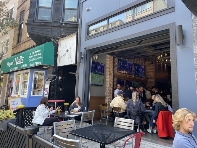
The primary commercial sector present in Old Town seems to be restaurants, cafes, bars and other food service providers. There are also many hair salons, nail salons, gyms, yoga studios, and other similar facilities that serve as neighborhood amenities. The photo below shows a popular bar and nail salon side by side, reflecting the prevalence of service industry facilities in the area.
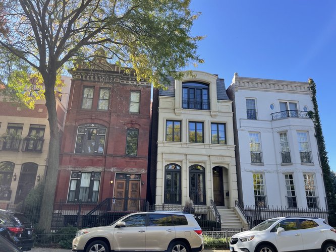
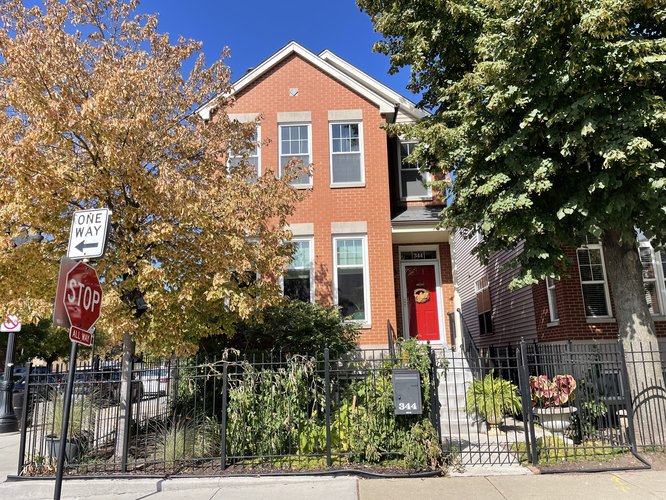
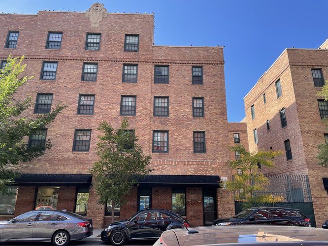
When walking around the neighborhood, I did not see many office buildings. I hypothesize that Old Town is largely an area for workers to live within a short commuting time of downtown offices. Many restaurants and bars have sprung up to serve the surrounding residents, serving a “secondary use”. Below are a few pictures of different types of homes, of different density levels, that reflect the primary use of inhabitation.
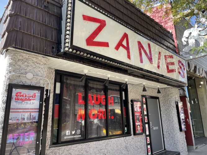
There are also several cultural and entertainment locations that serve as primary uses. For example, the Second City comedy club is an internationally-recognized comedy venue and draws visitors from across the city, as well as many tourists. Other locations that draw people into the neighborhood from other areas include Zanies comedy club, The Old Town School of Folk Music, and St. Michael’s Church, a prominent historical landmark.
There seems to be very little in the way of manufacturing or manual labor industries present in Old Town. Most places of work are actually secondary use locations, such as restaurants, bars, and other service industry jobs. There are also some retail and grocery stores that serve as places of work, but are technically considered secondary uses because most users of these establishments are local residents.
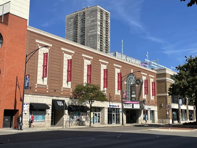
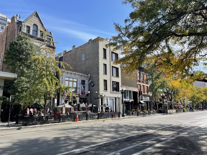
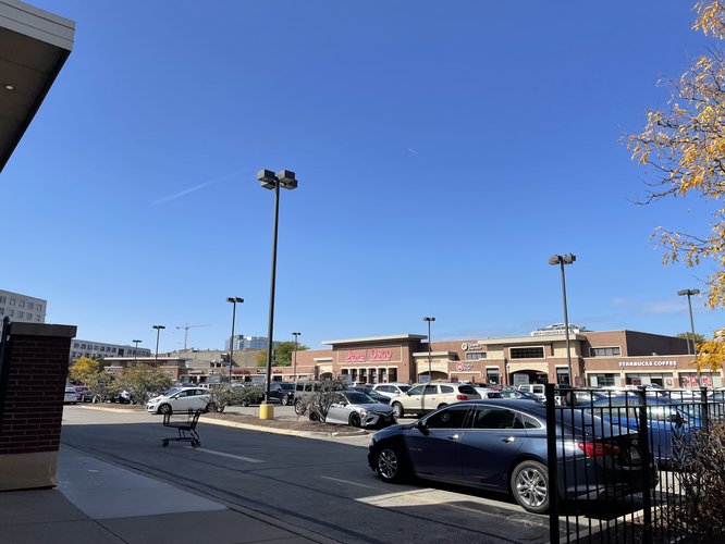
The first photo below shows the thriving restaurant scene along one of Old Town's major streets. There are sometimes dozens of restaurants and bars within a single block along major thoroughfares such as Wells St. The second photo below shows one of the few strip mall-like buildings in the area, with a Jewel Osco, a few fast food restaurants, and other corporate chains. These establishments provide jobs, but likely do not pay enough for workers to live in the immediate neighborhood surrounding their place of work.
Old Town’s primary uses reflect the relatively high income levels of residents. The median income for residents of the neighborhood is $121,682 (Social Explorer). Most residents of the neighborhood seem to leave the neighborhood for work, likely going to the Loop, West Loop, or other common locations for corporate offices. They then return home to their neighborhood and have enough money to frequently go out to eat and maintain a thriving scene of secondary use industries. Those who work in Old Town are primarily middle income individuals who come to work in service jobs, such as a restaurant server, but who may not have high enough incomes to live in Old Town.
Jane Jacobs says, “On successful city streets, people must appear at different times” (Jacobs 152). The relative lack of mixed primary uses in Old Town means that it has many eyes on the street in the evenings and nights when people are out at dinner, at bars, or attending a comedy show, for example. However, there are fewer people coming to the area during the day. Nevertheless, the few tourist attractions that the area does have draws enough people to the area during the day that it does not feel deserted.
The primary uses that are present in the neighborhood do contribute to the area's vitality and are relatively well integrated to the “pool of use” of the neighborhood. However, the area’s lack of income and racial diversity, as well as its location within an easy commuting distance of downtown Chicago, means that the primary uses are not as mixed and diverse as would be ideal.
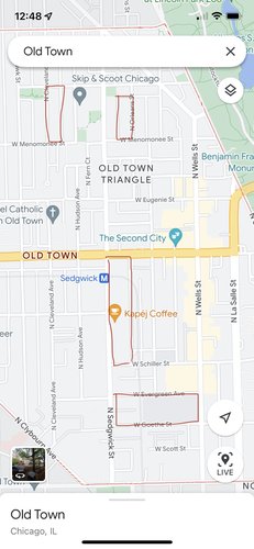
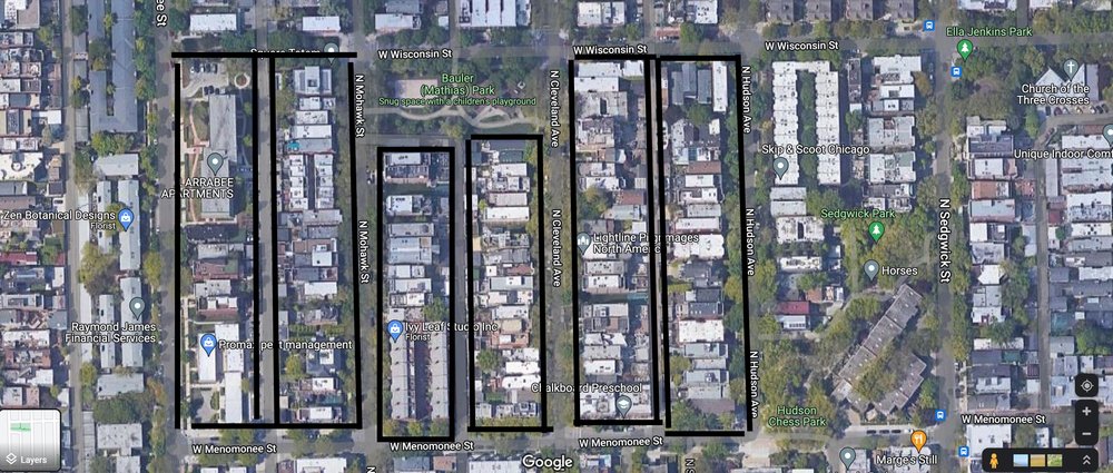
The primary block type in Old Town is elongated blocks, as defined by the Lexicon of the New Urbanism. Below is an image from Google Maps of the Old Town neighborhood. In the first image below, I have highlighted a few key examples of elongated blocks in red, but the image demonstrates that the primary block type throughout the whole neighborhood is elongated. There may also be some irregular block shapes, but the area does not appear to have any square blocks. The second image gives a more up-close view of blocks that further demonstrates the prevalence of elongated blocks. Elongated blocks, because they contribute to creating a fairly grid-like network, can be beneficial for promoting walkability. However, there may be some tradeoffs with longer blocks leading to fewer intersections and therefore increasing walking times and potentially reducing some connectivity.
This image shows the general street pattern and connectivity in Old Town. The neighborhood exemplifies a Savannah network pattern. I was able to determine this by first eliminating the Radburn pattern because Old Town has a webbed, rather than a stemmed pattern. I was also able to eliminate the Washington and Mariemont patterns because there is no central location that generates diagonal avenues. Old Town also clearly does not exhibit a Riverside pattern because it has a more grid-like design. Lastly, I eliminated the Nantucket pattern because this area does not have an “uncontrollable variety of blocks and lots” and there is not a focus on long routes for through-traffic. This left me with the Savannah pattern to best describe Old Town’s network type. This type of pattern creates excellent directional orientation, and I found it to be very easy to navigate when I was walking around the neighborhood. One drawback of this pattern is that it can be monotonous unless periodically interrupted. This issue is somewhat solved in Old Town by having parks scattered throughout, as well as a variety of block lengths which creates visual variety.
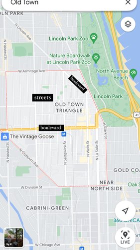
The primary thoroughfare types in Old Town are boulevards and streets. Boulevards are designed for high vehicular capacity and moderate speeds within an urban area. This is true of North Ave., designated with a boulevard label in the above image. This type of thoroughfare is distinguished from an avenue because it is not finite in length and is generally not equipped with a landscaped median. There are several other thoroughfares I would classify as boulevards in the neighborhood, including Lincoln Ave. (labeled in the image), Armitage Ave., and La Salle St. Also very common in this area are streets. Streets are local urban thoroughfares with low speed and low capacity. This aptly describes many of the thoroughfares, particularly in residential areas, in Old Town. In the first below image, I used a “streets” label within an area that I would argue is composed of many streets.
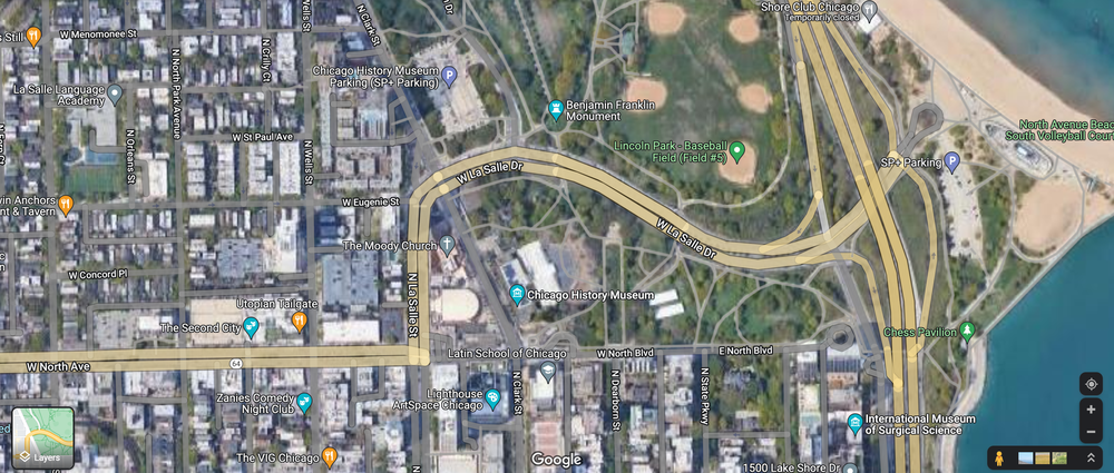
In the second image below, I highlighted one of the largest boulevards in the neighborhood that ultimately connects to Lake Shore Drive, providing an easy connection for cars to reach other areas of the city. This thoroughfare promotes external connectivity but, because the boulevard is only moderate capacity within the neighborhood, and does not reach high capacity until it connects with Lake Shore Drive which is outside of Old Town itself, there is not a feeling of high traffic in the neighborhood. This maintains pedestrian safety while still having a high level of external connectivity.
The Old Town neighborhood is fairly well connected both internally and externally. In terms of connection to the rest of the city, although there are no major highways going through the neighborhood, North Ave. connects to Lake Shore Drive right at the edge of the neighborhood, providing easy access to a major thoroughfare that connects the area to the rest of Chicago. There are a few primary boulevards within the neighborhood (i.e. Wells St, North Ave, etc) that have high enough capacity to easily connect different areas of the neighborhood by car.
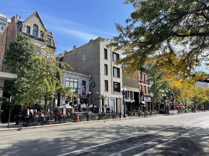
In terms of pedestrian connectivity, the neighborhood feels very walkable because of the lack of high traffic streets. There are sidewalks on every street that I walked on in the area, making the area feel safe for pedestrians and encouraging street-level social interaction. Many of the restaurants and other food service establishments in the area utilize sidewalk space for tables, creating a very lively street culture (see image below)
The Savannah patterned street network in Old Town also creates a walkable and highly connected environment. As Sandalack wrote in the article “Neighborhood Type and Walkshed Size”, more grid-like patterns are better equipped to create walk sheds that are larger so pedestrians can traverse a greater distance in an equal amount of time, as opposed to more curvilinear designs.
The Victoria Transport Policy Institute states that “A well-connected network has many short links, numerous intersections, and minimal dead-ends (cul-de-sacs)”. I was only able to identify one cul-de-sac in Old Town, and this one ends with a pedestrian pathway (see image below). Otherwise, there are many short and interconnected streets creating a high quality network of connectivity. There is also little to no presence of gated communities and restricted access roads, another key element of connectivity
Overall, Old Town has an impressive level of connectivity that effectively manages the tradeoffs between internal and external connectivity. While the area does not feel isolated from the rest of the city, it manages to have very minimal levels of through-traffic and to maintain a highly walkable, pedestrian-centered street network.
The neighborhood of Old Town is a vibrant community on the near north side of Chicago. The area bustles with residents and visitors at restaurants and bars for much of the day. Old Town is largely residential, with a few major commercial streets, and is connected to the rest of the city via the brown line on the L or by car. The neighborhood succeeds in many areas – it is well-serviced with high quality amenities, it boasts several quality parks and other public spaces, and it is connected both internally and externally. However, Old Town has a concerning lack of social diversity that detracts from the neighborhood’s vitality and multiculturalism.
The demographics of Old Town are quite homogeneous, both predominantly white and high income. The median household income is $121,000, and nearly 60% of households have incomes over $100,000. Furthermore, 27% of households are earning over $200,000 (Social Explorer). This stands in stark contrast to the overall Chicago household median income of $62,097 (U.S. Census Bureau). In terms of racial makeup, Old Town is 74% white and has a 1.76 Simpson racial diversity index score – much lower than Chicago’s 3.04.
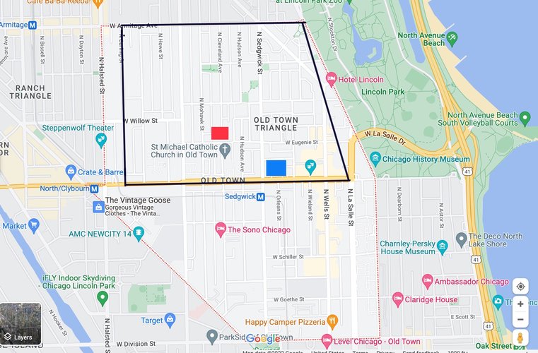
My goal with this project is to propose three key interventions which, together, can contribute to increasing the social diversity of the neighborhood. First, I propose a new inclusionary housing development that prioritizes affordable housing. Second, I propose a new public housing project that will bring more low income and racially diverse residents to the neighborhood. Third, I propose zoning changes to encourage mixed use developments.
This image highlights the locations of each intervention. The black outline demonstrates the geographic extent of proposed zoning changes. The red square represents the location of the new inclusionary housing development, and the blue square represents the location of the new public housing development.
Old Town currently lacks the diverse housing landscape necessary for a diverse population to develop. The area largely contains single family homes, with a median value of $500,000 (Social Explorer); this lack of affordable housing discourages low and middle income families from moving into the neighborhood. To address this issue, I propose a new housing development that is highly dense and largely affordable.
By increasing the supply of housing in the neighborhood, supply and demand will start to equalize and bring down housing prices. To further increase the affordability of housing, this development will be inclusionary zoned with 20% of units required to be affordable. I chose a 20% affordability level because this number achieves a balance between providing a large amount of affordable housing without disincentivizing development by reducing developers profits too much (SF Planning). These units will be reserved for those making below 80% of the area’s median income (AMI) and will be rented or sold at affordable rates (not exceeding 30% of the household’s income). Those below 80% of AMI generally would not be able to find housing in Old Town, but this development would provide units for them to have quality housing without spending more than 30% of their income on housing. The goal of this development is to encourage more low and middle income families to move into Old Town, as well as to give long-time residents an affordable option if they are being priced out of their current home.
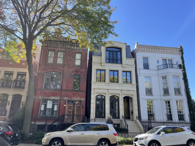
This image shows the dominant type of housing currently available in Old Town. Most homes are single family townhouses with a median value of $500,000. These types of homes do not create the density necessary to meet demand for housing in Old Town, and they do not allow for low enough costs to accommodate a diverse population. While most of these homes would stay in place under my proposed intervention, my proposal encourages expanding the diversity and affordability of housing in the neighborhood through new development.
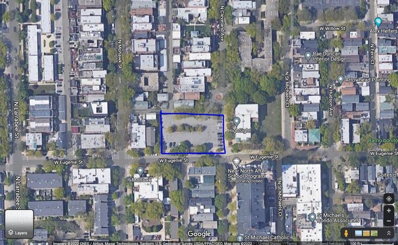
This satellite Google Earth image shows the proposed location for a new housing development. This mixed use housing development would take the place of a currently under-utilized parking lot on Eugenie St. – a very central location in the neighborhood, but also largely residential. The development would prioritize affordable housing in order to accommodate a broader distribution of income groups in the neighborhood.
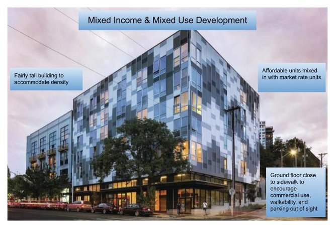
This is an example of what the new housing development on Eugenie St. could look like. The building would be 20% affordable units reserved for residents making below 80% of the area’s median income. The ground floor would contain commercial space to expand the economic vitality of the neighborhood and encourage walkability. Parking would be located in a small, multi-level garage behind the building to minimize the parking footprint. Residents would be encouraged to not have a car and instead rely on the extensive bike parking provided or simply walk and take public transportation. Source
To further diversify the income distribution of residents, I propose introducing a public housing project in Old Town. Currently, there are very few residences in Old Town reserved for the lowest income groups, and the public housing that is available is mixed income, with only a few units reserved for impoverished families (Chicago Housing Authority). This would benefit the neighborhood by diversifying not only the income demographics, but also the racial demographics. According to the National Low Income Housing Coalition, 66% of public housing residents are Black and Hispanic, suggesting that a new public housing project in Old Town could help start to change the demographic makeup of the neighborhood (NLIHC). This new public housing development would be centrally located in the neighborhood, with easy access to transit, groceries, and other services.
This also reduces the prevalence of concentrated poverty by introducing an impoverished community into a well-resourced neighborhood. Concentrated poverty “leads to an increase in crime rates” and “correlates with economic dislocation and the loss of jobs" (Talen 2018, p. 40). By introducing public housing into Old Town (rather than concentrating public housing projects in high poverty areas), the prevalence of concentrated poverty will decrease and these low income residents will get greater access to services and amenities while increasing the neighborhood's diversity.
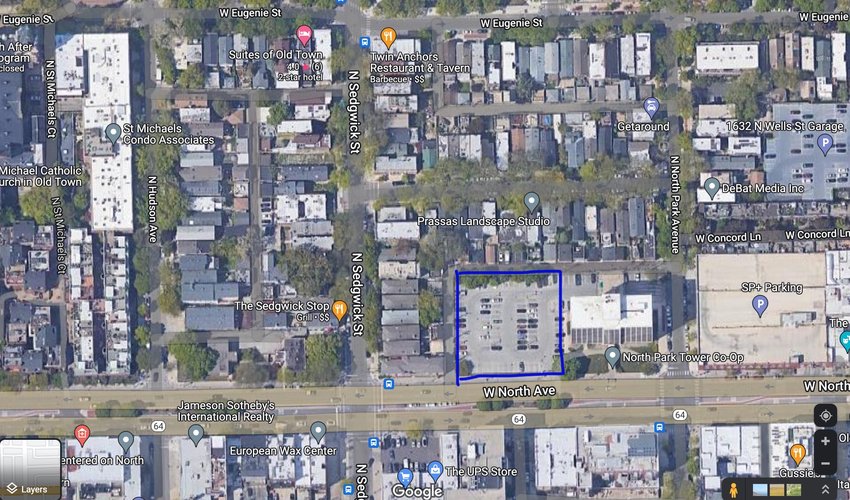
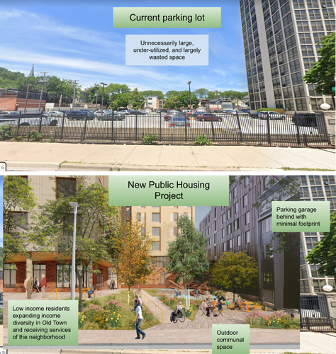
This image shows the proposed location of a new public housing development in Old Town. There is currently a large parking lot that serves a housing development that is very under-utilized and excessively large. My proposal suggests constructing a new public housing development on this lot, and providing a small parking garage behind the building to be shared by the public housing development and the neighboring building.
This image shows proposed changes to the parking lot to construct a welcoming and vibrant public housing community. The development would solely serve low-income residents, thereby increasing the social diversity of Old Town and introducing an under-served population into a well-resourced neighborhood. The design for the development would prioritize density, shared public green space, and walkability. This public housing project would be located in the heart of the neighborhood, just a one minute walk from the Sedgwick brown line station. Source
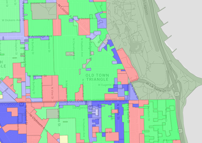
As the zoning map below shows, much of Old Town is zoned as solely residential (shown in green). I propose changing zoning in certain areas to accommodate mixed use developments. This would encourage more new development with ground floor commercial space (to facilitate accessible and walkable services) and upper floor residential space (to accommodate greater residential density). The housing development I proposed earlier would be a mixed use development, and this zoning change would allow for more similar developments to be constructed in the future. This would allow service workers to find affordable housing options in the neighborhood and work nearby, perhaps even in the same building, creating a walkable, complete, and diverse neighborhood. Through these developments, the neighborhood can support a more diverse income distribution by having both housing and employment opportunities for those at a wide range of income levels.
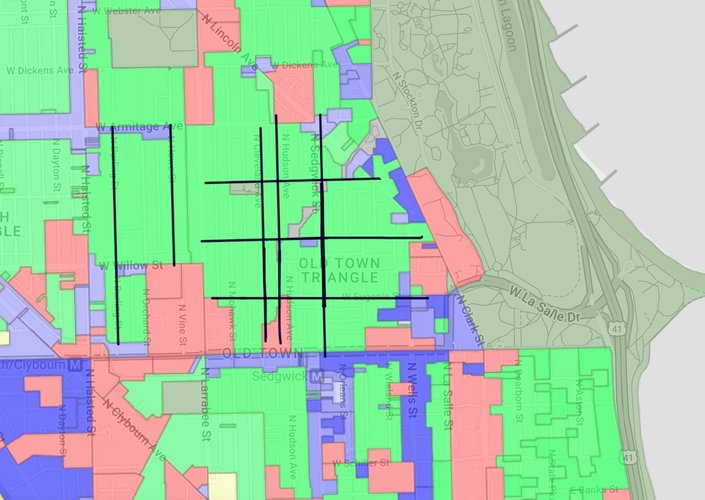
This image shows the current zoning map of the Old Town neighborhood. Areas zoned solely for residential use are shown in green. Areas zoned for commercial use are shown in blue/purple, and areas zoned for “planned development”, which encompasses “tall buildings, campuses, and other large developments that must be negotiated with city planners” are shown in red (2nd City Zoning). Source
This image highlights in black the key streets that I recommend rezoning for mixed use development. Through rezoning, these areas could support mixed use development (such as the one proposed in the first intervention). These sorts of developments help create walkable, complete neighborhoods with essential services located among residential spaces.
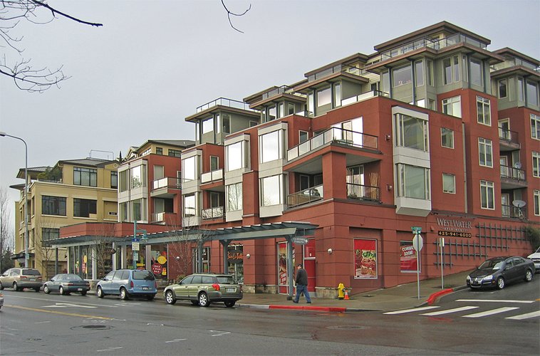
This is another mock-up of a potential mixed use development that the rezoning would allow for. In addition to creating more walkable neighborhoods, the creation of some new commercial spaces within mixed use developments could expand the set of primary uses present in Old Town. The ground floor space could allow for more office space and small businesses to take hold in the neighborhood. This expansion of mixed primary uses in the neighborhood would help sustain diversity in the long term by expanding the types of services and amenities that directly serve a diverse range of income and racial groups. Source
Through each of these housing interventions, a more diverse community can be built. This, in turn, will support a more diverse set of mixed uses. Because these businesses and services support all members of the neighborhood, people will feel supported and well-serviced so the diversity can be sustained in the long term.
Sources:
https://www.census.gov/quickfacts/fact/table/chicagocityillinois/LND110210
https://www.thecha.org/residents/public-housing/find-public-housing
https://nlihc.org/sites/default/files/HousingSpotlight2-2.pdf
Talen, Emily and Lee, Sungduck. Design for Social Diversity. Routledge, 2018.
Social Mix
Conducting the Simpson Diversity Index calculations was very illuminating. It is clear that the Old Town neighborhood is less diverse than the city of Chicago, as well as the North Region of Chicago, on these three variables. The neighborhood has slightly more education and age diversity than its broader community area, but in every other category and area it is less diverse than those it is compared with. The neighborhood does have a fairly high level of age diversity that is not dramatically different from the other scales of observation. However, I think the breakdown of age categories is slightly different in this neighborhood because a plurality of residents (about 42%) fall into the 18-34 age range. This suggests a slightly younger average age compared to the broader city. I did not use income as one of my variables for the Simpson Index, but it is clear from looking at the initial demographic table that Old Town is very skewed towards high income residents. Nearly 60% of households are earning over $100,000, and when the data is broken down further, 27% of households are earning over $200,000. This neighborhood is not particularly income diverse, although it does have higher income diversity than racial diversity (2.63 index with 5 categories compared to 1.76 with 6 categories).
Overall, I would not describe Old Town as diverse. It is predominantly white, high income, and fairly highly educated. The variable I calculated that demonstrates the highest level of diversity in this neighborhood is age. However, even in the age category, it is less diverse than its region and the city as a whole. The most striking observation to me is the race diversity score of 1.76 compared to Chicago’s 3.04. The table shows that the Old Town neighborhood, Lincoln Park community area, and North region are all much less racially diverse than the broader city.