Overview
Social Mix
Public Space
Amenities
Connections
Final Project
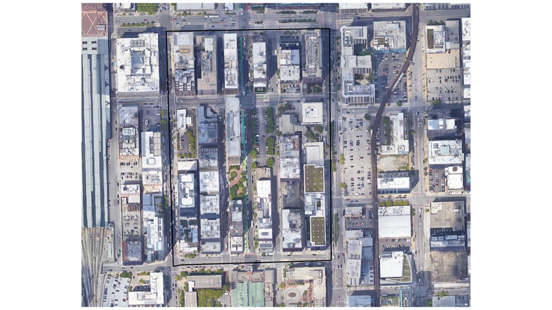
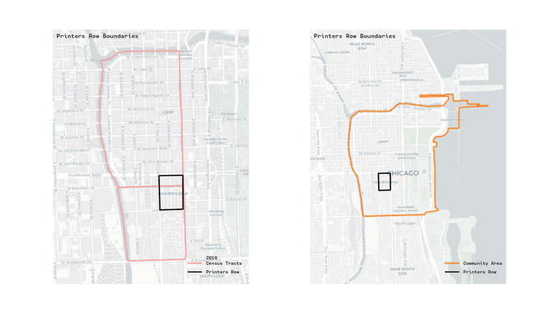
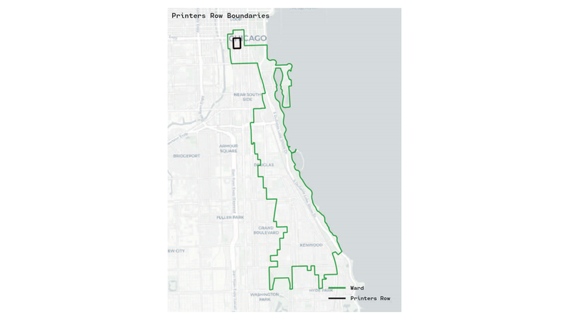
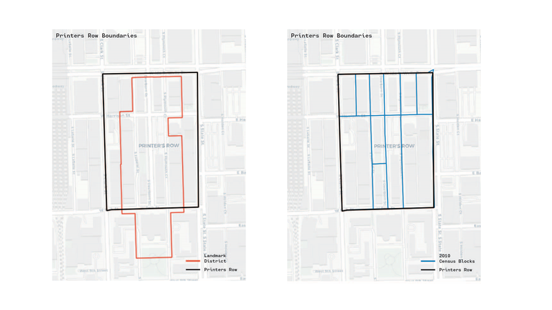
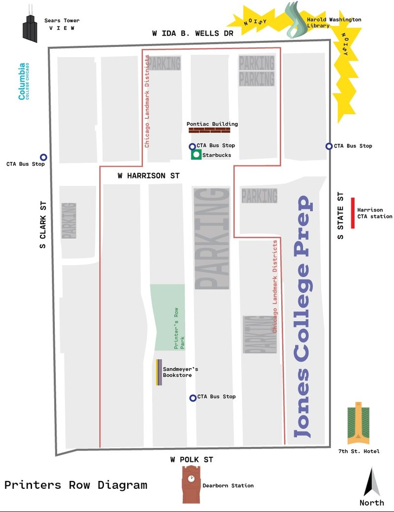
Size - Printers Row, according to Google Earth has an area of about 23.2 acres and houses a population of ~ 6,000 people. The neighborhood is bounded by Ida B. Wells to Polk St. (north to south), and Clark St. to State St. (east to west).
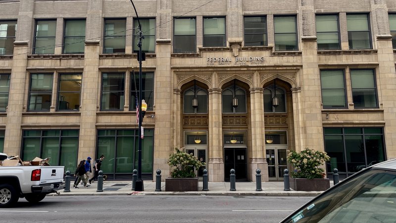
Identity - Printer’s Row is, to put it simply, a downtown neighborhood. With its renovated, loft style condominium towers, to the busy major roads that delineate its boundary, the neighborhood thrives in its location just south of the Loop in downtown Chicago. Besides a few references to the name, “Printer’s Row” – like Printer’s Row Park – one wouldn’t know they were in this neighborhood, as there is no official banners or neighborhood flags marking the streets as such. However, one could get a sense of coherence in the neighborhood by looking up.
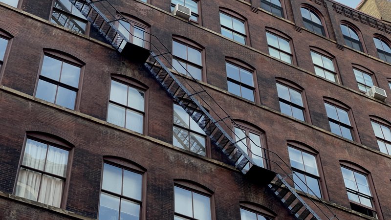
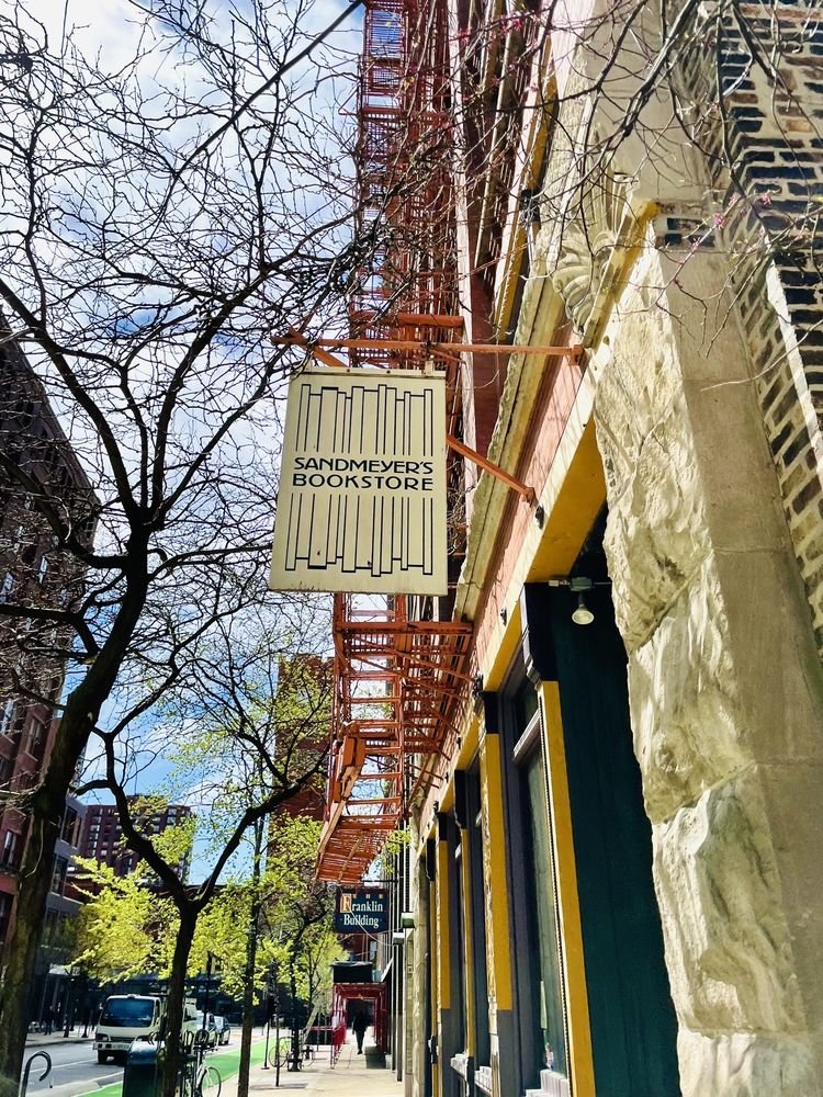
Looking at the unique buildings that make up the majority of printer’s row, one can get a sense of the neighborhoods once industry-led, printing past. The buildings within Printer’s Row are stone and brick, big buildings with great architectural patterns and details – many of them with steel fire escapes across their façade just like buildings in New York City do. These, along with the history that unites this neighborhood of Chicago, allows for one to visually get a sense of this neighborhood’s general “coherence” even though there is no explicit demarcation.
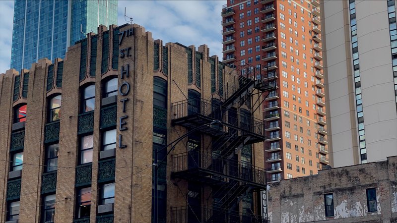
Printer’s Row is a small neighborhood, one can easily walk the whole perimeter within 30 minutes. In this walk, one would be able to see famous sites such as Dearborn Station, the Harold Washington Library, and the art deco style 7th St Hotel. Though this, in one sense, can be considered a great thing, the neighborhoods small size “bleeds into” its surroundings and not necessarily contained within the delineation of the given bounds. This, again, can be seen in the architecture of the surrounding neighborhoods/streets as well as the mixed use development within the neighboring blocks.
Layers
Diagram
History - Beginning in the early 1830s, with Publisher John Calhoun being the first to set up shop in this area just south of the loop for the Chicago Democrat newspaper, this region of Chicago quickly became the Midwest’s printing hub – housing nearly 30 publishers before the Great Chicago Fire of 1871. Even though this was the “Printing Capital of the Midwest” at the time, this place was not yet known as “Printers Row”, this would come after the building of Dearborn Station.
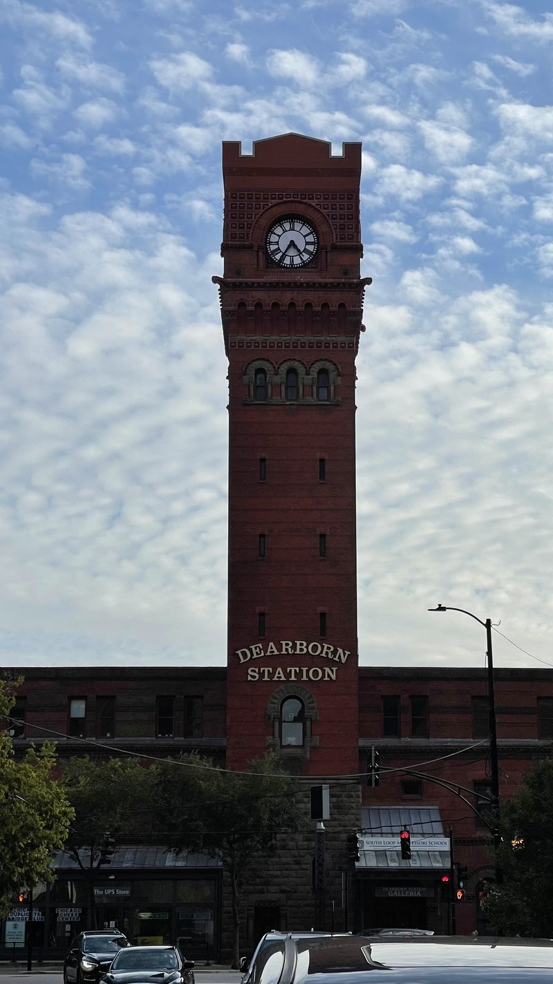
With its completion in 1885, Dearborn Station, just south of W Polk St., became the “catalyst for bringing businesses and residents to the area”, Peter Alter, chief historian of the Chicago History Museum, says in an article for the Block Club Chicago. This came to be the prime time for publishers in this area, as Dearborn Station provided them with easily accessible transportation network all throughout the Midwest. However, coming into the 20th century, like most things, all of this changed thanks to the automobile.
With the decreasing need for rail, many of the publishers in Printers Row began to move out of the city, often moving into the suburbs where they could pay less in rent while still having a wide distribution network thanks to expressways that interconnected cities. With the decentralization of many of these publishers, it was inevitable for Printers Row to eventually lose its title of “Printing Capital of the Midwest”.
By the 1960’s and 70’s, only a fraction of the publishers remained in Printers Row, and even then, they were struggling to keep themselves afloat. It wouldn’t be until 2018 when the last publishing company in Printers Row closed its doors – marking the end of an era. Printers Row, however, came to have a second life. With the need for housing within the city, many of the massive buildings left behind by these publishers were eventually converted to lofts for people to live in. Printers Row is now mainly a residential area well within the hustle and bustle of downtown Chicago.
Even though Printers Row has lost what gave this neighborhood its name, it still retains some of its history with bookstores such as Sandmeyer’s Bookstore as well as LitFest – a festival that highlights authors as well as independent bookstores in the neighborhood.
Yi, J. S. (2019, November 11). Printers row neighborhood guide. Times. Retrieved October 17, 2022, from https://chicago.suntimes.com/2018/6/27/18338966/printers-row-neighborhood-guide-chicago-restaurants-bars-shops
Bauer, K. (2022, September 9). Printers row was once the 'printing capital of the Midwest.' its rich literary tradition lives on. Block Club Chicago. Retrieved October 17, 2022, from https://blockclubchicago.org/2022/09/08/printers-row-was-once-the-printing-capital-of-the-midwest-its-rich-literary-tradition-lives-on/
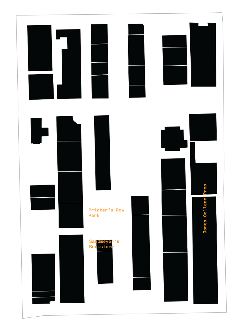
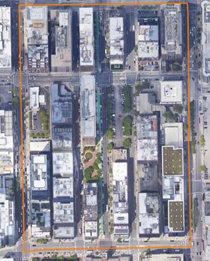
The map above shows the building footprint of Printers Row, the black shapes representing buildings, and the white space representing the social/public spaces within the neighborhood bounds (light black line). The majority of the buildings that make up the neighborhood are tall residential buildings, mostly loft-style apartments, a lot of them hosting businesses such as restaurants and bookstores (like the well-known Sandmeyer’s Bookstore) on the lower levels. The white spaces, besides Printers Row Park, are a combination of streets and parking lots.
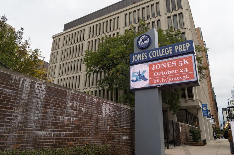
Within the boundaries of the neighborhood, there are three main public spaces: Printers Row Park, Sandmeyer’s Bookstore, and Jones College Prep.
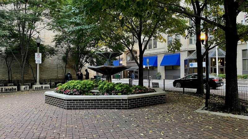
Printers Row Park plays host to the annual Printers Row Lit Fest, an annual book fair and library festival that honors Printers Row's legacy as a printing hub. This festival regularly attracts thousands of people from and outside Chicago and continues to be the largest literary festival in the country. Outside of Lit Fest, however, Printer Row Park is a small and quaint park that, in its own way also honors the historical legacy of Printers Row. Within it, it has giant type blocks that call to the neighborhood's printing past, educating visitors about the neighborhood's past.
The park itself does not have any major attractions or uses, its largely meant to be a space where one could come to spend time to learn more about the neighborhood and take a moment to relax/calibrate from the busy downtown setting.
Another public space Printers Row is home to is Sandmeyer’s Bookstore, a local, family-owned business active since 1982. Sandmeyer’s prides itself as a true mom-and-pop shop, one that has established itself as a staple to the neighborhood since beginning its operation 40 years ago. The store itself is a very relaxing space, old hardwood floors and rows and rows of books make up the space, allowing one to lose themselves in literature.
One other adjacently public space is Jones College Prep, a public high school operated by Chicago Public Schools that serves about 2000 students. This selective school has repeatedly been ranked high in national and Illinois High Schools. The school itself is the eastern most building (below W Harrison St.) and takes up a large chunk of the neighborhood. Though not entirely public per se, it has become an anchor to the neighborhood and will continue to play a key role in the neighborhood identity for a long time.
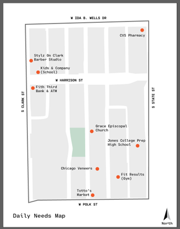
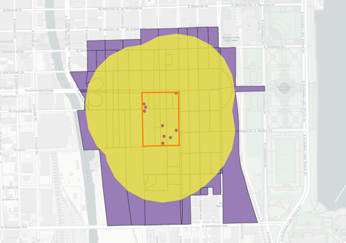
As it’s been mentioned before, Printers Row is primarily a mixed-use community, with many businesses at the lower, more pedestrian level, and housing above. But of the number of businesses that make up the commercial spaces, only nine were identified to serve “daily needs”. These include services such as schools, grocery and drug stores, and more. Below is a stylized representation of Printers Row with the locations of the daily needs services located within the boundaries of Printers Row.
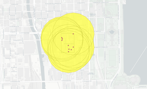
The spread of these daily need services are pretty well balanced, and further, when one looks at these points through a “pedestrian shed” of a ¼ of a mile, one can see that Printers Row is well serviced by its daily need businesses within its boundaries – even providing services for people outside of the neighborhood.
To try and estimate the number of people who could use these services, one can intersect the union of these buffers with the census block polygons.
The buffer intersects with about 128 census blocks, each with a different number of people residing within it but in total housing about 14,261 people (Based on 2010 Census Block Data).
Though these people have ample access to the services within Printers Row, it cannot be said with certainty that the routes to get to these services are exactly safe and pedestrian friendly. Printers Row and the surrounding downtown in general, have really busy streets often with careless drivers that don’t respect a pedestrian's right of way. However, road features such as wider sidewalks and longer stop signs for cars provide tools to make pedestrians as comfortable as possible. All things considered, Printers Row does fairly well in providing pedestrian-safe and friendly routes to its services with some minor hiccups here and there but not any atypical for a heavily urbanized landscape.
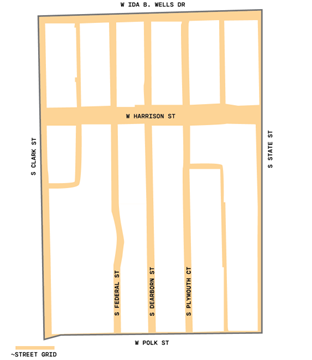
Though it has a few blocks that don’t necessarily follow the “block” pattern, breaking the grid pattern once in a while, the Printers Row neighborhood can safely be described as having elongated style blocks thanks to Chicago’s world-famous grid system. These "standardized" block types make it easy to direct both car and pedestrian traffic, as the blocks with the neighborhood ease the concept of directionality as one drive/walks through.
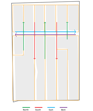
Printers Row, again thanks to Chicago’s grid system, can safely be described as having a Savannah Pattern type network. Having straightforward street directions, North/South or East/West, Printers Row’s street network follows a very straightforward and rigid pattern that makes it easy to navigate through. Alleyways between streets make the blocks within the neighborhood extra permeable for pedestrians as well as services such as garbage trucks.
As stated earlier, Printers Row has a very straightforward thoroughfare type – Streets. Thanks to its size as well as its location in downtown Chicago’s South Loop, there is no large variation of thoroughfare types. Streets make up the entirety of the neighborhood’s road network, making it easy for one to walk through and explore. The lack of variety in thoroughfare types make the neighborhood easy to navigate as well as easy to explore.
Having explored Printers Row’s block, network, and thoroughfare types, it is safe to say that the neighborhood is a very well connected neighborhood. The blocks themselves are straightforward to walk thanks to its (largely) standardized block shape, its network, thanks Chicago’s grid system, is easy to follow, and, lastly, its road network being entirely made up of streets, makes the neighborhood easy for one to get around. Overall, again, thanks to its size and location, Printers Row connectivity is superb and comes to reflect the “tightness” downtown dense neighborhoods often tend to have.
For a fairly small neighborhood, the neighborhood of Printers Row is one full of activity. Restaurants and café’s line the streets, various necessary services are well within walking distance, and every summer, over 100,000 people visit for its very own literary festival, “Lit Fest”.
Though full of activity, the neighborhood itself does not have sufficient public spaces. One park recently renovated in 2010, as I’ve come to find, is the only public space within the neighborhood boundaries. One would think this is enough sufficient public space for a neighborhood of this size, but not when one considers the fact that Printers Row houses six parking lots of various sizes.
To take on the improvement of public space in Printers Row, I have come up with three interventions:
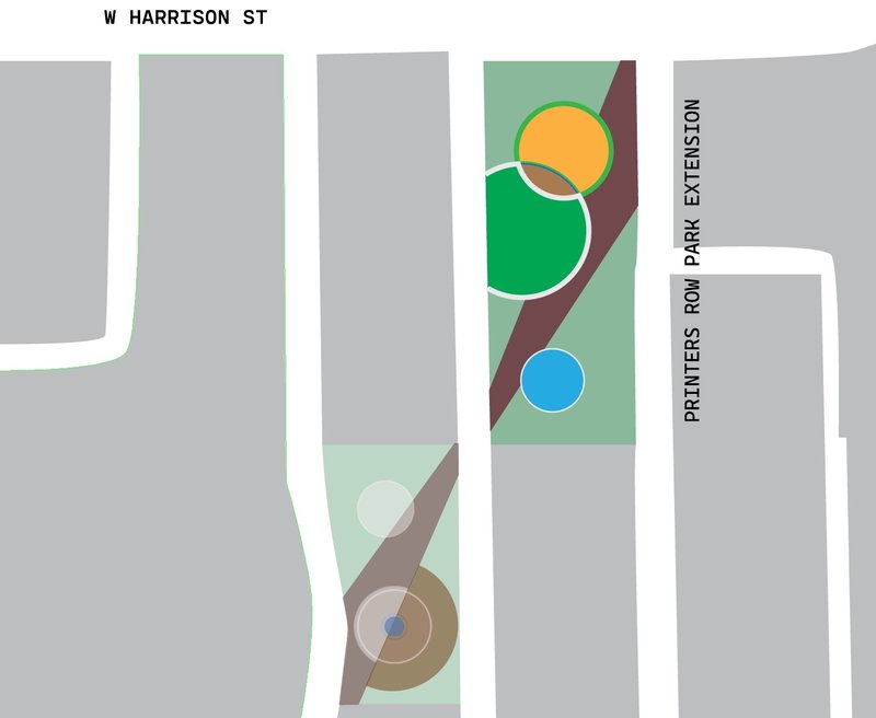
Printers Row Park Extension
A “pocket” park, Printers Row Park has a total land area of just about 0.2 acres. Just across the street, there is a large, single-level parking lot currently for a courthouse. Removing the parking lot and creating a “second” side to the current park would almost triple in size the total space dedicated to the public. This “extension” of the park would house elements for nature play as well as contain ample seating to benefit visitors as well as the Onnuri Church congregation next door.
The park would utilize the design “language” from the current park to marry both spaces together
Extension of Printers Row PArk as it relates to the existing park
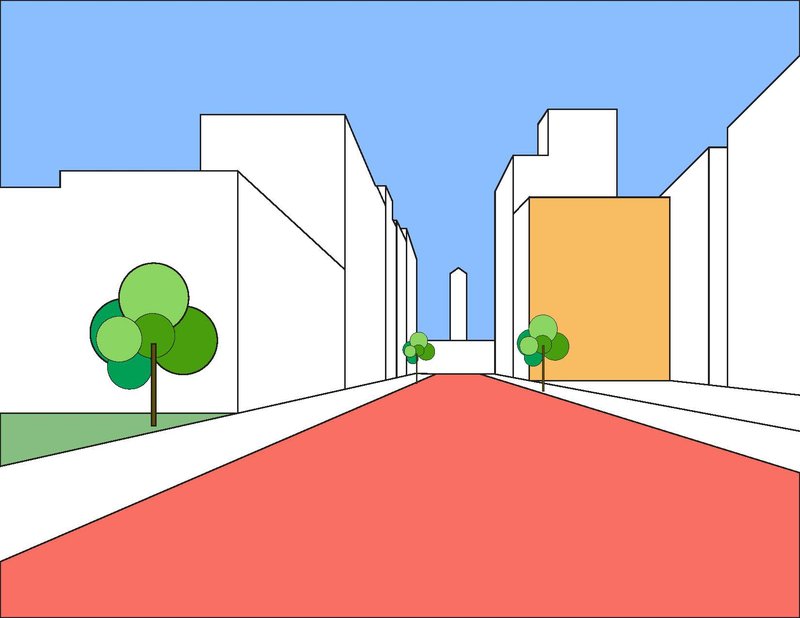
Street Plaza
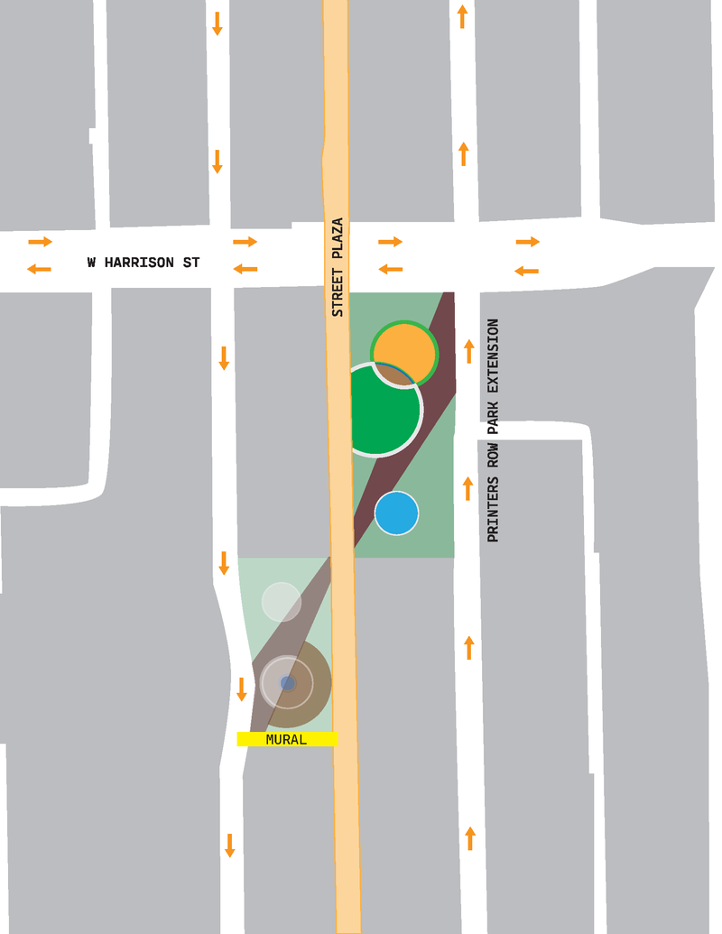
Lit Fest, arguably the most important event to take place in the neighborhood, uses S Dearborn to house its various exhibitors. This is the only time of year that the neighborhood has a second public space. Making this stretch of S Dearborn a dedicated pedestrian only area, not only could be a permanent host to the festival but would also add an additional public space that could be of service to its residents as well as the restaurants and bars that line the street.
The street plaza would run from W Ida B Wells to W Polk Street, at the intersection of W Harrison and S Dearborn, the plaza would be raised a few inches, making this stretch of the plaza kind of like a speed bump – forcing cars to slow down as they cross the plaza.
Plaza and additional interventions conceptually visualized
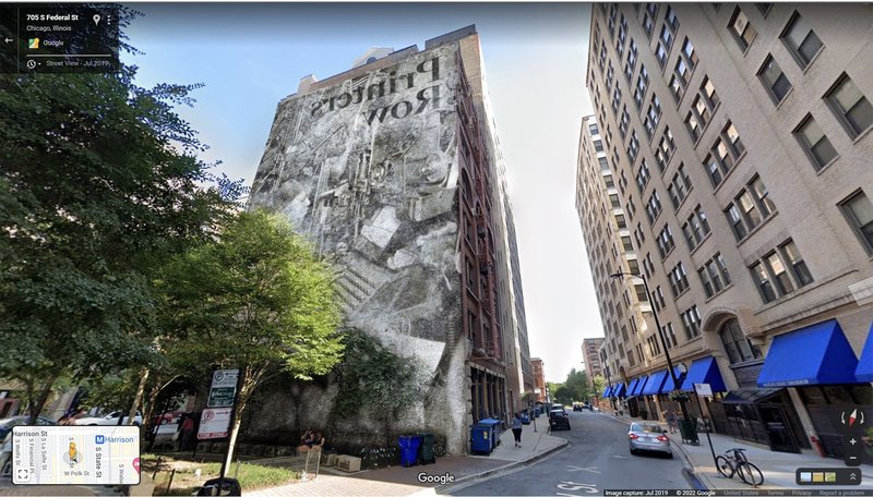
Mural
One would think that because of its historic past the neighborhood would be demarcated by various banners or plaques celebrating its history, but that’s not the reality. Besides the name popping up a few times, there is not much that can celebrate neighborhood identity. A mural, one that both contains the neighborhood name as well as one that celebrates its history, would be a great addition to heightened neighborhood identity and bring in a sense of ownership.
This mural, located on the southern wall of the current Printers Row Park, would also serve to beautify a tall, uninterrupted brick wall – improving on the only public space within the neighborhood.
Proposed commemorative mural
Final Map of Printers Row with interventions for its expansion of Public Space
Social Mix
The Printers Row Neighborhood is very small. No appropriate scale was available, so the information included in the tables below are the relevant statistics of the Census block groups that are within the boundaries of Printers Row and therefore do not accurately reflect the social makeup of the neighborhood explicitly.
Observations - When I walked through the neighborhood, the composure of its residents seemed to be made up of younger professionals who work within the downtown region of Chicago. Residences in this neighborhood are almost completely made up of condominiums and lofts, presenting itself as a middle/upper-class neighborhood – at least on the surface. The data generally holds up this perspective.
Column 1 - Race/Age Bins, Column 2 - CBG #1, Column 3 - CBG #2, Column 4 - CBG #3, Column 5 - Total CBG's
Column 1 - Med. House Value/Tenure/Housing Unit Bins, Column 2 - CBG #1, Column 3 - CBG #2, Column 4 - CBG #3, Column 5 - Total CBG's
Simpson Diversity Index Calculations
The block groups that make up Printers Row, according to the Simpson Diversity Index, are not super diverse – especially the Race and Employment Sector variables. This, in a way, is a bit unsurprising since Printers Row is a downtown neighborhood, where only those with certain jobs and of a certain class and demographics are able to live in. The data in the table above more or less supports this assumption.
Though this is quite true, as one takes a look at the neighborhood statistics with those at other, more larger scales, its great to see that Printers Row does not deviate much from the diversity indices results gathered from other scales. It goes to show that even though Printers Row is not a super diverse neighborhood (at least within these three variables), it is generally within the expected amount of “diversity” observed at other scales – making the neighborhood, in terms of diversity, mediocre at best.