Overview
Social Mix
Public Space
Amenities
Connections
Final Project
Size
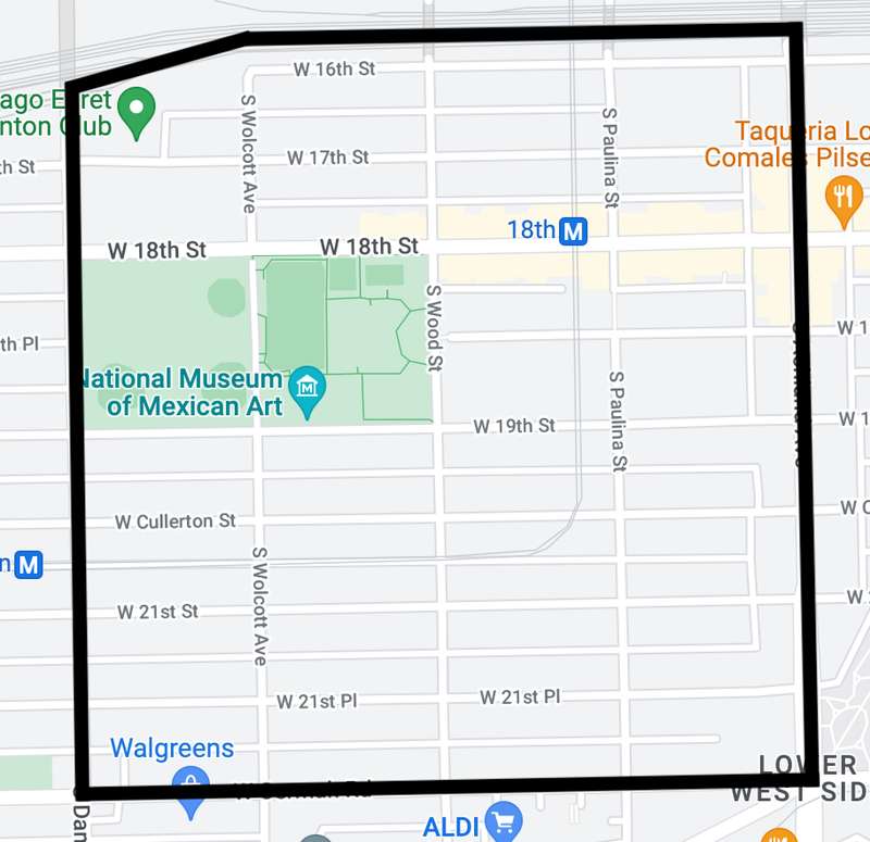
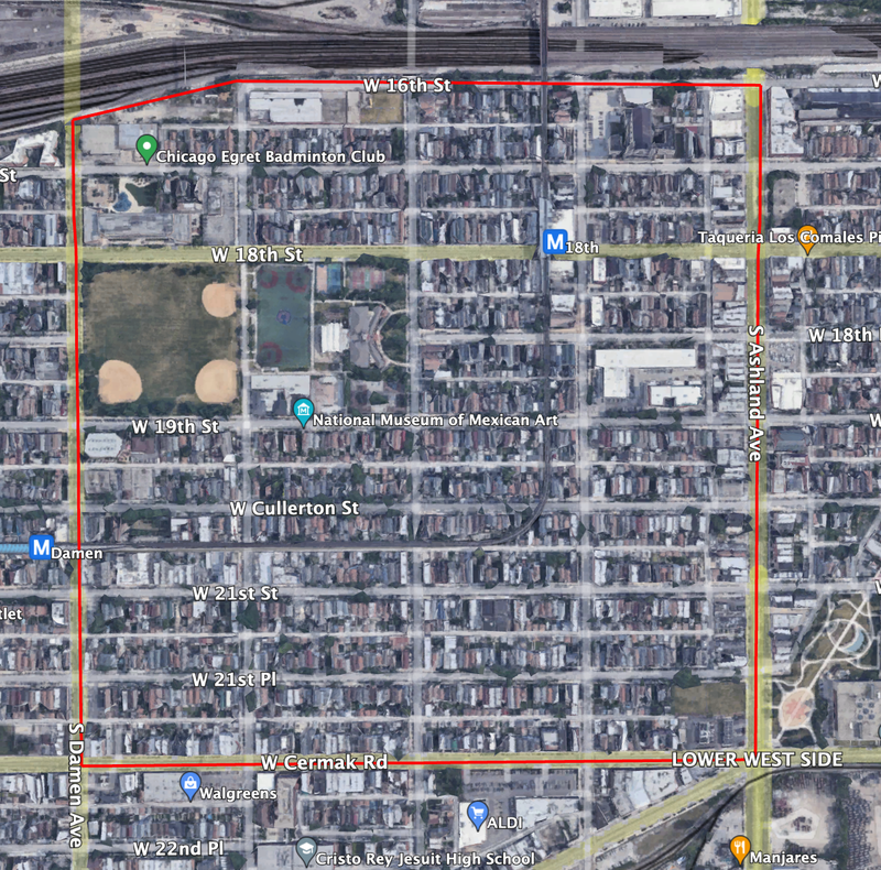
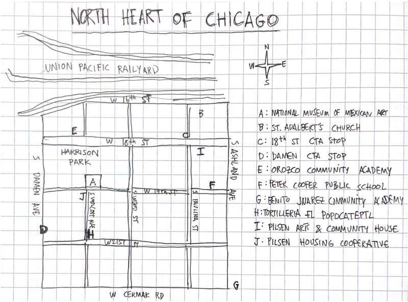
North Heart of Chicago, a subdivision of the larger Heart of Chicago neighborhood, extends from Damen Avenue on the west to Ashland Avenue on the east, and from Cermak Road on the south to the Union Pacific Railyard on the north. Per Social Explorer, it holds a population of approximately 7,422 people, making it somewhat larger than a big high school. North Heart of Chicago comprises the densest and most commercially active portion of the broader neighborhood. The neighborhood has an area of 160 acres (about 0.5 miles on each side), making it very walkable.
Identity
North Heart of Chicago feels, in many ways, like an extension of Pilsen. Though Ashland Avenue ostensibly demarcates the two neighborhoods, the strong Mexican identity that characterizes Pilsen is just as visible, if not more, throughout its western sibling. Indeed, North Heart of Chicago residents and businesses seem to view themselves more as part of a ‘Greater Pilsen’ than a separate neighborhood. Even several blocks west of Ashland, businesses use ‘Pilsen’ as the geographic identifier in their name: Pilsen Housing Cooperative, Pilsen Dental, Pilsen Body Shop. Farther south and west, in the area abutting Heart of Italy, Heart of Chicago assumes a more distinct identity–still decidedly Mexican, but inflected withItalian-American flavor (as evidenced by the presence of various red-sauce joints) and more willing to distinguish itself from Pilsen. The membrane between Pilsen and Heart of Chicago is porous and difficult to define confidently, but North Heart of Chicago undoubtedly leans more towards Pilsen.
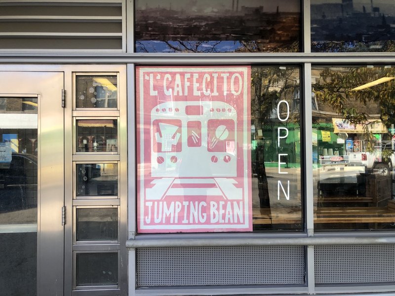
18th Street (particularly between Ashland and Wood St) constitutes the primary pedestrian commercial thoroughfare of North Heart of Chicago. Colorful signs advertising taquerías, bookstores, and cafés dot the street’s two- and three-story buildings. Harrison Park anchors the neighborhood. At 18.6 acres, the park serves as the main ‘third place’ in North Heart of Chicago; a soccer field and baseball diamonds occupy the western half of the park, while the eastern half is divided between a turf field, basketball courts, a fitness center, a playground, and the National Museum of Mexican Art. South of the park, the neighborhood is almost entirely residential and unmistakably Mexican; more than any other flag, green, white, and red tricolors hold watch over the porches of the duplexes and single-family homes that fill these streets. As in Pilsen, street art and murals constitute an integral part of the neighborhood’s aesthetics.
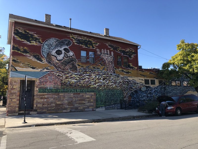
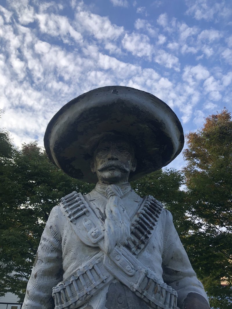
Even farther south, near and past Cermak Rd, the area is pockmarked by empty parcels and parking lots. There, the neighborhood sheds some of its residential character and adopts a more industrial personality. On the far southeast corner of the neighborhood, the courtyard of Benito Juarez Community Academy is adorned with iron statues of Mexican national heroes: the likenesses of Cuauhtémoc, Francisco Madero, and Emiliano Zapata, among others, illustrate how tightly Mexican history is woven into the social fabric of the Heart of Chicago.
Layers
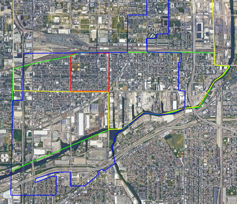
North Heart of Chicago (outlined in red) is part of the Lower West Side community area (outlined in green), Chicago police district 12 (outlined in yellow) and Ward 25 (outlined in blue). It is a full part of all these layers (and it should be noted that it remains whole within all other political subdivisions – i.e. Congressional District 7, State Senate District 1, and State House District 2 (all of these districts have substantial Latino populations). While Heart of Chicago as a whole is not entirely kept together in some of these layers (e.g. police district) the North Heart of Chicago sub-neighborhood, emphasizing its cohesiveness as a city subdivision with a population closer to that prescribed by Clarence Perry.
Diagram
History
It is difficult to recount the history of Heart of Chicago without accounting for how it is intertwined with that of Pilsen and the Lower West Side at large. German and Irish immigrants settled the neighborhoods first. Many of them worked on the Illinois Michigan Canal, while others were enticed by the Southwestern Plank Road, which eased trade routes along the canal. The Great Chicago Fire of 1871 displaced a large portion of the immigrants from Bohemia (now the Czech Republic) living in Chicago, leading many of them to resettle in the Lower West Side. Most of the Bohemians moved to what is now Pilsen (the name derives from a popular restaurant named after the Bohemian city of Plzeň). The opening of McCormick Reaper Works in South Lawndale in 1873 created many new jobs for residents of the Lower West Side and imparted the then-industrial town with a strong working class identity.
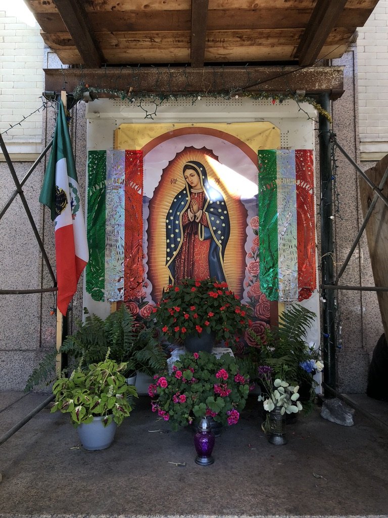
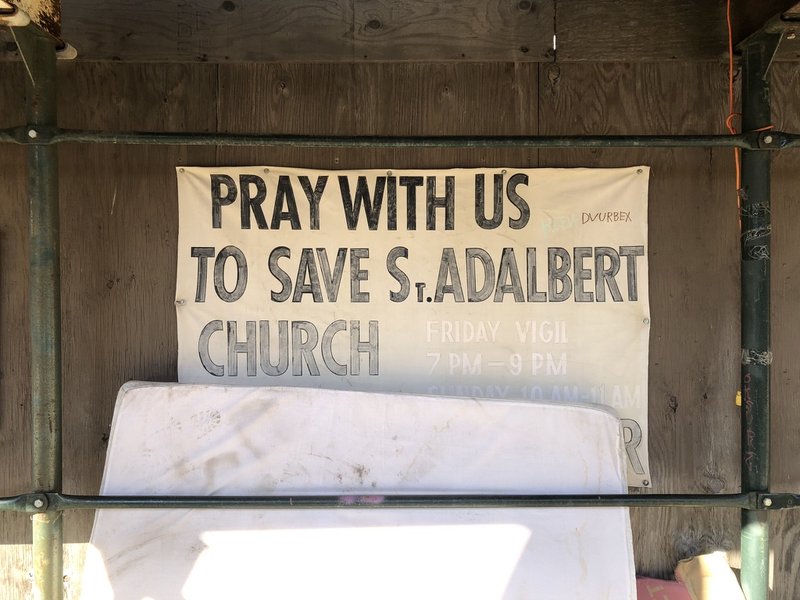
The distinction between Pilsen and Heart of Chicago first arose during the final decades of the 19th century. Heart of Chicago was more affluent than Pilsen, retained more of the original Irish and German population, and became largely Polish (with a non-trivial amount of Italian immigration, as well), while Pilsen remained poorer and predominantly Bohemian. Indeed, many better-off Bohemians from Pilsen moved to Heart of Chicago and South Lawndale as they became wealthier, buying property in these more desirable areas. During these decades, Polish immigrants established many of their own ethnic neighborhood institutions: (Catholic) churches, schools, newspapers, and so forth. Some vestiges of Polish identity persist even today: for instance, the facade of St. Adalbert’s Church, which was founded in 1874 to serve the Polish Catholic community, presents three open-air shrines, one featuring Mary hemmed in by American flags, another the Virgin of Guadalupe encircled by Mexican flags, and the third St. Adalbert of Prague surrounded by Polish flags.
The Lower West Side was annexed into the city of Chicago in 1889, paving the way for increased prosperity as the neighborhood gained access to the city’s ability to pave roads and its mass transit system. In the first decades of the 20th century, Heart of Chicago remained a major manufacturing center with a strong industrial character. However, the Great Depression and WWII undermined the neighborhood’s stability; when various plants in and around Heart of Chicago, including International Harvester, shuttered during the Depression and post-war, many of the neighborhood’s working class residents moved away, the economic cornerstone of the area having been broken. Between 1930 and 1960, the population of the Lower West Side as a whole decreased from 66,198 to 48,448–a nearly 27% drop.
The completion of the Stevenson Expressway (part of I-55) in 1964, helped spur the revitalization of the Lower West Side by connecting it to the Loop and other job-rich parts of Chicago. Between 1960 and 1970, the first wave of Mexican in-migration came to Pilsen and Heart of Chicago, and by the end of the decade, Mexicans comprised a majority of the neighborhoods’ population. The completion of UIC’s campus in the Near West Side (where many Mexican families lived) in the early 1960s impelled westward migration to the Lower West Side. In the ensuing years, an even greater number of Mexicans (and, to a lesser extent, Puerto Ricans) living primarily in the American southwest moved to Heart of Chicago and Pilsen, to the point where in 1990, 88.1% of Lower West Side residents were Latino (compared to less than 0.3% in 1960). As the Mexican population ballooned, residents refashioned the neighborhood institutions once dominated by white ethnic groups to reflect the area’s new composition. Catholic parishes opened for Polish immigrants began to cater to Mexicans, Mexican artists filled the neighborhood with flamboyant murals, Benito Juarez Community Academy (mentioned earlier) opened, Spanish-language newspapers began to circulate, and so forth: the ethnic transition was complete.
Heart of Chicago's original raison d’etre was manufacturing, providing a residential area near various industrial plants on what is now the West Side. Its proximity to the Union Pacific railyard further cemented the accessibility of employment opportunities. The neighborhood today does not particularly resemble the one that arose during the 19th century: Harrison Park was opened in 1912, most manufacturing plants had closed by 1960, and urban renewal had entirely altered the neighborhood landscape by 1970. Nevertheless, what has remained consistent in Heart of Chicago’s identity is its status as a point of entry for working class immigrants, originally from Europe, today from Mexico and the rest of Latin America.
Sources
ABC7Chicago: https://abc7chicago.com/pilsen-chicago-history-neighborhood-gentrification/12312130/
City of Chicago Data Portal: https://data.cityofchicago.org/Public-Safety/Boundaries-Police-Districts-current-/fthy-xz3r
Chicago Encyclopedia: http://encyclopedia.chicagohistory.org/pages/765.html
Chicago Gang History: https://www.chicagoganghistory.com/neighborhood/lower-west-side-heart-of-chicago/
Illinois Policy: https://www.illinoispolicy.org/maps/
Social Explorer: https://www.socialexplorer.com/a9676d974c/explore
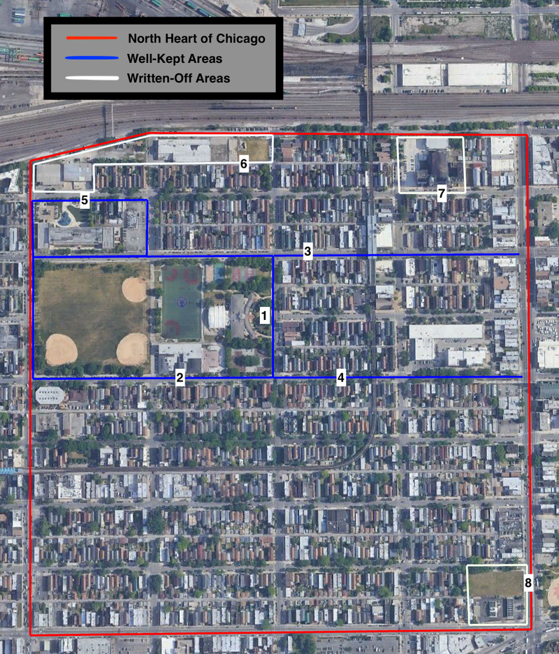
Residential zones comprise much of the area of North Heart of Chicago. Setting those aside, the neighborhood has (by my rough count) roughly seven public or semi-public spaces that exist in varying stages of upkeep and neglect. Of these spaces, the most frequented and essential for neighborhood cohesion are undoubtedly Harrison Park and 18th Street.
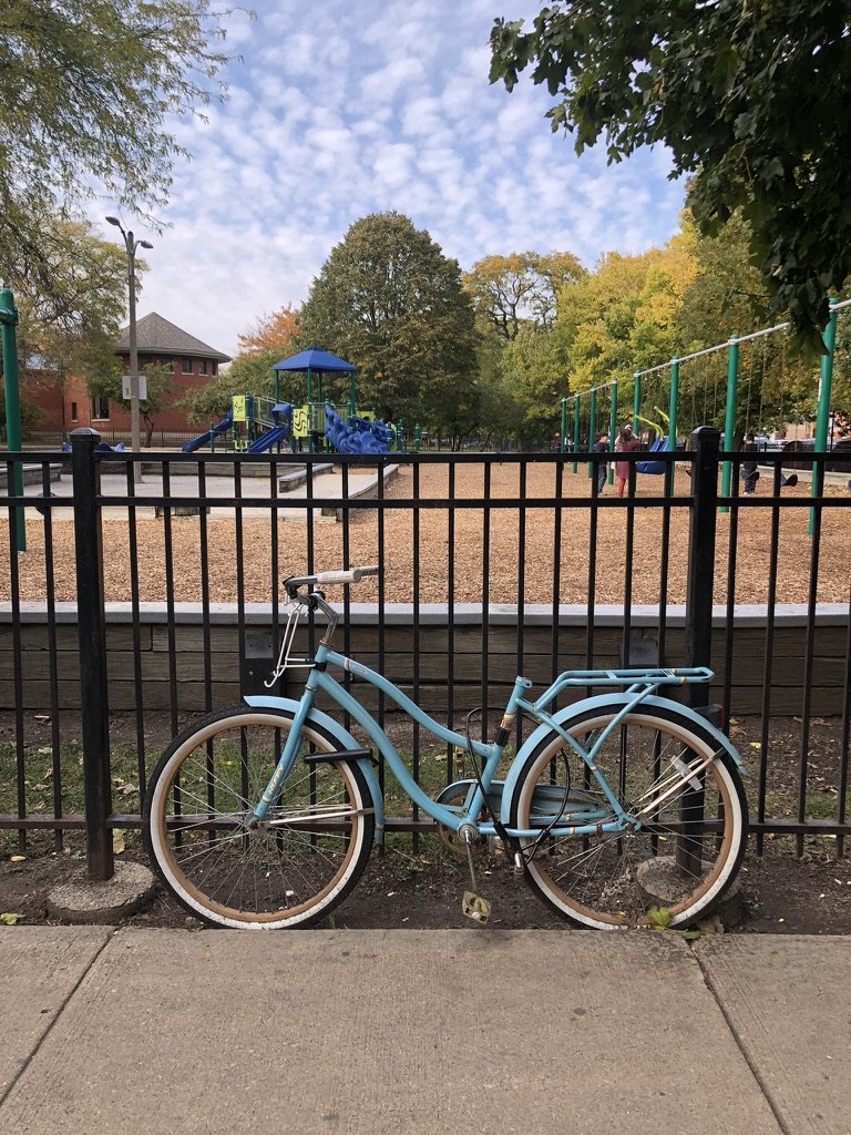
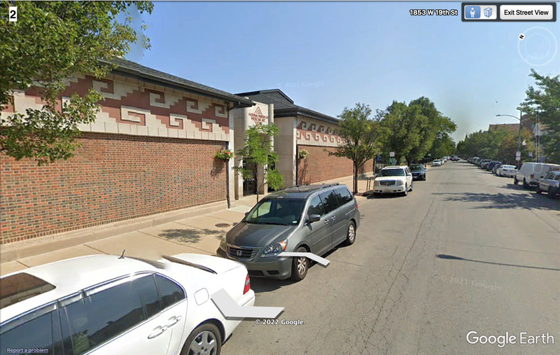
Harrison Park (pictures 1, 2) anchors North Heart of Chicago and serves as the most prominent ‘third place’ in the neighborhood. The park has various uses: it contains a fieldhouse (picture 1), basketball courts, baseball and soccer fields, a playground, a turf field, and the National Museum of Mexican Art (picture 2). The park is well-kept, neatly landscaped and litter-free. Anecdotally, on the occasions I visited, many people were enjoying the park’s amenities (significantly more than could be seen in any other space in the neighborhood). The sense of ownership felt over the park is further evidenced by the fact that various groups of people were celebrating birthdays, playing recreational sports, and selling empanadas and tacos on the sidewalk adjacent to the fields. The nature of the park makes it conducive to social interaction and mixing.
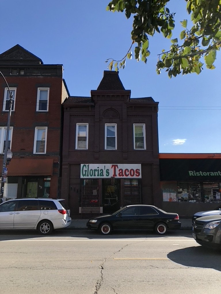
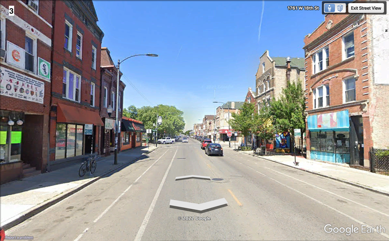
18th Street (picture 3) leads directly to Harrison Park and functions as the most important commercial avenue in North Heart of Chicago. The street has heavy foot traffic and is well-maintained. The street is lined with stores, restaurants, and cafés, and residents can be seen regularly frequenting the street’s establishments. It is infused with a strong Mexican identity: restaurants almost exclusively sell Mexican food, storefronts are painted red, white, and green, stores sell traditional Mexican clothing, murals on side-streets depict figures in Mexican history and art, and so on. This visible, cohesive ethnic identity permeates the space and makes evident the strong sense of ownership residents feel regarding the street.
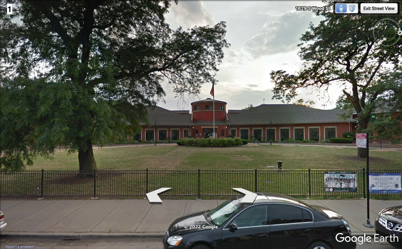
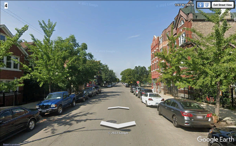
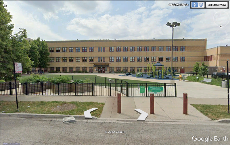
19th Street (picture 4) is quieter and more residential than 18th Street, but nevertheless has a nontrivial amount of commercial activity; like 18th Street, it is clean and well-maintained. Though the Mexican-ness of the street is not as strong as its neighbor’s, it nevertheless bears various colorful murals and is also home to a bilingual elementary school, giving it a deliberate sense of place for families. Orozco Community Academy (picture 5), north of Harrison Park, also seems to function as a well-kept public space in North Heart of Chicago. The school contains a new playground and lawn for children and families, allowing for community interaction in daily life.
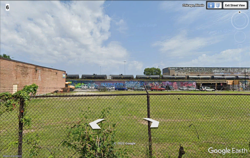
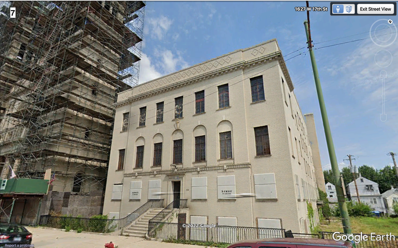
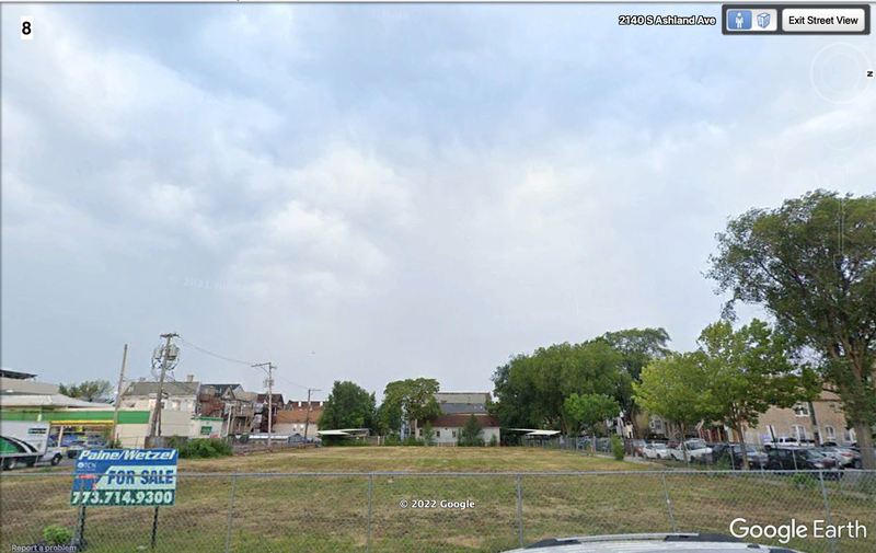
The far north and far south of the neighborhood are home to the most neglected and ill-maintained public spaces in the neighborhood. North of Orozco Academy (picture 6), the area contains parking lots for trucks and empty parcels; the space has visible litter, the lots are overgrown, and the space is not conducive to any sort of social intermingling – it is clearly not meant for people to linger in any capacity. This situation is similar to the southeast corner of the neighborhood (picture 8), where a gas station abuts a large empty lot that is similarly neglected and ignored. Finally, at the northeast corner of the neighborhood lies St. Adalbert’s Church (picture 7), which, although at one time was a powerful public space that served as a hub for the Polish (and later Mexican) Catholic population of North Heart of Chicago, the home parish for over 4,000 families, holding mass and providing services for families in the area. The Archdiocese of Chicago closed St. Adalbert’s in 2019, and the area surrounding it is fairly dead, with little foot traffic and more trash on the street. The space has transitioned away from serving a social function and the sense of ownership residents feel seems to have subsided around the church.
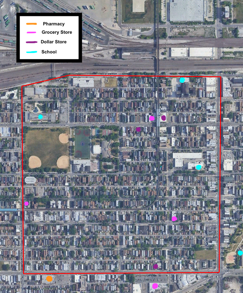
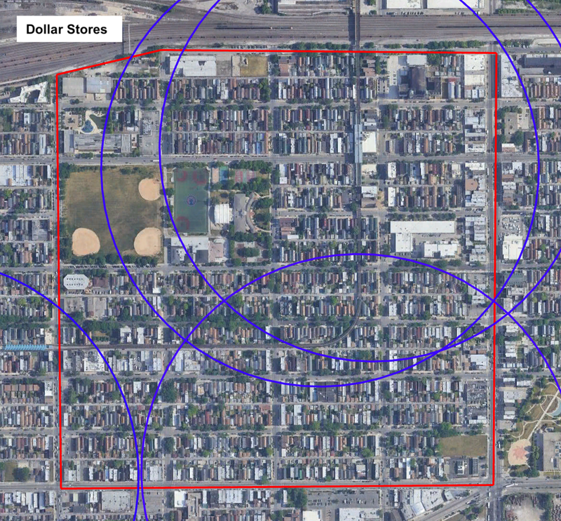
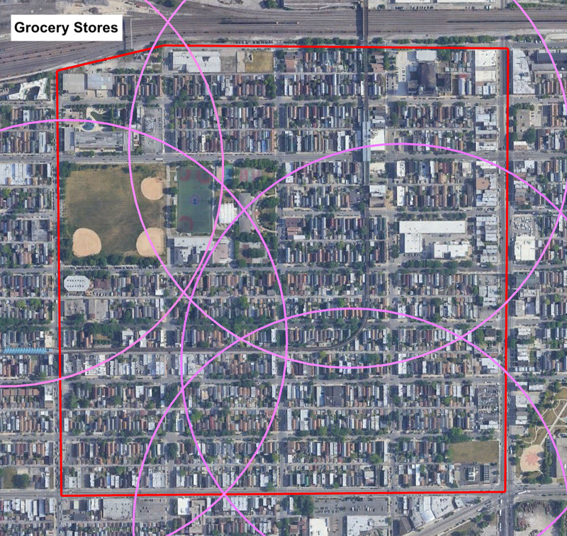
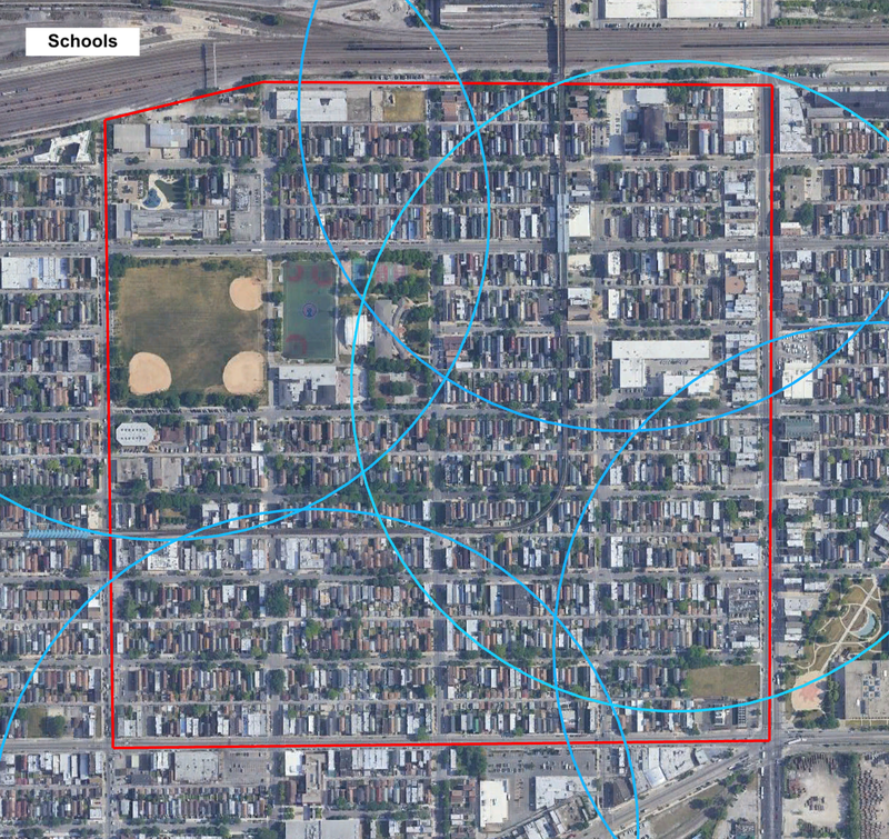
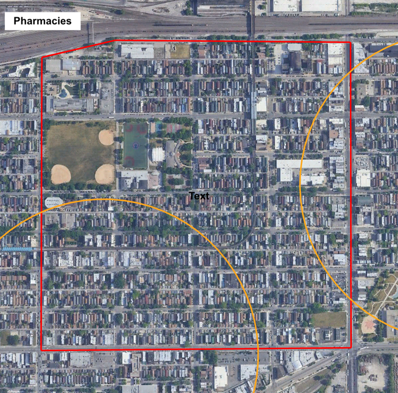
Per Social Explorer, the residential areas of North Heart of Chicago have a roughly even population density. Harrison Park and the northwest corner of the neighborhood have little to no population, but otherwise the population is distributed quite constantly. The distribution of the four daily services I identified – pharmacies, grocery stores, dollar stores, and schools – does not perfectly match the distribution of people, but these services are accessible on foot to almost all residents of the neighborhood within a 5-minute walk shed (and are accessible to all residents within a 10-minute walk shed), making North Heart of Chicago a relatively walkable and amenity-rich neighborhood. I selected the four services mentioned above because they all fulfill daily life needs: education for one's kids, food, medicine, and assorted products (that one might find at a dollar store). The map below illustrates the locations of these various services within North Heart of Chicago (n.b. some of the locations of these various services lie outside the confines of the neighborhood proper, and thus are not represented on this map, but nevertheless exist within a 5-minute walk radius of some parts of the neighborhood).
The first two maps show the five-minute 'pedestrian sheds' for dollar stores and grocery stores (which fulfill overlapping but not identical functions in daily neighborhood life). Based on estimates from Social Explorer and Google Earth, more than 90% of North Heart of Chicago residents live within a five-minute walk of a dollar store, and all residents of the neighborhood live within a five-minute walk of a grocery store. For the most part, these amenities are located in advantageous locations with reliable sidewalk access. The only exception is the Aldi (the pink dot on the far south of the top map) located south of Cermak Rd, which, while still accessible on foot, is primarily designed for automobile access rather than pedestrian access, as evidenced by the large parking lot that sits in front of the store. Otherwise, all locations (especially those on 18th Street) benefit from safe sidewalks and roads. A larger market on Ashland Avenue might benefit residents of the east side of the neighborhood, as they are generally left to rely on a smaller grocery or Aldi, but otherwise the distribution of dollar and grocery stores is consistent with a well-serviced neighborhood.
North Heart of Chicago is a relatively young neighborhood (~17% of the population is under 18), and it is serviced by several schools. Per Social Explorer, all households in the neighborhood are served by at least one school (though not necessarily a public school). Residents in the southwest portion of the neighborhood who do not wish to attend the Cristo Rey Jesuit High School may instead have to walk farther east to Benito Juarez Community Academy, and the southeast corner of the neighborhood is not within a five-minute walk radius of any elementary schools (though they are certainly within a ten-minute radius). Likewise, the northern two-thirds of the neighborhood (~60% of population) does not have access within a five-minute walk to a high school, although, as with elementary schools, they do have access within a ten-minute walk to Benito Juarez Community Academy and Cristo Rey Jesuit High School.
Finally, examining pharmacies, access is much more limited than it is for other daily needs. Only about 40% of the neighborhood (~3,000 people) lives within a five-minute walk radius of a pharmacy (neither of which actually lie within the confines of the neighborhood). While more than 90% of residents live within a ten-minute walk of either pharmacy, they are nowhere near as prevalent or accessible as grocery stores or dollar stores.
On the whole, basic daily life needs are eminently accessible in North Heart of Chicago to the vast majority of residents within a five-minute walk radius, and certainly in a ten-minute walk radius. The sidewalks throughout the neighborhood are well-maintained and generally accessible, and aside from Cermak Road on the south and Ashland Avenue to the east, the streets are narrow and safe to cross. Towards the north side of the neighborhood, there exists a clear 'border vacuum' with inferior pedestrian infrastructure and little-to-no services aside from a school in the northeast corner. Improvements to this neighborhood might consider developing alternative uses for this portion. However, generally the listed amenities are easy to access for almost all residents of the neighborhood.
Sources:
socialexplorer.com
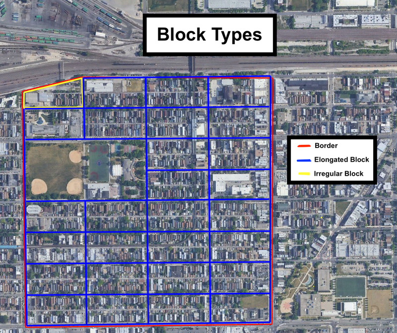
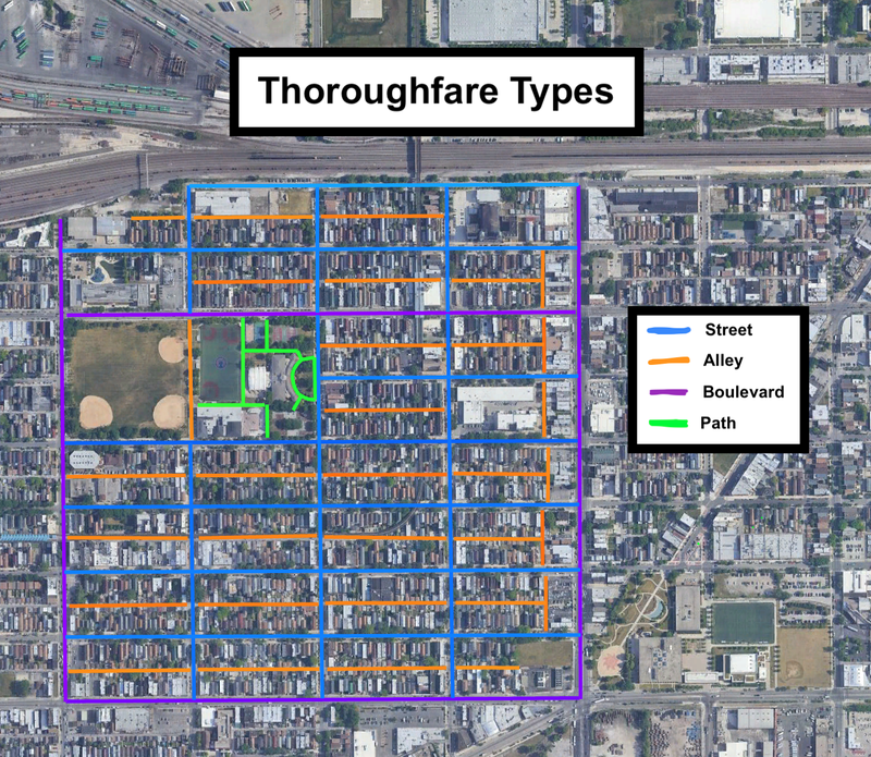
North Heart of Chicago is comprised entirely of elongated blocks, save for one irregular block on the northwest corner of the neighborhood (which owes its irregularity to the layout of the adjacent railyard. The elongated blocks are all the same size, with alleys running east-west (and near the east border, also north-south, as is visible in the next map). This block layout allows for most buildings to face quieter streets, with the shorter side of the block facing more crowded and active thoroughfares.
North Heart of Chicago is predominantly residential. Commercial activity is generally limited to the boulevards that circumscribe the neighborhood (Ashland Ave, Damen Ave, and Cermak Rd), as well as the main commercial thoroughfare of the neighborhood, 18th Street, which bisects the northern half of the neighborhood. The remainder of the thoroughfares are best described as streets: low speed, low traffic, providing frontage for apartment buildings and duplexes. Each of the elongated blocks also contains an alley running east-west, and a few also have an alley running north-south. The layout of thoroughfares results in a walkable neighborhood where cars generally move at lower speeds.
Network Types:
The network of North Heart of Chicago most closely resembles the Savannah pattern. The system is based on straight lines and right angles, with little deviation from the pattern. This orthogonal grid lends itself to easy directional orientation and limits heavy traffic to certain streets (i.e. the boulevards mentioned above), while the remaining streets have an essentially even, low flow of traffic throughout. The extensive alley system allows for efficient trash pickup and provides additional parking space for residents.
On the whole, North Heart of Chicago is very well-connected, in terms of block type, thoroughfare type, and network type. The streets are easy to navigate and are eminently walkable; the sidewalks are continuous and well-maintained, with no glaring accessibility issues. The low driving speeds of most of the streets in the neighborhood contributes to an overall sense of street safety. Furthermore, Harrison Park, which constitutes a large chunk of the neighborhood, provides a safe and accessible space for recreation, exercise, and walking. Residents can also walk across the park as a shortcut in their routes. Likewise, the well-developed alley system also allows for shortcuts and efficient trash pickup.
Despite its walkability, the neighborhood is nevertheless very car-friendly; residents who wish to commute by car benefit from favorable road infrastructure on the streets, and are able to move more quickly along the main boulevards on the edge of the neighborhood. The car-friendliness, however, does not dominate to the point of deterring pedestrian activity or posing a clear danger to residents of Heart of Chicago.
Design-wise, blocks in North Heart of Chicago are all about 0.12 miles long and 0.05 miles wide (approximately 4-5 acres), and there are no cul-de-sacs in the neighborhood (aside from alleyways). The streets are well-connected, not requiring any sort of access road, and there are no gated developments present in the community. All in all, North Heart of Chicago exhibits strong street connectivity and walkability, allowing for both pedestrian and automobile activity to create a strong residential neighborhood.
Public space in the core areas of North Heart of Chicago is well-kept and well-frequented. The mixed-use functionalities, well-maintained sidewalks, and variegated social spaces on 18th Street and in Harrison Park attract neighborhood families and tourists alike to mingle, play, and shop. Even in the less trafficked areas of the neighborhood’s core, the sidewalks are neat, the roads are smooth, and a strong sense of community ownership pervades the street network.
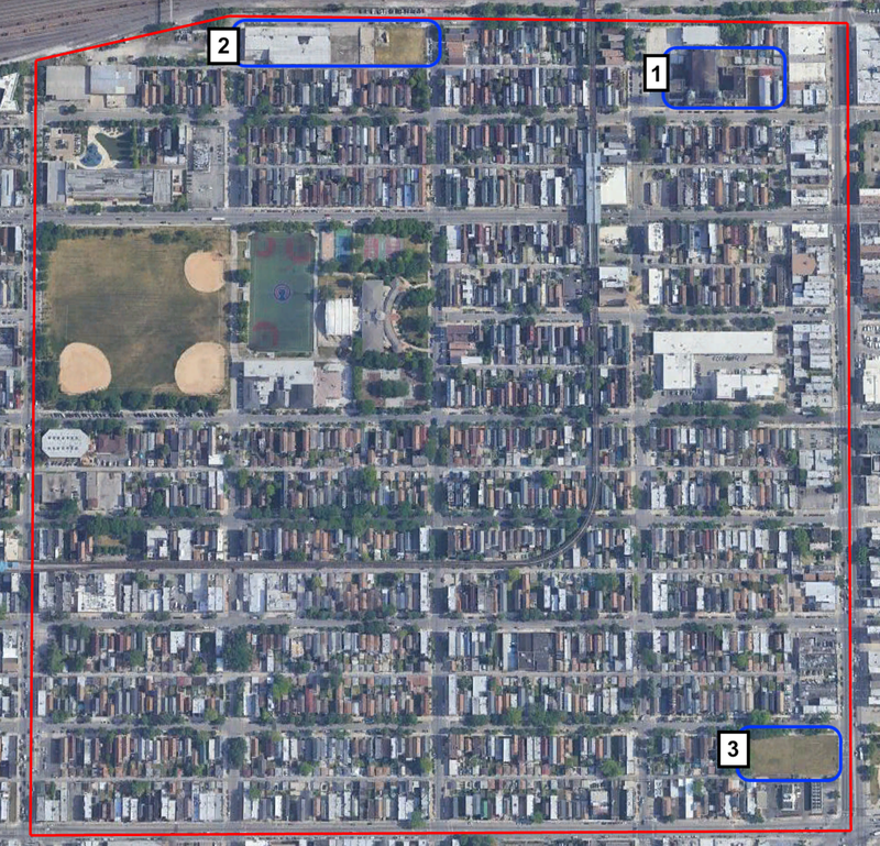
At the poles of North Heart of Chicago, however, the options for public space are lacking; in these peripheral zones, at the far north and far south ends of the neighborhood, public spaces exist in a state of neglect and disinvestment. In order to increase the sense of ownership residents of these areas feel, improve options for social connection, and generally elevate the sense of aesthetic value, I propose three interventions, two on the northern edge, one on the southern edge, aimed at revitalizing public spaces that have been written off.
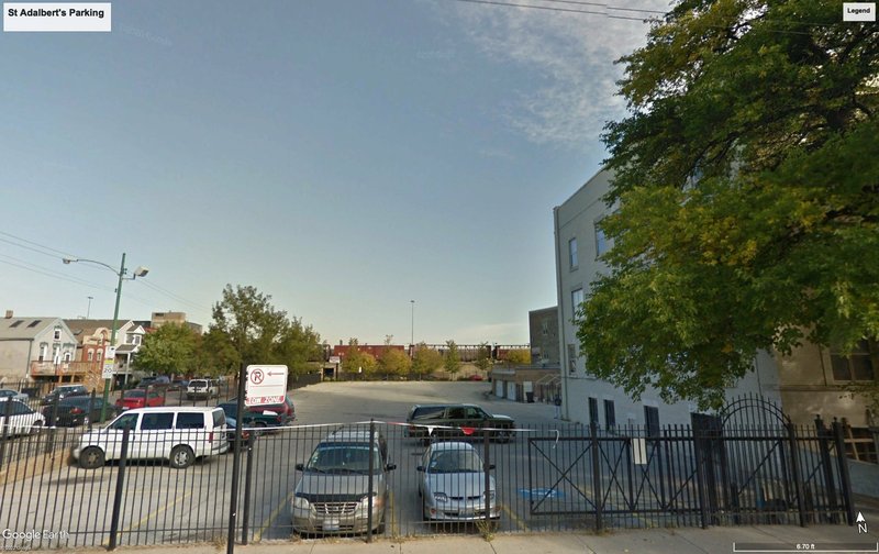
My first intervention focuses on the parking lot and shuttered music school abutting St. Adalbert’s Church in the northeast corner of North Heart of Chicago. Until the Archdiocese of Chicago permanently closed it in 2019, St. Adalbert’s had been a prime community hub in the neighborhood; since its closure, the area surrounding the church has lost frequent foot traffic, been neglected for repairs, and become more strewn with litter.
My intervention proposes reinvigorating this once-vibrant portion of the neighborhood by developing a new community center on the parking lot and the music school in partnership with the adjacent elementary school. Such a center would offer a space for social interaction, giving the opportunity for children and community members to make art, participate in events, and get to know their neighbors in an area that had once been crucial for such interaction.
This lot, which currently houses a municipal parking lot and a now-closed music academy...
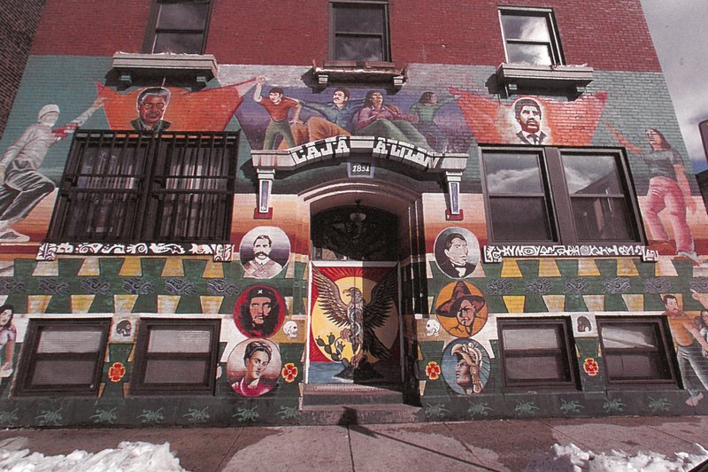
...could be repurposed as the home for a new community center, recapturing the social use that this area once had, perhaps with a mural celebrating Heart of Chicago's Mexican heritage (as seen on the façade of the now-shuttered Pilsen community house Casa Aztlán).
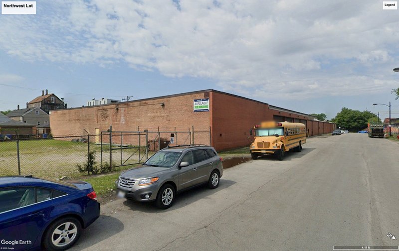
My second intervention focuses on the empty lot and empty warehouse in the northwest corner of the neighborhood. Currently, the area surrounding the lot and warehouse is the most disinvested in the neighborhood. This phenomenon is particularly visible on the side bordering 16th Street, where the lot does not even have a sidewalk, weeds are overgrown, and trash bags lie on the street.
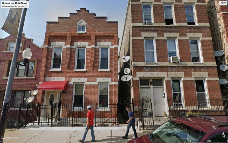
I propose redeveloping the entire portion of the block into a new mixed-income housing development. Housing on this block would be within a short walk of a public elementary school, Harrison Park, various daily necessities such as a grocery store and pharmacy, and a Pink Line Station. A block of small apartment buildings would provide more housing for neighborhood residents (helping prevent displacement) and allow many new people to live in an amenity-rich, transit-accessible area. Likewise, the new development would prompt residents to feel a sense of ownership over the currently neglected area, hopefully leading to quality-of-life improvements in the infrastructure and servicing of the block.
This neglected block, which is currently entirely devoid of use, either residential or commercial...
...might be redeveloped into a complex of small, mixed-income apartment buildings, like these on 18th Street, just two blocks away.
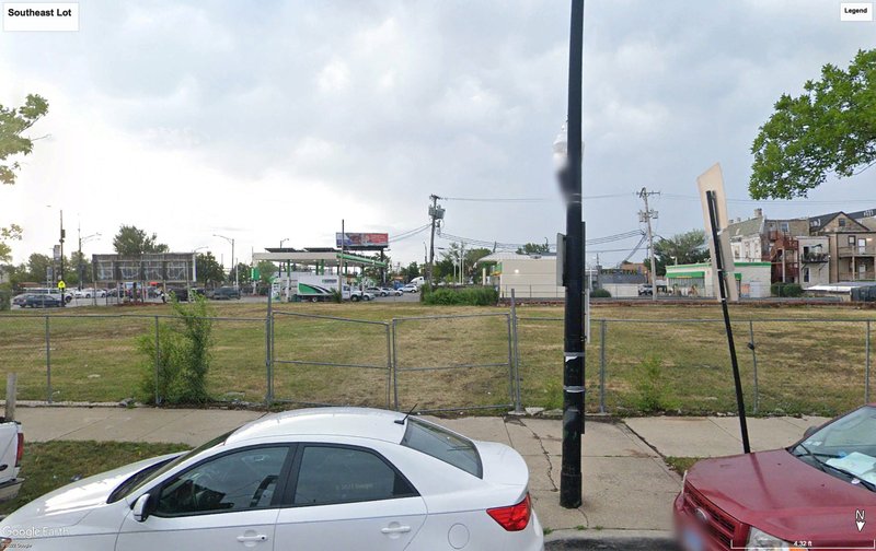
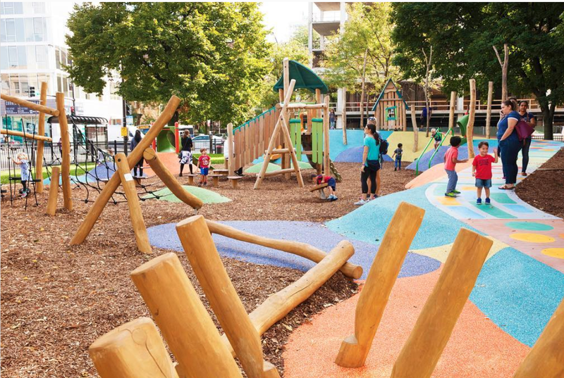
My final intervention focuses on the empty lot and an adjacent gas station on the southeast corner of North Heart of Chicago. Like the other empty lot, the sidewalks next to this zone are less well-kept than in other areas of the neighborhood, and the overgrown grass of the lot is an eyesore. I propose redeveloping the lot and gas station into a small family-oriented playground. The homes in the southeastern corner of the neighborhood are the farthest away from Harrison Park (about a 10 minute walk); building a new playground would provide another, closer option for families here (and, even more saliently, in the adjacent neighborhoods), while also potentially functioning as a sort of extension of the campus of Benito Juarez Community Academy, which lacks space for intermingling.
An intervention might serve to turn this unpleasant empty lot and gas station...
...into a small, vibrant playground for families nearby to make use of.
These three interventions would improve the public space in North Heart of Chicago, turning neglected lots into hubs for community engagement; if constructed, they would improve the sense of ownership people living in the peripheral areas of the neighborhood feel and improve the amenities they enjoy. North Heart of Chicago is already a desirable neighborhood, and these interventions seek to further improve the space, allowing it to reach its full potential.
Image credits:
Google Earth
https://chicago.curbed.com/maps/chicago-best-playgrounds-kids-parks
https://www.chicagotlan.org/5
Social Mix
Using the Simpson Diversity Index, I calculated the diversity of North Heart of Chicago with respect to three variables: race, educational attainment, and housing type. The corresponding indices for the Lower West Side (the community area within which Heart of Chicago resides), the West Side, and the city of Chicago as a whole are included to facilitate comparative analysis.
Relative to these other geographical subdivisions, North Heart of Chicago is less diverse with respect to all three selected variables. Its low racial diversity index (1.64) is a function of the neighborhood's heavily Hispanic population (more than 3/4 of residents self-identify as Hispanic). The Lower West Side as a whole is slightly more racially diverse, but is similarly disproportionately Hispanic. In contrast, the West Side and Chicago as a whole have substantially higher racial diversity indices (of course, the index does not account for the high level of racial segregation that exists in Chicago). When it comes to educational attainment, however, North Heart of Chicago appears to be more representative of the city. Its index of 4.76 more closely approximates the city's index of 5.17. It is relevant to note that the composition of educational attainment is not the same as the city; a plurality (28.2%) of North Heart of Chicago residents have not completed a high school education, compared to 14.1% of Chicagoans. This disparity is likely due to the high proportion of recent Latin American immigrants that live in the neighborhood, who have not had the opportunity to complete a secondary education in their home country or to pursue equivalency in the U.S. Finally, North Heart of Chicago has a less diverse mix of housing types than the other relevant subdivisions. Indeed, a vast majority (83.0%) of units in the neighborhood are in buildings with 2 to 9 units. As nearly 70% of neighborhood residents are renters, this sort of distribution makes sense, with most people living in apartments or duplexes. The city and the West Side have significantly higher proportions of single-family homes and buildings with more than 50 units.
On the whole, North Heart of Chicago is not particularly diverse, especially with respect to the primary variable that comes to people's minds when referring to diversity: race. The population is overwhelming Hispanic (Mexican, to be precise), and proportionally less diverse than its community area, region, and city. Though more diverse with respect to education and housing type, the neighborhood is not especially diverse on either of those metrics either. Given these variables, it is quite easy to imagine the modal North Heart of Chicago resident: a Hispanic person who lives in a four-flat and either has no high school degree or has a bachelor's degree.