Overview
Social Mix
Public Space
Amenities
Connections
Final Project
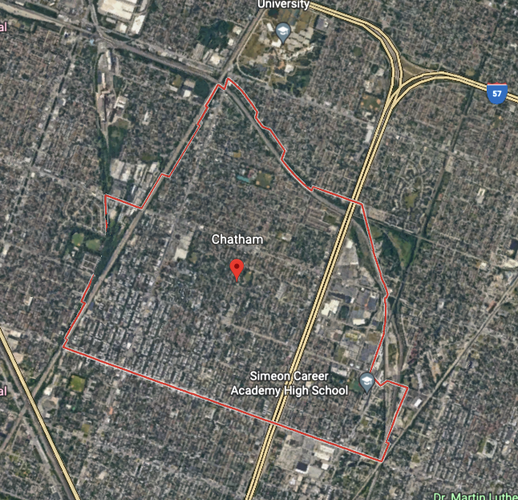
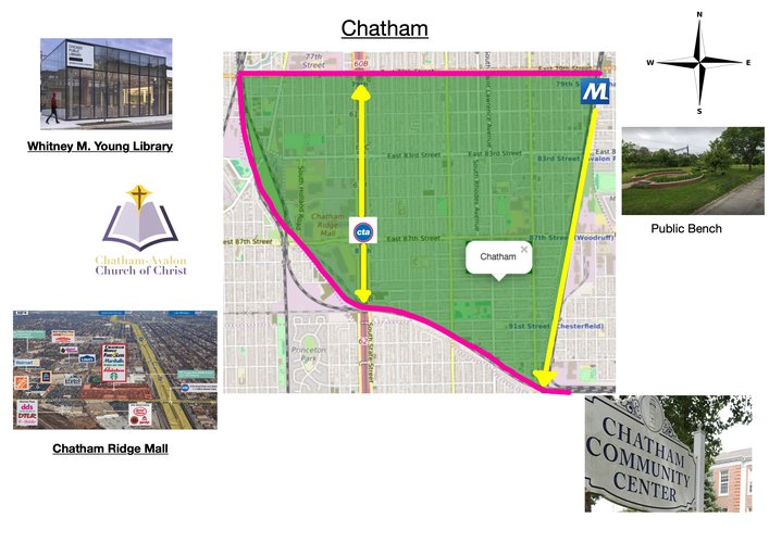
Chatham has a total population of 31,710 as of 2020 and encompasses 5 neighborhoods: Chatham-Avalon, Chatham Chatham Club-Chesterfield, East Chatham, West Chatham, and northern portion of West Chesterfield.
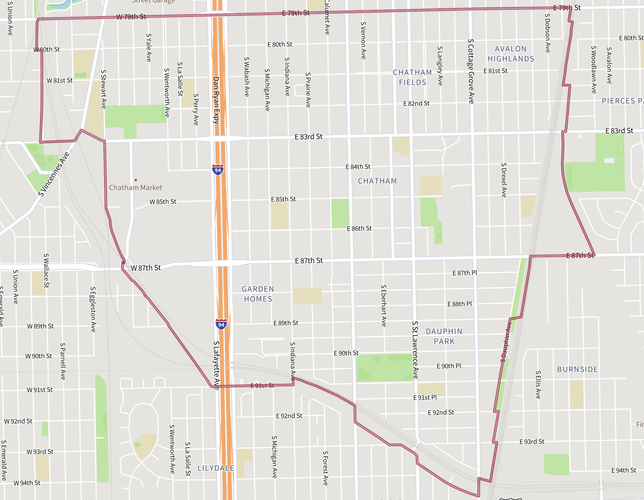
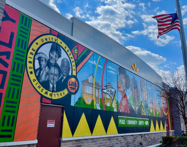
Chatham, is a predominately African-American neighborhood with a middle-class reputation dating back 60 years. One would think since Chatham is a conglomerate of sub-communities within the Chatham neighborhood there would seem to be a lack of identity, but it's quite the opposite. Residents not only identify with “Greater Chatham'', but they also identify themselves with their respective community area within the whole neighborhood unit at large.
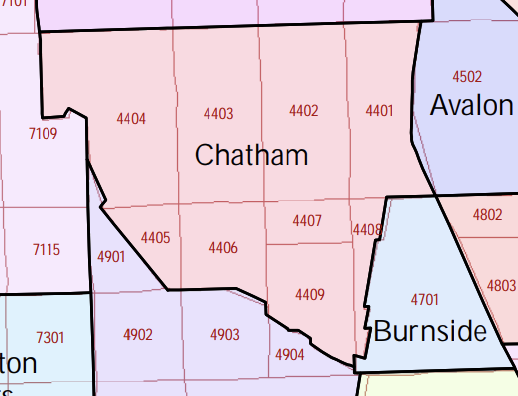
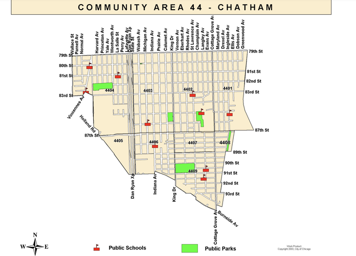
In terms of defined delineations the boundary lying within 79th and 95th streets and the Illinois Central Railroad (Eastern boundary) and the Dan Ryan expressway separates the conglomerate neighborhood into 2 separate pieces. This boundary, though useful for transportation, does not make sense in terms of its delineation. Seeing that the boundary separates the neighborhood in two halves, it wouldn't be unreasonable to assume that some parts of the neighborhood are more unsociable and/or alienated from the community than others.
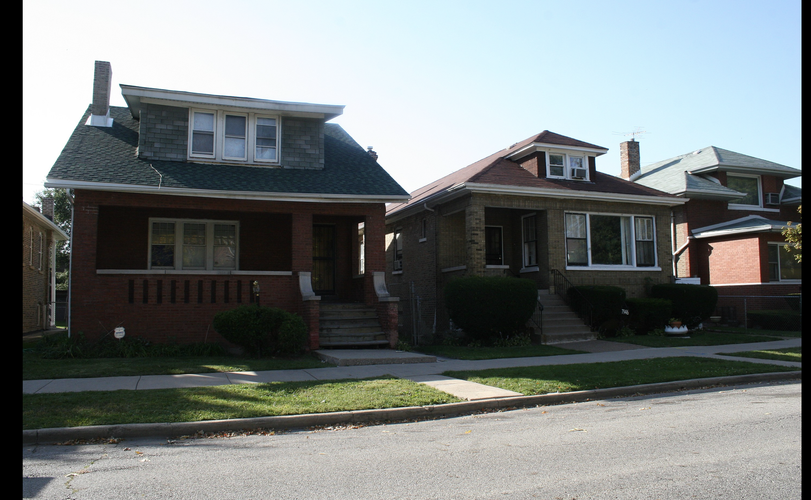
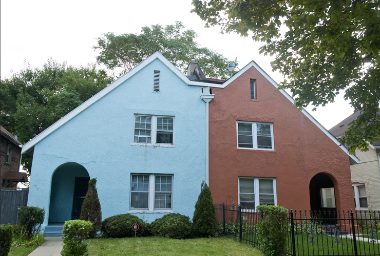
The two historical districts in Chatham; West Chatham Bungalow district and the Garden homes district provides the community with a sense of distinctiveness that rarely exists in other neighborhoods in chicago. The West Chatham district is unique in that the bungalows are all brick and very similar in design ultimately giving the neighborhood a uniform appearance. Similarly, the Garden district is known for being the first large housing development in the early 20th century. Related to design, the Garden district is composed of homes built on large lots giving residents more green space, which is uncommon for the traditional urban Chicago layout. This sort of distinctiveness gives the neighborhood a sense of originality and character.
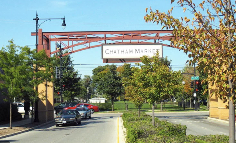
Built in 1919 the Garden Homes historic residential district includes 152 residential buildings and are known to be Chicago's first large housing project.
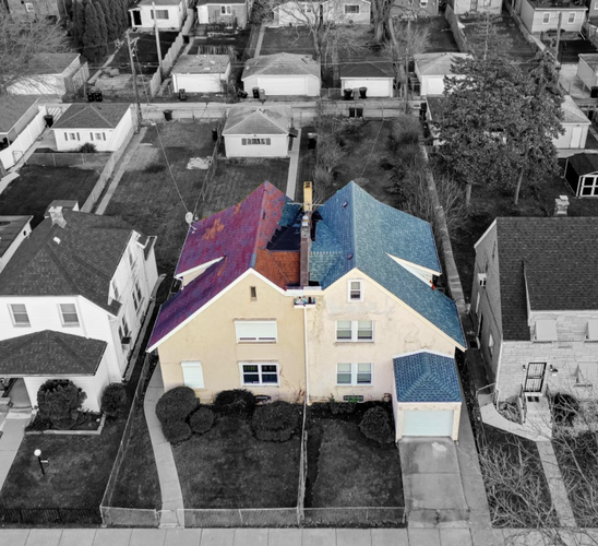
There exist 9 census tracts in the Greater Chatham area. There also exists one aldermanic ward (Ward 8) which is occupied by Michelle Harris.
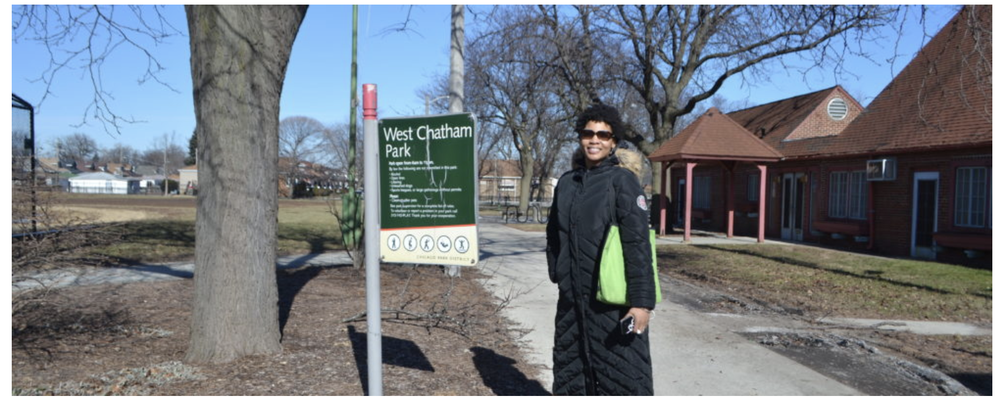
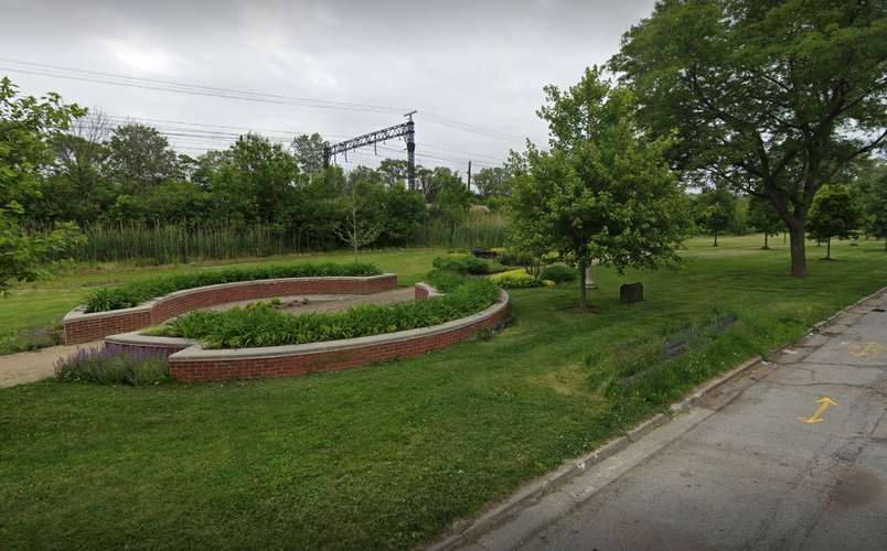
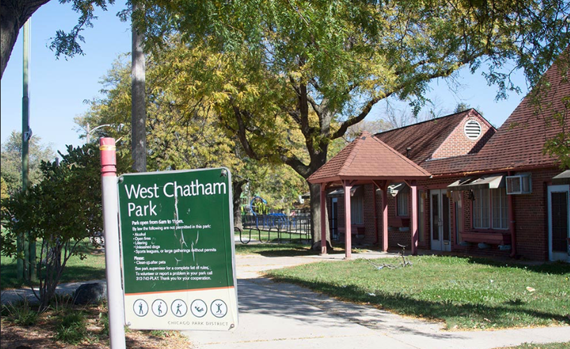
There are also 4 Public parks & park bench(West Chatham, Nat King Cole, Tuley, Brown, and a park bench.
There's also 2 parish boundaries within the Chatham community: Chatham-Avalon Chris, and Chatham fields Lutheran Church
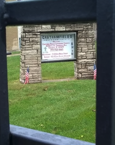
The history of the Chatham neighborhood is one that needs to be preserved. Originally known as “Mud Lake” for its swampland, Chatham was mainly used by European farmers for duck hunting until the 1860’s when the first structures of “corn Cribs” were built followed by frame houses built by railroad workers. Before being developed into what is now the Chatham neighborhood was only made up of three neighborhoods: Avalon Heights, Dauphin Park (now known as Chesterfield), and Chatham Fields. Then came the late 19 century when Hyde Park founder Paul Cornell established the Cornell Watch Factory at 76th and the Illinois Central Tracks, attracting a number of Irish, Swedish and Hungarian immigrants to the area.
By the 1920’s most of the residents in Chatham were of Swedish, German and Irish descent. Moving forward to the mid-twentieth century, like other neighborhoods around the city, Chatham experienced a hard transition with black integration. However, unlike other neighborhoods at the time, white residents in Chatham skeptically welcomed blacks into their community, church congregation and community association. The reason is up for debate, but I would make the argument that Chatham residents knew that at some point blacks would gain access to the existing institutions so avoid the chaos the least disastrous solution must have been to stand out to African Americans (in a good way). By the 1950-70’s the Chatham community transitioned from a middle class white community to a middle class African-American community. According to a Census report the African American population in Chatham was less than 1%. By 1960 the the African American population was 63.7%. As a result of the transformation some of the most successful black businesses were generated in the Chatham district such as: Johnson Products Company, the Independence Bank of Chicago, and a branch of the Illinois Service Federal Saving and Loan Association.
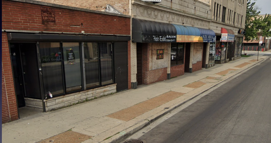
Considering much of Chatham's architecture was planned in aspiration of the stylistic trends during the time period much of Chathams architecture is pretty distinctive. For example, the buildings in the Chatham-Greater Grand Crossing district are home to the historic architecture style of the 1910 and 1920’s in which the district was developed. Particularly, the commercial buildings along 75th and 79th St towards Cottage grove display Classical Renaissance and Gothic Revival designs. So I would say it is possible to broadly characterize the time period in which some developments were established.
1. http://www.encyclopedia.chicagohistory.org/pages/232.html
2. https://www.chipublib.org/fa-chatham-grand-crossing-community-collection/
3. Chatham-Greater Grand Crossing Commercial District Report
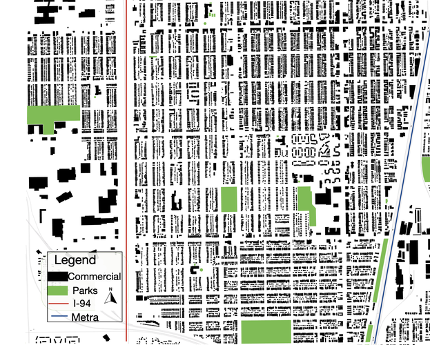
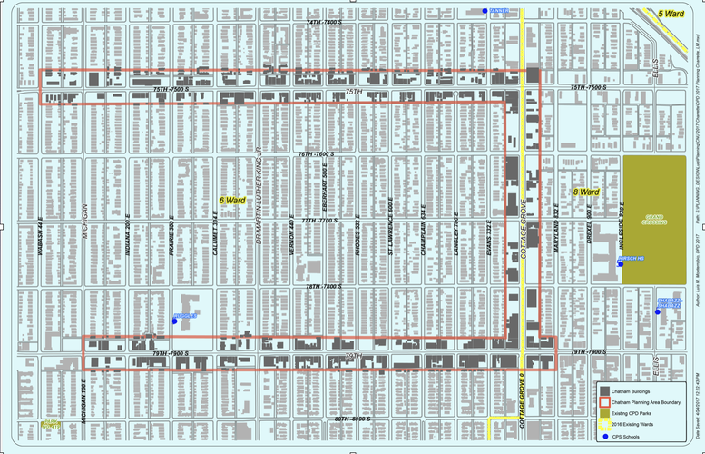
Black and White figure Map
As seen above, this black and white figure-ground depicts how dense the Chatham neighborhood is with respect to residential, commercial, and public space (i.e parks) within the community. The neighborhood itself does have a sustainable amount of greenspace/public parks dispersed throughout the neighborhood, but in recent years the public parks have been extremely declining in quality because of a lack of maintenance, a rise in crime, and other factors that deter residents from engaging with the space. There is one park, however, that has been kept up well in terms of quality and variety of amenities. This park is the one located at the bottom of the diagram called Tuley Park. This park has a variety of things to engage with such as an outdoor pool, tennis court, baseball field, and other things.
Because the neighborhood is relatively compact residents often form tight-knit sub-social groups within the community as a result of such close proximity to one another. Because Chatham is relatively diverse in terms of housing type, there is a somewhat proportionate split between older residents (usually homeowners) and newer families (usually renters/owners). This sort of help creates a more welcoming atmosphere for newer families knowing they’ll be surrounded by neighbors who have much insight into the history of the neighborhood.
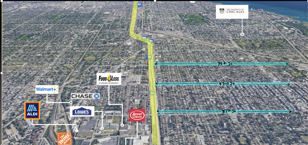
The pieces of black blocks are commercial/privatized footprints within the community. The commercial space located on the west corner of the diagram is called the Chatham Ridge Shopping Center and is roughly 176,000 SF of retail space. The success of Chatham Ridge is entirely dependent on the car traffic flowing through I-94 with a whopping 260,000 VPD. As can be seen above most of the commercial centers are located along of the neighborhood boundaries (with the exception of one) located next to the Park in the center of the neighborhood. This can entail several pros and cons....
75th Street Boardwalk
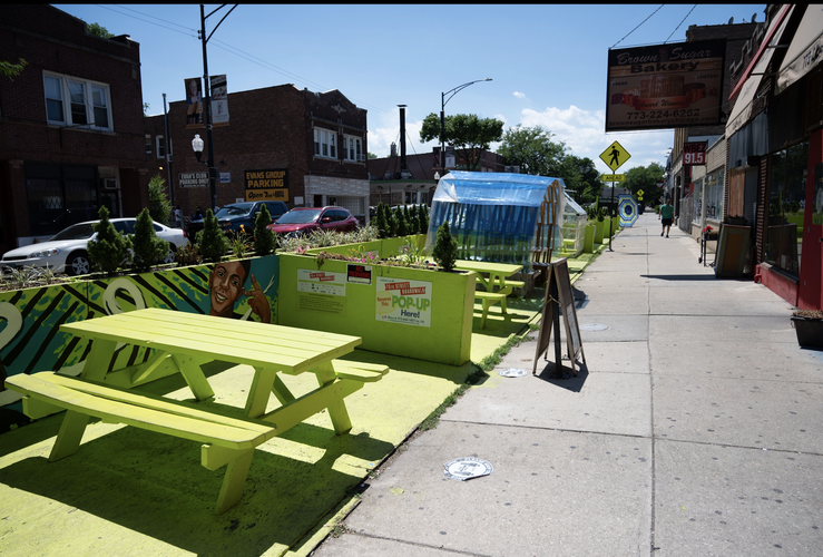
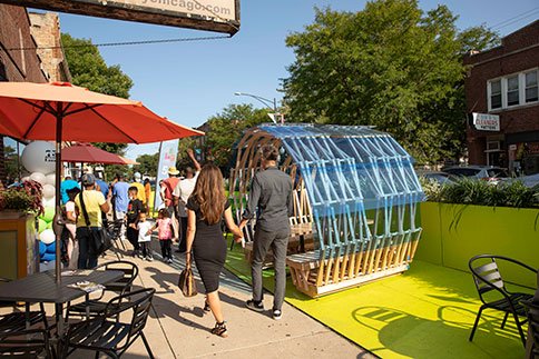
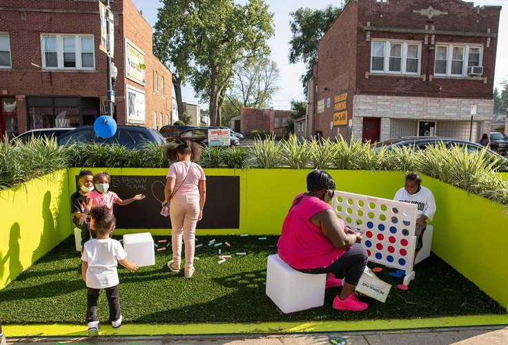
Located along Chatham’s commercial district existed (dismantled in 2021) the 75th Street Boardwalk was created (with the purpose of increasing social interaction, aiding local businesses amidst the Covid-19 pandemic with outdoor dining, etc. This boardwalk was created by the Greater Chatham Initiative with broader hopes of “giving back to the community” by connecting local business owners with youth to expose them to the process of construction and tactical urbanism. Unfortunately, the boardwalk was forced to close as a result of an influx in crime revealing some of the community’s challenges with combating community safety and civic engagement.
This community-led project serves as the perfect example of a place within the community that was created with the purposes of 1)enhancing economic growth within the neighborhood by bringing in different users throughout the day to support local businesses and 2) educating minority youth about the importance of civic engagement through social activities, networking opportunities with community activists, etc. This place, before being deconstructed, was an area within Chatham that people really cared about.
Vs. Community Garden
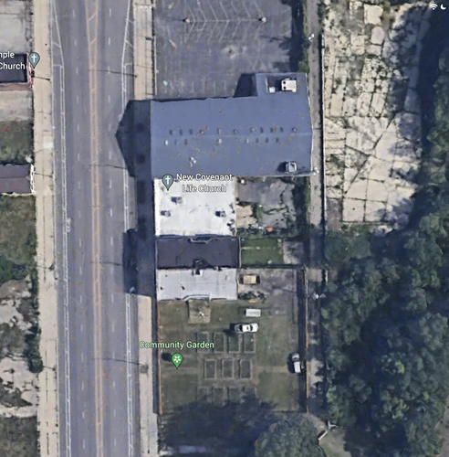
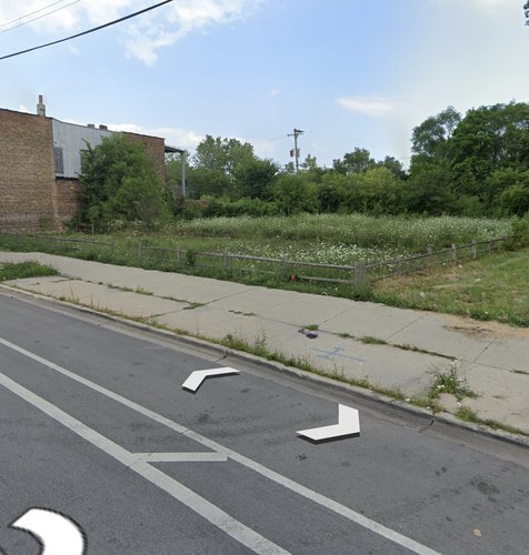
What's supposed to be a community garden that reflects neighborhood identity and supports community members with fresh produce or at the minimum provides a space for social interaction is the Chatham "community" garden. There exist no observable signifiers that this lot is even for the residents of the community. It seems as if the garden was just created by the church it's attached to and labeled a "community garden" though there seems to be no community involvement with the garden. Even if you try to research the garden on the internet, there exists no background or community attached to the garden, leading me to believe it's just a write-off that was planned for with an initial purpose but failed to follow through with its contribution.
Factors:
References
Boardwalk Pictures- https://www.site-design.com/75th-street-boardwalk
Commuinty Garden- Screenshots from Google Earth
Black & White Figure Map- Created through Adobe Illustrator
Daily Life Needs:
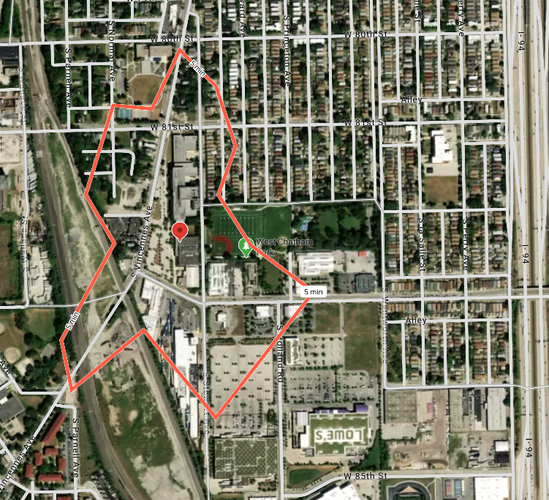
Simeon Career Academy: Population=400 within the quarter-mile shed
Paradise Supermarket: population=6,094 within quater-mile pedestrian shed
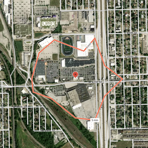
87th Street Chatham Ridge Center: Population= 474 people within quarter-mile pedestrian shed
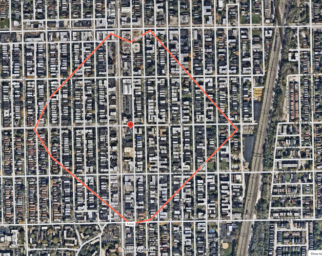
In a community estimated to be around 30,000 people, I found that only a very small portion of Chatham residents have access to the 5-minute pedestrian shed to access daily life necessities such as schools, grocery stores, and banks. This is in part because of how expansive the neighborhood is since it encompasses about 2.92 sq/mi. To illustrate the point that only a very small percentage of the Chatham population has access to the 5 min pedestrian shed I used Social Explorer to calculate the total number of residents living within 5 min (walkable distance) of 4 locations in Chatham. These locations are Simeon Academy, Paradise Market, Chase Bank, and The Chatham Ridge Center. According to social explorer, only 400 people live within a quarter mile of Simeon Career Academy which explains why many people drive their children to school since they’re outside of this 5 min pedestrian shed. The school is also located right next to the railroad tracks so those living on the west side of the school have to walk to either 81st or 84th to cross the railroad to reach the school which is not the most convenient. Similarly, about 474 people live within 5 min walking distance from the Chatham ridge shopping center. This is more than likely because of the complicated street thoroughfares, and an extremely large parking lot that takes up more square footage than the actual center itself. Though the mall encompasses almost everything residents need for their daily lives, it's not the most pedestrian. There are only 2 entrances that have sidewalks for pedestrians to enter located on 87th street. This is mostly because of how dependent the center is on car traffic which is one of the main reasons why the center does well financially since I-94 located on the east side of the center has 260,000 VPD.
Since the Chatham community is so expansive with a very small amount of grocery stores distributed throughout the neighborhood, only about 6,094 residents have access to the 5 min walkable pedestrian shed to Paradise Market. This is in part because there are no grocery stores in the southern part of the community, so the nearest grocery store is Paradise Market which is a little over a mile in distance from the southern edge of Chatham.
To conclude, it is reasonable to estimate that only about a third of the Chathams population has access to the pedestrian shed to access daily life needs. This is not only the result of vehicle-dependent development but also because of the lack of daily life essentials within the community alone. There are only about 5 grocery stores, but about three of them are located relatively close to each other leaving a sizable number of residents that live on the opposite side of the highway without walkable access. Even if they did decide to walk/bike to one of the grocery stores the route to do so is complicated and is not the best in quality (i.e disinvested roads, car-heavy thoroughfares, etc).
References:
Statistics from Social Explorer
Screenshots from Social Explorer
Block Types
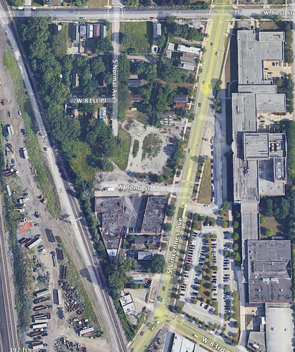
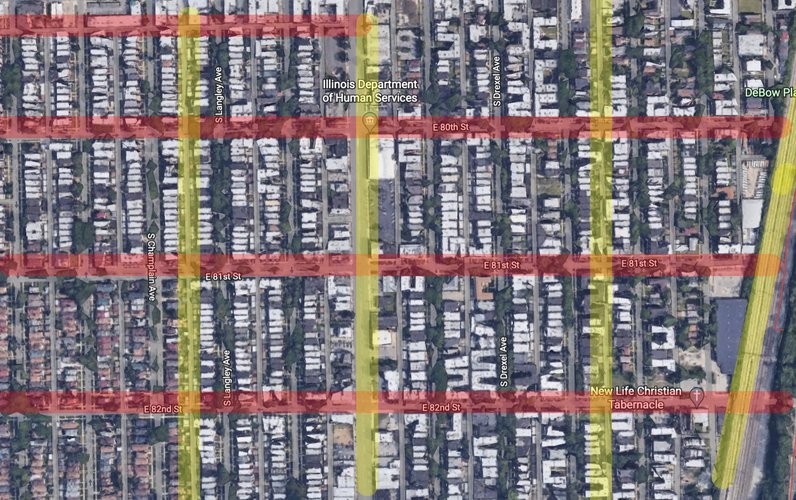
Most of the Chatham Neighborhood consists of elongated blocks that run north-south in the northern part of the neighborhood and east-west in the southern part past the 87th street thoroughfare. Most of the elongated blocks in the neighborhood range from about 400-600 square ft. This can be helpful in reducing the number of people that use their cars seeing that it doesn't take long to reach the main streets that either border or cut through the neighborhood. There are also a minority of irregular block types near the eastern border of the neighborhood, which has a minor effect on the flow of traffic which is described in the analysis.
Network Types
For the most part, the Chatham neighborhood follows the Savannah Pattern considering its “directional orientation”, with the exception of a few irregular blocks located near the eastern border of Chatham (Along Vincennes Street). The few irregular blocks lack controllable lot depth seeing how they differ from the vast majority of block types which are more uniform in lot depth closer to the center of the neighborhood. Within these networks, the traffic is somewhat evenly dispersed considering the web of straight lines that make up most of the thoroughfares throughout the neighborhood.
Throughfares
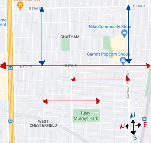
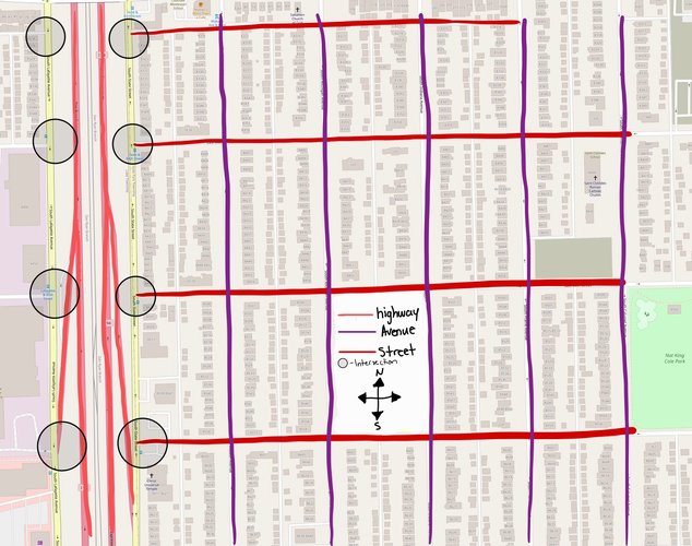
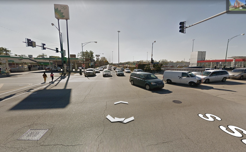
In terms of thoroughfares, Chatham has a few different types of thoroughfares in the neighborhood. For example, there are 4 300-500 ft intersections (as shown above on state st) located along the main streets that run east-west which are created from highway I-94. Chatham also has avenues that run north-south on the three main streets starting from 79th, 83rd, and 87.
Overall, the Chatham neighborhood is relatively connected, but there are a few that create a sort of disadvantage for the residents when it comes to pedestrian-friendly street walkability. One of them is the distance between accessing grocery stores and other essential needs that are located further away from the center of the community causing many people to have to walk far distances or use a car if they have one. However, the number of CTA routes that cross through the neighborhood compensates for this sort of urban disruption, therefore, allowing people to have more access to public transportation if necessary.
Within the neighborhood, there are 4 main intersections that are described above, that are created for the accessibility of the highway (I-94/Dan Ryan) that runs parallel through the western half of Chatham. From what I could analyze, those main intersections, which all have gas stations on the corner of them don’t work to create a more connected neighborhood in terms of neighborhood identity, rather they are simply used as a tool for controlling mass traffic.
Chatham’s built environment does a fairly good job of having a balance of connectivity without disturbing pedestrian access to walking throughout the neighborhood. However, the highway that runs directly through the neighborhood creates a sort of obstacle for pedestrians to walk without having to cross the major thoroughfares to access daily essentials. The irregular blocks, towards to western half of the neighborhood (as described above) also have a minor impact on the directional orientation of the neighborhood and its relationship to traffic. Since the majority of the neighborhood is built on elongated blocks it seems likely that residents feel more comfortable walking to nearby local businesses which are not only helpful for community social ties but also small business sustainability.
Chatham lacks accessible essential services that residents can access through the pedestrian shed model. So my interventions are mainly focused on improving the location of services and the accessibility to these services by 1)redeveloping the main streets into commercial corridors 2)improving sidewalks to make them more pedestrian-friendly and 3) revitalizing empty parking lots for local businesses. I believe these interventions combined have the potential to not only improve the servicing of the neighborhood but also improve Chatham’s community identity.
By developing more local businesses along Chatham's main streets (79, 83, 87th st) Chatham residents would be inclined to shop locally since there would be more local options as opposed to traveling 3 plus miles to the nearest commercial corridor on 87th street. Chatham residents will also have the ability to access the pedestrian shed model to access daily life essentials without the physical barrier of having to cross I-94 just to access things like grocery stores and pharmacies. However, to ensure residents will use this sort of development in a way that creates access there would need to be simple improvements made to the pedestrianization of the built environment for residents to feel comfortable and safe using the streets and sidewalks, which will be discussed later in this proposal.
On a smaller scale, the image below represents how the commercial corridors would look on each street. There would be local businesses that run on the main streets and on the streets that connect the main streets so that those that live within a 1-mile radius have access to these businesses without the barrier of any delineating thoroughfares like the one above. Having local businesses on the east side of the thoroughfare would inevitably create a local Vs. Corporate balance within the neighborhood so residents have the option to choose from a variety of business types.
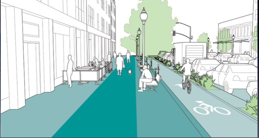
To encourage residents to use their cars less and walk more the physical design of the streets within Chatham would have to be improved. This is why my intervention to improve the amenities along the sidewalks and bike lanes directly relate to the sustainability of the local business investment. If streets are physically attractive inevitably more residents would be more inclined to use them when accessing services within the neighborhood. Iimproving the sidewalks would not only encourage residents to walk more but would increase the likelihood of social interaction. In this way, residents would begin to familiarize themselves with those they encounter while accessing primary uses, which all builds up to the success of community identity since there is more social contact with other residents and local business owners.
I believe that by improving the existing physical development that currently hinders pedestrian usage Chatham residents would begin to use the sidewalks more to travel to essential services such as banks/ATMs, grocery stores, and other mixed-use developments. Chatham also currently lacks any pedestrian-friendly amenities along the sidewalks and even lacks bike lanes. Therefore, by transforming the sidewalks into useable physical structures that allow for social connection many more residents would feel inclined to use their cars less and use the sidewalks more.
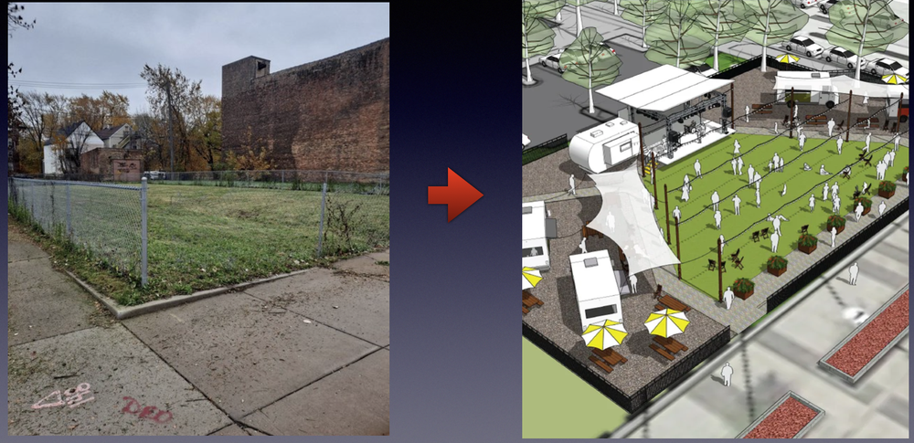
Revitalizing the vacant lots into social destinations for local businesses such as food trucks, etc local businesses will likely expand their consumer base while also aiding the community with a destination for community gatherings and other social opportunities. Through the use of nearby lots for local businesses, residents would be inclined to shop at other local businesses if they are nearby and can be accessed on foot which directly aligns with my intervention to revitalize the main streets into commercial centers for local businesses.
Essentially, my proposal is to not only improve the existing physical deficiencies in the Chatham community but also to provide the community with an abundance of accessible mixed used services to meet the daily needs of community members. It is my belief that the idea of improving the “daily life needs” of a low-income community cannot be fully understood without the interventions of improving access to essential services such as grocery stores, libraries, retail stores, etc. Conclusively, this is why the overarching public objective of my proposal is centered around the preservation or development of local business sustainability to not only aid the community economically but also to reinforce the pre-existing social familiarity that has been loist as a result of larger forces that have negatively affected the community as a whole.
“Chatham Ridge Shopping Center.” Stone Real Estate, 21 Sept. 2022, https://stonerealestate.com/project/chatham-ridge-shopping-center/.
Chatham Commercial Design Guidelines - Chicago. City of Chicago Department of Planning and Development, Dec. 2018, https://www.chicago.gov/content/dam/city/depts/zlup/Planning_and_Policy/Publications/chatham-design-guidelines.pdf.
Ink, Social. “Sidewalks.” National Association of City Transportation Officials, 24 July 2015, https://nacto.org/publication/urban-street-design-guide/street-design-elements/sidewalks/.
Social Mix
Racial Makeup
Diversity: 1.09/5
Education Attainment
Diversity: 3.99/7
Age
Diversity: 9.85/12
Housing Tenure
Diversity: 1.96/2
Housing Value
Like many Southside communities, the Chatham community possesses very little racial/ethnic diversity. On the Simpson Diversity Scale, it ranks a whopping 1.08/5. It is reasonable to assume this is the result of the series of events beginning in the 60s with the migration of black families (“white flight”) thus explaining why the SDI for the racial category is pretty homogenous. In terms of education, a sizeable amount of Chathamans has at least some form of higher learning above a high school diploma. The SDI for the Chatham neighborhood education attainment is 3.99/7, which is not too diverse in comparison to the southside community which has an SDI in the educational attainment of 5.3/7. However, if compared to its neighboring community, Greater Grand Crossing, which is also a predominantly black community, the score is pretty much the same being 4.29/7. On a wider scope, the SDI for educational attainment in the city as a whole is 5.75/8, which means that most of the categories for educational attainment have almost an even amount of distribution, but not too much. As far as housing tenure on the community level, there is a decent amount of diversity as to the number of owners/renters in the community. The SDI for housing tenure for total occupied units is 1.67/2, thus making the community diverse in this single facet. Similarly, at every other geographic level (i.e City/Southside/Community Area) the diversity for housing tenure is consistent with that of Chatham's diversity index.
In sum, the Chatham community aware of its struggles with respect to education inequity and racial homogeneity is still a historic community with a very rich background/history. I assume that because of the steep decline in investment and development within the community the past few decades have reconstructed the community's identity in a way that is completely different from its middle-class history. As a result of this disinvestment, many of the categories being defined above are not very heterogeneous, thus making this community look a bit less attractive to a broader audience.