Overview
Social Mix
Public Space
Amenities
Connections
Final Project
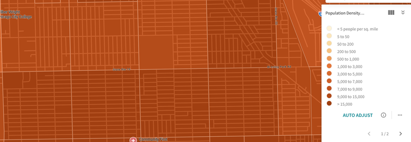
Both as a community area and as an individual neighborhood, Portage Park is quite a large. Using both Social Explorer and Google Earth, we are able to find that the Portage Park neighborhood is about 1,430 acres (or about 2.23 square miles) in area and has around 35,000 to 40,000 people.
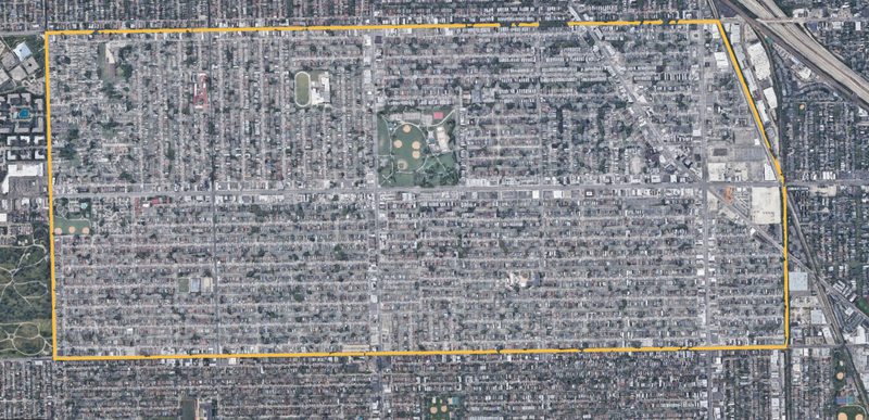
Portage Park has a pretty strong sense of identity as a neighborhood itself. What I mean by this is that there are obvious signs that show a strong identity with the location of Portage Park. It has been known as a working-class and blue collar area that, while far away from the city center that was formerly the main center of immigration, was a neighborhood that brought in people who had been residents of the city and surrounding area for years and immigrants. Much of these characteristics still continue to this day. Weaker now is a tie with a specific ethnic group. In the past, Portage Park had the largest Polish population in the city, now supplanted by the neighborhood to the north, Jefferson Park. Yet despite this, the area remains a hub for both older Polish residents and newer immigrants. Throughout the area there are many businesses and organizations that either directly serve the Polish community or have signage that included the Polish language. These include the Polish Jesuit center, the Polish American Association, travel agencies, salons, and more. Recently, there has been an increase in the amount of Latines in the area, especially over the past 20 years. While the main group of Latine residents are Mexicans, other ethnic groups are also moving to the neighborhood. These include Puerto Ricans, Colombians, and Guatemalans. Slowly but surely restaurants and businesses catering to these groups are increasing within the area, along with the increase of signage and advertisements in Spanish. This neighborhood and others in the Far Northwest Side of the city with similar populations often follow a trilingual system where English, Spanish, and Polish are used in advertisements, signs in grocery stores, help wanted signs, and occasionally documents from alderpeople or other city related groups. This is unfortunately changing as the Polish population continues to move out farther north and west into other neighborhoods of the city and towards the suburbs, meaning the neighborhood once known as the heart of the Polish community may lose that all together in the next 30-50 years. These groups and others have left the area with many Catholic churches and a continued strong Catholic presence in the area. Although there are other Christian sects in the area, such as Baptists, Lutherans, Eastern Orthodox, and non-denominal Christians.There also exist smaller pockets of other ethnic groups, such as Irish, Italians, Germans, English, and Filipinos, among others.
Physical indicators that show an identity for Portage Park include the namesake park, which is situated at the center of the neighborhood off the main streets of Irving Park Road and Central Avenue. Portage Park was constructed with the intention to unite the several ethnic groups that inhabited the neighborhood. It succeeded in achieving this and continues to do so to this date, with many youth sports teams, martial arts organizations, community groups, and the general public making use of the park and its various facilities throughout the year. One major attraction that especially unites the community is the Portage Park Farmer's Market, run by the Friends of Portage Park, which is held from the beginning of June to the first Sunday of October. The neighborhood's boundaries are mostly built off of major streets, those being Narraganset Avenue to the west, Addison Street to the south, and Montrose Avenue to the north, with the exception of the eastern boundary which is built off of railroad tracks that service the Metra and freight trains. These tracks are elevated above Irving Park Road, below on the sidewalks are signs that designate which neighborhood you are entering. If one walks east on Irving Park, the signs show that you are entering the neighborhood of Old Irving Park, while if you are walking west on Irving, the signs show that you are entering Portage Park, marking an obvious boundary to the neighborhood. What also helped was to look into how other neighborhoods that border Portage Park define themselves. Such as the Jefferson Park neighborhood to the north, which defines its southern boundary as Montrose Avenue, giving a limit to the area of Portage Park.
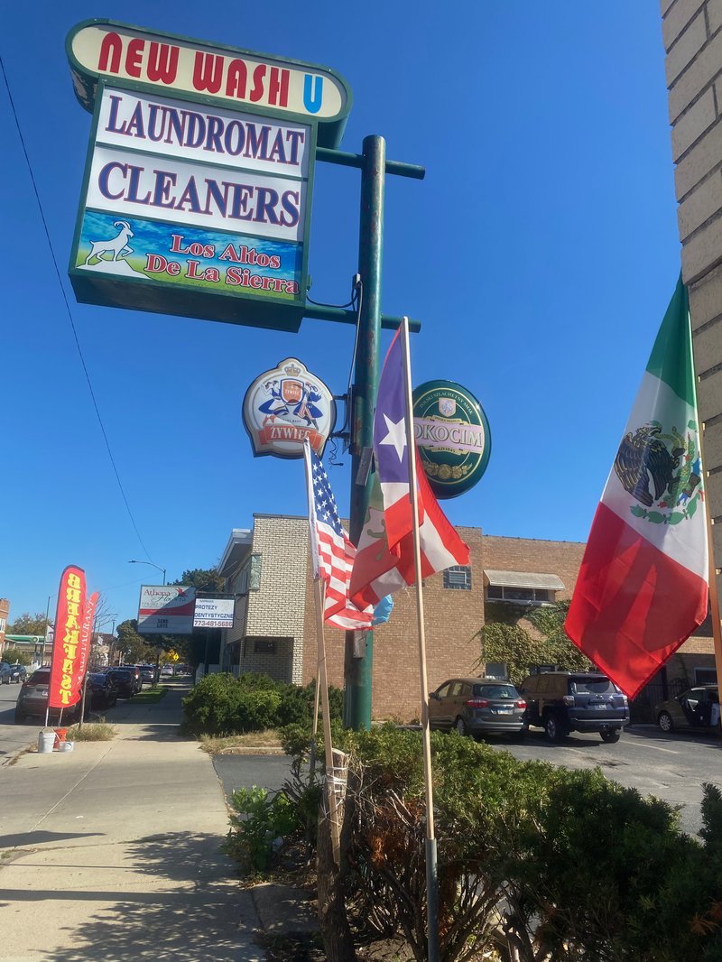
(Above shows sign of a mini plaza with a corner store that focuses on Spanish foods, specifically Puerto Rican [6043 W Addison St]. Shown are flags of various Latine ethnic groups and of the United States (in order, Guatemala, United States, Puerto Rico, Mexico). Also shown are two Polish beer companies, Żywiec Brewery and and Ococim brewery, and other businesses with Polish signs)
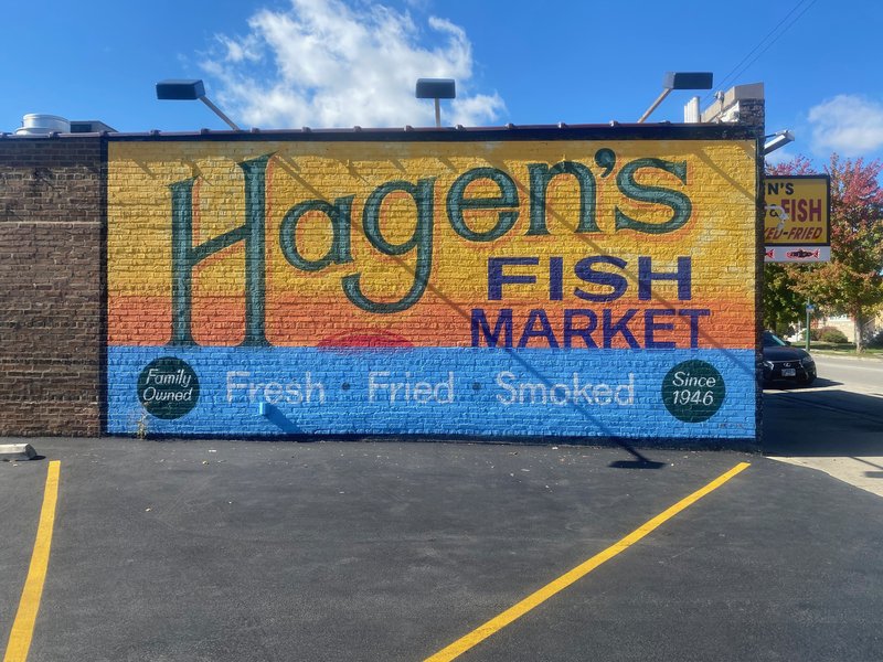
(Above is the side of Hagen's Fish Market [5635 W Montrose Ave], a family owned German store that has been around since 1946, well-known in the neighborhood and city at large)
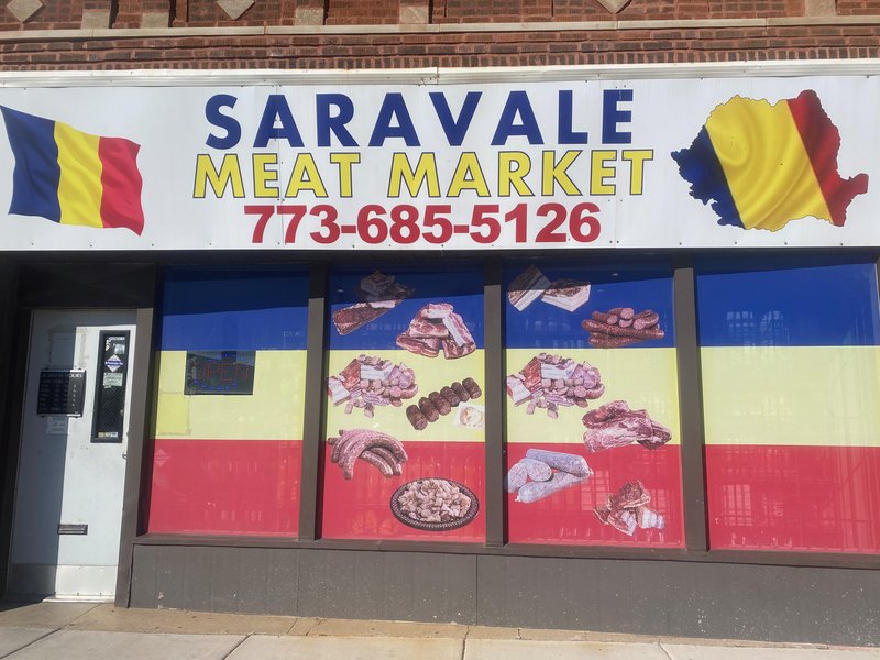
(Above is Saravale [5254 W Irving Park Rd], a family owned Romanian butchery that has been around since 2004 per the owner's words on Google)
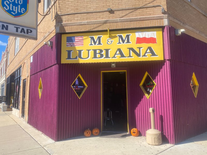
(Above is a Polish bar called Lubiana [6100 W Addison St])
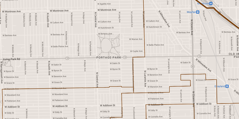
Here we can see the wards that cover the Portage Park neighborhood. We can see it is politically fragmented by the ward system, in a way that hints at the how the city of Chicago sees the demographic shift as changing the political landscape of the neighborhood. The north and northwest side is in the 38th Ward (Nicholas Sposato), the south and southwest side is in the 36th Ward (Gilbert Villegas), the east side is in the 45th Ward (James M. Gardiner), and the southeast side is in the 30th Ward (Ariel E. Reboyras)
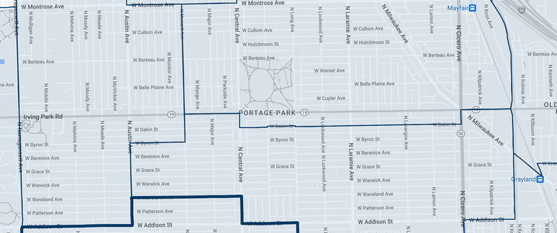
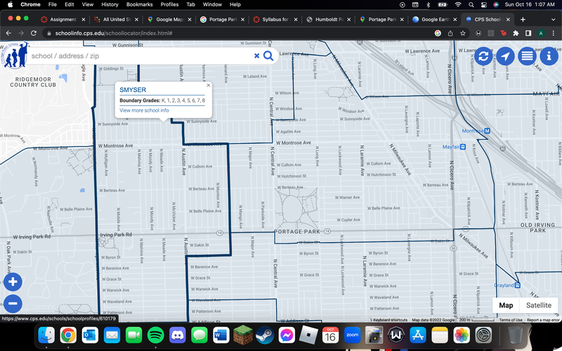
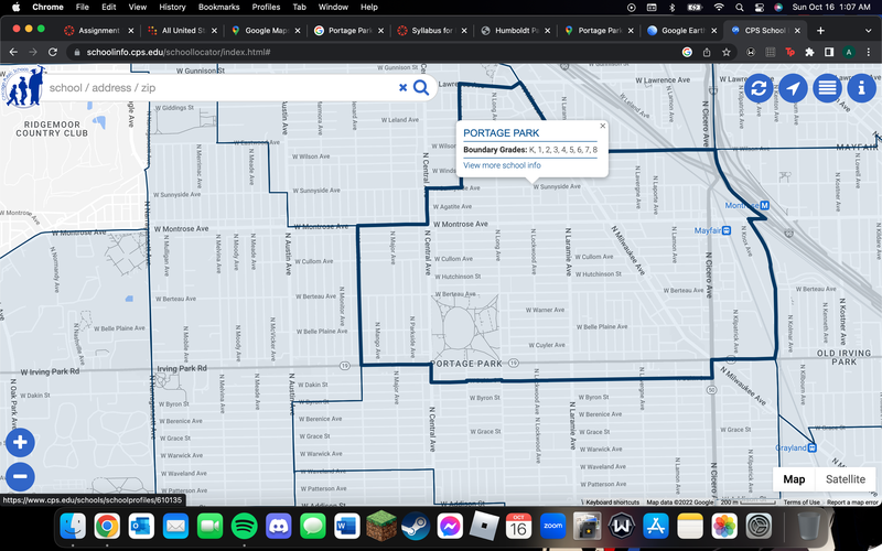
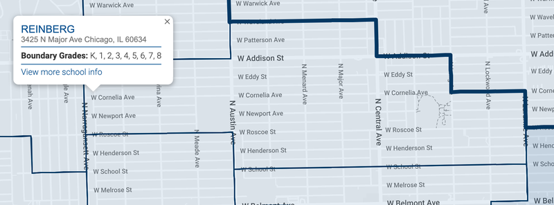
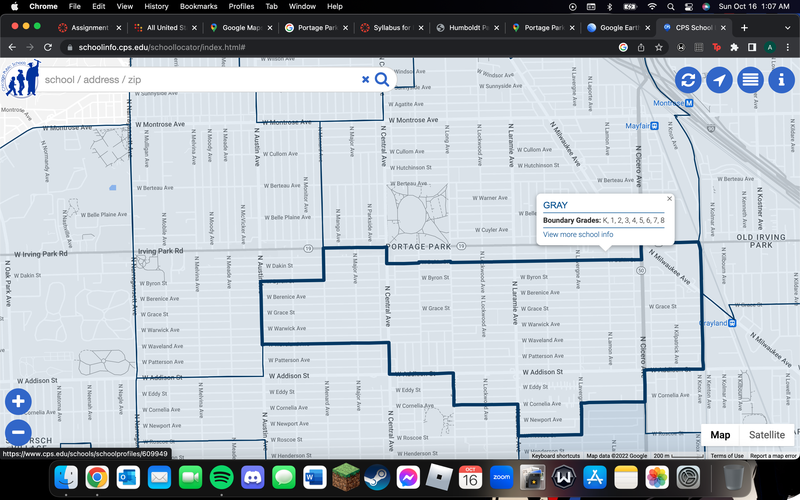
Here is CPS' map of elementary school zonings. Four schools service the neighborhood. The west side is in the Smyser Elementary zone, the north and northeast side is within the Portage Park Elementary zone, the south side and southeast side is within the Grey Elementary zone, the farthest southwest portion is within the Reinberg Elementary zone.
Before the colonization of the Americas, the land that is now known as Portage Park was inhabited by the Chippewa, Ottawa, Potawatomi, and Kickapoo tribes. The land was very swampy, much like the rest of the Chicagoland area, and was consistently filled with water every spring, water that was navigable via canoe, yet not enough for it to stay as a lake. This lead to the tribes of this land to use it as a way to travel quickly through the region, often to go in between the Des Plaines and Chicago Rivers. The French later encountered these lands in their exploration of the Great Lakes region and the southern end of Lake Michigan in the 17th and 18th centuries. The term for this in French is portage, which is to carry water craft or cargo over land, either around an obstacle in a river, or between two bodies of water, including the usage of other water sources. Thus arose the name of this general region of Illinois and later to the much smaller portion of it now called Portage Park. As this land traded hands from the French to the British and then to the Americans, it was forcibly settled starting in 1803 with the creation of Fort Dearborn. Most of the land that is now Portage Park was ceded to the United States not long after, but was not easily settled due to consistent pressure from Native Americans to the north and west. But they were removed in 1837 after the Black Hawk War, thus leaving the area open to colonization.
Soon after, an inn was constructed by E. B. Sutherland, who sold it to Chester Dickinson. This inn is where residents organized Jefferson Township, which stretched in between Harlem and Western Avenues west to east, and Devon and North Avenues north to South. This township layed the foundation for most of the north and northwest sides of the city, especially the northwest side. Here, despite the condition of the land, many farmers began to settle. Initially Germans and Scandinavians, and later Polish farmers. Maloof and Pogorzelski described it as the "rustic heartland of Jefferson Township". Soon we begin to see the areas around Central and Irving Park Avenues begin to develop, along with the economic hub of Six Corners, centered around the intersection of Cicero, Irving Park, and Milwaukee Avenues, beginning with the LaSalle Bank, which at one point served as the town hall of Jefferson Township. Residents at the time attempted to fight attempts at development, wanting to keep the rustic and rural character of the area. In the 1850s, residents blocked the Chicago and Northwest railroad companies from building a line through their lands. There was later a compromise just east of Cicero that would come to define the boundaries of the neighborhood and bring development. As time went on suburban developments popped up here and there, but the land was still mostly rural. That was until Jefferson Township was annexed in 1889, where it became incorporated into the city of Chicago and began to receive greater resources and more infrastructure form the city, leading to new found growth. Here we also begin to see a change in the trend of homeownership in the city, as by 1920, over 60 percent of people in Portage Park owned their own homes, versus 25 percent throughout the city. Now there was a mass influx of immigrants from Southern and Eastern Europe into the area, namely Polish immigrants who would come to inhabit the area and define it as a new home for the community away from their original origin in the inner city. The neighborhood continued to develop more into a residential city area throughout the 20th century, with Portage Park being built in 1913 to give green space and a new central area for residents to converge and converse in. To this day, as described earlier in the Identity section, the area continues to hold on to its working class and blue collar identity, with a still present Polish community, while also beginning to change in terms of its ethnic and racial demographics.
Sources
1. Pogorzelski, Daniel, and John Maloof. Portage Park. Arcadia Pub., 2008.
2. Jefferson Park Neighborhood Association, 2008. http://www.jpna.net/.
3. All photos were taken by me
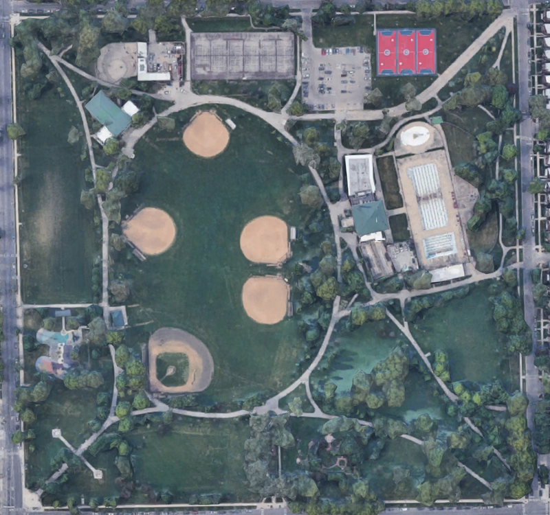
(Portage Park)
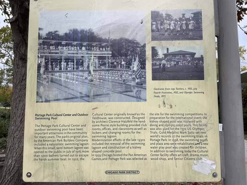
(Sign explaining history of the Olympic size swimming pool located in the park)
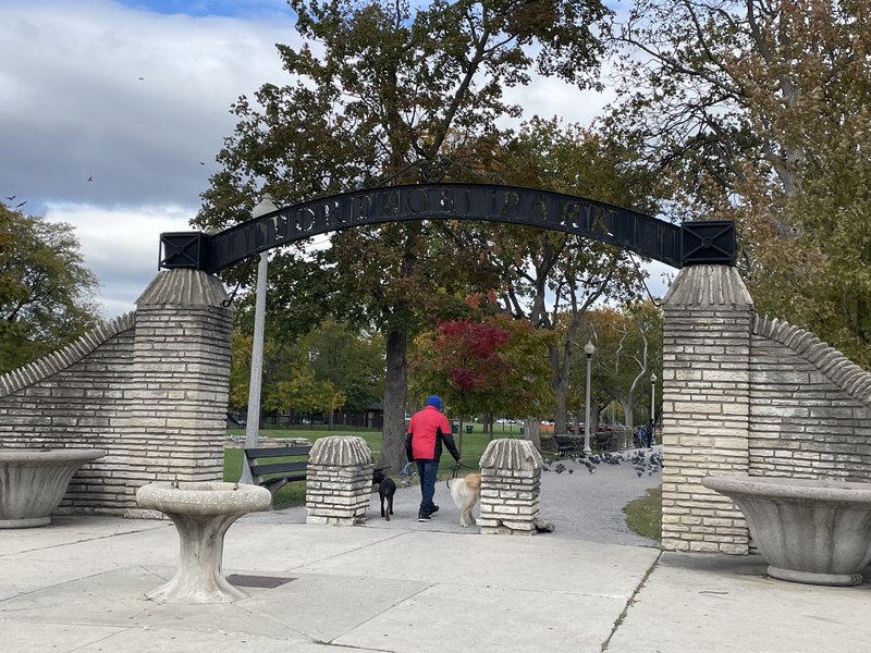
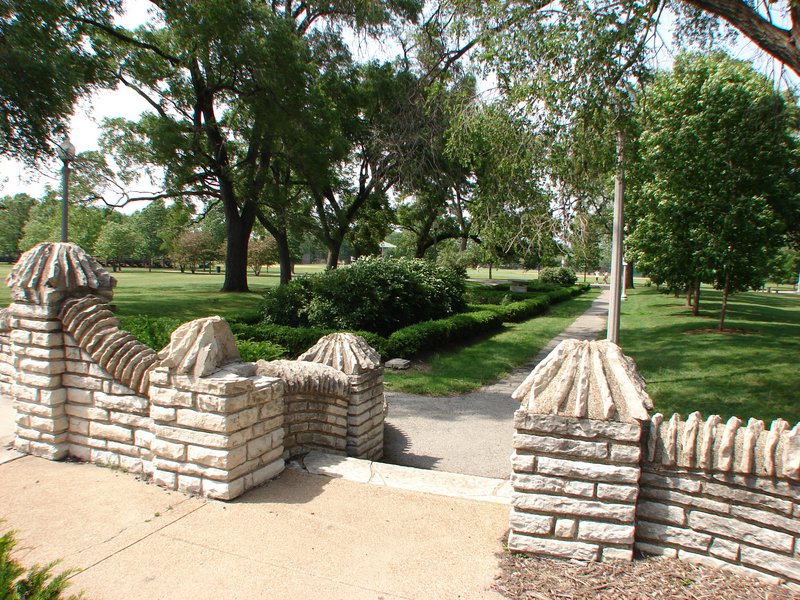
(Southwest entrance at the corner of Irving and Central)
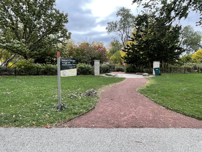
(Nature area)
If there is one place in Portage Park that is the center of the neighborhood, it has to be its namesake, Portage Park. Built in 1913 by the Old Portage Park District, it is bordered by Irving Park Road to the south, Central Avenue to the west, Berteau Avenue to the north, and Long Avenue to the east. The intention of the park was to both provide a large green public space for the people of the former Jefferson Township area to congregate and interact with one another. It is considered to be the main binding agent that lead to the actual formation of the neighborhood identity. It worked to unite the various ethnic groups living in the area as well. It is also a part of the National Register of Historic Places.
Using the Place diagram from the Project for Public Spaces as a guide and years worth of trips as knowledge, I have come to notice many positives about the park as a public space as well as negative aspects. Starting with the Uses and Activities, we see the park is home to many good areas for local families to use, with playgrounds, baseball fields, two field houses, swimming facilities, and other recreational spaces open year round for people to enjoy. It is also just south of the major street and one of the major intersections of the neighborhood, Irving and Central. It has a variety of businesses, both smaller, family run stores and larger corporate stores. They cover a variety of needs. From restaurants, gyms, cafes, convenience stores, salons, markets, and much more. It also borders residential areas all around it, with blocks of houses just south of Irving Park as well. The proximity of these many areas of commerce, recreation, and residence show a strong showing in the category of Uses and Activities. Next in Comfort and Image, Portage Park is historically known as one of the best parks in the city and arguably the best park on the far northwest side. It is quite clean, with minimal trash around and a good deal of trash and recycling cans. Although I do believe there could be more, as in some sections, such as the southeast, there is a long ways to walk before reaching either. In terms of walkability, while it is a large park, it has plenty of pathways that are well kept to make walking easy, along with large fields that are easy to navigate as well. Plant life is abundant in this park, with an entire nature area that sustains plants that are native to the region. The buildings are a little bit shabby, especially the field house that houses the gymnasium and outdoor pool. But not to the point of looking abandoned or neglected. Another issue is the lack of moveable seats, as while there are a good amount of benches and grass to sit or lay on, there is no mobile seating available, even in areas where it may be nice to have, such as again in the southeast corner. Overall, Portage Park puts on another good showing in this category. In terms of sociability, it is quite easy to be sociable with your neighbors in this area as there are places to congregate, such as the dog park, the bench row on the path leading from the Irving and Central entrance, and plenty of events in the warmer months to bring the community together, such as the Portage Park Farmer's Market and various youth sports teams that make use of the park for games and practices. Now one area that is somewhat lacking is the Access and linkages, as traffic in the area is quite heavy due to how close it is to Irving Park and Central. Here it can at times be dangerous to cross even with the stoplights due to the aggressiveness of Chicago drivers. It does make up for it in that it intersects two major bus stops in the Irving Park 80 CTA Bus and the Central 85 CTA Bus.
Sources
1. District, Chicago Park. “Portage Park.” Chicago Park District, 2022. https://www.chicagoparkdistrict.com/parks-facilities/portage-park.
2. Pogorzelski, Daniel, and John Maloof. Portage Park. Charleston, SC: Arcadia Pub., 2008.
3. Public Spaces, Project For. “What Makes a Successful Place?” RSS, 2020. https://www.pps.org/article/grplacefeat.
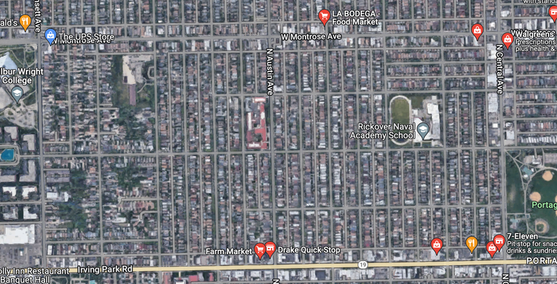
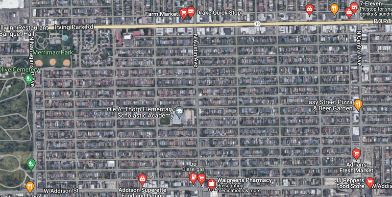
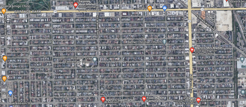
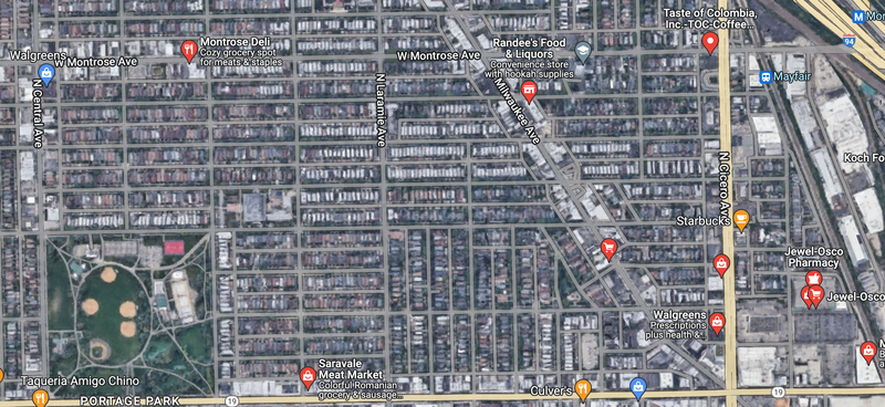
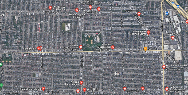
Grocery stores are an essential part of any neighborhood and need to be within a short walk in order to best accommodate people's daily needs. Within Portage Park, we see many of the grocery stores are located around the diagonal main streets of the neighborhood. For residents that live close to these streets it is quite easy to obtain food. But once we get towards the center of the neighborhood at large and the centers of the 4 quadrants of the neighborhoods shown above, it becomes more difficult to obtain food easily and without much walking. On top of this, many of the places shown in the photos are not full grocery stores. Instead, many are smaller corner stores or liquor that may have some essential daily items, such as milk, eggs, bread, etc, but do not have fresh produce or even a larger selection of items that a chain store may have. With this the true amount of grocery stores available dwindles significantly in each part of the neighborhood. Some exceptions to the placement around diagonal streets do exist, such as Adrian's Fresh Market on Central Avenue, which helps people more towards the center of the neighborhood, but is still quite far south. If one travels from the center of Irving Park Road and Central, it takes about 10 minutes to reach Adrian's Fresh Market and the same goes for Saravale Meat Market. Going west the distance grows more to 15 minutes. Already in this short span we see that the ideal of a 5 minute walk for essentials is very difficult to achieve in many parts of the neighborhood. Another possible issue arises in the fact that many of the stores in the neighborhood are marketed towards certain ethnic groups. The Montrose Deli chain and the Farm Market chains are both Polish grocery stores. This fits with the neighborhood's identity, but can also driver away people of other ethnicities in the neighborhood away from their stores simply due to the focus on foods and products they may not be familiar with or keen to. This is in ways alleviated by the emergence of stores owned by and serviced towards Latines, such as Adrian's Fresh Market and Cragin Fresh Market, and larger, general chain stores such as Jewel-Osco, Tony's, and Cermak. But most of these stores are on the boundaries of the neighborhoods or are outright in another neighborhood, pushing walking distances to over 20 minutes. Overall, we that while there does exist a good deal of grocery stores and corner stores in the neighborhood, there exists problems with their distance from the centers of the neighborhood and with ability for some stores to reach out to more groups within the neighborhood.
Portage Park is fortunate to have 4 public elementary schools within there boundaries, along with other private elementary schools in the area. The schools fall rather neatly within the neighborhood with only Reinberg barely being in the neighborhood at all. All of the elementary schools in the area are nested deep into the residential areas of the neighborhood, with the exception of Pope Francis Global Academy, a Catholic private school, which is directly on Addison Street. Travel to elementary schools is thus overall much safer due to many kids not having to cross most major streets and with many residents of the neighborhood being able to keep watch over them as they go through. Some of the school zones do defy this, especially the zonings of Smyser and Portage Park Elementary Schools, as they cover areas that are outside of the neighborhood. Meaning that many kids are quite far away and would need to walk more than 20 minutes to make it to school. This creates a predicament as smaller zoning may be more beneficial to reduce walking distances and promote more neighborhood cohesion, but it may make the pool of students available much smaller and thus make more elementary schools unsustainable by current means of funding.
(Various Block types in Portage Park, all within one area)
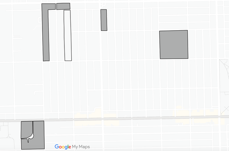
Portage Park is mostly composed on square block, with some larger grid parts of the neighborhood being entirely composed of square blocks. There does exist some elongated blocks, such as shown above, and larger squares that are typically occupied by a school or park area. Only a small handful of blocks could be considered irregular, such as the block on the lower left of the above photo, where a small grass mound divides the street in two, creating a street area that is solely intended for the residents on that smaller part of the street.
Most of the neighborhood would be considered Savannah Pattern, with the exception of the area of Six Corners, which would follow the Washington Pattern, as the intersection of the three streets of Milwaukee, Irving Park, and Cicero create a different pattern. But the development from this part of the neighborhood does not conflict heavily with the grid design and Savannah Pattern of the rest of the neighborhood. Nor does the railroads that form the boundary of the eastern end of the neighborhood.
Portage Park is built primarily on Avenues, Streets, and Alleys. The main roads are all Avenues with the exception of Irving Park Road. In the Lexicon of the New Urbanism, the urban counter part of a road is an avenue. But Irving Park Road handles heavy and fast traffic in a four lane structure, making it more busy than most of the other Avenues in the neighborhood, culminating in the Six Corners area of the neighborhood, where it intersects the other busiest streets of Milwaukee and Cicero Avenues. Alleyways are quite common in the neighborhood, with its less dense and heavily residential structure. These allow for more connectivity in the neighborhood by decreasing the amount of parking on main streets through garages and small parking lots for buildings, and by being a way for residents too avoid heavily crowded main streets during periods of heavy traffic.
Overall, I believe that Portage Park is internally very well connected, with the smaller streets that comprise the neighborhood being easy to navigate and very consistent in terms of type and structure, with the mass majority of blocks being square. The main streets are also quite easy to navigate as while they do have much higher amounts of traffic, the sidewalk structure is built to where cars are rarely right next to the sidewalk. On Irving Park there farthest ends of the road are for parking on the street, working as an attempt to reduce the speed of drivers. This structure extends to the smaller avenues such as Addison and Montrose, as well as north-south avenues like Austin and Laramie. Now while this helps in some areas, I find that Irving Park before Six Corners and the Six Corners area in general are more difficult to navigate, especially Irving Park when you are at a crosswalk without lights. Due to the large size of Irving Park and its lanes, coupled with the distance between some stoplights, drivers tend to be quite reckless and drive at high speeds without stopping for pedestrians. This creates a problem when traveling this street from north to south and vice versa. In term of its connectivity to the city at large, Portage Park is in a weird position. If you live in the eastern and northeast end of the neighborhood, you are quite close to the Blue Line CTA train station and the Metra Stations at both locations. Along with the Metra line that creates the eastern border of the neighborhood. The Blue line stations are outside of the neighborhoods, in Jefferson Park and Old Irving Park respectively, but are quite close by and have buses that go directly to these stations, such as the 80 Irving Park Bus, 56 Milwaukee Bus, 91 Austin Bus, and others. But the distances to these stations, especially if you are on the western end of the neighborhood, are quite difficult and can results in 20+ min bus rides.
Portage Park is at the epicenter of a change in demographics that has been occurring throughout the city of Chicago for the past 50 years. As White and Black people are moving out of the city to the surrounding suburbs and beyond, we're seeing increases in the amount of Latine and Asian people. Portage Park is following most of demographic shifts, with the white population decreasing drastically over the past 20 years, and with Latine groups moving in at the same, along with a smaller amount of Asians. Slightly diverging from the trend is that there has been an increase in black residents in the neighborhood. These newer arrivals into the neighborhood are a mixture of immigrants and residents from other neighborhoods of the city that have become more gentrified and more expensive to live in, such as Logan Square, Pilsen, and Humboldt Park. Yet with these changes we are seeing a demographic shift that is heavily Latine and only such. This is leading to a neighborhood that will become equally as homogenous as before the 1990s, when the neighborhood was last heavily White. Along with this, more of the new residents are lower income, and this creates issues as there are very few affordable options for housing the area. While homes are generally cheaper in this part of the city than in others, they are still out of reach for many and the mainly single family home zoning further worsens this issue. This is why my interventions will be focused on Portage Park for both its current growth and changes, and for facilitating future growth that will diversify the neighborhood economically and ethnically. These interventions are building affordable, mixed use housing, revitalizing Portage Park, the namesake park, and installing stop signs on Irving Park Road.
Multi-family housing outside of two flats, six flats, and horizontally built two-three story apartments, are few and far between in Portage Park. In a part of the city that grew based on its increased lot size and history as a place of homeownership, it is quite easy to see why this is the case. Based on data I calculated from Social Explorer, the Portage Park neighborhood has about 7,777 owner occupied units and 4,404 renter occupied units. The mass majority of those owned are single family homes and the mass majority of renter units are in apartments, with very few vacant units overall in the area. Meaning there are few options for incoming residents who are unable to afford owning a house to live in the neighborhood. On top of this, units that do exist are having their rents rise quite drastically, especially with the pandemic's effect on the economy. Rents on apartments in the neighborhood have nearly doubled in the past 3 years, my family and I knowing this from first hand experience.
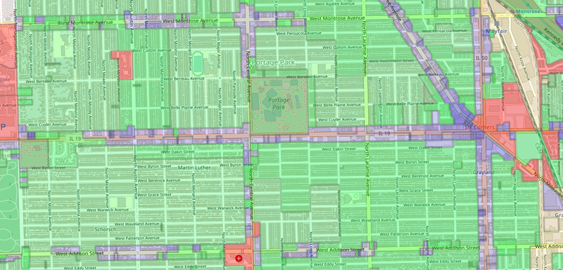
(Zoning Map of Portage Park , from https://secondcityzoning.org/)
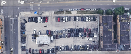
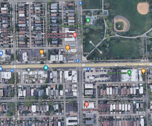
Zoning in the area being primarily single family homes also worsens this crisis. Some areas also allow two to six flats, but most exclude anything larger than that unless they are on the main streets of the neighborhood. Ideally shifting more of these areas from this zoning to denser zonings would help alleviate this problem and is an ideal I hope becomes reality. But with whats available in terms of vacant areas there is only so many places that can allow for increases in affordable housing without tearing down existing homes. One such area is this lot located on the corner of Irving Park Road and Central Avenue shown in the first two photos above. This lot has been vacant and for sale for the past three years outside of cars left there from the time that it was an auto dealer. This lot, with its central location in the heart of the neighborhood, proximity to several CTA buses and train stations, and to the local hospital, can be a great location for a new mid-rise affordable housing development. Ideally it would be in the range of ten to twelve stories, be without a parking lot, with incentives to use the public transport available close by, and with a grocery store occupying the bottom floor. This grocery store would ideally be locally owned, with a possibility being to have one of the many vendors of the local Portage Park Farmer's Market as owners, owing to their familiarity to the neighborhood and possibility to expand their own brand. A chain store would also be a possibility, but I think this is unlikely due to the smaller size of the lot. Regardless, a place where residents can buy fresh groceries, in closer proximity to those in the center who are farther away from other grocery stores, and with tons of foot traffic, can be a great success for both the residents and owners.
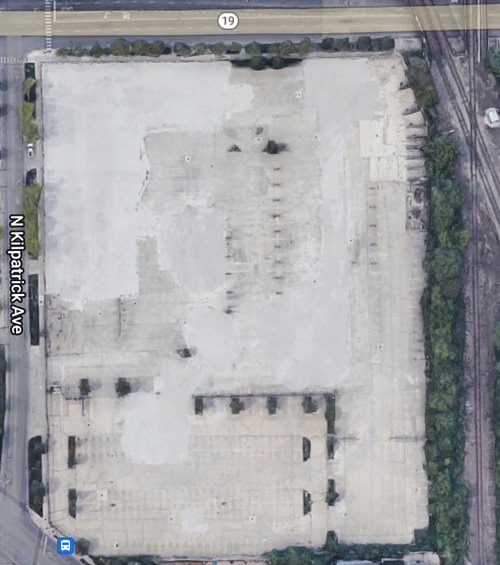
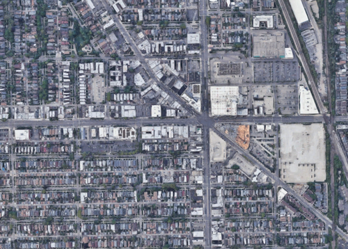
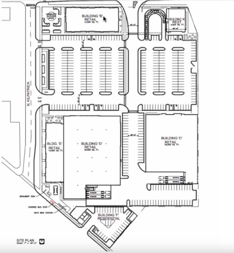
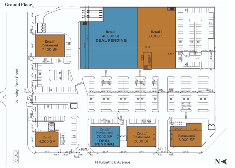
Six Corners, located on the eastern edge of the neighborhood, has been experiencing decline and decay since its peak in the 1950s and 1960s. Before, it was the origin point of Jefferson Township, and later became the economic heart of the entire Northwest Side. Since then, many of its staple stores have closed, such as the Sears that had been a staple in the community since 1938. While there are current construction projects in place that are seeking to bring back stores and people to the area, they are leaving out the housing that is needed in order to facilitate economic growth in the area as a whole. Residents have been very wary of recent plans by developers that are seeking to increase businesses, but not storefront businesses, add more parking lots to the area, and not factor housing at all into their developments. Many have rejected recent proposals for redevelopment of the former location of the People's Gas companies offices for these reasons[3]. That is why I want to focus on it as a place for affordable mixed use housing, instead of simply a shopping mall complex with more parking lots in an area that has too many already.
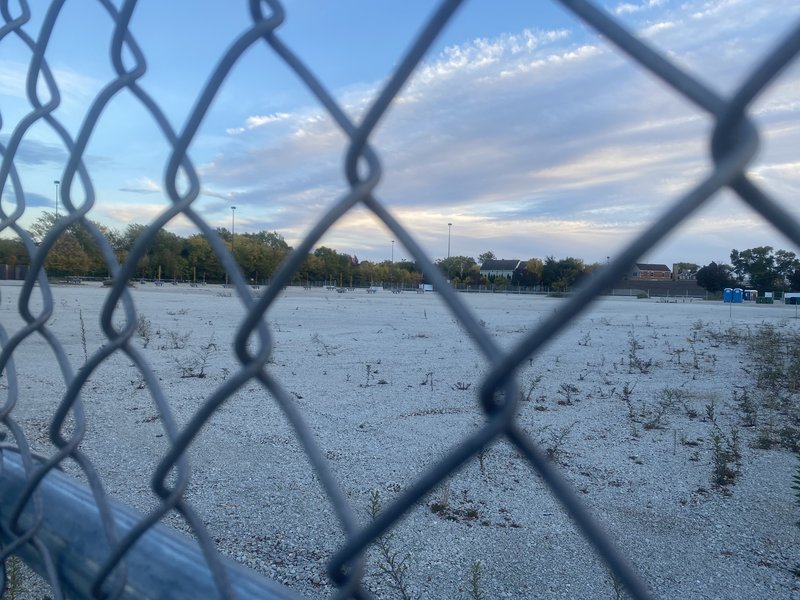
(3955 N. Kilpatrick Ave, the former site of People's Gas and the location I will be focusing on)
(Two plans developed by GW Properties and Mid-Atlantic Real Estate Corporation respectively, note the minimal to no mention of residential buildings and loads of parking lots, all killers of connectivity and social diversity within a neighborhood.)
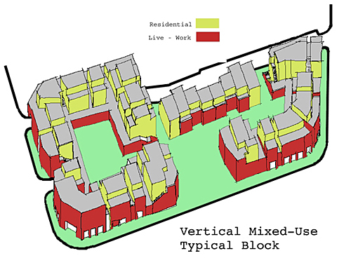
(A reference model of how this area could be developed, from https://www.completecommunitiesde.org/)
I would like to develop this area in a way that is similar to the above, with a focus on storefront options for residents of the buildings, neighborhood, and city at large to enjoy, while having mid to high rise apartments built on top that are also affordable. The stores could be of any variety, but should include stores that cater to daily life needs along with some possibly higher end products. Entertainment could also be a distinct focus here as a neighborhood needs a variety of activities within it to stimulate growth and to allow residents a space within their community to have fun and enjoy life. A smaller parking lot may be built towards the train tracks that can be available for resident usage or be for employees and suppliers. Ideally, many residents living within the building itself could work for these stores, eliminating the need for employee parking. These residents would have an even greater incentive to ditch car usage as they are very close to the Irving Park Blue Line train station and its sister Metra Station, along with living right next to stops for the 56 Milwaukee Bus, 80 Irving Park bus, and 54, 54a, and 54b Cicero buses, the latter which also extend service up towards the northern suburb of Skokie.
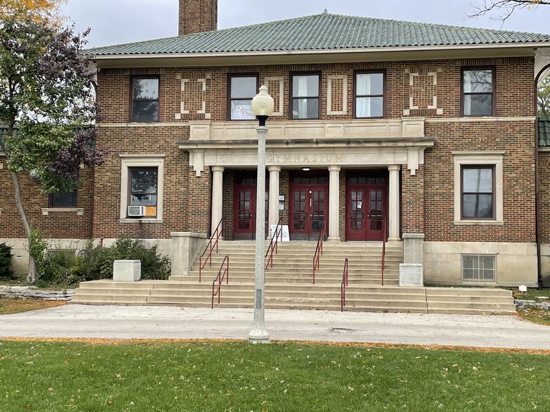
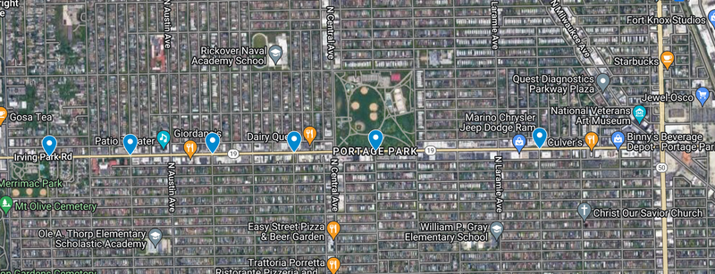
(A google maps view of Portage Park and a photo of the Portage Park gymnasium, which is currently closed and has been for a few years now)
Portage Park was initially constructed as a way to unite the various ethnicities in the neighborhood and worked wonders in doing so, helping to create the neighborhood's modern identity[7]. While Portage Park is still used and is in a generally good state of upkeep, it does have problems that residents have noted over the years. Two of what I believe are the biggest to tackle are issues of seating and the current closure of the Portage Park Gymnasium.
(Taken from Wikipedia article on Portage Park)
As the Google maps image above shows, there is plenty of green space that people can enjoy, with paths that connect the entire area. The problem is that outside of the pathways, which have stationary benches, and the bleachers surrounding some of the baseball diamonds, there are very few places for seating in the park. While people can lay out on the grass, there are some people, such as the elderly and people with physical disabilities, who are not able to do this without possibly harming themselves. There also are often events happening in the park that could see improvement with seating, such as the western field where many soccer and football games are played during the year, and the aforementioned Portage Park Farmer's Market in the southeastern corner of the park. Benches also need to be expanded, as some stretches of the path have large distances between benches, leaving less seating available for people. This is why we need to add some form of mobile seating to the park. Mobile seating will allow for people to be able to seat themselves wherever they please in the park without needing to be in close proximity of the paths. It will also allow for seating to be available for various events in the park, which will increase people's interest and desire to go to these events, especially those with performances. This increase in people in the park will allow for more social interaction between residents and ease any possible tensions that arise between older residents of the neighborhood with newer residents.
Along with this, Portage Park Gymnasium needs to be reopened and revamped with new equipment and updated facilities. Due to its connection with the Portage Park Swimming Pool, these updates would also go to the changing rooms and bathrooms that service the pool. Having this gym be closed puts more pressure on the other fieldhouse in the park to operate the various activities and sports the Park District runs. Reopening it will alleviate this and allow for new activities to take place in the gymnasium and for the other fieldhouse to be more able to host different types of events. One such group that could especially benefit from this is the Portage Park Neighborhood Association, which does not have a specific public building from which it operates. The increased availability of the other fieldhouse can allow for the group to host its meetings there and thus further push Portage Park as the center of the neighborhood. These updates will allow for Portage Park to further facilitate the social diversity this neighborhood needs in order to continue to grow.
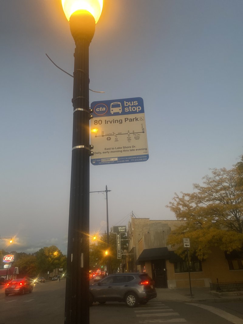
(Bus stop on Irving Park Road, located on Major Avenue, one of the locations I propose to add a stop sign and to repaint the crosswalks)
In an area that is highly residential, has larger lot sizes, and is farther out from the city, there is bound to be more car usage. According to data from Social Explorer, the mass majority of residents own a car and use it to travel to work, with many having jobs in the city or surrounding suburbs. This leads to a large amount of road traffic in the area. While improvements to public transit that make the CTA more efficient and cheaper would be major steps to lessen the dependency on cars, that is not within my area of control in terms of these proposals, nor are major extensions of the closest train lines, the Blue and Green Lines, feasible economically to the area at this time. My other proposals deal with lessening car dependence with newer residents, and I believe that these new developments will decrease car dependence amongst older residents as well with the increase in stores, activities, and jobs closer to the neighborhood instead of outside of it.
(Irving Park Road in Portage Park, with my proposed locations for stop sign)
With that being said, Irving Park Road as it is now has parts of it that are not pedestrian friendly, leaving a divide that splits the neighborhood in two due to the high volume of traffic and especially due to the speed and recklessness of drivers. According to Social Explorer, the majority of Latine, Asian, and Black residents live in the southern and eastern parts of the neighborhood, while the north and west sides are predominantly white, with the neighborhoods surrounding them fitting these demographics as well. This is also reflected in the current and future ward delineations of the neighborhood, with residents being split between four alderpeople, two white, representing the north and west sides, and two Latine, representing the south and east sides of the neighborhood. The census tracks of the neighborhood are mainly divide by Irving Park Road, reflecting its role in this divide. Irving Park Road's high speed traffic hinders residents from crossing it, leaving residents to prefer being in areas away from the center or other end of the neighborhood, lessening social interaction. This means that we need to create a more pedestrian friendly environment that does not have people driving over 50 mph in a 30-40 mph street. This is why I am proposing to put stop signs up on various street intersections of Irving Park Road. The streets I would place stop signs on are Mobile Avenue, where I also propose to add two north-south crosswalks, the street disconnects at Irving Park Road and is not continuous, Meade, Marmora, Major, Linder, and Leclaire Avenues. These avenues are all in between stop lights, but far enough from them where they do not fully inhibit traffic and make Irving Park incredibly slow to travel on. They are all locations where crosswalks are located but difficult to navigate. The addition of these stop signs would also come with repainting of all crosswalks on Irving Park in the neighborhood to make them more visible to drivers. These stop signs would ease the speed of drivers and allow for people to more easily cross the road, allowing for greater connectivity among the residents, and allow for more people to travel towards other parts of the neighborhood.
Overall, these are some of the ways in which Portage Park can improve itself as a neighborhood. Allowing itself to defy the staunch NIMBY attitudes of many of the neighborhoods to the north and west of it will allow it to both adapt to the changes in Chicago's demographics and the neighborhood's demographics. These plans would also give Portage Park an opportunity to revitalize itself economically, with housing needs balanced with economic needs by having buildings with storefronts that fit the needs of both residents and potential customers from around the city.
1. https://secondcityzoning.org/
2. https://www.socialexplorer.com/
3. https://blockclubchicago.org/2021/04/28/neighbors-worry-latest-six-corners-development-plan-could-bring-the-suburbs-to-portage-park-and-hurt-local-businesses/
4. GW Properties
5. Mid-Atlantic Real Estate Corporation
6. https://www.completecommunitiesde.org/
7. Pogorzelski, Daniel, and Maloof, John. Portage Park. Charleston, SC: Arcadia Pub., 2008.
8. https://en.wikipedia.org/wiki/Portage_Park_(Chicago_park)
9. Portage Park Gymnasium photo taken by me
Social Mix
Portage Park Demographics
Simpson Diversity Index
Diversity Analysis
Through the data here, we can see that Portage Park is relatively diverse in terms of the Northwest side of the city of Chicago, with neighborhoods to the north, northwest, and west tending to be more white and racially homogenous. The split of the neighborhood into being majority white and a very large minority Latine does leave much to be desired in terms of diversity. With there being a minimal amount of Asians and Black people in the neighborhood. In terms of housing values, it follows the working class identity that has been long established in the neighborhood, with the mass majority of houses being valued at less than $500,000