Overview
Social Mix
Public Space
Amenities
Connections
Final Project
Population of the Avondale Community Area: 36,000 people (source: https://www.cmap.illinois.gov/documents/10180/126764/Avondale.pdf)
It is important to note that Avondale is the name given to both Chicago’s 21st Community Area and a specific neighborhood contained within it. Most readily available population statistics, presented by the City of Chicago, narrow down population metrics to the community area level. As a result, the city’s statistics do not reach enough of a granular picture to gather the population of the neighborhood itself.
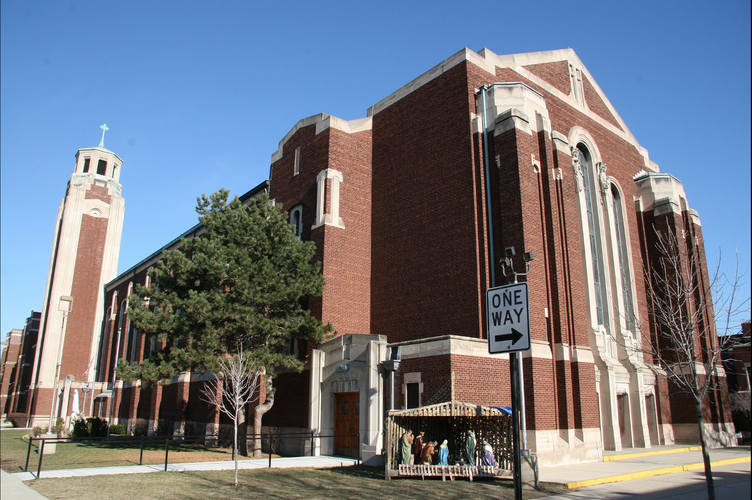
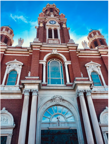
Avondale’s identification as a landmark site of Polish Chicago stems in large part from the cultural institutions established by and for Polish immigrants to the city. From the early stages of Polish migration to Chicago, Catholic parishes played a central role in community formation. Two of the major Polish churches in Chicago, St. Hyacinth’s Basilica and St. Wenceslaus Church, are located in Avondale.
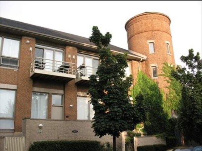
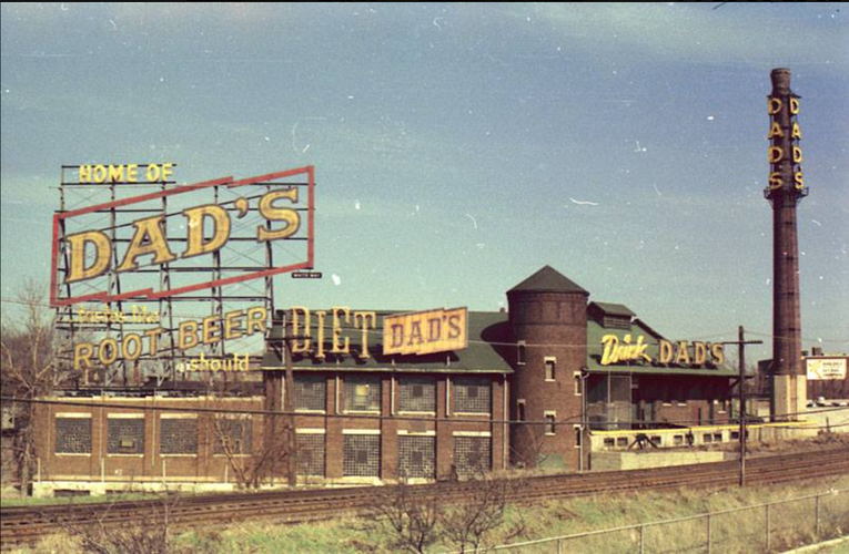
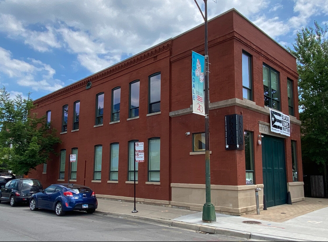
As a relic of its working class and industrial past, there are many remnants of old factories and warehouses that continue to stand out among the neighborhood’s landscape. Some of these facilities have even been restored and converted to residential uses. An example of this is the old Dad’s Root Beer Factory, which today has been repurposed as a condo development.
The more recent influx of Latin American migrants has also left its mark on Avondale, with different types of Latin American (chiefly Mexican and Puerto Rican) restaurants, businesses, and other institutions. One that stands out is the Puerto Rican Arts Alliance, which promotes Puerto Rican culture and musicals heritage while engaging the surrounding community through concerts, apprenticeship programs, and other initiatives.
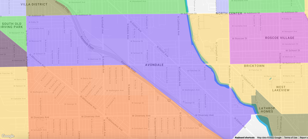
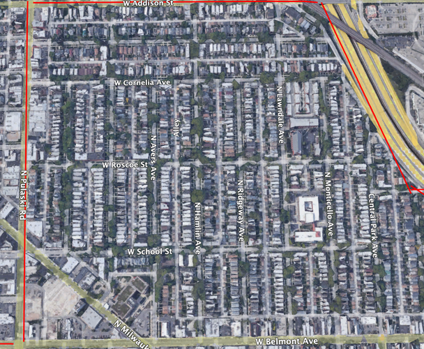
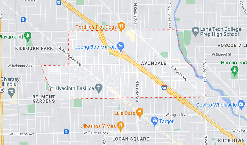
Map of the area considered to constitute the neighborhood of Avondale
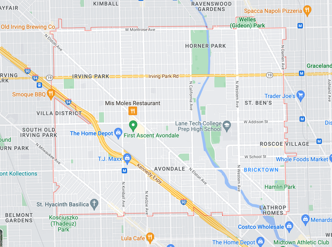
Here we see an outline of the 60618 zip code, which is centered around Avondale’s major streets but also includes Irving Park and St. Ben’s, as well as parts of Logan Square and Roscoe Village (source: https://www.dreamtown.com/maps/chicago-zipcode-map)
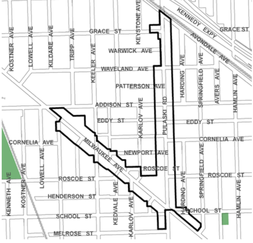
Source: https://www.chicago.gov/city/en/depts/dcd/supp_info/tif/avondale_tif.html
This picture outlines the Avondale TIF zone. Chicago’s Tax Increment Financing Program (TIF) facilitates the financing of neighborhood development or infrastructure improvement projects through capturing the increase in the value of local assets associated with the project in question. Avondale’s TIF is located at the intersection of Pulaski Rd. and Milwaukee Ave., which places it in the northeast part of the neighborhood, along its border with the southern portion of the Old Irving Park neighborhood.
Initially part of various routes of Native American prairie trails through the area, the history of modern-day Avondale can be traced back to the peak of Chicago industry and migration-fueled expansion. Located along both the North Branch of the Chicago River and various important railroad tracks, what was once a sleepy suburb part of the larger Jefferson Township eventually became host to heavy industrial activity. One moniker for the area that persists until today is “the neighborhood that built Chicago” given the crucial importance of Avondale’s brickyards in new, fire-safe construction after the Great Fire of 1971 (as well as the economic weight of its industrial sector).
Avondale, along with the rest of Jefferson Township, would eventually be annexed to Chicago in 1889. This led to a sustained period of rapid growth, during which infrastructure improvements funded by the city consolidated Avondale as a major working class neighborhood within Chicagoland. The availability of industrial employment and the construction of much needed housing stock attracted waves of Scandinavian, Central and Eastern European immigrants through the 1920s. By the 1930s, the Polish population came to constitute over 30% of Avondale’s population, and the area became an important part of Chicago’s larger Polish Village. Polish settlement was especially concentrated in two nodes on the north and west sides of Avondale, two of the so-called “Polish Patches”, known as Jackowo and Wacławowo by the Polish community. The final significant wave of Polish migration, subdivided into the Solidarity and Post-Solidarity migrations of the 80s and 90s, saw Polish institutions in Avondale revitalized by the arrival of a new generation of Polish Chicagoans, along with Eastern Europeans from other post-Soviet States. This period also saw Avondale cemented as a center of political activity and artistic and cultural expression for the Polish diaspora.
Though a Black community settled in Avondale in its early days (in fact, Black parishioners founded the neighborhood's first ever church), the segregationist development policies that have characterized much of the urban growth experienced in Chicago ensured that, for much of its history, the neighborhood’s place as an important center for migrant diasporas in the city was limited to white newcomers. That being said, this began to shift in the 1980s. Throughout the final decades of the 20th century, Avondale became a prominent destination for Mexican and Puerto Rican immigrants. The neighborhood also contains pockets of Central American and Asian diasporic settlement. For example, Avondale is also one of the centers of Chicago’s Filipino community. Though Avondale’s Polish heritage is still baked into the neighborhood ecosystem, much of the Polish population has dispersed to the suburbs or other neighborhoods since its peak in the mid-20th century. By 2000, 62% of the community area’s population self-identified as Hispanic or Latine.
Recent shifts in population dynamics are once again reshaping the neighborhood, as gentrifying forces spreading along the Milwaukee and Elston Avenue corridors challenge the area’s working class history. As a result of gentrification, the area’s white population has been expanding more rapidly than other population groups in yet another reversal of settlement trends in Chicago’s former industrial heavyweights.
References
https://chicago.suntimes.com/entertainment/avondale-neighborhood-things-to-do/#:~:text=Initially%20a%20quiet%20suburb%2C%20Avondale,city%20of%20Chicago%20in%201889.&text=Like%20the%20rest%20of%20the,initial%20settlers%20were%20Native%20Americans.
http://www.encyclopedia.chicagohistory.org/pages/98.html
https://chicago.curbed.com/2016/4/12/11414228/chicago-avondale-neighborhood-guide-polish-village
https://avondaleneighbors.wordpress.com/history-of-avondale/
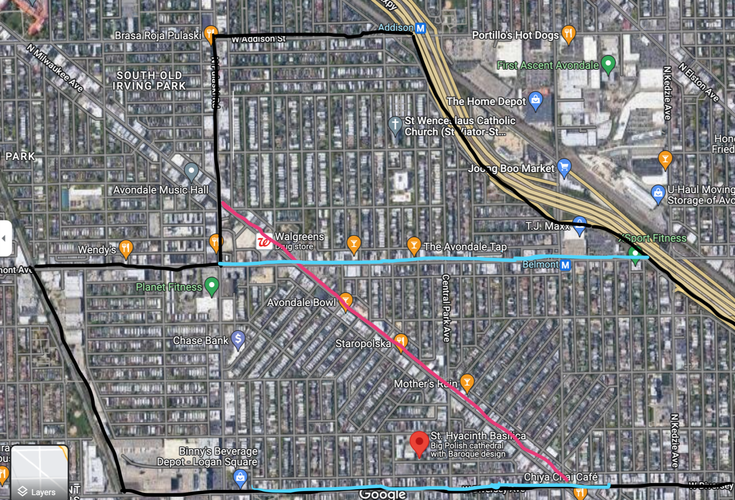
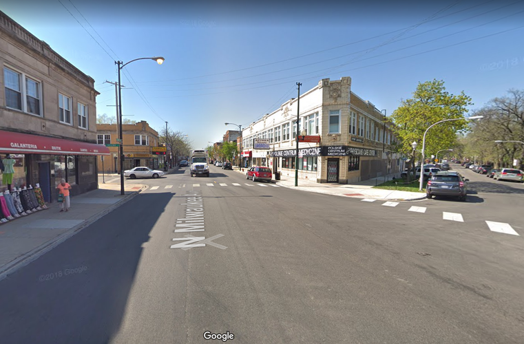
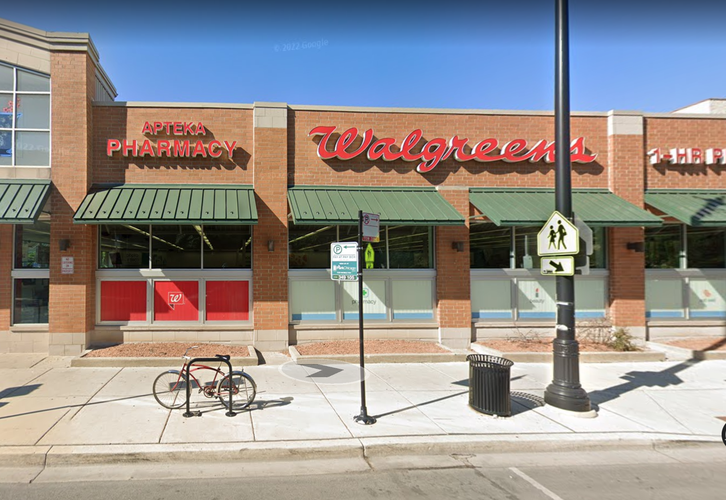
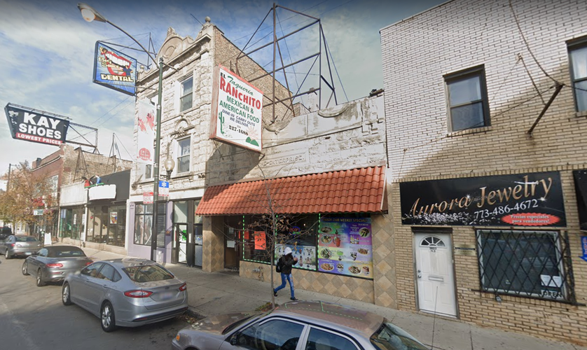
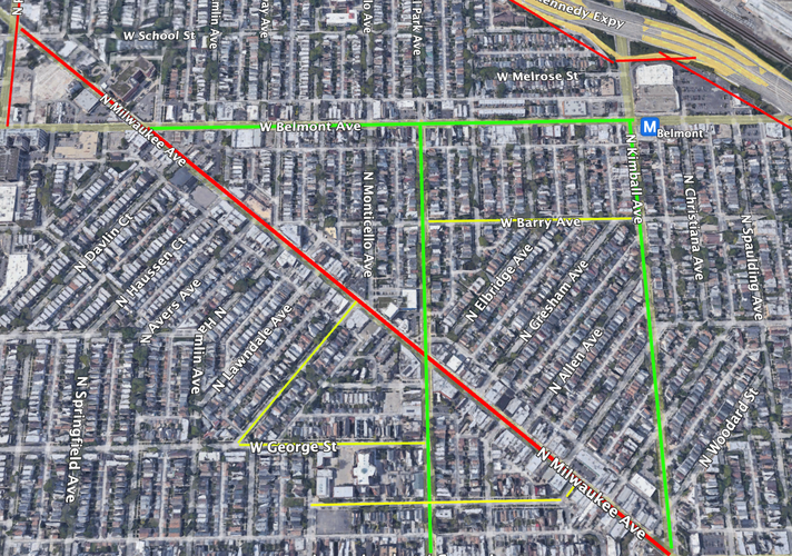
Much of Avondale’s current layout reflects its historical habitation patterns, both in its initial development and its expansion as a major housing hub for workers employed in Chicago’s once powerful industrial sector. Avondale first grew through the expansion of Milwaukee Avenue northwest of what is today Logan Square, and today this street remains the neighborhood’s vital and active commercial corridor. As expected, I observed this artery to contain higher-density residential zoning relative to the rest of the neighborhood. Furthermore, both smaller and larger buildings line Milwaukee Ave. with street level retail. I observed many restaurants in particular, with many large national chains coexisting with eateries representing the neighborhood's historically shifting ethnic makeup (traditional Polish restaurants coexisting with Mexican and Central American cuisine). In this vein, the linguistic diversity of storefronts, signage, and streetside advertisements highlights the neighborhood’s position as one of Chicago’s most diverse. Milwaukee Avenue is shown in light red in the following map:
Typical Milwaukee Ave. streetscapes in its passage through Avondale
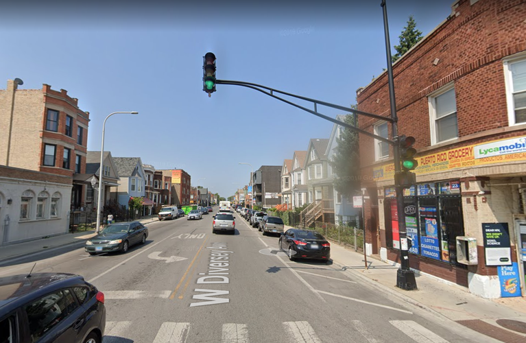
The neighborhood also has two somewhat lower scale and intensity corridors along West Diversey and West Belmont Avenues (both still higher density relative to the rest of the neighborhood), the other two main thoroughfares connecting Avondale to the rest of the city. These streets are highlighted in light blue on the map.
Typical W Diversey Ave. streetscapes in its passage along Avondale's southern limits
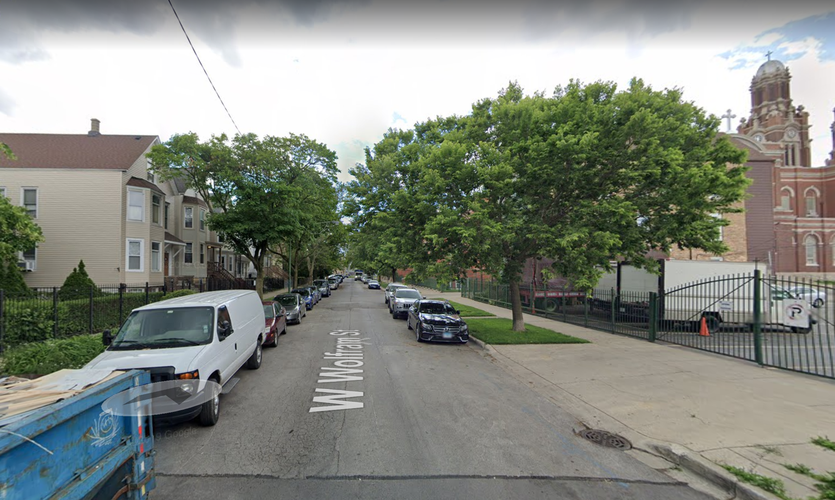
As mentioned earlier, the majority of Avondale is residential. Many of the neighborhood’s most well known attractions, such as St. Hyacinth’s Basilica, are located in lower-scale residential streets.
In its heyday, Avondale Park was one of the neighborhood’s most significant spaces. Unfortunately, the park was decimated by the construction of the Kennedy Expressway. Today Avondale lacks any sizable parks or other recreational public amenities. One potential exception is Kosciuszko Park, which is located along the “border” with Logan Square. Given the lack of a legal definition of neighborhood-level boundaries in Chicago, some delineations of Avondale exclude the park from the neighborhood. However, its historic ties to the neighborhood and dedication to Chicago’s Polish diaspora (it is named after a major Polish-American figure in the Eastern European country’s independence movement) warrant its inclusion.
Regardless, both Kosciuszko Park and the remnants of Avondale Park are marginal relative to the neighborhood core and haven’t drawn much commercial activity or residential density in their surroundings. The aforementioned commercial corridors, in contrast, seem to function as the center of neighborhood life. A wide variety of businesses service the needs of locals and visitors alike. In line with the way the neighborhood developed, even many businesses and landmarks not located on these immediate streetscapes are located in off-streets that fan out from the busy avenues.
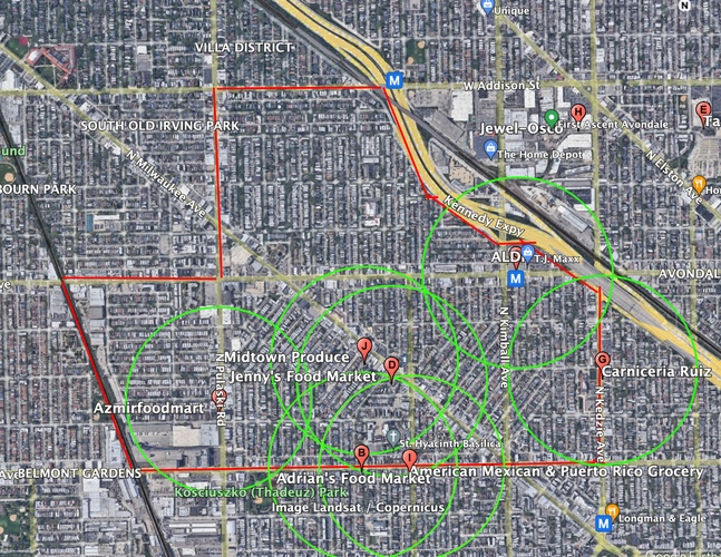
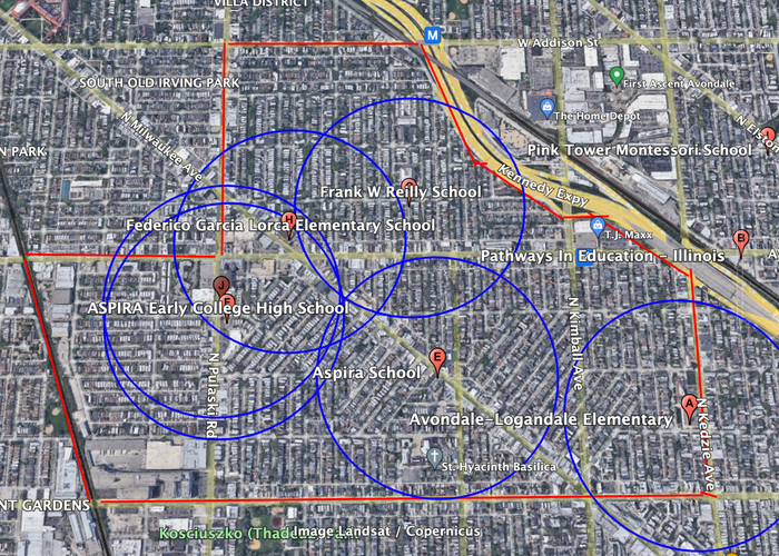
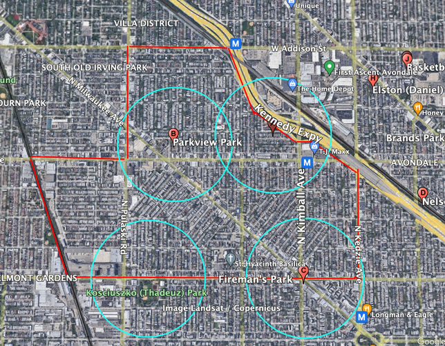
The following maps outline the availability of several important amenities in Avondale. Each circle encompasses the portions of the neighborhood that are located within a 5-minute walk (a quarter mile) of the location in question. The amenity categories analyzed will be grocery stores, schools, parks, and health centers. Since Avondale is a fairly dense and largely residential neighborhood, we can infer that these radii correspond fairly accurately with the ease of access residents have to local amenities.
First, we have grocery stores. The majority of Avondale seems to have easy access to several different grocery stores, with a glaring exception in the neighborhood’s northern sector. It is worth noting that Avondale has far more locally owned, independent grocers than big-box chains, with the exception of the ALDI adjoining the Kennedy Expressway. In sum, southern Avondale is well-supplied in terms of grocery access, while the northern reaches are sorely lacking in opportunities for grocery shopping within walking distance of residents.
Avondale’s boundaries outlined in red, grocery store radii outlined in green
Next, we have schools. As expected due to its residential history, Avondale has a variety of options for primary and secondary education, especially for younger children. There are some small pockets with less home-school walkability, but these seem to be in the minority relative to the rest of the neighborhood. Once again, the bulk of these more educationally isolated neighborhoods are on the north side of the neighborhood. In general, however, the neighborhood succeeds in providing families walkable access to schools.
Avondale’s boundaries outlines in red, school radii outlined in dark blue
At first glance, Avondale seems to be fairly well-covered as far as walkability to park and recreation spaces. However, upon further inspection, most of these parks are small and poorly designed and maintained green spaces. Kosciuszko Park is arguably the only true park servicing the area, which reveals the lack of easy access to recreation and expansive green space in the neighborhood.
Avondale’s boundaries outlined in red, park radii outlined in aqua
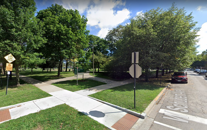
Street view of Avondale Neighborhood Park
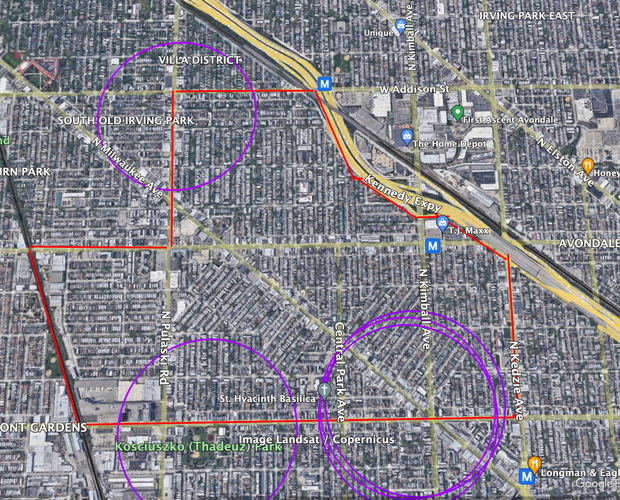
Finally, we have health centers. The majority of the neighborhood does not have walkable access to health centers, as most are concentrated at the edge of Avondale’s boundaries. Notably, none of these are major hospitals (the access to infrastructure beyond small clinics is nonexistent in the neighborhood, and even limited in surrounding communities). Though it is fair to expect that clinics would be less common than, say schools, Avondale fails to provide walkable access to health services.
Avondale’s boundaries outlined in red, health clinic radii outlined in purple
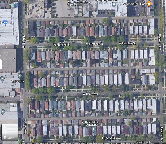
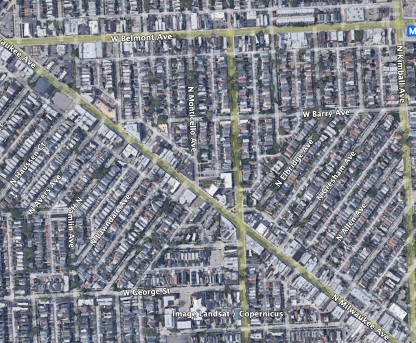
For the most-part, Avondale maintains Chicago’s typical grid-like street pattern. It is divided into a mix of elongated and irregular blocks, with many of the irregularly sized blocks branching off from Milwaukee Avenue.
Elongated blocks in western Avondale
Irregular blocks in central Avondale
Layout of the mix of elongated and irregular blocks on and around Milwaukee Ave.
Most of Avondale is built in a manner that most resembles the Savannah network pattern. The CTA Blue Line runs underground through the neighborhood, so transit infrastructure does not interrupt the flow of traffic (which remains constant and dispersed through the grid).
One notable exception is, once again, the Milwaukee Ave. corridor. Development along Avondale’s main diagonal thoroughfare contains some elements more akin to the Washington pattern.
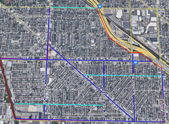
Several different thoroughfare types are present in Avondale. The Kennedy Expressway, one of Chicagoland’s major highways, forms the neighborhood’s eastern boundary, running right through the Avondale community area. Avondale is an interesting case, as it is both centrally located and largely residential. As such, mobility in the neighborhood is directed through a group of important avenues, which are in turn fed by lower-density streets, courts and alleyways. In the picture below, major avenues are highlighted in dark blue, the more “connectivity-facilitating” streets are highlighted in aqua, and the rest of the Avondale streetscape (small streets and courts connecting the neighborhood beyond the busy corridors) are left un-highlighted.
Avondale has been a mainly residential area for most of its history, and this has certainly influenced the way intra-neighborhood connectivity has developed. Outside of Milwaukee Avenue, the relatively large block sizes and limited street-level activity make it seem somewhat difficult to walk, especially for longer commutes within the area. The neighborhood’s streets have what one might consider average Chicago sidewalks, but little to nothing else in the way of pedestrian or bicycle infrastructure beyond that. The northern section of Avondale at least does a better job of providing green space and tree-cover along sidewalks, but this does not overcome the lack of activity in its residential streets (which make up the bulk of the neighborhood).
Avondale's streets do seem to be fairly well-designed for vehicles. There are no cul-de-sacs or gated communities, and traffic flows without many restrictions (aside from the ever-present one-ways). The neighborhood’s main thoroughfares, Milwaukee and Diversey Avenues, are able to distribute car traffic throughout the neighborhood (though traffic could surely develop on the one-ways feeding them in the event of construction, an accident, or any other traffic-slowing delay). Milwaukee Ave., in particular, does a good job of combining connectivity within Avondale as well as to other parts of the city without sacrificing street-facing uses. That being said, for being the neighborhood’s main commercial artery, its sidewalks are very narrow and its general non-car space is lacking.
Founded as a working class neighborhood at the height of Chicago’s industrial boom, Avondale has long been home to the diverse communities settling in the area during their respective migratory waves. However, the neighborhood’s unique multicultural identity is being challenged by encroaching gentrifying forces spreading westward from the lakeshore and near northside communities such as Logan Square and Lincoln Park. Displacement and long-running challenges such as a lack of public amenities are at the center of the challenges facing community-members that I observed during my research. The following will be a series of suggested interventions aimed at addressing the historic lack of public investment in the neighborhood and expanding resident access to affordable housing and green space.
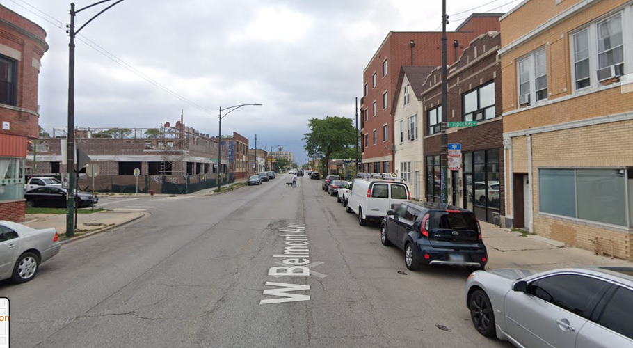
My interventions will be centered around the revitalization of W. Belmont Avenue in its passage through Avondale. I selected Belmont due to its location, an accessible middle point for residents living on the north and south sides of the neighborhood. It marks the unofficial boundary that delineates the northern sector of Avondale, which is almost exclusively residential and not serviced by many businesses or amenities. Belmont also intersects with the commercial corridor on Milwaukee Ave. while still being one of the few areas with potential for greater mixed-use density, with empty lots and underutilized storefronts that would not require resident displacement. Lastly, the street is well-connected to public transit, with the Belmont blue line stop located within Avondale.
W. Belmont Ave. in its passage through Avondale. Image taken from Google Earth
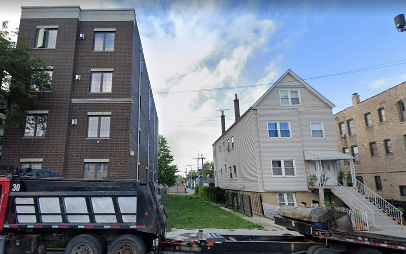
My first suggested intervention along the Belmont corridor is the pacification of the street itself. As it stands, Belmont Ave. is not very pedestrian-friendly. Most of the street is dedicated to cars, and its narrow sidewalks are largely not well maintained. This contributes to the low rates of pedestrian transit I observed during my time in Avondale, which in turn contributes to the presence of several empty storefronts along what should be a vibrant commercial and residential street. I am suggesting that streetside parking space be reduced, with the leftover space being used to expand sidewalks. I envision these improved sidewalks as a greened corridor, with tree cover being greatly expanded and certain already green lots being converted into pocket parks. Avondale is one of the most park-poor neighborhoods in the city, and the introduction of more green space is an environmental and public health necessity. However, the neighborhood is pretty densely populated, and there is no room for middle or large-scale park construction.
Lack of sidewalk space on Belmont Ave. Picture uploaded from Google Maps
Potential pocket park along Belmont Ave. Picture uploaded from Google Maps
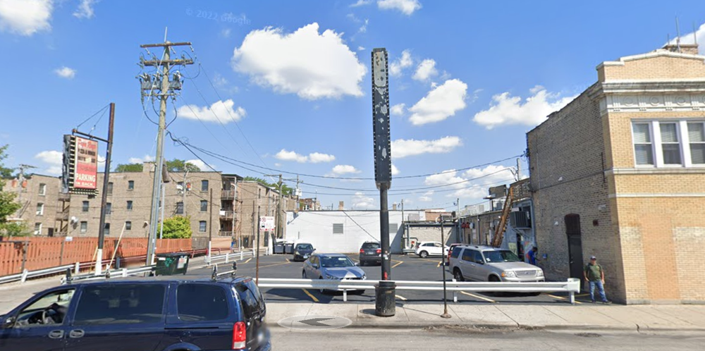
My second suggested intervention is the construction of mixed-use housing (with a street-level retail component) on currently underutilized lots. There are several surface parking lots and empty lots along Belmont with the potential for housing construction. An added benefit to building housing along this street is its transit accessibility, which reduces the need for cars and parking space for residents. Furthermore, densification could be a boon for local businesses and even spur new business growth. These new businesses could potentially be types that tend to attract more consistent foot traffic, such as restaurants or dispensaries.
Parking lot apt for housing development along Belmont Ave. Picture uploaded from Google Maps
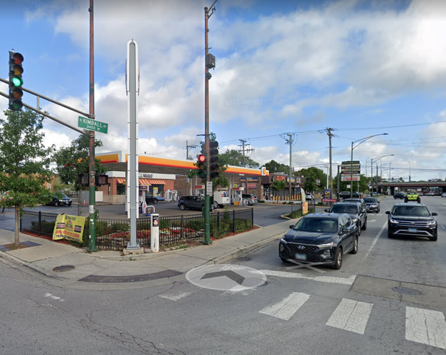
My third suggested intervention is the densification of the area surrounding the Belmont Blue Line stop. The station is located at the intersection of Belmont and N Kimball Avenues. The other three corners of this intersection are currently occupied by a small restaurant with empty parking space next door, a gas station, and a very large parking lot reserved for a bank branch. Continuing for a few blocks, one notices that the area closest to the station is actually one of the least dense along Belmont Ave. This area has even more potential for the affordable and public housing construction sorely needed in the neighborhood.
Gas station across the street from the Belmont Blue Line stop. Picture uploaded from Google Maps
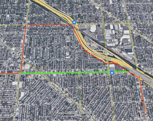
My final suggested intervention is the generation of pedestrian access underneath the Kennedy Expressway. The construction of the freeway is a lasting scar on communities across Chicago, and a long-term obstacle to citywide integration and non-private vehicle transit. However, I believe some short term changes could be made to allow the community to retake the areas near the expressway. Belmont Ave. crosses under the expressway, and improvements have the potential to integrate the Avondale neighborhood with the rest of the Avondale Community Area and surrounding neighborhoods.
Though many of the challenges facing Avondale owe themselves to larger citywide and national issues of structural racism, lack of housing access, and poorly planned urban expansion (among others), I am confident that efforts such as those I am suggesting here can serve as a strong starting point for the recovery of Avondale and other communities across Chicago long overlooked by city government.
Social Mix
The following tables lay out several demographic indicators regarding the Avondale neighborhood. Given the lack of a legal framework for Chicago’s neighborhoods, and the consequent lack of specific neighborhood-by-neighborhood demographic data, I have pulled information from US Census Tracts 2105.01, 2105.02, 2106.02, 2107, 8311 (from Social Explorer), as they most accurately cover the area corresponding to Avondale (the neighborhood, not the identically-named Community Area).
These census statistics really bring to light the demographic transformation that has taken place in Avondale over the past 30 years. At first glance, the large majority of the population identifies as White, which we can infer is not necessarily a major shift compared to the Avondale of the 70s and 80s. However, upon closer examination we see that modern-day “White” identifications may have much more to do with the incompatibility of many Latin American racial and ethnic identities with American racialization (a lack of widespread recognition of mestizaje, for example). Once we conflate racial and ethnic data, we get a fuller picture of how Avondale has transformed into a much more diverse neighborhood today. In a sense, Avondale serves as a case-study of shifting immigration patterns to Chicago, as Mexicans, Puerto Ricans and, to a somewhat lesser extent, Central Americans, overtake Central and Eastern Europeans as the city’s primary immigrant groups. That being said, we can observe the influence of historic redlining patterns and their effect on settlement and urban community formation in the area’s relatively smaller Black population.
In terms of age groups, Avondale’s population seems to be concentrated in the “middle” of the demographic period, with those aged 18-64 making up the bulk of the area’s population. This phenomenon is not unique to Avondale, and reflects longer-term population trends in the United States. Interestingly, Avondale is fairly diverse as far as educational attainment.
As expected, Avondale’s Simpson Diversity Index was lowest for the racial identification category, and it seems to be far less diverse than the city overall. However, in line with the city of Chicago, Avondale is highly income diverse, a trait which is becoming exceedingly rare in many American neighborhoods.