Overview
Social Mix
Public Space
Amenities
Connections
Final Project
Pullman has a population of approximately 6,820 people according to the 2020 Census. The amount of land taken up by Pullman is approximately 1354.5 acres according to the Chicago Metropolitan Agency for Planning Analysis of the 2015 Land Use Inventory.
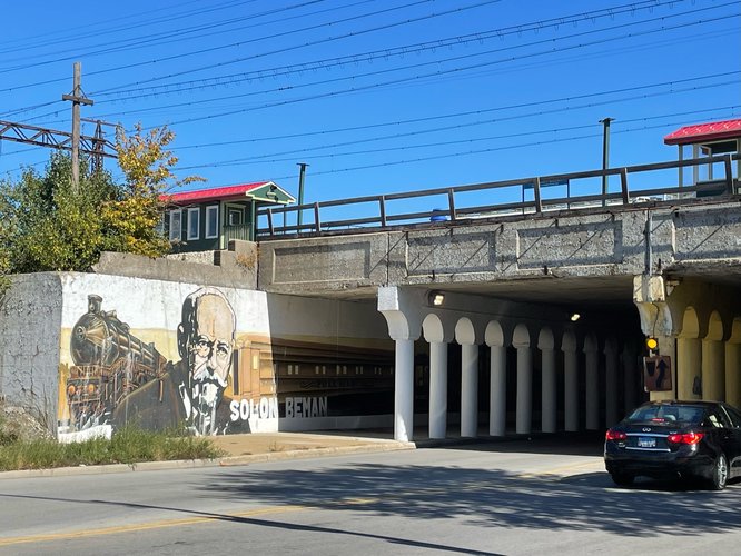
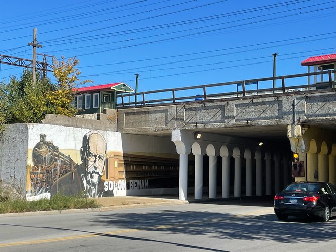
Pullman has a strong sense of historical identity on the basis of its significant role in the history of American labor movements. As soon as one steps off the Metra at the 111th St (Pullman) and walks through the tunnels under the station, they encounter murals of trains, symbols, big letters of “Pullman Porters” as well as portraits of historically relevant pioneers such as Solon Beman, the primary architect of Pullman.
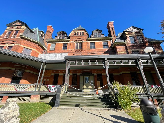
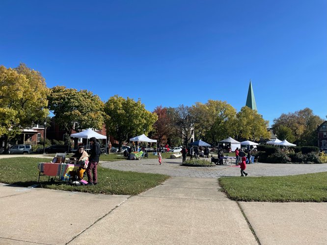
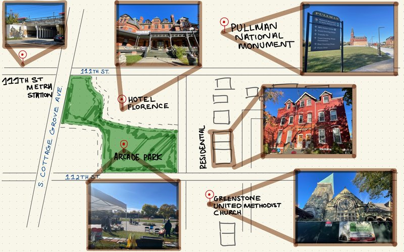
Arcade Park, right off S Cottage Grove Ave and North of 112th St, is filled with signs explaining the history of the park, the Depot and Lake Vista, and Hotel Florence (named after George Pullman’s daughter). Furthermore, though Pullman’s identity is historically based, it is very much a lively neighborhood. On the day I visited, October 15 2022, there was a music festival occuring at Arcade Park. There were signs of Pullman on the stage, little booths selling maps of Chicago architecture featuring Pullman, as well as large murals depicting strong laborers working with wheels and tools.
I spoke to Janeff Media, one of the organizers of the music festival, and he told me about how Pullman continues to preserve the architecture of their residential spaces. For instance, there are rules about how residents, and even homeowners, are not allowed to alter the appearance of the house in certain ways to preserve its original identity.
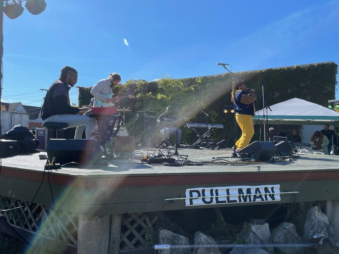
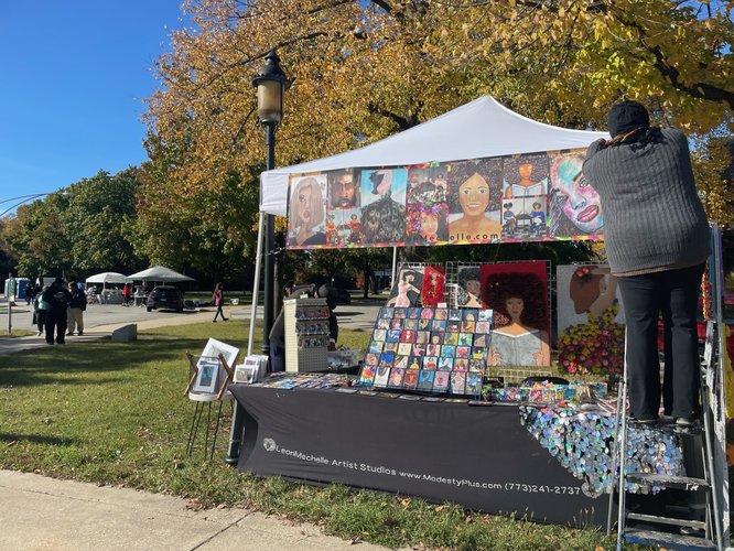
The music festival was next to a farmer’s market with booths selling original art. Rolanda, one of the artists selling at a booth, told me about her particular fondness for Pullman as a neighborhood strongly supporting local artists. She turned away four other offers so that she could be at Pullman that day.
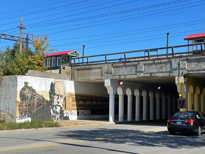
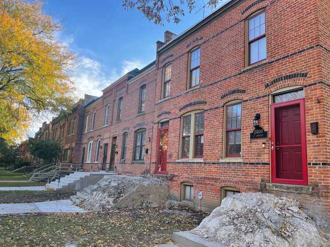
Upon the recommendation of the ranger at the Pullman National Monument, I took a route parallel to S Cottage Grove Ave and walked South through 111th St to 115th St. Along this route were the homes of the Pullman workers. Closer to 111th St was where those with more high-end, managerial positions lived, as to minimize their walk to work. This system aligned with the appearances of houses, as the further south one walks along, the more compact and smaller the houses appeared.
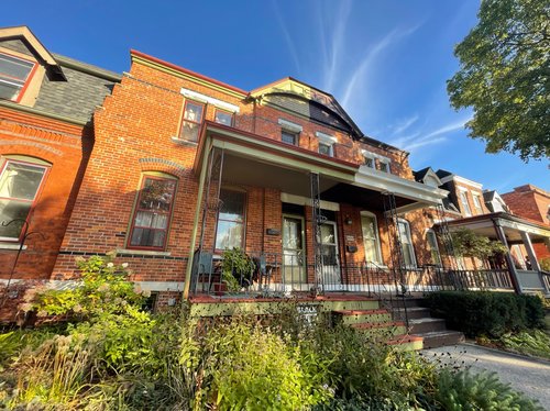
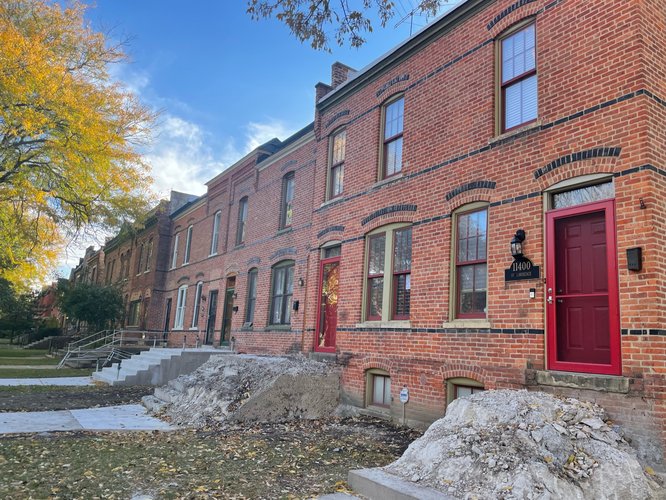
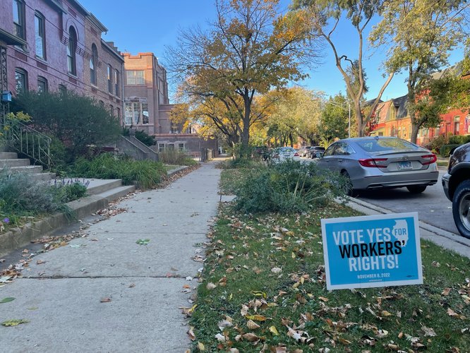
Many of the houses placed yard signs outside their house, some of which were repeated and the exact same. For instance, some had signs expressing goodwill through words of “Be Civil” and “Help each other”. Other signs were more politically inclined, with words promoting worker rights and the importance of equal treatment towards American immigrants.
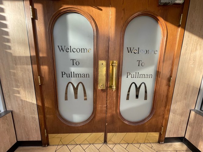
Finally, it goes to show that Pullman has a strong sense of identity given that the local McDonald’s had “Welcome to Pullman” written on their double doors.
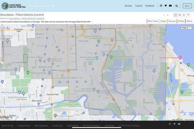
The following map shows the police district boundaries of Chicago. Pullman falls under district 5, alongside Roseland and West Pullman. The grey area bordered by the center boot shaped border marks District 5. The police department itself is assigned the name Calumet, as it is border the plains and Lake Calumet, and is located on 111th St a few blocks East from the Pullman National Monument.
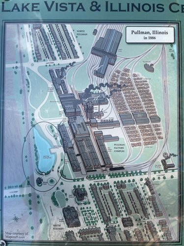
The Pullman neighborhood is historically significant as one of the first planned communities created during the American labor movements of the late 19th century. George M Pulman, founder of the Pullman Palace Cars for the country’s enlarging railway system, was looking to maximize retention of his factory’s laborers. Towards this end, he initiated a plan to erect a town designed to provide its residents - the families of his company’s laborers - with sturdy brick houses, local parks, a library, a theater, and neighborhood activities. While the neighborhood was praised by the state labor commissioners, certain observers claimed the company-planned neighborhood ensnared certain rights such as the right to control one’s home environment.
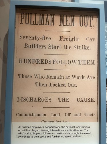
Following a recession in 1894, wages were cut without a decrease in rent prices, resulting in Pullman workers going on strike. This strike received nation-wide scrutiny as the strike represented the larger issue of the working and political rights of laborers, or more specifically, the corporate ownership of housing. In response to the strengthening negative sentiment, the Illinois State Supreme Court ordered the company to divest itself of residential property in the Pullman neighborhood.
Throughout the beginning of the 20th century, Pullman experienced neighborhood phenomena of ethnic succession, labor migration, and thus resident migration. However, due to a decaying of Pullman’s reputation in the late 1920s and 1930s due to unemployment and certain unsettled areas, Pullman’s main area between the 111th and 115th St were recommended for destruction by Chamber of Commerce consultants to utilize for industrial expansion. Pullman residents rallied and reactivated the Pullman Civic Organization to fight against this destruction, and later founded the Historic Pullman Foundation to strengthen their cause. Thus, Pullman maintains its status as a neighborhood largely due to its residents’ pride in its historical value. This sense of pride in Pullman’s historical value is consistent with the neighborhood today.
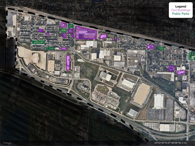
The map above displays around 75-80% of Pullman neighborhood, showing all areas with the exception of the Northern most area. It displays the civil buildings in purple, public parks in green, and all other commercial and residential buildings are the backdrop. While most of Pullman consists of residential and commercial buildings, there are a sizable number of civil buildings including museums, schools, and a police department. Pullman, in particular, has a large number of museum buildings serving as civil buildings.
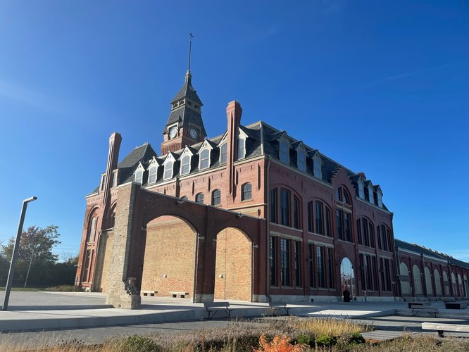
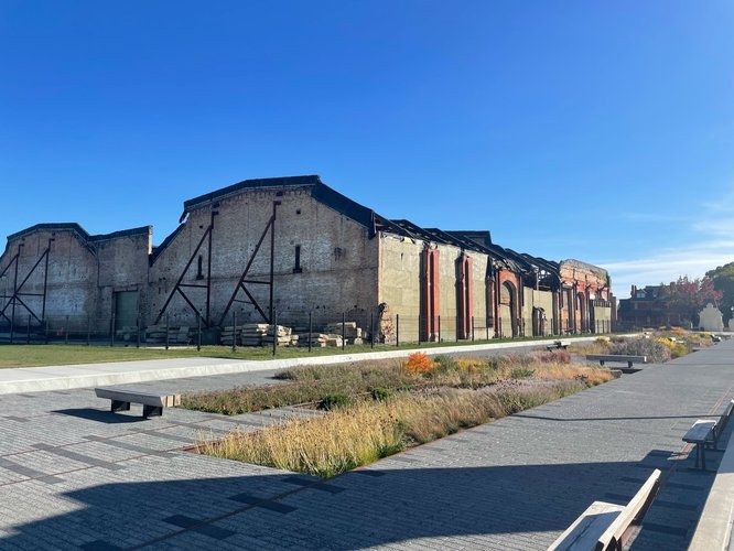
Choosing to compare the layout of civic buildings compared to commercial/residential buildings is especially interesting for Pullman, given that the buildings that used to be for commercial use by the Pullman Company have been transformed into civic buildings. This is an interesting example of how what was once purely a commercial building, with the passage of time, was transformed into a heritage site and historical treasure. The Pullman National Monument in particular boasts the remnants of a former factory, incorporating the formerly commercial building into the historical monument complete with a large museum.
When analyzing the map based on the sizes of the purple squares, one may be unimpressed, however it is important to keep in mind that some of the squares represent highly frequented buildings. The museums often have tours attracting various Chicagoans from other areas of the city.
Furthermore, though a majority of the area south of 111th St. are residential areas, these houses retain significant historical, and thus civil value. Tourists walk south of 111th St to view the houses workers in the Pullman company used to live in. Furthermore, there is an annual day where people can even visit and tour some of these houses internally, to experience the facilities that were modern at the time of the workers.
In this way, Pullman represents the unique cohesion between res publica and res economica. What was once res economica has now been transformed into res publica, and retains aspects of both attributes.
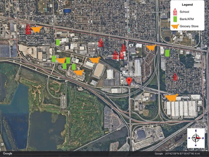
A method of analyzing the neighborhood of Pullman is through the lens of walkability access to daily life needs. For this purpose the graph below displays key schools, banks/ATMs, and grocery stores within the neighborhood. While examining the graph, it is important to keep in mind that the population of Pullman is distributed in such a way where the Eastern area (bottom part of the map as the map is rotated 90 degrees to the right) is less populated than the Western (top of the map). This is because there are more industrial areas in the Southern areas and residential areas are concentrated in the North and West areas of the map.
However, as can be seen by the map above, daily life needs services are not widely accessible throughout the area. Both the banks and schools have a certain area with a greater concentration of buildings available, while grocery stores are slightly more spread out yet limited in quantity. In particular, the Northern most residential area seem to be lacking in services given as there is only one of each service provided for the entire area. A general glance of the map implies that potentially due to the spread of industrial and residential areas, daily life needs are not the most evenly distributed across the neighborhood.
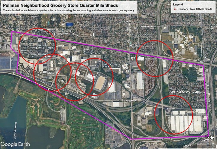
In the following visual, the red circle represents “pedestrian sheds”, where the radius of a quarter mile represents a walkable area for a consumer. The graph below specifically illustrates the walkable areas around grocery stores. A large portion of the grocery stores, including large markets such as Walmart and Whole Foods are concentrated towards the Southern area of Pullman. In this area lies the former residential neighborhoods established by the Pullman Company. It is interesting to note that this particularly historical region of the neighborhood has the most consistent access to grocery stores. It would be a valuable question for further research to investigate the relationship between historical value and establishment of stores providing daily life necessities in that area. It is curious that the residential area of Cottage Grove Heights on the opposing end of the neighborhood has only one local grocery store, that too not in walking distance.
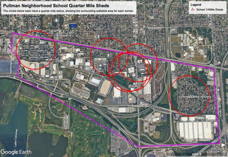
The graph below shows the pedestrian sheds in light of schools present in Pullman. According to the Chicago Metropolitan Agency for Planning, Pullman is home to 1343 minors embodying approximately 18.8% of the population. With a sizable portion of the population of school age, walkable distances to schools is necessary. Furthermore, the distribution of schools gives further insight into the distribution of overall families, as families are sure to live in areas where schools are accessible. There lies a school within walking distance for the majority of residential areas in Pullman. However, four of the six schools indicated all exist in the Western most part of Pullman. Such schools include Edgar Allen Poe Elementary, Corliss High School, and Butler College Prep. Here we see a variety of schools attending to different ages and demographics. However, this does mean that for residents living in the Eastern side of Pullman, closer to the industrial areas, walking to their school proves difficult and likely results in an alternative method of transportation.
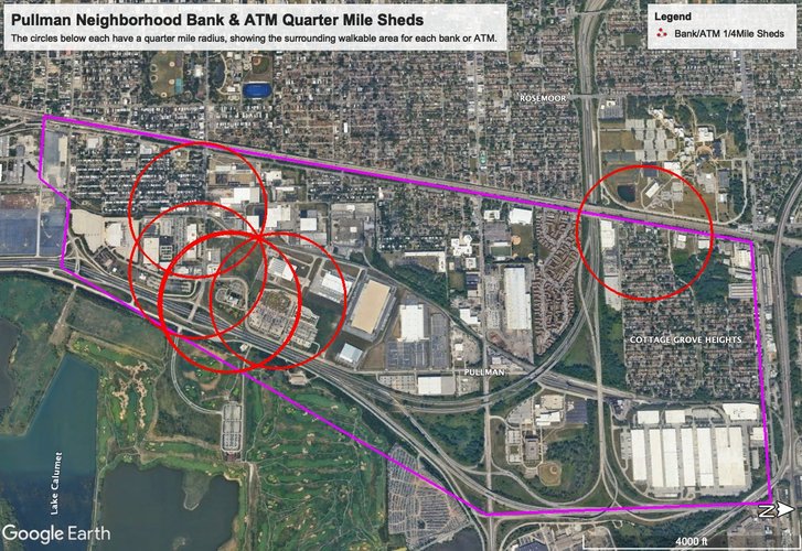
When viewing the ATMs and Banks below as the centers for pedestrian sheds, it is clear that there lies a concentrated number of such services in the Southern area of Pullman. With four of five of the bank/ATM services available in this area, it is clear that residents living in the Northern parts of Pullman such as Cottage Grove Heights may have difficulty accessing a financial institution without traveling to the bank on the Northwestern edge of Pullman or to the Southern area of Pullman.
I find this example to potentially have yet another connection with Pullman’s history as home to the Pullman Company. The presence of Pullman’s financial area concentrated in the same area as former company headquarters may not be a coincidence, as the same transactions and infrastructure exist through time. Furthermore, there may be stronger value attached to the buildings and areas in the South, as well as employment opportunities, which may be cause for the concentration of financial institutions in such areas. Further research, potentially looking at change in bank locations over time would be necessary to conclude whether such a relationship exists.
Overall, Pullman is not the most walkable neighborhood, especially given that most services are unevenly distributed across the residential areas. This lack of walkability impacts markets and prices of housing in various areas, and also may be linked to the relatively greater historical value of the Southern area of Pullman. However, given that the overall size of Pullman spans not more than 3 miles, the area is relatively small. Furthermore, the metra train line borders the Western edge of the neighborhood, providing easy access to those who do not necessarily live in Pullman but work there, coming in from other neighborhoods.
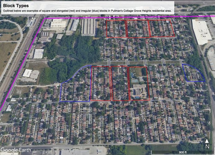
The above image shows a residential area of Pullman. The primary block types in the residential areas of Pullman are square/elongated block types with a few irregular block types as shown below. The variety of the block type allows for the incorporation of the residential areas into the greater area surrounding Pullman, as it integrates into bordering industrial and commercial areas.
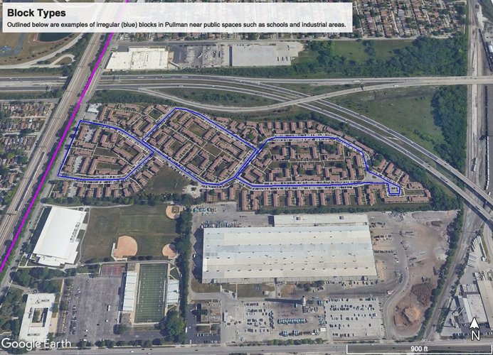
The map above outlines an example of three irregular blocks uniquely put together south of the residential area above. These specific blocks border a public school area as well as a power plant, showing how Pullman uniquely integrates many different types of areas together. This usage of irregular blocks may be an effect of building houses around industrial areas from when they were first formed, especially given that Pullman is a neighborhood planned around the major industrial/job providing factories of the time.
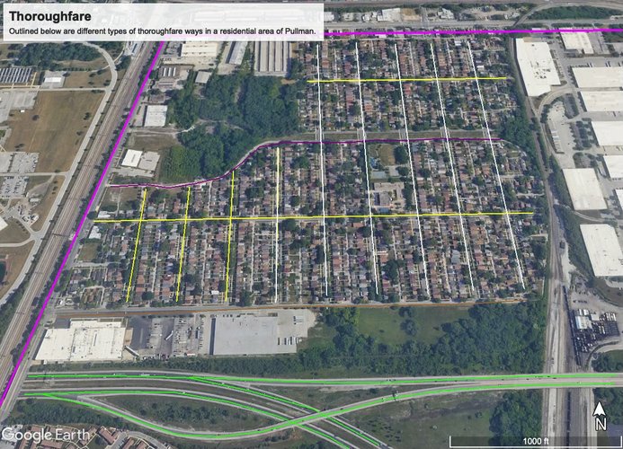
The map above outlines examples of various thoroughfare ways in a residential area (Cottage Grove Heights) in Pullman. It incorporates multiple types of thoroughfare ways including the bordering highways, boulevards, avenues, drive, road, and streets. One can see the narrowing of the thoroughfare depending on the specific location one is trying to reach. Thus, the residential areas of Pullman are internally walkable given that they are low velocity.
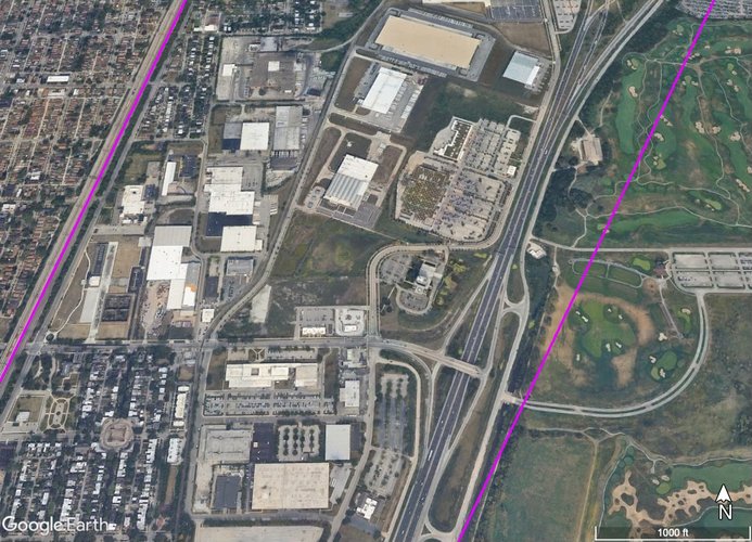
However, when zooming out of residential areas, the majority of especially Eastern areas of Pullman consist of industrial areas and are not nearly as walkable, primarily consisting of high velocity highways and boulevards.
The above image shows an example of the Nantucket pattern present in Pullman Neighborhood’s network system. This is an example of industrial areas interconnected with high velocity roads. This pattern has the advantage of splitting traffic relatively well, especially during the high traffic times when people are going or coming back from work.
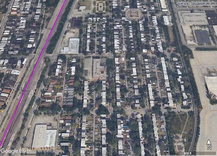
However, the image above also shows the Savannah pattern that also exists in parts of Pullman’s neighborhood, especially in residential areas. This allows for highly walkable roads to co exist within neighborhoods and create smaller communities within Pullman. As exists with Savannah patterns, there is greater ease with directional orientation for those navigating their way through the neighborhood. Furthermore, there is not as much need for traffic delegation because by existing as a residential area the roads are not high velocity.
Pullman exists as a unique mix of connectivity patterns, primarily due to it being home to both residential and industrial areas. Since it is a neighborhood that historically was built around the key factories and industries at the time, and planned residential areas around these places, the remnants of the neighborhood uphold a similar mix of the two. This is clear in the variety of block types, where primarily residential areas consist of square and elongated block types whereas residential homes closer to industrial areas consist of irregular block types. With thoroughfare ways, there are distinct differences in the types of roads when one is navigating industrial areas, as these roads are high velocity, non walkable, and not nearly as connected to the rest of the neighborhood. However, within the residential areas, there are highly connected roads linking to public spaces as the full spectrum of high velocity to low velocity thoroughfare ways can be seen. Finally, network may be the clearest framework through which to identify the unique combination of savannah and nantucket patterns present in Pullman.
In this way, Pullman has certain areas that are highly connected internally, however the neighborhood is not necessarily connected throughout. This is because the neighborhood is clearly stratified into residential and industrial areas, especially with the Western and Eastern areas respectively. Thus, walkability is easily achieved in residential areas, though much more difficult when reaching Eastern, more industrial and commercial areas of Pullman. This may have larger impacts of things such as segregation, as the neighborhood may be internally separated due to lack of connectivity throughout. This would be a good area to check for correlations between internal separation and amount of connectivity/network pattern of the given area.
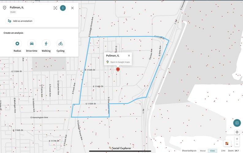
Pullman, is a neighborhood located in the SouthEast region of Chicago, west of the Calumet Lake. For the purposes of this proposal, the neighborhood is vertically bound by 95th St and 115th St, and horizontally bound by Cottage Grove on the West and the railroad tracks on the East. A relatively small neighborhood covering 2.2miles respectively.
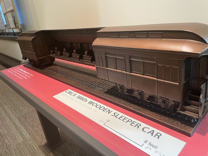
The overarching goal of the proposal to Pullman is to improve public space, specifically aiming to embody Pullman’s historical value in a living, breathing manner. We will accomplish this goal by creating a shuttle transportation system, modeled after sleeper train invented by the Pullman Palace Car Company, which will navigate the neighborhood. In addition to having the clear benefit of connecting various parts of the neighborhood through public transportation, it will create public spaces in both the stations and on the streets (through increasing walkability between stations and destinations).
The motivation for this proposal is to expand on the historical value of Pullman through a method that creates active public spaces. In 1960, certain industries and local governments considered bulldozing Pullman. In response, the local community mobilized the Pullman Civic Organization to stop the project. They succeeded in getting Pullman declared a National Historic Monument. Given that Pullman is one of America’s first planned communities, the birthplace of the Pullman sleeping car and the origin of the famous labor-management battles in US history, Pullman’s history forms the foundation of this proposal. By establishing an active transportation resembling the Pullman sleeper trains, the origins of the neighborhood are sustained in a useful and efficient manner in the everyday lives of Pullman residents.
The overarching proposal consists of three sub-interventions:
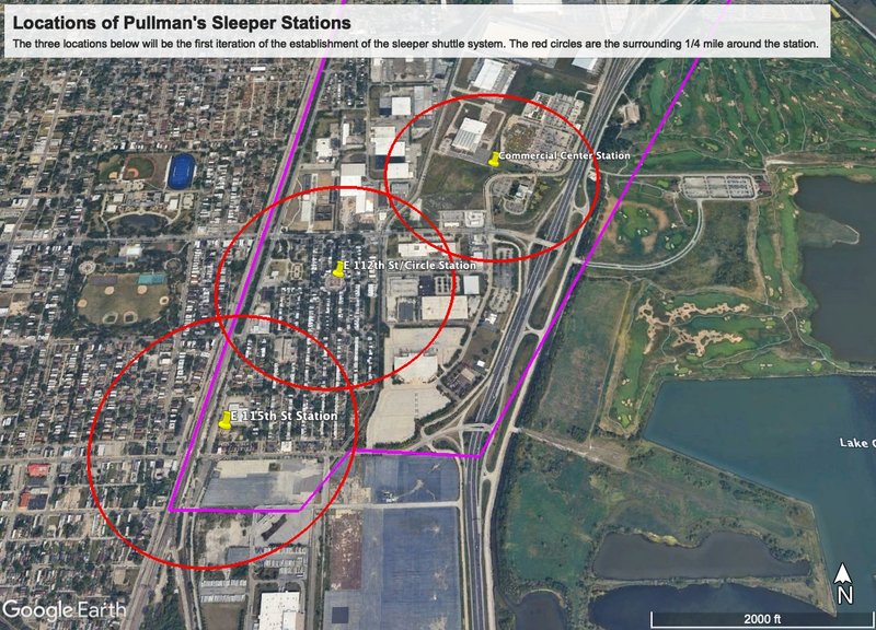
The following map displays the location of the three stations (main intervention) and the surrounding 15-minute (1/4 mile) pedestrian walk circle.
Establishment of sleeper stations serving the dual purpose of parking sites for shuttles and more importantly, indoor, public spaces consisting of market hubs and information centers
Establishment of routes connecting various parts of the neighborhood, directly creating 15-minute walkable sheds and thus improving the public space of neighborhood streets
Procurement of funding on the basis of preservation of historical identity of the neighborhood in order to fund the first two initiatives
In addition to serving as the parking center for shuttles, each station will serve as an indoor public space for residents and tourists. These spaces will contain areas for small businesses and local restaurants to rent or lease, establishing weather-resistant areas for businesses to depend on a consumer market daily. Such stations will be built to replicate the Queen Mary Anne inspired architecture, using brick cemented from clay from Lake Calumet as many of the historical buildings in Pullman do.
Rolanda, an artist, who sells her artwork at Arcade Park on the few sunny days in Chicago would have an opportunity to display her artwork to Pullman residents on the regular at the sleeper stations.
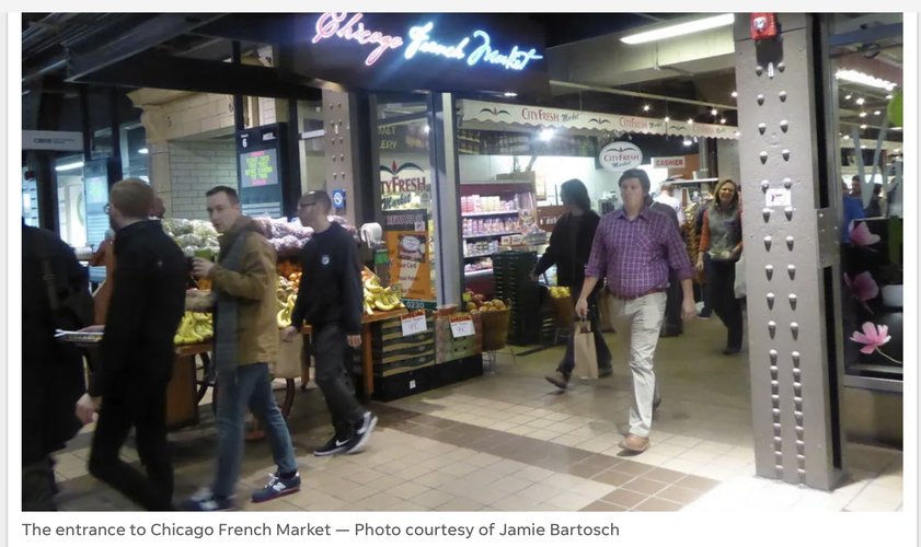
The image above portrays an example of what the inside of a sleeper station would look like: bustling with markets and customers, especially pre-work commute hours. The image is the French Market below the Ogilvie Transportation Center in Chicago.
Secondly, the sleeper stations will be established within the neighborhood residential area between 111th St and 115th St, and will stretch across major employment centers towards the Eastern side of the neighborhood. The first interaction of the sleeper system will establish stations at the following locations:
1. E 115th St Station is located near the Kensington 115th Metra Station on 115th St. The surrounding ¼ mile radius walk contains a few restaurants and the Southern section of the residential neighborhood. This station will be built on the abandoned green space just south of E 114th Pl, East of Cottage Grove Ave and North of 115th St.
2. E 112th St/Circle, located at the E 112th Market Square Circle building. This open area would be the main station, located at the heart of the neighborhood. With a large circular area surrounding the main open building at the center, this creates the perfect setting for a station, with enough space for shuttle parking as well as a center space for the indoor station. Furthermore, the 15 minute walking shed surrounding this station contains the following historical gems: Greenstone Methodist Church, Morgan’s Chicago World Fair Museum, Hotel Florence, and most importantly, the Pullman National Monument. Additionally, the 15 minute walking shed covers the entire rest of the surrounding residential area from 111th St to 113th St, Arcade Park, Langley Park, and commercial buildings just east of S Ellis Ave.
3. Commercial Center Station, located near on the Eastern side of the neighborhood in the green space next to S Doty Ave, south of the Walmart Supercenter. The indoor station will be built in the open green space currently present. The 15 minute walking shed provides access to many major commercial stores in the area including Walmart, Dollar Tree, US Banks, Planet Fitness, gas stations, and multiple local restaurants such as Culver’s and Richard’s Super Premium Ice Cream.
The image above shows the location of the E 112th St/Circle Station, located at the E 112th Market Square Circle building. This area provides large parking space and contains an unused open building space that can be used to create the major station at the heart of the neighborhood.
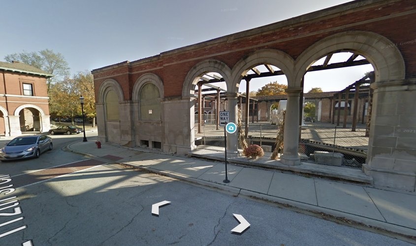
The image above shows an example of where a station would be located outside the Kensington Metra Station on 115th St. This station would provide easy access to those coming in and out of the neighborhood, as well as be especially welcoming to tourists stepping out of the metra station.
Finally, funding for the project will be procured through multiple methods. Firstly, this project is highly cost-effective, given that there will be self-generated revenue. For instance, the shuttles can have tourist-geared tours, taking tourists on a tour of the major historic attractions, generating profit from tourists. Furthermore, residents may purchase cheap monthly or yearly subscriptions to the shuttle service, as well as the revenue generated from leasing the public station space out to local businesses and restaurants. Finally, since this is a historic-preservation based project, there are multiple government sources of funding that may be acquired including grants from the National Trust for Historic Preservation. Additionally, the National Park Service offers 20% income tax credits fro rehabilitation of historic properties, which can be applied to this project.
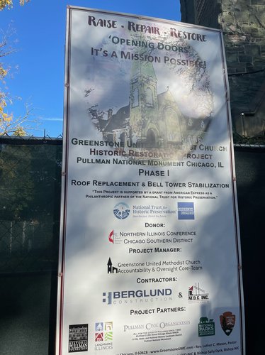
The image above displays the funding sources for historically preserving the historical landmark that is the Greenstone Methodist Church. This was a structure that received attention from both Pullman residents and more largely from organizations such as the National Trust for Historic Preservation. It is through a similar means that funding may be acquired for this larger project bringing the Pullman sleeper train to life.
In modeling the shuttles after the original sleeper train, as well as the stations after Romanesque style architecture, this entire system will maintain the historical identity that originally gave birth to Pullman. It is through this mission that not only will this proposal acquire funding from federal grants as well as attract small businesses, and tourists, but it will serve as a means of revitalizing public space throughout Pullman.
By creating public spaces in sleeper stations dispersed throughout Pullman’s historical sector, establishing market hubs at these public spaces, and revitalizing the streets as public spaces by encouraging walking from station to destination, Pullman will continue progressing towards becoming a community-centered neighborhood, uniting its residents and incoming tourists through their shared connection with the neighborhood’s beautiful history.
Social Mix
The tables below provide information on the demographics of Pilsen as well as the calculated Simpson Diversity Index of Pullman, Far South region of Chicago, and Chicago as a whole. These data tables assist viewers in understanding Pullman through the context of its diversity. All data is courtesy of SocialExplorer.
In terms of race, Pullman is not diverse relative to the city of Chicago. The Black or African American population consists of approximately 80% of the neighborhood population, the next most populous being the White population. Compared to the city of Chicago, with a diversity index of 3.01, Pullman is significantly less diverse. This is interesting given that when speaking with three to four locals at Pullman, multiple observed the ‘diversity’ as a major positive point of the neighborhood. It would be interesting to see whether this diversity is potentially observed on the visitor end as opposed to the resident end.
In terms of education however, Pullman is significantly diverse. There are a large portion of people spanning various types of education attainment from less than high school and high school graduate to master’s degree, with some also obtaining a doctorate degree. The diversity index of 4.21 comes close to Chicago City’s index of 5.17. The neighborhood offers public schools part of the CPS system, as well as colleges for local students. A couple of locals spoke of teaching at Olive-Harvey College, a community college with many local students. It would be an interesting next step to look at the number of students currently listed in the education section of the table who were provided with their education in Pullman itself compared to another area. This study would allow for further analysis to determine where the relatively higher education diversity in Pullman stems from.
Finally, the housing value diversity index (1.92) remains low but not too different from Chicago’s index of 2.20. It’s curious to see that Pullman’s housing value diversity index matches that of the Far South Region of Chicago exactly the same, when rounded to the nearest hundredth. This is particularly interesting because Pullman’s housing district is remnant of the houses lived in by the Pullman Porters. The cost of rent for these houses were originally controlled by the Pullman company. Given the changes in housing value since then to the point where the diversity of the values is representative of the larger Far South Region may allow a viewer to consider that Pullman’s housing district, with the passing of time and removal of the company’s impact, is now dependent on the same market dynamics as the rest of the Far South Region.