Overview
Social Mix
Public Space
Amenities
Connections
Final Project
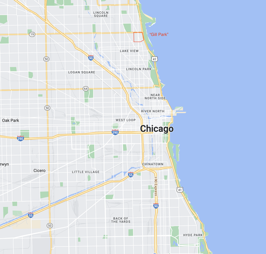
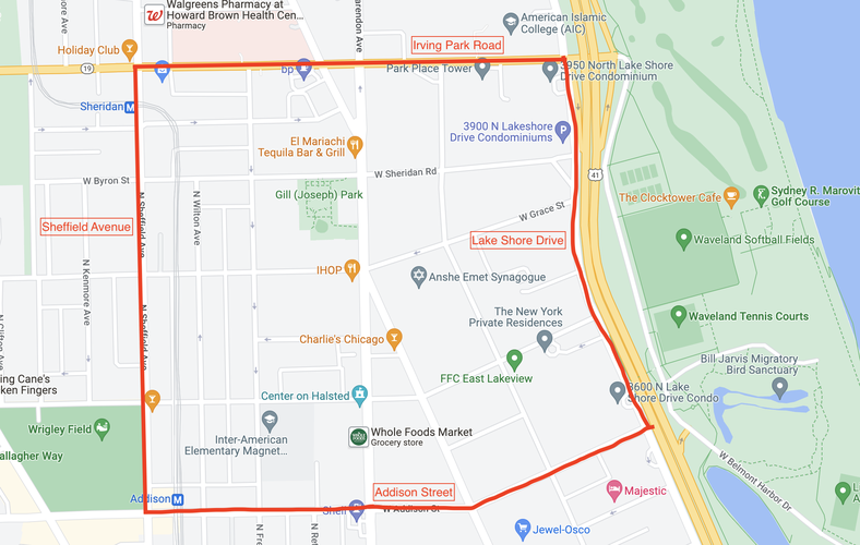
Gill Park as I define it is a neighborhood within the Lakeview community area. It is bounded by Irving Park Road to the north, Lake Shore Drive to the east, Addison Street to the south, and Sheffield Avenue to the west. It is roughly square in shape, being approximately 159 acres, or .25sq mi. This is a small enough area that one can walk from one side to the other in ten to fifteen minutes. This would be small enough to be considered a neighborhood in many traditional definitions, as journeys within the neighborhood would not require the use of a car in most cases.
This area according to Social Explorer contains somewhere in the ballpark of fifteen to seventeen thousand people. While this is larger than many who study neighborhoods would say a neighborhood can be, it is also much smaller than neighborhoods that are often referred to colloquially, such as Lakeview itself.
Gill Park is interesting in that it is not really defined as being a neighborhood officially in any way. It falls on the edge of two community areas, is surrounded by more identifiable and arguably charismatic neighborhoods like Wrigleyville and Boystown, however I believe Gill Park does have its own identity. While it does not have anything bearing the name Gill Park, besides the namesake public park, it does stand out as being a unique area, and the things identifying itself as such are a little more subtle and relational. One thing that makes this neighborhood so unique is the number of small grocery stores. There seems to be one on almost every block at times. While there are larger chains such as a 7/11, Whole Foods, and Walgreens, there are also small, independently run stores that have snacks, drinks, alcohol, and daily necessities. These small stores are not as common in surrounding areas, giving Gill Park a unique feeling.
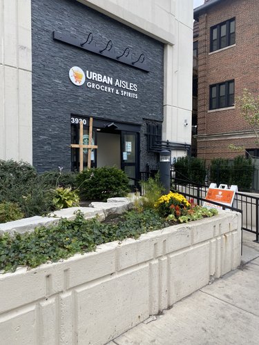
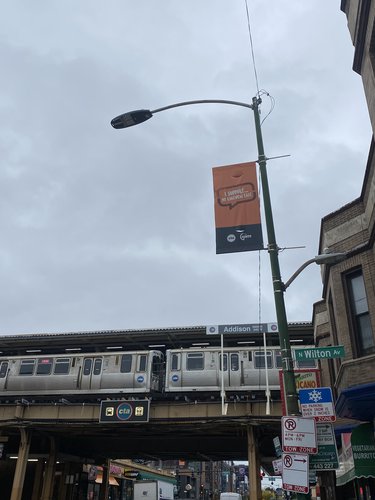
There are also very few chain stores in general in the neighborhood, with lots of small businesses giving the area a unique character as opposed to the more commercialized and generic feeling of Wrigleyville. Additionally the transit connections of the neighborhood are very evident, and give the neighborhood a feeling of being at the center of everything. All parts of the city can be reached in a breeze by hopping on the red line, or catching an express bus downtown.
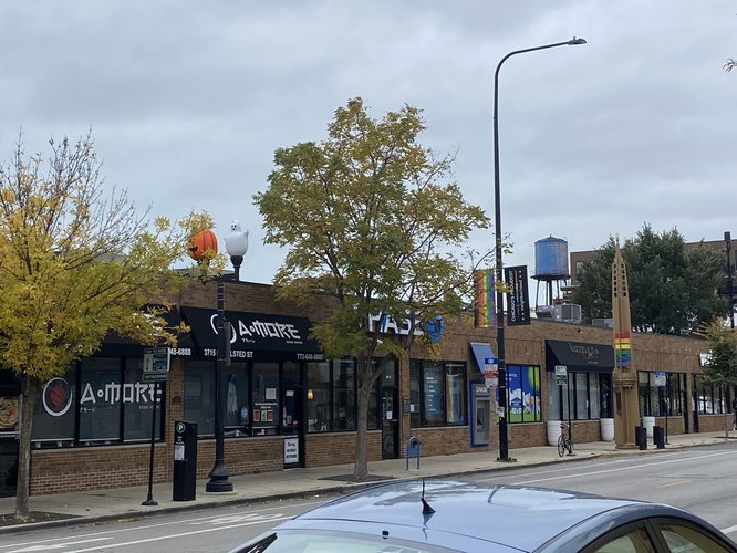
Another identifying feature of the neighborhood can be seen in the numerous pride flags found throughout the neighborhood, both on lamp posts and in business and residence windows. Gill Park, while technically encompassing part of the Boystown/Northalsted neighborhood, feels markedly different from areas further south in the heart of Boystown. While still having a high LGBTQ population, Gill Park has fewer bars and stores catering specifically towards LGBTQ patrons, giving the neighborhood a less commercial or touristy feel.
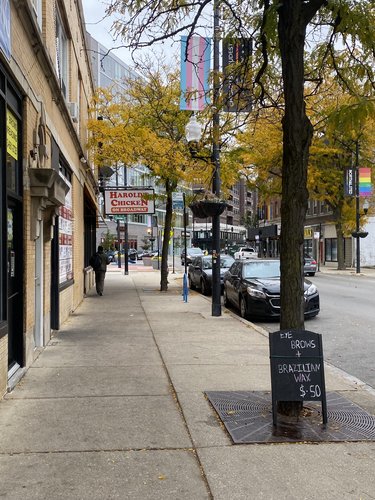
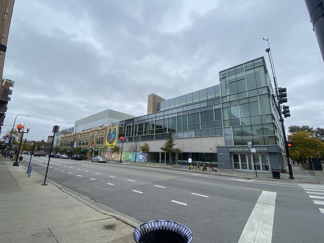
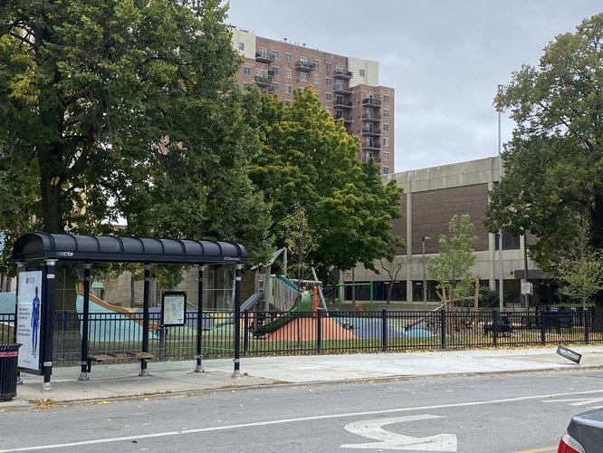
While being a fairly linear neighborhood, with businesses along a central street and residences around the outside, there are a few places that could be identified as centers of the neighborhood. One place would be the namesake Gill Park. This public park has a playground and an open field, as well as fieldhouse with a pool and other facilities. People can be seen here playing with their children, walking their dogs, or exercising. Another place would be one block south at the intersection of Halsted Street, Grace Street, and Broadway. This five-way intersection while not really hosting any central meeting place feels like a pedestrian transit hub for the neighborhood. Another location central to the neighborhood is the Center on Halsted, an LGBTQ community center serving the neighborhood and located above a Whole Foods. This serves as a meeting point of people from all walks of life, with many people passing through on a daily basis.
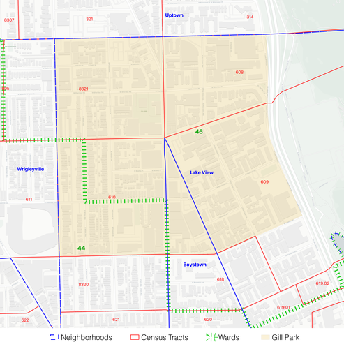
For my comparison layers, I’ve chosen to look at census tracts, aldermanic wards, and neighborhoods as determined by the City of Chicago Department of Tourism. My definition of Gill Park fits surprisingly well with census tracts, being made up of tracts 608, 610, and most of 609 and 8321. In terms of wards Gill Park is split, with most of the neighborhood falling in the 46th ward, which encompasses areas further north such as Buena Park and Uptown, and a small portion falling into the 44th, which is the Lakeview/Wrigleyville ward. It is perhaps this split that partially explains why Gill Park feels different from Wrigleyville, Boystown/Northaslted, or Lake View East. In regards to the Department of Tourism’s neighborhood boundaries, Gill Park encompasses the northern end of Boystown, but mostly falls into the quite large Lake View neighborhood. It is abutted by the Wrigleyville neighborhood to the west and Uptown to the north in this definition of neighborhood.
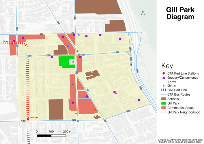
For my diagram I wanted to capture the elements I think are most important to the neighborhood, as in the places that residents of the neighborhood would be visiting the most. One of the most defining features of Gill Park is how well connected it is. The CTA redline runs through the western side of the neighborhood, and two stops are easily accessible to the residents. There are also at least eight CTA bus routes that run through or next to the neighborhood, making it possibly one of the most connected areas outside of downtown. Thesee transit lines are utilized by thousands of people every week to get to jobs downtown, and generally get around the city. Also a prominent feature of the neighborhood are five schools located in or next to the neighborhood, with another located a few blocks outside the boundary I’ve defined. This is a particularly high concentration of schools for one small area. Two other key features of the neighborhood are the number of grocery/convenience stores (both large chain stores and small corner stores) and gyms. These places are frequented by residents, allowing this small area to support at least thirteen grocery/convenience stores, and nine gyms. There are also large strips of businesses running up and down Broadway and Halsted Street, as well as around the Sheridan red line stop.
The name of the namesake Gill Park comes from Joseph L. Gill, a prominent Democrat in Cook County during the mid 1900s, who served on the Chicago Park District Board of Commissioners for many years. The site of the park was acquired in 1970 and the highrise structure was built that contains the park’s indoor facilities. The history of Gill Park the neighborhood is a little less clear than that of the park. Gill Park has never really been considered a neighborhood in its own right, it has always been tacked on to other neighborhoods with a more definable character such as Lakeview, Wrigelyville, or Boystown. It is perhaps this vagueness about what exactly the area is that allows it to be less touristy and busy than nearby neighborhoods, leaving the residents to enjoy the relative calm. The history of Lakeview as a whole is more easily found. The area originally started as a resort town, an escape from the hustle and bustle of the city. In the 1850s the area was formally organized into a township, later a city, and by the late 1800s was annexed into the City of Chicago. The neighborhood hosted various amenities intended to attract people to the area such as the baseball field that would become Wrigley Field, and various shopping centers. Many people who moved to the area, especially post-World War II were young, single people, with many being LGBTQ. This trend continues to today, with the area being occupied by much of the same demographic that it was seventy years ago. Much of the area’s development also stems from city investment into the lakefront that first brought people to the area from the downtown.
Data:
Census Tracts Data: https://data.cityofchicago.org/Facilities-Geographic-Boundaries/Boundaries-Census-Tracts-2010/5jrd-6zik
Official “Neighborhoods” Data” https://data.cityofchicago.org/Facilities-Geographic-Boundaries/Boundaries-Neighborhoods/bbvz-uum9
CTA Rail: https://data.cityofchicago.org/Transportation/CTA-L-Rail-Lines-Shapefile/53r7-y88m
CTA Bus: https://data.cityofchicago.org/Transportation/CTA-Bus-Routes-Shapefile/d5bx-dr8z
Schools: https://data.cityofchicago.org/Education/School-Grounds/qxjd-z277
History:
https://www.chicagoparkdistrict.com/parks-facilities/gill-joseph-park
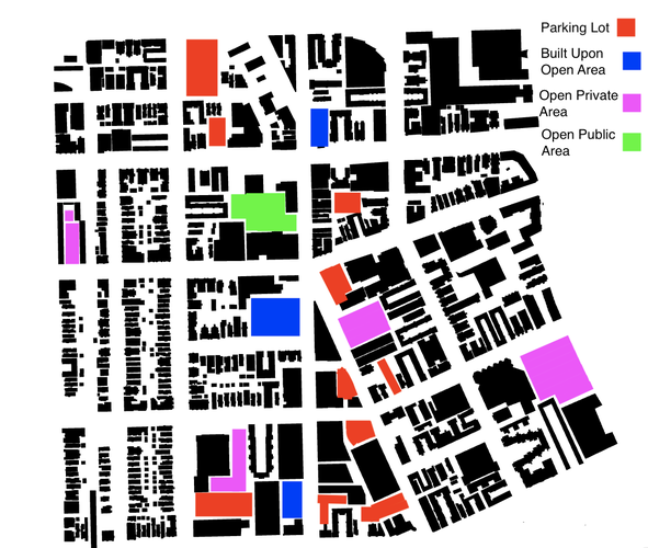
Looking at the empty areas from the black and white ground figure of Gill Park, there are a few things that can be gleaned about the spatial definition of the public realm. One of the most glaring observations is that there is really only one instance of a public space that isn't just a sidewalk. This is Gill Park itself, which has a playground, open grass, and a fieldhouse. This is the clearest sign that there is a deficit in public space in this neighborhood.
The other open space in the neighborhood is taken up by three different things: parking lots, recently constructed buildings, and open area that is privately owned. A parking lot is the most numerous use for open areas in the neighborhood. This is expected in any car-centric society, however for such a well-connected neighborhood the number of cars and parking lots is surprising. The second most common case is that of open areas, often with grass, trees, and other things, but they are privately owned areas. These could be school yards, housing development courtyards, or unbuilt land next to a condo tower. This land appears to be public, but isn't really, with people unsure if they're allowed to use it. The third type of non-public open area use is recent developments that have gone up in areas that were open in 2008 when this dataset was made. These buildings are a result of the high demand for residences in this neighborhood driven by the good transit connections. As seen in the map above, the red, blue, and pink areas represent a very large amount of open area that is not public. It would be very interesting to see how different the neighborhood would be if these areas were truly public areas.
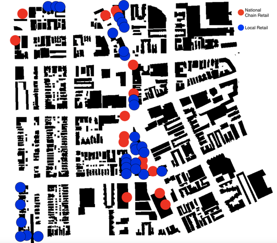
The Gill Park neighborhood has a healthy mix of both local and corporate businesses. In my evaluation I looked specifically at a specific cross-section of businesses that includes essentially every business where you receive some physical object. This includes places like grocery stores, pharmacies, and stores, but also things that aren't as commonly thought of as retail such as bars and restaurants. In the map below, every location of a business that fits this criteria is marked with either a red circle or blue circle. A red circle indicates a national-scale chain, and a blue circle indicates a local business of some degree. The red circles include things like Walgreens, 7/11, Whole Foods, Subway, Starbucks, and more. The blue circles outnumber the red ones in Gill Park, giving the impression that the neighborhood is quite well serviced by local businesses.
I would argue that in the case of this particular neighborhood, especially when compared with surrounding neighborhoods, Gill Park strikes a good balance between small businesses and larger corporate entities that may draw in people from further away. When looking at nearby neighborhoods such as Wrigleyville or further south areas of Lakeview East, there is a much higher density of corporate chains which leads to a much more generic feel. I would also say that the large corporations help to fill in the gaps without overwhelming local businesses. Whole Foods for example is quite a large draw, but there are also numerous small grocery and convenience stores that exist in the neighborhood. Something interesting that Whole Foods also does as a large corporation is it draws people to the attached Center on Halsted community center, bringing it a higher number of visitors than it perhaps would get otherwise. While Gill Park is certainly not completely devoid of large corporate businesses, it is not drowning in them to the point that the neighborhood completely loses its local character.
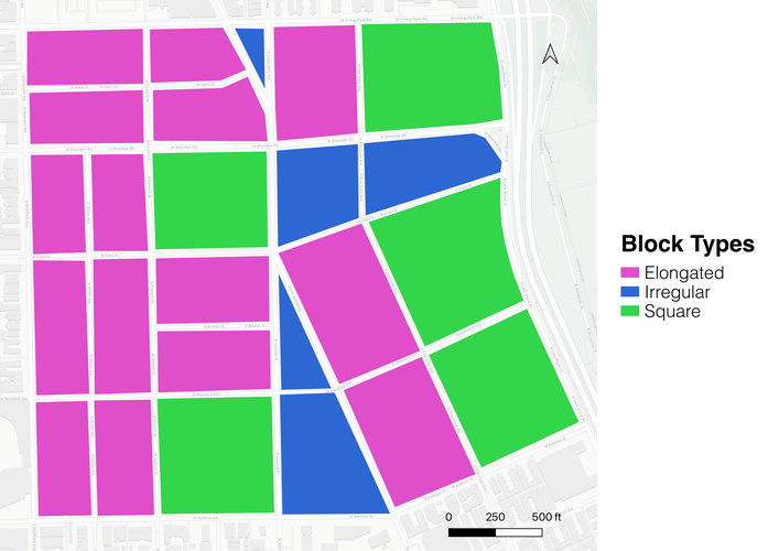
Gill Park has a mix of the three block types of square, elongated, and irregular. Elongated blocks are a very common block style to see in Chicago, with the blocks typically being used for single family homes and apartment buildings with few units. They often have alleys running down them lengthwise to allow every lot a parking space off of the street. There are a handful of square blocks, these tend to have larger apartment buildings on them, with many being the typical U-shaped courtyard buildings, allowing the building to penetrate deep into the block, negating the need for an alley for access. The square lots are where many of the larger buildings in the neighborhood are located such as the Center on Halsted. There are also a few irregular blocks in the neighborhood caused by the angled Broadway and Grace Street. The tight corners at the intersections of these streets are sometimes occupied by buildings, but other times are parking lots or simply sidewalk.
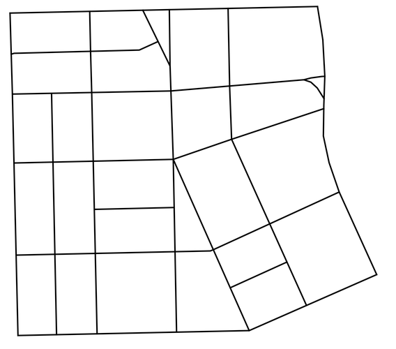
In terms of a network type Gill Park seems to overall be a Washington pattern network, with the neighborhood generally being a grid, with a few diagonal streets breaking it up and acting as more arterial roads. The diagonal streets provide good traffic flow parallel to the lake in the case of Broadway, and good movement off Lakeshore Drive in the case of Grace Street to the east of Broadway. While the variability of lots in Gill Park is not as bad as it is in some Washingtonian networks, it does have a few instances of angles that are simply too sharp to be usable space.
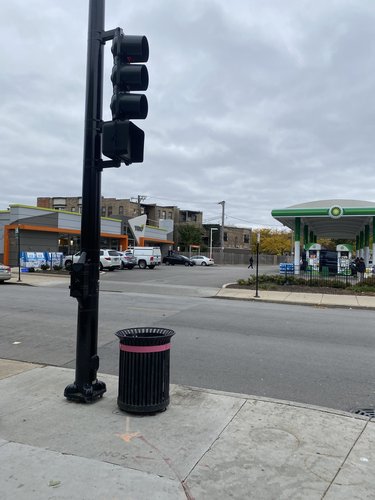
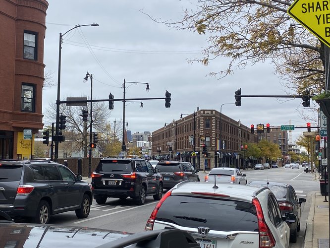
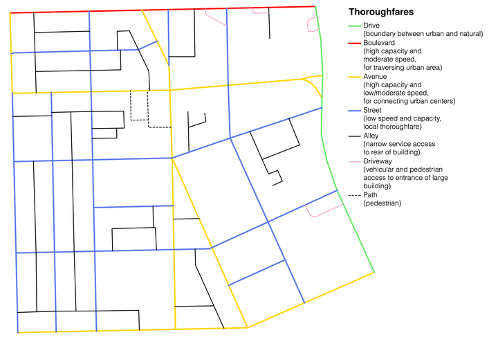
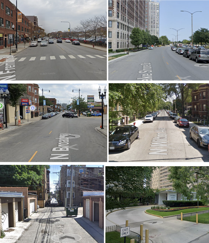
Gill Park has a wide variety of thoroughfares for such a small area. While not running through the neighborhood it is bounded by a Boulevard type to the north and a Drive type to the east, Irving Park Road and inner Lakeshore Drive, respectively. Irving Park Rd. lacks slip roads, but is a higher-speed thoroughfare which carries more people than other streets in the neighborhood characteristic of a Boulevard type. Inner Lakeshore Drive, while not carrying a particularly high volume, clearly fits the definition of a Drive type thoroughfare with buildings only on one side and park on the other. A few thoroughfares fall into the Avenue type in Gill Park: Addison Street, Broadway, Halsted Street, and Sheridan Road. While these do not have termini as the Lexicon of New Urbanism suggests they should, I believe they still fit this type of thoroughfare, as they carry more traffic than a Street type thoroughfare. They are the kind of thoroughfare one might use to cross a neighborhood or two, but are impractical for longer distances in the city. The rest of the other thoroughfares that are used for automobile transit as opposed to access fall into the Street type. They carry less traffic, are sometimes one way, and have frequent stop signs making them impractical for most travel. Gill Park also has quite a few alleys, perhaps fewer than expected though. Especially in the west side of the neighborhood alleys are used to provide parking access to individual lots. Alleys on the east side of the neighborhood tend to not be used by every building backing up to them. There are also a few thoroughfares that could be considered Driveway types. While not really fitting into the Lexicon's definitions, there are enough occurrences in the neighborhood that make them distinct from something like an alley. They occur with large apartment towers that create a pull-through entryway for the lobby. These are often used by pedestrians as shortcuts to escape the weather, besides obviously being used by vehicles visiting the building. Gill Park only has one location that has any paths, being the namesake Gill Park itself. These paths are essentially sidewalks that just go from one side of the park to the other, not really adding any accessibility to the neighborhood.
In terms of connection, overall Gill Park could be considered to be quite well connected in terms of block, network, and thoroughfare types. The variety of block types in the neighborhood allows for great diversity in terms of buildings, with square blocks being used for larger buildings, and elongated blocks being great for small residences. Irregular types, while not numerous, do provide some noticeable character to the area, breaking up the otherwise stark grid, and allowing for corners to be particularly highlighted. Network type goes hand-in-hand with block type, so overall I would say the network type is a positive thing for the neighborhood. The Washingtonian type network is pretty, but does of course lead to some places having weirdly shaped lots. Having only a few instances of angles within the grid strikes a good balance between the aesthetic appeal of an angled street with the practicality of a grid. The diagonal streets also provides good opportunities for improved traffic flow which is ever so important in car-based American society. In terms of Thoroughfare connectivity I would say that Gill Park is well-connected, but could be improved in one specific way. The neighborhood is very well-connected from a vehicle perspective. The mixture of Drive, Boulevard, Avenue, and Street types encourages a clear hierarchy for travel, focusing traffic onto key streets while keeping others more quiet. There are also quite a lot of alleys, allowing buildings to easily be serviced and parking easily reached. The one way in which connectivity could really be improved in Gill Park is pedestrian connectivity. As mentioned in the Thoroughfare section above, pedestrian-only paths are only found within the park, with pedestrians otherwise having to share the space with vehicles to some degree. Alleys that do not go all the way through a block may provide access to parking areas, but they don't allow pedestrians to get all the way through the block, as they will run into private buildings eventually. Some blocks are also quite long with no way to cut through as a pedestrian, leading to extra walking depending on the journey. Finding a way to add in paths through blocks would greatly improve accessibility of the neighborhood, and would likely increase social connection as residents would be more likely to walk within the neighborhood.
My plan for intervention in the Gill Park neighborhood focuses on improving connectivity in the neighborhood. As we’ve seen, the issues facing the Gill Park neighborhood include lack of wide diversity (although the neighborhood does fare better than Lakeview as a whole) and ambiguous spaces that leave residents wondering whether they are public or private. While these are both important issues, for my intervention I am going to focus on connectivity, as diversity is such a complex issue that is difficult to be solved with one intervention and ambiguous spaces can partially be addressed by addressing connectivity. The connectivity of the neighborhood can be improved via simple changes to the built environment, whereas something like lack of diversity will involve more systemic change to policy. The neighborhood particularly needs improved pedestrian connectivity because while the neighborhood is quite well connected from a car’s perspective, in terms of a pedestrian there are many places that are not easy or safe for a pedestrian to access, and this lack of pedestrian connectivity leads to more car usage than is necessary. By improving pedestrian connectivity it would also create a greater sense of neighborhood for residents through bringing more people into contact with each other, as the area is a sort of borderland between other neighborhoods and doesn’t have a well-defined identity. Descriptions of three specific interventions and their locations are below.
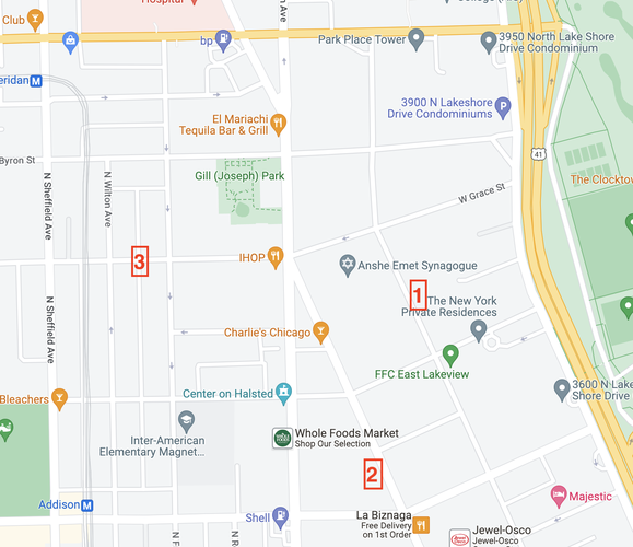
Map above shows the specific locations of the examples in the following examples, but there are numerous examples throughout the neighborhood where these interventions could be implemented.
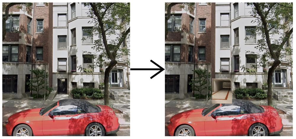
The first intervention to improve pedestrian connectivity involves creating pedestrian pass-throughs in some of the largest and most inaccessible blocks. Some blocks in the neighborhood are over 500 feet on a side and have no pedestrian access to the interior of the block. This requires residents to have to make longer journeys, which in turn increases car usage, since at a certain point their route becomes too long and they’ll simply take a car. This intervention seeks to decrease the “Manhattan distance” that pedestrians have to travel to access services. This would involve transforming pass-throughs that already exist in some buildings into public pedestrian walkways. These pass-throughs allow the residents of the building to access the alleyway, essentially functioning as a private connector between two public thoroughfares. By making a handful of these public it would greatly increase access and would require minimal cost.
Creating pass-throughs makes blocks more accessible, and fosters more social connection.
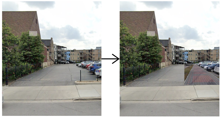
The second intervention to improve pedestrian connectivity in the neighborhood would involve semi-pedestrianization of parking lots. Currently there are a variety of street-facing parking lots that serve various businesses in the neighborhood. While intended for cars, these are also utilized by pedestrians to access the buildings, as well as often used to access the alleyway that these parking lots abut. While in a perfect world these parking lots could be removed entirely, it simply isn’t feasible in this part of Chicago to do so. This intervention would involve building in pedestrian infrastructure like sidewalks into parking lots to separate pedestrians from cars, making the parking lots safer, more welcoming for pedestrians to use as a thoroughfare, and more accessible to disabled residents.
Adding sidewalks to parking lots creates a safer, more inviting space for pedestrians to utilize.
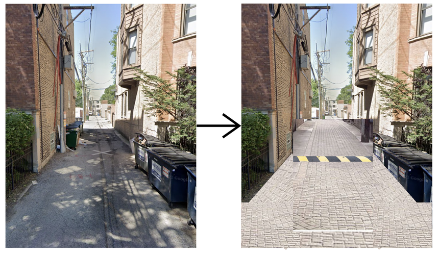
My third intervention to improve pedestrian connectivity is by improving the quality of alleyways for pedestrians. Alleys in the neighborhood are currently utilized by cars to access the rear of buildings for parking, with pedestrians utilizing them having to dodge potholes and vehicles, making the alleys dangerous and also completely unusable by disabled residents. Improving the alleys would include repaving them either with concrete, or ideally something like pavers that would be more inviting to a pedestrian, and more obvious that they are intended for pedestrian use. It would also involve installing speed humps to slow down cars using the alleys and make it safer for pedestrians.
Improved alley conditions and new speed humps make cars less of a focus.
Google Maps. (2017). [Street Panoramas. Chicago, IL] [Broadway, Grace St., Pine Grove Ave.]. Retrieved Dec 4, 2022
“Strengthening Our World-Class Highway System.” Federal Highway Administration, https://highways.dot.gov/.
“Precast Concrete Company: Chicago, IL.” Utility Concrete Products, https://utilityconcrete.com/.
Speed Bumps Are an Unavoidable Part of Business | Inc.com. https://www.inc.com/ami-kassar/speed-bumps-an-unavoidable-part-of-business.html.
The Illustrated Technical Guide to the Accessibility Standard for the Design of Public Spaces, https://gaates.org/DOPS/default.php.
Social Mix
As it is a North-Side-of-Chicago neighborhood popular with young professionals, I would say that Gill Park is unsurprisingly not incredibly diverse, especially when looked at in the broader context of the North Side region as a whole, and the city of Chicago. As seen in the demographics table, Gill Park is a neighborhood filled with white 20 and 30 somethings, with the majority having a college degree or more. The majority are renting and living in large buildings, with the residents that are owning tending to be in lower-value housing, most likely condos as opposed to single-family houses. These demographics aren't really surprising, and would overall be similar to other nearby neighborhoods. Interestingly however, when Gill Park is compared to the community area it falls into, Lakeview, it actually comes away as being more diverse than the community area when taken as a whole except in the diversity of household type. Household type in this chart refers to households as either being a married family, father-only family, mother-only family, or non-family household. As Gill Park is in a very dense area near transit filled with young people who have yet to settle down and start a family, it isn't surprising that Lakeview as a whole, which extends further west with more single family homes, has more family households. It is perhaps this access to transit and more dense areas that gives Gill Park more diversity, by being an attractive area to live in for more people compared to other areas of Lakeview which perhaps cater more specifically to families.
Note: Poverty in the diversity comparison is based on a rating of residents being poor, struggling, or OK financially.