Overview
Social Mix
Public Space
Amenities
Connections
Final Project
Defined as the area between the Chicago River and the streets Montrose, Ravenswood, and Diversey, the North Center community area’s 2020 population is 35,114. This is quite large for one neighborhood, which is reflected in the fact that the community area can be broken down into several smaller and more distinct neighborhoods. What I define as the core Northcenter neighborhood has a population of closer to 19,000 (a rough estimate using census tracts). This is still large, equivalent to a well-attended hockey game in the NHL, but still a cohesive neighborhood which will be discussed below.
Geographically, the North Center community area is 2.07 square miles, while the core Northcenter neighborhood makes up about 1.1 square miles.
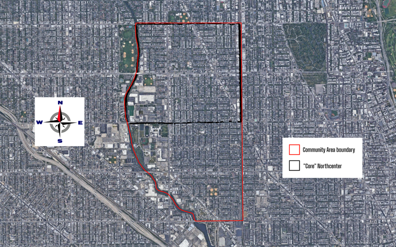
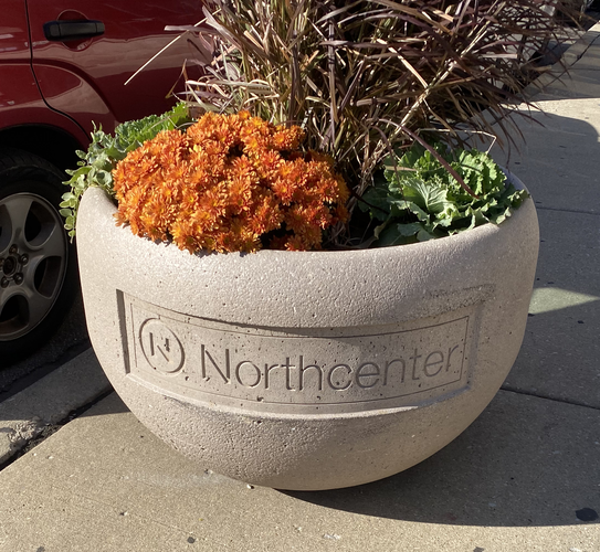
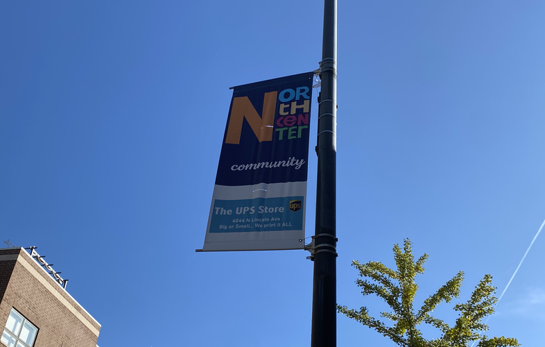
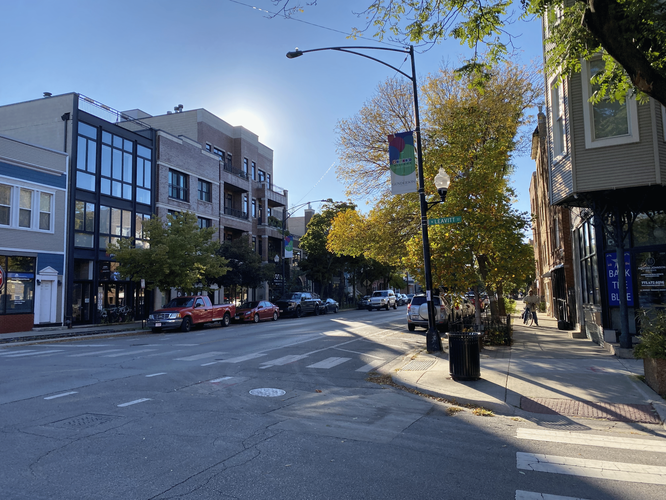
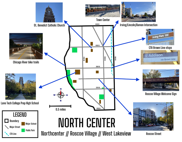
North Center certainly has a distinct identity as a neighborhood. Banners, flower pots, boundary posts, and more display the neighborhood name and can be seen all around the area. The local identity goes against the semi-official community area’s spelling and doesn’t include a space between North and Center. As a lifelong local of the area myself, I feel as though the community area designation of North Center is relatively well-delineated, especially considering other community areas in Chicago, but it’s still not entirely perfect. One minor shortcoming is a very small northeast section near Ravenswood Avenue and the Metra tracks, which is sometimes considered part of the Ravenswood neighborhood. A more pertinent culprit is the southern third of the community area, south of Belmont Avenue and centered around Hamlin Park, which is also less connected to the core Northcenter neighborhood and often thought of more as West Lakeview. This can be seen in the naming of some businesses in the area, like the New Life Community Church Lakeview. Conversely, Northcenter’s boundaries at the scale of locals also transcend the community area designation - for example, the Northcenter banners can be seen along Irving Park Road west of the Chicago River next to Horner Park. This is the largest green space near the neighborhood and while not officially part of the community area, is seen by locals like myself as an extension of the neighborhood. The Northcenter Chamber of Commerce is a prominent local institution for the neighborhood, and their area of influence stretches west to include Horner Park and California Park, but also includes some areas east of Ravenswood. Calling anything east of Ravenswood here anything but Lakeview feels wrong to me, especially seeing as Lakeview High School is there, but it is worth noting this area’s inclusion by the Chamber of Commerce.
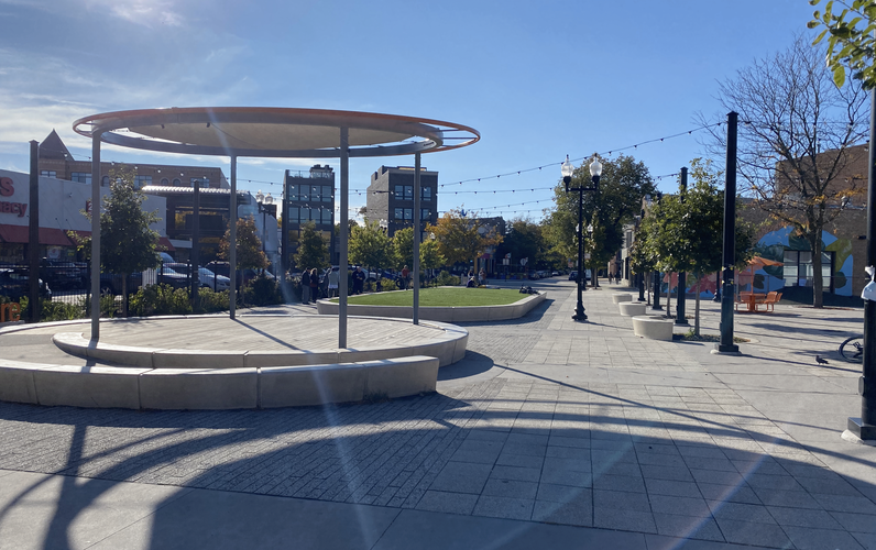
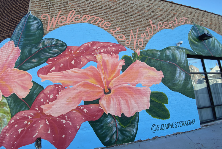
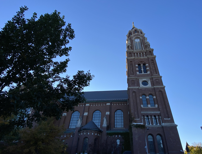
The north half of the community area, bounded by the river, Addison, Ravenswood, and Montrose, is what I would consider to be the “core” Northcenter neighborhood. This section contains Northcenter’s most distinct intersection of Irving Park, Lincoln, and Damen. A block north of said intersection, a short section of Belle Plaine Avenue between Lincoln and Damen was fairly recently closed to vehicle traffic and converted into a pedestrian plaza called the Northcenter Town Square, complete with play areas, seating, and murals. The intersection and town center work in tandem as the focal points of the neighborhood. The identity of this area is also closely tied to St. Benedict Catholic Church, an iconic landmark on Irving Park Road. It operates a popular private school and many nearby residents might think of their neighborhood as being called St. Ben’s. Although my house is a block away from the church, I wouldn’t refer to my neighborhood as being called that, but some people around here definitely do.
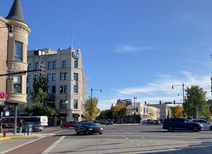
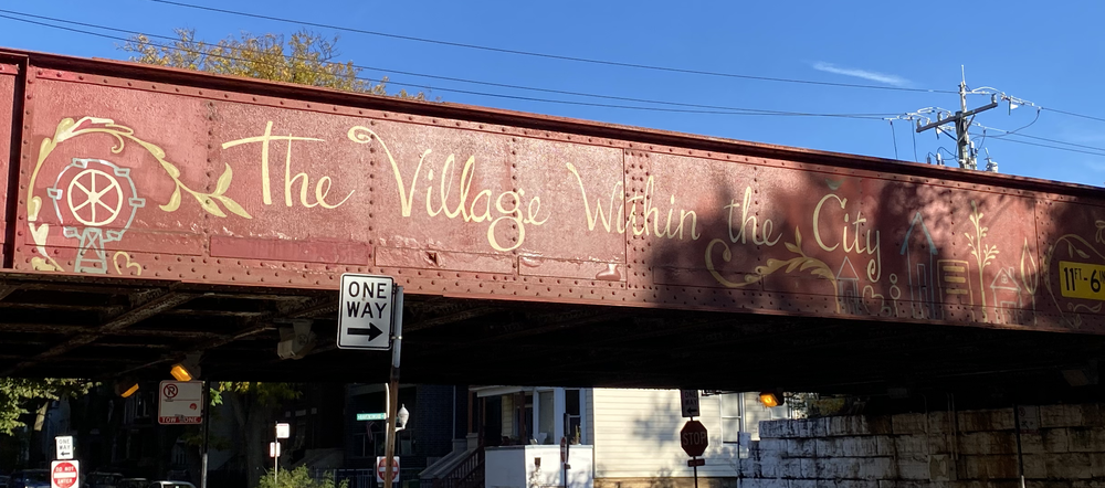
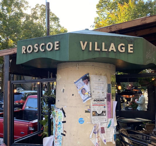
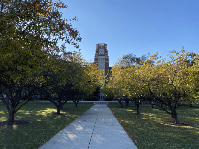
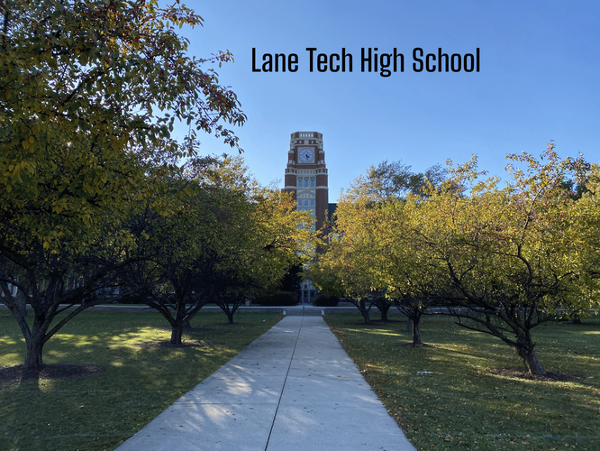
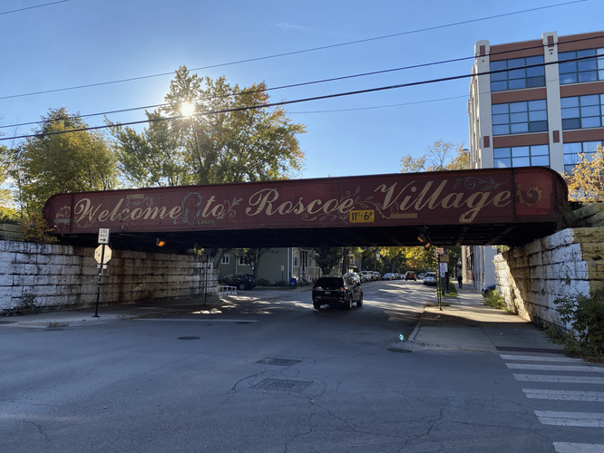
The middle section, bounded by the streets Addison, Belmont, and Ravenswood and by the Chicago River to the west, has a very distinct identity called Roscoe Village. It has its own banners flying from lampposts, community flier posts along Roscoe Street, and a welcome sign painted on the Metra bridge at Roscoe and Ravenswood which advertises it as “The Village Within The City”. The focal point of this sub-community is the Roscoe Street corridor, full of shops, restaurants, and other local businesses. The area of Roscoe Village west of Western Avenue contains some relatively new shopping centers as well as Lane Tech High School, the largest in Chicago and where I went for high school. Roscoe Village is typically thought of as its own neighborhood separate from North Center, but I personally see it as an extension of the larger area. In this way, the “greater” North Center neighborhood as I define it would be everything in the community area north of Belmont, including Horner Park, and this leaves the southern third of the community area definition as having its own “West Lakeview” identity.
Beyond the community area and local neighborhood conceptions, there are many other conflicting and overlapping boundaries that slice North Center up in different ways. All of the “core” Northcenter neighborhood is located within the 47th Aldermanic Ward. The 47th Ward is larger than just this neighborhood though, and reaches into Roscoe Village and parts of the Uptown/Edgewater areas, for example. The core of Roscoe Village as well as most of West Lakeview (the two other areas making up the North Center community area) are in the 32nd Ward. However, two small slices of this area are in the 33rd and 1st Wards. If anything, this goes to demonstrate the absurdity of Chicago’s gerrymandered ward system.
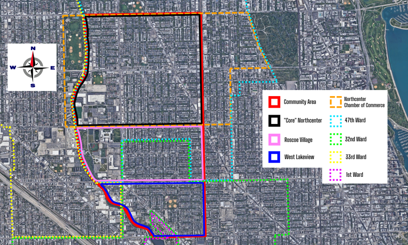
Northcenter’s origins go back to the 1860s and 1870s, at which time the “Ravenswood Land Company” was selling lots for $200 to $2,500 each. Interestingly, this land subdivision took place exactly within the boundaries of the modern-day community area - between Montrose, Diversey, Ravenswood, and the Chicago River. Much of the neighborhood remained undeveloped, and the land being partitioned was used for agriculture originally. As for the neighborhood’s name? It came about exactly like you’d expect. Local resident Henry Moberg chose the name because of its location at roughly the center of Chicago’s North Side. The name was officially adopted by local organizations in 1921.
The neighborhood really began to emerge in the 1880s as the result of industrial processes, at least in the beginning. Along the Chicago River, many clay quarries were opened to support brick production, driven by the rise in demand for brick in Chicago in the rebuilding period following the Great Chicago Fire in 1871. The area quickly earned the nickname of Bricktown, and other industrial sites were set up in the area too. As waves of European immigrants arrived to live closer to their factory workplaces, largely coming from Germany and other central/southern European nations, they brought the neighborhood a stronger residential feel and this encouraged the eventual development of the Ravenswood “L” line (now the Brown Line). This also led to Ravenswood Avenue becoming a light industrial corridor, a permanent mark on the area visible today with its spacious warehouses and brick construction.
Residents gradually became frustrated with pollution from the quarries and other industries along the river, and as a result of complaints, these factories soon ceased their North Center operations and moved farther north. Because of the industrial contamination and use of the former sites as dumping grounds, no housing developers wanted to build on the land, leaving the area open for larger public properties such as the shopping centers, Lane Tech High School, and Clark Park that exist today. One iconic piece of North Center history is the Riverview Amusement Park that operated on this open land near Belmont and Western for several decades until 1967. It was then redeveloped into the shopping centers and other buildings in its place today.
North Center’s more recent history is characterized by quickly changing demographics - in the latter half of the 20th Century, experiencing significant white flight like many other parts of Chicago, the neighborhood became increasingly Hispanic and Asian in its makeup. By the 21st Century though, gentrification began to take hold and spill over from nearby areas like Lakeview, resulting in the North Center of today which is home to many young families and an increasingly urban professional atmosphere. This is especially true of areas farther south in North Center, like Roscoe Village which has only recently developed such a strong identity. The North Center community area is mostly White today but still has a significant presence of Hispanic residents.
https://www.northcenterchamber.com/history
http://www.encyclopedia.chicagohistory.org/pages/899.html
https://www.cmap.illinois.gov/documents/10180/126764/North+Center.pdf
https://www.socialexplorer.com
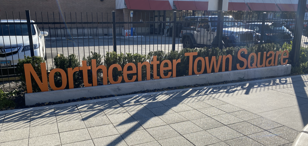
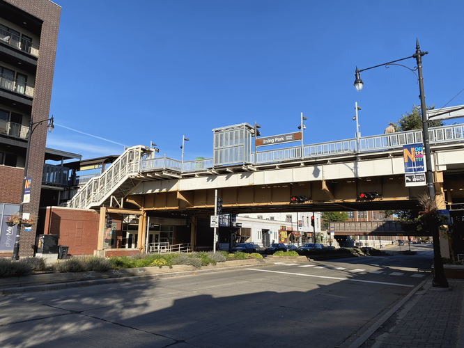
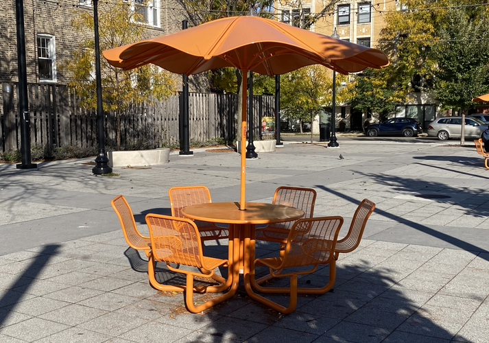
Northcenter has one area that acts as its primary center in my opinion. The Northcenter Town Square, a short section of Belle Plaine Avenue which was converted from a cul de sac to a pedestrian plaza, acts as the center of the neighborhood along with the major intersection of Lincoln, Irving Park, and Damen a block south. The town square has seating areas, public art displaying the neighborhood’s name, a small stage for local performers, and more. Although it’s a small space, it opens up the immediate area in a unique way, providing a pleasant path for pedestrians moving between Lincoln and Damen. The Lincoln/Damen/Irving intersection to the south is also a hub of transport in the community, with major CTA bus routes meeting here and a short quarter mile walk to the Irving Park Brown Line stop. In this way, the town square and intersection naturally facilitate the gathering of pedestrians, transit users, and drivers. However, due to geopolitical factors and the nature of the town square, I feel as though this “center” lacks properties that make it a desirable gathering space and defining feature of Northcenter.
The town square is very new, opening during the midst of the COVID-19 pandemic in 2020. As a result, the space feels underutilized and as though people in the neighborhood aren’t fully aware of its existence. Speaking anecdotally, my family has not made use of the space despite us living only a few blocks away. When I visited it for this project, it was the middle of the afternoon on a sunny autumn Saturday, yet only a handful of people were there. The features of the square attempt to define the neighborhood and draw people in, with its word art and murals displaying Northcenter, yet despite these efforts and its centralized geography, it feels underappreciated. I would argue that the COVID-19 pandemic has certainly contributed to this trend, but other aspects of the local urban fabric also seem to hinder its ability to draw neighborhood residents together.
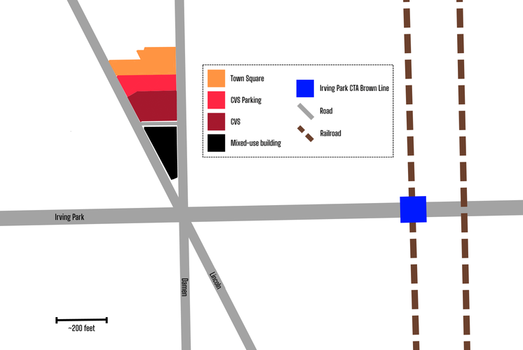
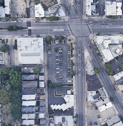
One issue I identified with the area is its location next to a CVS Pharmacy and its parking lot. The store and parking lot take up around half of the triangle-shaped block that it shares with the town square and a mixed-used building. I have always thought of the CVS as overbearing and not a good fit for that location, and when I walked around the area for this project I got the same impression. The town square feels squeezed in between CVS property and the other buildings north of it. It also doesn’t help that the space, with its most prominent features being a stage and various small lawns, feels geared towards small concerts specifically rather than the all-purpose gathering space as intended. In this way, the town square feels secluded and limited in the uses it offers to the community, perhaps leading to the underutilization that I perceived.
In summary, the town square is a great improvement to the neighborhood, increasing its already pedestrian-friendly nature and appeal for families. However, it suffers from its small size and limited features, contributing to a lack of full utilization. The town square subsequently is not entirely successful at increasing neighborhood definition and bringing residents together, although it absolutely makes a great effort to do so and vastly improves upon the road that existed previously.
North Center offers an excellent variety of grocery stores and schools, allowing its residents to not have to travel far for their everyday needs. Despite this, the distribution of some of these amenities is questionable. Local schools in the area are very well-placed, providing each subset of the community area with schools largely within walking distance to most households. However, North Center’s grocery stores are mostly on the neighborhood’s fringes and in locations that fall victim to geographic and car-centric boundaries. In this way, North Center’s walkability and access to daily needs is highly dependent on where within the neighborhood one lives, reflecting its pockets of vehicle-dependent infrastructure and pockets of transit-oriented, walkable infrastructure.
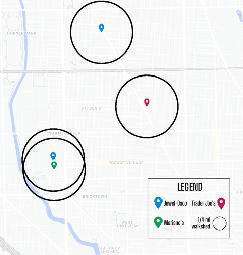
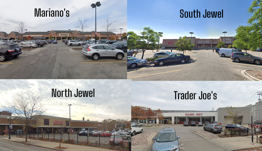
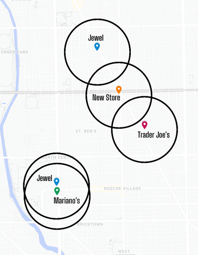
There are four all-purpose grocery stores within the North Center community area: two Jewel-Oscos, a Mariano’s, and a Trader Joe’s. The locations of these stores, especially when just considering the boundaries of North Center, are far from ideal. Every store is near the fringe of the neighborhood, which in the case of the northern Jewel and Trader Joe’s makes them accessible by the nearby neighborhoods of Lincoln Square and Lakeview respectively. However, the southern Jewel and Mariano’s are clustered next to each other on the west edge of the neighborhood. This location near the Chicago River means that they aren’t easily accessible by Avondale residents west of the river. Exacerbating their accessibility issue is the two stores’ car-dependency, located in a strip mall setting with large parking lots in front of the stores. Pedestrians attempting to walk to the stores from the east are forced to cross the busy, multiple-lane Western Avenue and navigate around cars in the parking lots.
The above map shows a quarter mile radius around each grocery store, with areas covered by the circles having a roughly 5 minute or less walk to the store. This clearly demonstrates the poor distribution of the 4 grocery stores - the south Jewel and Mariano’s are very set back from the residential areas, making them harder to walk to and forcing car-dependent infrastructure upon an otherwise very walkable urban neighborhood. There is also absolutely no good reason for the two stores to be so close together, and this placement severely hinders the distribution of grocery stores throughout the neighborhood. As can be seen in the map, most of the area is not within a short walk to a grocery store, and it would benefit greatly if Mariano’s was distanced from the Jewels. The north Jewel and Trader Joe’s are better situated in the area, but also have parking lots of their own which encourage car-dependency over walking.
An interesting note to mention is the possibility of a 5th major grocery store opening in the area. While I am not aware of any official resources on this matter, I have heard rumors that the bank parking lot at the southwest corner of Irving Park and Damen (the intersection at the core of Northcenter, as previously mentioned) could be redeveloped into an Amazon Fresh location. This would be a very centralized and pedestrian-friendly location for a grocery store, and while the potential tenant is perhaps not the ideal store, it would be great to have this additional option in the neighborhood.
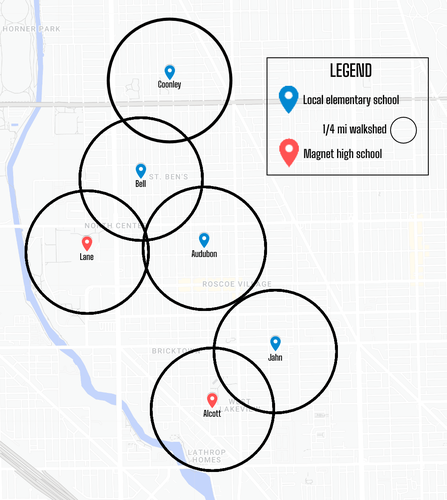
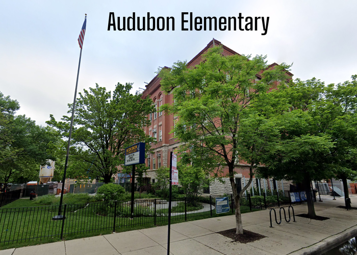
In comparison to its grocery stores, North Center has excellently distributed schools, particularly its elementary schools. There are 4 local CPS elementary schools in North Center. This allows most sections of the community area to have easy access to a local elementary school, with many residents living within the quarter mile walksheds and almost all living a 10 minute walk at most away. In my eyes, this is a victory of urban planning in this area and directly contributes to North Center’s great desirability for families. Attendance boundaries of schools help limit the amount of busy streets children have to cross to get there - for example, the Coonley attendance boundary stays mostly north of Irving Park (the dark gray road on the map), so that kids south of it can attend Bell and not have to cross a multi-lane state highway.
High schools are a very different story in North Center - there is no local high school in the neighborhood. Most of it is within the attendance boundary of Lake View High School, which is a bit east of the neighborhood at the intersection of Irving Park and Ashland. The two CPS high schools in the neighborhood, Lane and Alcott, are both magnet schools. Lane is the largest school in Chicago and one of the largest in the country, and its status as a magnet school brings in students from all across the city. As such, many students take public transportation to get there and aren’t as concerned with walkability. Those that are fortunate enough to attend Lane and also live in the area (like myself a few years ago) have to cross the busy streets of Western and/or Addison to get to Lane’s campus. I lived about a 15 minute walk away from Lane and found it mostly manageable, but always dreaded crossing the Western/Addison intersection. Any neighborhood residents that aren’t accepted to Lane, Alcott, or a different selective enrollment high school have to make their way over to Lake View, which for most of the neighborhood is not within a reasonable walking range. This dilemma is a failure of CPS’ citywide high school distribution, which creates massive attendance boundaries and some very overcrowded schools.
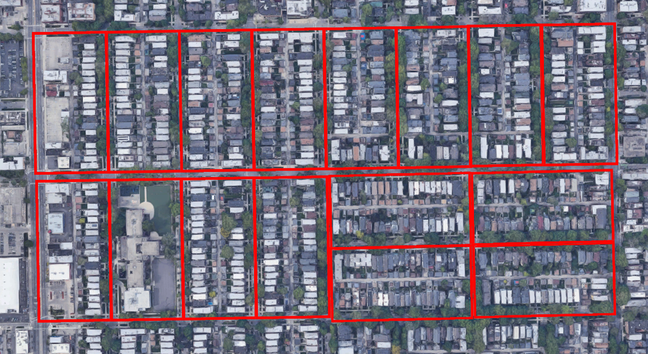
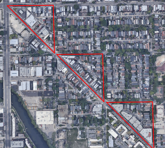
Much like most of Chicago, the Northcenter neighborhood is almost entirely composed of elongated blocks, as per the Lexicon of New Urbanism’s three block categories. A handful of blocks could be considered irregular (e.g. the several triangle-shaped blocks bounded by diagonal streets like Clybourn and Lincoln). However, even these blocks are still cutouts of the larger elongated block system that are, in a sense, the literal building blocks of Chicago. The images below highlight some examples of Northcenter’s prevalence of elongated blocks and some triangular blocks along Clybourn.
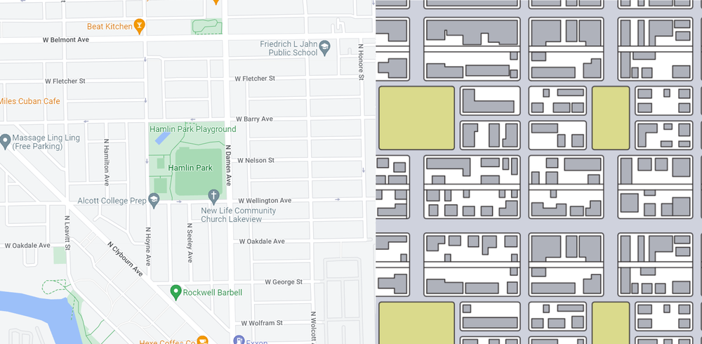
Of the 6 network types, Northcenter most closely resembles the Savannah pattern. Its consistent straight-line street grid, blocks with central alleyways, and almost perfect alignment along cardinal directions are the neighborhood’s most-alike features to Savannah. Much like Savannah, Northcenter has a couple instances of a park or green space breaking up the typical grid pattern, although it’s slightly different in Northcenter. The below graphic compares Hamlin Park to the Savannah pattern example from the Lexicon - notice that while Hamlin Park is the size of two elongated blocks, it is still aligned with existing streets rather than interrupting them. Northcenter also has one characteristic of the Washington pattern, with a couple diagonal streets acting as major through traffic routes. Its diagonal streets are not the majority though, and they also don’t culminate in any one central circle like seen in the pattern’s namesake, Washington DC.
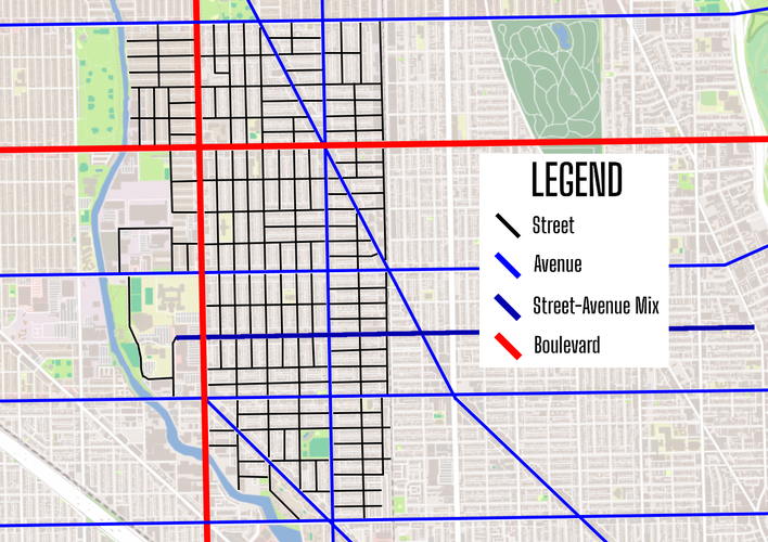
Northcenter is mostly characterized by avenues and streets, as a result of its largely residential character and location within the tightly-woven urban fabric of Chicago’s North Side. Avenues like Belmont, Addison, and Lincoln provide ~30 mph travel distances for typically short-distance drives to surrounding neighborhoods like Lakeview, Lincoln Square, and Avondale. Between this network of usually half-mile spaced avenues are many streets, providing slower traffic and local access to residential blocks. Some streets could be thought of as a blend of avenue and street. A good example is Roscoe, which is both a busier commercial strip providing access between Northcenter/Roscoe Village and Lakeview to the east, but also has 4-way stops at nearly every intersection and feels intertwined with the residential street network.
Northcenter has two larger thoroughfares which are most closely aligned with the boulevard definition provided by the Lexicon of New Urbanism. Irving Park and Western are very large and major thoroughfares, not only in Northcenter, but for a large part of Chicago as well as its surrounding suburbs. Western is the longest street in the city of Chicago, and Irving Park is designated as Illinois Route 19 (making it part of the state highway system) and runs all the way to Elgin, Illinois. Although the speed limits are posted as 30 mph, traffic often moves closer to 45 mph, and these roads are used to travel much farther distances across Chicagoland. While Irving Park and Western are not the quintessential boulevard like others in Chicago’s actual boulevard system, they still operate much like the Lexicon of New Urbanism describes.
The diagram below is a rough categorization of every road in North Center. The extent of the streets (shown in black) corresponds to the boundaries of the community area.
When considering all of the above components in combination, North Center has excellent connectivity, both between subsections of the community area and to other parts of Chicago and beyond. Two main boulevard-like thoroughfares, one east-west and one north-south, provide the neighborhood main pathways to reach far away neighborhoods in Chicago as well as access to highways like Interstate 90/94 to the west and south, and Lake Shore Drive to the east. Smaller but still main thoroughfares offer local commercial districts to neighborhood residents and connection to nearby neighborhoods. And lastly, the majority of roads in North Center are local streets, which are all themselves interconnected and reach major thoroughfares, allowing slow traffic access to all parts of North Center’s residential corridors.
In consideration of the Victoria Transport Policy Institute’s guidelines for connectivity, North Center meets and exceeds nearly every criteria provided. For example, as far as I am aware there are no true cul-de-sacs in the neighborhood - the only one I can think of is Belle Plaine between Lincoln and Damen, which as discussed in previous sections, has been converted to a pedestrian plaza. One area where North Center (and thereby a lot of Chicago) doesn’t meet the standard is its intersection spacing. The guidelines recommend that street connectivity “Limits maximum intersection spacing for local streets to about 600 feet”. The long sides of North Center’s elongated blocks are about 650 feet in length, which creates very slightly overly spaced-out intersections in some areas. However, this is a minor issue and can be overlooked in my opinion among what is an otherwise extremely well-connected urban neighborhood in a well-planned city.
In general, North Center is a well-serviced and largely walkable community on Chicago’s North Side. It features high-quality schools distributed evenly through its neighborhoods, multiple CTA bus routes and L stops, and a relatively dense and diverse housing stock. The neighborhood is family-oriented and has been very attractive to young families in recent decades, pushing the area to develop a stronger sense of identity. Examples of this include the newly-opened Town Square at the heart of the neighborhood and investments in neighborhood branding on flower pots, banners, etc. However, North Center’s amenities could be vastly improved in terms of their size and location. Investing in areas at its main intersection of Lincoln, Irving Park, and Damen would encourage greater pedestrian traffic, heighten the neighborhood’s identity, and allow residents to feel welcomed in their own neighborhood.
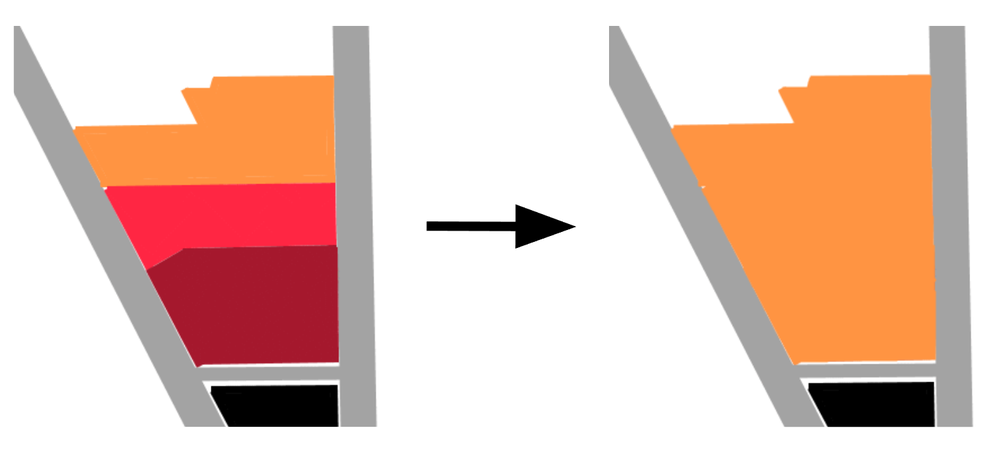
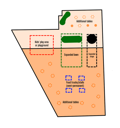
My first intervention calls for the town square to expand by taking over the space currently occupied by CVS and its parking lot. This CVS property is car-centric and takes up far too much space at this prime intersection. As a consequence, the adjacent town square to its north is small and feels closed in by the CVS. The town square’s small size and subsequently small list of amenities leaves little reason for neighborhood locals to make use of the space. It’s a nice space, but with just 3 tables, a small stage, and two small sections of grass, it leaves a lot to be desired. Ceding the CVS property to the town square would well over double its size, allowing us to add many more seating areas, a kids’ play area or playground, an expansion of the stage and viewing lawn, and a space for local restaurants or food trucks to set up small stands. The space would be much larger and pedestrians would feel as though they belong in the space, rather than being boxed in by two streets and a parking lot. With such a good location at the heart of the neighborhood, this much more pedestrian-friendly square will bring increased foot traffic to businesses and increased usage of public transit.
Orange = town square; dark red = CVS; light red = CVS parking
The dark orange indicates newly-added space to the town square, and everything in dashed lines does not currently exist.
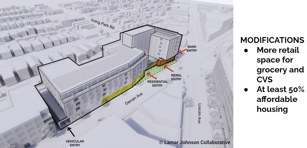
Again at the Lincoln-Irving-Damen intersection is this large Fifth Third Bank complex, with a large parking lot taking up the southwest corner. This is an entirely car centric development, complete with drive-thru lanes for the bank. This is a waste of prime real estate at North Center’s heart, again limiting the density, walkability, and transit-friendly nature of the area. There are ongoing attempts to take over this lot and construct a mixed-use building; while current proposals are huge improvements, I would like to modify their plans slightly. A mixed use building with a small grocery store, space for Fifth Third Bank and the CVS to relocate, and around 150-200 residencies (preferably with a majority being affordable housing) is a slight expansion of the current plan which doesn’t explicitly mention a grocery store or affordable housing. I would also only include a parking lot for residents of the building, in order to discourage additional vehicle traffic at this busy street corner. Much like the town square’s impact, having this dense mixed-use building will encourage residents to walk to the store, take public transit, and provide foot traffic to nearby businesses. Affordable housing near transit nodes is extremely important, and North Center remains a largely middle to upper middle class area without providing many options for lower income brackets. This development would increase its income diversity in addition to fulfilling a large gap in the urban fabric at its core.
The above rendering is the current proposed building, created by Lamar Johnson Collaborative. My plan would include the above modifications, as well as move the parking entrance to the alleyway behind the building (and make parking only for residents).
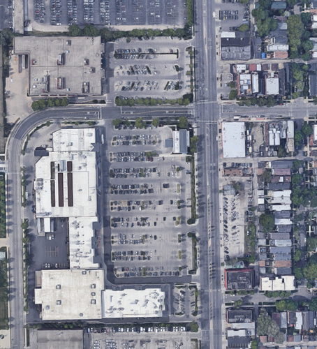
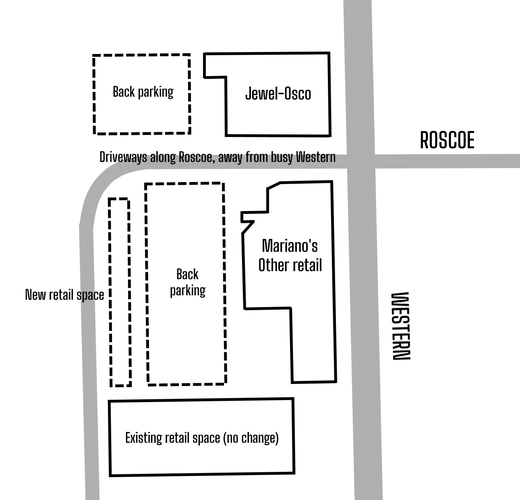
My final intervention focuses fully on grocery stores, and shifts away from the main intersection down to Roscoe Village farther south. At Western and Roscoe is a car-centric shopping center featuring a Jewel-Osco and a Mariano’s, two grocery stores directly across the street from each other. Large parking lots are in front of the stores at the street fronts, encouraging shoppers to only drive to the stores, and making it difficult for pedestrians to navigate. As such, I want to swap the locations of the parking lots and stores, placing the stores right at the sidewalk. This would make the shopping experience far better for pedestrians, most of whom are walking to the store from the east in Roscoe Village. While I did consider moving one of these stores farther north along Western as well, I decided that would be unrealistic given that the shopping center was recently remodeled, and having the stores swap places with their parking lots is already a lofty request. All vehicle entrances to the lots would now be on Roscoe west of Western, limiting the traffic holdups that currently exist on Western from the parking turn-ins. I would also decrease the size of Mariano’s lot to add another retail space west of the lot, to create another buffer between the car and pedestrian infrastructure and provide additional economic value to the neighborhood.
Above is a rough idea of how this reconfiguration could look. Below is an updated grocery store quarter-mile walkshed map, featuring the new configuration and the new store in the mixed-use building. While moving one of the southwest stores farther north would be an improvement, as stated I feel as though that would be too unrealistic. Most residents of the neighborhood are still within a mile or less of a grocery store (especially given that there is a Whole Foods just out-of-frame to the southeast).
In combination, I see these interventions as great first steps that North Center could realistically take to increase its already existing status as one of Chicago’s most well-serviced and walkable neighborhoods. It still lacks in identity and access to some resources, and so investing in its main intersection and grocery store infrastructure will vastly help to tackle these issues.
Social Mix
Considering the Simpson Diversity Indices calculated above, North Center is overall not a very diverse neighborhood. By racial makeup, the area is about three-fourths White. In comparison to the North Region of Chicago, it falls a little bit behind in racial diversity due to areas such as West Ridge and Rogers Park containing a much greater range of diversity compared to other North region areas like Lincoln Park and, of course, North Center. A similar pattern can be observed in educational attainment - North Center has a highly educated population, with almost all 25+ year olds at least having their high school diploma, and a vast majority having completed a bachelor’s or professional degree. This again places it a bit behind the similarly-well educated overall North Region, which scores a bit higher on the index again due to neighborhoods like Rogers Park with greater diversity across these categories.
Interestingly, North Center is very diverse in age cohorts, and has the highest index compared to the North Region, all of Chicago, and Cook County. When looking at the percentages of each age cohort, we see that North Center has a good mix of children and various ages of adults, reflective of its significant population of families. The North Region of Chicago’s age diversity seems to be dragged down by young professional-dominated neighborhoods like Lakeview, which have very large populations of 20 and 30 somethings compared to other age cohorts.