Overview
Social Mix
Public Space
Amenities
Connections
Final Project
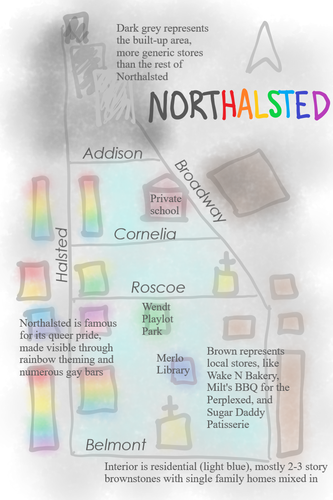
All of these are nicknames for Northalsted, the tiny neighborhood located in the trapezoid between Halsted, Broadway, and Belmont. With a population of around 4500, and a square mileage of only 0.12, Northalsted fits cleanly into Clarence Perry’s “size of a large high school” neighborhood definition. Commercially centered on two streets (Halsted and Broadway), it may fit Jane Jacobs’ idea of a face block as well.
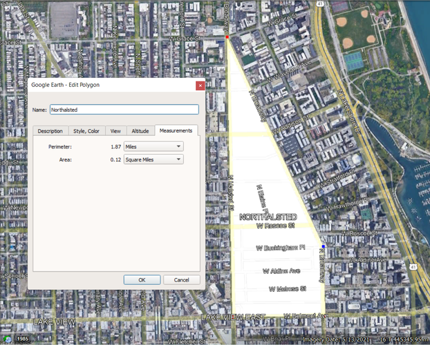
{a screenshot of Google Earth, displaying the geographic size of Northalsted as 0.12 sq. mi.}
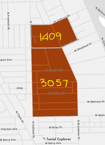
{an image of the two main census tracts for Northalsted with the populations included, amounting to a total of 4,466 people}
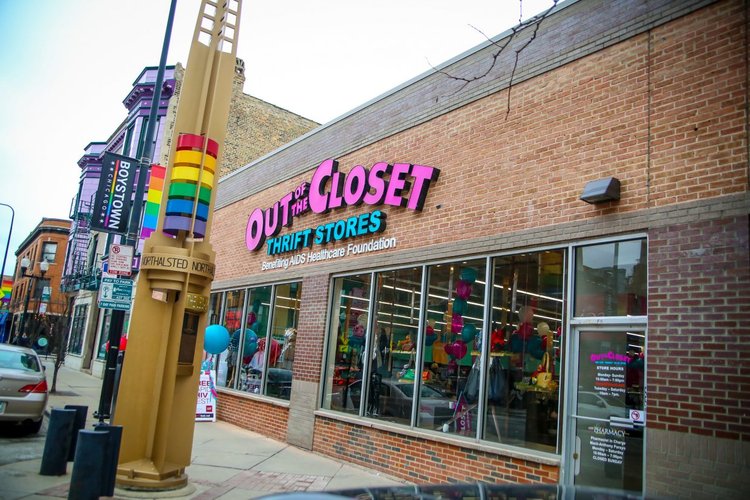
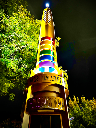
Northalsted has a very strong sense of identity. As revealed by its byline, The city’s proudest neighborhood, Boystown is unified by its LGBTQ+ pride. From the gay and trans flags that line the sidewalk, to the towering art deco rainbow pillars, to the names of its businesses, it’s very clear that neighborhood coherency is based on displaying pride. Because of its small size and fairly clear boundaries (due to the angling of the street grid along Broadway), the neighborhood makes sense in terms of its delineation.
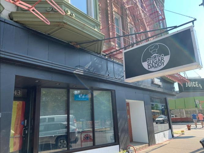
Several windows along the residential interior streets display pride flags, and local businesses bear such names as Flamin’ Pies, Out of The Closet thrift store, and Sugar Daddy Patisserie. A sense of gay pride has clearly transferred to a sense of neighborhood pride as well.
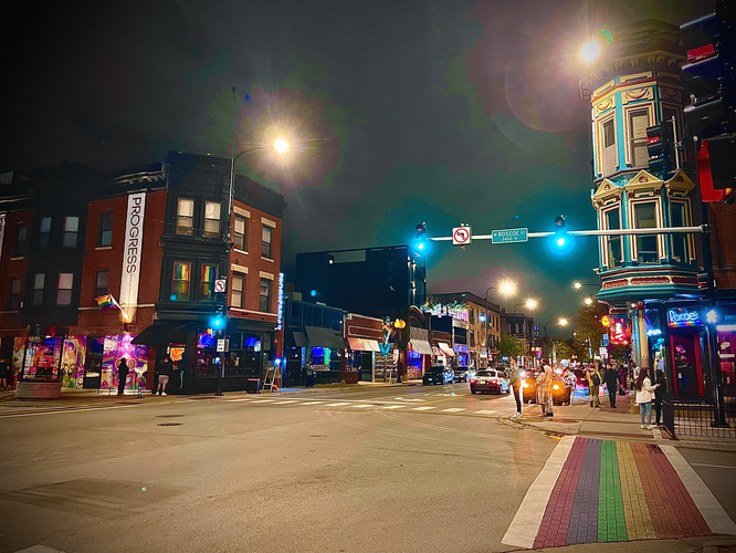
Rainbow crosswalks and art deco light pillars bring cohesion to the built environment. The pillars were constructed in 1998 and mirror distinguishing gateways in traditionally ethnic neighborhoods (Keating 2008).
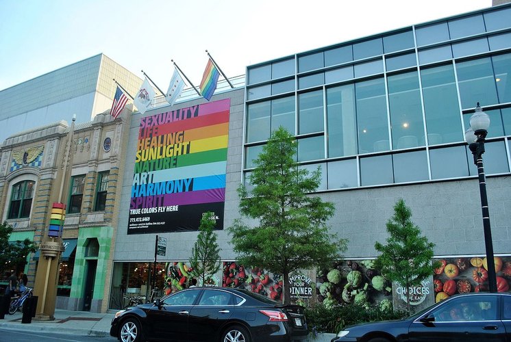
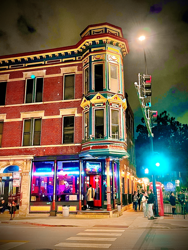
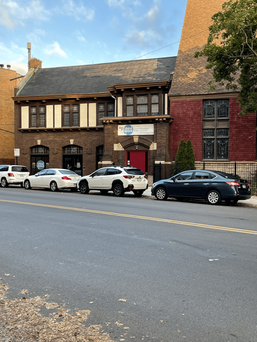
The designated “neighborhood center,” appropriately called the “Center on Halsted,” is not located in the center of the area, but rather in the north corner, where Halsted meets Broadway. It appears to be important civically, offering educational programming and medical services, while the intersection of Halsted and Roscoe is the social center, having the most popular gay bars. Pictured above is the Center on Halsted (attached to a Whole Foods) and Roscoe's Tavern.
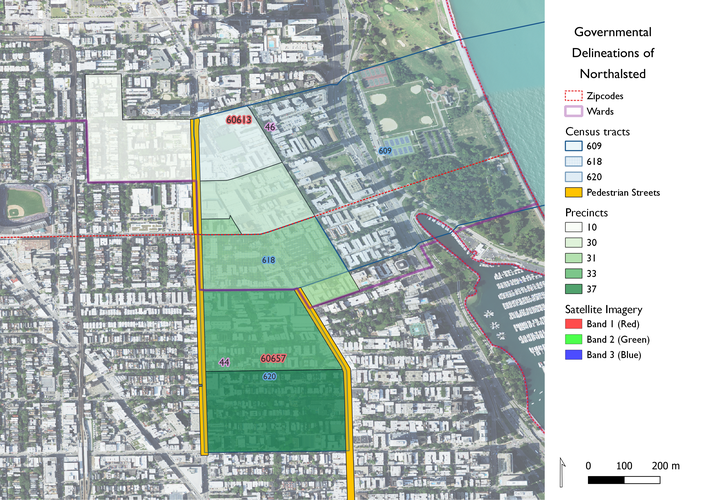
The map above displays the overlapping governmental categories located in Northalsted. The neighborhood, despite being 0.12 sq. mi., is split into two zipcodes, two wards, three census tracts, and five precincts. It is impressive that the neighborhood has such a strong unified identity, considering its split government. The reason for this is because its business alliance is powerful and unified, as will be discussed in the History section below.
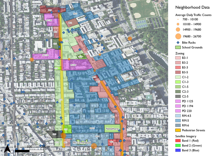
This map displays some of the features of daily life in Northalsted. The zoning for the neighborhood matches what's currently on the ground, with residential units in the interior and commercial development on the arterial streets. The livelier businesses are in fact located along Halsted, with the smaller scale shops and restaurants on Broadway, which reflects the C - commercial zoning (green) on the west side and the B - business zoning (red) on the east. The map also displays bike racks and school grounds, a good measure of pedestrian/bicylist access and flow throughout the area. Furthermore, the orange bubbles represent average daily traffic counts, showing that cars tend to stay on the peripheral arterial streets. Finally, the orange Pedestrian Streets represent city-designated stretches that are particularly friendly to walkers, and thus have special restrictions to maintain this atmosphere. Such restrictions include preventing large blank walls on the sidewalk and front-of-building parking.
A LGBTQ+ community emerged in Lakeview–the broader community area in which Northalsted is located–by the early 1980s, after many had sprung up and disappeared elsewhere in the city (Heap 2004). It also became home to the city’s pride parade at this point, as well as numerous gay bars, such as Sidetrack. It only began to be known as Boystown in the 1990s, and in 1997, Mayor Richard Daley officially recognized the neighborhood as Chicago’s gay district. This was the first time a major city had acknowledged its gay village so prominently; the rainbow pillars were installed shortly thereafter. Queer bars have come and gone over the years, but remain central to Northalsted’s identity. Many older queer activists name the bars as historically de facto community centers, which were established due to low rents in Lakeview in the early 80’s, around which grew the neighborhood identity as we currently know it (Jackson and Nargis 2017).
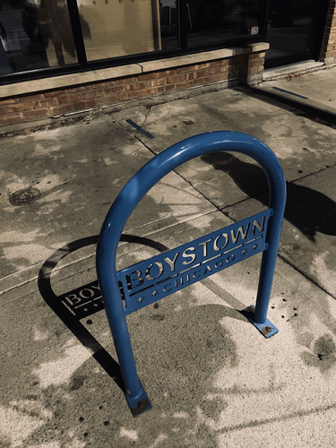
The Northalsted Business Alliance has existed since 1980 and has been instrumental in unifying the neighborhood through optics. Representing over 100 local businesses, this is the group responsible for the 2021 name change from Boystown to Northalsted. There have long been inclusivity concerns surrounding Northalsted’s overwhelmingly white and male population, from the closure of lesbian bars to intensive ID checks targeted at Black and brown bar customers (Jackson and Nargis 2017). After a community survey in 2020, and to reflect its broader base of residents and clientele, the business alliance rebranded the neighborhood Northalsted in 2021. Remnants of Boystown still live on, both in residents' vernacular and bike rack branding, as seen below.
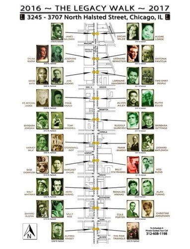
Since the 1980’s, the neighborhood has been an incubator for LGBTQ+ activism. From pride parades and AIDS protests in the 80’s, to transgender rights marches today, both neighborhood residents and LGBTQ+ people from around the area have been brought together to celebrate identity and make change. In 2012, a Legacy Walk was installed along Halsted, which functions as an outdoor walking museum for queer history. Featuring bronze plaques affixed to the rainbow pillars, the Walk celebrates LGBTQ+ figures and social activists like Jane Addams, Alan Turing, and Audre Lorde. It was designated a historical landmark in 2019.
While the neighborhood’s identity as a self-contained gay village–arguably its most visible and most important feature–only emerged after the development of the built environment, a brief look at the history of the general Lake View area reveals a common pattern of Chicago neighborhood development: originally an area of rural farmland, the construction of new railroad lines in the 1850s led to early suburban development. The township of Lake View was annexed by Chicago in 1889 and urbanized quickly, with the addition of Wrigley Field, new shopping centers, and high rise apartments. In the mid 1900s, after this urbanization, the area was mainly settled by childless couples, single adults, and gay men (Seligman 2005).
Heap, Chad. 2004. “Gays and Lesbians” in Encyclopedia of Chicago.
Jackson, Steven and Nargis, Jason. 2017. “Making Chicago’s Boystown.” WBEZ 91.5 Chicago.
Keating, Ann Durkin. 2008. “Chicago Neighborhoods and Suburbs." Pp. 113.
Seligman, Amanda. 2005. “Lake View,” from Encyclopedia of Chicago
Data Sets (from Chicago Data Portal):
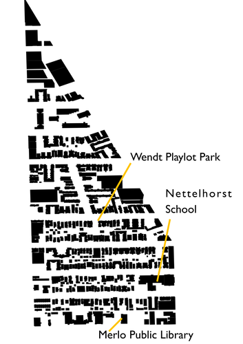
Northalsted has very little traditional public space. This is probably due to the small size of the neighborhood, but in terms of civic space, it contains only a playlot park, a library, and an elementary school.
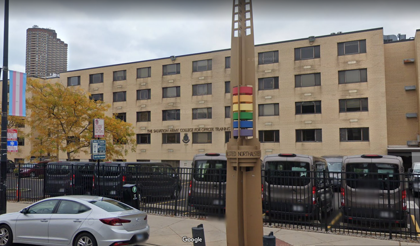
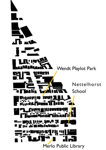
The map above depicts the spatial layout of the buildings in Northalsted, with black polygons representing the buildings and the white interior representing open space like streets, parking lots, courtyards, and parks. As shown, there is very little continuous open space. Most of the social interaction in the neighborhood occurs on the sidewalks and in private establishments like bars (see Overview for more information). Additionally, the area that appears to have the most open space–between the clusters of buildings located near the top of the map–is not a public space at all, but an entirely walled-off training academy for Salvation Army officers. Most of the land is not visible from the street. While Northalsted contains no large park or civic center, the spaces it does have are well-utilized, for the most part.
The three public spaces that exist are all very different from each other, and serve different purposes, though none of them contain much land. However, this does not mean that they are unsuccessful public spaces, as explained below.
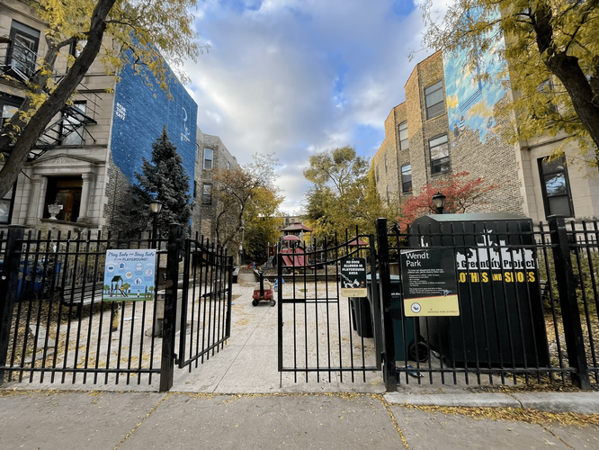
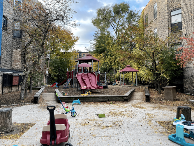
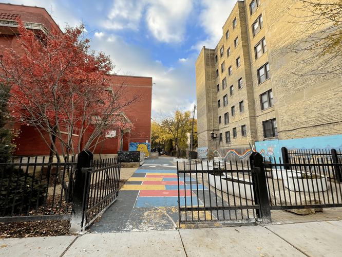
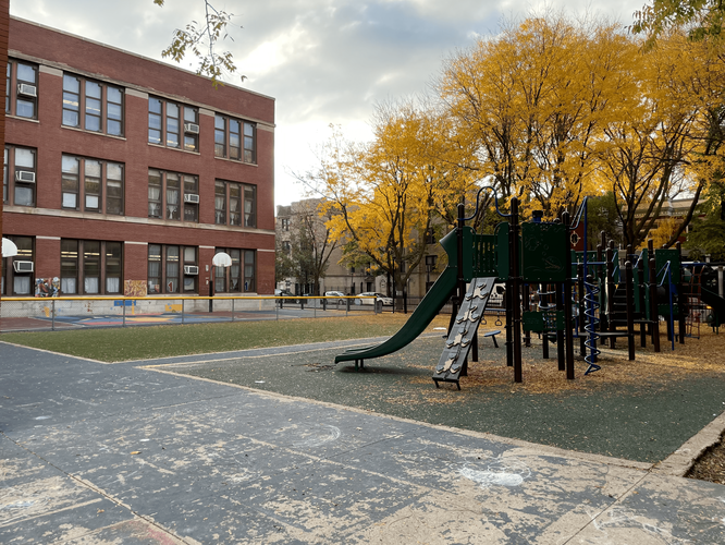
The most traditional public space that Northalsted contains is Wendt Playlot Park. This is a small block playground containing a large play structure, some benches, childrens’ play vehicles, and mulch. There is no grass nor tables. As shown on the map, the playlot is centrally located and situated at the corner of a three-way intersection. Despite this, it still feels sequestered and safe; it’s far from being a focal public space.
Due to its small size and narrow purpose, it is a homogenized space. It would be inappropriate for anyone without small children to spend time in the park; thus, only parents and guardians would experience novel social interactions. While this is understandable from a safety perspective, social interaction between more diverse groups could be facilitated if there were simply more seating options. For example, tables would allow picnic-goers or students to utilize the space.
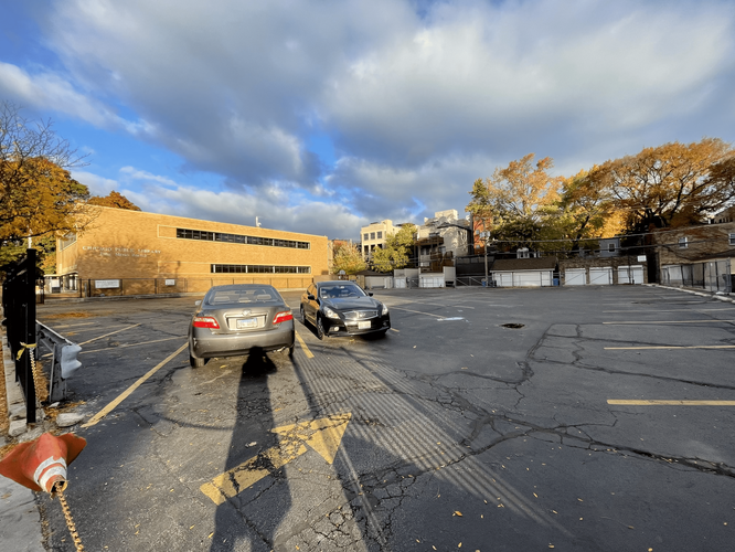
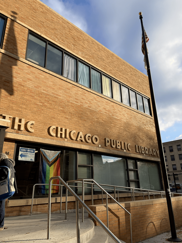
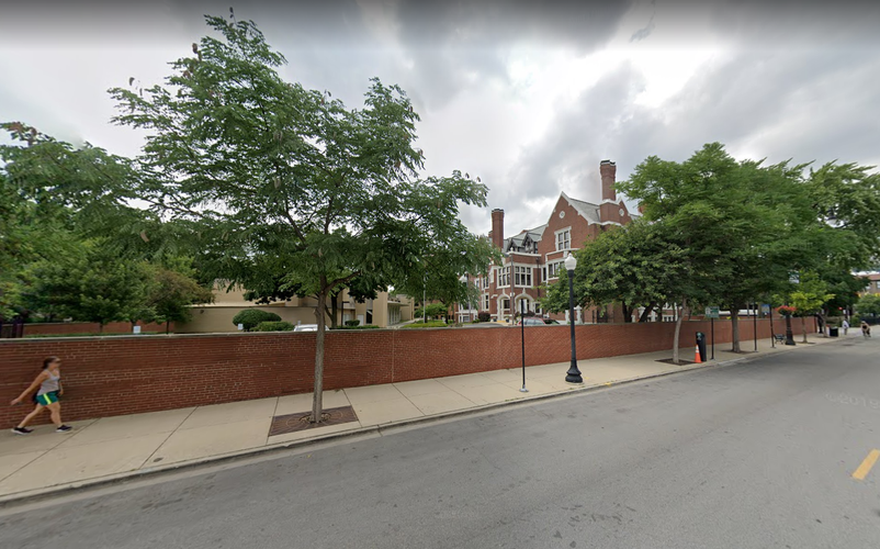
Merlo Public Library is the second-most traditional civic space. Located at the bottom of the map, the library appears to contain lots of open space around it. Unfortunately, this is not actually the case. The space to the right is a large parking lot, while the space to the left is a yard for the church next door. The churchyard is gated and does not appear welcoming as a public access space. The library itself is well-maintained and contains public programming, but it is a mostly functional space where people come to read or access computers. This is an example of an invaded public space in which the car has been given priority: the parking lot next door is unnecessarily large and could become a valuable public space if affiliated with the library. The library is usually busy and located on a pleasant street; outdoor public space would be well-utilized.
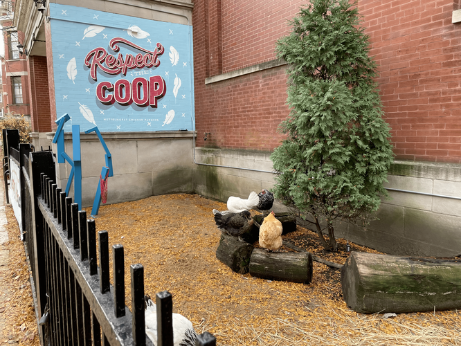
The Nettelhorst School is a Chicago public school. It contains open space on the left side and front (south) of the school. It appears to be a well-loved facility: there is art covering all of the doors and playspace ground, school vegetable gardens, and even a chicken coop. There are multiple playgrounds on the school grounds, as well as turf and blacktop space for students.
While this is a public facility, it is only partially accessible by the public, as no people are permitted to pass through while students are present. Like the playlot, this makes sense from a safety standpoint, though it is good that the space is still accessible when school is out. The school’s spirit and pride in its space almost does more for the neighborhood than public access to the space does. While the school’s playspace is somewhat “privatized” and homogeneous (as it is clearly reserved for students and families with children), changing access would most likely do more harm than good. The mostly insular nature of the space keeps children safe and allows the school to maintain a strong identity.
Located just off the map on the top left is the Center on Halsted. This is a public-private indoor space managed by a nonprofit that specializes in community programming focused on LGBTQ matters. Lots of educational outreach and health programming occurs here. The indoor public space contains lots of tables for general use, and is probably most important in the winter.
There is a church located on the east side of Northalsted that contains a center called “Third Space” (as popularized by Ray Oldenburg and Robert Putnam) that focuses on community building. While it was not busy when I visited, it may be more busy on Sundays when people congregate around the church.
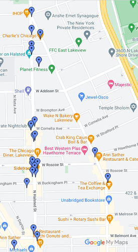
Jane Jacobs defined primary uses as “those which, in themselves, bring people to a specific place because they are anchorages.” In other words, primary uses are businesses or institutions that act as magnets for people who do not live in the area. In Northalsted, by far the most dominant primary uses are the gay bars that line Halsted Street. The image below displays a 2015 record of all of the gay bars located within Northalsted, of which there were 36 at the time. While some have closed due to the pandemic or various market pressures (such as Rehab or Buck’s Saloon), most have remained.
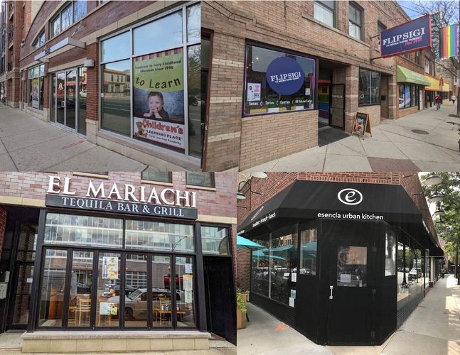
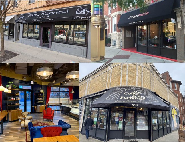
Besides the bars, the vast majority of the remaining businesses are secondary uses, only meant to service customers once they have been brought into the neighborhood by the primary uses. These include local restaurants like Latin-inspired Esencia Urban Kitchen, Mexican El Mariachi, and Filipino FlipSigi, as well as many essential businesses like daycares, grocery stores, and small banks. Useful but non-essential amenities like salons and cafes are also especially prolific in Northalsted.
{a collage of local restaurants and a daycare in Northalsted}
{a collage of salons and cafes in Northalsted}
It may seem odd to assert that bars, which are only active at night, are primary uses, but no other institutions in Northalsted draw people in from outside the neighborhood. There is a large Salvation Army training center in the heart of the neighborhood, but it is fully gated off and does not appear to generate traffic.
Northalsted’s queer bars do a fantastic job of bringing vitality and culture to the neighborhood, but due to their homogeneous nature, they fail to create diversities of use or time. It’s a chessboard populated only by queens. Northalsted only feels “busy” at night; during the day, residents fulfill essential duties and children attend school, but no one from outside the neighborhood arrives, lending the neighborhood a quiet and fully-residential quality. Since the bars are clustered to the west of the neighborhood, along Halsted Street, the neighborhood feels lopsided during different times of the day. In the morning and throughout the day, the sidewalks along Broadway (on the east side) are more used, populated with joggers, brunch-goers, and grocery-shoppers. In the evening, the action intensifies and shifts to Halsted Street, which is often at a standstill due to rideshares depositing their passengers at the bars on the corner of Roscoe and Halsted.
The gay bars–ones like Roscoe’s, Scarlet, and Sidetrack–are primarily responsible for the neighborhood’s well-known vitality and reputation throughout the city. This is due to their historical role in the neighborhood [see Overview] as well as their density. There are five separate establishments on the 100-yard block between Roscoe St. and Buckingham St. alone. The neighborhood (especially its western stretch) has become known for the robustness and eclecticness of its queer nightlife, which functions as a positive feedback loop: the more the street's reputation for liveliness grows, the more people come in, and the more lively its nightlife actually gets.
Despite its quieter character during the day, the local businesses do not appear to be struggling. Very few stores are vacant. The neighborhood most likely has a large enough residential population that remains in the area during the day to make up for its lack of diurnal primary uses.
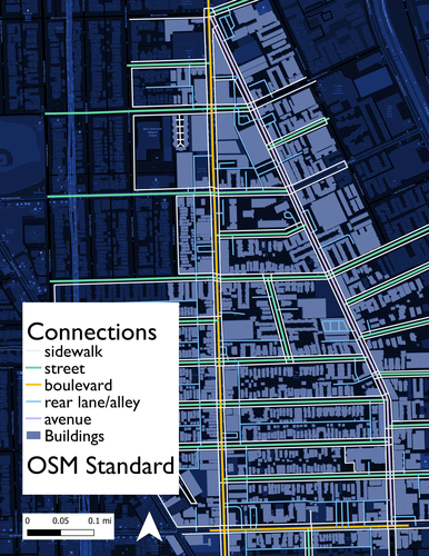
Northalsted is characterized by five main thoroughfare types: boulevards, avenues, streets, rear lanes/alleys, and pedestrian sidewalks. These thoroughfares are distributed in accordance with the neighborhood’s zoning and overall character [see Overview], with the busier boulevard on the western commercial side, the moderate avenue on the restaurant/local business eastern side, and quiet residential streets on the interior. Sidewalks line all thoroughfares. Rear lanes and alleys bisect most of the blocks. A map of these thoroughfares is displayed below.
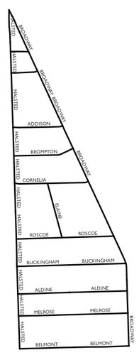
In terms of network type, the neighborhood displays elements of both the Savannah and Washington Pattern. Most of Chicago is gridiron, and likewise, most of Northalsted adheres to the rigid regularity of right-angled streets. However, there are also some streets that cut through the neighborhood at angles, à la the Washington Pattern. Broadway and Elaine both disrupt the Savannah network and provide vistas at the north end of the neighborhood, as well as help distinguish Northalsted from surrounding neighborhoods. However, the diagonals result in oddly-shaped lots, and the intersection at the north corner is ill-defined. The network layout of Northalsted is displayed below.
{the ill-defined north end intersection: a product of the Washington Pattern}
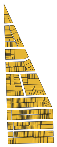
Finally, Northalsted is mostly populated by elongated and irregular blocks. The south of the neighborhood follows the traditional pattern of elongated blocks, with residences on the long edges and businesses on the short edges. Several of these blocks have back alley utility. Meanwhile, the north end has irregular blocks that conform to the diagonals of the streetscape. The lot sizes are highly irregular in size. A map of Northalsted's parcels is displayed below.
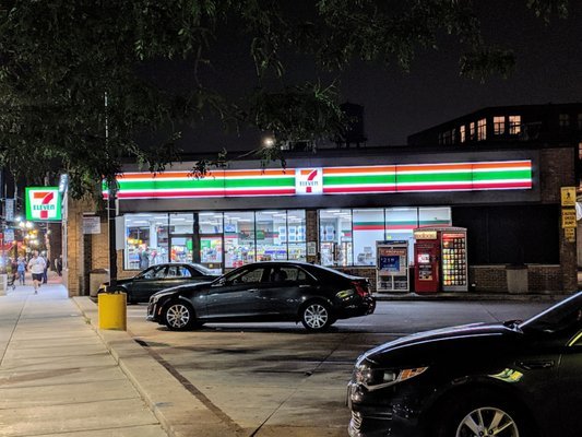
Overall, Northalsted is well connected, but it fares better in terms of thoroughfare and network type than block connectivity. The flow of traffic around the neighborhood is well distributed, with boulevards connected to avenues via streets. The data on thoroughfare type in Northalsted was gathered using open source GIS Open Street Map, then renamed according to The Lexicon of the New Urbanism. According to traffic count data [see Overview], the busiest roads are indeed boulevards Halsted and Belmont. While the busyness of Halsted makes the pedestrian experience unpleasant at times, activity at all hours of the day ensures there are always eyes on the street. This could be improved, however, by enhancing identity space: the intersection of Halsted St and Roscoe St is the “100% corner” of the neighborhood, but one corner is occupied by a 7-11 parking lot (shown below). This disrupts the cultural and pedestrian fabric of Northalsted.
The network connectivity is also satisfactory in Northalsted, since the combination of gridiron and Washington Pattern provides orientation without monotony. The neighborhood is easy to navigate due its regular angles that fit within the larger patterns of Chicago, but it is differentiated from its surroundings by the diagonal Broadway. However, the small size of the neighborhood (caused in part by the angle of Broadway) causes a lack of collective space [see Public Space]. A drawback to the gridiron network is that it is hard to implement any large collective space that was not planned for early on, but Northalsted has many surface parking lots that could be co-opted as public space or completely redeveloped altogether.
Block connectivity is where Northalsted has the most room for improvement. The south end is well connected; since businesses face towards the short ends of the block, they contribute to eyes on the street and general commercial wellbeing. The length of the blocks along Halsted are very short, at only 200 feet. This allows for many route options, a virtue that Jane Jacobs extolled. It is easy and pleasant to traverse the area between Belmont St and Roscoe St, since blocks are short, interior streets are residential and well-maintained, and attractions exist on both ends of the neighborhood, along Halsted and Broadway. However, the neighborhood block connectivity is lacking on the north end of the neighborhood. North of Roscoe St, blocks become longer along the north-south axis, as well as more irregular. This is due to the slant of Broadway, which was a virtue in terms of network connectivity, but disruptive in terms of block design. Odd space leads to underutilized space, mainly unmaintained parking lots. The street frontage is also unpleasant because of the longer, irregular blocks: many large box stores fill these lots, resulting in blank building sides, large parking lots, or walls. While the irregularity of the network is good for neighborhood character, block sizes on the north end can be made smaller to facilitate connectivity.
{the long, blank wall outside of the Salvation Army College: a product of large, oddly-shaped lots on the north end}
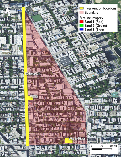
{locations of interventions to improve public space}
While there are many potential areas for improvement in Northalsted–racial diversity and age diversity spring to mind [see Social Mix]–the focus area that is most readily amendable is public space. As discussed in "Public Space", there is a lack of freely-accessible, outdoor public space in Northalsted, especially aimed towards adults, which is the largest age group in the neighborhood. In fact, there is zero greenspace and no public gathering space that isn’t a playlot or schoolground. The three current public spaces are displayed in the spatial diagram below.
The vibrant culture of Boystown is inhibited by its lack of gathering space. This is most readily apparent on the corner of Halsted and Roscoe St. This intersection is the “100% corner” of the neighborhood, or the busiest area within Northalsted. It’s home to Progress Bar and Roscoe’s Tavern, and in close proximity to Sidetrack and Scarlet, which are all busy or historical gay bars. Most nights of the week, all time of year, the corner is crowded with rideshares and pedestrians hopping from bar to bar. However, that is basically the extent of outdoor activity. There is no gathering space at or near the 100% corner, which inhibits the cultural vitality of the neighborhood and fails to make the most of the high volume of foot traffic in the area. Even worse, one corner of the intersection is occupied by a suburban-style 7-Eleven, with a parking lot in front. This space would serve the neighborhood much better as an accessible consumption space, considering the traffic that the adjacent businesses generate. It may be most feasible if the nearby bars bought and developed the lot together. With some zoning and permit adjustments, it could be transformed into a mixed-use, public-private plaza that could be used at all times of day. Said plaza could also contain infrastructure for cultural events, like seating for concerts. The neighborhood often has events going on, like Halloween parades or market days, and creating a communal space for these activities would provide a known gathering space for residents.
{comparison of potential public plaza design to current land use}
Amphitheater photo source: Ramos, D. (2017, June 30). How Boston fails at Public Space. The Boston Globe. Retrieved December 3, 2022, from https://www.bostonglobe.com/opinion/2017/06/30/how-boston-fails-public-space/ku59qo4pLnm6hAPhX3WI2N/story.html
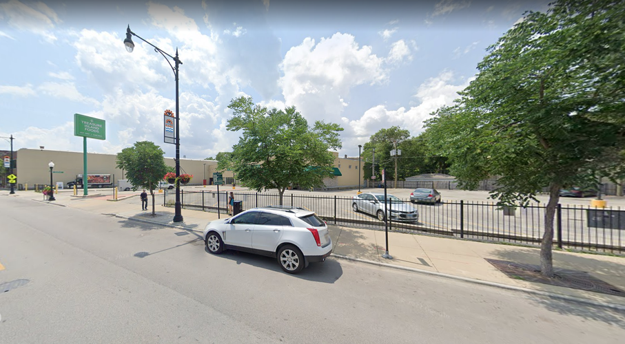
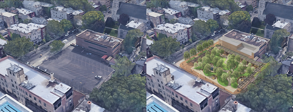
As mentioned above, Northalsted has no publicly accessible greenspace. The sole public park–Wendt playlot–only contains a playground, mulch, and concrete, and is not inviting to teenagers and adults. At the same time, there is a sizable parking lot adjacent to the public library on Belmont Ave that appears to be rarely used. Replacing the lot adjacent to Merlo Library with a park would give the community much-needed greenspace and serve currently-underserved populations within the neighborhood. This new Merlo Park would attract young adults, the largest population within Northalsted, as well as the heavily overlapping population of dog-owners. It would also provide healthy outdoor space to patrons of Merlo Library, including many public computer bank users. Greenspaces adjacent to libraries often serve as space for cultural events as well, such as the outdoor reading room and concerts that the New York Public Library holds in Bryant Park. The design of a potential Merlo Park should ensure easy accessibility from the library and provide a diversity of use-options. People reading should be able to separate themselves from people walking dogs, or teenagers hanging out.
{comparison of potential Merlo Park design to current parking lot}
Park design photo source: Montes, B. R. (2020, January 15). West end historic district gets a high-tech park. D Magazine. Retrieved December 3, 2022, from https://www.dmagazine.com/business-economy/2020/01/west-end-historic-district-gets-a-high-tech-park/
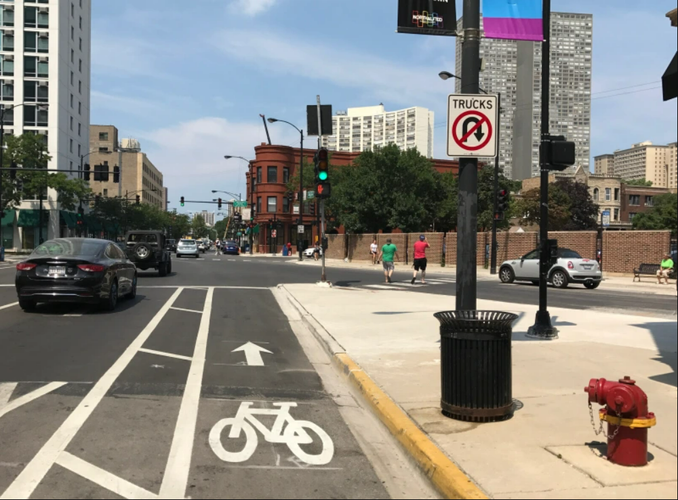
The last intervention involves the pedestrian experience on Halsted St, the heart of the neighborhood. Despite being an important and well-traveled street, it does not create a pleasant pedestrian experience. Most curbs don’t have buffers, and there is little sense of separation or safety from the cars whizzing by. This is heightened by the narrowness of sidewalks in some places, as well as the presence of many surface parking lots. Examples of poor pedestrian design can be observed below:
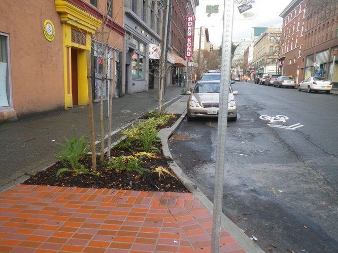
All of these issues can be fixed by widening sidewalks and incorporating smart design elements. Widening sidewalks serves multiple purposes, including protecting people from cars, slowing traffic, and generating more street business. Wider sidewalks would accentuate the successful businesses that cater to pedestrians along Halsted, which is designated as a Pedestrian Street. Since Northalsted is already very well-serviced by public transit, slowing cars and inducing traffic would only encourage more people to take the CTA. Vegetation buffers should also be planted when the sidewalks are widened, to further separate cars and people, as well as provide drainage. Planters such as the bioswales seen below help improve the health of the neighborhood, which is especially important considering Northalsted’s current lack of greenspace.
Pedestrian street design source: NACTO. (2015, July 24). Sidewalks. National Association of City Transportation Officials. Retrieved December 3, 2022, from https://nacto.org/publication/urban-street-design-guide/street-design-elements/sidewalks/
Bioswale source: NACTO. (2016, October 5). Bioswales. National Association of City Transportation Officials. Retrieved December 3, 2022, from https://nacto.org/publication/urban-street-design-guide/street-design-elements/stormwater-management/bioswales/
Social Mix
Before we discuss Northalsted's diversity in relation to the surrounding area, there is one point of interest to highlight about the neighborhood's demographics on their own: there is a slightly larger male population than female population, which is notable since Chicago's population is slightly more female than male. This is a remnant of the Boystown name and reputation as home to gay men.
The Simpson Diversity Index measures the diversity of groups in a community and is commonly used when analyzing biodiversity and ecology. The specific measure used here is called Simpson's Reciprocal Index, calculated as D = N(N-1) / Σni(ni-1), with N representing the total population and n representing the population of each category or group. When using this calculation, high diversity will be represented by a value close to the total number of categories, while low diversity will be closer to 1.
The types of diversity analyzed for Northalsted are displayed above: age, race, and housing units. The highest measure of diversity for each category is displayed in the left hand column. Since it is difficult to determine if an area is more or less diverse solely by looking at that area alone, Northalsted has been compared to its greater community area (Lakeview), its region (north side) and the city of Chicago as a whole.
According to the Simpson Diversity Index, Northalsted has comparatively low diversity across the board. Age diversity is particularly lacking in Northalsted, with only four age groups represented. By contrast, Lakeview has five age groups, the north region has seven, and Chicago as a whole represents almost nine. According to the demographic data table, 17% of Northalsted residents are 18-24 years old, 44% of the residents in Northalsted are 25-34, and 14% are 35-44. Cumulatively, this relatively young adult cluster represents three-quarters of the entire neighborhood population. This makes sense, considering the businesses the neighborhood is able to support, namely bars and cafes. However, there are drawbacks to having such a limited diversity in ages. As Jane Jacobs writes about, different age groups use the neighborhood at different times of day, with families and retired people providing most of the daylight business. Without these age groups, the neighborhood feels dead during business hours.
Northalsted is not racially diverse, a quality it shares in common with Lakeview and the north side as a whole. Only one and half racial groups are represented in the neighborhood, very similar to the Lakeview community area. Northalsted is 82% white. The city of Chicago has roughly three races represented, and is only 48% white overall. Chicago is one of the most segregated cities in the US, and Northalsted reflects this. There are many negative effects when neighborhoods are racially homogeneous, such as lack of innovation and opportunity, inequitable distribution of resources, and low cultural crossover. The fact that Northalsted is overwhelmingly white is responsible for the historic claims that the neighborhood is unwelcoming to Black and other non-white residents and bar patrons.
Northalsted does better when it comes to housing unit diversity, a measure of different housing densities. Five different categories are represented, with denser categories making up the majority. There are relatively few single houses and duplexes. While this dearth of individual homes could factor into the lack of young children, the high density overall is responsible for the walkability and pedestrian-focus of the neighborhood. The north side and the city of Chicago have more housing unit diversity because those regions contain more suburban development, which increases the representation of single-family homes and duplexes.