Overview
Social Mix
Public Space
Amenities
Connections
Final Project
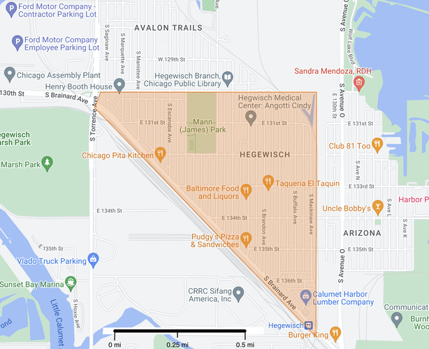
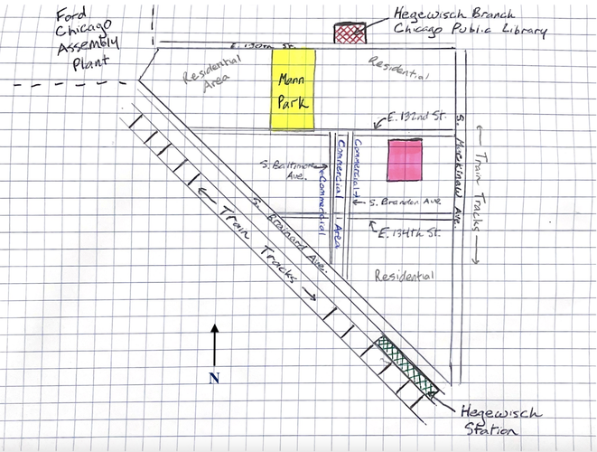
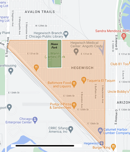
Hegewisch is both a neighborhood in Chicago and the southeasternmost community area in the city. The neighborhood of Hegewisch, however, is smaller than the community area, which also contains the neighborhoods of Arizona, Avalon Trails, and Harbor Point Estates, along with substantial uninhabited land area in the form of large parks and the William W. Powers State Recreation Area. The neighborhood of Hegewisch spans north to south from E. 130th Street to S. Brainard Avenue, and west to east from S. Brainard Avenue to S. Mackinaw Avenue. This almost-triangular neighborhood is approximately 300 acres in area, with all homes and businesses sitting no more than 0.7 miles from the neighborhood’s center. Hegewisch’s streets are in a grid layout, and the neighborhood is relatively spread out given the large number of single-family homes. Almost all of the homes face the street with a front (and oftentimes back) yard, and in the center of the neighborhood, residential buildings are interspersed with commercial businesses. Hegewisch is divided into four census block groups, with a total population of approximately 5,200.
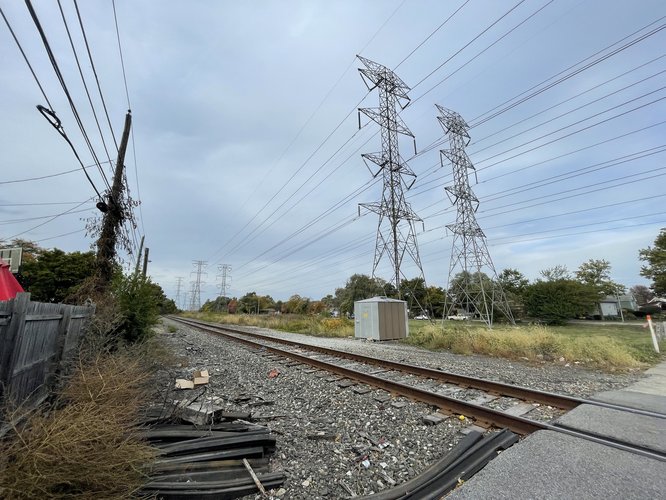
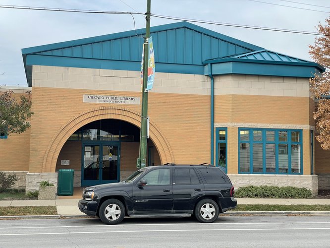
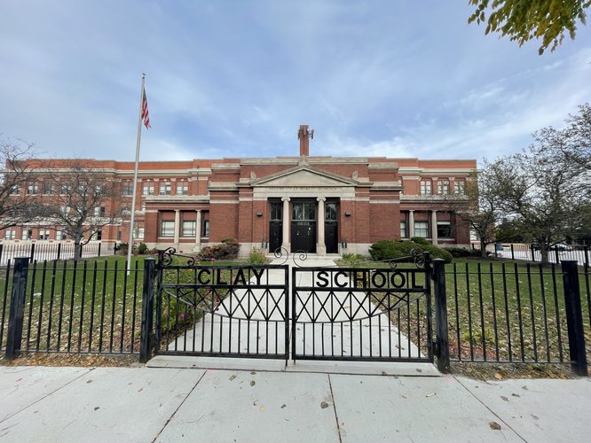
In most directions, the delineating boundaries of Hegewisch are clear. To the south and west, the neighborhood is bounded by diagonally-running train tracks utilized both for freight transportation and passenger commuter travel between Indiana and downtown Chicago on the South Shore Line. There is no crossing point over these tracks for almost the entire length of Hegewisch, largely isolating the residents of the neighborhood from regular interaction with the sparsely populated area across the tracks. To the east, the neighborhood is again bounded by train tracks and a stretch of green space, over which run extensive systems of electricity cables. While this boundary line is less strict than the tracks forming the south and west boundary, as cars and pedestrians can cross this boundary in three places, the long stretch of undeveloped space distinguishes Hegewisch from the neighboring Arizona. The northern boundary of Hegewisch is the least clearly defined, as Avalon Trails and Hegewisch have no clear geographical delineation. However, E. 130th Street seems like the most viable dividing line between the two neighborhoods, and is the boundary used by Google Maps. The street serves as a breaking point for back alleyways, as each of the north-south running back alleyways that exist north and south of E. 130th Street through Hegewisch are not continuous through E. 130th Street. Furthermore, the north end of Mann Park lies at E. 130th St., slightly inhibiting traffic between the north and south, and thus seemingly serves as both a gathering space and a dividing line. The park lies at the Hegewisch’s border rather than its center, serving as a shared recreational space for both neighborhoods, but also as a delineation point. Across the street from the park is the Hegewisch Branch of the Chicago Public Library, which similarly serves as a shared resource between Avalon Trails and Hegewisch. Finally, Avalon Trails is centered around one CPS elementary school, while Hegewisch to the south is home to CPS’s Clay Elementary School.
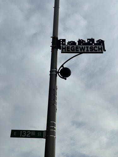
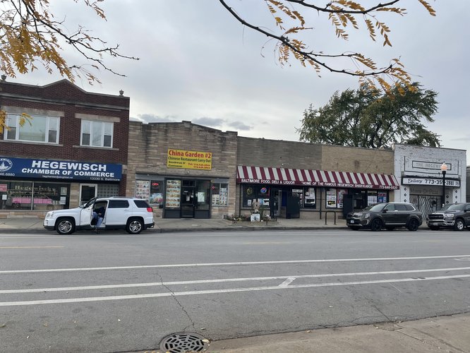
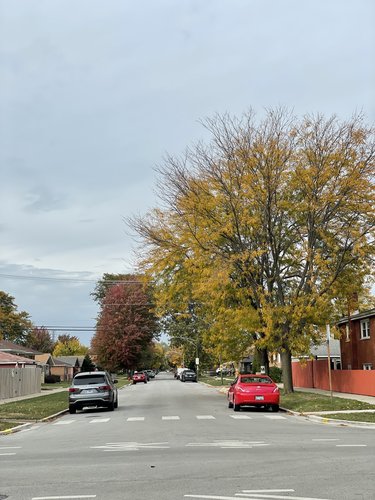
The residential areas of Hegewisch do not seem to necessarily have a distinct “Hegewisch” identity, but they nonetheless have a significant level of homogeneity. The neighborhood is made up primarily of single-family homes, most with a front yard facing the street. A significant number of prisoner of war flags fly around the neighborhood, along with union signs and posters for supporting alderperson candidates in the upcoming election for the 10th Ward. And although the neighborhood is primarily residential, its main commercial area does make an effort to have a distinct identity. The commercial area is encompassed mostly within the rectangle formed by E. 132nd Street, E. 134th Street, S. Baltimore Avenue, and S. Brandon Avenue. Walking down South Baltimore Avenue, one will notice that the street is lined with “Hegewisch” signs overhead on lampposts. Establishments such as Henry Booth House Hegewisch Head Start bear the neighborhood’s name, and the neighborhood has its own community-oriented business organizations, like the Hegewisch Chamber of Commerce and the Hegewisch Business Association.
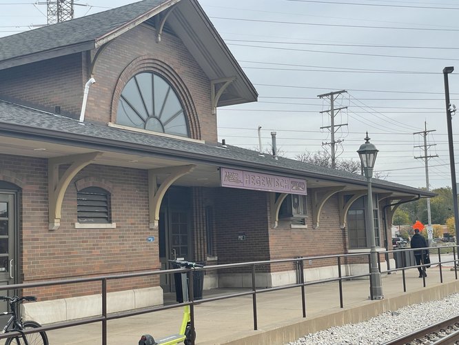
The Hegewisch train station similarly serves as an identifying location for the community. Located towards the southern point of the neighborhood, the train station bears the Hegewisch name and is the main public transportation stop for getting into and out of the relatively isolated neighborhood. Although it would likely be beneficial to Hegewisch residents to have greater or more frequent access to public transportation, having this singular main connection site to the rest of the city nevertheless appears to be a location that is a shared and often-utilized space for many community members.
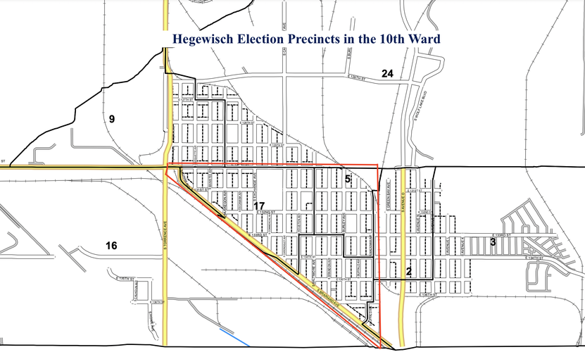
The Hegewisch neighborhood is contained within the 10th Ward of Chicago. Out of the 36 election precincts in the ward, Hegewisch is covered by three precincts: the 5th, 16th, and 17th. This precinct map provides further support for how the boundaries of Hegewisch are defined here, as the precincts are similarly bounded by S. Brainard Avenue, E. 130th Street, and S. Mackinaw Avenue.
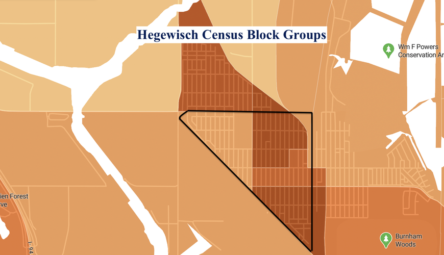
Four census block groups cover the Hegewisch neighborhood. In this map, each different shade bounded by the black lines represent a different census block group within Hegewisch. As with the election precincts, the boundaries of the census block groups do a relatively good job of following the boundaries of the neighborhood itself. The census block groups suggest that the highest population density in the neighborhood is in its northeastern section, and they can help us estimate the neighborhood's population to be around 5,200.
Hegewisch received its name and layout beginning in 1883, when Adolph Hegewisch, the President of the U.S. Rolling Stock Company, decided to develop the area as a new town along the pre-existing rail line. The company itself moved its operations from a location further west so that it would border the new town of Hegewisch, while Adolph Hegewisch intended to use the geographical location of the new town not because of its strategic placement along the rail line, but also for the development of two canals (though neither were ever built). Adolph Hegewisch’s goal was the creation of “an ideal workingman’s community,” and he thus established Hegewisch with the goal of creating a planned, working-class community with close proximity to his company’s industrial manufacturing. In many ways, the vision for Hegewisch was quite similar to the development described by Ann Keating in her chapter “Industrial Towns of the Railroad Age”: the neighborhood was founded by a railroad line at the periphery of the city, and planned for industrial laborers to live near their workplace.
Zooming out, the region that eventually became Hegewisch was part of the Hyde Park Township even before Adolph Hegewisch began to develop the neighborhood, starting in 1867. When the entirety of Hyde Park Township was annexed by Chicago in 1889, Hegewisch officially became a part of the city.
Although Adolph Hegewisch anticipated a population of 10,000 in Hegewisch by 1885, the community did not grow quickly, in part due to the lack of funding for Hegewisch’s proposed canals; according to the Chicago Encyclopedia, only about 500 people lived in the community by 1889. The neighborhood continued to develop as a community for industrial workers in the following decades, as new steel mills were built around Hegewisch. According to the Chicago Encyclopedia, the neighborhood included significant populations of immigrants from Eastern Europe, Sweden, and Ireland.
The neighborhood developed as a settlement for manufacturing laborers, and although the manufacturing industry has largely left the city, Hegewisch still neighbors the present-day Chicago Assembly Plant for Ford Motor Company. The plant employs over 5,800 people (source), and while these are certainly not all Hegewisch residents, it demonstrates that Hegewisch is one of the few Chicago neighborhoods originally developed for industrial production that still has an active manufacturing presence today.
Located in the southeastern-most corner of Chicago, Hegewisch seems almost suburban compared to the rest of the city. It is made up primarily of single-family homes, the number of active commercial businesses is relatively low, and there is limited accessibility to public transportation.
Gellman, Erik. "Hegewisch." Encyclopedia of Chicago. http://www.encyclopedia.chicagohistory.org/pages/577.html.
Sellers, Rod, and Dominic A. Pacyga. Chicago's Southeast Side. 1998.
Maps created using Google MyMaps, Chicago Data Portal, and Social Explorer.
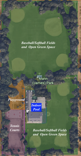
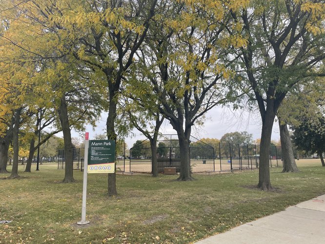
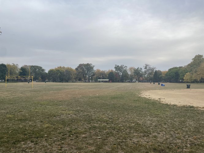
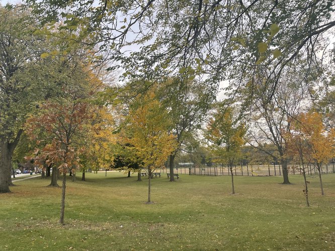
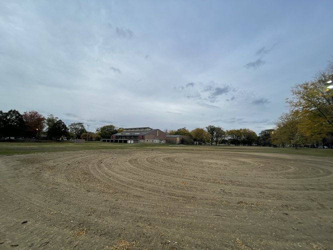
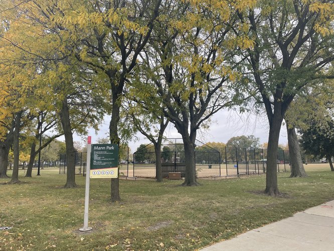
Mann Park is the largest, and seemingly primary, public space located within Hegewisch. The park spans two blocks north-to-south from the northern boundary of the neighborhood at East 130th Street to East 132nd Street, and two blocks west-to-east from South Exchange Avenue to South Carondolet Avenue, encompassing an area of just over 19 acres. The park feels large; it has seven baseball/softball fields, four tennis courts, an indoor pool building, a playground, and wide open grassy field space. In this way, this public space seems constructed for a variety of uses; there are athletic spaces, children’s spaces, benches around the perimeter of the park for sitting, and open multipurpose grass space that can be used for both informal purposes and organized activities. However, given the apparent lack of use described below, some of this substantial grassy area and the substantial number of baseball fields may also be “dead space” to a certain degree—these areas do not all seem to be particularly regularly used.
Because of its location to the north-center of the neighborhood, Mann Park seems relatively accessible to the surrounding residential neighborhoods, although it sits in a somewhat distinct location from the more commercial center located around S. Baltimore Avenue, S. Brandon Avenue, and E. 133rd Street. It also seems strategically placed on the border of the Hegewisch neighborhood proper, such that it can also be utilized by residents of the Avalon Trails neighborhood to the north.
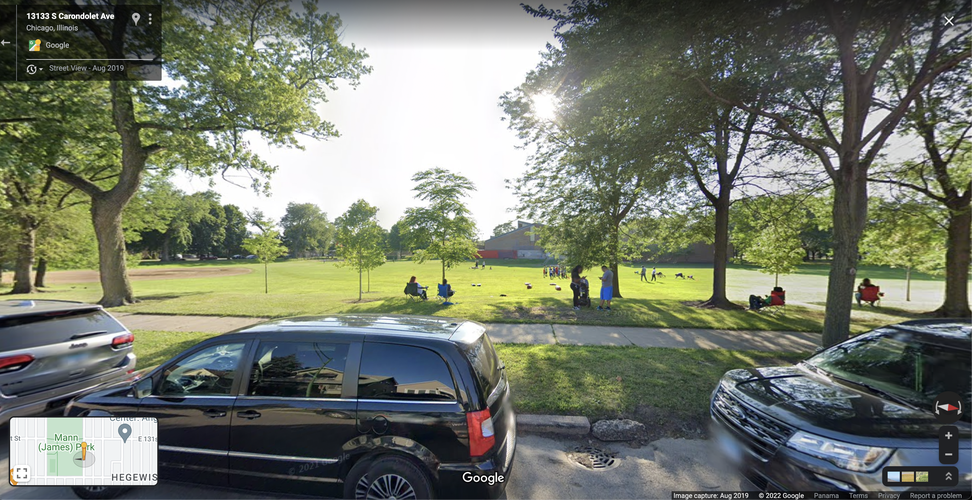
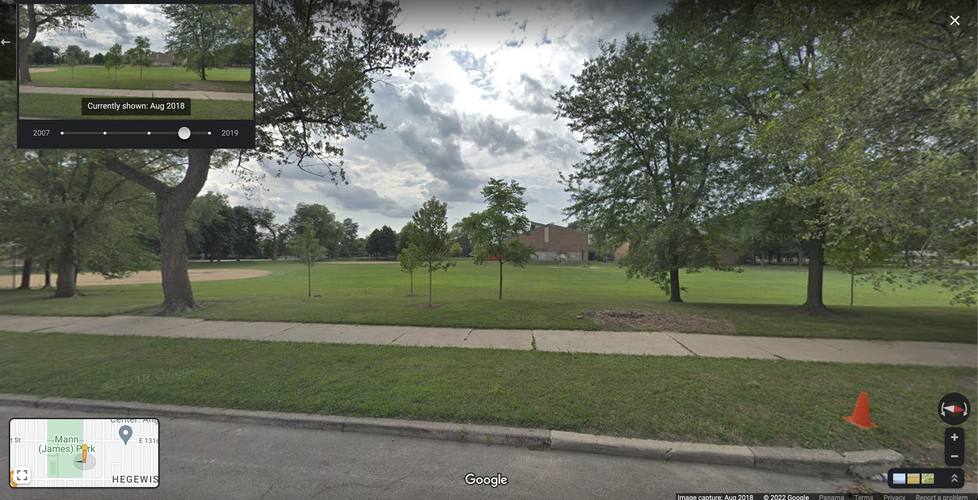
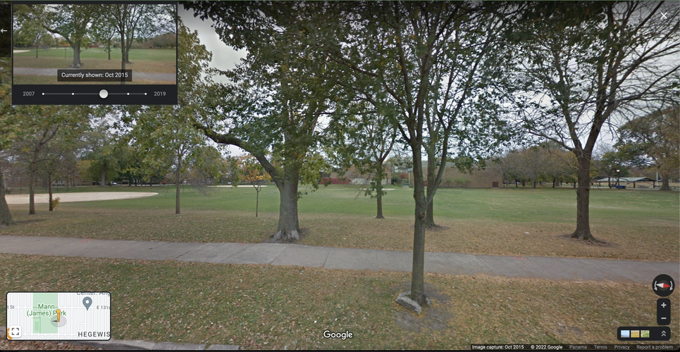
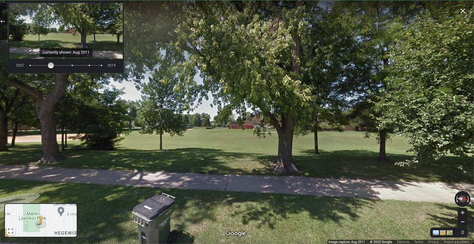
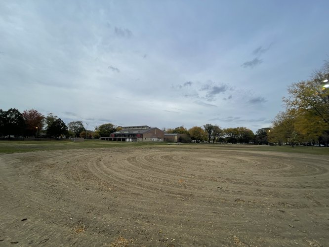
When I visited at around 4 p.m. on a cool Friday in mid-October, I did not see anyone in the entire park. When I returned around 5 p.m. that same day, there was still nobody in the park itself, although a few young people (around middle school age) stood by the southwestern corner of the park and appeared to be ready to practice lacrosse on the field. The primary users of the park, from my observations and Google Maps data, appear to be children and their parents participating in athletic activities (although the park also likely serves as a recreational and community space for other residents as well). The day was relatively cool (around 50º Fahrenheit), but the sky was clear and sunny. It could have been that I did not visit the park at a popular time, but Mann Park does have a feeling that it is under-utilized for at least parts of the year—even taking a look at historical Google Maps Street View, it appears that the park is often empty, although these images also show some examples of active park use.
The following images show Mann Park at different times from 2011-2019, showing both activity and non-activity in the park:
This image from 2019 helps to demonstrate Mann Park in use, as a recreational space for children and families.
The above three pictures, taken for Google Maps in 2018, 2015, and 2011 respectively, further demonstrate a sense of emptiness in Mann Park. The park is a large public space in Hegewisch, and the only large park in the neighborhood. At the same time, it does not appear to be particularly crowded on a day-to-day basis, which may be for reasons of accessibility, weather, population, or disinterest in park activities. Hegewisch does have a substantial and well-maintained public space; however, the question remains as to whether it sufficiently serves the neighborhood as a community space.
This section maps the levels of accessibility to daily life needs—including grocery stores, schools, and daycare centers—across Hegewisch. Because Hegewisch is not a particularly large neighborhood, and the neighborhood contains at least one establishment for each of these daily life needs, a significant portion of the neighborhood's population lives within a quarter mile (approximately a five-minute walk) of each of these amenities.
However, there is a noticeable lack of close walking accessibility to some of these services for residents who live in the northwestern, northeastern, and southern corners of the neighborhood. These are residential areas with primarily single-family homes, which thus have very few non-residential establishments around them. I would argue that daily life amenities are not well-distributed in Hegewisch, as the division between residential and mixed-use areas makes it difficult for many residents to live in close proximity to amenities.
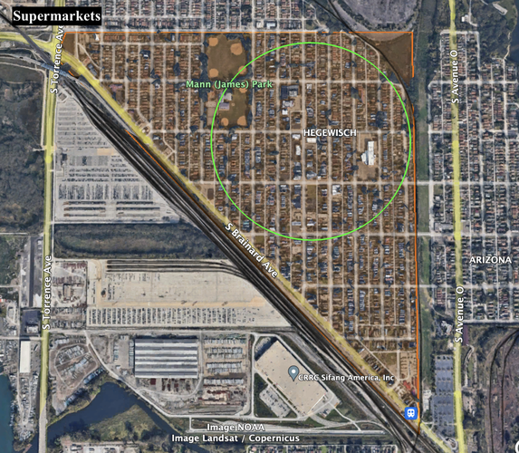
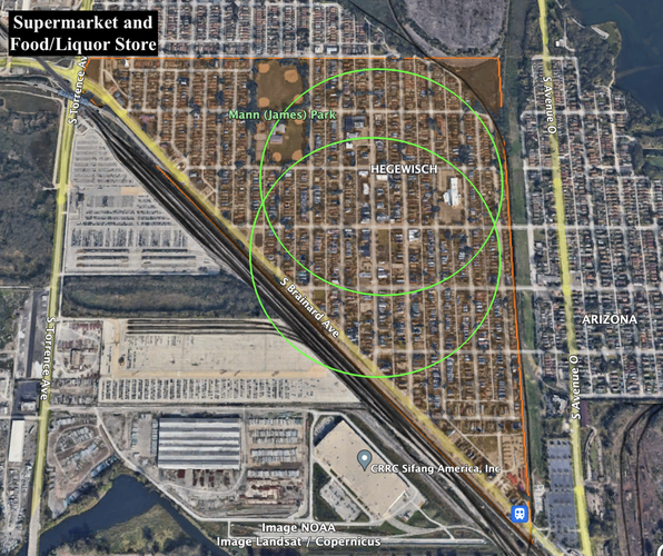
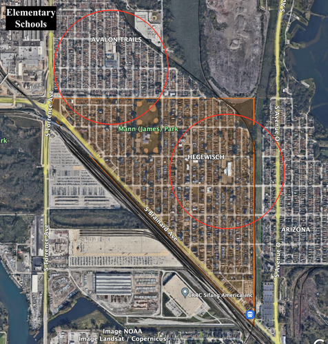
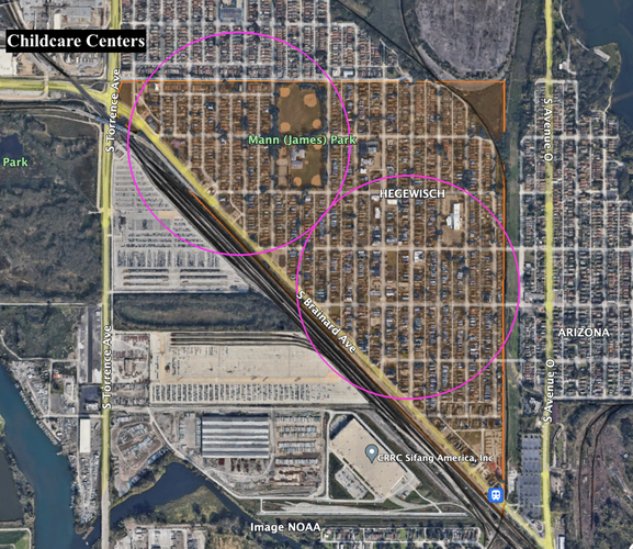
Each of the maps below depict regions within a quarter-mile radius of a site for each type of amenity, in order to visualize which areas of Hegewisch are (and are not) well-served with close proximity to daily life services. Given that housing density is relatively standard across Hegewisch, I have roughly approximated the portion of residents served by each amenity (within a quarter-mile radius) by calculating the percentage of the neighborhood's area that overlaps with the "5-minute walking shed" circles.
Supermercado el Tapatío, located at E. 132nd Street and S. Baltimore, is the sole supermarket in Hegewisch, and approximately 45% of Hegewisch residents live within a 5-minute walking distance of this grocery store (as depicted in the green circle). By this calculation, a majority of Hegewisch residents do not live within this 5-minute shed. While a significant majority of the neighborhood's population does live within a half mile of the supermarket, residents in the northwestern and southern corners of the neighborhood may live as far as 0.7 miles from the supermarket.
While there is only one official "supermarket" in Hegewisch, there is also Baltimore Food and Liquors, located at E. 134th and S. Baltimore. Although this is a more of a convenience and liquor store, the store does have a relatively comprehensive grocery section, including a variety of fresh produce. Given that this establishment could meet some of the daily grocery needs of Hegewisch residents, we can potentially increase the estimate for the percentage of residents who live within five minutes of a grocery establishment; on this map, approximately 60% of residents live within a 5-minute walking distance. Again, the northwestern and southern corners of the neighborhood are not encompassed by these 5-minute sheds.
Accessibility to schools in Hegewisch seems relatively low. There are two schools in the area, both of which are Chicago Public Schools elementary schools (Clay Elementary School and Virgil Grissom Elementary School, located to the north in Avalon Trails). About 40% of Hegewisch residents live within a 5-minute walking distance of one of these schools. The maximum distance for some residents from the nearest school is again not particularly high, at approximately 0.7 miles. But there are also only elementary schools in the area; there are no middle or high schools within walking distance of Hegewisch.
Finally, we can look at accessibility to daycare centers in Hegewisch. Daycare access is the highest of all of these amenities, with approximately 83% of Hegewisch residents living within a 5-minute walk from the nearest daycare center. This is one amenity that serves the northwestern corner of the neighborhood well; nevertheless, residents in the northeastern and southern corners of the neighborhood do not live within a 5-minute walking distance of daycare centers. Still, all residents of the neighborhood live within approximately 0.5 miles of the nearest daycare center, and it appears that daycare access is relatively well-distributed across the neighborhood.
Hegewisch is made up of primarily residential streets. Most streets are two lanes, with relatively slow traffic speeds (almost all roads have a speed limit of 30 miles per hour or lower). Inside the boundaries of the neighborhood, almost all of the streets have pedestrian sidewalks, and safety concerns do not seem particularly high. For these reasons, routes to each of these amenities for most residents of Hegewisch seem fairly safe and pedestrian-friendly. The main place of concern for pedestrian accessibility is S. Brainard Avenue, the diagonal street that serves as the southern and western boundary of the neighborhood. This street has fast-moving traffic, few places for safe pedestrian crossing, and areas without any paved sidewalk. Fortunately, most residents do not have to walk on this street to access daily life amenities.
Finally, the access that these maps portray to daily life services in Hegewisch does not necessarily mean that Hegewisch residents, even if they do live within a quarter mile of each of these services, benefit from diverse or high-quality amenities. A deeper analysis would be needed to understand the extent to which these amenities fulfill the daily needs of neighborhood residents. For example, there are two elementary schools in the Hegewisch area that provide 5-minute walking access to a portion of the community; however, there are no middle or high schools within five minutes of any part of Hegewisch, suggesting that schools may not actually be accessible in a 5-minute walking shed to any Hegewisch families with kids older than elementary-school-age. Furthermore, we can measure the proximity of residents to grocery stores in the neighborhood, but this analysis cannot tell us to what extent the grocery establishments actually meet the daily needs of residents. Each of the above amenities appear to exist in relatively close proximity to most homes in Hegewisch, but some peripheral areas of the neighborhood do not have close walking access to some types of amenities, and there does not seem to be a substantial variety of establishments available for each of these amenities.
Block Types
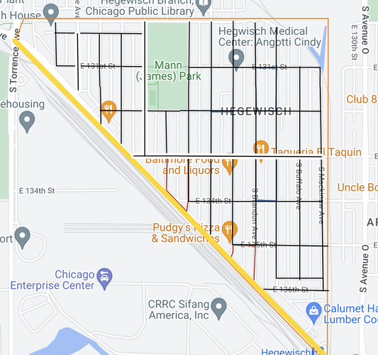
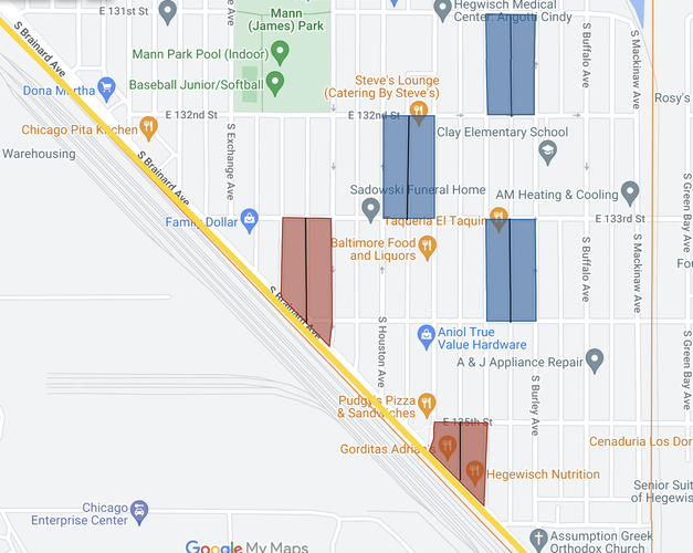
The vast majority of the blocks in Hegewisch are elongated blocks, which can be seen in the first map, highlighting the street patterns in the neighborhood. Some examples of these rectangular elongated blocks are highlighted in blue in the second diagram, with each block having an alley running north-south in the middle of the block (the alleys for the highlighted blocks are depicted as black lines in the second map). These are formed from the grid-like layout of the streets in the neighborhood, where each block is about twice as long (north-south) as it is wide (east-west). The block types differ from this pattern mainly in the southern part of the neighborhood, where South Brainard Avenue runs diagonal to the rest of the streets in the neighborhood. For this reason, blocks bounded by South Brainard Avenue (pictured as a yellow line on the second map) are irregular blocks, varying from the rectangular shape of the elongated blocks in the rest of the neighborhood. A few examples of these irregular blocks are highlighted in red in the second map, and they vary pretty widely in their dimensions.
Network Types
Hegewisch's network type is most similar to the Savannah Pattern. This network pattern is synonymous with an orthogonal grid or gridiron pattern, and the first image above shows that the streets are laid out in an orthogonal grid, interrupted only by South Brainard Avenue to the south, which serves as a border of the neighborhood. This allows for clear directional orientation in the neighborhood for both pedestrian and vehicle traffic, and the use of alleyways allows for multiple access points to most buildings.
Thoroughfare Types
The predominant thoroughfare types in Hegewisch are streets and alleys. The streets in the neighborhood are depicted in the first map as black lines, with the white north-south lines running in the middle of each block representing alleys. These streets are predominantly two-lanes, with local speed limits, and provide access to the fronts of buildings. The alleys provide a second access point to most buildings, and serve as thoroughfares for waste hauling, services and maintenance, and alternative walkways for pedestrians. South Brainard Avenue, depicted as a yellow line on both maps, is the exception to the streets and alleys, and would be most accurately categorized as a drive. This road features businesses on one side and railroad tracks on the other, with relatively high speed traffic providing access into, out of, and alongside the Hegewisch neighborhood.
Connectivity Analysis
Overall, Hegewisch is relatively well connected internally. There are few cul-de-sacs, dead end streets, or gated communities within the neighborhood, which is important for connectivity—most streets allow for unobstructed through-traffic for pedestrians and bicycles. Because of the grid-like pattern, the neighborhood is easily directionally navigable. All of the local streets have adequate sidewalk access, making it possible to walk safely from almost any point in the neighborhood to another.
Because the neighborhood consists of predominantly elongated blocks, the north-south distance between intersections is greater than the east-west distance. If the optimal average spacing for local intersections is 300-400 feet, this is achieved in the east-west direction, as the highlighted elongated blocks in Map 2 are approximately 315 feet wide. However, these blocks tend to be approximately 650 feet in north-south length, which cuts off connectivity in the east-west direction. Alleys provide an option for pedestrian paths beyond streets, increasing connectivity—although it does not ameliorate the issue of long blocks in the neighborhood, as the alleys also run north-south. If blocks should be within 5-12 acres in area to maximize connectivity, Hegewisch blocks allow for good connection, as the elongated blocks that make up the majority of the nieghborhood average around 5-6 acres.
Connectivity to adjacent neighborhoods is slightly worse, so people living on the periphery of the neighborhood may experience lower levels of connectivity. On the eastern side of the neighborhood, many streets do not go through to the adjacent Arizona neighborhood, and residents in the parts of the neighborhood to the south and west are limited in their directions of movement, as there is no connectivity to any of the land beyond the train tracks adjacent to South Brainard Avenue. For these reasons, Hegewisch is relatively well-connected within the neighborhood proper, but is somewhat isolated from connections with adjacent neighborhoods.
As previously discussed, Hegewisch is relatively well-connected—its streets are quiet and pedestrian-friendly, and almost every location in the neighborhood is safely pedestrian-accessible to every other location. However, when visiting the neighborhood, it seems that there is actually very little pedestrian activity, and thus a lack of day-to-day social connections. The reason for this lack of pedestrian and social activity in Hegewisch, I would argue, stems from the absence of viable “third places,” or public spaces, in the neighborhood. I have already written about how Mann Park is beautiful, but seems to be scarcely used by the public—it is thus important to improve existing public space to increase its usage, and add more thoughtfully-planned public spaces to the neighborhood. The interventions laid out in this section address the lack of public spaces in Hegewisch, a problem that contributes to the lack of pedestrian activity, as there really are not many destinations for residents to walk to at all. These three interventions to implement and improve public spaces in Hegewisch can help to increase pedestrian activity, bolster local commercial activity, and increase social interactions between residents in the neighborhood.
Revitalizing Mann Park
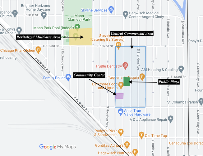
My first intervention is the revitalization of Mann Park, to increase interaction with this public realm by reducing dead space and creating a multi-use park space. As highlighted in the Public Space section, is seemingly scarcely used by the Hegewisch community. One of the reasons for this is appears to be that Mann Park is home to a significant amount of dead space, or space that does not well-serve a large portion of the community. Almost all of the outdoor space is dedicated to athletic activities, with 7 baseball/softball fields and a central soccer/football field space. The only seating areas are benches on the periphery of the softball/football fields, making Mann Park feel more like an athletic space than a community gathering space.
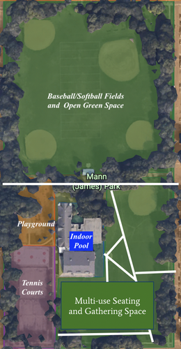
In order to increase the uses of and public interaction with the park, I propose designating a significant portion of the southern section of the park for multi-use public seating and gathering. With this change, Mann Park can be a destination for outdoor social meet-ups, gatherings, and impromtu interactions. My proposal also includes the establishment of more walking pathways through this area of the park, to encourage pedestrian activity through (rather than around) the park. These new pedestrian paths are designated as white lines on the diagram below. With these changes, Mann Park will become a space that people will be more likely to walk through, and spend time in, for reasons other than youth athletic activities.
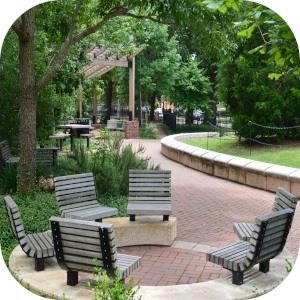
The southern portion of Mann Park has a significant amount of "dead space," as area is only really utilizable for baseball or softball games, and the park already has six other baseball/softball areas. This area could be re-designed with benches, tables, walking paths, and more, to make the park more accessible and enticing to adult pedestrians.
Areas with pathways, varied seating options, and community gathering space would help to invigorate Mann Park as a multi-use park space.
Establishing a Central Public Plaza
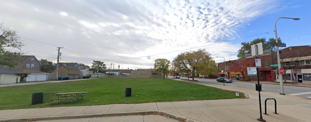
The central commercial area of Hegewisch appears to be the area of the neighborhood with the most community activity, but it nonetheless lacks any real “third place” for community gathering. Most of the businesses in this area are take-out restaurants, small stores, and offices—places that do not serve as spaces for public gathering and social interaction. Furthermore, at the corner of S. Baltimore Avenue and E. 133rd Street sits an empty lot, right in the heart of the neighborhood. I propose converting this grassy lot from a dead space to a public plaza, allowing for the use of this space as a central gathering space in the heart of Hegewisch. It can be a place to meet up with people or enjoy food or a cup of coffee, making the center of the neighborhood not just a place where residents visit a single business and then leave, but rather a destination to engage with businesses and other people. A central plaza in this location could provide a third-place destination for pedestrians, and encourage people to spend more time in the commercial area of the neighborhood, increasing commercial activity.
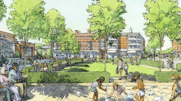
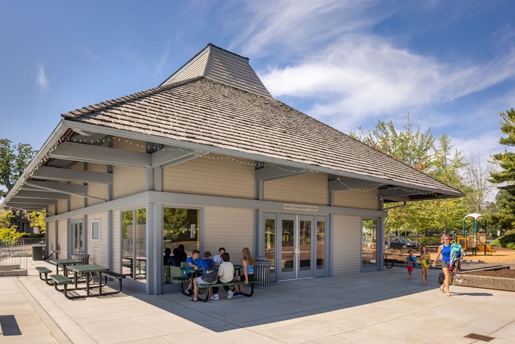
Such a plaza could be funded under the City of Chicago’s Public Outdoor Plaza (POP!) program, which supports the construction and maintenance of public plazas on empty lots in commercial districts of low- to moderate-income Chicago neighborhoods—making the Hegewisch lot a perfect candidate for POP! funding. Pictured is an example of what such a plaza could look like. Grassy and paved areas, benches and tables, and thoughtfully planned urban greenery would all be important components of this central plaza. It could convert a presently dead space to a lively, central gathering space and destination for community members.
Image source: "Industrial Urbanism: Places of Production," MIT, https://dusp.mit.edu/projects/industrial-urbanism-places-production.
Establishing a Central Community Center
A community center in the heart of Hegewisch would solidify the central area of the neighborhood as a destination for its residents. As of now, the only real indoor third places in the neighborhood are a coffee shop/record store with irregular hours, and the Hegewisch branch of the public library. Hegewisch would benefit from a central, free-to-access third place in the neighborhood. A community center would allow community members to spend time in the heart of the neighborhood in all weather conditions, increasing interaction with others and making the center of the neighborhood a pedestrian destination.
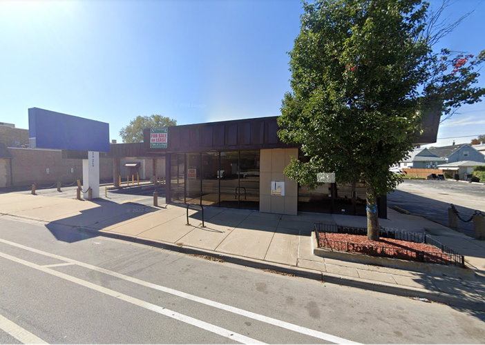
Hegewisch is currently home to a significant number of vacant buildings, and reappropriating one such building for a community center would help to reinvigorate the neighborhood and minimize construction costs for a community space. I propose the establishment of a community center at the site of the vacant bank building on S. Baltimore Avenue and 134th Street, which has been closed for years. There are already two other banks within two blocks, and this large space could be renovated to establish a third place where people could work, gather, meet with others, or organize. The space would be a flexible-use space, with activities and attractions for children and adults alike.
A small community center, with indoor and outdoor public spaces, could be constructed at this empty bank building as a space for social gathering, community events, and day-to-day activities.
By implementing these three interventions, Hegewisch can invigorate community interaction with the neighborhood and with others, encouraging pedestrian activity with public spaces serving as community destinations.
Additional Sources
Google Maps
https://westutx.gov/455/Friends-Park as an example for Mann Park.
https://opsisarch.com/project/oak-hills-recreation-center/ as an example of a small community center.
Social Mix
The table above compares Simpson's Diversity Indices for the neighborhood of Hegewisch with those for the greater Hegewisch community area, the Far South region of Chicago, and the City of Chicago itself. I have calculated and compared the Simpson's Diversity Indices for each of these regions in three demographic categories: race and ethnicity, educational attainment, and housing value.
Interestingly, looking at the Simpson's Indices for race and ethnicity, the Hegewisch neighborhood appears to be more diverse than both the larger Hegewisch community area and the Far South region of Chicago (which encompasses 12 community areas on the Far South Side). While almost 50% of Hegewisch neighborhood residents are Hispanic/Latino, this neighborhood seems to be an outlier as compared to the rest of the Far South Side, as the region itself is over 67% Black (and less than 15% Hispanic or Latino). It is difficult to tell from these calculations alone whether the neighborhood is more "diverse" than its community area or region, as it has a substantially lower population of Black residents as compared to the city at large (11.51% versus 29.20%), and a significantly greater Hispanic/Latino population as compared to the city (47.95% versus 28.60%). The racial and ethnic demographics of both the community area and the region vary significantly from Chicago overall, but in different ways (with Hegewisch being disproportionately Hispanic/Latino and the Far South Region being disproportionately Black/African American). Furthermore, according to these data, Hegewisch is home to 0 residents whose racial identity is "Asian Alone," "American Indian and Alaska Native Alone," or "Native Hawaiian and Other Pacific Islander Alone," suggesting that Hegewisch is lacking representation from significant racial and ethnic groups.
Looking at the Simpson's Indices for Educational Attainment, the Hegewisch neighborhood has the lowest index (and is thus the least diverse) as compared to its community area, the Far South Region, and the City of Chicago. The majority (61.3%) of Hegewisch residents over the age of 25 have not attained a level of education higher than a high school degree, and fewer than 12% of residents have received a Bachelor's degree or higher. There are much higher percentages of residents in the Far South Region and the City of Chicago who have received degrees of higher education, which likely accounts for their higher Simpson's Indices. These data suggest that Hegewisch has overall lower levels of educational attainment than these encompassing regions.
The housing value for owner-occupied units also appears to be less diverse in Hegewisch. The values of the vast majority of housing units (69.1%) seem to fall in the range of $100,000-$300,000, with fewer than 3% of housing units valued at greater than $300,000. The majority (64.4%) of housing units in the Far South Region fall within the same range, but over 13% of housing in the region is worth more than $300,000. The same goes for the city overall: 63.6% of owner-occupied homes are valued between $100,000-$300,000, but over 15% of homes are valued higher. The Simpson's Index for the Hegewisch community area is slightly lower than for the neighborhood itself, but this comparison does not in turn imply a high level of "diversity" in the neighborhood, as the neighborhood's housing values are still relatively homogenous.
While the Hegewisch population has representation from a variety of backgrounds related to race, educational attainment, and socioeconomic status (as measured through housing types), I would still not categorize the neighborhood as obviously "diverse." The neighborhood may have more racial/ethnic diversity as compared to the Far South Side overall, but groups like Black residents and Asian residents are significantly underrepresented (particularly when the surrounding neighborhoods of the region are overwhelmingly Black). Levels of educational attainment and housing value are relatively homogeneous, Hegewisch lacks the diversity of the rest of Chicago in both of these categories.
Data compiled from Social Explorer, 2020.