Overview
Social Mix
Public Space
Amenities
Connections
Final Project
Bucktown encompasses just over one square mile (653.4 acres) on
Chicago’s northside and lies adjacent to the west of Lincoln Park. Bucktown,
surrounded by many dynamic communities, is home to some 24,000 residents many
of whom are young professionals and young families. Property values continue to
rise; today’s average value of a detached house is $628k. Most new homes cost
well over a million dollars; a 6 bedroom, 6 bath, 5100 Sq. Ft. single family
home on Honore Street is currently listed at $2.4 million. There are many
older homes (the majority of residences were built before 1939) that have been
rehabilitated for today’s lifestyle. Beginning in the early 1990s Bucktown
experienced a significant transformation with the renovation of older properties
to new construction ranging from traditional, stone estates to uber modern
architecture. The average age of a Bucktown resident is 32. Nearly half of
those residents hold an undergraduate degree and approximately 20 percent have
Master’s degrees. A remarkable 76 percent of married couples both work. Not
surprisingly, more than 50 percent of children enrolled in grades K - 12 attend
a private school. Bucktown could easily be compared to Martha’s Vineyard, an
island off the coast of MA. It has an incredibly strong culture among its
year-round residents and ranks among the most popular U.S. destinations to
visit for its architecture, shops and food. Bucktown, like Martha’s Vineyard,
has a unique lifestyle brand.
(Statistics taken from: http://www.city-data.com/neighborhood/Bucktown-Chicago-IL.html)
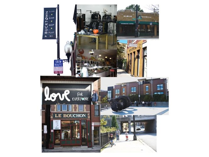
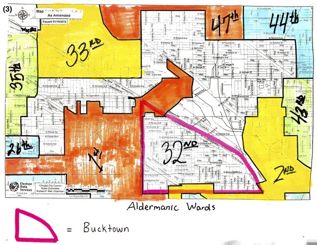
Within Bucktown’s one square mile is a thriving community of engaged residents who proudly call the cohesive neighborhood their home. The area, part of the 32nd Ward represented by Alderman Scott Waguespack, today is predominately composed of young professionals and young families. Sprinkled throughout Bucktown is a small population of longtime residents who have owned their properties for 40 to 50 years. The juxtaposition between young and old, new and vintage has, according to Elizabeth Gomez, advisor to Alderman Waguespack, caused tension over some larger residential building permits.
The overwhelming majority of residents in Bucktown are college educated, employed and help sustain the local economy of award winning restaurants and variety of sophisticated retailers including high end home and clothing stores. Last year, Crain’s Chicago Business reported on the emergence of Bucktown’s ‘Indie Row,’ saying it has become one of the hottest shopping destinations for home décor. Bucktown businesses greatly benefit from being blocks away from the Kennedy Expressway providing easy access from downtown Chicago and the suburbs. The restaurant and bar scene is vibrant and attracts people from all over the metro Chicago area. Among its best-known food spots are Le Bouchon, The Bristol, Coast Sushi Bar, Iraazu and Club Lucky. Practically every cuisine can be found in Bucktown.
The well-educated nature of the Bucktown population puts education at the center of its community culture. Parents can choose from among several Public, Montessori and Catholic school options for pre-K to 8th grade. Bucktown lies adjacent to Wicker Park and while the communities are distinct and unto themselves in many respects, there is much crossover in commerce and public resources. The library dedicated to Bucktown is the Bucktown/Wicker Park Branch. The local Chamber or Commerce is the Wicker Park/Bucktown Chamber. Well- known neighborhood events, arts events and festivals are promoted across Bucktown and Wicker Park. Bucktown enjoys its own hip identity and has become as popular a place to live and enjoy as its nearby sister community, Lincoln Park.
The origin of Bucktown dates back almost 200 years before Chicago was even incorporated as a city. In the 1830s, Polish immigrants inhabited the fields and marshlands adjacent to the Chicago River. It provided an ideal place for newcomers to reside and work. Polish settlers utilized the vast land and body of water to raise large numbers of goats. To locals, this area would be known as “kozie prery” or “goat prairie.” The male term for a goat is “buck,” so it was only fitting for the settlement to be named Bucktown.
By the 1840s, a number of German immigrants from Schleswig-Holstein arrived in Chicago. However, they came with limited supplies to get them through the cruel winter. Fortunately and ironically, a noble man named Marcus Nobles who worked with Archibald Clybourn established the first meatpacking house and generously provided a sufficient amount of flour to start their new lives. By 1854, the town of Holstein was founded but soon annexed to the City of Chicago. Another large migration of Polish immigrants--mainly Jewish immigrants facing persecution in Europe—settled in the area between the 1870s and 1930s. Russian and Latin migration began in the 1960s along Damen and Milwaukee Avenues through the 1980s.
A very strong Polish identity can be seen in Bucktown in the churches built during the early days of the neighborhood. St. Stanislaus Kostka was the first Polish Catholic parish built around 1867. Immigrants organized their lives around these churches, which served as an important centerpiece of the community. By the early 20th century the population between the Chicago River and Milwaukee to Fullerton was nearly two-thirds Polish. Because of the high density of Poles, Chicagoans referred to the area as Chicago’s “Polish Corridor.” St. Stanislaus Kostka pioneered the development of many parishes, including Bucktown and Chicago’s most renowned Polish cathedrals St. Hedwig’s, built in 1888 and St. Mary of the Angels in 1897.
Roads were dirt in early Bucktown but by the mid 19th century thoroughfares including Milwaukee Avenue were lined with planks of wood. Roads slowly improved with material like asphalt, which surfaced North Avenue in the 1870s. Streets, named in honor of Poland, became Kosciusko, Sobieski, Pulaski and Leipzig. When Germans and Poles shared the neighborhood tensions arose over street naming. By order of the City Council pressed by a German group with political clout, several Polish sounding streets were renamed Frankfort, Berlin and Holstein. The World Wars and resulting anti-German attitudes prompted another street name change and Anglo-Saxon sounding streets McLean, Shakespeare, Charleston and Palmer among others were introduced. By late 19th century, Chicago declared that all city streets must sit the same number of feet above sea level. Consequently, Bucktown’s streets were raised. Many houses built in low lying areas had to be jacked up so new basements could be installed.
The Chicago River was heavily utilized for transportation by early settlers to develop industry in the area. Beginning in the 1940s clay was rummaged from the river for brick making. After the Great Chicago Fire in 1871, a lot of homes were reconstructed of brick and stone. The Great Fire also drove continual growth for the community of immigrant laborers. The three-way intersection of Armitage, Ashland and Elston became the area’s industrial hub. Many residents were employed at the Chicago Carriage and Wagon Factory located near Milwaukee and North Avenues. Construction of the North Western and Chicago Railroad began in the 1850s and by the 1890s the elevated railway, Chicago’s Blue Line, would be built.
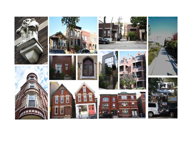
Remnants of history and long-standing tradition can still be stumbled upon in Bucktown. Archaic street numbers appearing in stained glass, toilet rooms beneath vaulted sidewalks, original cobblestone lining alleyways, streetcar tracks flowing through the streets, and, needless to say, the stunning century-old buildings.
"The History of Bucktown." Bucktown Community Organization. N.p., n.d. Web.
Otet, Ama. "Living in Bucktown - One of Chicago's Trendiest Neigborhoods." RENTCafe Rental Blog. N.p., 29 Feb. 2016. Web.
Wilusz, Luke. "Drawing the Lines: Bucktown, Wicker Park Borders." Bucktown-Wicker Park, IL Patch. Patch, 08 Mar. 2013. Web.
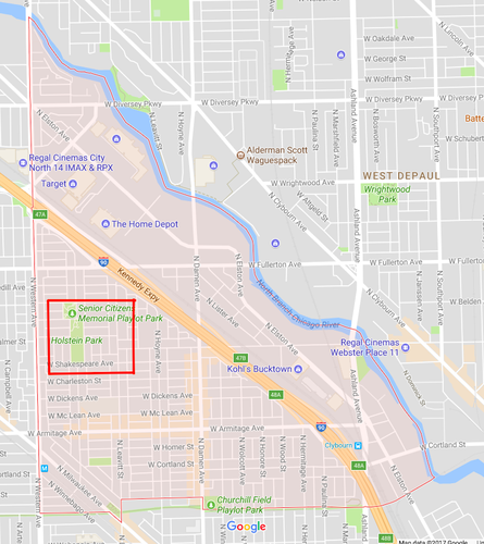
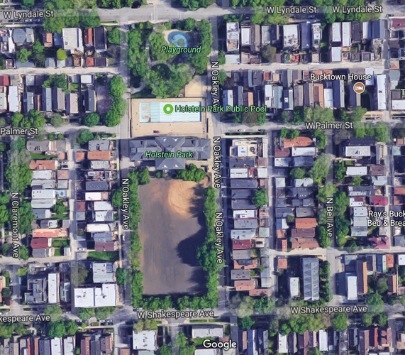
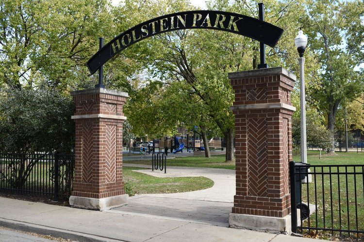
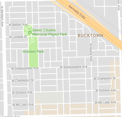
I observed and analyzed two spaces in Bucktown, Holstein Park and Senior Citizens Memorial Park, as examples of public spaces in the civic realm. The two parks lie adjacent to each other and are located on Bucktown’s western border neighboring Logan Square.
The park was pretty much completely empty, however that does not reflect the parks use or makeup considering the time of year and especially cold weather. Also, I visited at a time where kids were most likely in school. I would most certainly classify the park as an active space.
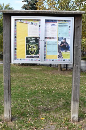
Located in the park is a well-crafted cork board, which is glass sealed and locked with special authorization to post things. On display is advertised community events and local organizations.
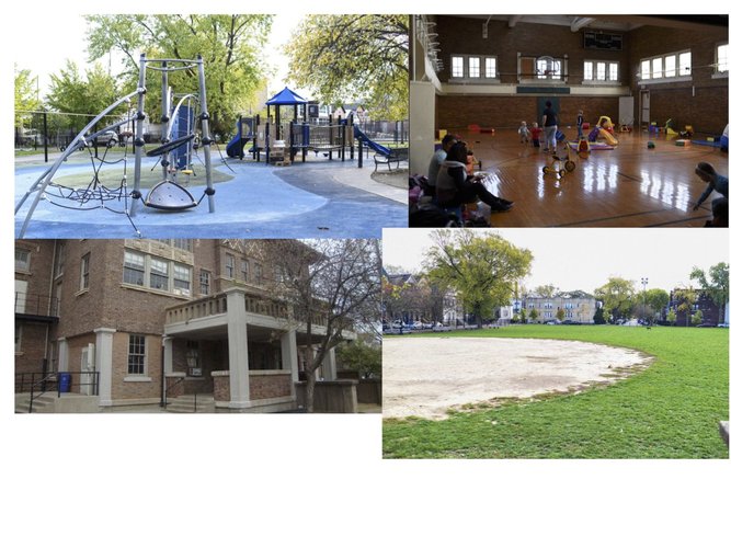
Holstein Park has been around for 100 years and sits on approximately three acres consisting of a fieldhouse and sizeable park. The fieldhouse is a large, nicely designed brick building that includes two gymnasiums, an assembly hall (with a stage), and clubrooms for rental. Outside, the park offers a swimming pool, baseball and softball field, a volleyball court, and a playground with a spray water feature for hot days. The park inside and out is a site for many kids, teens, and seniors to make new friendships in their age-oriented activities.
The park is very
well-maintained. It is clean and can tell it is kept in continuous proper order.
It is also completely gated despite the gateway so looks to be a very safe environment.
Comfortability of the park seems to be an especially accentuated aspect as there
are a plethora of benches extending from the playground to the baseball fields.
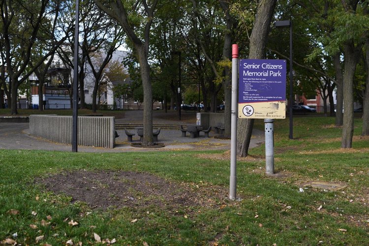
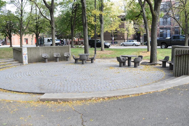
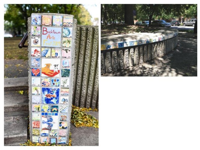
Senior Citizens Memorial Park, nearly one-acre, includes both a shuffleboard court and a passive recreation area with chess tables. Compared to Holstein Park, this park is much less kid friendly, hence its name. Though the park seems dull and “dead”, each summer the park hosts the Bucktown Arts Fest showcasing local artists, musicians, dancers, and poets uniting the neighborhood.
Considering the name of the park, it really is a perfect place for seniors to congregate and play chess and shuffleboard. It is an ideal contrast to the neighboring Holstein Park since it is predominantly for younger people. Similar to Holstein, the park was deserted because of the cold weather. The park has a well-maintained greenspace with little trash laying around. Aesthetically speaking, it is certainly an interesting design seeming as if it was developed years ago. Compared to Holstein Park, it is not as comfortable with minimal seating arrangements and a smaller lawn situation to lounge.
These mural-esque works of art are posted creations by people from the arts festivals over the years. It's a nice touch to the apparent weary vibe you get of the park. This art, however, does symbolize the camaraderie and connection within the neighborhood as they are all created by different random people, but, even so, are displayed alongside each other.
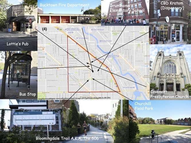
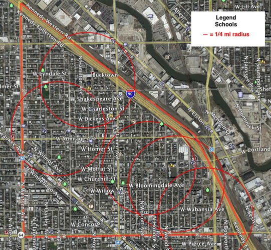
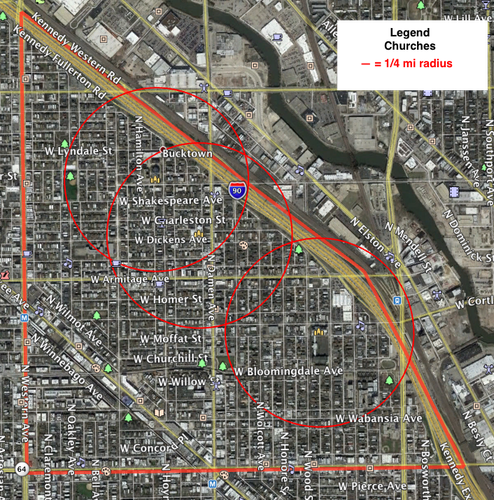
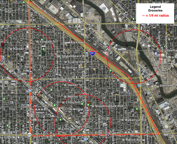
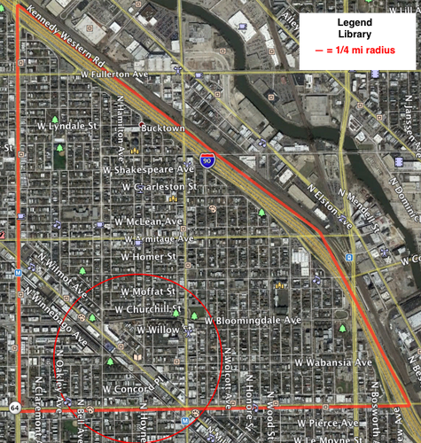
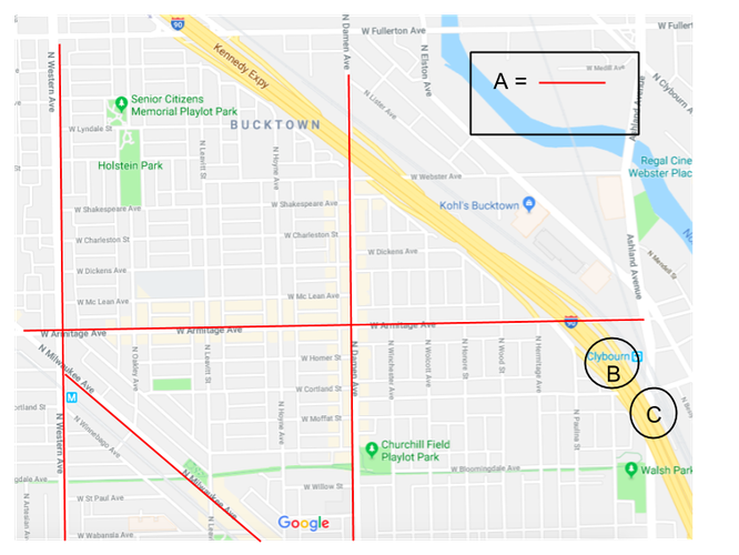
Bucktown is generally a very walkable city, and to some extent does not require much car use. Schools and access to churches via walkability is reasonable, but main grocery stores and a library, significantly, are much less so. All routes to these daily needs are very pedestrian friendly and for the most part safe. A benefit for pedestrians is that there are only three main roads (which are easy to navigate), with the remaining thoroughfares being predominantly side streets. This disallows automobiles to travel at fast speeds. The maps displayed show availability in terms of a five-minute walk (1/4-mile radius).
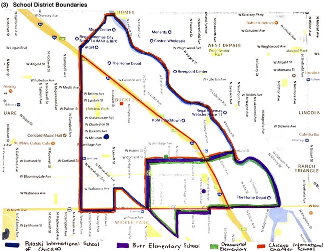
A healthy mix of public, selective enrollment, and charter schools offers a wide range of options for families and children in Bucktown. With a ¼ mile distance pedestrian shed, all of the schools are reasonably walkable for those living inside or a little outside of the radius. Though, if you live far outside of that radius, one might need to find other means of transportation to get to school.
Availability of churches in terms of walking distance is decent. However, for those living towards the southwest corner of Bucktown, it would definitely be limiting one’s walkability to get to church. On the other hand, not pictured, there is a church located on Wicker Park's northern border which would accommodate those that are out of walking distance of the churches situated east and north.
There are four main grocery stores located in and around the Bucktown neighborhood. There is a Mariano’s which is located outside of the neighborhood’s boundaries but is regarded as one of the more popular groceries for the Bucktown neighborhood. You would most certainly have to drive since it is across the highway and really would not be a pleasant walk. Despite mini markets scattered around, there are three other main groceries around Bucktown that would be very walkable depending on where you live. However, on the whole, it seems less walkable than walkable to get to these grocery stores.
Unfortunately, there is only one library located in Bucktown, which is also shared with the neighborhood of Wicker Park. Although it is located in Bucktown, the library is situated very close to the southwest border limiting walkability for the majority of the neighborhood.
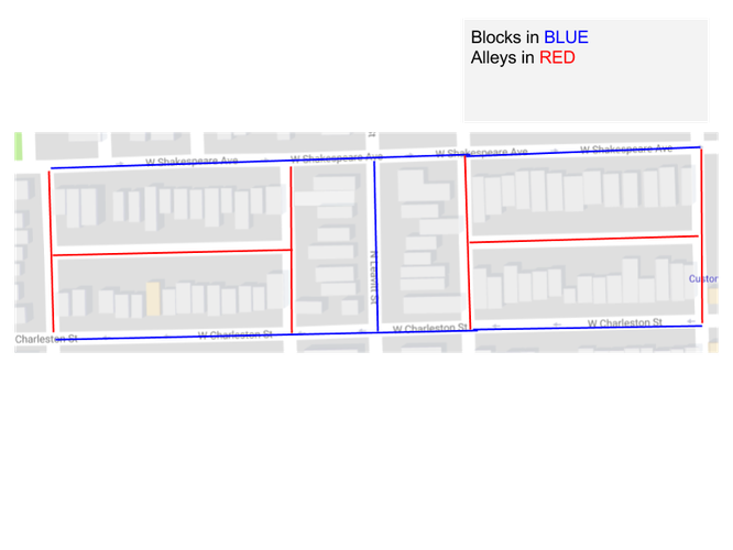
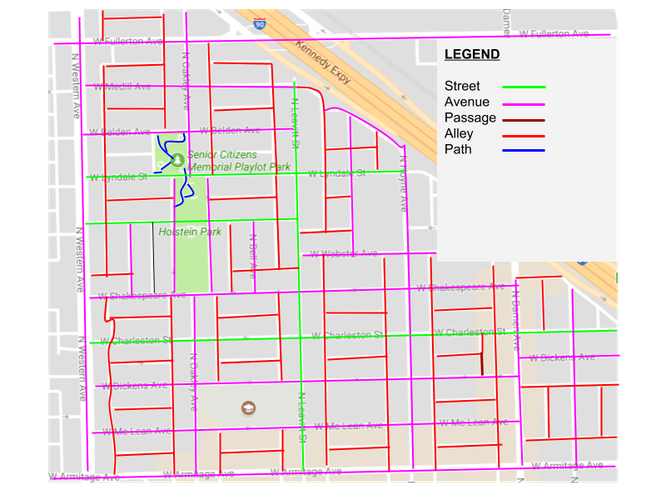
Bucktown is predominantly comprised of rectangular elongated blocks, mostly the same size, with alleys running in all directions between them. Although the blocks are mostly elongated, there are a few irregular blocks that lie parallel to larger roads, such as Milwaukee Avenue to the west and the Kennedy Expressway to the east.
Similar to most Chicago neighborhoods, Bucktown is structured as a regular Savannah-style orthogonal grid. The Savannah pattern provides a course for faster traffic, since a number of side streets guide traffic away from the busy main streets like Damen, Milwaukee, and Armitage Avenue.
Bucktown consists mainly of Avenues and Streets with a plethora of alleys running through them. Even though the majority of thoroughfares are Avenues, I would consider a lot of them to strongly resemble streets. Besides the major Avenues, the ones that are similar to streets are one-way traffic and are lined with trees. Along these residential streets and avenues are single-family homes and multi-family apartment buildings.
In terms of block, network, and thoroughfare types, Bucktown is very much so considered to be a well connected, sociable neighborhood. With a regular grid-based layout and overall orderliness of alleys, this makes the neighborhood much simpler to navigate. The rectangular and some square elongated blocks make it easily navigable as well. This elevates a range of residential homes like apartments, condos, and houses. This mix of homeowners allows for diversity amongst age groups to blend and socialize. The Kennedy Expressway that lines the eastern border of Bucktown is an easy means of traveling in and out of the neighborhood. The Savannah network pattern deflects ongoing traffic from busier streets such as Damen Avenue and Armitage Avenue onto side streets which allows a controllable diffusion of traffic throughout the neighborhood. In general, the connectivity of Bucktown creates a quality way of life where there is a more than ideal sense of pleasing social interaction among all sorts of individuals. The organized division of main avenues with retail, restaurants, and apartments along with residential side streets creates an easy intersecting bond between the two. Overall, the great level of connectivity produces a range of communal mixing which keeps residents well-connected and united.
Bucktown has one of the most expansive transportation networks in Chicago and a growing share of people choosing transit, biking, and walking to get around. Despite a sound foundation and material momentum as far as transportation options, there are still several opportunities to improve the way residents and visitors travel from place to place and ways to better promote transportation options. Bucktown is truly unique; it is one of the few neighborhoods in Chicago with easy and direct transportation via CTA, Metra, or the I-90/94 expressway to the Loop as well as O’Hare International airport and the north and northwest suburbs, along with access to the numerous Chicago neighborhoods. The neighborhood is known as one of the most bike-friendly areas in the city. With the growing popularity of the 606, a linear park and path, and the Divvy bike-share system, the bicycling trend is only expected to continue. Overall, Bucktown has many captivating qualities regarding its connectivity via transportation, however, a few enhancements could be made to further advance the neighborhood. Improving connectivity in Bucktown will allow residents to better enjoy the spaces and services around them.
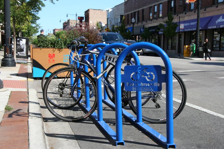
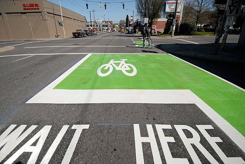
My first intervention’s objective is to reclaim space for people walking and biking. I propose two projects to aid this objective. As a neighborhood with one of the highest bike riderships in the city, Bucktown has one of the highest demands for bike parking. The first project focuses on on-street bike corrals. With limited sidewalk space, accommodating bike parking, utilizing on-street bike corrals will create a high-capacity bike parking area while freeing up space on sidewalks that potentially infringe on pedestrian space. The second project to better serve bikers in the neighborhood is to insert additional neighborhood greenways. Neighborhood greenways create comfortable and convenient connections for people on bikes, including those who are not comfortable traveling on busy streets. The purpose of this objective is to build out a comprehensive network of bikeways composed of bike lanes and neighborhood greenways to accommodate people of all ages.
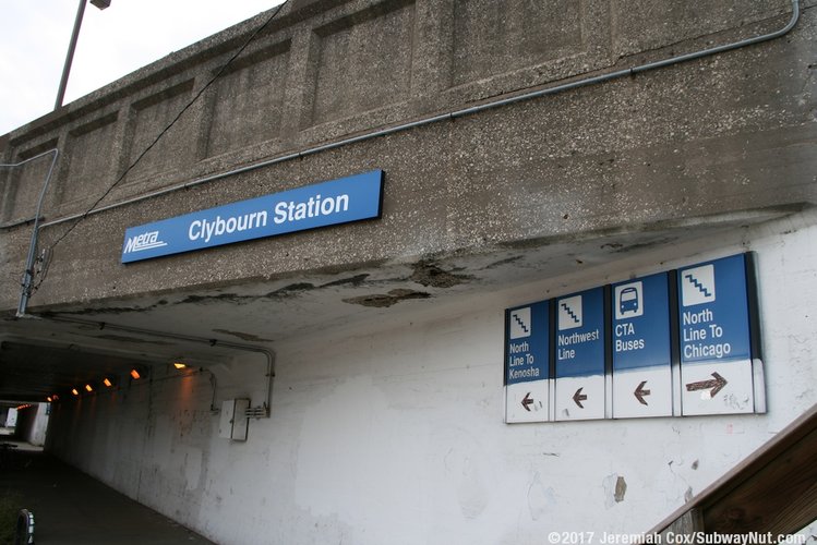
My second intervention is to undertake a comprehensive approach to improve the Clybourn Metra Station. This station is a huge asset to Bucktown providing residents with quick and efficient access to downtown Chicago as well as north and northwest suburbs. It is the most frequently used station in Chicago outside of the Loop and also serves as a transfer to CTA buses as well as being located just one block away from the start of the 606 and local Divvy stations. Even with these benefits, there are important issues that need to be tackled. The conditions at the station are stark, with deteriorated staircases and infrastructure, and few shelters from wind or rain. Signage is also a bit troublesome. Accessing the station requires traveling under long, gloomy viaducts and getting to the platform can be confusing as well, especially for those who aren’t familiar with it. By improving access points, infrastructure, signage, and building overheads in waiting areas along the tracks will greatly enhance the station. With regards to the viaduct, as simple as fixing and/or adding decorative lighting and creating murals will make it feel less dangerous and welcoming for those having to wait for CTA or walking through. Improving the station and surrounding connections to CTA will not only make the station more hospitable to local residents, but it will serve as a more prominent and safe connection between Metra, CTA, the 606, and Divvy.
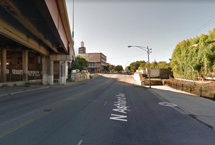
Project #1: Pathway would be placed parallel to Ashland Avenue along tree line.
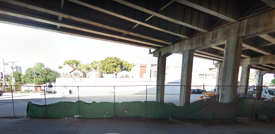
Project #2: Remove maintenance facility, insert underpass skate park.
My third intervention includes two projects that address the underpasses beneath the Kennedy Expressway. The first is to create a pathway along Ashland Avenue for a more accessible connection to the 606. The second project is to build a skate park beneath the Kennedy at Cortland and Ashland Avenues to develop a better public space for youth and to create a better sense of place. A new off-road, multi-use path that connects to the 606 will allow for a much-needed connection for people biking or walking entering or exiting Bucktown. A well-lit skate park would transform the current unpleasant park district maintenance facility into a much-needed destination for youth. A skate park would not only transform the underpass into a livelier scene for youth but the space is also located in an area with no residential living so this would allow for young people to go somewhere that would not disrupt residents. These underpasses would benefit from comprehensive rebuilding to best accommodate pedestrians and bicyclists, however, since reconfiguring these underpasses can be too expensive and time-intensive, focusing on incremental changes will effectively improve conditions for pedestrians and young residents.
Bucktown is a special community and these improvements will emphasize how great the neighborhood’s connectivity is externally and internally. Intervening rehabilitation to the Clybourn Metra Station will enhance connection to the greater City of Chicago as well as the suburbs and other points of the city. With regards to improving internal connectivity, creating additional greenways and inserting an underpass skate park will help build a stronger community by bringing people together and promoting connection with their health/wellness and general well-being.
Image #1: Google Maps
Image #2: foxcitiescycling.org
Image #3: blog.bicyclecoalition.org
Image #4: Subwaynut.com
Image #5 & #6: Google Maps
Social Mix
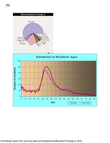
The Bucktown neighborhood of Chicago is fairly homogenous compared to the city of Chicago in terms of race, age, and education completion. With regards to race, Bucktown is predominantly white with a moderate population of Hispanics scoring a 1.8 out of 6. This is substantially lower than Chicago’s diversity index for race of 3.5. Though, with that index, I wouldn’t consider Chicago that diverse considering it is out of 6 possible points. Understandably, Chicago is much more diverse in age with a 6.0 out of 7 compared to Bucktown’s 4.5. Per capita Chicago is much larger than Bucktown, obviously. Bucktown comprises a large amount of people aged 25 to 34 exceeding all other age groups. Surprisingly, Bucktown’s educational attainment for population 25 years and older is lower than expected scoring a 2.9 out of 5. Compared to the whole of Chicago, it is exceptionally low in reflection of the city’s 4.8 out of 5.
In conclusion, Bucktown is most diverse in age compared to the other two variables explored. Compared to Bucktown, Chicago is much more diverse with regards to the Simpson Diversity Index calculated for race, age, and education.