Overview
Social Mix
Public Space
Amenities
Connections
Final Project
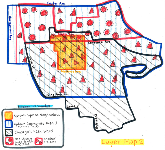
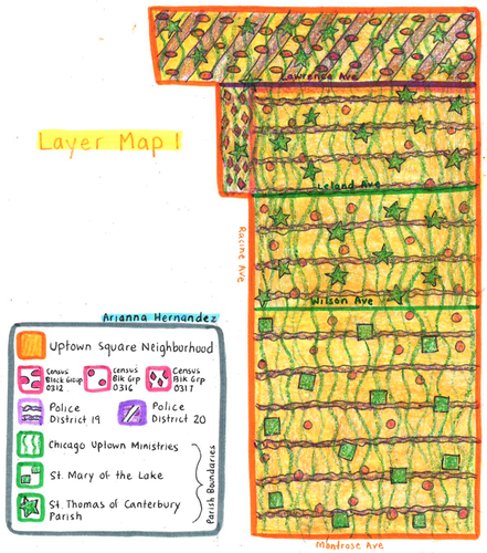
Uptown Square has a population density of 10,598.2 per square mile. With a geographic size of 102.77 acres, or 0.16 square miles, its total population density is roughly 1,695.712. I would characterize the size of Uptown Square as a bit larger than an average public high school in Florida, according to the National Center for Education Statistics.
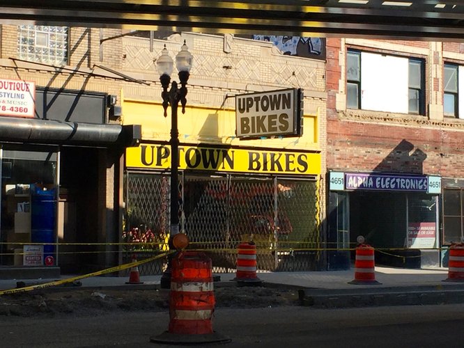
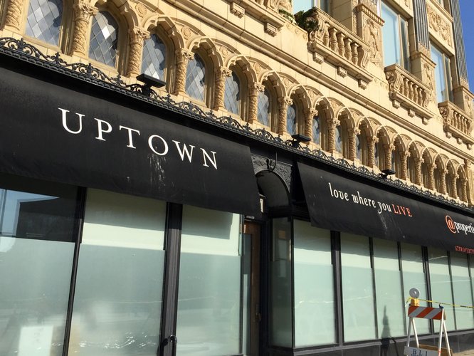
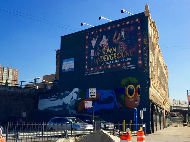
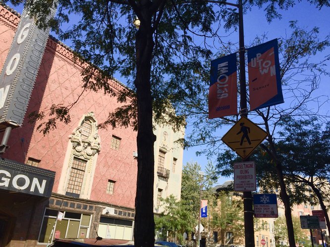
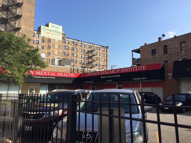
Uptown Square has a quality of forming a unified whole. As I walked throughout the neighborhood, I noticed that the name “Uptown” is ubiquitous in signage, banners, and shop names. The name “Uptown” is most likely an abridged version of “Uptown Square.” For example, there is a street banner that says “Uptown Square,” but the “Uptown” lettering of the banner is significantly larger than the “Square” portion. When one explores Uptown in a search engine, mixed results appear, some speaking of it as a community area and many regarding “Uptown” as a neighborhood although they may be referring to a shortened version of “Uptown Square.” My findings suggest that Uptown is a community area containing six neighborhoods, Uptown Square being one of them. It seems that Uptown Square in Uptown has an inherent definitional problem because it can be unclear which particular “Uptown” one is referring to, the community area or the neighborhood.
One may ask whether the other neighborhoods in Uptown demonstrate the same sense of coherence, and I would say no. Because Uptown Square is a vibrant commercial area, rich with historic buildings, and a multiethnic dining scene, it appears that Uptown Square is the entertainment destination (capital, if you will) of the community area of Uptown, whereas the community’s other neighborhoods have their own sense of identity. For example, residents of Buena Park, strongly associate with their own neighborhood name when giving titles to businesses, for instance. While residents of Buena Park may identify as members of the Uptown community, their own neighborhood culture and history would ultimately rule over the possibility of identifying with the Uptown community alone.
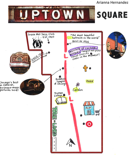
In 1900, the Northwestern Elevated Railroad built a terminal in Uptown at the intersection of Wilson and Broadway (now a stop in the CTA Red Line). For a while, Wilson and Broadway was the last stop for all northbound elevated trains coming from downtown Chicago. This station had an enormous impact on the development of Uptown, one way being that Uptown became a vacation destination for Chicagoans who lived farther south. Around 1910, the popularity of a shop called Uptown Store, owned by Loren Miller, gave the community its name. By the mid-1920s, the concentration of retail and recreation around the crossroads of Broadway and Lawrence obtained the name Uptown Square. Although the neighborhood area of Uptown Square is not actually a square, the name was given in reference to the sense of commercial activity that takes place in a market square.
The community area now known as Uptown was originally outside the city limits of Chicago and constituted part of Lake View Township, established in 1857. Uptown Square was developed throughout the first two decades of the twentieth century by real estate, which transformed the countryside crossroads of Broadway and Lawrence to a bustling entertainment district. It is clear that Uptown Square’s development was related to the aforementioned transit line stop because after its construction, the community received an influx of residents, more than doubling its population between 1900 and 1910. Larger, multi-story apartment buildings took the place of single-family homes.
Entertainment venues glamorous and great in size, such as Riviera Theater and the Aragon Ballroom, were constructed just in time to house jazz artists among others in time for the “roaring twenties.” The Uptown neighborhood experienced great prosperity in the housing industry. As interest in motion pictures, social dancing, and a new culture of consumption grew through the 1930s, Uptown was a prosperous and flourishing neighborhood known for its bright lights, theater scene, and exquisite selection of shops and restaurants.
In The Everyday Neighborhood, Professor Talen mentions that a purpose of neighborhoods is to unite the lives of its inhabitants and one way to do that is through its offerings. Uptown Square, with a glowing public space, dance halls, concert venues, retail centers, all within a three-block radius, contributed to an atmosphere that truly manifested “the basis of urban experience” in its early years. Uptown Square offered a great pool of jobs and goods to the people, an important feature according to Jane Jacobs in The Death and Life of Great American Cities. Moreover, The Neighborhood and the Neighborhood Unit suggests that because cities are mobile, neighborhood life typically loses its character and the neighborhood ceases to be part of the “lovable whole.” Uptown Square seems to have only reaped more success in its prime as it invited city dwellers and folks from all walks of life to share in its fruits of pleasure and escape from the everyday monotony to a vibrant bubble. Uptown Square is unique in that it was not deliberately designed to accommodate people or provide community. Rather, it appears that its very beginning as an entertainment district magnetized the people to live there.
Uptown Square is designated as a Chicago Landmark, which speaks volumes to the significance of the neighborhood’s history and architecture to the story of Chicago. While Uptown Square has weathered changes over the years, a renewal is underway to restore its historic movie palaces and architectural gems, most of them dating back to the 1920s and 1930s.
Gorski, E. “Chicago Landmark Designation: Uptown Square District.” City of Chicago, Planning and Development, www.cityofchicago.org/city/en/depts/dcd/supp_info/chicago-landmark-designation--uptown-square-district0.html.
Jacobs, Jane. 1961. Chap. 6, “The Uses of City Neighborhoods” in The Death and Life of Great American Cities. New York: Vintage. Pp. 112-142.
Mumford, Lewis. 1954. “The Neighborhood and the Neighborhood Unit.” The Town Planning Review 24, 4: 256–70.
“Rich History of Uptown Neighborhood Spans More than a Century.” Uptown Chicago Commission, 6ADAD, uptownchicagocommission.org/jun_13b_07.html.
Schlater, Angela. “The Bright Lights of Uptown.” The Bright Lights of Uptown | Edgewater Historical Society, Edgewater Historical Society, Aug. 2000, www.edgewaterhistory.org/ehs/articles/v11-4-2.
Talen, Emily. 2017. The Everyday Neighborhood (excerpts from forthcoming book Neighborhood, Oxford University Press).
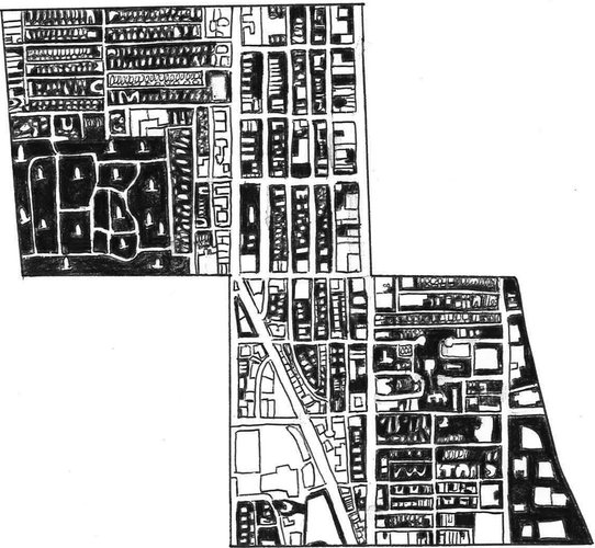
In the figure ground map above, white areas represent built space whereas black areas represent unbuilt space. Uptown is a densely populated neighborhood, with little to no unbuilt space after one accounts for the small spaces between buildings and the distance between buildings and the street. While the map might suggest that there are vast expanses of unbuilt space on either side of the neighborhood, the space on the left-hand side of the map is a cemetery and the space on the right-hand side of the map is the neighborhood park, Clarendon. Although Clarendon offers several activities and facilities, its location on the edge of Uptown, in comparison to being centrally located, prevents it from contributing more to everyday life of neighborhood residents.
While almost all of the streets that run through Uptown are narrow, the one main road, Broadway Street, serves as Uptown’s cultural and commercial hub. Broadway Street is the wider street that runs north/south and northwest/southeast in the middle of the map. Although Uptown boasts a booming entertainment district on Broadway, the very nature of its appeal poses a limiting factor on the accessibility of its center as a public space since it is privately owned. For example, beyond walking the street, most spots in the Broadway area involve live music, ethnic dining, and trendy bars, which could be pricey for residents of lower socioeconomic status and thus a hindrance to encouraging diversity.
Uptown’s layout does not necessarily facilitate flow or direct attention toward a center. The spatial definition of the neighborhood is constructed on a grid plan that does not order streets outside of a plaza/public space or connect the rest of the neighborhood to a center, the way successful Spanish systems did. In addition, a street as the primary public realm of the neighborhood is problematic in that it is a main road with heavy traffic, which is inhospitable to its walkability.
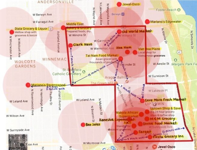
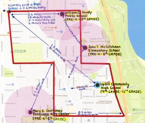
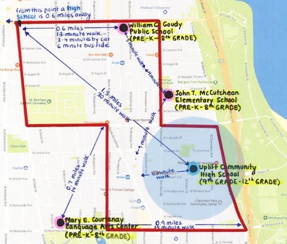
Note: Pedestrian sheds based on 1/4 mile distance around facilities.
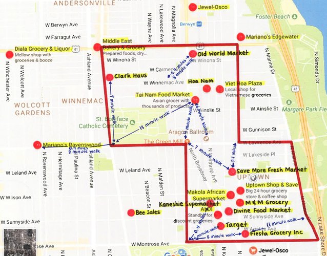
Approximately 83 percent of Uptown residents (16,754 of 20,186 people) have walkable access to at least one grocery store, and many of the 83 percent have walkable access to more than one. When viewing the map above, it is understandable why Walk Score, a site that provides walkability scores for neighborhoods, claims that daily errands do not require a car in Uptown. In addition to most of the Uptown population living within a quarter mile of a grocery store, virtually all routes to stores are pedestrian-friendly. Sidewalks are of sufficient width and tree-lined streets not only offer shade, but are also a design element that serves as a buffer between walkers and moving cars. Street parking is another buffer that protects the pedestrians from the continual traffic. Moreover, buildings in Uptown tend to have transparent doorways and windows, making trips to the store (or school, place of worship, pharmacy, etc.) interesting. It also encourages employees and workers inside these buildings to keep an eye on the street, which makes the area safer.
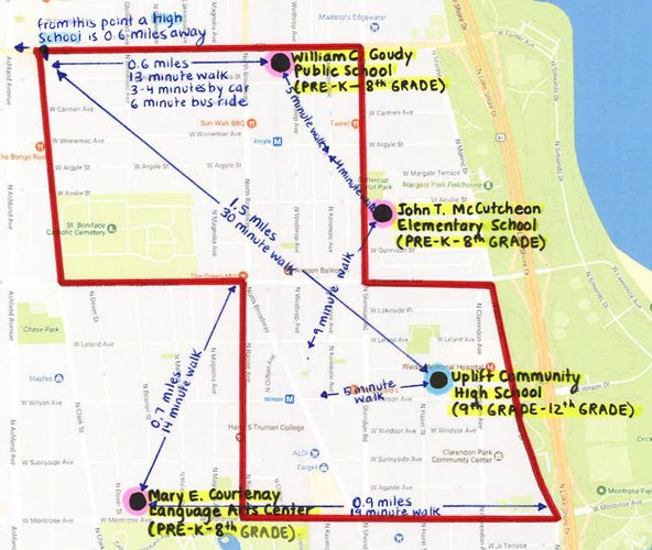
Schools that Enroll Preschoolers through Eighth Graders
School that Enrolls Ninth Graders through Twelfth Graders
Uptown's school-age population is very small, with roughly six percent of the neighborhood population, or 1200 children, of elementary and middle school age, and less than two percent, or 312 young people, of high school age. Although schools within a five-minute walking distance may be essential in neighborhoods dominated by families, the majority of Uptown residents are between emerging and middle adulthood. For this reason, the fact that approximately 6,861 neighborhood residents (about 34 percent of the total population) are within a quarter mile of at least one elementary school and roughly 5,881 neighborhood residents (29 percent of the total population) are within a quarter mile of the high school is impressive. It may also allow families to build a stronger sense of community around the school and separate themselves from the entertainment district nightlife scene.
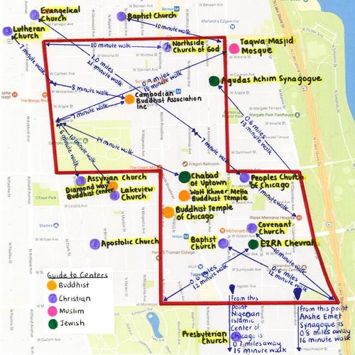
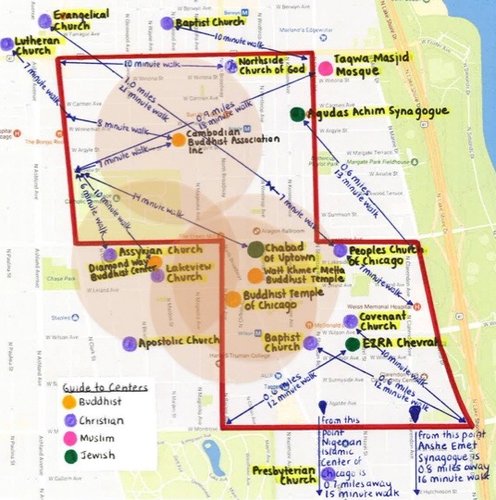
About half of Uptown residents (10,093 people) are within walking distance of a Buddhist center.
Three-quarters of the neighborhood population (15,139 people) lives in a pedestrian shed of a church, broadly speaking, of which there is a variety of denominations, such as Baptist, Evangelical, and Lutheran.
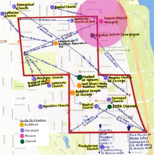
There is one mosque located just outside the neighborhood that is within walking distance of 1,211 residents.
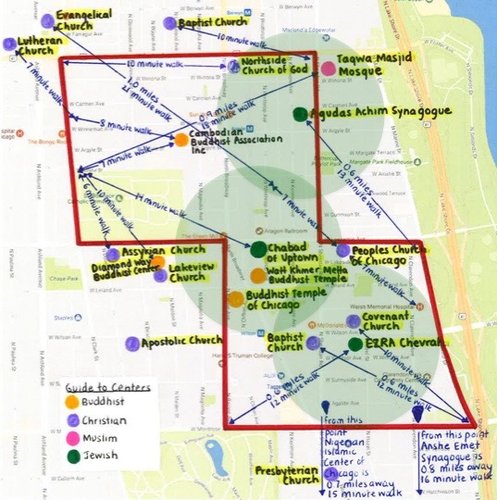
Though there are only three Jewish places of worship, the scope of their pedestrian shed is over half the neighborhood population (10,093 people) due to efficient spacing between locations.
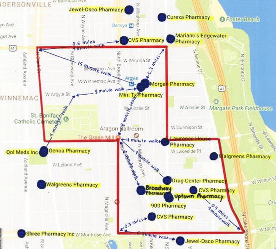
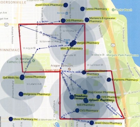
Approximately 15,139 of 20,186 neighborhood residents are within walking distance of a pharmacy. Because health care is an important aspect of daily life, living in close proximity to a pharmacy is convenient in times of illness. For example, if a neighborhood resident who lives alone falls ill, they would have an easier time picking up their medication if they live within a quarter mile of a pharmacy. As for the 5,047 residents who do not live in a pedestrian shed of a pharmacy, their walk would likely fall between six and nine minutes, which could be more difficult to do if they were in the aforementioned scenario.
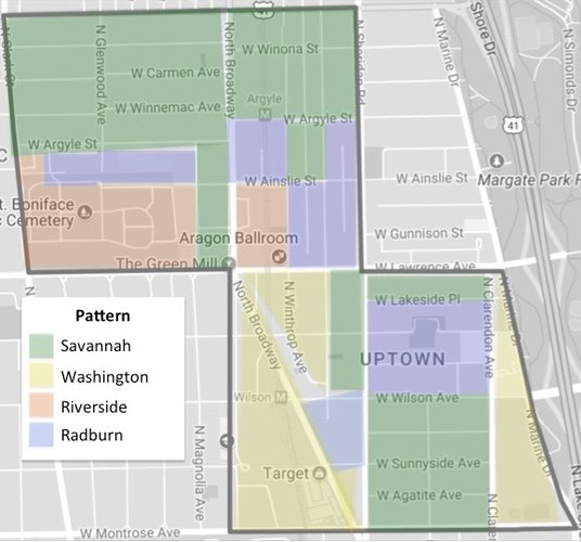
Many of Uptown’s block types are elongated and on a Savannah network pattern that offers advantages for neighborhood residents and visitors. One advantage of the grid arrangement of thoroughfares is that it facilitates the movement of traffic and creates options in terms of how a driver or pedestrian can move from one point to another. In addition, the savannah pattern supports directional orientation, which aids in giving and taking cardinal directions. While automobiles have a presence in Uptown, the fact that the neighborhood does not have gated communities and restricted access roads makes it open to a range of Chicago Transit Authority routes, such as Red Line and buses. Neighborhood residents and visitors can thus enjoy a variety of transportation options, not to mention that most parts of the neighborhood are located in a pedestrian shed of everyday essentials, such as grocery stores.
The scope of Uptown’s network is not limited to Savannah, which is a pattern that can become monotonous if not “periodically interrupted,” according to the Lexicon of the New Urbanism. In fact, its network expands to three other types. They combine to form an assortment of thoroughfare experiences that provide a sense of organization with its foundation of straight lines, even if they are on a diagonal. For instance, the Washington pattern best complements the Savannah pattern in its dispersal of traffic that interrups the grid while still fitting in well with its spatial structure. One issue with the Washington pattern in Uptown is that the diagonals have formed triangular-shaped, irregular blocks that have peculiar lot shapes and sizes. At the same time, they are home to specific intentions, such as a shopping center and a hospital campus, which shows how the unlimited variations of irregular blocks can be the perfect match for a particular purpose.
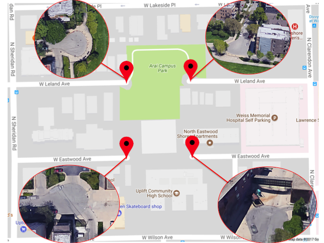
Uptown’s several cul-de-sacs certainly constitutes less than 20 percent of streets, which meets the guidelines set by the Victoria Transport Policy Institute. However, some of the sizes of the cul-de-sacs surpass 400 feet, with a few reaching about 518 feet. This is at odds with the criteria that holds maximum cul-de-sac length should be 200 or 400 feet. It seems the dead ends were made with the intention of providing a safe, though not very practical, route to the John F. Arai Park and the neighborhood high school. Unlike the picturesque cul-de-sacs of suburbia, with homes in rows around the bulb, the cul-de-sacs of Uptown have mixed-housing along the roads, which contribute to neighborhood diversity despite it being on a dead end road.
Overall, Uptown is well connected in terms of blocks due the their shapes and thoroughfare arrangement on the grid. Many streets not only serve as boundaries between blocks, but also facilitate traffic and encourage connectivity through the sheer number of them that are connected to each other.
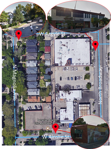
Example 1
This is one of the three square blocks in the neighborhood, all of which are located contiguously on the grid. This block's irregular size does not hinder it from meeting a variety of purposes, such as a tree-lined area of single family homes, a Chicago Public Library, a gas station, and a restaurant.
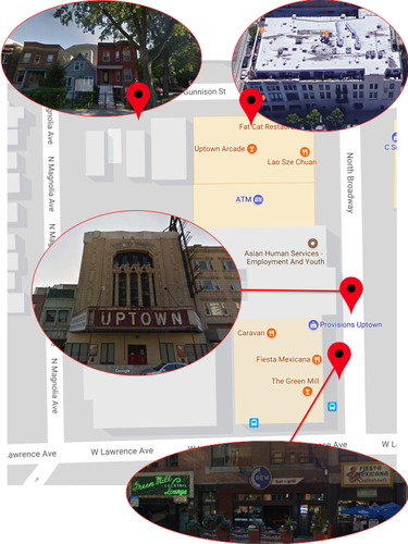
Example 2
Shown above is another square block in Uptown that also has a range of lot sizes occupied by single family homes, a 42-unit apartment building, the Uptown Theatre, Green Mill Cocktail Lounge, and restaurants. These city blocks are examples of mixed-use development, which integrates different uses: residential, commercial, and cultural, to name a few.
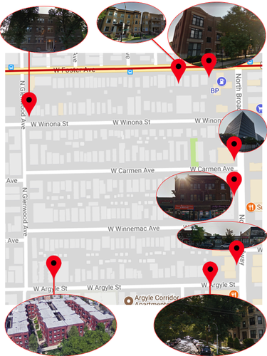
Elongated blocks are prevalent in primarily residential areas of Uptown. The diagram showcases four different blocks that share almost identical lot depths. The advantages in altering lot width in this block type is illustrated by the scope of housing options seen in the images, which allows people of different income levels to live as neighbors and promotes diversity. Longer edges of Uptown's elongated blocks tend to be more residential whereas their shorter edges are home to office buildings, local businesses, and services.
Irregular blocks in the neighborhood, although arbitrarily shaped on an individual level, combine to form diagonals in the big picture, which facilitates the flow of traffic and the routes for pedestrians.
Uptown's network embodies combines four patterns of thoroughfare arrangements. Overall, the neighborhood has a Savannah pattern, with many straight lines, boosting directional orientation, dispersing traffic, and making alleyways more efficient. Because one of the disadvantages of the Savannah pattern is that it is monotonous, it seems the other patterns: Washington, Riverside, and Radburn, complement it well by interrupting the repetitive grid.
There are several cul-de-sacs in the neighborhood, which is unexpected in an urban setting. Similar to the cul-de-sacs bounded by homes in suburbia, it appears that Uptown's cul-de-sacs provide a safe environment for students and their families given that there is a high school and park nearby, which may encourage walking. However, the dead end street may also problematize the route to the hospital, which is in close proximity as well.
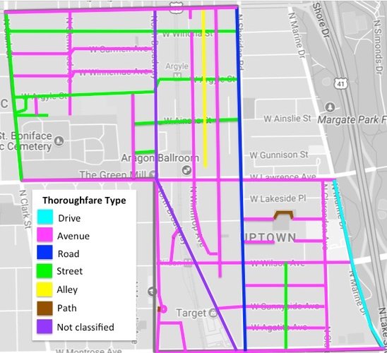
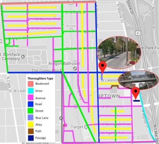
In this map, thoroughfares are labeled according to actual "street" names such as Foster Avenue. Interestingly, there are several inconsistencies between apparent thoroughfare type and actual thoroughfare type. For example, Foster Avenue's name suggests that it is could be a finite, short distance connector between urban hubs, yet I see its characteristics more aligned with a boulevard, because it has a high vehicular capacity at moderate speed, and it is linked to U.S. Route 41.
Note: Not all Rear Lanes, Alleys, Paths, and Passages in the neighborhood shown in the above diagram.
Virtually all of Uptown's blocks are cut through by alleys, many of which double as rear lanes.
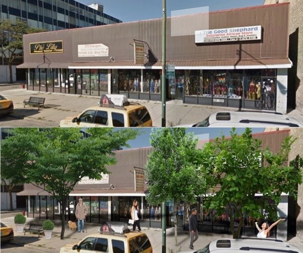
An infusion of nature would make Uptown’s main commercial drag greener, transforming the barren sidewalks of North Broadway into lively public realms. While pleasant greenways adorn many of the primarily residential areas of the neighborhood, trees are scarce on North Broadway. In Happy City, Montgomery holds that nature’s presence can shift mindsets, supporting kinder attitudes and behaviors towards others due to biophilia. Montgomery also states that sharp architectural angles characteristic of the urban landscape can decrease the probability that a person will stop and interact with places and others. Therefore, Uptown could shift residents’ and visitors’ orientation by a slight adjustment in green space that would counter this natural psychological and physiological response. Additionally, in “Pathways and artifacts: neighborhood design for physical activity,” Hess and colleagues argue that visual interest and safety are two factors that render an environment attractive for walking. North Broadway surely meets these criteria with its mom-and-pop shops that convey character and unique storefronts that provide the public surveillance highlighted by Jacobs in the Death and Life of Great American Cities. Uptown should invest in upgrading North Broadway to a tree-lined hub that will be an inviting outdoor space as opposed to a mere concrete façade. The neighborhood will reap beauty and shade, which will give drivers an incentive to go pedestrian because the walk is worth the breath of fresh air.
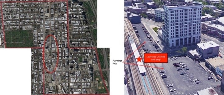
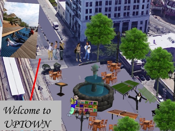
I propose that Uptown transform two parking lots located in the heart of the entertainment district to a creative urban park that unifies the restaurants, historically important buildings, and businesses that surround them. In “Public Life, Public Space, and the Changing Art of City Design,” Southworth holds that an imaginatively conceived place does not guarantee that it will vibrate with life. However, public activity already thrives in Uptown’s district despite not having a designated point of connection to unify the movement/circulation. The amount of thoroughfare surrounding the neighborhood’s center would decrease if there were a larger emphasis placed on a space for connection. Uptown should create an innovative, recreational space that would be located at the intersection of well-traveled blocks. This space would contain, for example, public art, tables and chairs, and opportunities for easy-going diversion at game tables. A fountain could be positioned in the middle of the park to dignify it, making it an official center. In addition, an Uptown welcome sign could be placed by the CTA Red Line stop as a means to greet patrons and pedestrians alike, bidding adieu to automobile dependence by the very shift of making a park out of pavement.
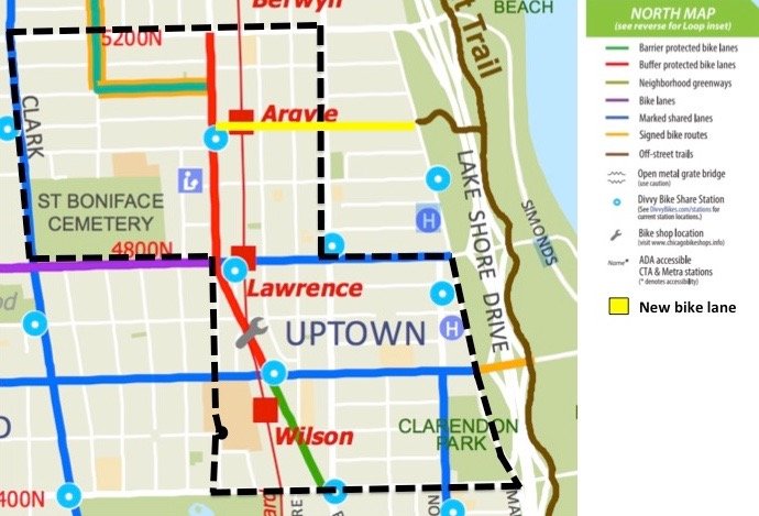
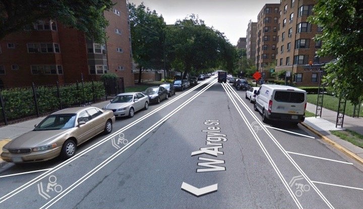
Installing a bike lane that links Argyle Street to the Lakefront Trail, a popular route for athletic training, leisure rides, and physically active transportation to other neighborhoods, could be beneficial to Uptown’s public realm. Without the aforementioned bike lane, Uptown’s proximity to the trail is a missed opportunity considering that the neighborhood is located only a mile away. There is potential for the connection to services the trail could provide Uptown, and the services Uptown could offer to cyclists on the trail. Adding a bike lane would expand the public space available to Uptown residents, which would otherwise be difficult to achieve considering the size of the neighborhood, while stimulating non-residents’ interest in engaging with Uptown’s public life scene.
Although Uptown is successful in blending a vivid history with upscale enjoyment, I suggest that redesigning its public space to encourage walkability, with crossover of connectivity, would boost not only the quality of the public space along its main commercial drag and entertainment district, but also its appeal as a Chicago destination for public celebration, ceremony, and social connection.
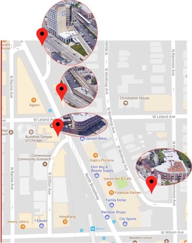
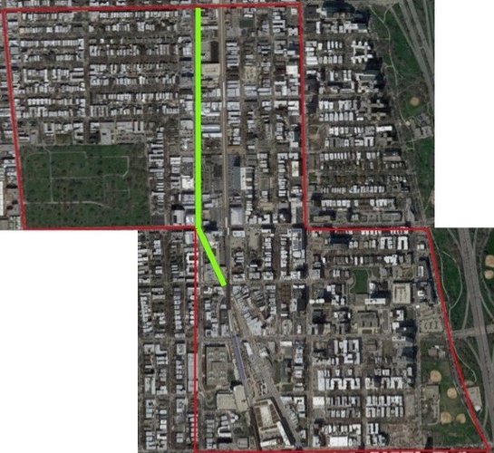
This proposal targets North Broadway, from the northern tip of the neighborhood as it turns diagonal going southeast until reaching W Sunnyside Ave.
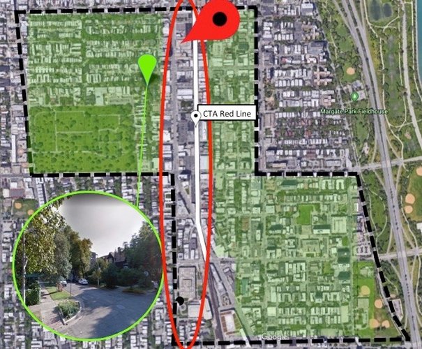
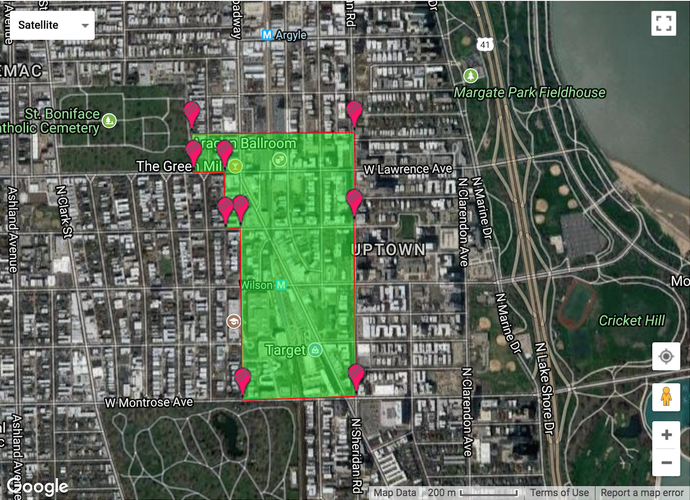
Uptown's primarily residential areas, highlighted in green, tend to have more green space. From this satellite view, the difference between the streets with trees and those without is noticeable. The aim is to to make the area in red more walkable. The following graphic hones in on the the red dropped pin pictured above.
This is an example of how an infusion of nature on North Broadway would change people's orientation to the space as it becomes more walkable.
Photos: Google Earth, Google Maps
This proposal targets the entertainment district, bordered by North Broadway and N Racine Avenue to the West, W Ainslie St to the North, the CTA Red Line to the East, and North Broadway to the South. In its current state, this area is dominated by thoroughfares, which makes it an uninviting place to walk. The two parking lots pictured to the right-hand side of the graphic are an ideal location for a public space since it is surrounded by venues and locally owned restaurants.
This public space idea is inspired by Seattle's Occidental Square Park. Occidental Park was once a parking lot and today it as pedestrian-friendly, urban gem that is full of life. A similar space would unify Uptown's entertainment district.
Photos: Google Earth, Google Maps
As shown in the map above, Uptown has several bike lanes. This proposal identifies the potential for improving bike lane connectivity with the Lakefront Trail. A bike lane would begin on Argyle St, at the intersection of North Broadway to the West, and extend to the intersection at N Marine Dr to the East.
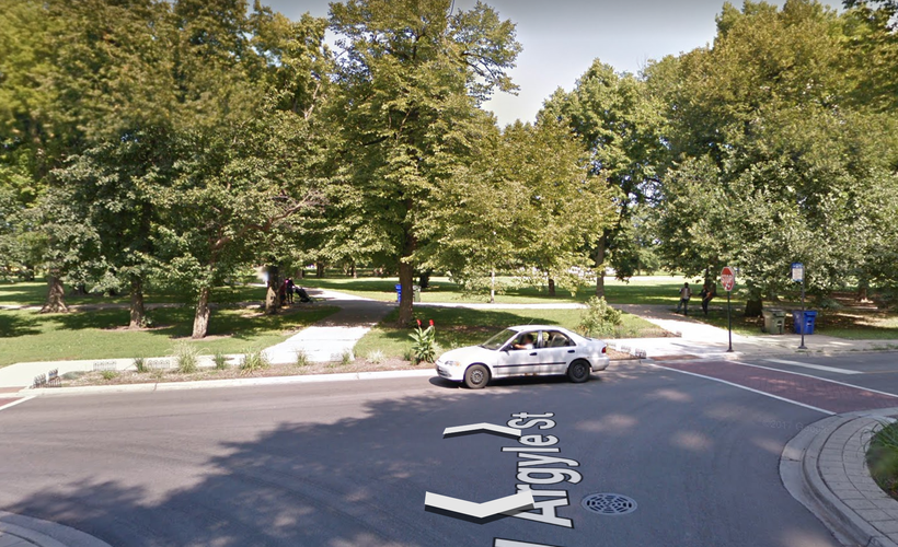
This image shows what a person on a bike exiting the Lakefront Trail would encounter. There is no sense of place, which a bike lane could provide. It would also point to Uptown as a destination. The opportunity to ride on a bike lane could completely transform bike-riders' attitude toward the space, making them feel more comfortable and included.
If Uptown were to install a bike lane outside the vicinity of the Lakefront Trail, it would increase the interchange of services between Uptown and the trail.
Photos: Google Earth, Google Maps, Chicago Complete Streets City of Chicago Bike Map
Social Mix
With regard to race/ethnicity, over half of Uptown’s population is white and about a quarter is African-American. Although this may appear to be non-diverse, when one considers the indices of the Uptown Community Area, North Region of Chicago, and the City of Chicago, Uptown is not only equally as diverse as the city, but also more diverse than the community area and region. Because of this, Uptown identifies as an ethnically diverse community although it scores a three on the Simpson Diversity Index with seven different categories. In regard to age, more than 50 percent of Uptown’s population is between 25 and 54 years old. There are not many children in Uptown as 55 to 64 year-olds are more numerous than individuals ages 17 and under. According to the indices for age, Uptown has similar diversity to the North Region, and is less diverse than Chicago. It is possible that a strong presence of entertainment venues and nightlife may be more appealing to single adults than families with young children. In relation to educational attainment, the Uptown neighborhood and community area is almost as diverse as Chicago and slightly more diverse than the North Region.
The concept of diversity is complex because even with an apparently low Simpson Diversity Index, a neighborhood can still be diverse by comparison to its surroundings. Moreover, I understand diversity as a sliding scale and not binary. For example, I could describe Uptown as less diverse than Chicago, but it may be very diverse in comparison to another neighborhood with a virtually homogenous (on paper) population. Therefore, when analyzing characteristics of a neighborhood for diversity, it is necessary to recognize the context and factors that may influence the diversity.