Overview
Social Mix
Public Space
Amenities
Connections
Final Project
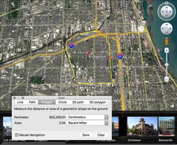
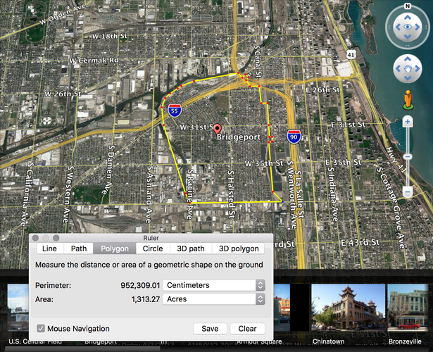
maps created using Google Earth
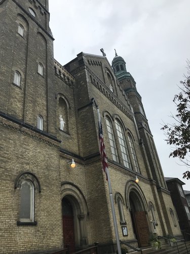
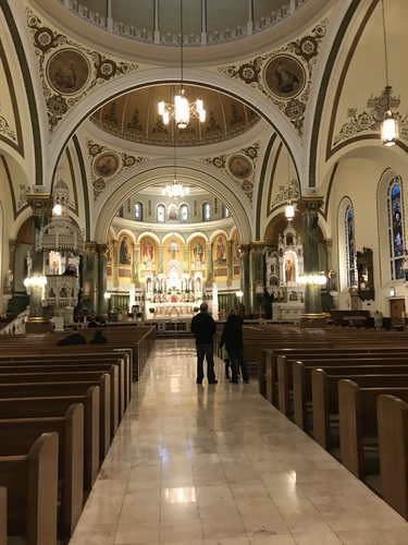
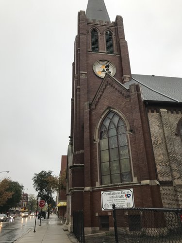
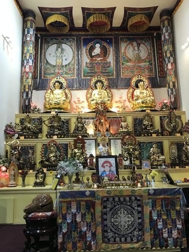
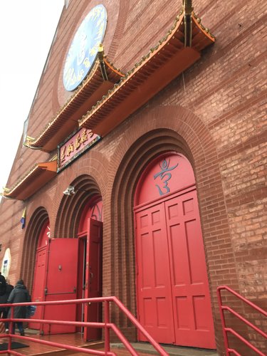
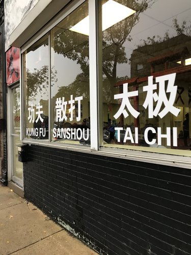
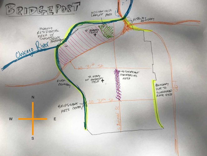
Bridgeport is quite a large neighborhood, and from what I saw of it, it seems to be subdivided into a few smaller sections that overlap and intermingle to a certain extent; there is only a limited sense of overall neighborhood coherence. The main artery of the neighborhood is South Halstead St., which has a variety of small shops and restaurants. Many of the restaurants offer Chinese food, and I noticed a few Mexican restaurants mixed in. Moving north, I encountered an area with a more clear Eastern European influence-- the St. Mary of Perpetual Help Church was founded in 1882 by Polish immigrants, and much of the signage within the chapel is written in Polish. The Eastern European Catholic influence is evident further north as well, as the St. Barbara Church and school, the other major place of worship in the neighborhood, was also founded by Bridgeport’s Polish community, in 1914. As I walked further north and east, Chinese businesses became more common, as did signage in Chinese. Not too far north of the St. Mary of Perpetual Help Church was the Ling Shen Ching Tze Buddhist Temple, which was converted from a church to a temple only 20 years ago. The northwestern region of Bridgeport stands out from the rest of the neighborhood because its streets are positioned at an angle to the standard grid system that prevails in the rest of the area. This makes driving between the two regions more difficult, and it seemed that the houses in the diagonally-organized area were more isolated, with fewer community institutions, pedestrians, and public spaces than in the rest of Bridgeport.
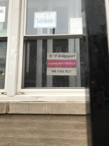
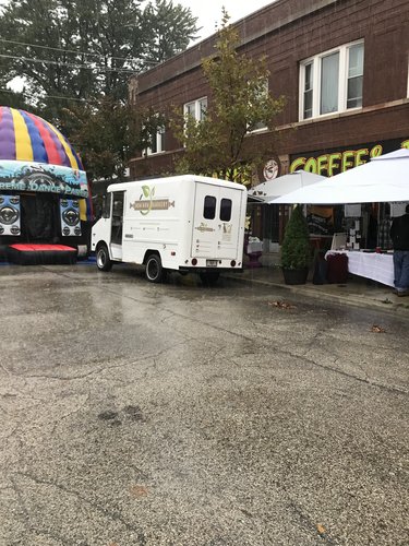
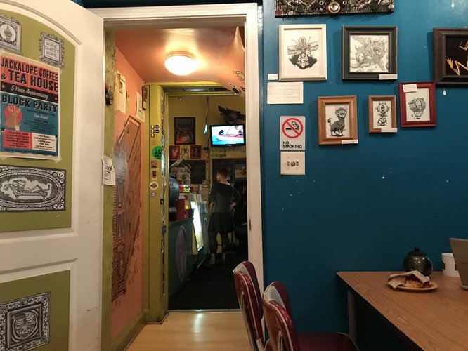
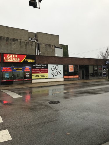
The clearest evidence of a cohesive neighborhood atmosphere was the interactions I saw between people. One of the local coffee shops, Jackalope Coffee, was hosting a block party to celebrate its 5-year anniversary in the neighborhood, and many of the patrons knew each other and were chatting about their lives and families. This was also true of the Bridgeport Coffee House. In addition, there were several stores that incorporated “Bridgeport” into their names, and a customer I saw at Jackalope Coffee was sipping tea from a mug that said “Bridgeport Rocks!” Another significant sign of neighborhood unity was the many clear indications that I was in the heart of Sox territory. Guaranteed Rate Field is located on the eastern border of Bridgeport, and throughout the neighborhood there were signs saying “Go Sox!”, stores selling paraphernalia supporting the team, and people sporting the logo. Throughout the neighborhood, I also noticed signs saying “Bridgeport Community Watch: We call 911”. Combined, these features helped give the otherwise disparate elements of the neighborhood a more cohesive feeling.
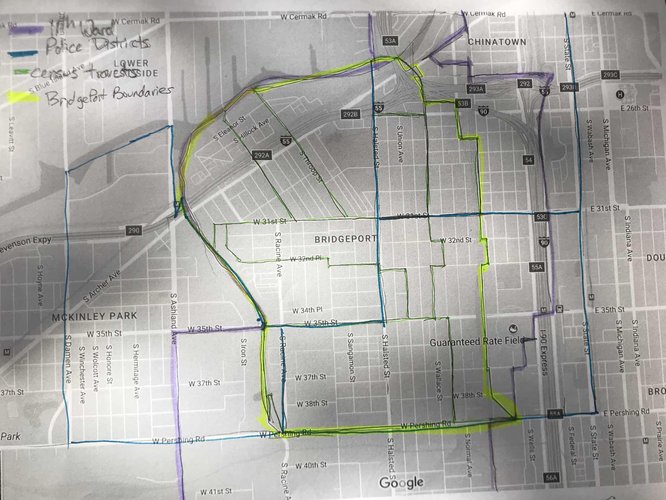
In the above diagram, the purple line represents the 11th ward, which is mostly composed of Bridgeport, the blue line represents CPD police districts, the green line represents the U.S. census tracts, and the yellow line represents the boundaries of Bridgeport itself.
Among the first people to live in the community along the South Branch of the Chicago River were traders and fur company workers, as Henry Binford notes in “Multicentered Chicago”. However, the large, diverse, varied neighborhood that today is Bridgeport originated in 1836, when construction began on the Illinois and Michigan Canal, which represents the first true phase in Bridgeport’s expansion. According to the Encyclopedia of Chicago, Bridgeport likely got its name from canal commissioners in order to distinguish it from Canalport, a settlement that had been planned earlier. The first inhabitants of Bridgeport were Irish immigrants who arrived to work on the canal, followed closely by Germans and Norwegians.
The second period of development in Bridgeport came in the mid-19th century, when many of the area’s meatpackers relocated to the Union Stock Yards, and manufacturers began to move to Bridgeport, providing residents with a new source of employment. During this second period, many of Bridgeport’s religious institutions were founded. Most of the Eastern European immigrants who populated the area were Catholic, and they were responsible for the creation of the St. Mary of Perpetual Help Church and St. Barabara Church, two Polish Roman Catholic monuments that dominate the horizon over Bridgeport. The development of parishes in the Catholic tradition within Bridgeport seems to have been a deliberate planning strategy, as Catholic immigrants sought to emulate the neighborhood structure they were familiar with at home.
In the 1930s, Bridgeport faced another era of change and redefinition, as Chicago’s famous Democratic machine began to take shape under Mayor Anton Cermack. The role of Bridgeport Democrats in Chicago’s political history is intertwined with Bridgeport’s neighborhood identity. Bridgeport was and still is largely a blue-collar area, and the five Chicago mayors-- Edward Joseph Kelly, Martin Kennelly, Richard J. Daley, Michael Anthony Bilandic, and Richard M. Daley-- who hailed from the neighborhood could all speak to the needs of the city’s working class. Mayor Kelly was a first generation Irish-German American who had worked his way up from working odd jobs around Bridgeport as a child to the mayorship, and could relate to the interests of the city’s many Irish and Eastern European immigrants. Richard J. Daley, perhaps Chicago’s most famous mayor, spent a great deal of time working in Bridgeport’s Eleventh Ward as a young man, and remained living in Bridgeport even as his career soared. In return for serving as the breeding ground for five of Chicago’s mayors, Bridgeport gained further economic stability.
The last phase of the development of Bridgeport is the modern era. In recent decades it has seen an influx of Mexican-American and Chinese-American inhabitants, through the expansion of Chinatown to the northeast and Pilsen to the northwest. With them have come distinctive restaurants and schools and afterschool programs dedicated specifically to children of those communities. Like many of Chicago’s neighborhoods, Bridgeport is also beginning to transition into a neighborhood for young hipsters, although it still retains some of its blue-collar roots. The low cost of living in the neighborhood, its nearness to both Chinatown and downtown, and its working-class political history have enticed young people to the neighborhood, and led them to found trendy institutions like Maria’s Packaged Goods and Community Bar, Jackalope Coffee & Tea House, the Co-Prosperity Sphere (an experimental cultural center), and the Bridgeport Art Center, among others.
It seems that the greatest factors driving the development of Bridgeport over the years were first the construction of the Illinois and Michigan Canal, and subsequently the movement of various manufacturers into the area. These two factors-- transportation and economic development-- are the elements that Ann Durkin Keating emphasized in Chicagoland: City and Suburbs in the Railroad Age, saying that first the canal and then the Union Stock Yards played a major role in the population and development of Bridgeport and nearby Back of the Yards. Urban planning seemed to play a limited role in Bridgeport’s history, but neither does it fit with Reginald R. Isaac’s conception of an area where people simply reside rather than live, work, shop, play, recreate, and pray. All that is necessary for these activities is contained within Bridgeport. What started as a fur trader encampment has developed into one of chicago’s largest, most diverse up-and-coming neighborhoods.
Sources
https://stbarbarachicago.org/history/
http://lockzero.org.uic.edu/V.html,
Keating, Ann Durkin. 2005. “Chapter Four: Industrial Towns of the Railroad Age”. In Chicagoland: City and Suburbs in the Railroad Age. Chicago: University of Chicago Press.
Isaacs, Reginald R. “The Neighborhood Theory: An Analysis of Its Adequacy.” Journal of the American Institute of Planners 14, no. 2 (1948)
http://www.encyclopedia.chicagohistory.org/pages/165.html
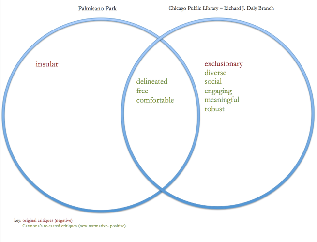
I analyzed two spaces in Bridgeport, Palmisano Park and the Richard J. Daley Branch of the Chicago Public Library, as examples of public spaces in the civic realm, while also drawing on concepts from Matthew Carmona’s theory of problematized spaces.
In Re-theorizing Contemporary Public Space: A New Narrative and a New Normative, Matthew Carmona gives a list of critiques (shown in the diagram above in red) that have been levied against those responsible for public spaces. After conducting a case study of public spaces in London, Carmona re-casts these critiques as qualities that good public spaces ought to have (shown in the diagram in green). The two spaces I studied both have elements of the critiques and the qualities of good public spaces. If one space has elements of the critique, it doesn't necessarily mean that it has the corresponding re-casted quality- for example, Palmisano Park is insular without being social.
Originally a quarry, and subsequently a landfill, Henry C. Palmisano Nature Park only became a civic space in 2009.
The park was almost completely deserted on both visits, with only one or two people walking through the park on their own-- there was no social interaction occurring. However, both visits occurred in mid to late fall, when the weather was quite cold, so the limited use may be an artifact of the weather. During the visits, however, the park would certainly qualify as a dead space.
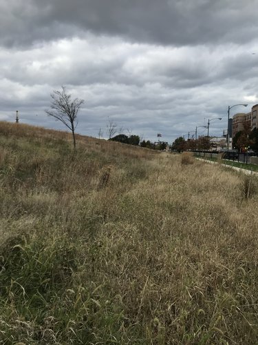
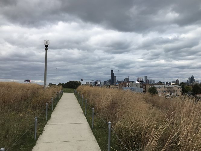
Palmisano Park is very well-maintained, with impeccable sidewalks lined with shin-high barriers to separate the path from the grass, no litter at all, and very little graffiti. The grass in the fields is mown, and the fence surrounding the park is in good condition. This helps add to the sense of comfort and safety in the park.
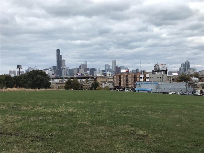
Palmisano Park is beautiful-- the view of the skyline is breathtaking, and the park is huge, containing a lagoon, wetlands, and hills. The enormous size of the park may be a disadvantage for the sociability of the space however, because it is possible for many people to be in the park without encountering one another.
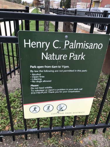
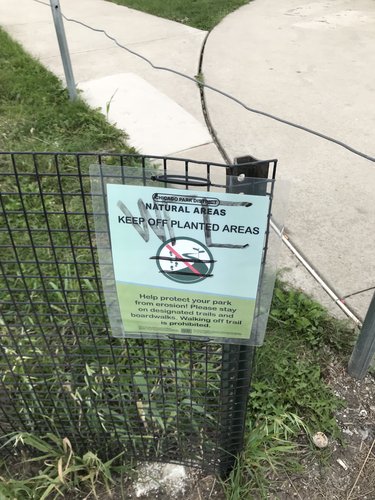
This was one of the three pieces of graffiti observed in the park. Despite the graffiti, this sign reveals the amount of care that was taken to make the park a pleasant space, with well-maintained green space and expectations of conduct.
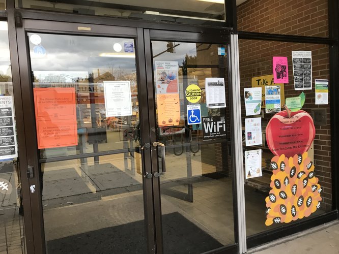
The front door of the library advertised community events, local organizations, and services the library offers.
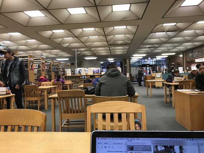
The space is used by a variety of people, from adults working and studying to older people reading newspapers to children reading and working on computers. There were a variety of resources, including signage and newspapers in English, Mandarin, and Spanish.
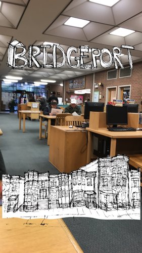
The space is certainly active, with people from across the community, of many different races, using the space for different purposes. The space is designed to accommodate this diversity, with separate computer stations for children and adults, a kids' corner, a variety of newspapers, DVDs, CDs, and books and different workspaces, including desks and cubicles. The drawing in the photo above is from Bridgeport's local snapchat filter, and has the same childish, hand-drawn quality as several other of the filters in Chicago neighborhoods-- it conveys a sense of welcome and community identity.
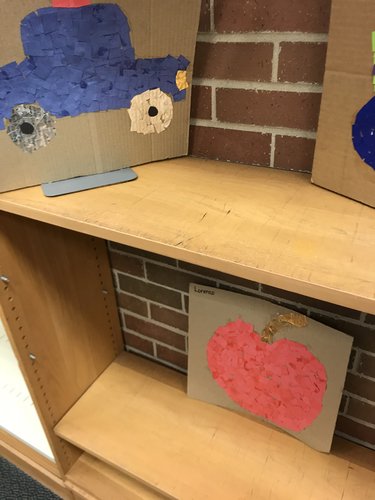
The library isn't especially aesthetically appealing-- it is a short brick building with grey carpet, lit by fluorescent lights, and with wrinkled book posters on the walls-- but it is made into a welcoming place with artwork from the daycare, colorful signs, and festive decorations on display. The building also appears to be well-maintained, and there is a CPD officer on duty. Together, these combine to create a sense of comfort and safety.
There is a great deal of programming offered at the Richard J. Daley Branch, including daycare, storytimes, and crafts that make the library a pleasant place for a variety of people to use. Source: https://www.chipublib.org/location/daley-richard-j-bridgeport-events/
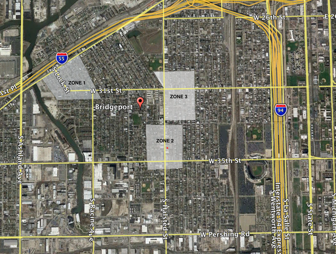
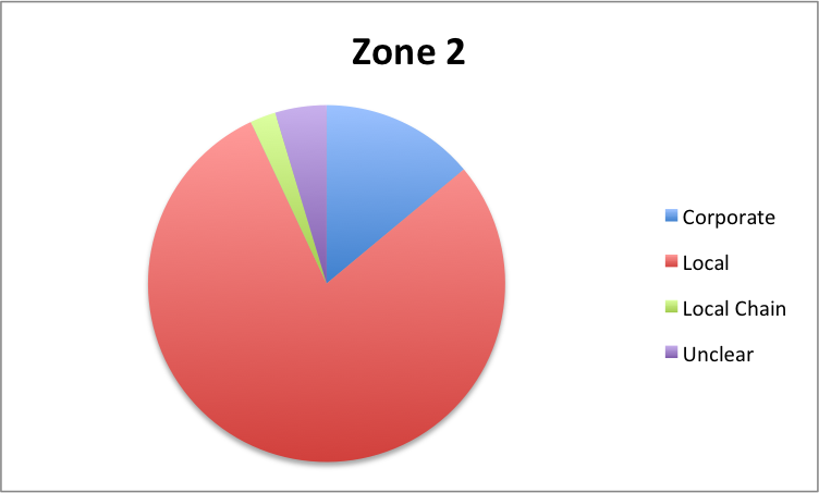
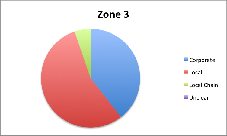
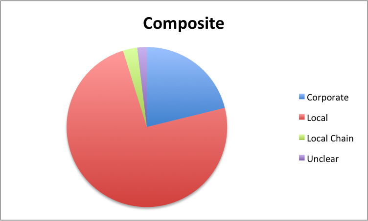
Bridgeprort is a large neighborhood with many businesses within its borders. In order to evaluate the relative amounts of corporate and local businesses, case studies were done of three commercial areas, each approximately 50 acres in area. The number of local businesses, local chains, and corporations in each zone was determined, and this was used to create a composite distribution that represents the approximate frequency of each type of amenity within Bridgeport as a whole.
Three different commercial zones were considered for this study.
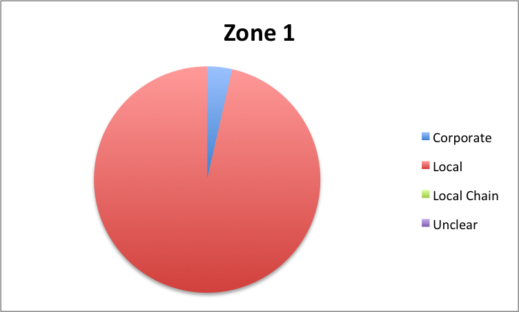
The first zone, centered around S. Archer Avenue, is primarily local businesses. The businesses here include a variety of restaurants, including a bakery, a Thai noodle restaurant, and a Mexican restaurant, as well as several auto services. The one corporate/national amenity in the zone is a Farmers Insurance agency. This is not in competition with any of the local businesses in the area, and in fact may benefit them if they choose to use the auto and business insurance options. Therefore, in Zone 1, the large-scale business may benefit the small local businesses around it.
The second zone is part of what could be considered Bridgeport's main commercial strip, running along S. Halstead St from 31st to 36th Street. In this area, most of the local amenities are restaurants and bars, as well as a few specialty shops, while many of the amenities that serve the basic needs of the residents are chains, including Family Dollar, MetroPCS, and CitiBank. It is difficult to draw conclusions without knowing the conditions of S. Halstead Street before the presence of these chains; however, it is possible to imagine local businesses that could serve the same function, perhaps with a greater benefit to the neighborhood as a whole.
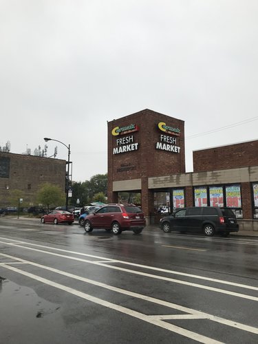
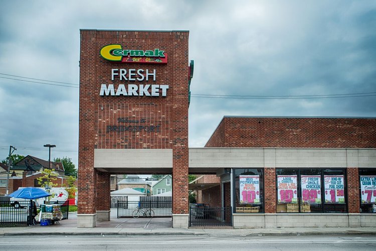
The third section of Bridgeport that was studied is the commercial area south of McGuane Park, which stretches from 30th to 33rd Street. This zone had the most corporate presence, as it includes the strip mall area immediately south of McGuane Park. The strip mall contains a Little Ceasars, McDonalds, and a Wingstop, which may pose a challenge to the restaurants located slightly further south on Halstead Street. However, Zone 3 also has the largest proportion of local chains, which are chains based in the Chicagoland area. A distinction was made between local chains and larger corporations, because while local chains do not put money directly back into Bridgeport, they are part of the smaller, more accessible economy of the city of Chicago. Local chains such as Cermak Fresh Market may strike a sustainable balance. Because grocery stores have a very small profit margin, a local chain may be better able to stay afloat while still keeping some amount of revenue in the community.
The composite chart of businesses in Bridgeport shows that, in the three zones sampled, local businesses make up a large proportion of the amenities in the community. Many of these are restaurants, auto shops, and specialty stores; when it comes to basic needs such as groceries, pharmacies, banks, and gas stations are part of larger corporations. In some cases, such as that of insurance agencies, such corporations may help support local businesses. Others, such as chain restaurants, may compete with local offerings. Still others, like local chain grocery stores, may allow for some of the benefits of both local and corporate businesses.
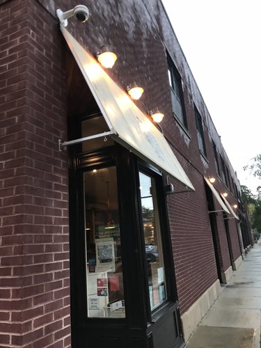
A local coffee shop, Jackalope Coffee, hosts an art fair for local artists, contributing to both the economic and social life of the neighborhood.
Nana, an organic, locally-sourced restaurant, is arguably one of Bridgeport's best-known eateries. Based on its reviews, it seems to draw traffic from outside Bridgeport, adding to the neighborhood economy. However, its high price point and non-local customer base does leave it open to accusations of gentrification.
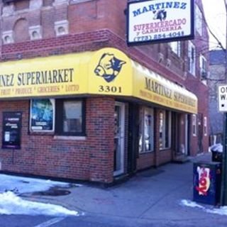
Martinez Supermarket, located away from the more commercial areas of Bridgeport, is one of the few survivors of the classic corner grocery store breed, whose name is circulated by word of mouth. Besides its stock of groceries, Martinez Supermarket serves hot Mexican food and hosts events.
(image source: http://www.imgrum.org/media/1195199773231098102_2991466097)
Cermak Fresh Market is a Chicagoland chain, with a location just south of McGuane Park in Bridgeport. Although it is not based in the neighborhood, it is more local than the Walgreens and McDonalds that are its neighbors; signage reading "Welcome to Bridgeport" on the building's facade underscores this fact.
(image source: http://skyriseco.com/portfolio/cermak-fresh-market-halsted/)
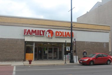
Located on Bridgeport's arterial South Halstead Street, the Family Dollar is the major mainstream retail option in an area populated by stores such as Monster Island Toys and Bark N' Bites Pet Boutique. Although it is possible to imagine a local store filling a similar niche, there are no evident local stores with which the Family Dollar is in direct competition.
(image source: https://www.dnainfo.com/chicago/20170201/bridgeport/bridgeport-family-dollar-robbed-police)
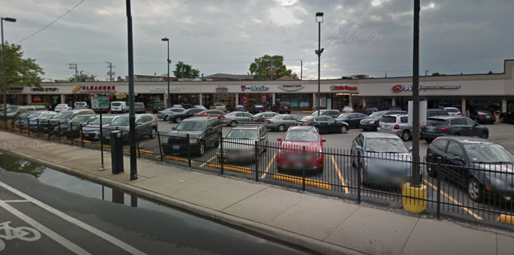
South of McGuane Park, a McDonalds sits nestled in a strip mall, in an image that characterizes corporate intrusion in the United States. Although McDonalds provides a low-price, stable dining option to Bridgeport residence, it is in direct competition with many of the restaurants that line South Halstead and South Archer Street, and as it is a member of a multinational chain, the value it feeds back into Bridgeport is minimal.
(image source: Google Maps)
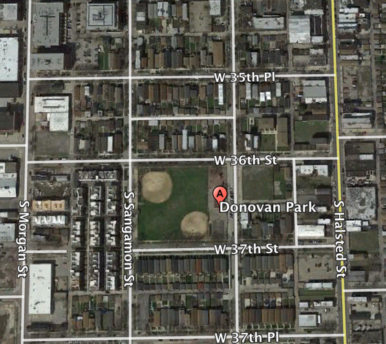
Square Blocks
Bridgeport has only a handful of square blocks, primarily located around the area of Donovan Park. Most of these blocks are subdivided into smaller groups of houses, with small alleys running between them.
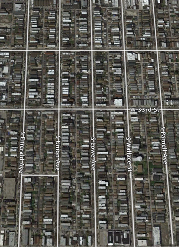
Elongated Blocks
The majority of Bridgeport is composed of elongated blocks, with several (located along the parking lot for Guaranteed Rate Field) being twice the length as the rest. The purpose of this may be to reduce cross-streets that border on the large parking lot, which would provide low utility.
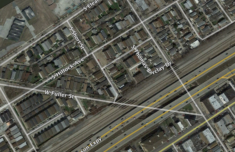
Irregular Blocks
The closest Bridgeport has to irregular blocks are located between the Stevenson Expressway and the river; their strange shapes likely arise out of an attempt to fit blocks between these two barriers.
Bridgeport's streets follow the highly-gridded Savannah Pattern. This allows nearly every block to have double-loading alleys
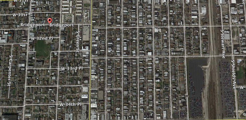
Even around irregularly-shaped parks, care is taken to maintain a Savannah grid pattern.
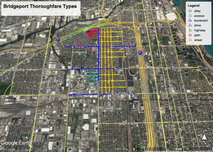
The above image shows a sampling of different types of thoroughfares in Bridgeport (note that not all instances of a thoroughfare type are shown).
In terms of block types, Bridgeport is quite well-connected. It is composed almost entirely of elongated blocks, which allow double-loaded alleys. The double-long blocks that border on the parking lot for Guaranteed Rate Field reduce unnecessary and inconvenient cross-streets at the edge of the neighborhood. There is a great deal of street parking in Bridgeport, and it is increased by long blocks; this allows for greater permeability by car. Additionally, long blocks foster connection because they can be shorter to allow for more pedestrian permeability in central areas and longer to prevent it in areas such as near the field.
Essentially all of Bridgeport is composed of a Savannah pattern network, which is ideal for permeability. According to the findings of TK, gridded streets have the greatest pedestrian shed. The disadvantages of the Savannah pattern that the Lexicon of the New Urbanism specifies include that it does not easily adjust to environmental interruption and is unresponsive to steep terrain. This works well for Bridgeport because the only environmental interruption is the river in the northwest corner of the neighborhood (where the blocks are irregular to compensate) and the terrain is very flat. Therefore, the network pattern of Bridgeport is amenable to connectivity.
The most prominent thoroughfare type in Bridgeport is the network of streets. This is beneficial to connectivity because such streets provide frontage for shops that can foster socialization. However, Bridgeport does lack major boulevards of the kind described in the Lexicon-- the three thoroughfares that serve as boulevards in that they accommodate high vehicular capacity and moderate speeds, but they do not have the slip roads described in the Lexicon and are generally very unwelcoming to pedestrians. The connectivity of Bridgeport would likely benefit from the inclusion of such slip roads and better-protected pedestrian crossings on its boulevards, as well as potentially another North-South boulevard running perhaps near Wallace Street to allow for an expansion of both commercial and public life. However, overall Bridgeport's connectivity is fairly robust.
source: Google Earth
Bridgeport, as one of Chicago’s oldest and most diverse communities, has the potential to benefit immensely from robust public spaces. It already has some active public spaces, including the Richard J. Daley Branch of the Chicago Public Library, McGuane Park, and, to a lesser extent, Palmisano Park. The impact of these spaces can be improved through built solutions. These spaces are limited in the services they provide, the number of people they can serve, and their availability to residents of the neighborhood. The Bridgeport Public Space Proposal strives to strengthen and equalize Bridgeport's public realm
source: Chicago Public Library
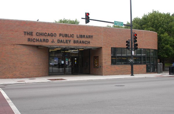
The Richard J. Daley Branch is already located in a very central location on S. Halstead Street and is used for children's programming and as a resource for teens and adults. It is one of the few indoor public spaces in Bridgeport, and therefore is a vital community resource when the weather begins to become colder. The popularity of its reading room and computer resources for a diverse range of people attest to the demand for library space. However, it is small, with limited resources, and is not aesthetically appealing-- it does not have the welcoming and uplifting form that James Kunstler considered necessary in order to honor the public realm.
source: https://ebookfriendly.com/modern-libraries/
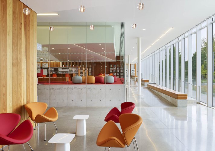
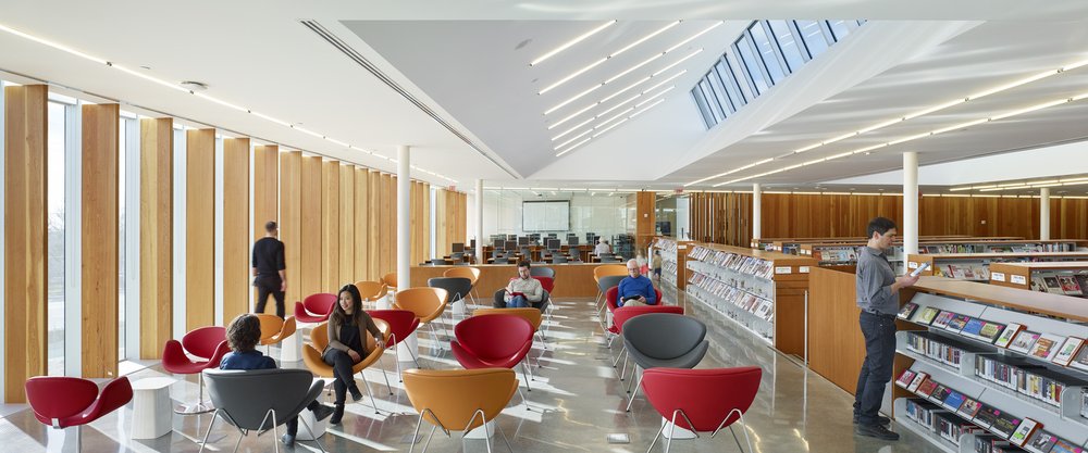
The above images are from the Waterdown Library and Civic Centre in Ontario. Although the library is larger than the Richard J. Daley Branch, it has elements that could easily be emulated in Bridgeport's library. Its automated book check-out system gives staff more time to focus on programming for the community, and it also houses a community service office, a heritage society archive a seniors' recreation center. These elements incorporate Jane Jacobs' notion of mixed uses into a single building- by catering to a diversity of needs at various hours, the library could be converted into a more active space. A community service center and senior recreation space (and perhaps also dedicated daycare space for the already-extant daycare program at the library) could foster connection among Bridgeport residents, and as one of Chicago's oldest and most historically rich neighorhoods, Bridgeport could certainly benefit from the inclusion of historical archives in its library.
source: http://exhibitions.nypl.org/100/visit
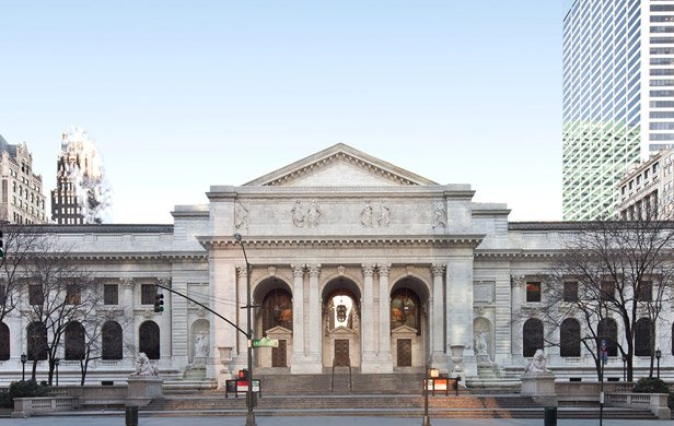
Above is the facade of the New York Public Library. As one of the country's most magnificent libraries and a very large building, the New York Public Library is clearly not meant as a model for Bridgeport's library to imitate directly, but rather it should serve as inspiration for the type of public space that is being created-- a beautiful space that provides identity and pride to the communities, and that is grand while still keeping in accordance with the neighborhood's architectural tradition.
Talen, Emily. 2008. Chapter 8: “Connection.” in Design for Diversity: Exploring Socially Mixed Neighborhoods. London: Elsevier. Pp. 135.
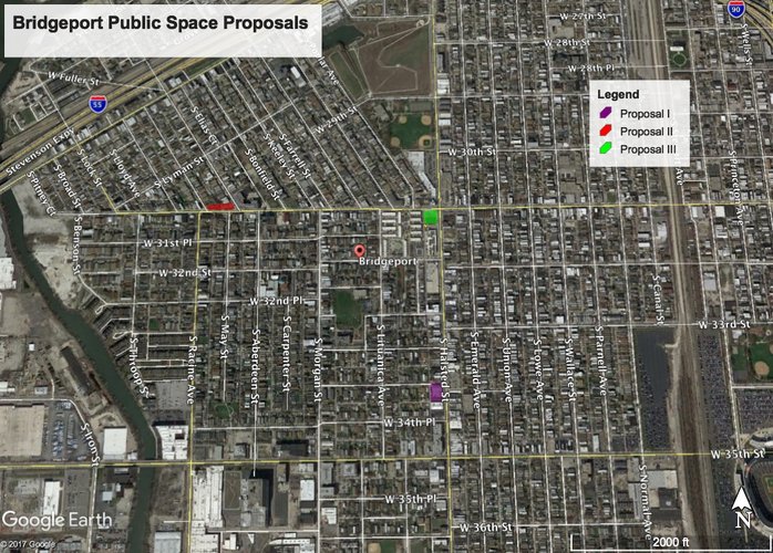
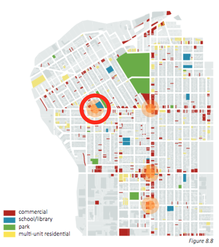
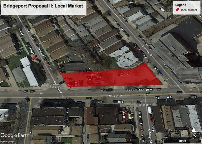
Most of Bridgeport's public spaces (as well as its private commercial spaces) are located along the main drag of S. Halstead Street. However, as Emily Talen and Sungduck Lee argue in Design for Diversity, there is also the opportunity to place a neighborhood center on a strategic site (circled in red) alone 31st Street, the other major street in the neighborhood. Retail options are fairly limited outside of S. Halstead Street, and public spaces in the north and east areas of the neighborhood are few and far between. Additionally, the northeast corner of Bridgeport is composed of a diagonalized street pattern that serves to isolate that area from the neighborhood south of 31st St. A public space on that boundary could serve to strengthen the connections between the diagonalized area and the rest of Bridgeport.
source: Google Earth
Two adjacent parking lots on 31st St. between S. Hayes Ct. and S. Loomis St. would form the site of the weekly local market.
source: Project for Public Space
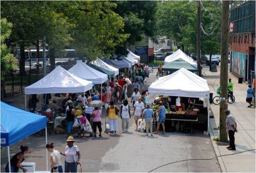
A public market could also benefit Bridgeport's public space immensely. A recent art market at a local coffee shop in Bridgeport has proven that there are craftspeople in Bridgeport who are eager to exhibit and sell their work. The neighborhood is also home to community as well as private gardens. Furthermore, Bridgeport is incredibly culturally diverse. A local, weekly art and food market would give Bridgeport residents the ability to forge connections through cultural and social exchange as well as contribute to the local economy and provide an accessible public space for people living in the north and east area of the neighborhood.
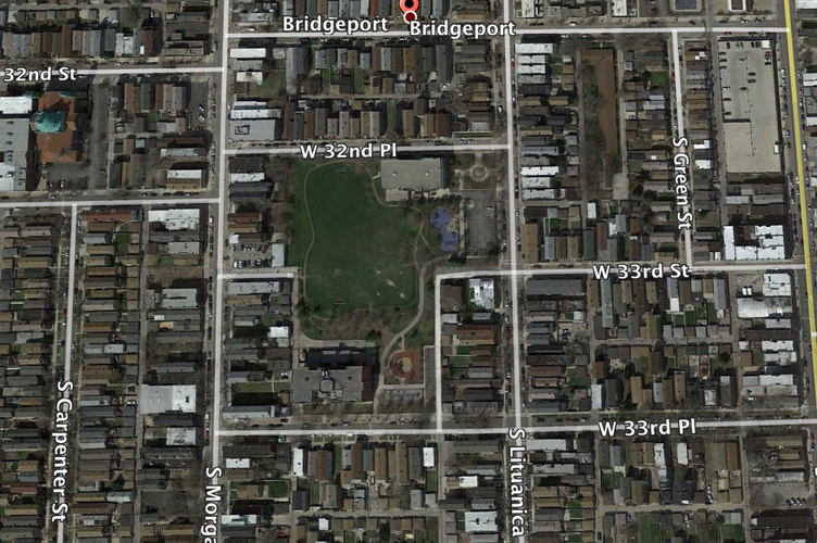
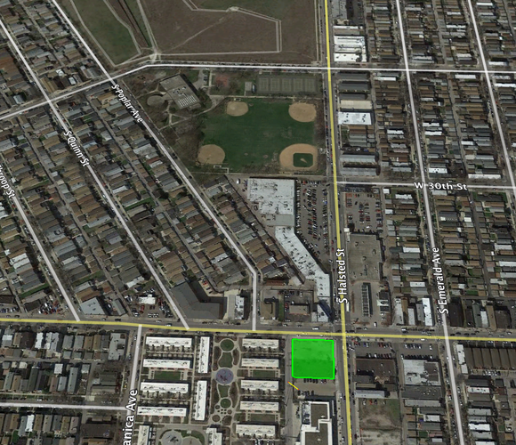
Palmisano and McGuane Parks are the two largest parks in Bridgeport. While Palmisano Park is entirely composed of open space, McGuane Park contains several sports fields and an indoor recreation center. However, the parks are separated from the main commercial drag of S. Halstead St. by a strip mall, several corporate chains, and an empty lot. In order to extend the public space of the two parks and improve the connectivity between the commercial and public areas of the neighborhood, I propose creating a social public space at the site of the empty lot at the corner of 31st St. and S. Halstead St, which could be considered the main intersection of the neighborhood.
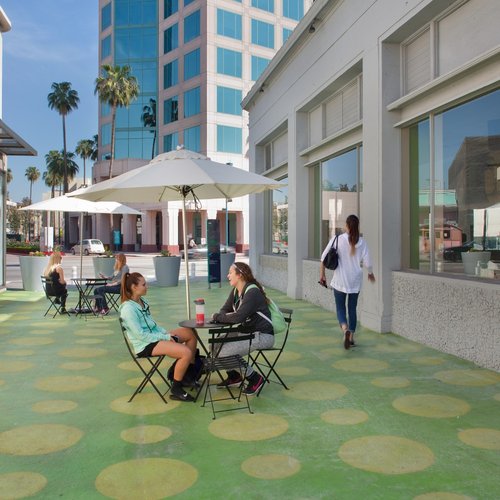
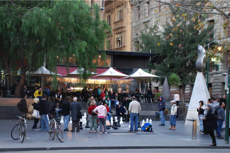
The above photos from the Project for Public Spaces show elements of a active public space. It incorporates seating areas, bright and welcoming colors, shade, games, artwork, and a variety of elements to appeal to various people. These spaces are open, welcoming, and engaging, and thus could help augment the already-extant public space of Bridgeport.
Social Mix
© Social Explorer 2005-2017
Based on the indices I calculated above, Bridgeport is fairly diverse. Although Bridgeport is its own community area and it is therefore difficult to compare it to other areas in its immediate vicinity, it is significantly more diverse in all three categories than its broader region. However, Bridgeport is slightly less diverse than the city of Chicago as a whole. Chicago is more diverse in all three measures, and especially so in educational attainment. This may be explained by the fairly large number of universities and colleges in Chicago, fewer of which are located in Bridgeport or the Southwest Region, as they tend to cluster downtown and along Lake Michigan.
It is important to note that I made some adjustments to the data groupings in order to keep the number of categories at five or fewer. For the racial index, I grouped Hispanic/LatinX people of all races together and took the numbers for the other races from the non-Hispanic/LatinX category. This left me with six categories; I removed the numbers for Hawaiians and other Pacific Islanders because in the samples I studied their population was so small as to make up effectively 0% of the total population. People of mixed race or who listed their race as “other” are also not included. The income category is divided evenly into four large income brackets. The educational attainment category groups those with a master’s, professional degree, or doctorate together into one category.