Overview
Social Mix
Public Space
Amenities
Connections
Final Project
Size [1]
Total Population: 62,010 (about 12 Perry neighborhoods put together!)
Population Density: Approximately 7993.2 people per square mile
Physical Area: ~2491 acres
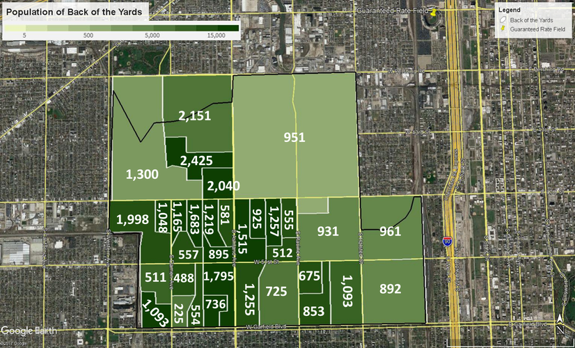
In the map below, the green scale indicates the population density per square mile of each census block tract. The total population of the block tract is shown in white.
Identity
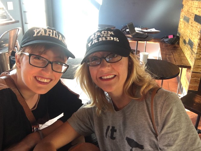
The Back of the Yards neighborhood absolutely displays a coherence and sense of community pride. Several shops sell Back of the Yards t-shirts and baseball caps in both English and Spanish, and many businesses and shopping centers include Back of the Yards in their names. The Union Stock Yard Gates remain a neighborhood identifier. However, Back of the Yards is quite a large area. While the gates are a distinct feature, then, the name of the neighborhood itself seems to serve more strongly as a badge-of-honor bond amongst residents. Banners on street lights along the main commercial street also identified the neighborhood. People do seem to be tied to their face-block neighborhoods, but there is a true sense of pride around belonging to Back of the Yards. Most of Back of the Yards’ borders are large streets, which limit pedestrian traffic and logically demark the area.
One unique thing about Back of the Yards is that it has a neighborhood song! I did not have the opportunity to interview residents to discover whether it was still commonly known, but I hope to on my next visit. What I did observe was a sense of community with the larger Chicago City neighborhood. I found a large mural on the side of Hedges Elementary School depicting Chicago landmarks (e.g. the Sears tower and the Bean) and advertisements for the One Chicago reading program.
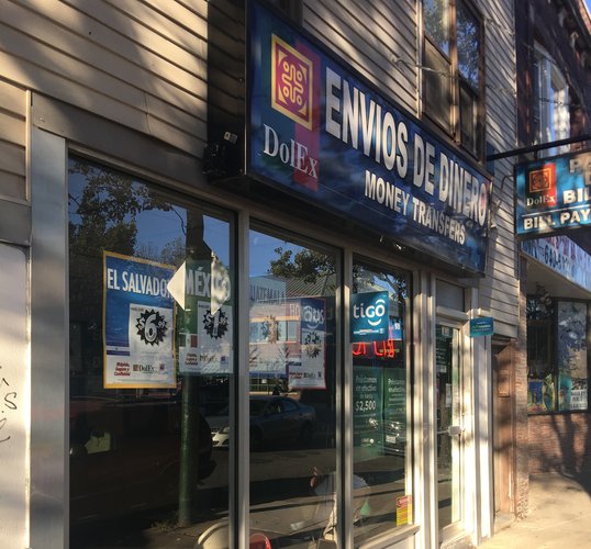
The cultural identity is clearly influenced by the Hispanic immigrant subpopulation that constitutes the majority of the neighborhood’s total population. Many signs and advertisements are in both Spanish and English. Money sending services, immigration attorneys, and passport photo services were very common, as were people with pull-carts selling tamales and other traditional street foods. Other cultural features include a school named after César Chavez and specialty ethnic grocery stores, bakeries, and liquor stores.
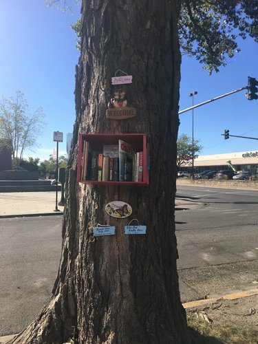
Community-sourced efforts, such as this Little Free Library, offer bilingual resources, as do larger corporations in the area. The cultural identity of Back of the Yards is thereby quite clear.
Character Diagram
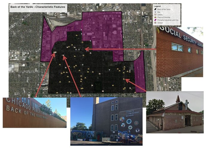
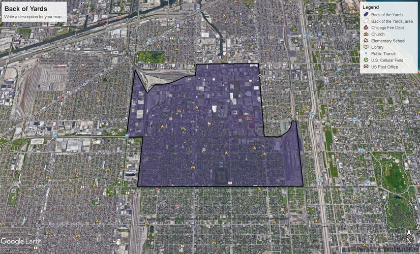
Back of the Yards has many churches, two public libraries, and access to several governmental service centers.
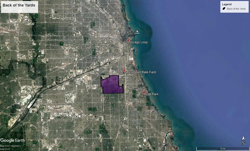
Overlapping Geographic Definitions
The following map displays amenities available in Back of the Yards, including libraries, public transit, elementary schools, and fire departments.
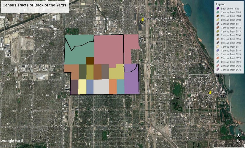
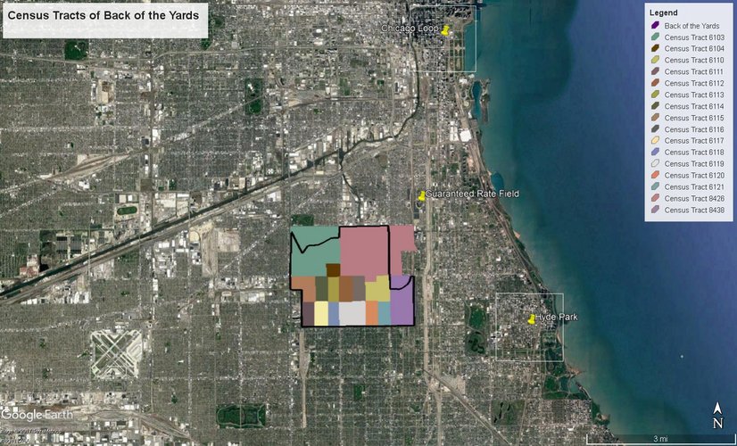
Back of the Yards is divided into 16 census tracts, mapped below.
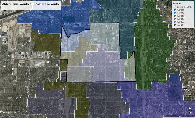
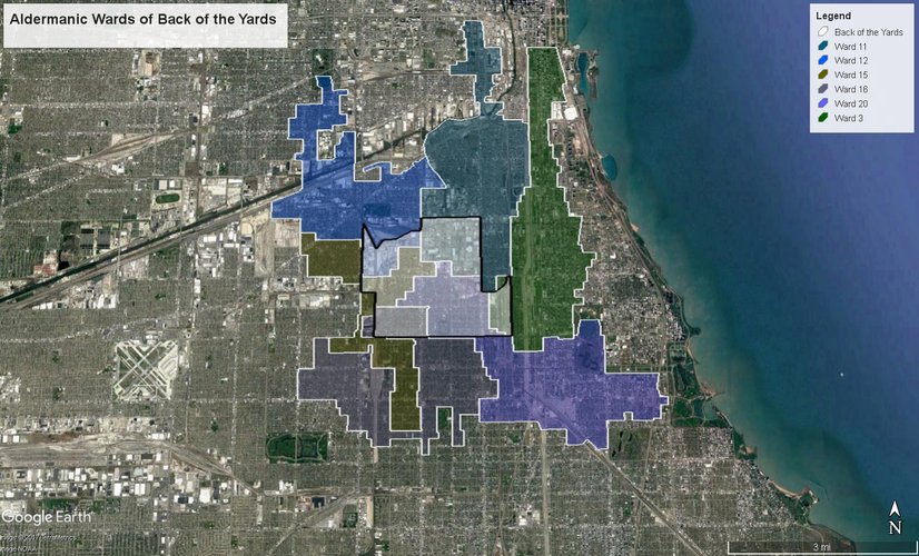
Here we see that Back of the Yards is represented by six different Aldermen.
History
Back of the Yards became a part of what is now the New City community area of Chicago when it was annexed from the town of Lake in 1889. By this time, it was already a sprawling neighborhood with a large meatpacking economy thanks to the railroads, Union Stock Yard, and “perfection of the refrigerated boxcar”[2]. Irish and German butchers originally settled in Back of the Yards, and were later joined by Czechs, Slovaks, Poles, and Lithuanians[3]. Each ethnic enclave had its own parish and school, “with a head priest imported from the motherland as a way to stay connected to their heritage”[4]. Every group also tended to have separate social and cultural organizations, including men’s social clubs, women’s leagues, and sports associations[5]. The strong majority of workers lived in Samuel Gross’ cheap workingmen’s cottages near the factories[6]. 25,000 people were employed in packing and slaughtering houses by 1900, with a thousand more working in other neighborhood factories that utilized the byproducts of meat processing[7]. The butchering process was broken down in a disassembly line fashion. This was significant in that it created entry-level work for the thousands of European immigrants entering Chicago[8].
Small numbers of Mexican and African American immigrants are recorded moving into Back of the Yards, particularly from Bridgeport, with the onset of World War I and the resultant job openings[9]. However, the area experienced a decline when large shipping trucks began to replace railroads after World War II[10]. Back of the Yards was “a notorious slum”[11]. Jane Jacobs reports that as late as the 1930’s, people from Back of the Yards would provide false addresses when applying for jobs outside of the neighborhood “to avoid the discrimination that then attached to residence there”[12]. The community remained largely Slavic until the Central Manufacturing District closed the stockyards in 1971[13]. Then, the area slowly became a Chicano community with a minority African American population[14].
The Great Depression and credit blacklisting forced the many different ethnic groups of Back of the Yards to unify. In fact, it was this unification that allowed the community to “unslum” itself from the portrait of “the dregs of city life and human exploitation” in Upton Sinclair’s The Jungle[15]. The Packinghouse Workers Organizing Committee (later known as the United Packinghouse Worders of America, or UPWA-CIO) and Back of the Yards Neighborhood Council (BYNC) were established for this purpose in 1937 and 1939, respectively[16]. The UPWA-CIO “raised wages, stabilized employment, and fought for civil rights in the plants”[17]. The BYNC began as a coalition of neighborhood schools, churches, and social clubs across the ethnic enclaves. Uniting the neighborhood as a whole to effect change remains the BYNC’s goal, and the BYNC maintains to this day the slogan, “We, the people, will work out our own destiny”[18]. It operates essentially as a neighborhood-specific government in the Back of the Yards today, with a legislature of 200 elected representatives that sets neighborhood policies[19]. These groups are credited by Jane Jacobs as improving community conditions so that residents wanted to stay rather than immigrate to the suburbs.
The challenge for those staying, however, was that Back of the Yards was blacklisted for mortgage credit and it was therefore nearly impossible to improve one’s quality of living[20]. A survey by the BYNC discovered that Back of the Yards businesses, residents, and institutions had deposits in roughly thirty of Chicago’s savings and loans associations and banks. The neighbors agreed to withdraw their deposits if lending institutions continued to blacklist their district, and so a meeting was held with the lenders to negotiate Back of the Yards’ ability to take out loans. BYNC managed not only to garner favorable consideration of loan requests, but also to receive a loan of $90,000 to modernize and rehabilitate existing dwellings and build new housing[21]. Since this revitalization, Back of the Yards has continued unslumming.
[1] “US Demography 1790 to Present.” Social Explorer, 2017, www.socialexplorer.com/a9676d974c/explore.
[2] “Back of the Yards,” 2004, http://www.encyclopedia.chicagohistory.org/pages/99.html.
[3] Ibid.
[4] “BYNC | About Us | History,” 2017, http://www.bync.org/about-us/history#.
[5] Ibid.
[6] “Back of the Yards.”
[7] Ann Durkin Keating, “Chicagoland: City and Suburbs in the Railroad Age” (Chicago: The University of Chicago Press, 2005).
[8] Ibid.
[9] “Back of the Yards.”
[10] Keating, “Chicagoland: City and Suburbs in the Railroad Age.”
[11] Jane Jacobs, “The Death and Life of Great American Cities,” 2004.
[12] Ibid.
[13] Keating, “Chicagoland: City and Suburbs in the Railroad Age.”
[14] “Back of the Yards.”
[15] Jacobs, “The Death and Life of Great American Cities.”
[16] “Back of the Yards.”
[17] Ibid.
[18] “BYNC | About Us | History,” 2017, http://www.bync.org/about-us/history#; “BYNC | About Us | Hours and Location,” 2017.
[19] Jacobs, “The Death and Life of Great American Cities.”
[20] Ibid.
[21] Jane Jacobs, “The Death and Life of Great American Cities,” 2004.
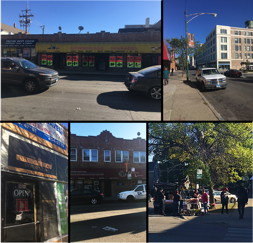
As the "100% corner", the intersection of Ashland Ave. and 47th St. is one form of a "center" of Back of the Yards. There are many commercial properties along the north, west, and south branches of this intersection. Both streets consistently feature heavy road traffic and displayed moderate foot traffic during observation on a Saturday afternoon. Not only do businesses in rented space serve this area, but small carts provide traditional foods to the largely Hispanic population. These carts serve as social sites, with groups gathering to make purchases and discuss neighborhood affairs. The photo collection above aims to represent some of the services available along 47th St. as well as the congregation around carts discussed earlier.
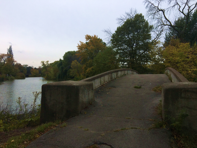
For several reasons, Sherman Park seems as though it would function as a neighborhood center. It offers a track, swimming pool, sports fields, tennis courts, and two playgrounds. Its lagoon is clean enough to be visually appealing, and the center island is far enough from traffic that it nearly serves as an oasis. All this is surrounded by a paved walking path and a loop for vehicles. On the park's borders are a branch of the Chicago Public Library and an elementary school. This area therefore has amenities that should appeal to various sub-populations within Back of the Yards: mobile older folks and those with dogs may be drawn to the walking path, children and parents may come for the playgrounds, and people of all ages are likely to use the athletic facilities as well as the pool. Sherman Park was much less active than 47th and Ashland. This may in part be due to changes in weather and time of visitation. Another explanation for its lack of use is that Sherman Park is along the Back of the Yards- Englewood border. As Sherman Park is widely acknowledged as lying within the territory of the Almighty Black P. Stone Nation, the number of people who feel comfortable within this space may also be limited.
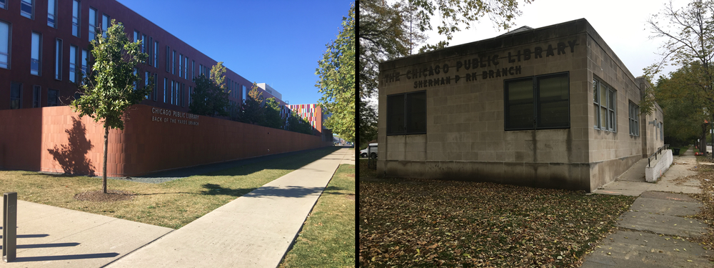
These photos offer a visualization of the difference in sense of ownership of and pride taken in an area. The Back of the Yards Branch of the Chicago Public Library is on 47th Street. It is approximately 0.6 miles from the "100% corner" at 47th Street and Ashland Avenue. The Sherman Park Branch 3.5 farther from this corner. Distance from the 100% corner appears to be positively correlated with the level of disrepair and negatively correlated with the cleanliness of the library's exterior. Granted, the Sherman Park Branch was in the midst of a three week closure for "interior upgrades", which could indicate a superior level of care on the way.
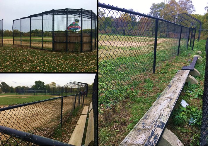
There can be varying levels of sense of ownership within a singular public space. In the case of Sherman Park's baseball diamonds, there is a clear divide. Two of the baseball diamonds have dilapidated benches and overgrown fields. The third diamond, on the other hand, is sponsored by a grant from the Cubs Charities Diamonds Project. This diamond is well-manicured, with brand new benches and even stands for spectators. The differences are likely a matter of funding as well as levels of use and sense of ownership.
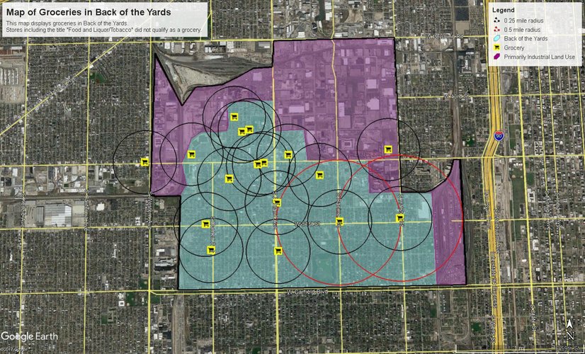
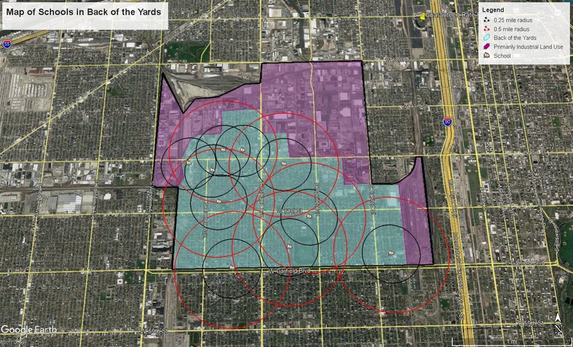
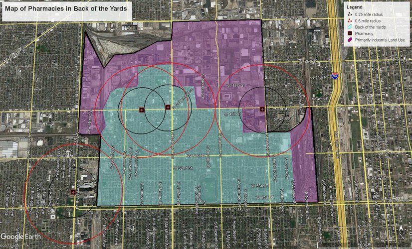
On the whole, Back of the Yards residents have fair access to daily life needs. Groceries are particularly abundant, while pharmacies and libraries are significantly less so. A conspicuous difference in access exists between the neighborhood's northwestern and southeastern quadrants. This difference is somewhat correlated with a difference in population density, with the western and southern halves of Back of the Yards denser than the eastern and northern halves, respectively. The following maps display availability in terms of both a 5-minute walk (0.25 mile radius). Availability in terms of a 10-minute walk (0.5 mile radius) is also displayed in cases in which Back of the Yards residents lack access to a daily life need within a 5-minute walk.
Mapping grocery availability in Back of the Yards was particularly complicated. Many corner stores include "Food and Liquor" or "Food and Tobacco" in their names. It was ultimately decided that these stores should not be included in mapping grocers because they often do not offer access to fresh produce and other major dietary needs. While the southeastern quadrant of Back of the Yards is under-served in terms of a 5-minute pedestrian shed, most residents in that area will have access within a 10-minute walk. As shown on the map, the areas completely devoid of grocers are primarily industrial land use. Thus, a lesser demand justifies the lack of grocers in these areas.
Back of the Yards has many schools in the northwestern quadrant. In fact, there is even some overlap of 5-minute walk pedestrian sheds between these schools. The southeastern region, on the other hand, requires a 10-minute walk of most residents. Since this map also does not distinguish between elementary, middle, and high schools, it is possible that access to a particular level of education is further limited.
Each of the pharmacies that lies within Back of the Yards is along 47th Street. As discussed on the page dedicated to public spaces, 47th Street is the commercial center of Back of the Yards. It is logical to have major resources clustered along the major commercial strip. However, this leaves approximately 11,000 people (19% of the population) beyond a 10-minute walk of a pharmacy.
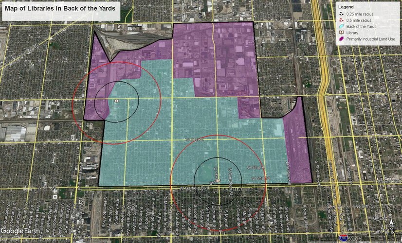
Libraries are a wonderful daily life need across generation and race, and knowing that there are two branches of the Chicago Public Library within Back of the Yards gives one a sense of optimism. Yet the majority of residents are not within a 10-minute walk of these libraries. An estimated 41,000 residents (66% of the population) do not have a public library in their 10-minute pedestrian shed. The libraries in the neighborhood both lie towards the outer edges, limiting the number of residents within their respective pedestrian sheds. A more central library would serve a greater portion of the population.
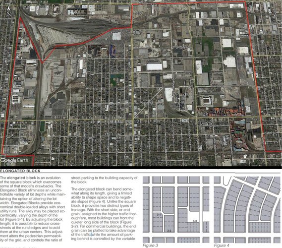
One means of characterizing an area's connectivity is by defining its block type(s), network type(s), and thoroughfare types. Back of the Yards contains two block types: elongated blocks in residential and commercial areas, and irregular blocks in the industrial areas. This difference of block types is a result of corporations purchasing large, irregularly shaped plots of land for industrial purposes. An image from Google Earth can be found below. This picture displays both the elongated and the irregularly shaped blocks in Back of the Yards. A definition of elongated blocks and an analysis of their advantages and disadvantages, as provided in The Lexicon of New Urbanism, is included.
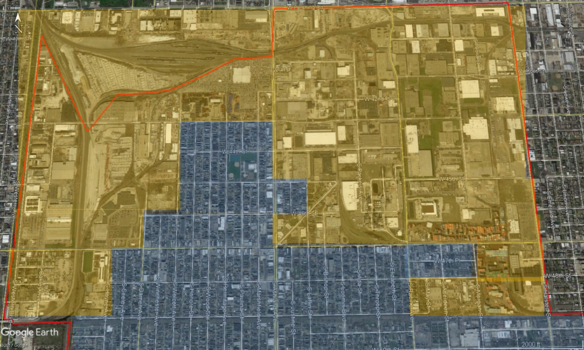
In the map below, the elongated blocks are shaded blue while the irregular blocks are shaded orange to show the location dichotomy in the northern region of Back of the Yards.
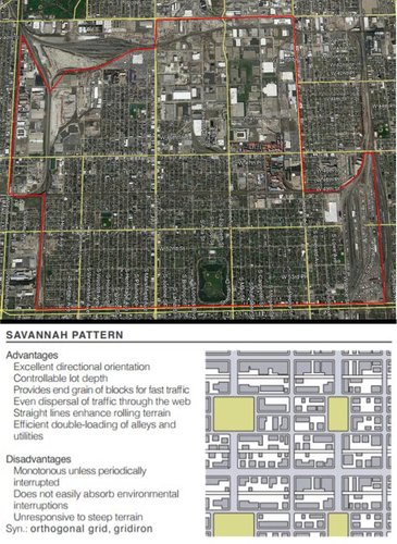
Back of the Yards also displays two network types. In general, the neighborhood follows the Savannah pattern. A minimal influence by the Nantucket Pattern can be seen in the more industrial areas. The Nantucket Pattern does not appear to have been intentional in the design of the industrial zones, but rather a result of the irregularly shaped blocks.
Back of the Yards is a neighborhood spatially defined by thoroughfares and railroad tracks. Its southern and parts of its northern and western borders (Garfield Blvd., W. Pershing Rd., and S. Western Blvd.) are boulevards as defined by The Lexicon of New Urbanism. The portion of its eastern border constituted by S. Halsted St. is an avenue. The rest of its boundaries are railroad lines.
Vehicular thoroughfares throughout the neighborhood are nearly entirely streets. The exceptions are S. Ashland Ave. and S. Racine Ave., which both qualify as avenues due to their capacity. Due to traffic rates and flow, though, it would be much more reasonable for the vehicular capacity of 47th and 51st Streets to be increased into avenues if possible. The economic impact of such an expansion, on the other hand, would likely be devastating to existing shops. S. Damen Ave. is a major street in terms of spatial definition of the larger grid, but was often less congested than 47th and 51st during observation.
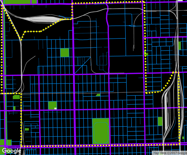
The avenues, boulevards, and major streets mentioned above are shown in purple in the following map. By this map, it is clear to see which thoroughfares define the larger grid. Lesser streets are shown in blue. The black areas are developed, while the green are parks. Gray lines correlate to railroad tracks.
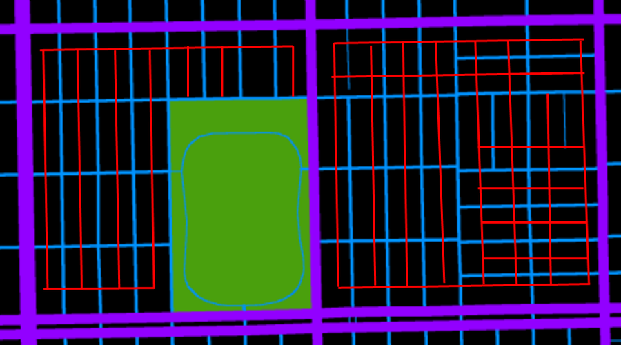
Back of the Yards also has a highly complex system of alleys. I have mapped the alleys present in a small section of the neighborhood, near Sherman Park. The alleys are displayed in red below.
In terms of block type, Back of the Yards is very well connected. The elongated blocks allow for easy to navigation and traffic dispersal. Traffic would be better dispersed, though, if some streets currently experiencing congestion were expanded to increase capacity, as discussed above. Elongated blocks do limit connectivity some, by requiring travelers to sometimes walk greater lengths and double-back after making turns more often than happens with shorter or square blocks.
I have yet to find a passage in my exploration of Back of the Yards, but the alleys often function similarly. Back of the Yard's complex alley system allows pedestrians to cut between buildings. This greatly enhances connectivity. Between the alleys allowing for shortcuts along the elongated blocks and the paths in the parks, it is fairly simple to arrive at one's destination relatively quickly on foot.
The Savannah Pattern of Back of the Yards is convenient in terms of orienting oneself and traffic dispersal, as discussed in terms of the block system. Perhaps the inclusion of another network pattern would have broken up the monotony or increased connectivity some. The Savannah Pattern serves Back of the Yards well, though, and is logical in a neighborhood that has historically been deeply connected with the streamlining rooted in industrial capitalistic production.
Bibliography
“The Lexicon of New Urbanism.” Duany Plater-Zyberk & Co, 2014.
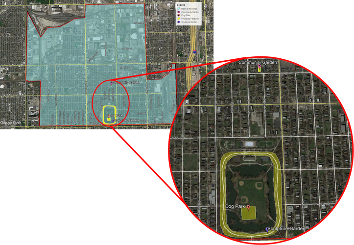
Back of the Yards has two advantages in terms of public space: an abundance of existing public space, and a strong sense of community. Unfortunately, most public spaces are not well-maintained. A sense of ownership over the shared spaces seems to be missing from the community. Three interventions could be installed as a means of increasing the utility of existing public spaces and the sense of pride and ownership over them. These interventions are the establishment of a community garden in an empty lot at the intersection of S. Elizabeth St. and 50th St., the installation of a sculpture garden along the main pathway through Sherman Park, and the creation of a dog park on Sherman Park’s center island.
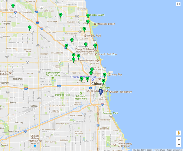
Locations of the proposed interventions
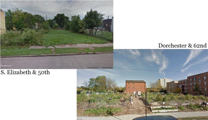
These photos compare the existing empty lot at S. Elizabeth and 50th with a community garden located at Dorchester and 62nd. The garden at Dorchester and 62nd was selected because it is located between residential buildings, as the garden at Elizabeth and 50th would be.
The empty lot at the intersection of Elizabeth and 50th is aesthetically very unappealing, and creates a sense of decreased safety on the street. It’s unmaintained and a dead space. Converting this space into a community garden would have six significant effects: (1) bring together people from a wide variety of backgrounds, thereby creating a foundation for community organizing; (2) generate interest in this less-popular area of the neighborhood; (3) bring more eyes on the street, increasing the sense of safety in the area; (4) provide a public space with a clear means of investing and providing care, enabling a sense of ownership in those otherwise uncertain how to act as an owner of a public space; (5) increase low-income households’ access to fresh produce; and (6) provide a space for Back of the Yards’ large immigrant population to grow traditional crops to which they may otherwise lack access. There are many empty lots in Back of the Yards that could benefit from transformation into a community garden. The lot at Elizabeth and 50th, however, is unique in that it is located within a five minute walk of several existing public spaces and a ten minute walk from the current 100% corner. This makes the location fairly convenient for a majority of residents.
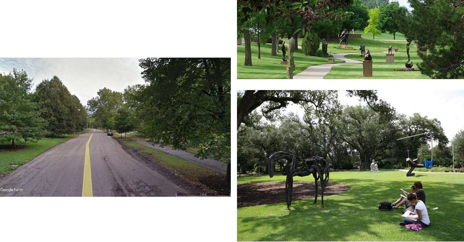
Clockwise from the left is the road and walking path that circle Sherman Park, a sketch of a proposed sculpture garden, and on the lower right is an existing sculpture garden in New Orleans.
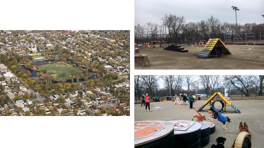
On the left is Sherman Park's island as-is, and on the right are two photos of a dog park created and maintained by residents of Jackson Park. One of the existing spaces most apt to serve as a neighborhood center, Sherman Park, is a prime example of an undervalued public space in disrepair. Sherman Park offers many valuable amenities, including an outdoor pool, baseball diamonds, soccer fields, and an indoor fitness center. Many of these facilities, however, are only useful for a portion of the Chicago seasons. The seasonal limitations upon Sherman Park’s usefulness will be alleviated through the installation of a sculpture garden and a dog park. Sculptures are beautiful and interesting year-round, and can be transformed as their context changes with the seasons. Dogs need to exercise at all points in the year, and at all times of day. These two features would bring more “eyes on the street” to Sherman Park, reducing the amount of gang activity that haunts the area. The investment in the park would also demonstrate an appreciation of the space. Hopefully, the demonstrated value of the park by the Chicago Park District would increase the sense of community ownership over the park. The investment and increased sense of ownership would ultimately result in a cleaner, safer, more regularly used space.
One of the reasons a dog park would be so beneficial to Sherman Park is that the city of Chicago does not have dog parks on the south side of Chicago. Dog-owners on the southern side of Chicago are under-served. Sherman Park often has owners walking their dogs, sometimes letting their dogs off-leash despite signs discouraging doing so. Adding a dog park to such an under-served area, where the demand demonstrably exists, would improve the quality of life for residents of Back of the Yards. It would also benefit the people of Englewood, Back of the Yards' southern neighbor, and serve as a connection between the two neighborhoods.
A 3 Minute Intro to Jackson Bark. YouTube, 17 Feb. 2017, www.youtube.com/watch?v=49W0IsCUifM.
“Benson Sculpture Garden Planned Path.” Sculpture in the Park, The Loveland High Plains Arts Council, 2017, www.sculptureinthepark.org/.
D., Lauren. “Was This Photo …?” Jackson Bark Photos & Videos, Yelp, 19 Jan. 2017, www.yelp.com/biz_photos/jackson- bark-chicago-2?select=POCGZotEVnfG7cjmvejO2w.
“Dog Friendly Areas.” Chicago Park District - Facilities, City of Chicago, 2017.
Leibowitz, Bruce. Sherman Park, Chicago. Flickr, 25 Oct. 2009, www.flickr.com/photos/28042007@N07/4046614989/.
Lisa. “People in the Sculpture Garden in New Orleans City Park.” Visit the Sculpture Garden in New Orleans City Park, Crescent City Living LLC, 2012, www.crescentcityliving.com/living-in-nola/visit-the-sculpture-garden-in-new- orleans-city-park.
Map data provided by Google Earth.
Social Mix
Diversity Analysis
The Back of the Yards is a southwestern Chicago neighborhood conversationally described as predominately Mexican-American, and of low socioeconomic status. Data provided by Social Explorer, an online demographic database, confirms that Back of the Yards is nearly two-thirds Hispanic. It also shows that less than a quarter of Back of the Yards residents has attended college or other professional training programs. The strong majority (i.e. 70.33%) of households reports an income of $49,999 or less, and 62.37% of occupied housing is rented. That is to say, the everyday consensus is largely correct in its description of Back of the Yards. The Simpson Diversity Index Values of Back of the Yards are very similar to those of its larger community area, New City, because New City is composed only of Back of the Yards and the much smaller neighborhood of Canaryville. Thus, comparing these values provides little context by which the diversity of Back of the Yards may be evaluated.
However, the Simpson Diversity Index Values of household income and household type in Back of the Yards are fairly different from those of the Chicago and its southwestern region to which Back of the Yards belongs. Back of the Yards demonstrates less diversity in household income than these two greater areas, likely correlated with its below average educational achievements. Household type was described as either a married-couple family, a family with male householder without a wife, a family with a female householder without a husband, or a nonfamily. Here, Back of the Yards demonstrated significantly greater diversity than the rest of southwestern Chicago and Chicago as a whole. Southwestern Chicago had a lower proportion of families with single male householders, and Chicago at large had both a much high proportion of nonfamilies and much lower proportions of single parent families. These proportional differences between Back of the Yards and Chicago likely correlate with the socioeconomic status diversity of the city. Another likely factor is the number of college students located near the many colleges and universities outside of Back of the Yards, as students are less likely to have started families. The Simpson Index Values for age and sex demonstrated less variation across areas. This indicates that Back of the Yards is fairly representative of the rest of southwestern Chicago and Chicago as a whole in terms of age and sex diversity.