Overview
Social Mix
Public Space
Amenities
Connections
Final Project
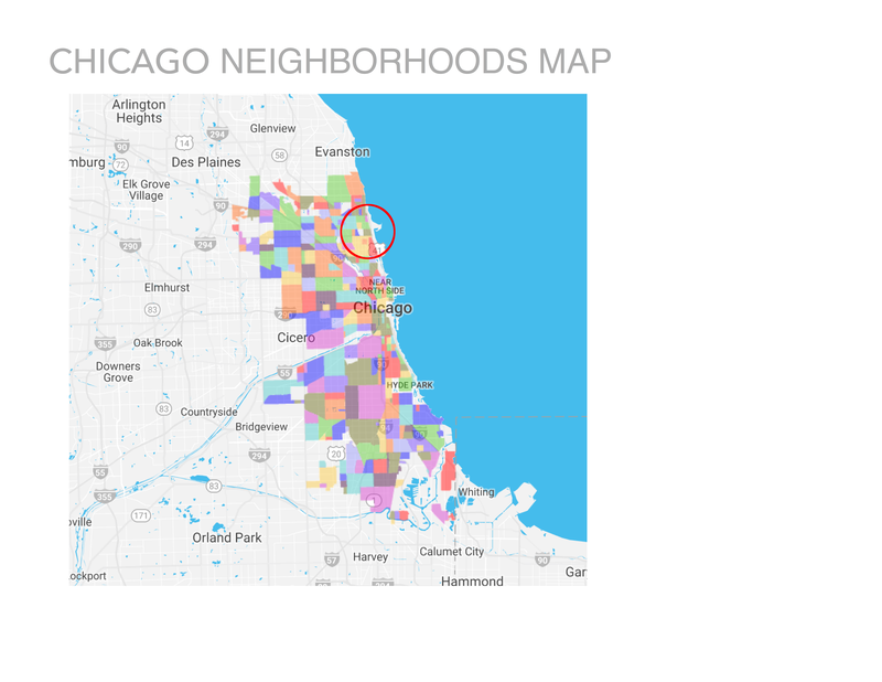
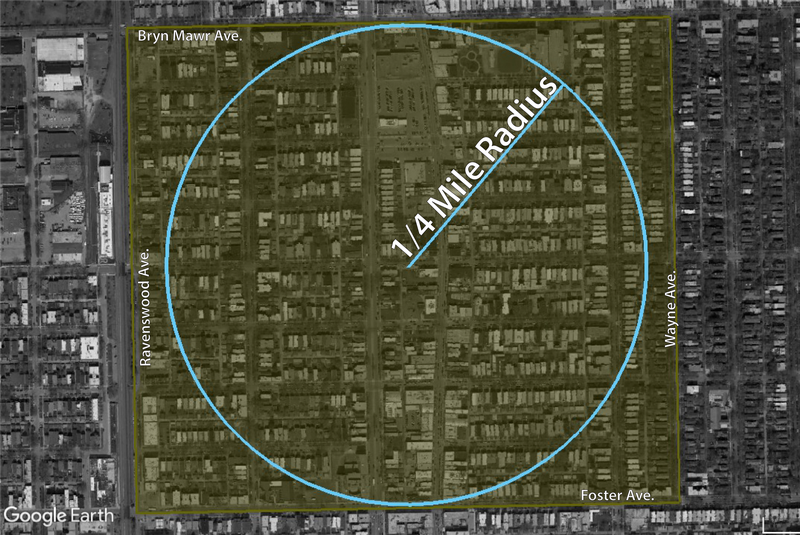
Andersonville is located in the Northeast part of Chicago. It is a relatively small neighborhood with a population of approximately 6,200 people and an area of 180 acres or .28 square miles. In terms of population size and area, it fits fairly well with the Perry Neighborhood Unit ideal of a ¼ mile radius for pedestrian walkability and population size of 5,000 - 9,000 residents.
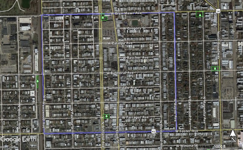
It is bordered to the North by Bryn Mawr Ave. the South by Foster Ave, the East by Wayne Ave., and the West by Ravenswood Ave.
Neighborhood life in Andersonville is centered around the commercial strip located on Clark Street. Most of the neighborhood’s services and amenities can be found on this street lined with lampposts bearing the name of the neighborhood. The buildings are all more or less the same height and while they do not all look exactly the same there is cohesion to their styles such that the street flows nicely in the commercial center of the neighborhood.
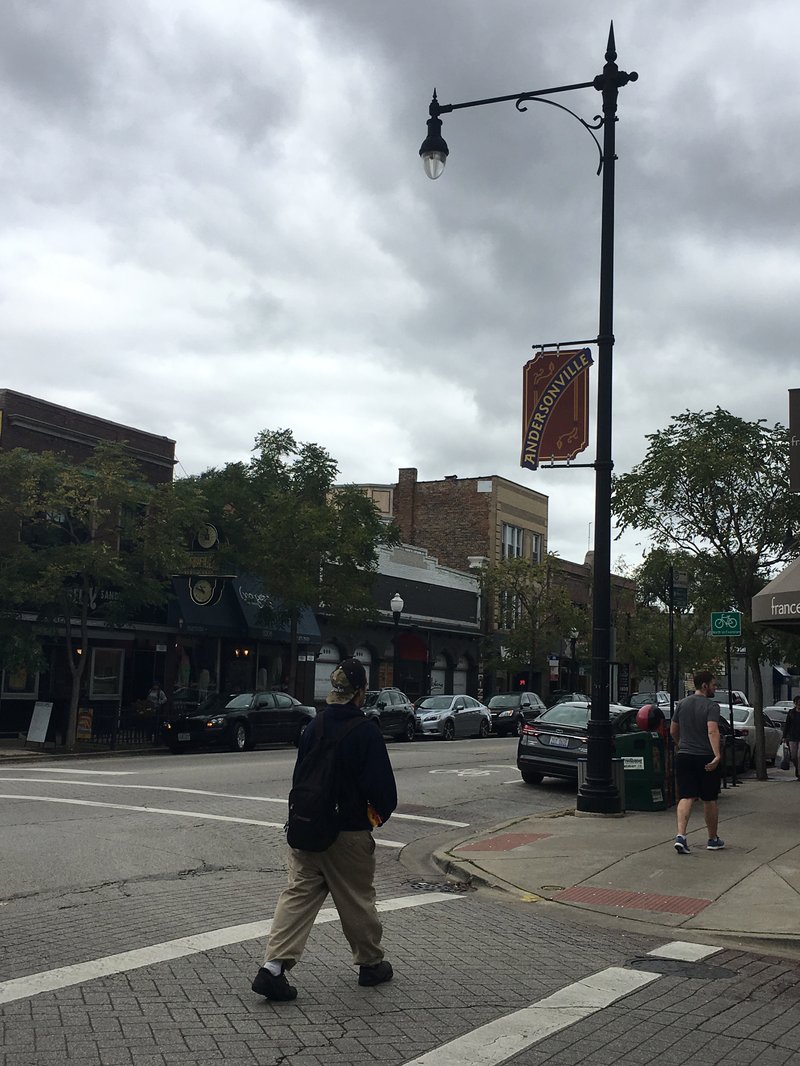
A large number of the businesses have “Andersonville” in their name and display posters and materials from the Andersonville Chamber of Commerce in their windows advertising local events and activities like the Andersonville Farmers Market, Arts Week, and Dessert Crawl. Taking in the businesses and institutions on this main drag, the neighborhood identity seems to coalesce on its past iterations as Swedish and LGBT enclaves and can be further characterized by liberal values, a focus on locally owned businesses, and promoting the arts/culture.

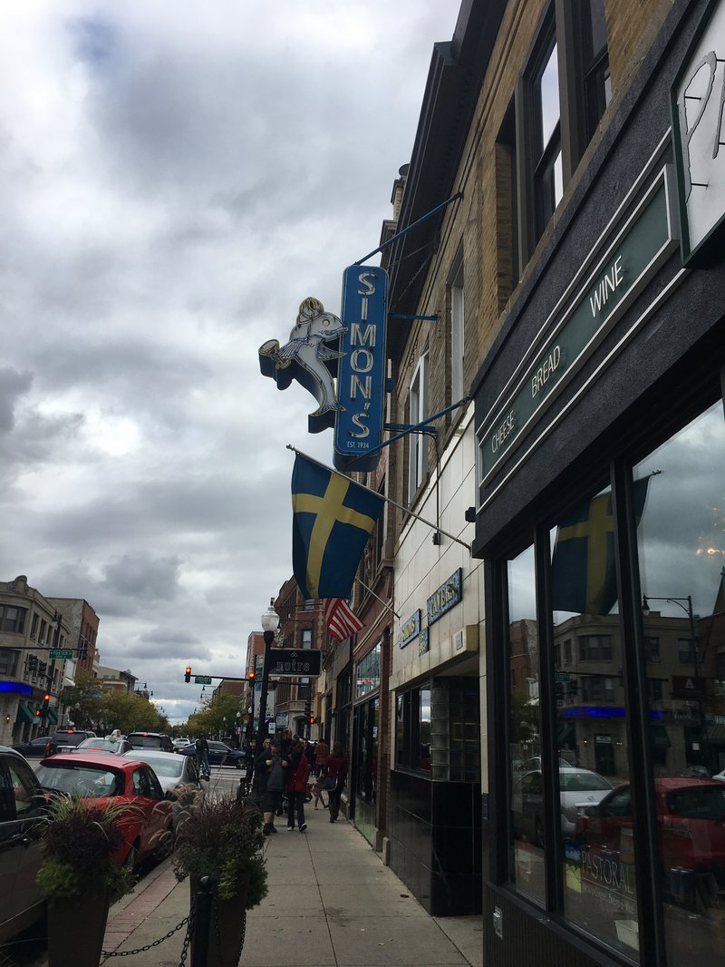
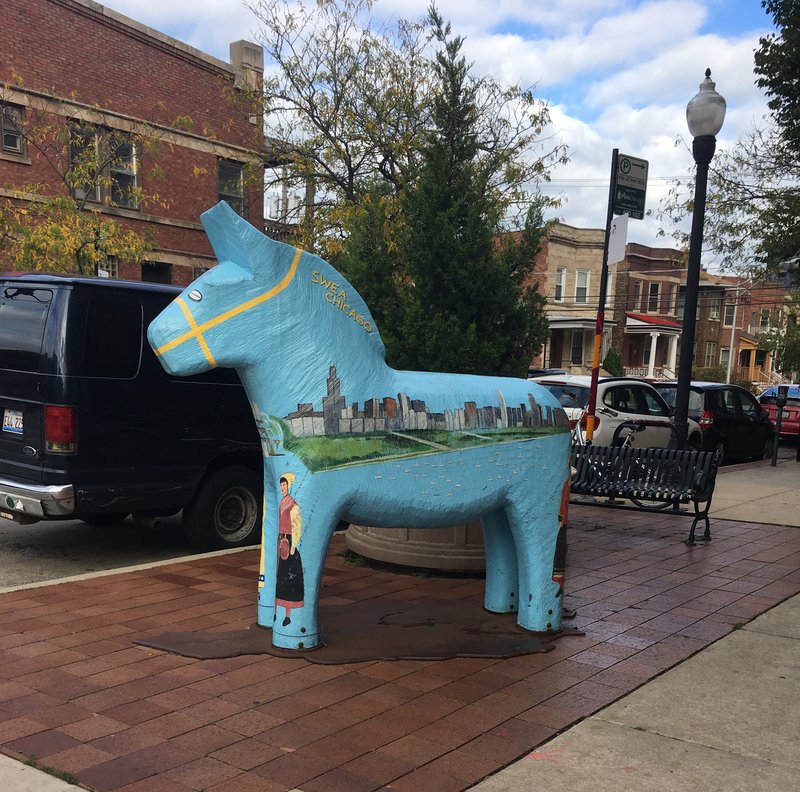
This commitment to preserving the neighborhood’s Swedish identity is evidenced by the designation of a section of Clark Street as a Historic District. Most of the Historic Buildings and Businesses have some significance to the history of Swedish immigration and settlement in the area. The Swedish American Museum is also located on Clark Street and businesses, such as Simon’s Tavern, celebrate the neighborhood's Swedish roots through symbols like like the Swedish Flag.
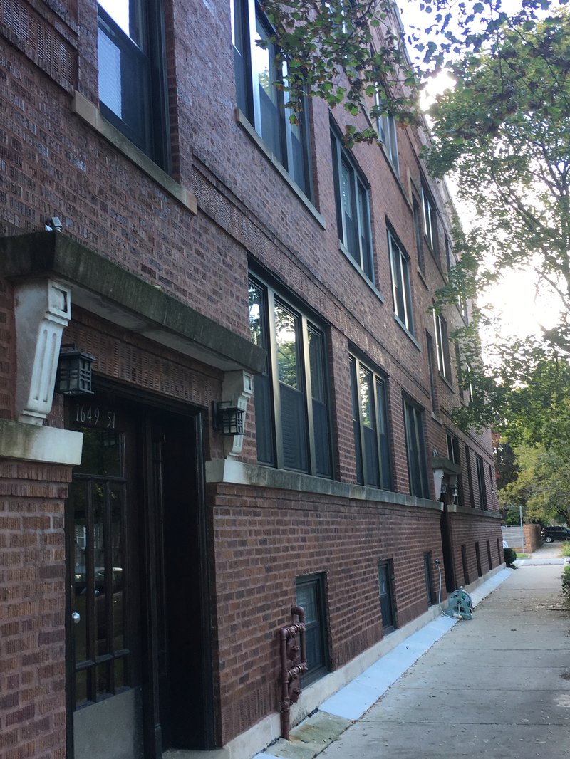
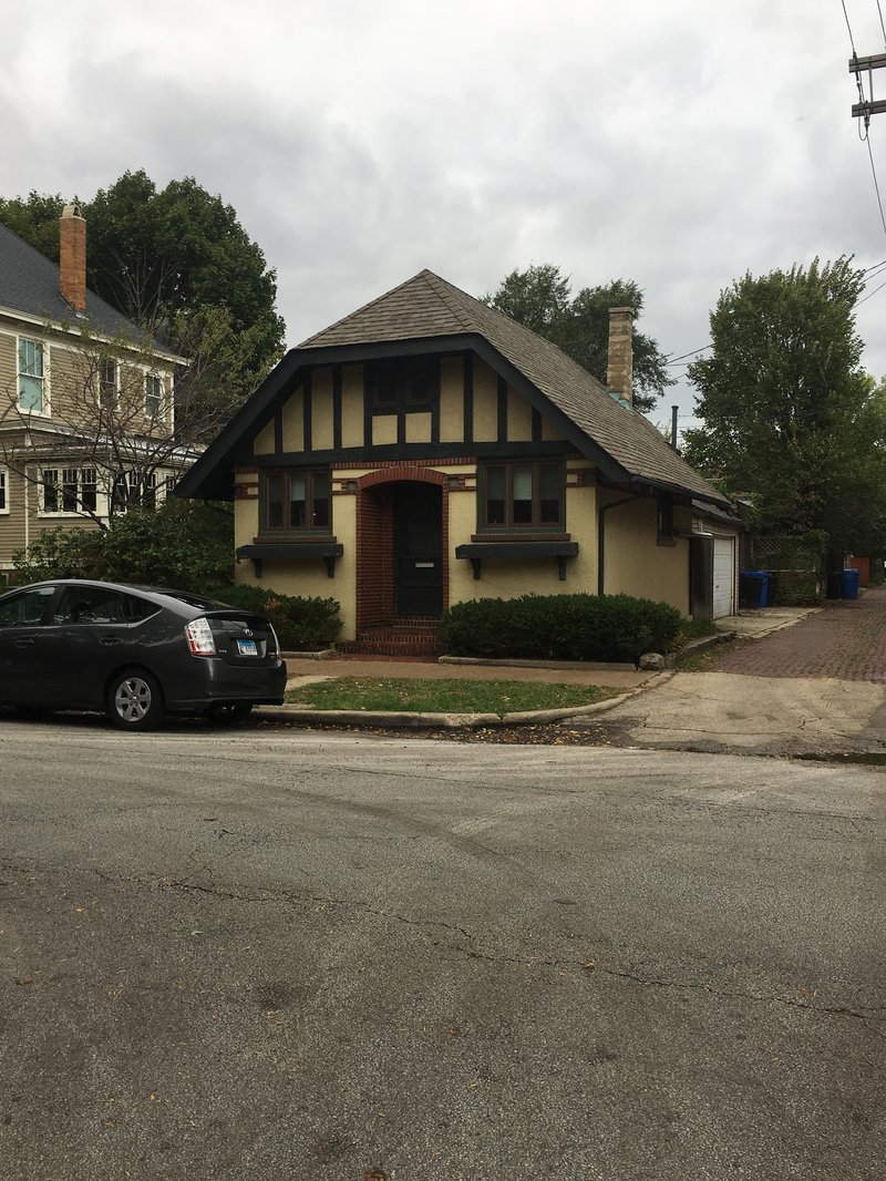
Additionally throughout the residential areas of the neighborhood, nods to Swedish architectural style can be seen both in older restored single-family homes and many newer apartments.
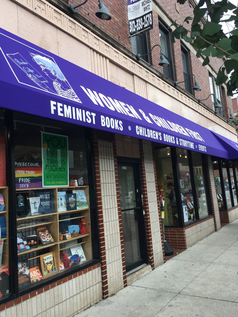
Andersonville’s history as a haven for LGBT individuals, particularly lesbians, has formed a lasting part of the community’s identity. Many of the shops, including the iconic Women and Children First Bookstore, are either aimed at the LGBT community or show support through rainbow stickers in their windows or selling buttons at the register or something of that sort. Also displayed in many windows are signs or stickers advertising the business as locally owned showing a strong sense of pride in the neighborhood’s individuality and spirit
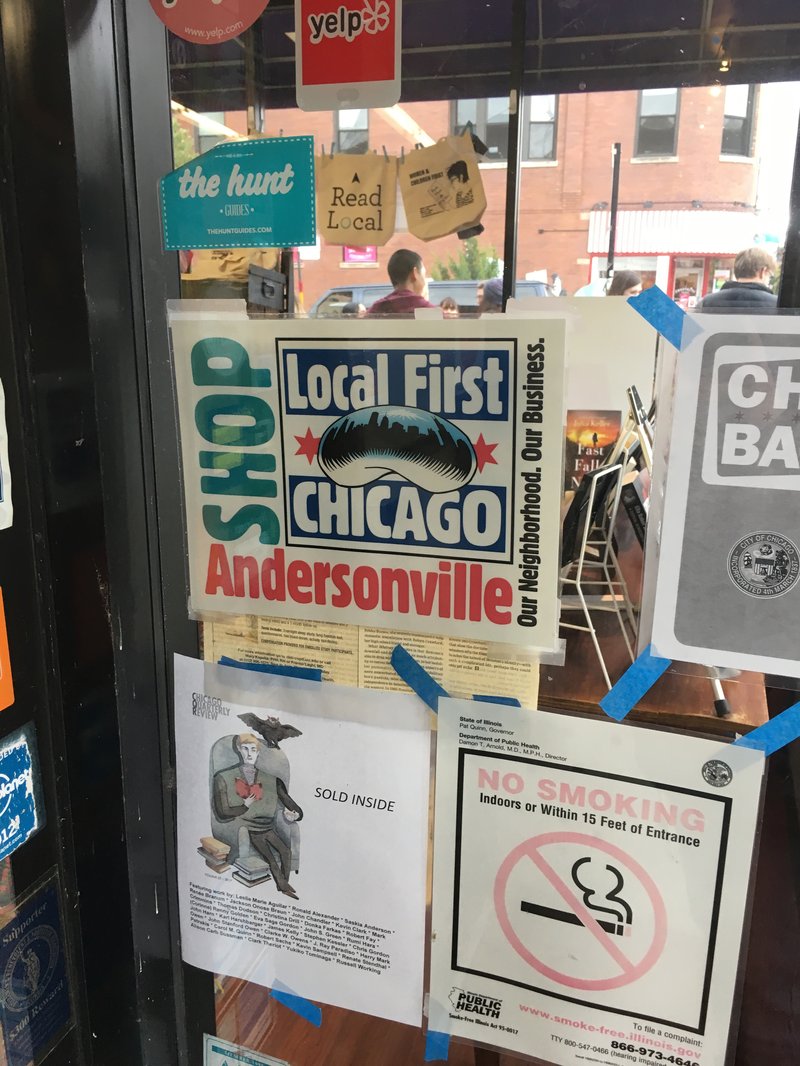
Throughout the neighborhood there are multiple venues centered on the arts and the Chamber of Commerce holds an Arts Week in which many businesses participate. Liberal values beyond simply being LGBT friendly were overtly touted by many of the businesses through window displays and selling buttons or stickers in support of movements like Black Lives Matter, as well as signage promoting neighborhood eco sustainability programs. While Andersonville is no longer ethnically homogenous, it seems to be fairly ideologically homogenous, at least as far as can be seen from the street.

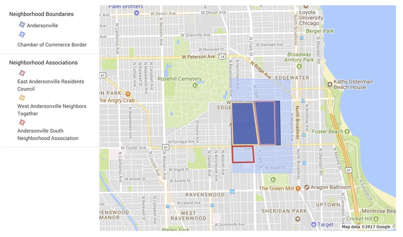
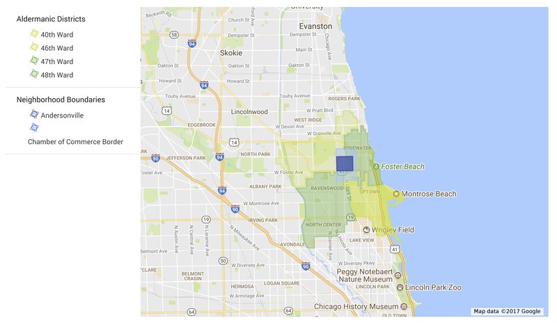
For the purposes of this project I will be defining Andersonville's Neighborhood Boundaries at Bryn Mawr Ave., Wayne Ave., Lawrence Ave., and Ravenswood Ave. as outlined by the darker purple square in the map below. However, neighborhood boundaries are not as set in stone and undisputed as this delineation would imply.
For example, the Andersonville Chamber of Commerce, which has an economic interest in claiming more territory for the neighborhood extends the boundaries further to the North, South and East more than doubling the area of the neighborhood.
Local Neighborhood Associations, on the other hand, line up better with the narrower definition of Andersonville's boundaries. Although, there is a small Andersonville South Neighborhood Association that falls outside the smaller boundaries.
Although, like many cities, Chicago is branded as a "city of neighborhoods," administrative boundaries don't always match up with neighborhood boundaries. For example, Andersonville is represented, depending on where you draw the neighborhood boundaries, by 2 - 4 Aldermanic Districts. This can make it difficult to sustain a neighborhood identity and accomplish neighborhood goals through local government.
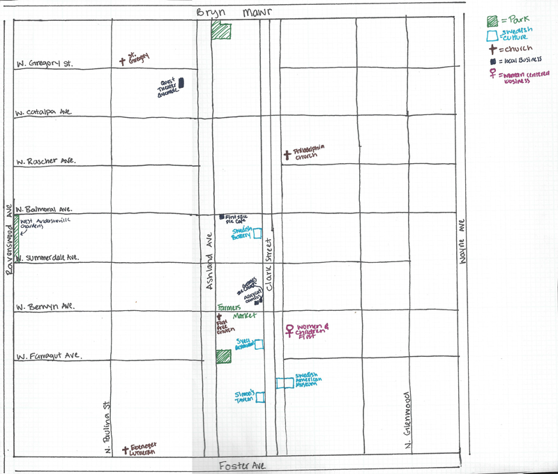
Below is a diagram outlining the basic character of Andersonville. The neighborhood is largely residential with Clark Street serving as the neighborhood center, both geographically and in terms of commercial and cultural institutions.
Andersonville was firs settled in the 1850s by Swedish Farmers moving into the area north of Chicago. However, settlement of the area did not begin in earnest until after the Great Chicago Fire in 1871. After the fire, wooden houses were banned in the city proper and Swedish immigrants who could not afford the more expensive and less flammable building materials like stone or brick, moved out the city limits, many to the Andersonville area. New Swedish immigrants continued to move to the area for several decades. The neighborhood continued to grow and thrive until the Great Depression and post-war periods when many groups including the Swedes in Andersonville began to leave the city for the suburbs.
It was at this point that business owners in the area, concerned about the commercial situation, renewed their commitment to the Swedish heritage of the neighborhood. In 1965 the first Midsommarfest was celebrated in Andersonville as part of the Swedish tradition of marking the Summer Solstice. The festival continues to be celebrated in the neighborhood today. Additionally in 1976 the Swedish American Museum was founded as part of the grassroots effort to preserve the history of Swedish Immigrants and their contributions to Chicago.
While the neighborhood
is much more ethnically and culturally diverse today, it remains one of the
largest concentrated areas of Swedish culture in America.
Andersonville saw a period of revival beginning in the 80s and 90s as new groups, particularly LGBT people, began to move to the area. Lesbians and other LGBT individuals were drawn to the neighborhood by the relocation of the Women and Children First Bookstore to Clark Street, which served as magnet for like-minded individuals. Like the store that drew them to the neighborhood, the new residents were being priced out of Boystown and in search of an affordable neighborhood that was accepting of the LGBT community. Several other lesbian oriented businesses and bars - like Stargaze, T’s, and Tomboy - opened in the neighborhood leading the neighborhood to be informally known as “girlstown” by many in the 90s.
Today, while Andersonville is still one of the most popular neighborhoods for married gay and lesbian couples in Chicago, there are more married gay men living in the area than lesbians. Most of the lesbian establishments closed in the late 2000s early 2010s as the neighborhood became more trendy and expensive. So while Andersonville is no longer the Swedish enclave that it once was, or the “girlstown” counterpart to Boystown it was in the 90s, its past history as these places continues to inform the neighborhood’s identity and character today.
Geographic/Demographic
History/Identity
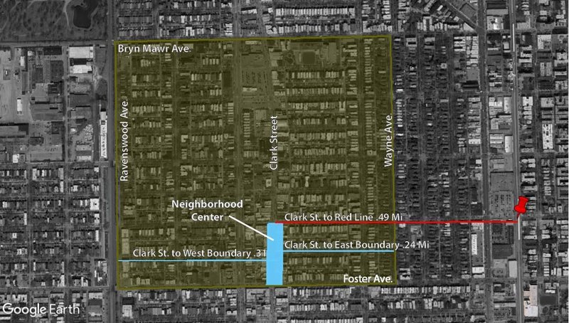
In Andersonville, Clark Street is the closest thing to a neighborhood center. It is the main area in the neighborhood with concentrated pedestrian traffic, commercial space, and civic services. It is also branded visually as the neighborhood center with periodic signage and many of the shops displaying materials from the Chamber of Commerce in their display windows.
An argument could be made that the entire stretch of Clark Street within Andersonville's boundaries from Foster Ave. (Highway 41) to Bryn Mawr Ave. serves as the neighborhood center, however, the case is stronger for limiting the bounds to the southern portion of the street specifically. The pedestrian density thins out as you go further North and the stores are bigger and broken up by parking lots making it more spread out and less walkable.
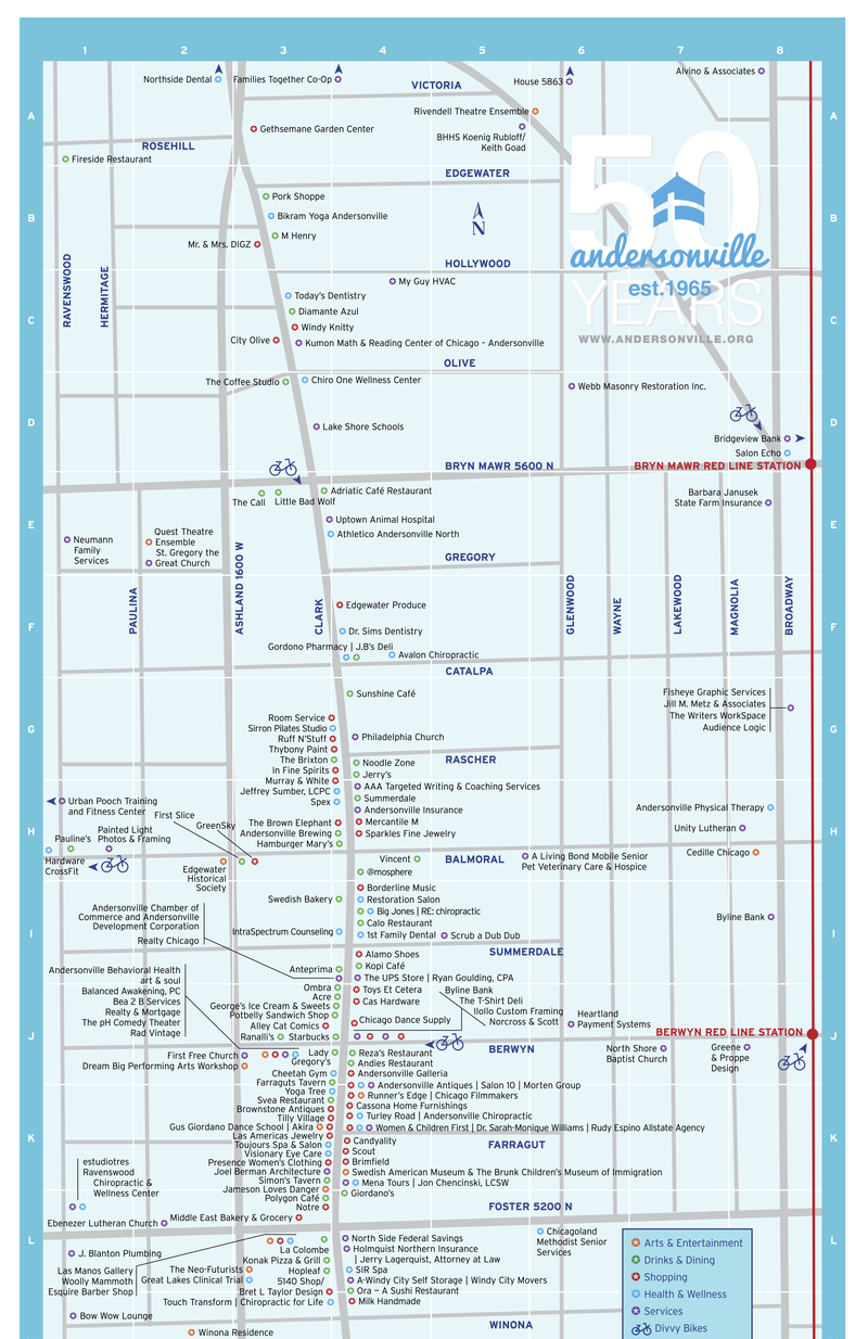
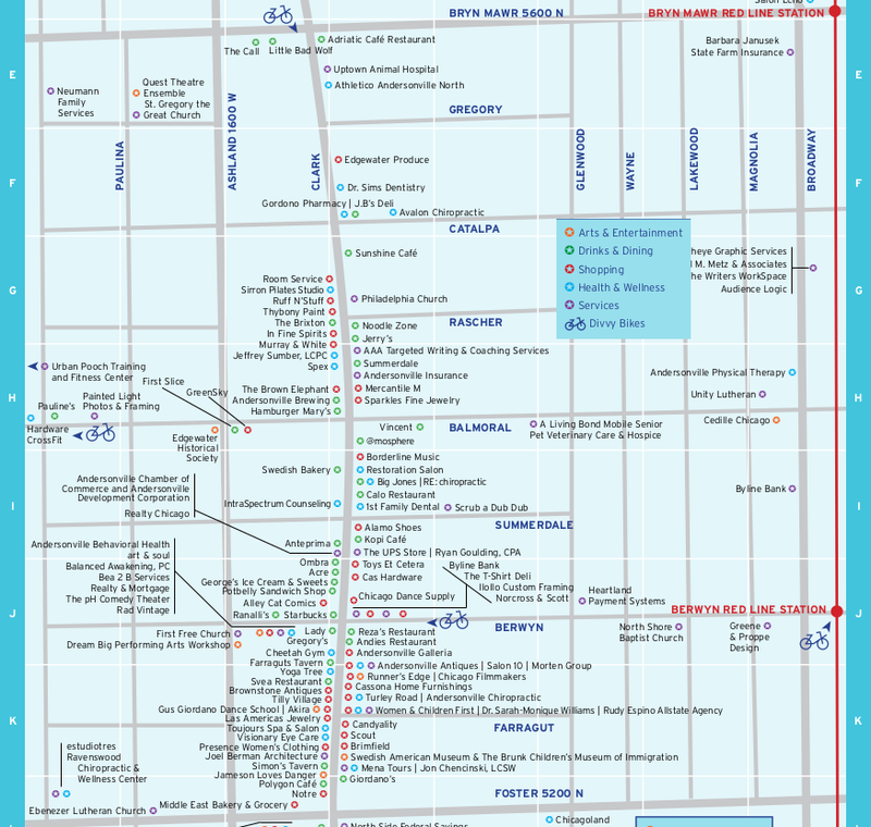
The above map from the Andersonville Chamber of Commerce, although it is not a complete list, shows the higher density of amenities between Berwyn and Foster on the southern portion of Clark Street. In addition to having a high density of amenities to attract people to the area, the street has wide sidewalks and ample opportunities for pedestrians to cross the street safely resulting in a fairly high density of pedestrians in the area.
Clark street is also fairly accessible both from an intra-neighborhood and inter-neighborhood standpoint. There is a decent amount of parking available nearby if not on Clark Street itself through side streets and parking behind buildings. It is also a walkable distance from the Red Line, meaning that it can be reached by public transit from pretty much anywhere in the city and it is also near several bus lines. However, the only bus line that runs East/West in the neighborhood is on Foster Street, the southern border of the neighborhood with the other two running North/South on Clark and Ashland. Within the neighborhood itself, Clark Street is geographically fairly close to the center and a walkable distance from both the East and West boundaries. However, the stretch between Berwyn and Foster Ave. can be a bit far if you are in the northern areas of the neighborhood. That being said, this area still functions as the neighborhood's center with a high density of pedestrians and amenities/services drawing residents and visitors into the area.
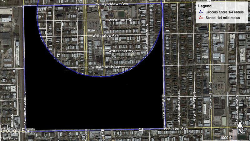
Overall, Andersonville does a pretty good job at providing for the daily life needs of the neighborhood. Most amenities and services that one would need for daily life exist in the neighborhood. However, there is a fairly clear separation between residential and nonresidential uses in the neighborhood with the majority of nonresidential use buildings located on Clark Street. This linearity, somewhat limits access to amenities that can be reached within a 5-minute walk, ¼ mile radius or pedestrian shed. For example the grocery stores, a necessity for meeting daily life needs in a neighborhood, are located on the same block on the northern end of Clark Street. This results in a large portion of the neighborhood falling outside the ¼ mile walkable radius of the stores making it necessary for people who live in the southern portion of the neighborhood to use a car or public transit if they wish to meet their daily needs within their neighborhood.
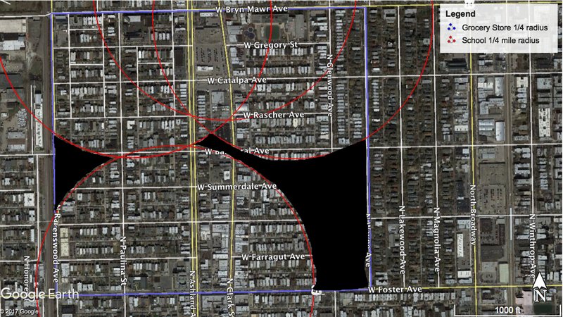
The Pedestrian sheds for schools, on the other hand, are better distributed encompass most of the neighborhood. However, there is a small section on the west side and a larger section in the southeast corner of the neighborhood that fall outside the scope of the sheds. Furthermore, none of these schools in Andersonville itself go farther than the eighth grade meaning residents will have to leave the neighborhood to attend high school. This fact, however, is not necessarily inconsistent with a neighborhood that provides for daily life needs as even in Clarence Perry’s incredibly cellular and self sufficient neighborhood ideal, middle and high schools could be located further from the home and neighborhood.
On Clark Street itself, and the other non-residential strips in the neighborhood, there are a variety of services and amenities to meet the daily life needs of residents. The following map provided by the Andersonville Chamber of Commerce, gives an idea of what is available in the neighborhood and the distribution. Although the linear nature of the commercial strip means that an essential service like the grocery store may not be walkable for individuals, it also means that some amenity is within walking distance. Clark Street is fairly central, it may be slightly farther than ¼ mile if you are on the very western edge of the neighborhood, but at least some chunk of Clark Street is within a ¼ mile of most residential areas in the neighborhood. Meaning that some assortment of the various services, arts and entertainment, drinks and dining, health and wellness, and shopping opportunities that are necessary for daily life are reachable within the neighborhood without car or transit for most people.
Block Type:
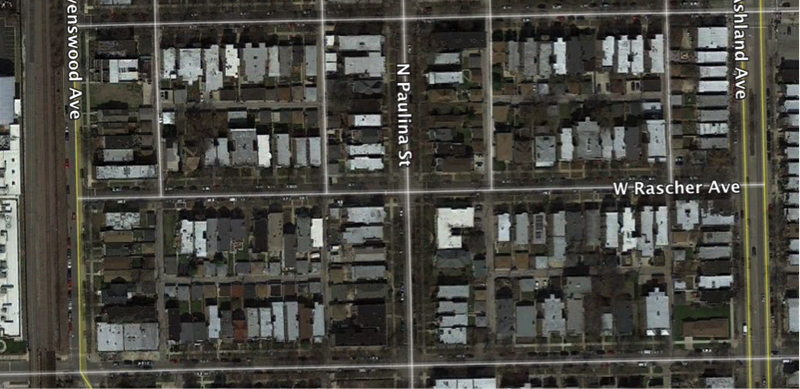
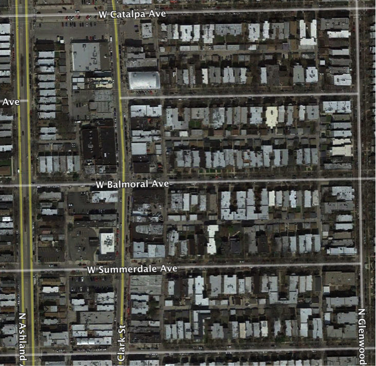
The prevalent block type in Andersonville is the Elongated Block. The elongated block provides double-loaded alleys and allows for adjustment of the permeability of the grid through varying block lengths. This block type is most regular in the residential parts of the neighborhood off of the main commercial street, Clark Street. Along Clark Street, the regularity of the blocks is slightly disrupted and there are also some Square Blocks that allow for greater parking space.
Network Type:
The network is the arrangement of thoroughfares that create the structure of the neighborhood. Andersonville best fits the Savannah Pattern network type. The thoroughfares are structured in a webbed pattern of right-angled blocks with double-loading alleys. Along Clark Street, the main commercial strip, the regularity of the network is slightly disrupted. Rather than having the short ends of the elongated blocks face the commercial higher traffic thoroughfare, many of the blocks are elongated even further, actually decreasing the pedestrian permeability of the grid in the commercial area.
Thoroughfare Types:
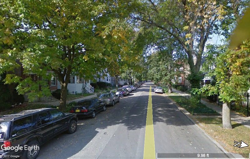
The most common thoroughfare type in Andersonville is streets, which have a low speed and vehicle capacity.
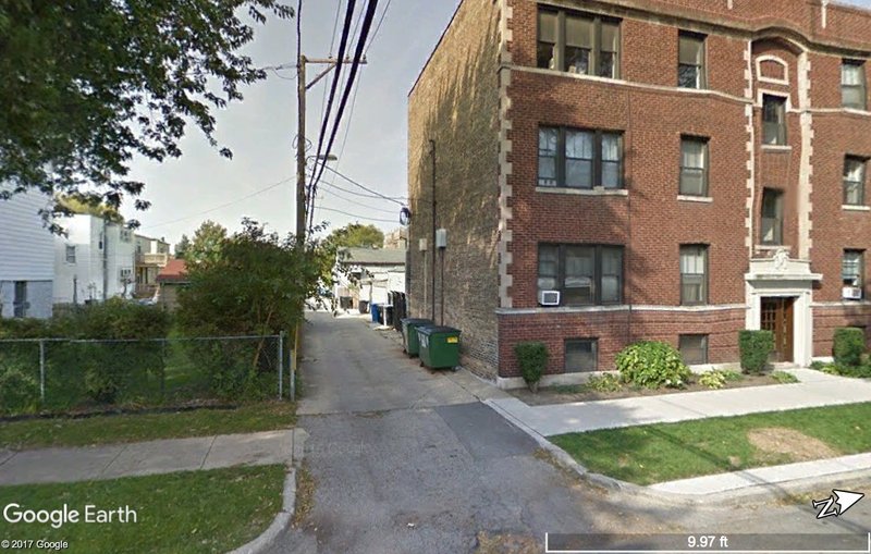
Many blocks also have alleys providing parking and utility access at the rear of the buildings.
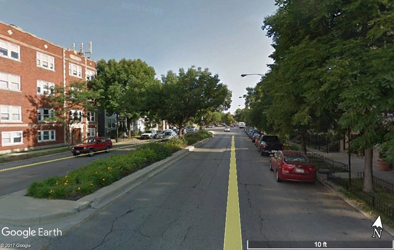
The busiest thoroughfare in Andersonville is Ashland Avenue which contains a high vehicular capacity and landscape median.
Overall Connectivity
According to the Victoria Transport Policy Institute’s criteria for typical street connectivity standards the average intersection spacing for local streets should be 300 – 400 feet with 600 feet being the maximum for intersection spacing for local streets. In Andersonville, most of the streets running north south fall within the ideal 300 – 400 feet range. However, a large portion of the spacing for east west intersections exceeds the maximum of 600 feet. Additionally, the spacing between arterial streets like Ashland and Ravenswood exceeds the 1,000 feet maximum suggested by the connectivity standards indicating limited connectivity terms of intersection spacing. The street pavement widths in Andersonville also tend to exceed or fall on the wider end of the 24-36 foot limit suggested by the connectivity standards. On the other hand, the block size in Andersonville falls within the max block size of 5-12 acres. In fact, most of the blocks are less than 5 acres. There are also very few dead ends or restricted access roads which falls in line with the connectivity standards. Furthermore, there are multiple connections providing access to the arterial roads providing good connectivity to the wider city.
The overall connectivity of Andersonville is a mixed bag. On the one hand, the spacing of the blocks is longer than is ideal for good connectivity within the neighborhood. Yet at the same time there is good permeability within the neighborhood as there are very few dead ends and most streets go through to the arterial streets providing connection to the wider city. Additionally, the spacing of blocks along the main commercial area does fall within the spacing standards for street connectivity so the busiest part of the neighborhood does have good connectivity while the less well-connected parts are mostly residential.
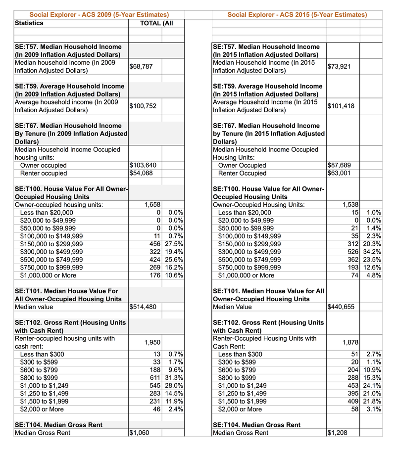
The table below uses Social Explorer to compare data from the American Community Survey 2005 - 2009 and 2011 - 2015 (5 year estimates) to look at income diversity trends in Andersonville. As discussed previously in the Social Mix section of this project, Andersonville, is a fairly diverse neighborhood in many regards although, it tends to be less diverse than the wider areas it inhabits (Community Area, Chicago Region, City of Chicago). However, in recent years many former residents and businesses have reported being priced out of the neighborhood.
From these tables we can see that the overall median and average household income in Andersonville is rising. However, when you break it down by tenure you can see that the income for owner-occupied units is decreasing while the income for renter-occupied units is going up. This is reflected in the fact that median housing value for owner-occupied units is decreasing while gross rent is increasing. Given the fact that most owner-occupied units in Andersonville are single-family homes and that renting has historically been the cheaper housing option in the area allowing for people with a diversity of incomes to be able to afford housing in Andersonville, the fact that renting is becoming more expensive does not bode well for the preservation of income diversity in the neighborhood. Although, the median income for owner-occupied households has decreased, they are still not a viable option for promoting income diversity in Andersonville. It appears that price points for renters and home-owners is converging on a more uniform and generally pricier narrower range, limiting the neighborhood's capacity for social diversity.
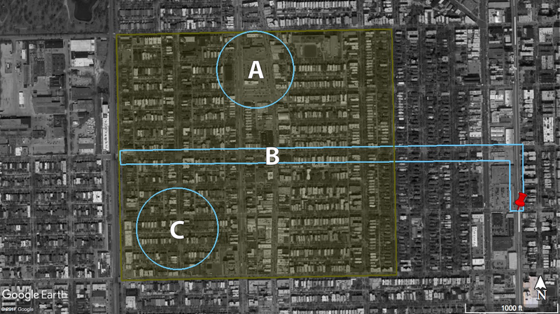
In order to preserve and encourage the growth of social diversity in Andersonville, I propose three interventions targeting income diversity in the neighborhood. Intervention A focuses on servicing the neighborhood and takes advantage of the open space occupied by parking lots on Clark Street, the main commercial drag in Andersonville. Intervention B addresses the lack of East/West transit connectivity in the neighborhood which can create a cost barrier of necessitating car ownership to live in the neighborhood. Lastly, Intervention C addresses housing affordability in Andersonville which most directly affects the ability for the neighborhood to support a diversity of incomes.
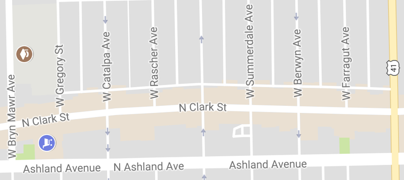
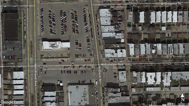
My first proposed intervention addresses the significant space sacrificed to parking lots on the Northern portion of Clark Street in Andersonville. As discussed in the Public Space section of this project, Clark Street serves as the neighborhood center in Andersonville. However, the southern portion of the street is much more utilized than the northern portion. Pedestrian traffic thins out as you walk north and there are some more elongated storefronts and parking lots which reduce walkability.
Re-arranging the space so that storefronts face the street and any necessary parking is tucked away behind the buildings would encourage full utilization of Clark Street as the neighborhood center and allow for more services and amenities to be accessible within the neighborhood. As it stands the neighborhood is fairly well serviced; however, many of the stores, particularly at the southern end of Clark Street, are trendier and more expensive. This is not necessarily a bad thing, but when inserting new businesses into the area special attention should be given to ensure that a diversity of services are available to residents. A neighborhood can't be effective at meeting the needs of residents with diverse incomes if the services in it cannot serve a variety of price points.
Revitalizing the Northern portion of Clark Street can support the goal of preserving social diversity in Andersonville by ensuring that businesses that serve diverse needs are sought after to fill the space. This would encourage further pedestrian utilization of the Northern portion of Clark Street, increasing the number of eyes on the street and the safety and vitality of the neighborhood.
(Satellite image of large parking lots on N. Clark Street)
(Photo taken of the denser, more utilized, southern portion of Clark Street in Andersonville)
Andersonville's main transit connection to the rest of the city is through the Bryn Mawr and Berwyn Red Line stops. There are also 3 bus routes that run through the neighborhood: the 22 on Clark Street and the 50 on Ashland run North/South and the 92 runs East/West on Foster. This provides fairly good North/South connectivity in terms of intra and inter neighborhood connectivity. However, the only East/West route in the neighborhood is along the southern border, outside the 1/4 mile radius of easy walkability for many residents. The red line itself is also outside of this range of walkability for most Andersonville residents. Although both are within a 10 or 15 minute walk for most people, this provides a barrier in terms of easy access to transit for residents. This barrier can make transportation via public transit impractical for many residents and create a cost barrier to living in the neighborhood by necessitating use of a car for transportation.
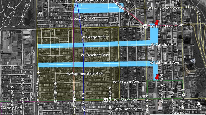
In order to reduce this barrier, I propose implementing a bus route to improve East/West connectivity both within the neighborhood and with the rest of the city. Potential locations for this implementation are highlighted in blue below.
The Balmoral Ave route would be ideal as it would go right through the center of the neighborhood before turning south to connect to the red line stop. This proposal would be within 1/4 mile walking distance for most residents in the neighborhood and improve neighborhood connectivity.
Likewise the Catalpa Ave route proposal would help with connectivity for residents in the Northern part of the neighborhood as the existing Foster route is inaccessible for them. It would also pass next to the two grocery stores in Andersonville increasing the neighborhood's ability to meet the daily needs of residents.
The northernmost proposed implementation is the least effective, however it would be the easiest to implement. Simply extending the 50 route that goes up Ashland Ave. would allow it to provide connection to the red line via the 84 bus represented by the lighter pink line.
Implementing any of these routes would improve Andersonville's connectivity and reduce the cost of living in the neighborhood by reducing the need to own a car. This would help preserve and encourage social diversity, particularly income diversity in Andersonville.
Housing Affordability most directly impacts social diversity in terms of income diversity. A neighborhood cannot have a diversity of incomes if the all of the housing available becomes very expensive and unsustainable for residents with lower incomes. Earlier in this section, I highlighted the Southwest corner of the neighborhood for this implementation as that is currently where some of the most expensive homes available in the neighborhood are located. However, this intervention would ideally impact the neighborhood at large.
Housing at a variety of price points is the most effective way to ensure that people with a variety of incomes can live in the neighborhood. In order to encourage this, several measures can be taken regarding both existing and future housing in Andersonville. Firstly, single-family houses tend to be fairly homogenous and are particularly affordable, yet, at the same time many of the existing single-family homes have cultural and architectural value in the neighborhood. For this reason I propose that the building of new single family homes in the area is discouraged, leaving existing homes as they are, and the encouragement of mixed income housing through apartments.
Apartment buildings allow for a variety of types of units at different price points within a single building. Tax breaks for buildings that have mixed income housing or low income housing would encourage the preservation and encouragement of income diversity in the area. Furthermore limiting the number of single family homes would make the implementation of the other two proposed interventions more viable as a certain level of density is required to make public transit and increased commercial space viable.
These three intervention proposals work together to promote social diversity in Andersonville while preserving the strong neighborhood identity that already exists. Revitalizing and extending the neighborhood center located on Clark Street, improving connectivity via transit, and encouraging the availability of affordable housing all play an important role in improving the experience of living in the neighborhood while also encouraging social diversity
Social Mix
Using Social Explorer to analyze the American Community Survey 2015 (5-year estimates) from the US Census Bureau we are able to take a closer look at the demographics and diversity of Andersonville. In the tables below, you will find a summary of the basic demographics of Andersonville (census tracts 308 and 309, Cook County, Illinois), as well as a more in depth analysis of select characteristics of the neighborhood’s diversity utilizing the Simpson Diversity Index. The equation for the Simpson Diversity Index is [N(N-1)]/∑[n(n-1)] with N being the total population and n being the population of each category. Using this index, the highest possible value is the number of total categories and the closer the number is to the total number of categories the more diverse the area is with regards to the characteristic being analyzed.
Demography Overview
At first glance, we can note that the population of the area is 7,364 and split fairly evenly between the sexes, household type (family and nonfamily), and tenure (owner occupied and renter occupied). The vast majority of the population 25 year and older has a high school degree, 93.1%, and most have a Bachelor’s degree or more, 66%. There are very few homes in the area with a value less than $150,000 and the median value of a home in Andersonville is $440,655. For tenants, the median rent is $1,208 with very few units available for less than $600.
Diversity Tables and Analysis
Using the Simpson Diversity Index, we can take a closer look at the diversity of Age, Race, and Household Income present in Andersonville, and compare it to the larger geographic context it occupies. In the age category, Andersonville scores a 6.7 out of a possible 12. This is slightly lower than the scores of the larger Edgewater Community Area, and North Chicago Region who score at 7.5 and 7, respectively, and more significantly lower than the city at large which scores an 8.9. While it is less diverse than the city at large, and has relatively fewer older residents, considering that it is highly unlikely to have an even distribution in terms of age given that the distribution of ages of people currently alive, the neighborhood is still fairly diverse in terms of age. And, in fact, the neighborhood is likely to become more diverse in the coming years given that the “under 5 years” category was the largest category of minors.
In the category of race, on the other hand, Andersonville scores fairly low with a 2.4 out of a possible 7 with 61.1% of the population falling into the “White Alone” category. This makes sense given the neighborhood’s roots as a Swedish enclave and that Chicago as a whole is known for being one of the most racially segregated cities in the US and scores only a 3.5 using the Simpson Index.
Lastly, Andersonville scores fairly well with regards to income diversity at an 11 out of a possible 16. However, this is lower than the scores of the larger Community Area, Region, and City which all score around 14. The median income in the neighborhood is $73,921, with the largest percentages of the population falling in the $60,000 - $74,999 and $75,000 – $99,000 categories indicating that while not wholly un-diverse in terms of income, the neighborhood definitely skews wealthier.
Sources
Social explorer: https://www.socialexplorer.com/tables/ACS2015_5yr/R11537676